CONNEMARA & WESTPORT
Cong • Connemara Scenic Drive • Westport
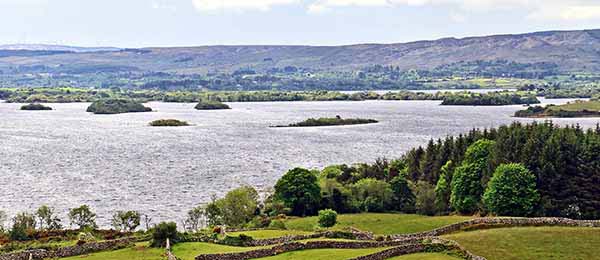
If you have a car, consider spending a day exploring the wild western Irish fringe known as Connemara, along the edges of County Galway and County Mayo. The scenery here is rough and rugged: towering bald mountains and moody lakes that feel closer to the Scottish Highlands than to the Emerald Isle. Hike the peak of Croagh Patrick, the mountain from which St. Patrick supposedly banished the snakes from Ireland. Pass through the desolate Doo Lough Valley on a road stained with tragic famine history. Bounce on a springy peat bog.
This beautiful area claims a couple of villages—Cong and Leenane—where classic Irish movies were filmed, an unforgettable falconry experience on the grounds of a castle, the photogenic Kylemore Abbey, and the prim, neatly planned town of Westport. At the end of the chapter, I’ve described a few interesting stops near Westport, including rugged Achill Island, the Virgin Mary shrine at Knock, and—halfway to Dublin—the thoughtful Irish National Famine Museum.
While prosperous and lively today, County Mayo suffered horribly during the Great Potato Famine. As you’ll encounter many sights in this area (and throughout Ireland) tied to that tragic event—including the Irish National Famine Museum—get your bearings by reading the sidebar on here.
PLANNING YOUR TIME
By Car
Connemara’s highlights make for a satisfying day. You can see this region either on the way from Galway to points north (County Donegal or Northern Ireland), or as a handy side-trip loop from Galway.
From Galway to Northern Ireland: Heading north from Galway toward Derry or Portrush, it’s easy to stop in Cong and Westport en route. But with a little more time, it’s worth passing through the more rural areas of Connemara on the way (via Leenane, possibly Kylemore Abbey, then through the Doo Lough Valley to Louisburgh and Murrisk). I’ve outlined this route in my Connemara Scenic Drive, later in this chapter.
Westport makes a good overnight stop. From there, the direct route onward to Northern Ireland comes with a series of worthwhile, fast, and easy little stops and detours (see “Between Westport and Derry” on here).
Round-Trip Loop from Galway: With a long and well-organized day, you can enjoy this region in a five-hour loop drive (200 miles) beginning and ending in Galway. For maximum coverage, lace together the most important sights in this order: Cong, Westport, Murrisk, Louisburgh, through the Doo Lough Valley to Leenane, then on to Clifden (passing Kylemore Abbey and Connemara National Park), along the coast to Roundstone, and finally back to Galway. From Westport, you’ll follow my Connemara Scenic Drive in reverse to Kylemore Abbey, then finish the loop with the “Western Connemara Extension” (on here).
Without a Car
By Tour: It’s most efficient to take a day tour from Galway. Galway Tour Company and Lally Tours both run all-day bus tours of nearby regions, including Connemara, Kylemore Abbey, and villages like Cong or Leenane. Tours go most days, heading out at 10:00 and returning at 18:00 (€35-55, check details online, see here for contact information).
For a more intimate experience, consider a private driver/guide. Neal Doherty knows this corner of Ireland well and can take up to six people from Westport to anywhere in Mayo, Galway, and Sligo counties in his Land Rover (around €575/full day, +353 86 259 6887, www.alchemytours.ie, info@alchemytours.ie).
By Public Transportation: Public transit in this region (except to and from Westport) is patchy, and some areas are not served at all. Buses run between Galway and Westport, but by train you must connect through Dublin.
Cong
The hamlet of Cong (pop. 145) is a small, efficient, unspectacular, but satisfying stopover with a quirky mix of attractions: a medieval ruined abbey, a modern church with exquisite stained-glass windows, a museum about a John Ford film that was filmed here (The Quiet Man), and a falconry experience on the grounds of the extravagant Ashford Castle. Everything is within a short walk of the parking lot in front of the abbey.
Cong (from conga, Irish for “isthmus”) lies between two large lakes an easy hour’s drive north of Galway. On the way into or out of town, you may see a dry 19th-century canal as you pass over a scenic bridge. Built between 1848 and 1854, the canal was a Great Potato Famine work project that stoked only appetites. The canal, complete with locks, was intended to link Lough Mask to the north with Lough Corrib to the south, providing boat access much deeper into Connemara. But the limestone bedrock proved too porous, making the canal an expensive idea that just wouldn’t hold water. The project was abandoned. The unfinished canal sits there, dry to this day, as an embarrassment to British Victorian-age engineering.
Orientation to Cong: Drivers can find a few parking spaces right in front of the abbey; if that’s full, additional parking is just up the road into town. You’ll know you’ve hit the village center when you see the statue of John Wayne hoisting Maureen O’Hara in his arms...just as he did in The Quiet Man. The TI, where you can pick up a handy map, is in the Old Courthouse just below the abbey (www.discovercong.com). Public WCs are 50 yards down the street from the TI (to the left, as you face it); the Quiet Man Museum is just beyond that.
Sights in Cong
Cong Abbey
The ruins of Cong Abbey (free and always open) are the main attraction in town. Construction on the abbey began in the early 1100s in Romanesque style and continued into the Gothic age. You’ll notice a mix of styles—with both round Romanesque and pointed Gothic arches (especially around the doorway). The famous Cross of Cong, which was believed to have held a splinter of the True Cross (now on display in Dublin’s National Museum), was hoisted aloft at the front of processions of Augustinian monks during High Masses in this church. Rory O’Connor, the last Irish high king, died in this abbey in 1198. After O’Connor realized he could not outfight the superior Norman armies, he retreated to Cong and spent his last years here in monastic isolation.
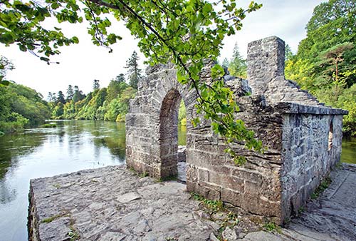
Nearby: Take a walk through the cloister and down the gravel path behind the abbey. The forested grounds—called Cong Wood, formerly part of the Ashford estate—are lush, and the stream water is clear. Cong’s salmon hatchery contributes to western Ireland’s reputation for great fishing. From a little bridge you’ll see the monks’ stone house. It was designed so part of the stream would flow directly under it. The monks simply lowered a net through the floor and attached a bell to the rope; whenever a fish was netted, the bell would ring.
Next to the abbey’s cemetery is the modern, concrete, bunker-like Church of St. Mary of the Rosary (free, daily 8:00-22:00). Drop in to marvel at its exquisite windows, made by Irish artist Harry Clarke in 1933. Step behind the altar to get up close. Just take in the details for a moment. The set of three windows depicts the Holy Family. Jesus, in the center, is depicted as Creator of the Universe, clad in stunningly intricate robes. He’s flanked by Mary and Joseph. Each one has a strong personality, typical of Clarke’s Neomedieval style.
Quiet Man Museum
This cottage-museum is interesting (only) for fans of the 1952 movie. The village of Cong (but not this cottage) is where John Wayne and Maureen O’Hara made the famous John Ford film The Quiet Man. You’ll see modest historical exhibits and film props. The museum is also the home base for walking tours that tie together locations related to the film (1-4/day, described on the website).
Cost and Hours: €5, daily 10:00-16:00, closed Oct-March, +353 94 954 6089, www.quietmanmuseum.com.
Ashford Castle
This massive stone palace (now a hotel) sits on a vast, exclusive estate that’s a lush and peaceful 20-minute walk or five-minute drive from town. Its river serves as a modern-day moat: To cross the bridge, you’ll need to have a reservation at one of the attractions on the property. The falconry show—listed next—is easily the best reason to come here, but you can also book afternoon tea at the swanky Connaught Room, a meal at one of the restaurants, a room at the hotel, a guided fishing tour, or a tee time at the golf course (details for all of these at www.ashfordcastle.com). The castle is closed to nonguests, but if you wind up here, the grounds are a gardener’s delight, creating a lakeside paradise of greenery. Many scenes from The Quiet Man were filmed here.
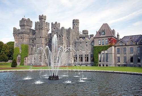
▲▲Ireland’s School of Falconry
Animal lovers, aviation engineers, and wannabe medieval hunters will thrill to Ireland’s School of Falconry, hidden on the Ashford Castle grounds. Spending some quality time with an actual Harris hawk is a unique experience you didn’t realize you had on your bucket list.
Cost and Hours: You must reserve ahead for the hour-long falconry experience. It’s €130 for one person, €200 for two, €240 for three, or €280 for four. All experiences are private—you are not grouped with strangers. Info: +353 94 954 6820, www.falconry.ie, info@falconry.ie.
Getting There: You can walk from Cong village all the way to the falconry school (allow 20 minutes) or save some time by driving partway: Drive to the castle’s main gate, tell the guard you have a falconry appointment, then continue through the grounds. Just before the bridge to the castle itself, you’ll see a big thatched-roof restaurant on your right. Park here and walk across the bridge to the castle, then circle around behind it and follow the walkway about 10 minutes through the trees to the falconry school, tracking signs (and likely seeing other budding falconers out with their birds).
Falconry Experience: You’ll start in the courtyard with a brief Hawks 101 lesson, surrounded by aviaries housing hawks. Your expert handler and guide will explain how the Harris hawk is a rare raptor that hunts socially, rather than independently, making it better suited to safely working alongside humans. And you’ll understand how the hawk hunts on their own terms and chooses to return at each day’s end to these aviaries—where they get fed and get to fly every day. Then your handler leads you on a “hawk walk” through the forest. Along the way, you’ll learn all about the fascinating intricacies of falconry as you launch and land a bird from your own gloved forearm. You’ll do this several times as you spend about a half-hour on the castle grounds; each time, your hawk returns for the tasty reward the trainer has tucked into your leather glove. All the while, you’ll get lots of amazing photographs of your graceful and majestic bird.
Eating in Cong
Fuel up with a pub grub lunch at $$ The Crowe’s Nest (daily until late, in Ryan’s Hotel on Main Street, +353 94 954 6243). $ McHughs, between the abbey entrance and the Quiet Man Museum, is good for soup and sandwiches (closed for dinner and all day Mon, +353 87 152 5004). The Spar Market meets the town’s grocery needs (daily, next to gas station at end of Main Street).
Connemara Scenic Drive
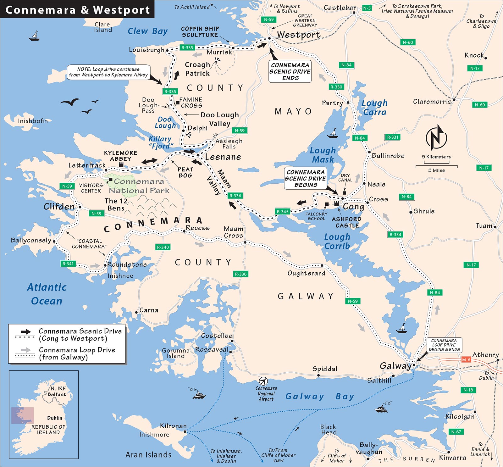
If you’re heading between Cong and Westport, the most direct route is simply to head 45 minutes north on the main roads (R-345 to N-84 to N-5). But then you’d miss wonderful scenery and intriguing countryside sights in Connemara and nearby County Mayo. If you can spare the time and miles, consider instead following this scenic drive west through the Maam Valley to Leenane, possibly detouring south to peat bogs and Kylemore Abbey, then continuing scenically north through the Doo Lough Valley and east along Clew Bay to Westport. This adds about one hour of driving (plus an additional 40 minutes for the Kylemore Abbey detour), not including sightseeing stops—but it’s worth it.
Driving Tips: Below, I’ve outlined the major stops on a scenic route between Cong and Westport and connected the dots with driving instructions. If you’re instead doing a loop drive from Galway, you’ll start this drive at Westport and visit the sights in reverse order.
CONG TO LEENANE
• Departing Cong, head west on road R-345 (signed for Maam Cross). After driving along the shore of the sprawling Lough Corrib, you’ll enter...
Maam Valley
This brooding and desolate valley feels like a land of ghosts. The valley, once densely populated with potato-eating peasants, was depopulated in the famine and remains that way to this day. The old sod cottages are long washed away, but you can still make out the sad corduroy ridges where those last potatoes were planted.
• Soon you’ll exit the valley at...
Leenane
The “town” of Leenane (just a crossroads) is a good place for a break. Cozy $$ Hamilton’s Bar is the place for lunch and a pint (closed Wed); while you’re there, find the old photo of the British dreadnought battleships that filled Killary “Fjord” when King Edward VII visited a century ago. $ The Purple Door Café has crêpes, sandwiches, and pastries, with tables across the road by the harbor (closed Thu-Fri).
Across the bridge, drop into the Connemara Sheep and Wool Centre to see interesting wool-spinning and weaving demonstrations (€10, demos run about hourly on weekdays, closed off-season, café, +353 95 42323, www.sheepandwoolcentre.com).
• Leenane sits on the large...
Killary “Fjord”
This long, narrow body of water—more a harbor than a true fjord—was carved by an advancing glacier. The rows of blue floats in the harbor mark mussel farms, with the mollusks growing on hanging nets in the cold seawater. In Ireland, “Killary” is synonymous with top-quality mussels.
• To stay on the main scenic drive, turn right at the crossroads in Leenane and follow N-59, then R-335, around Killary “Fjord” and straight up the Doo Lough Valley (skip down to “Leenane to Westport,” below).
But if you have some time to spare, I recommend taking a...
DETOUR TO KYLEMORE ABBEY
This detour gives you the chance to bounce on a bog (about 10 minutes out of Leenane) and continue through the rugged Connemara landscape to Kylemore Abbey to snap a photo. (If you go all the way to Kylemore Abbey, figure about 20 minutes each way—40 minutes total—to return to Leenane and carry on. While you could spend an hour or so touring the abbey, a five-minute photo stop is free, easy, and for many visitors, worth the extra driving.)
• To take this detour, turn left at the crossroads in Leenane and follow N-59 toward Clifden. About 4 miles (7 km) west of town—just after veering away from Killary Fjord, near the turnoffs for Bunowen and Tullycross—look for the small pullouts on the left/south side of the road. Find a good place to park and get out of your car for some...
▲▲Bog Fun
This area offers a good, close look at a turf cut in a peat bog. Be sure to get out and frolic in the peat fields...with decent footwear and an eagle eye for mushy spots.
Walk a few yards onto the spongy green carpet. (Watch your step on wet days to avoid squishing into a couple of inches of water.) Find a dry spot and jump up and down to get a feel for it. Have your companion jump; you’ll feel the vibrations 30 feet away. Rip off a piece of turf and squeeze the water out of it. It’s almost all water.
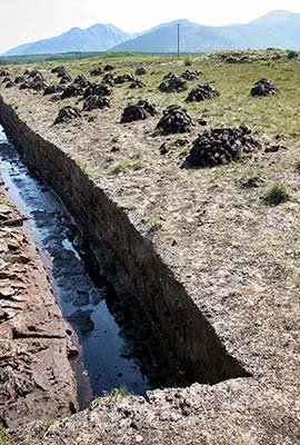
These bogs once covered almost 20 percent of Ireland. As the climate got warmer at the end of the last Ice Age, plants began growing along the sides of the many shallow lakes and ponds. When the plants died in these waterlogged areas, there wasn’t enough oxygen for them to fully decompose. Over the centuries, the moss built up, layer after dead layer, helping to slowly fill in the lakes. During World War I, this sphagnum moss was collected to use in bandages to soak up blood (it absorbs many times its weight in fluids).
It’s this wet, oxygen-starved ecosystem that has preserved ancient artifacts so well, many of which can be seen in Dublin’s National Museum. Even forgotten containers of butter, churned centuries ago and buried to keep cool, have been discovered. But most bizarre are the wrinkled bog mummies that are occasionally unearthed. These human remains (many over 2,000 years old) are so incredibly intact that their eyelashes, their hairstyles, and the last meal in their stomachs can be identified. They were likely sacrificial offerings to the pagan gods of Celtic times.
Since these acidic bogs contain few nutrients, unique species of carnivorous plants have adapted to life here by trapping and digesting insects. The tiny pink sundew (less than an inch tall) has delicate spikes glistening with insect-attracting fluid. Find a mossy area and look closely at the variety of tiny plants. In summer, you’ll see white tufts of bog cotton growing in marshy areas.
People have been cutting, drying, and burning peat as a fuel source for more than a thousand years. The cutting usually begins in April or May, when drier weather approaches. You’ll probably see stacks of “turf” piled up to dry along recent cuts. Pick up a brick and fondle it. Dried peat is surprisingly light and stiff. In central Ireland, there are even industrial peat cuts that began after World War II to fuel power stations. But in the past few decades, bogs have been recognized as a rare habitat, and conservation efforts have been encouraged. These days, the sweet, nostalgic smell of burning peat is becoming increasingly rare.
• Carry on along N-59 about 10 more minutes. As you cross a bridge, watch on your right for the scenic abbey; the turn for parking is just beyond the bridge.
▲Kylemore Abbey
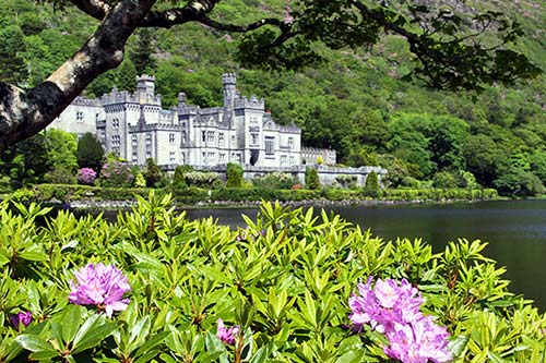
This Neo-Gothic country house was built by the wealthy English businessman Mitchell Henry in the 1860s, after he and his wife honeymooned in the area. Now they are both buried on the grounds. After World War I, refugee Benedictine nuns from Ypres, Belgium, took it over and ran it as an exclusive girls’ boarding school—which peaked at 200 students—until it closed in 2010. In 2015, the Indiana-based University of Notre Dame signed a 30-year lease to use part of the facility for summer classes and student housing (they’re mostly in the glass-roofed annex on the right side of the abbey). The nuns still live in a newly completed monastery complex, which you’ll pass on the stroll between the ticket office and the abbey.
For me, the best thing about a visit here is the view of the abbey from the lakeshore. There’s just something picturesque about the ornate gray building huddled at the base of bald cliffs. From the free parking lot, simply stroll to the viewpoint. But with time and interest, you can buy a ticket to enter the mansion. You’ll wander through a half-dozen rooms (wood-grain entry hall, drawing room, and dining room) peppered with modern exhibits that introduce you to various members of the Henry family and illustrate their cushy lifestyle. Your ticket also includes the extensive walled Victorian gardens. From the visitors center, the gardens are a one-mile, level walk or quick shuttle bus ride (runs every 10-15 minutes). If you have even more time to spend, you can follow the lake walk for additional views.
Cost and Hours: Viewpoint is free; pricey €17 ticket for abbey and gardens; daily 10:00-18:00, shorter hours off-season; WCs in gift shop next to parking lot, cafeteria can be overwhelmed by multiple big-bus tour groups, +353 95 52017, www.kylemoreabbey.com.
• From Kylemore Abbey, to complete the scenic drive to Westport, do a 180 and retrace your route 20 minutes on N-59 (past the “bog fun” pullouts) back to Leenane. Carry on straight through town, driving along the Killary Fjord to the Aasleagh Falls to resume the drive, below.
Or, to carry on past Kylemore Abbey and loop back to Galway, skip down to the “Western Connemara Extension,” later.
LEENANE TO WESTPORT
• About five minutes (2 miles/3.5 km) out of Leenane, after the sign welcoming you to County Mayo, turn left onto R-335 (marked for Louisburgh) to stay on the fjordside road. Just beyond, on the right, you’ll see...
Aasleagh Falls
At the east end of Killary Harbor, stop to enjoy the scenic Aasleagh Falls, a broad cascade on the River Erriff. In late May, the banks below the falls explode with lush, wild, purple rhododendron blossoms.
• Continuing on R-335, you’ll soon pull away from the fjord and head up a desolate valley. About 11 miles (18 km) after leaving Leenane, just after passing a large lake in the middle of nowhere, watch on your right for the nub of a simple gray stone cross.
▲Doo Lough Valley and a Famine Cross
The Doo Lough Valley, unfolding between Delphi and Louisburgh, is some of the most desolate country in Ireland. Signs of human habitation vanish, and it seems ghosts might appear beside the road. The lake below is Doo Lough (Irish for “Black Lake”). This is the site of one of the saddest famine tales.
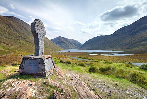
County Mayo’s rural folk depended almost exclusively on the potato for food and were the hardest hit when the Great Potato Famine came in 1845. In the winter of 1849, about 600 starving people walked 12 miles from Louisburgh over this summit and south to Delphi Lodge, hoping to get food from their landlord. But they were turned away. On the walk back, almost 200 of them died along the side of this road. Today, the road still seems to echo with the despair of those hungry souls, and it inspires an annual walk that commemorates the tragedy. Archbishop Desmond Tutu made the walk in 1991, shortly before South Africa ended its apartheid system.
• Now we’ll follow the path of that fateful outing, carrying on along R-335 toward Louisburgh. East of that town, the road turns east and begins to trace the coast of...
Clew Bay
This wide bay is peppered with more than 300 humpbacked islands of glacial gravel dumped by retreating glaciers at the end of the last Ice Age. A notorious 16th-century local named Grace O’Malley (dubbed the “Pirate Queen”) once ruled Clew Bay, even earning the grudging respect of Queen Elizabeth I with her clever exploits.
• About 7.5 miles (12 km) east of Louisburgh, you’ll reach the town of Murrisk.
Murrisk, Croagh Patrick, and a Coffin-Ship Sculpture
In the tiny town of Murrisk, on opposite sides of the road, you’ll find the trailhead for the long hike up Croagh Patrick and a monument remembering the famine (sharing the same pay parking lot, on the right, with WCs).
Croagh Patrick: This fabled mountain-pilgrimage destination rises 2,500 feet above the bay from Murrisk. St. Patrick is said to have fasted on its summit for the 40 days of Lent in the fifth century. It’s from here that he supposedly rang his bell, driving all the snakes from Ireland. As there were actually no snakes in Ireland, the story represents the pagan beliefs that Patrick’s newly arrived Christianity replaced. Every year on the last Sunday of July, “Reek Sunday” (a “reek” is a mountain peak), as many as 30,000 pilgrims hike three hours up the rocky trail to the summit in honor of St. Patrick. The most penitent attempt the hike barefoot (some come down on a stretcher). On that Sunday, Mass is celebrated throughout the day in a modest cinderblock chapel at the summit.
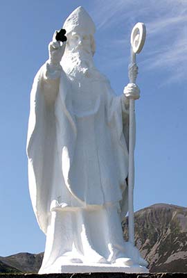
In the 1980s, a seam of valuable gold deposits was discovered within Croagh Patrick. Prospectors turned out to try their luck, but the local community swiftly came together to keep the sacred mountain free of commercial mining activity.
Hiking Croagh Patrick: From the trailhead at Murrisk, you can see the ruddy trail worn down by a thousand years of pilgrims heading up the hill and along the northeast ridge to the summit. It’s 4.5 miles round-trip; fit hikers should allow three hours to reach the top and two hours to get back down (wear good shoes—solid boots if you have them—and bring rain gear, sunscreen, and plenty of water). The first half of the trail is easy to follow. But once you’re on the upper half of the mountain, it’s a steep slope of loose, shifting scree. I highly advise buying or renting a walking stick in nearby Westport (most important for unexpected gravel skids on the way down). There’s a primitive WC near the summit.
Coffin-Ship Sculpture: Across the road from the Croagh Patrick trailhead and parking lot is a modern bronze sculpture. A memorial to the famine, it depicts a “coffin ship,” like those of the late 1840s that carried the sick and starving famine survivors across the ocean in hope of a new life. Weak from starvation, the desperate emigrants were vulnerable to “famine fever,” which spread like wildfire in the barely seaworthy ships’ putrid, cramped holds. Many who lived through the six- to eight-week journey died shortly after reaching their new country. Look at the silent skeletons swirling around the ship’s masts.
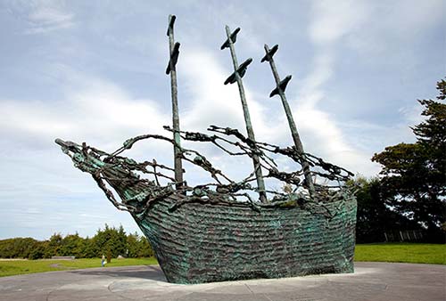
Now contemplate the fact that famine still exists in the world—in virtually every country—even though there’s enough food grown worldwide to feed the hungry. The challenge is distribution and buying power. If my cat has more buying power than your child, my cat gets the tuna. That’s simply the free market system.
• From Murrisk, you’re just a few minutes’ drive from our next stop, the most pleasant town in the region: Westport (covered later in this chapter).
WESTERN CONNEMARA EXTENSION
These two additional sights neatly fill out Connemara for those doing a loop drive from Galway (described under “Planning Your Time,” earlier): Head first to Cong, then Westport. From Westport, do my self-guided Connemara Scenic Drive in reverse. After Kylemore Abbey, you can splice in these two sights on the 1.5-hour return drive to Galway.
• From Kylemore Abbey, it’s about 2.5 miles (4 km) to the turnoff for the Connemara National Park visitors center (just past Letterfrack, on the left).
Connemara National Park
Kylemore Abbey marks the beginning of this park, which encompasses almost 5,000 acres of wild bog and mountain scenery. The visitors center displays worthwhile exhibits of local flora and fauna, which are well explained in a 17-minute film that runs on request (free, park open daily year-round, visitors center open daily 9:00-17:30, café/tearoom; +353 95 41054, www.connemaranationalpark.ie). For a quick visit, take a nature walk along the boardwalk raised above the bog. Nature lovers may want to join a longer walking tour in summer with a park naturalist (call ahead to confirm walking-tour schedules, and bring rain gear and hiking shoes).
• From the national park, it’s about a 20-minute drive on N-59 to the town of Clifden. From there, if you’re short on time, you can stay on the fast main road all the way to Galway. But the slower coastal loop along R-341 rewards drivers with great scenery.
Coastal Connemara
The essence of scenic Connemara—rocky yet seductive—is captured in this neat little 38-kilometer stretch that circles south from Clifden along the coast. The 12 Bens (peaks) of Connemara loom deeper inland. In the foreground, broad shelves of bare bedrock are netted with stone walls, which interlock through the landscape. The ocean slaps the hardscrabble shore. Fishermen cast into their favorite little lakes, and ponies trot in windswept fields. Abandoned, roofless stone cottages stand mute. While the loop is pretty desolate, Roundstone is a fine place to stop for a cup of coffee to fuel your ride back to Galway.
Westport
Westport, with just 9,000 people, is “the big city” in this part of Ireland. While other villages seem organic and grown out of the Middle Ages, Westport is unmistakably a planned town. It was built in the late 1700s with a trendy-back-then Georgian flair by celebrated architect James Wyatt, who designed it to support the adjacent estate of the English Lord Browne (now the tourable Westport House). The town thrived in its early days on linen created on local Irish handlooms. But after the Act of Union with Britain in 1801, Westport was unable to compete with the industrialized British linenmakers and fell into decline. With the famine, things got even worse.
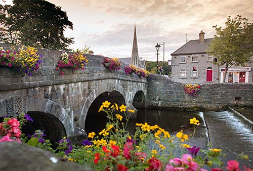
The town is still pretty and well worth a stop. It’s idyllic and small-town-friendly, with a nice shopping vibe and an “Irish Mayberry” appeal. If in need of an overnight between Galway and Derry, this would be my choice.
Orientation to Westport
Westport’s main street, Bridge Street, stretches from the clock tower down to the river. A block from the clock tower is the eight-sided main “square” called the Octagon. The TI is at the box office desk for the Town Hall Theatre, facing the Octagon (Mon-Sat 9:30-18:30, closed Sun, +353 98 28459). To get oriented, follow my “Westport Walk” or join the guided walk (both described later).
HELPFUL HINTS
Bookstore: Run by friendly Seamus, The Bookshop is a delightful place (Mon-Sat 9:30-18:30, Sun 11:00-18:00, later in summer, Bridge Street, +353 98 26816).
Laundry: You can get same-day service if you drop off early at Gills (Mon-Sat 9:00-18:00, closed Sun, James Street, +353 98 25819).
Parking: It’s free to park on the street for one hour. Otherwise, there are several handy, inexpensive pay-and-display lots in the center.
Theater: The Town Hall Theatre is worth checking out for music concerts or stage plays (in Town Hall facing the Octagon, +353 98 28459, www.westporttheatre.com).
Town Walk: For a lighthearted and entertaining jaunt around town, join Stephen Clarke or one of his team for a two-hour guided walk. You’ll feel like you’ve made friends with a local and get a sense for the town’s pride and personality (walking tours Mon-Fri in summer, but check schedule on website in advance, also does pub tours and food tours, +353 87 410 1363, www.westportwalkingtours.ie).
Westport Walk
This little self-guided walk—almost a complete loop—will acquaint you with Westport’s charms, beginning at the Octagon and ending at the clock tower on Bridge Street. It takes less than 30 minutes.
Octagon: This is Westport’s main square, but as it’s eight-sided, it’s called the “Octagon.” Surrounded by 30 townhouses, it was the centerpiece of the planned town back in the 1760s. The big limestone structure with the clock was the old market house, where trade was organized and taxes and customs paid.
The monument in the center of the Octagon was built in 1843 (just before the famine) to honor Lord Browne’s banker, George Glendenning. But the statue of the English banker was shot to pieces by Irish patriots in 1922 during the civil war (notice the gunfire-pocked column). Today, St. Patrick perches on top, garbed in Roman clothes (recalling his kidnapping from Britain’s corner of the crumbling Roman Empire).
As you wander around town, you’ll see Westport is a proud little place with a strong community spirit. It’s competitive, too. In 2012, Westport got the award for “best Irish town to live in.” The skinny bronze statue just up the hill from the Octagon celebrates Westport’s claim to be the most livable town in Ireland. Westport has also won the whole shebang in the national Tidy Towns contest an impressive three times.
At the bottom of the square, the stately building is the former Town Hall; today it houses the top-quality Town Hall Theatre, whose box office doubles as the TI.
• Stroll downhill from the Octagon along James Street.
James Street: Notice a few things. First, there are no stop signs. That’s because traffic is supposed to be so friendly that drivers yield to anyone in a crosswalk without being reminded. Second, there are no chain stores. The town council has allowed no big chains to open in the town center. Finally, note how locals seem to have almost no expressions on their faces. (I’m told that’s because the biggest employer here is Allergan Pharmaceuticals, and about a thousand people in Westport earn their living making Botox.)
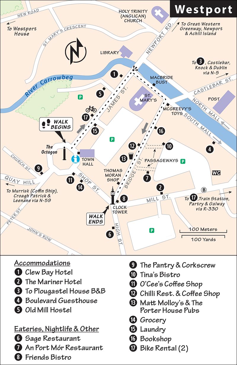
Halfway down the street, on the left, you’ll see a bike-rental shop (Westport Bike Hire). Bike shops here are busy because of the Great Western Greenway bike path (see listing later, under “Activities in Westport”). Photos in the window show the popular 26-mile route, which runs from Westport to Achill Island over the abandoned right-of-way of a narrow-gauge railway that operated from 1895 to 1937.
• At the bottom of James Street, pause at the base of the bridge.
Along the River: Look over at the pointy steeple of the fancy Anglican church across the river (wealthy English Protestants). Rather than crossing the bridge, we’ll head right, to the humbler Catholic church of St. Mary’s (for poor indigenous Catholics; it’s deceptively big inside, but quite austere).
In front of the church, by the water, is a bust of Westport-born Major John MacBride, one of the more colorful rebels of the 1916 Easter Rising. MacBride joined a band of insurgents marching into position in Dublin at the start of the rebellion and was among the 14 men executed at Kilmainham Gaol after its failure.
The river feels like a canal here. Lord Browne, inspired by the embankments he saw in Paris, decided to show off by having this promenade built here, at the western fringe of Western civilization. The flowers along the embankment and on the bridges sure are tidy.
• At the next bridge, turn right and go uphill on Westport’s main street.
Bridge Street to the Clock Tower: McGreevy’s Toy Store (on the corner) gets heat from townsfolk for its tacky giant ice cream cones, which the owner insists on posting on the sidewalk (not tidy). Bridge Street is, nevertheless, lined by some of the finest old storefronts in Ireland.
Farther along, halfway up the street on the right, Matt Molloy’s Pub is the biggest draw in town—famous because its namesake owner is the flutist for the Irish trad group The Chieftains. You can hear music here nightly (see “Entertainment in Westport,” later). Explore the pub during the day when it’s quiet and empty. The back room is a small theater with photos of celebrated guests on the wall.
At the top of Bridge Street you’ll reach the classic storefront of Thomas Moran (on the right)—so classic it’s on an Irish stamp. These days, it sells Irish souvenirs—mostly tacky, but some practical...try out a hurling stick.
Tidy flower beds (tended by an army of volunteers) surround the clock tower, which dates to 1947. Back when people needed a reliable timekeeper to set their watches to, this tower had a practical function. The tower marks the town’s second square—and the end of our walk.
Activities in Westport
Westport House and Estate
The grand Georgian mansion that’s the reason for Westport’s existence—the centerpiece of a 400-acre estate once home to the Browne clan—is open to the public. The sprawling grounds offer a variety of eateries (from a pizzeria to a café) and activities (adventure park, leisure center with gym and pool, gaming zone, and frequent special activities), plus a hotel and campground. But the main attraction is a guided tour of the mansion interior, which is still under restoration (€15; July-Aug daily 10:00-17:00, tours hourly; May-June and Sept-Oct daily 10:00-16:00, tours 3/day; shorter hours off-season). While I’d rather focus on exploring the town center or going for a bike ride, those with time to kill can consider the 20-minute walk or short drive out of the town center to the estate (grounds free and open long hours daily—typically 8:00-dark; for a full rundown of options, see www.westporthouse.ie, +353 98 27766).
Biking the Great Western Greenway
For an easy way to enjoy Ireland’s great and scenic natural beauty, consider the popular 26-mile ride along the Great Western Greenway. For cyclists, it’s easily worth ▲▲▲ and a half-day; even for only sometimes-bikers, it’s worth considering. From 1895 to 1937, a narrow-gauge railway operated from Westport to Achill Island (connected to the mainland by bridge and described later in this chapter). In 2010, the rails were replaced by a level, paved path, creating an ideal rural route dedicated to bikers and walkers—no vehicles allowed (www.greenway.ie).
Bike shops will shuttle you by bus to Achill Island; you then bike scenically for three hours (with the wind generally at your back) along the old train bed back to Westport. You’ll cross stone bridges, wind through forested and open bog stretches, and usually have the sea in sight as you hug the coastline. About midway, you’ll pass Mulranny village (with a pub and old station renovated into an inviting café). At Newport village, you’ll bike over an old viaduct.
Westport has several good bike-rental shops (smart to reserve in advance). Westport Bike Hire runs daily shuttles at 9:30 and 12:00 to Achill, included in the price of a bike (daily, James Street, +353 86 088 0882, www.westportbikehire.com, Jerry). Clew Bay Bike Hire also rents bikes and e-bikes and can advise on bus options to Newport, Mulranny, or Achill; plus, they offer kayaking trips (daily, Distillery Road, +353 98 24818 or +353 98 37675, www.clewbaybikehire.ie).
Entertainment in Westport
Westport has plenty of live traditional music nightly in its pubs.
On Bridge Street: The most popular place in town is Matt Molloy’s Pub, whose owner plays with The Chieftains, the group credited with much of the worldwide resurgence of interest in Irish music over the past 50 years. They have traditional music nightly at 21:30 (be there early or stand all night, no food, +353 98 26655).
The Porter House (next door to Matt Molloy’s) is a popular pub for traditional music and also has nightly sessions at 21:30 (and often also earlier, around 18:30). You’ll find more room and fewer crowds here. Larry, the head barman, is proud of his craft beers.
Sleeping in Westport
As Westport is popular for weekend getaways, prices tend to be higher on Friday and Saturday nights.
$$$ Clew Bay Hotel has 54 large, modern rooms decked out in cherry-wood furniture (family rooms, elevator, free use of adjacent pool and fitness center, James Street, +353 98 28088, www.clewbayhotel.com, info@clewbayhotel.com).
$$ The Mariner Hotel’s lobby has a clinical feel, like a doctor’s office, but the 34 rooms are comfortable, if generic (family rooms, elevator, Mill Street, +353 98 29200, www.themariner.ie, welcome@themariner.ie).
$$ Plougastel House B&B, named after Westport’s sister town in Brittany, has nine inviting, smartly furnished earth-tone rooms with marble-floored bathrooms (Distillery Road, +353 98 25198, mobile +353 86 107 8648, www.plougastel-house.com, info@plougastel-house.com, Sandra Corcoran).
$ Boulevard Guesthouse is an old-school, charming value. Warmly run by Sadie and John Moran, it’s pleasantly located right on the leafy South Mall overlooking the river. Its six large, traditional, tasteful rooms share a cushy lounge with a quirky guest library under the stairs, plus a small kitchenette where you can assemble a light continental breakfast (family rooms, cash only, RS%—discount with multiple-night stay, South Mall, +353 98 25138, mobile +353 87 284 4018, www.boulevard-guesthouse.com, boulevardguesthouse@gmail.com).
¢ Old Mill Hostel is a thick-walled stone structure that could stop a tank. An inexpensive, ramshackle bunkhouse with 52 beds for an international mix of youthful vagabonds, it can be loud—but it’s the only game in town as hostels go (James Street, +353 98 27045, www.oldmillhostel.com, oldmillhostel@gmail.com).
Eating in Westport
MEMORABLE DINNERS
For a small town, Westport has more than its share of high-end, fairly expensive, good-quality eateries. At any of these, it’s smart to book ahead. All are open only for dinner.
$$$ Sage Restaurant is filled with a happy energy. Shteryo (a talented Bulgarian chef) cooks an international array of dishes, while his wife Eva serves (good vegetarian options, popular early-bird specials, daily, 10 High Street, +353 98 56700, www.sagewestport.ie).
$$$$ An Port Mór Restaurant is the town’s top-end choice, where chef Frankie Mallon prepares quality cuisine in a sophisticated yet cozy courtyard. Reservations are essential (fixed-price meals, closed Sun-Mon, 1 Brewery Place, +353 98 26730, www.anportmor.com).
$$$ Friends Bistro, run by a Romanian-French couple, has a pleasantly eclectic menu of mainly Mediterranean dishes, with reasonable prices in an unpretentious setting (closed Mon-Tue, top of Bridge Street at #1, +353 98 56788).
$$$$ The Pantry & Corkscrew is a local favorite, serving modern Irish in a woody, welcoming atmosphere. It’s smart to reserve ahead (early-bird specials, closed Tue-Wed, The Octagon, +353 98 26977, www.thepantryandcorkscrew.com).
BUDGET LUNCHES
You’ll find plenty of options along Bridge Street; for pub grub, consider J. J. O’Malley’s.
$ Tina’s Bistro, presided over by hardworking Tina Jones, is a friendly and filling locals’ hangout for breakfast or lunch (closed Sun-Mon, hidden up Market Lane off Bridge Street, +353 98 29100).
$ O’Cee’s Coffee Shop, attached to the big SuperValu supermarket at the Octagon, serves good, basic cafeteria-style lunches (daily, +353 98 27000).
$ Chilli Restaurant & Coffee Shop is another reliable local diner for sandwiches, burgers, and other lunches (daily, Bridge Street, +353 98 27007).
Groceries: The SuperValu market has picnic fare; it’s just off the Octagon on Shop Street (daily).
Westport Connections
By Bus to: Galway (6/day, 2-4 hours), Derry (3/day, 6 hours, bus #440 to Knock Airport or Charleston then #64 to Derry), Dublin (6/day, 6 hours with transfer in Galway, train is better). For details, see www.buseireann.ie.
By Train to: Dublin (5/day, 3.25 hours, www.irishrail.ie).
By Car to Derry: It’s a three-hour, 210-mile (340 km) straight shot up N-15. For a series of worthwhile, easy stops along the way, see “Between Westport and Derry” on here).
North of Westport
ACHILL ISLAND
An hour’s drive 35 miles (60 km) northwest of Westport lies lumpy, end-of-the-road Achill Island. Ireland’s largest island (56 square miles), with 2,000 hardy residents, is 85 percent bog land and connected to the mainland via a hundred-yard-long bridge, making it easy to reach: Take N-59 north out of Westport, then peel off onto R-319, which eventually crosses the bridge and becomes Achill’s main road.
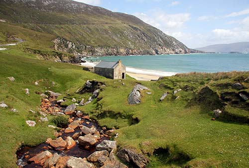
Although rugged, with a couple of ridges over 2,000 feet, much of Achill Island’s interior is sprinkled with holiday homes (dubbed “bungalow blight” by some) built by blow-ins flush with cash from the Celtic Tiger economic boom a generation ago. More recently, a new wave of visitors has come here seeking filming locations from the movie The Banshees of Inisherin (2022).
You can see the island’s two best sights (both free and open dawn until dusk) in a couple of hours; I’d start with Keem Beach (accessed by a narrow road that gets more congested as the day goes on), then head for the famine ruins of the Slievemore Deserted Village. Don’t confuse the remote Keem with the midisland crossroad settlement of Keel, which has some basic services and cafés.
Keem Strand (Beach)
The island’s main R-319 road dead-ends at Keem Strand, a “blueflag” (top-quality) beach. This is an Irish picture-postcard setting featuring a secluded beach cupping a blue-green marbled bay. The lone, simple building above the beach doubled as the house of Brendan Gleeson’s fiddler in The Banshees of Inisherin.
Slievemore Deserted Village
Rocky County Mayo had the highest percentage of death during the Great Potato Famine—particularly among the rural poor (see the sidebar on here). Strewn across a soggy hillside in the island’s interior, the tumbled ruins of Slievemore and its adjacent graveyard could not be more evocative. It’s just over a mile north of the hamlet of Keel (signposted up Slievemore Road).
Here more than 80 blocky, roofless stone hovels line a mossy country lane with open views south across the island. The uneven vertical scars in the grassy plots of land between the ruins once held thriving potato beds to feed the tenant farmers laboring on the landlord’s more profitable fields. With the famine, the potato crops rotted away, the tenant farmers starved, and landowners evicted them in favor of more profitable, less needy grazing land. After the village was abandoned, it fell into ruins. Later generations used it as a booley—a summer-time shelter for herders tending cattle brought up onto the higher slopes of Slievemore ridge to graze. Today, the deserted village is yet another haunting reminder of Ireland’s greatest tragedy.
When you see a small cluster of travel trailers at the side of an Irish road, you’re looking at a dying way of life. These are the Travellers, a nomadic throwback to the days when wandering craftsmen, musicians, and evicted unfortunates crowded rural Ireland. Often mislabeled as “gypsies,” they have no ethnic ties to the Roma of Central and Eastern Europe, but rather have an Irish heritage going back centuries.
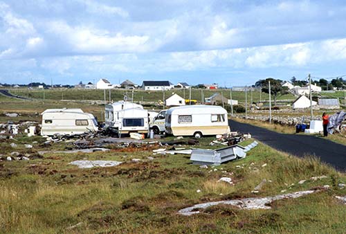
There were once many more Travellers, who lived in tents and used horse-drawn carts as they wandered the countryside in search of work. Before the Great Potato Famine, when Irish hospitality was a given, Travellers filled a niche in Irish society. They would do odd jobs, such as repairing furniture, sweeping chimneys, and selling horses. Skilled tinsmiths, they mended pots, pans, and stills for poitín—Irish moonshine. (Travellers used to be called “tinkers,” but this label is now considered derogatory.) Settled-down farm folk, who rarely ventured more than 20 miles from home their entire lives, depended on the roaming Travellers for news and gossip from farther-flung regions. But postfamine rural depopulation and the gradual urbanization of the countryside forced this nomadic group to adapt to an almost sedentary existence on the fringes of towns.
Today, the 30,000 remaining Travellers are outsiders, usually treated with suspicion by other Irish. Locals often complain that petty thefts go up when Travellers set up camp in a nearby “halting site,” and that they leave garbage behind when they depart.
Travellers tend to keep to themselves, marry young, have large families, and speak their own Irish Gaelic-based language (called Shelta, Gammon, or Cant). They are very religious and often camp near the pilgrimage town of Knock. Attempts to settle Travellers in government housing and integrate their children into schools are controversial, as portrayed poignantly in the 1992 movie Into the West.
East of Westport
The following sights are due east of Westport (about 45 minutes to the shrine and 1.5 hours to the museum). For locations, see the “Northwest Ireland” map on here.
Knock Shrine
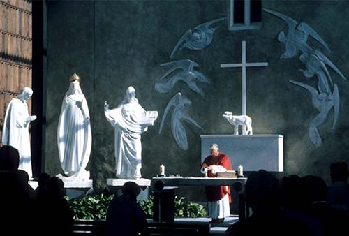
In 1879, locals in the little town of Knock reported a miracle—an apparition of the Virgin Mary, St. Joseph, and St. John in the south gable of their humble church. Pilgrims started coming. Word of miraculous healings on that spot turned the trickle of pilgrims into a flood and put Knock solidly on the pilgrimage map. And the pilgrims keep coming, even precipitating construction of a commercial airport (Ireland West Airport, about 12.5 miles northeast of Knock). Today, you can visit the shrine. At the edge of the site, a small but earnest folk museum shows Knock’s knickknacks, photos of a papal visit, and sturdy slices of traditional life.
Cost and Hours: Free, shrine daily 8:00-21:00, museum daily 9:00-18:00, +353 94 937 5034, www.knockshrine.ie.
Getting There: The shrine is located on N-17, midway between Galway and Sligo (about 45 kilometers east of Westport).
▲▲Strokestown Park and Irish National Famine Museum
The Irish National Famine Museum, on the former estate of the British Mahon family, offers a clear and concise introduction to the Great Potato Famine of 1845-1849 (the bleakest period in Irish history). You’ll come away with a greater understanding of the class divide and sequence of events that led to the great Irish diaspora (which sent an estimated two million desperate, hungry peasants across the globe) and crystallized Irish nationalist hatred of British rule. Your ticket also includes access to six acres of Georgian walled gardens; you can pay extra for a tour of the Mahon mansion.
Cost and Hours: €14.50 for museum and garden; €18.50 includes the mansion by guided tour only—3/day in summer, 1/day off-season; open daily 10:00-17:00, Nov-Feb until 16:00, last entry one hour before closing; +353 71 963 3013, www.strokestownpark.ie.
During your time in Ireland, you’ll frequently see pretty little roadside shrines and grottoes honoring the Virgin Mary. The older ones were built in 1929 to celebrate 100 years of Catholic emancipation (the Roman Catholic Relief Act of 1829, spearheaded by Daniel O’Connell—see here). The majority were constructed in the “Marian Year” (devoted to Mary) of 1954. This was the 100th anniversary of Pope Pius IX’s 1854 proclamation of the dogma of the Immaculate Conception (God kept the Virgin Mary “from the stain of original sin” from the moment she was conceived). A record number of devout Catholics flocked to the holy pilgrimage village of Knock to pray during the centenary, and many Irish girls born that year were named Marian.
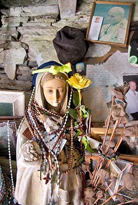
A more recent, related event happened in 1985 at a shrine devoted to the Virgin Mary on the other side of the country, outside the tiny hamlet of Ballinspittle (4 miles southwest of Kinsale in County Cork). Several locals claimed they had witnessed the statue of Mary moving spontaneously, and thousands of pilgrims flocked there that summer. Some pilgrims said they also witnessed the statue moving. But the Catholic Church remained neutral on the Ballinspittle event, and interest in it eventually subsided.
Getting There: The museum is in the market town of Strokestown, about midway between Westport and Dublin (90 kilometers northeast of Galway, 110 kilometers east of Westport—about 1.5 hours from either).
Background: For important context before visiting the museum, first read the Great Potato Famine sidebar earlier in this chapter. Strokestown was just one of countless locations in Ireland where people suffered horrifying fates during the famine. But, as a thriving market town presided over by local landowner Major Denis Mahon (who was particularly callous about his peasants’ suffering), it offers an illustrative case study for better understanding Ireland’s famine predicament—especially with the help of Mahon’s meticulous documentation.
Famine Museum: From the modern reception building (with an inviting café), cross through the courtyard and follow the one-way route through the museum. Thoughtful, interactive exhibits soberly explain the full story, starting with important historical and social context of an island of eight million people, controlled by British landowners, for whom three million peasants toiled in the fields, subsisting almost entirely on potatoes. You’ll be presented with both staggering statistics and intimate portraits of individuals whose lives were affected by the famine. Excerpts from letters of the age, and a variety of poignant quotes on the walls, help tell the story. Understanding the social hierarchy of 19th-century Ireland—from peasants and tenant farmers to middleman tax collectors to landowners and everyone in between—provides context for the devastating consequences of the famine.
Even before the blight devastated potato crops in 1845, Strokestown landowner Major Denis Mahon’s wealth and ostentatious lifestyle was already a house of cards. Mahon, easy to cast as one of the great villains of the famine, famously dined on lobster soup even as he evicted 3,000 suffering people from their homes.
Eager to offload his desperate, starving charges in whatever way possible, Mahon chartered ships to Quebec...and cut every corner, making conditions on those ships unbearable and dangerous. But first, the people of Strokestown had to get to the docks. In 1847, 1,490 starving people were forced to walk the 100 miles to Dublin. From there, they were shipped to Liverpool (a city that was rife with disease and crime, and shocking for these simple country folk) before being loaded onto “coffin ships” to Canada. Today, this route is commemorated by the National Famine Way, a poignant walking trail that begins right here and ends on the banks of the River Liffey in Dublin, at an evocative monument next to the Jeanie Johnston tall ship and in front of the EPIC Emigration Museum (www.nationalfamineway.ie).
Termed “worse than Cromwell” by the people of Strokestown, Mahon was ultimately assassinated. You’ll see the actual gun used to slay him—offering a bitter conclusion to the story of what happened here in Strokestown and across Ireland.
Circling back to the main building, find the door outside to the walled garden. While pretty and suitable for a contemplative stroll, it feels like an afterthought to the weighty and important museum.
Mahon Mansion: Tours of the musty Big House showcase the gulf that divided the Protestant upper crust from their Catholic house staff. Some tours include a peek at the servants’ tunnel—connecting the kitchen to the stable—built to avoid cluttering the Mahon family’s views with unsightly common laborers.