ARAN ISLANDS
Inishmore • Inisheer
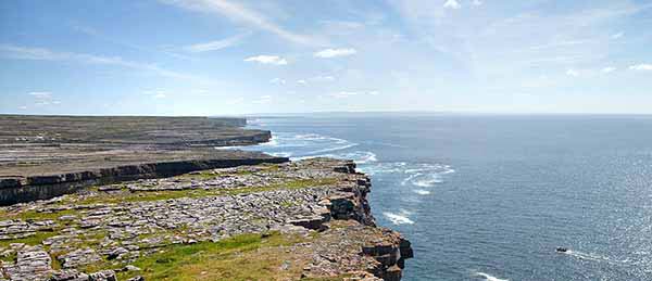
Strewn like limestone chips hammered off the jagged west coast, the three Aran Islands—Inishmore, Inishmaan, and Inisheer—confront the wild Atlantic with stubborn grit. (“Inish” is Irish for “island.”) The islands are a bit of a project to reach. But the payoff is remote, rustic Gaelic culture with a castaway charm and a spirit of adventure.
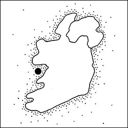
The largest, Inishmore (“big island,” 9 miles by 2 miles), is by far the most populated, interesting, and visited. Most visitors side-trip here from Galway, but it’s worth considering for an overnight. Inisheer (“east island”) is the smallest at just 1.5 miles square. Best reached from Doolin, it’s easier and faster to see. Snoozing between them is Inishmaan (“middle island,” 3.5 miles square), with little tourism infrastructure (not covered in this chapter). For help deciding between Inishmore and Inisheer, see the “Which Island to Visit?” sidebar, later.
The landscape of all three islands is harsh. Craggy, vertical cliffs fortify their southern flanks (particularly Inishmore). Windswept rocky fields, stitched together by stone walls, blanket the interiors. And the islands’ precious few sandy beaches hide in coves that dimple their northern shores. During the winter, severe gales sweep through; because of this, most of the settlements on the islands are found on the more sheltered northeastern side.
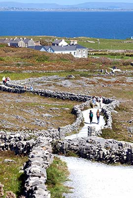
There’s a stark beauty about the Aran Islands and the simple lives their inhabitants eked out of a mean sea and less than six inches of topsoil. Precious little of the land is productive. In the past, people made a precarious living here from fishing and farming. The scoured bedrock offered little in the way of arable soil, so over centuries the islanders created it by layering seaweed with limestone sand and animal dung. Fields were small, divided by endless dry-stone walls.
Nowadays, tourism represents 80 percent of the islands’ economy. Each day, the 800 people of Inishmore greet as many as 2,000 visitors. The vast majority are day-trippers, who hop on a minibus at the dock for a visit to Dun Aengus (the must-see Iron Age fort), grab lunch, and then spend an hour or two browsing through the few shops or sitting at a picnic table outside a pub with a pint of Guinness. An overnight on Inishmore is a memorable low-stress treat.
The Aran Islands are a Gaeltacht area. While the islanders speak Irish among themselves, they happily speak English with visitors. And many islanders have direct, personal connections with close relatives in America.
PLANNING YOUR VISIT
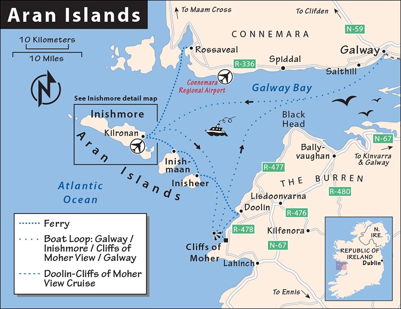
On Your Own: Reaching Inishmore is easiest from Galway, either via Rossaveal or direct from Galway. You can drive or take a shuttle bus to Rossaveal, about an hour west, for the 50-minute ferry crossing to Inishmore. Alternatively, you can take a boat from Galway’s City Docks directly to Inishmore, but you’ll spend a lot more time on the boat and less time on the island. Yet another option is to fly: From Galway, drive 45 minutes west to Connemara Regional Airport, then take a 10-minute hop in a little propeller plane to Inishmore. Once on Inishmore, you can rent a bike to explore on your own, or take a minibus, off-road, or horse-cart tour.
Inisheer is most easily reached from Doolin. From Doolin’s harbor, boats make the quick 15-minute crossing. This combines well with other sights in County Clare: Doolin itself, the Cliffs of Moher (a 15-minute drive from Doolin’s ferry dock), and the Burren. Note that you can also take a ferry to Inisheer from Rossaveal (west of Galway), but it’s a much longer crossing. Once on Inisheer, it’s easy to reach most of the island’s highlights on foot. A one-hour horse-cart tour and rental bikes are also available.
With a Tour: Group tours take you from Galway to Inishmore and back, and include transportation and the services of a guide. While convenient, this is more expensive than figuring it out yourself and limits you to a set itinerary (for details, see here in the Galway chapter).
GETTING TO THE ISLANDS
Most people visit the islands by boat. Be aware that the seas around the Aran Islands can be rough, even in seemingly nice weather. If you’re prone to seasickness, take precautions, or consider flying.
By Ferry from Rossaveal or Galway (Best for Inishmore)
Aran Island Ferries runs ferries to Inishmore and Inisheer from Rossaveal (about an hour west of Galway) and to Inishmore from Galway’s City Docks. The ferry company has two offices in Galway: at 37 Forster Street and at 1 Victoria Place (+353 91 568 903, www.aranislandferries.com; see map on here for locations).
From Rossaveal: From mid-April to September, ferries depart from Rossaveal at 10:30, 13:00, and 18:30, and from Inishmore at 8:15 (9:00 on Sun), 12:00, and 17:00 (50-minute trip, there may be additional sailings in summer—check schedule online). Ferries to Inisheer are less frequent (2/day, 1 hour). Both crossings are €30 round-trip.
Without a car, you can get from Galway to the Rossaveal dock on a shuttle bus operated by the ferry company that’s timed with each boat (€19 round-trip, 1 hour). Catch shuttle buses from Galway on Queen Street, a block behind the Kinlay Hostel (departs 1.5 hours before sailing, book ahead with your boat ticket and confirm departure point); shuttles return to Galway immediately after each boat arrives.
Drivers should go straight to the ferry landing in Rossaveal, passing several ticket agencies and pay parking lots. At the boat dock, you’ll find convenient pay parking and an office that sells tickets (with better WCs than on the ferry).
From Galway: Aran Island Ferries also offers a day-tour excursion that departs from Galway’s City Docks to Inishmore for a 4.5-hour stop before sailing to view the Cliffs of Moher en route back to Galway. This sailing takes 1.5 hours over and 2.5 hours back; it shortens your time on Inishmore, but departs directly from Galway (no shuttle bus or drive time) and adds cliff views with swooping seabirds near the salty cliff base splash zone (€49, departs daily at 9:30, returns to Galway by 18:00).
By Ferry from Doolin (Best for Inisheer)
The Doolin Ferry Co. runs boats from Doolin’s harbor to all three Aran Islands through the tourist season (May-Oct). The easy trip to Inisheer takes only about 15 minutes (€34, 4-6/day), while it’s 35 minutes to Inishmore (€44, 2-3/day). They also offer a €50 triangular day trip that takes you from Doolin to Inisheer, drops you off on Inisheer for a few hours, then sails along the base of the Cliffs of Moher before docking back in Doolin (3/day; enjoyable in good weather, less so when it’s socked-in or on rough seas). Check sailing times and buy tickets in advance online (+353 65 707 5555, www.doolinferry.com). There are two ticket offices at the dock, both for the same company. Parking at the dock is pay-and-display.
Arrive at the dock at least 20 minutes early. Be patient: Timings can be approximate (you’re on Irish island time), and the loading and unloading of boats can be a little chaotic.
By Plane
Flying is a fun and efficient way to reach the Aran Islands. Hopping on the eight-seat propeller plane costs about twice as much as the ferry, but it has lots of advantages. From Galway, it’s faster to drive to the airport than to Rossaveal, the flight takes less than 10 minutes, and flying allows you to come and go at different times than the day-trippers on big boats. Flying also avoids rough seas (though flights are subject to turbulence and can be cancelled in bad weather).
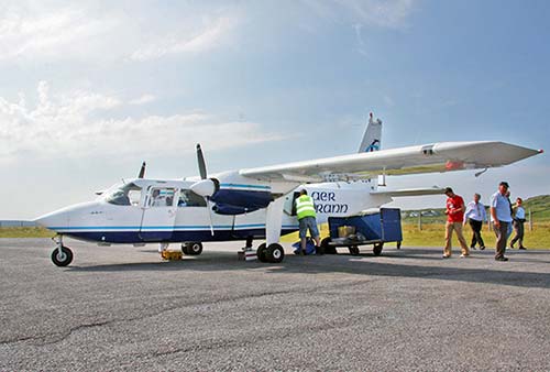
Aer Arann Islands, a friendly and flexible little airline, flies daily from Connemara Regional Airport, serving all three islands (runs about hourly in peak season, 4/day off-season, €35 one-way, €63 round-trip, 10-minute flight, +353 91 593 034, www.aerarannislands.ie). The planes get booked up—reserve via the website as soon as you are sure of your dates. Note the baggage weight limit is 50 pounds per person.
Getting to the Airport: Connemara Regional Airport is 20 miles west of Galway—allow 45 minutes for the drive, plus 30 minutes to check in before the scheduled departure (free parking at airport). A minibus shuttle—€5 one-way—runs from Victoria Hotel off Eyre Square in Galway an hour before each flight. Reserve a space on the shuttle bus when booking your flight.
Arrival on Inishmore: The minuscule Kilronan airport is around the bay, about two miles away from the town center. A minibus shuttle meets each arriving plane; the return minibus departs from town about 30 minutes before each flight departure (€4 one-way, €7.50 round-trip; stop is just behind the Aran Sweater Market).
Sightseeing Flights: Chartered sightseeing-only Aer Arann flights leave from the same airport. Cruising at 500 feet, you’ll fly above all three Aran Islands with an extra swoop past the Cliffs of Moher (around €750 for seven-passenger aircraft, 35 minutes, reservations required).
Inishmore
The largest of the Aran Islands, striped with distinctive dry-stone walls and infused with a quirky and cheery island spirit, has a blockbuster sight: the striking Dun Aengus fort, set on a sheer cliff. Everyone arrives at Kilronan, the Aran Islands’ biggest town...though really it’s just a village. Groups of backpackers wash ashore with the docking of each ferry. Minibuses, bike-rental shops, and a few horse carts sop up the tourists.
PLANNING YOUR TIME
If You Arrive By Boat: Here’s a good framework for a day trip if you’re sailing from Rossaveal (adjust this plan if you sail from Galway or Doolin): Leave Galway at 9:00 by car or shuttle bus to Rossaveal, where you’ll catch the 10:30 boat. When you arrive in Kilronan around 11:30, buses and horse carts wait at the dock, offering tours. Bike-rental offices are nearby (often with long lines). Determine how you’d like to see the island—minibus, off-road tour, horse cart, or rental bike—and get started quickly, as time is short. Visit Dun Aengus, and grab a bite at a simple café near the base of the fort trail (or bring a picnic). You’ll depart on the boat when high tides return, in the late afternoon.
If You Arrive By Plane: You’ll likely arrive earlier in the morning. Just enjoy the town and island when it’s sleepy, until the boats show up. If you’re renting a bike, you could use this time to get a head start to Dun Aengus, when it’s less crowded. The minibus tours appear just in time to meet the boats, so to join one of those, you’ll likely have to wait until late morning.
Choosing Your Sights: If you’re on a day trip, your time is too short to see everything in this chapter; you’ll have to be selective. Minibus tours are efficient in linking up some highlights—including ample time for the hike up to Dun Aengus—but are not designed to reach some of the others (including the Worm Hole, and the ancient sights at the eastern end of Inishmore). Off-road tours hit both Dun Aengus and the Worm Hole. For maximum flexibility, rent a bike.
Staying Overnight: If you’re spending the night, plan your time around the crush of day-trippers, who make a beeline straight off the boat to Dun Aengus. Upon arrival, head first in the opposite direction to check out the subtle charms of the less-visited eastern end of the island. Buy a picnic at the supermarket in Kilronan. Then walk to either the ruins of tiny St. Benen’s Church (an easy 45-minute hike one-way from Kilronan) or the rugged Black Fort ruins (a rocky one-hour scramble one-way from Kilronan). Save Dun Aengus for later in the afternoon, after the midday crowds have subsided. Enjoy an evening in the pubs and take a no-rush midmorning boat trip or flight back to the mainland the next day.
Orientation to Inishmore
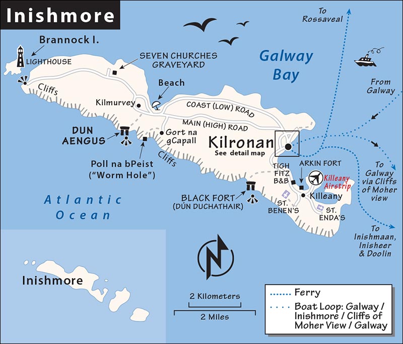
Your first stop on Inishmore is the town of Kilronan, huddling around the pier. There are a half-dozen shops, a scattering of B&Bs, a few restaurants, and a couple of bike-rental huts. The friendly Man of Aran café/shop (sells hiking maps) lurks on the back side of the stony Aran Sweater Market building. A few blocks inland up the high road, you’ll find a post office, a tiny bank (open one day a week) across from the roofless Anglican church ruins, and—at the very top of town—the best folk music pub (Joe Watty’s).
Kilmurvey, the island’s second-largest village, nestles below the island’s top sight—Dun Aengus. For sights without hordes of tourists, consider the eastern end of the island near Killeany.
These are the traditional fishing boats of the west coast of Ireland—lightweight and easy to haul. In your coastal travels, you’ll see a few actual currach or navogue boats—generally retired and stacked where visitors can touch them and ponder the simpler age when they were a key part of the economy.
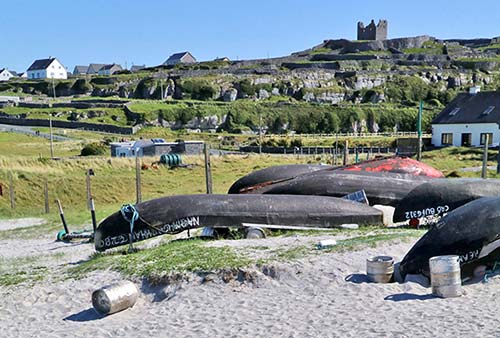
The currach is native to the Aran Islands, while the navogue is native to the Dingle Peninsula. It’s primarily a case of semantics and, to us, they look almost the same. But a fisherman would build a boat to suit his needs: a higher bow to deal with more surf, higher sides to lean over when pulling up lobster pots, a flat stern, and so on. Few raw materials were needed to make the boats: a wooden frame with canvas (originally cowhide) and paint with tar. But the skill in making them came from generations of fine-tuning by fishermen who knew their environment intimately.
The advantage of both boats was maneuverability on the sea and ease in getting them in and out of the water (the seamanship of these skilled sailors is too often underestimated). Their disadvantage was their fragility when hauling anything other than men or fish. When transporting sheep, farmers would lash each sheep’s pointy little hooves together and place it carefully upside-down in the currach—so it wouldn’t kick a hole in the little craft’s thin canvas skin.
TOURIST INFORMATION
Kilronan’s very helpful TI faces the harbor (daily 9:00-17:00, may close during lunch, +353 99 20862). The free map given out by the TI or ferry operators is all the average day-tripper or leisure biker will need. But serious hikers who plan on scampering out to the island’s craggy fringes will want something more serious. Check at the Man of Aran café/shop; they may stock the detailed Ordnance Survey map #51 or another map that’s better than the TI’s.
HELPFUL HINTS
Seasonal Closures: Inishmore is busiest from about June to September. Outside of these times, several shops, restaurants, and accommodations—including some of my recommendations—close down, even as the island remains somewhat busy with day-trippers in the shoulder season.
Events: The three-day Patrún celebration during the last weekend of June includes currach boat races, Galway “hooker” boat races, and a fun run. June 23 is St. John’s Eve Bonfire Night, a Christian/pagan tradition held the night before St. John’s Day, close to (but not on) the summer solstice. Each community stokes a raging fire around dusk, and dozens are visible not only on the island but also on the distant shore of Connemara. Fans of Father Ted, the 1990s TV series set on a fictional “Craggy Island” inspired by the Aran Islands, enjoy Tedfest (first weekend in March).
Money: Bring cash. While local businesses—such as minibus tours and B&Bs—increasingly accept credit cards, some still prefer or require cash payment. The island’s only ATM is inside the Spar supermarket.
Services: Public WCs are 100 yards beyond the TI on the harbor road, just past the Aran Dive Academy.
Groceries: The Spar supermarket, directly uphill from the harbor, is well stocked—it seems too big for the tiny community.
Tours on Inishmore
For a basic island introduction—getting the lay of the land, with transportation to Dun Aengus and back—choose between the first three options: minibus, off-road vehicle, or horse cart. Only the off-road trip needs to be booked in advance; the others simply meet arriving boats.
▲▲Minibus Tours
Fewer than 100 vehicles roam the island, and about a third of them are in the business of showing day-trippers the sights. A line of minibuses (seating 8-18 passengers) awaits the arrival of each ferry, offering €20 island tours (cash preferred, tips appreciated). The standard three-hour tour zips you to the far western tip of the island for a quick stroll on a rocky beach and a distant glimpse of a lighthouse, gives you 10 minutes to wander through the historic Seven Churches graveyard, and then drops you off for about two hours at Dun Aengus (allow 30 minutes to hike up, 30 minutes at the fort, 20 minutes to hike back down, and 40 minutes for lunch or shopping at the base) before running you back to Kilronan. (Some minibuses may use a different sequence.) Most drivers return along the smaller coast road (with scenic beaches and well-camouflaged sunbathing seals at low tide). Note that the minivan tours do not include the Worm Hole (for suggestions on squeezing this in, see the description under “Sights on Inishmore,” later).
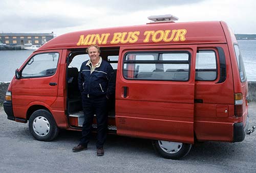
Which minibus to choose? Chat with a few drivers to find one you enjoy talking with. You’ll learn interesting tidbits: Inishmore has three elementary schools and three churches, and it’s 800 islanders live in 14 villages (actually just crossroads—each one built near a well along the main road). Most islanders own a small field where they keep a couple of cows (sheep are too much trouble). There are 400 types of flowers and 19 types of bees on the island. One guide told me, while pointing to the 2,000-year-old ring fort on the hilltop, “It’s so popular with visitors that we plan to build another 2,000-year-old ring fort next year.”
▲▲Aran Off-Road Experience
While about double the price, this is a more intimate and active alternative to Inishmore’s generic minibus tours. Brothers Pádraig and Aonghus Hernon load up to 11 travelers into a 4 × 4 Land Rover and guide them around the island, including some locations the minibuses simply can’t reach. They also offer opportunities to hike together over rocky terrain. (These tours are intended for fit and active travelers.) Unlike other tours, this includes a walk to the Worm Hole natural pool. As the groups are small, it’s essential to book ahead. Their “Wild Atlantic Experience” departs daily at 11:30 (€45, 4 hours; other options and private tours also available; +353 83 0185 175, www.aranoffroadexperience.ie, hello@aranoffroadexperience.ie).
▲Horse Cart Tours
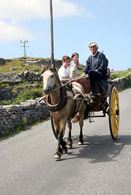
Horse-drawn carts (operated by equestrian tour guides locally called “jarveys”) meet arriving boats, offering a guided tour to Dun Aengus and back. While charming and rustic, these are much more expensive (recently they’ve been charging as much as €50 per person), and because the horses are slower, you’ll cover less ground than with a minibus tour.
▲Walking & Bike Tours
The O’Flaherty family leads group tours (on foot or by bike) that take the navigational hassle out of reaching natural wonders like the Worm Hole, the Black Fort, or St. Benen’s Church while adding rich insights on local history, wildlife, language, and culture (reserve ahead, +353 87 688 0688, www.aranhikingandbiking.com).
Activities on Inishmore
Biking
Biking here is great. Several rental options are near the pier (regular 21-speed bikes-about €20/day, electric bikes-€40/day). Most companies require a cash deposit unless you prebook online (www.aranbikehire.com).
Figure 30 minutes to ride from Kilronan to the start of the trailhead up to Dun Aengus. Cyclists enjoy taking the main (high) road over and the coast (low) road back—you’ll encounter fewer hills, scenic shoreline, and at low tide, a dozen seals basking in the sun. Novice bikers should be aware that the terrain is hilly and there are occasional headwinds and unpredictable showers. And you’ll be sharing the narrow roads with lots of minibuses and horse carts.
Keep a sharp lookout along the roadside for handy, modern limestone signposts (with distances in kilometers) that point the way to important sights. They’re in Irish, but you’ll be clued in by the small metal depictions of the sights embedded within them.
Music
Kilronan’s pubs offer music sporadically on summer evenings. Expect guitar-strumming folk songs rather than traditional Irish sessions (lacking the variety of instrumentation that the term “sessions” implies). Ask at your B&B or look for posted notices in front of the supermarket or post office. Joe Watty’s Bar, on the high road 100 yards past the post office, is worth the 10-minute walk from the dock. Its appealing front porch goes great with a pint, and live music warms the interior most nights. Another possibility is The Bar (next to the high cross at the base of the high road).
Scuba and Snorkeling
Aran Dive Academy, based right in the middle of Kilronan’s waterfront, offers scuba and snorkeling lessons for beginners, and guided dives for the experienced (+353 85 725 7260, www.diveacademy.info).
Sights on Inishmore
MID-ISLAND, NEAR KILMURVEY
These sights are a few miles west of Kilronan. You can reach (most of) them on a minibus, off-road, or horse-cart tour, or by bike.
▲▲▲Dun Aengus (Dún Aonghasa)
This is the island’s blockbuster sight. The stone fortress hangs spectacularly and precariously on the edge of a cliff 300 feet above the Atlantic. The crashing waves seem to say, “You’ve come to the end of the world.” While the ring fort itself is nothing special, those cliffs are breathtaking. Allow at least an hour for the visit, including the hike up and down, plus time to linger up top. Dun Aengus gets crowded with day-trippers after about noon; if you can, visit early or late.
Cost and Hours: €5, daily 9:00-18:00, off-season 10:00-16:00, guides on site can answer questions, access is open and free when visitors center is closed, +353 99 61008.
Getting There: The fort is 5.5 miles from Kilronan. You’ll stop here on any of the island tours (minibus, off-road, or horse cart), or you can rent a bike to pedal here at your own pace.
Visiting the Fort: At the base of the hill, just up a rural road from the “village center” of Kilmurvey, you’ll reach a giant bike parking lot. Circle around behind the big shop to find the ticket desk and entrance. A small visitors center displays aerial views of the fort and tells the story of its inhabitants. From here, it’s about a 15- to 20-minute hike to the top.
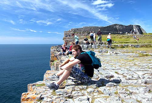
This “fort of Aengus” goes back 2,000 years, to the Bronze Age—though nothing is known about who Aengus was. The fort’s concentric walls are 13 feet thick and 10 feet high. As an added defense, it’s ringed with a commotion of spiky stones, sticking up like lances, called chevaux-de-frise (literally, “Frisian horses,” named for the Frisian soldiers who used pikes to stop charging cavalry). Slowly, as the cliff erodes, hunks of the fort fall into the sea.
While this history is impressive for some, the real reason to visit Dun Aengus is for its stunning setting: at the top of sharp cliffs that plummet 300 feet straight down to the churning ocean below. (This is what visiting the Cliffs of Moher used to be like, before they built the protective wall.) You’ll enter through a lower courtyard, with steep cliff views back across the island and over the Atlantic. Work your way uphill to the upper, innermost part of the fortress, with the highest views.
Gaze out to sea. Off this coast, Hy-Brasil—a phantom island cloaked in mist—was said to pop into view once every seven years. This mythical place appeared on maps as late as the mid-1800s.
Warnings: Like the Burren (its nearby mainland limestone cousin), this is rocky, irregular ground with primitive steps of varying heights and some smooth surfaces that can be slippery both wet and even dry. But watch your step on bare rock—some stable-looking rocks can be surprisingly shaky. The trail is gravel for the first half of the hike and lined with rock walls. Rangers advise visitors to wear sturdy walking shoes and watch kids closely; there’s no fence between you and a crumbling 300-foot cliff. Also, be wary of unexpected gusts of wind and uncertain footing near the edge. The Irish don’t believe in litigation...just “natural selection.”
The Emerald Isle is as rocky as it is green. When the English took the best land, they told the Irish to “go to hell or go to Connaught” (the rugged western part of Ireland, where the soil was particularly poor and rocky). Every spring, farmers would “harvest” rocks driven up by the winter frost in order to plant more edible fare. Over generations, Irish farmers stacked these rocks into fences, which still crisscross the landscape.
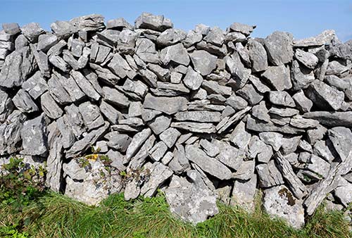
These are particularly abundant on the Aran Islands and in the Burren (nearby in County Clare), where you’ll see endless jagged, dry-stone walls, built without mortar. There may be as many as 1,500 miles of these walls on the Aran Islands (a total area of less than 18 square miles). While some—like those of Dun Aengus and other prehistoric forts—date back centuries, most were built in the 19th century, when communal land moved into private ownership.
The walls demarcate property and contain animals, but primarily, they were built to clear fields. The walls have an added benefit of protecting both topsoil and livestock from howling winds. Rather than being stacked in a strictly horizontal manner, they often contain stretches that are vertical or at sharp angles. And on sunny days, you can see light shining through all the little holes—particularly the most delicate fences, called “lace walls.” This is intentional: It allows the harsh winter winds to blow through without knocking down the wall.
If you get a chance to examining a dry-stone wall, you’ll notice that they’re punctuated with V-shaped gaps, filled in more irregularly with smaller, round rocks. When a farmer needs to move some cattle, he slowly unstacks the smaller rocks, moves the cattle through, and then restacks them. (More recently, modern gates have been built into many of the walls.) If a wall falls, rebuilding it is the responsibility of the farmer on whose property the stones land.
Flying low over western Ireland, the fields—alligatored by these rock fences—seem to stretch forever. While less spectacular than a towering castle or cathedral, the dry-stone walls of the Aran Islands and western Ireland are a remarkable and beautiful monument to hard work.
Kilmurvey
More a simple crossroads than a village, Kilmurvey sports a good soup-and-sandwich café, a healthy number of shops, and a too-good-to-be-true rusticity, with a gaggle of thatched-roof houses that feel right out of a Hollywood movie. (In fact, that’s exactly what they are: The huts that now sling souvenirs were built as sets for the 2010 Amy Adams romantic comedy Leap Year.) Located on the narrowest section of the island, Kilmurvey also has the best grazing land, a fact not lost on the local landlord who claimed it for himself.
Eating in Kilmurvey: $ Teach Nan Phaidi is an order-at-the-counter café with indoor and outdoor seating, selling a variety of soups, salads, hot meals, and cakes. Across the way, their second location—marked Teachín Nan—offers a simpler menu of soups and sandwiches at outdoor tables (both open daily). Next door is a popular ice-cream parlor. As every minibus tour on the island descends on this spot at just about the same time, it can be busy; to avoid waiting in line, considering packing a picnic instead.
Near Kilmurvey: Just down the road (toward Kilronan) is a great sheltered swimming beach with a blue flag. Throughout Ireland, “blue flag” beaches proclaim clean water, safe currents, and the color of your toes when you shiver back to your towel.
The Worm Hole (Poll na bPeist)
Off the beaten path and accessible only by hiking, this site (also called the “Serpent’s Lair”) takes the “logic” out of geo-logic. It’s a large, perfectly rectangular, 40-by-100-foot, 60-foot-deep seawater-filled pool that was cut by nature into the flat coastal bedrock. You’d swear that God used a cake knife to cut out this massive slab—just to mess with us. But limestone often fractures at right angles. So, the Worm Hole was formed when the roof of the hidden cave underneath (cut by tidal action) collapsed just so. To add to the surreal scene, Red Bull has featured this site several times in its annual cliff-diving competition from the 90-foot cliff above it (search YouTube for thrilling video clips).
Warning: The Worm Hole is a popular attraction...much to the consternation of islanders, who report that it’s not uncommon for tourists to sustain serious injuries (or worse) by getting too close. Their advice: Stay on the higher levels, and do not go near the water or swim here, as dangerous sneaker waves can sweep in at any moment.
Getting There: Minibus tours ignore the Worm Hole (in fact, most drivers actively discourage you from going here). If you’d like to do both Dun Aengus and the Worm Hole, and you’re just here for the day, your best bet is to come to this part of the island by bike, or to take the Aran Off-Road Experience, which includes visits to both Dun Aengus and the Worm Hole (described earlier).
You’ll find the Worm Hole beneath the island’s southern cliffs, one mile due south of Kilmurvey’s fine beach. Very roughly, figure about a 30-minute hike each way from Kilmurvey. The Worm Hole is signposted from the main road as Pol na bPeist, but the detailed Ordnance Survey map is handy for navigating, as the route is tricky to find: Consult your map and start with the primitive gravel lane leading toward the tiny inland community of Gort na gCapall. From there, you’ll be using dead reckoning.
Seven Churches Graveyard (Na Seacht Teampaill)
Close to the western tip of the island, this gathering of ruined chapels, monastic houses, and fragments of a high cross dates from the 8th to 11th century. Inishmore is dotted with reminders that Christianity was brought to the islands in the fifth century by St. Enda, who established a monastery here. Many great monks studied under Enda. Among these “Irish apostles” who started Ireland’s “Age of Saints and Scholars” (AD 500-900) was Columba (Colmcille in Irish), the founder of a monastery on the island of Iona in Scotland—home of the Irish monks who produced the Book of Kells. Check out the ornate gravestones (best detail on sunny days) of the “seven Romans,” located in the slightly elevated back corner of the graveyard, farthest from the road. These pilgrims came here from Rome in the ninth century, long after the fall of the Roman Empire.
ANCIENT SITES NEAR KILLEANY, AT INISHMORE’S EASTERN END
The quiet eastern end of Inishmore offers ancient sites in evocative settings for overnight visitors with more time, or for those seeking rocky hikes devoid of crowds. First, try to get the detailed Ordnance Survey map (check at the Man of Aran Coffee & Craft Shop). Then consider assembling a picnic, to fuel up either before or after you spend a couple of hours exploring these sights on foot. Ask the folks in town for directions (almost always a memorable experience).
St. Enda’s Church (Teaghlach Einne): Closest to the road, amid the dunes one mile past the Tigh Fitz B&B and just south of the airport, is this eighth-century church. Protected from wave erosion by a stubborn breakwater, it sits half-submerged in a sandy graveyard, surrounded by a sea of sawgrass and peppered with tombstones. St. Enda is said to be buried here, along with 125 other saints who flocked to Inishmore in the fifth century to learn from him.
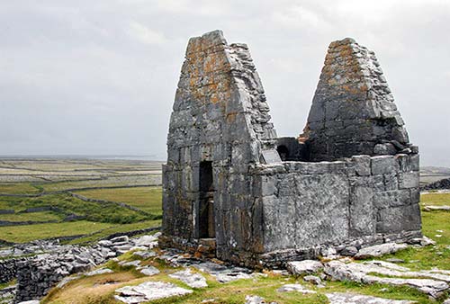
St. Benen’s Church (Teampall Bheanáin): This church perches high on a desolate ridge opposite the Tigh Fitz B&B. Walk up the stone-walled lane, passing a holy well and the stubby remains of a round tower. Then take another visual fix on the church’s silhouette on the horizon, and zigzag up the stone terraces to the top. The 30-minute hike up from the B&B pays off with a great view.
Dedicated to St. Benen, a young disciple of St. Patrick himself, this tiny (12-by-6-foot) 10th-century oratory is aligned north-south (instead of the usual east-west) to protect the doorway from prevailing winds. It’s thought that this structure was built, not as a place to say Mass, but primarily to house holy relics (a splinter from Christ’s cross, a thorn from his crown, etc.), which at the time were highly sought after. Also, its prominent location served as something like a beacon to those many pilgrims who had made the arduous journey to this remote holy island on the edge of the then-known world.
Arkin Fort: About a five-minute walk past the Tigh Fitz B&B (on your left as you head toward the airport), you’ll notice an abandoned stone pier and an adjacent, modest medieval ruin. This was built by Cromwell’s soldiers in 1652 using cut stones taken from the round tower and the monastic ruins that once stood below St. Benen’s Church. The fort was used as a prison for outlawed priests before English authorities sent them to the West Indies to be sold into slavery.
Black Fort (Dún Duchathair): Hidden on a remote, ragged headland an hour’s walk from Kilronan to the south side of the island, you’ll find the Black Fort. After Dun Aengus, this is Inishmore’s most dramatic fortification, built on a promontory with cliffs on three sides. Its defenders would have held out behind dry-stone ramparts, facing the island’s interior attackers. The Ordnance Survey map is essential to navigate here. Watch your step on the uneven ground and be ready to course-correct as you go, and chances are you’ll have this windswept ruin all to yourself. Imagine the planning and cooperative effort that went into building these life-saving structures 2,000 years ago.
Sleeping on Inishmore
The following places are all in Kilronan. Remember, this is a rustic island. Many rooms are plain, with simple plumbing. Luxury hasn’t made the leap from the mainland.
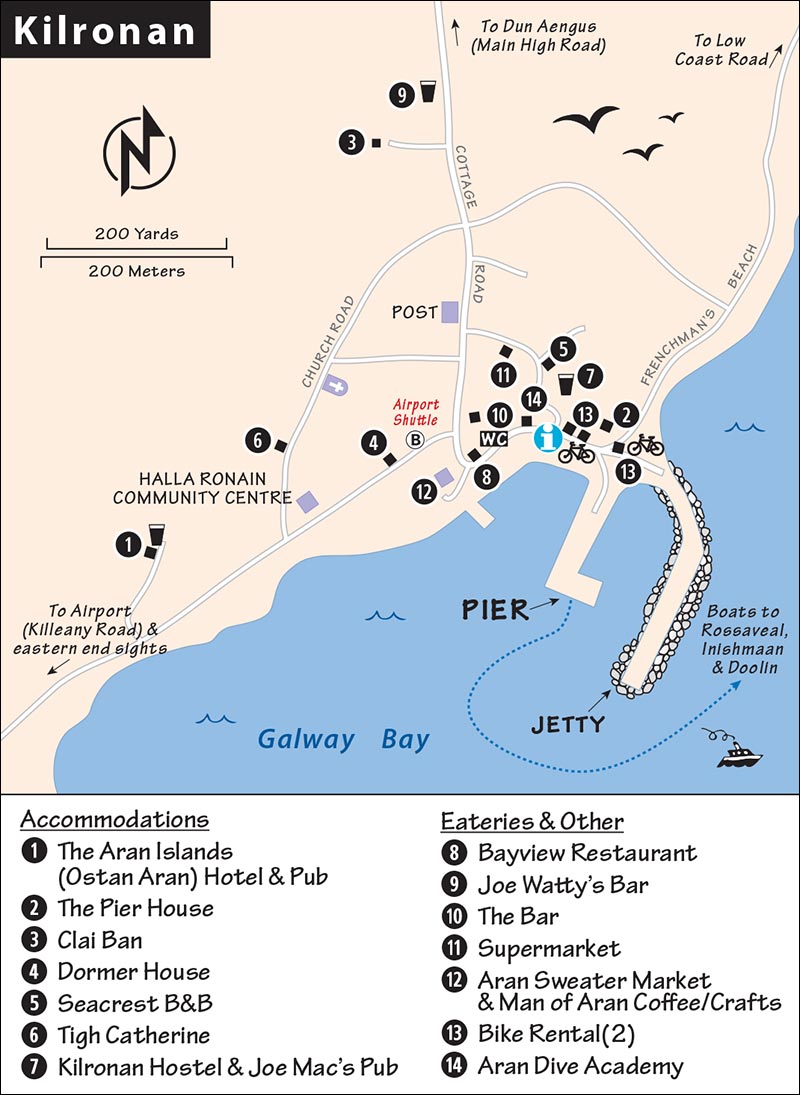
$$$ The Aran Islands (Ostan Aran) Hotel is the most modern option on the island. Its 22 rooms (five with large harbor-facing porches) have the comforts you’d expect. An additional 40 boxy “chalets” (freestanding studios with queen-size beds and balconies) cascade down the slope beside the hotel—the island’s first “glamping” option. Beware of loud weekend stag/hen parties drawn to their downstairs pub (+353 99 61104, 10-minute walk east of the dock on the coast road heading toward Killeany, www.aranislandshotel.com, info@aranislandshotel.com).
$$ The Pier House stands solidly 50 yards from the pier, offering 12 decent rooms, many with harbor views (+353 99 61417, www.pierhousearan.com, pierhousearan@gmail.com).
$$ Clai Ban, the only really cheery place in town, is run by friendly Marion and Bartley Hernon. Their six rooms and warm hospitality are worth the 10-minute uphill walk from the pier. The place is energized by their affectionate hound, Porter (cash only, walk past bank out of town and up the 50-yard-long lane on left—just before Joe Watty’s Bar, +353 99 61111, www.claiban-house.com, claibanhouse@gmail.com).
$$ Dormer House has eight centrally located rooms and has been run by kind Alice Joyce for over 30 years. It’s on par with the neat, no-frills vibe of the other B&Bs in town (next to Spar Market, +353 99 61125, dormerhouse@mail.com).
$ Seacrest B&B offers six uncluttered rooms in a central location behind the Aran Sweater Market (+353 87 161 6507, www.aranaccommodations.com, seacrestaran@gmail.com, Geraldine and Tom Faherty).
$ Tigh Catherine is a well-kept B&B with four homey rooms overlooking the harbor (cash only, on Church Road behind the Halla Ronain community center, mobile +353 87 980 9748, +353 99 61464, catherineandstiofain@gmail.com, Catherine Mulkerrin).
¢ Kilronan Hostel, overlooking the harbor near the TI, is cheap but noisy above Joe Mac’s Pub (+353 99 61255, www.kilronanhostel.com, kilronanhostel@gmail.com).
Eating on Inishmore
There are few restaurants in Kilronan, and none are fancy. Expect comfort food at reasonable prices. Beyond the places listed here, Kilronan’s modest cafés dish up hearty soup, soda bread, sandwiches, and tea.
$$ Bayview Restaurant, standing proudly beside the high cross, is the island’s most central and stylish (a relative term). Soup, salads, pizza, and some Spanish-inspired dishes fuel up tired bikers and hikers (daily, +353 86 792 9925).
$$ Joe Watty’s Bar, a 10-minute walk up the hill and away from most of the tourist congestion, is a classic-feeling, inviting pub with tasty grub. Try the goulash with a pint, and stick around for the music (daily, +353 99 20886, pleasant front-porch seating).
$$ The Aran Islands Hotel pub is a big, modern place serving good pub food (daily for dinner only, +353 99 61104).
Supermarket: The Spar has all the groceries you’ll need (daily). Next door is a handy, summer-only fish-and-chips counter.
Inisheer
The roughly circular little island of Inisheer (Inis Oírr) has less than a quarter of the land area and population of Inishmore. But Inisheer’s close proximity to the mainland makes it an easy 15-minute boat journey from Doolin and a good option for those with limited time, or who aren’t going north to Galway.
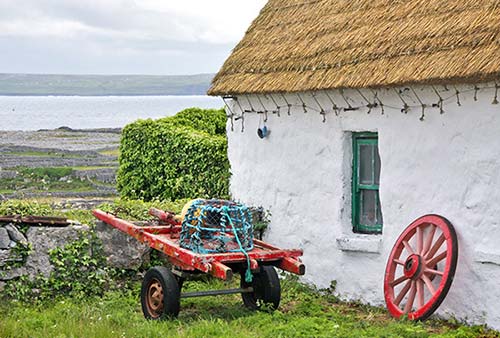
Inisheer offers an easy yet vivid glimpse of Aran Islands culture and has an engaging smorgasbord of salty but modest sights. As boat service has improved, it’s gained in popularity as an alternative to Inishmore, but remains relatively untrampled. Inisheer has ambitious plans to build a big pier, perhaps as early as 2025, which could attract more visitors.
Orientation to Inisheer
Inisheer has three pubs, one small grocery store, and no ATMs. All the sights—with the exception of the lonely lighthouse on the southern coast—are concentrated on the northern half and can easily be seen on foot. Inisheer lacks the dramatic (and much higher) coastal cliffs of Inishmore, but has its own unique photogenic charms.
ARRIVAL ON INISHEER
You’ll land at the north side of the island, in Inisheer’s only settlement. Facing inland, nearly all of the island’s landmarks are visible (except the An Plassy shipwreck and the lighthouse on the southern shore—both of which you’ll spot on the boat ride in). Horse-drawn carts meet you at the boat dock.
GETTING AROUND INISHEER
The island is small enough to see on foot, but with a horse-drawn cart ride you get some narration, and a bike lets you go farther, faster.
Horse-drawn carts (waiting at the dock) offer a one-hour introduction to the island for €15/person: a trot between endless dry-stone walls out to the shipwreck for a photo op, a scenic loop back toward town, and a drop-off at the base of the lane up to the castle (about a 10-minute uphill hike to the top). As it comes with a little lesson on island history and culture from a local, this is an efficient way to get your bearings. (You may also see tractors pulling trailers that offer a similar trip.)
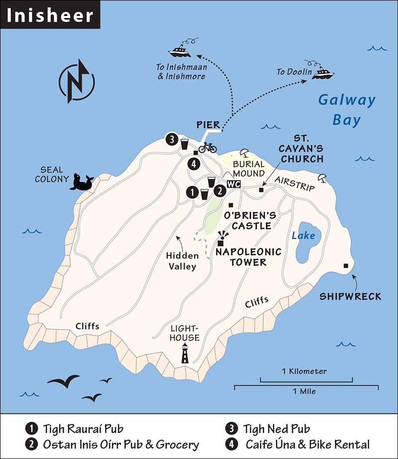
The only reason to skip the tour is if you’d rather explore by bike, although note that some sights—like O’Brien’s Castle—are steep enough that you’ll probably have to walk your bike up (and down) the hill. But to cover a lot of ground—especially for getting out to the shipwreck without a horse-cart tour—a bike can be worth considering. The bike-rental outfit is right at the base of the pier (€16/day, electric bike-€45, +353 99 75049, www.rothai-inisoirr.com).
Even if you’re not renting a bike, pick up the free bike-rental brochure. It includes a map of the island showing Inisheer’s primitive road network. That’s all you’ll need to navigate on foot.
Sights on Inisheer
The following sights are free and open 24/7. Here’s a good plan: On arrival, take the horse-cart tour, which goes out to the shipwreck and then loops around the island. You’ll be dropped off just below the castle. From there, first take a little detour to the cemetery and St. Cavan’s Church; then hike up to the castle and back down to town (via the “hidden valley”).
If you skip the horse-cart tour, you can still do everything in this order (starting with the walk from the port to the castle outlined first), then carry on to the shipwreck by foot (or with a rental bike) at the end, if time allows. Altogether it’s a two-mile loop that takes about an hour on foot, plus any time at the sights.
Walk from the Port to the Castle
If you’re on foot, here’s a quick self-guided walk to get to the sights. (Horse carts follow this same route.)
From the harbor pier, turn left and walk past the bike-rental kiosk, a little café, and then along a row of makeshift food and souvenir stalls. When you reach the sandy beach, swing right with the road, and head inland. You’ll run into a grassy mound ringed by stones; called Cnoc Raithnge, this is a Bronze Age walled burial mound. From here, turn left with the road so that the big playing field is on your right. (The three Aran Islands have a unified Irish football team that competes in County Galway.) Soon you’ll pass some free public WCs on your left, then a playground on your right.
About 100 yards past the playground, a side-road branches steeply uphill on your right, between stone walls. This lane—which is also where the horse-cart tours leave visitors—leads up to O’Brien’s Castle, and beyond it, to the Napoleonic Tower.
But before you head up, check out one sight closer to sea level: Turn left and follow the gently uphill lane a short distance to the cemetery you’ll see on the horizon, just to your left (overlooking the airstrip).
• Go through the gate to the cemetery. In the middle of it, you’ll find...
St. Cavan’s Church (Teampall Chaomhain)
St. Cavan was the brother of St. Kevin, who founded the monastery at Glendalough in the Wicklow Mountains. In the middle of the graveyard is a sunken sandpit holding the rugged, roofless remains of an 11th-century church. The shifting sand dunes almost buried it before sawgrass stabilized the hill. St. Cavan’s reputed gravesite is protected by a tiny modern structure (at the corner of the sunken area) that’s worth poking your head into for its candlelit atmosphere. Local folklore held that if you spent a night sleeping on the tomb lid, your particular illness would be cured. The cemetery itself is also evocative to explore, with its many Celtic crosses, both old and new, overlooking the sea.
• When you’re done at the cemetery, backtrack to the steep lane that leads up to...
O’Brien’s Castle (Caislean Ui Bhriain)
The ruins of this castle dominate the hilltop and are visible from almost anywhere on the northern half of the island. The small castle was built as a tower-house refuge around 1400 by the O’Brien clan from nearby County Clare. It sits inside a low wall of a much older Iron Age ring fort. Cromwell’s troops destroyed the castle in 1652, leaving the evocative ruins you see today.
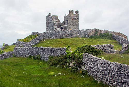
If you’ve made it up to O’Brien’s Castle, you can carry on up the same lane another easy five minutes to the Napoleonic Tower (An Tur Faire), which was built in the early 1800s to watch for a feared French invasion that never took place. While you can’t enter the tower, the views from this highest point on the island are, as the Irish say, grand.
• We’ll take a scenic route from here back down to town.
Walk from the Tower to Town
Continue walking (south) past the tower on the paved road into the heart of the island. Take your first right turn, roughly 200 yards after the Napoleonic Tower, onto a rocky, grassy cow lane that zigzags downhill into a lush hidden valley, displaying the prettiest mosaic of ivy-tangled rock walls and small green fields I’ve seen anywhere on the Aran Islands.
When you hit pavement, turn right (downhill), then take the next right. You’ll wind your way back down to the main north-shore road again, near the top of the village. From here, you can explore and relax in town—maybe grab a meal at one of the three pubs—until your boat departs. Or, if you haven’t seen it yet, consider heading out to the shipwreck (described next).
Shipwreck of the An Plassy
This freighter was wrecked offshore on Finn’s Rock in 1960, but islanders worked with the coastal patrol to rescue the crew with no loss of life. A couple of weeks later, the unmanned ship was washed high up onto the rocky shore, where it still sits today, a rusty but fairly intact ghost ship with a broken back. The fierce winter winds and record-breaking waves of 2013 shifted the wreck, further weakening it, and discussions are underway to remove it as it deteriorates. A local told me, “We may have to go out some night with lanterns to bring in a new shipwreck.”
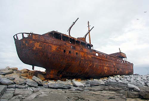
Beware of unstable footing on the rounded cobbles thrown up by the surf near the wreck. It’s extremely dangerous to touch the wreck, and those trying to climb it are begging for a rusty puncture wound...or worse.
Getting There: You can reach the shipwreck on a horse-cart tour, by bike, or on foot (it’s about a 30-minute walk from the boat dock). To walk, start by following the directions from the port to the castle (earlier). Walk past the lane up to the castle, staying on the main road below the cemetery (with the airstrip on your left). Then just keep going, between stone-stacked walls, as the road hooks to the south. You’ll pass the island’s very own “Great Lake” (An Loch Mór), and eventually the rusted hull of the An Plessy will come into view on the left horizon.
Eating on Inisheer
Inisheer’s three main pubs offer decent pub grub and have ample and inviting outdoor seating in good weather.
$$ Tigh Rauraí Pub (House of Rory) is the epicenter of island social life (from the pier, head east to the edge of the beach and turn right—inland—up a narrow lane for 100 yards).
$$ Ostan Inis Oírr Pub (Hotel Inisheer), closer to the beach, sports a colorful collage of international flags draping the pub’s ceiling and stag/hen parties on weekends.
$$$ Tigh Ned Pub (House of Ned; the sign says Pádraig Ó Conghaile) is next door to the hostel, near the pier on the north-shore road. Sit outside at their appealing front tables on a summer evening, enjoying a pint in the salt air.
Cafés and Other Eats: In summer, you’ll find a few other basic eateries on the island. Caife Úna, next to the bike-rental shop at the pier, has coffee and cakes, and fish-and-chips wagons serve basic meals.
Grocery Store: Picnic lovers flock to the small Ó Conghaile XL grocery, behind Ostan Inis Oírr Pub and below Tigh Rauraí Pub (daily). In summer, their deli counter has sandwiches.