DINGLE PENINSULA
Dingle Town • Slea Head Loop Drive • Blasket Islands • Tralee
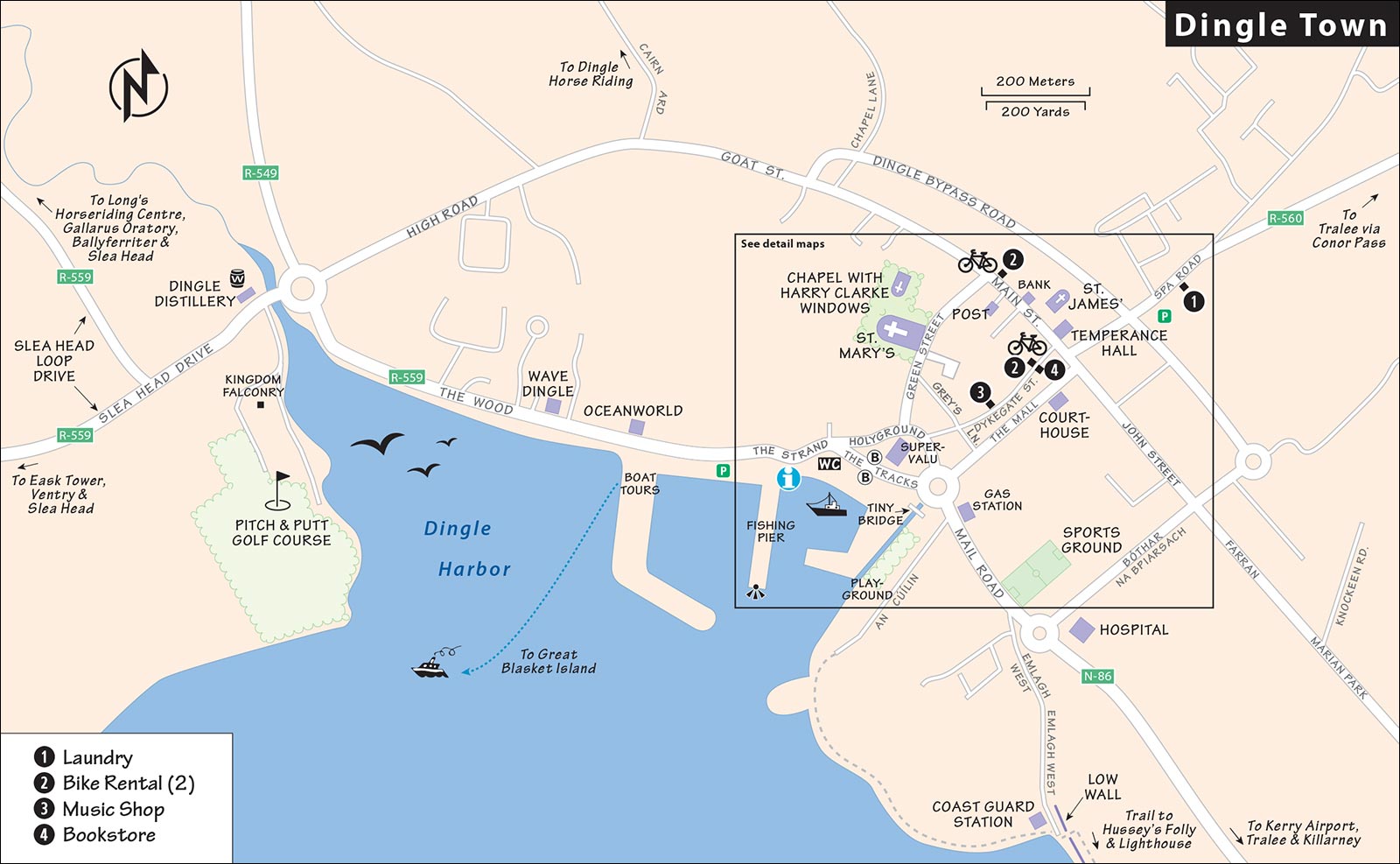
Map: Dingle Center Restaurants & Pubs
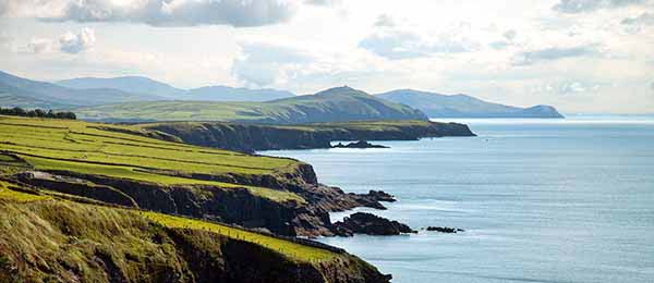
The Dingle Peninsula, the westernmost tip of Ireland (and Europe, for that matter), offers just the right mix of far-and-away beauty, isolated walks and bike rides, and ancient archaeological wonders—all within convenient reach of its charming main town. Dingle town is just large enough to have all the necessary tourist services and the steady nocturnal beat of Ireland’s best traditional music scene.
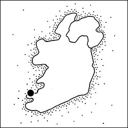
For almost 40 years, my Irish dreams have been set here on this sparse but lush peninsula, where locals are fond of saying, “The next parish over is Boston.” There’s a feeling of closeness to the land on the Dingle Peninsula. When I asked a local if he was born here, he thought for a second and said, “No, it was about six miles down the road.” I asked his friend if he’d lived here all his life. He said, “Not yet.”
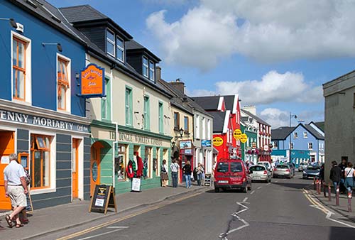
The Dingle Peninsula feels so traditionally Irish because it’s part of the Gaeltacht, a region where the government subsidizes the survival of the Irish language and culture. While English is always there, the signs, chitchat, and songs come in Irish Gaelic. Children carry Gaelic footballs to class, and the local preschool brags “ALL Gaelic.” And although Dingle town is crowded in summer, it still feels like the fish and the farm really matter. A half-dozen fishing boats sail from here, tractors leave tracks down the main drag, and a faint whiff of smoke from peat fires fills the nighttime streets.
But Dingle town is a destination in transition—more travelers discover it each year, and big-bus crowds crush in at midday after touring the peninsula. Small cruise ships eye the harbor from a distance with the hope of docking here a few years down the road (if infrastructure and dredging plans go through). And weekend stag and hen (bachelor and bachelorette) parties are attracted by Dingle’s growing reputation as “a drinking town with a fishing problem.” The filming of a 2015 Star Wars movie at the tip of the peninsula once again put this Irish paradise on the big screen (it was previously featured in Ryan’s Daughter and Far and Away).
Despite increased tourism, the Dingle Peninsula’s charms are resilient. As the older generation slows down and fades away, a new generation of entrepreneurs—either local kids or “blow-ins” from out of town—is giving Dingle fresh vitality. While residents hold a “goodbye to Dingle” party with the start of each tourist season in the spring and a “no more tourists” party at the end of the season, their welcome is warm and genuine.
PLANNING YOUR TIME
For the shortest visit, give Dingle town two nights and a day. By car, it takes five hours to get here from Dublin, four hours from Galway, and three hours from Cork or Kinsale. By spending two nights, you’ll feel more like a local on your second evening in the pubs.
With one day, here’s a good plan: In the morning, get acquainted with Dingle on my self-guided town walk. Then, around lunchtime—as the tour-bus groups begin to clog the formerly sleepy streets—head out on the 30-mile loop from Dingle around the peninsula by car or bike (following my Slea Head Loop Drive). If it’s too rainy to enjoy the outdoors, the distillery and surprisingly good local aquarium are worthwhile (book ahead for either).
For more serious walking or relaxing, you’ll need three nights and two days. It’s not uncommon to find Americans slowing way, way down in Dingle. In good weather, Great Blasket Island (off the western tip of the Dingle Peninsula, with the best ferry options from Dingle town) is a rewarding and easy-to-navigate hiking option (see here).
Dingle town’s activity level ramps up in late April, peaks through July and August, and stays pretty high through late September; the food festival the first weekend in October marks the grand finale of the busiest season. It’s smart to book your lodging as soon as you know what dates you’ll be in town. I’ve generally listed hours for the tourist season (April-Sept). Hours may be longer in July and August, and many places cut back or shut down entirely from October to March.
Dingle Town
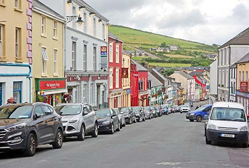
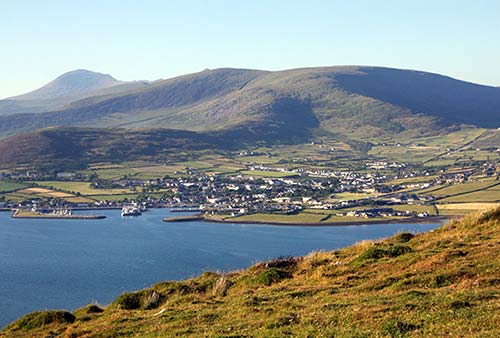
Of the peninsula’s 10,000 residents, about 2,000 live in Dingle town (Daingean Ui Chuis). Its few streets, lined with ramshackle but gaily painted shops and pubs, run up from a rain-stung harbor always sheltering fishing boats and leisure sailboats. Traditionally, the buildings were drab gray or whitewashed, but Ireland’s Tidy Town competition has prompted everyone to paint their buildings in playful pastels.
The courthouse (1832) is open one day per month. The judge wraps up business within a few hours. During the day, you’ll see teenagers—already working on ruddy, beer-glow cheeks—roll kegs up the streets and into the pubs in preparation for another night of music and craic (fun conversation and atmosphere). It’s a friendly town.
Orientation to Dingle
Dingle—comfortable on foot—hangs on a medieval grid of streets between the harbor and Main Street (three blocks inland). Nothing in town is more than a 10-minute walk away. Street numbers are rarely used. Everyone knows each other, and people on the street are fine sources of information. Locals love their soda bread, and they understand that tourism provides the butter.
TOURIST INFORMATION
The TI has a free town map, and staff who know the town but less about the rest of the peninsula (June-Sept daily 9:00-17:00, shorter hours and closed Sun in off-season, on Strand Street by the water, +353 066 915 1188). For advice on outdoor activities, talk to your B&B host.
ARRIVAL IN DINGLE
By Bus: Dingle has no bus station and only one bus stop, on the waterfront behind the SuperValu supermarket.
By Car: Drivers coming from Tralee choose two roads into town: the easy southern route on N-86 or the much more dramatic, scenic, and treacherous Conor Pass on R-560 leading into R-569 (see “Route Tips for Drivers” at the end of this chapter). It’s 30 miles (48 km) and about one hour from Tralee either way. If you’re coming from the Ring of Kerry or Killarney area, you’ll simply loop all the way around big Dingle Bay (N-70 to R-561, then join N-86 for the last 10 miles into town).
For parking, get advice from your B&B. Street parking is free but tight; to avoid the stress of looking around, you can head for the pay-and-display waterfront parking lot extending west from the TI, or the lot four blocks inland on Spa Road (free overnight).
By Plane: Kerry Airport, halfway between Tralee and Killarney, is a one-hour drive from Dingle. Short puddle-jumper flights connect the region to Dublin and make a visit to Dingle possible even for travelers with limited time. For more on Kerry Airport, see the end of this chapter.
HELPFUL HINTS
Before You Go: Check the local website for a list of festivals and events (www.dingle-peninsula.ie).
Crowds: Crowds trample Dingle’s charm throughout July and August. The craziest times are during the Dingle Races (early Aug), Dingle Regatta (early to mid-Aug), Blessing of the Boats (end of Aug or beginning of Sept), and Dingle Food Festival (first weekend in October). Easter week brings Irish families. The first Mondays in May, June, and August are Bank Holidays—three-day weekends when Dingle fills up. The town’s metabolism (prices, schedules, activities) rises and falls with the tourist crowds, so October through March is sleepy, windy, and chilly.
Farmers Market: On Fridays in season, farmers sell fresh produce, homemade marmalade, and homespun crafts in a small parking lot across the street from the SuperValu supermarket (mid-April-mid-Oct 9:00-15:00).
Money: Of the few ATMs scattered around town, the best deal is at the AIB Bank right along Main Street. (The others, run by private money-changing outfits, have worse exchange rates.)
Bookstore: An Café Liteartha is a perfect rainy-day hideout on a quiet back lane, with stacks of books and a backroom café (unpredictable hours but roughly daily 10:00-18:00, closed Sun Oct-May, near the top of Dykegate, +353 66 915 2204).
Laundry: Dingle Cleaners is convenient (Mon-Fri 9:00-18:00, Sat until 16:00, closed Sun, up Spa Road, +353 66 915 0680, mobile +353 87 793 5621, run by Ciarán—pronounced key-a-RAWN). There’s no self-service laundry in Dingle.
Bike Rental: Try Paddy’s Bike Shop, with reliably maintained 21-speed hybrids as well as electric bikes (daily 9:00-19:00, near the top of Dykegate, +353 66 915 2311, www.paddysbikeshop.com). Dingle Electric Bike Experience rents electric bikes as well as 24-speed hybrid bikes and will deliver them to your hotel and pick them up later (behind Curran’s Pub on Main Street, +353 86 084 8378, www.dinglebikes.com).
To bike the peninsula, get a bike with skinny street tires, not slow and fat mountain-bike tires. Be aware that the Dingle Peninsula has no bike lanes and increasing traffic volume.
Taxi: Try Diarmuid Begley (+353 87 250 4767), Sean with Dingle Cabs in Dingle (+353 87 660 2323), or Kathleen Curran (+353 87 254 9649).
Music Shop: Dánlann Gallery sells violins made by the owner, tin whistles, woodcrafts, and traditional toys, with a tiny café upstairs (summer Mon-Fri 10:00-17:00, “flexible hours” on weekends and off-season, Dykegate).
Tours in Dingle
Minibus Tours
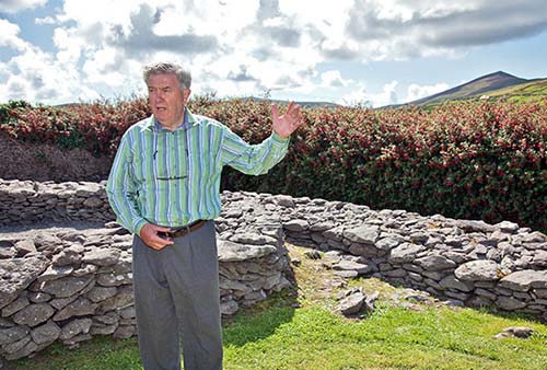
Sciúird Archaeology Tours, worth ▲▲▲, are offered by a family team with a passion for sharing the long history of the Dingle Peninsula. Archaeologist Michael Collins, with the occasional help of his father Tim (the retired Dingle police chief), gives informative three-hour-plus tours in a minivan with running commentary that basically follows the self-guided route in this book (Tim helped me write it). The tour stops at a variety of archaeological sites: medieval churches, ogham stones, early-Christian monastic sites, ring forts, holy wells, oratories, and beehive huts (€50, daily at 10:00, tour does not include the Blasket Centre; tours fill up in advance—book online as soon as you know your dates, +353 87 419 8617, www.ancientdingle.com, info@ancientdingle.com). Off-season, you may have to check with them to see if a minimum of six people have signed up.
Dingle Slea Head Tours is a small company (just Rory, Eibhlis, and Colm) that does single- and multiday private driving tours of the region from their Dingle home base. They also run Slea Head group tours daily at 10:00 and 14:00 (3 hours, €50, +353 87 218 9430, www.dinglesleaheadtours.com).
Walking Tours
Celtic Nature Walking Tours, run by Claire Galvin and Kevin O’Shea, takes fit hikers (with proper footwear) into the scenic backcountry of the Dingle Peninsula to connect with nature and Gaelic culture. Options range from climbing Mount Brandon to hiking Great Blasket Island. Routes can be tailored to your interests (+353 87 624 7230 or +353 87 790 3950, www.celticnature.com, info@celticnature.com).
Or consider the Dingle Hillwalking Club, an informal, visitor-friendly hiking group that connects you with active locals. You must have serious footwear for the rugged terrain (free, most Sun at 10:30, check schedule at www.dinglehillwalkingclub.com).
Dingle Town Walk
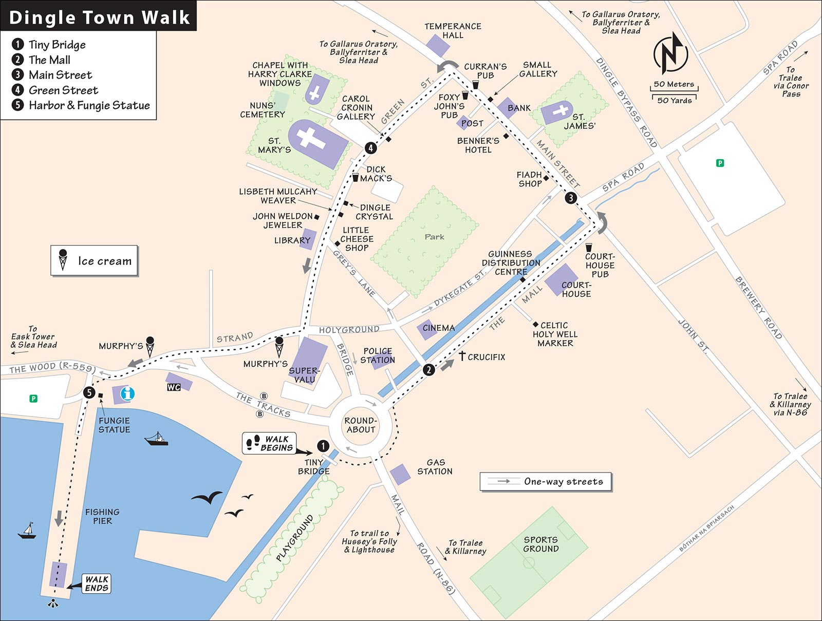
This quick, self-guided loop through town, worth ▲▲▲, gives you a once-over-lightly historical overview and good orientation.
• Start just beyond the “old roundabout” and beside the playground at the...
1 Tiny Bridge
This pedestrian bridge is built upon part of the original train line coming into Dingle (the westernmost train station in all of Europe from 1891 to 1953). The train once picked up fish in Dingle; its operators boasted that the cargo would be in London markets within 24 hours. The narrow-gauge tracks ran right along the harborfront.
All the land beyond the old buildings you see today has been reclaimed from the sea. Look inland and find the building on the left with the slate siding (the back wall of O’Flaherty’s pub), facing the worst storms coming in from the sea. This was the typical design for 19th-century weatherproofing. Just beyond, the radio tower marks the sky-blue police station.
• From here, cross the roundabout and walk up the big street called...
2 The Mall
After about 20 yards, two stubby red-brick pillars mark the entry to the police station. These pillars are all that remain of the 19th-century British Constabulary, which provided an embedded base for British troops when they tried to subdue the local insurgents here. It was burned down in 1922, during the Civil War; the present building dates from 1938. Today, in a small, peaceful town like Dingle, the police department is virtually unarmed.
The big white crucifix across the street and 50 yards up The Mall is a memorial to heroes who died in the 1916 Rising. Note that it says in the people’s language, “For honor and glory of Ireland, 1916 to 19__.” The date is unfinished until Ireland is united and free. The names listed are of local patriots who died fighting the British, and one (Thomas Ashe, or Tomás Ághas) who died while on a hunger strike.
• Just past the Russel’s B&B sign, take 15 paces up the B&B’s driveway to see an old stone etched with a cross embedded in the top of the wall (on the right).
This marks the site of a former Celtic holy well, a sacred spot for people here 2,000 years ago.
Back on The Mall, cross over the street and continue walking uphill along the delightful gurgling stream. Seventy yards farther up is another much-honored spot: the distribution center for Guinness. From this warehouse with its rusty, red, corrugated second floor, pubs throughout the peninsula are stocked with beer. The wooden kegs have been replaced by what locals fondly call “iron lungs.”
Across the street is the blocky, riot-resistant 19th-century courthouse, made of gray stone. Once a symbol of British oppression, today it’s a laid-back place where the roving County Kerry judge drops by to adjudicate cases on the last Friday of each month (mostly domestic disputes and drunken disorderliness). Next door, the blue building, is the popular (and recommended for trad music) Courthouse Pub.
• Continue to the big intersection and pause at the small bridge over a little stream. Notice the colors all around you.
A century ago, all these buildings were just shades of black and white. Their exteriors were originally exposed stonework (like the houses upstream). Then, in the 1920s, came the plaster (notice the bumps on the yellow An Droichead Beag pub), and in the 1970s, cheery pastels (along with modern tourism).
• Now head left into the commercial heart of the town on...
3 Main Street
First, find the little Fiadh Handwoven Design shop, on the left just past the first little corner, across from Ashes Bar. Fiadh (pronounced Fia) Durham creates locally inspired contemporary designs with local wool at her loom and welcomes curious visitors (check out her fine scarves).
A few doors farther up on the left is Benner’s Hotel. This was Dingle’s first hotel, where the old Tralee stagecoach route ended. Note the surviving Georgian facade and door.
Across the street, up a short gravel alley, is the humble, gray St. James’ Church. Since the 13th century, a church has stood here (just inside the medieval wall, closed to public during the day). Today, it’s Anglican on Sundays and filled with great traditional music several nights a week. In 2003, a midwinter concert series sprang up at the church, featuring internationally known artists seeking an intimate venue. It became known as the “Other Voices” series and grew into an annual event.
• A half-block farther uphill on the same side, past the bank, is a co-op gallery at #18.
The Small Gallery (An Gailearai Beagg) is the cute little showroom of the West Kerry Craft Guild, a collective of 14 local artists and artisans who each tend the shop two days a month to show off their work. Drop in and see who’s working today and learn about their creations.
Just uphill, past the Centra grocery, are two of Dingle’s most unapologetically traditional drinking holes: Curran’s and Foxy John’s. You’re welcome to pop in and look around, though you’ll feel a little more welcome if you order a drink (a small beer is “a glass” or half-pint). These pubs are throwbacks to the humble day when a single hole-in-the-wall address would do double duty: commercial shop by day, pub by night.
James Curran runs Curran’s Pub out of what was once his grandma’s general store. On the last Saturday of every month—when farm families were in town for the market—the wives would pick up their basics here, ordering butter, tea, sugar, jams, and salted meat through the little window. (Just about everything else they consumed was homegrown.) The same shelves Grandma used for jams and socks today stock beer and whiskey. Notice the “snug” in front. Until the 1950s, women didn’t feel welcome to drink in Irish pubs—for fear of being groped or otherwise mistreated. So instead, they’d discreetly nurse a sherry in the snug while their men enjoyed the main room. The great photos all around give you a sense for the old days. Buy a beer and chat with Mr. Curran.
Foxy John’s Pub, across the street, is still a working hardware store. Any time of day, you can order a bag of nails with your pint. Notice the back room; while pubs historically have had a legal “last call” at 23:30, the action would often migrate to the back room after the front door was locked.
• Walk a few steps uphill to the Green Street intersection.
On your right, notice the big, reddish Temperance Hall, which dates back to a 19th-century church-promoted movement that attempted to cut down the consumption of alcohol. To this day Ireland has a serious alcohol problem behind the happy veneer of all this pub fun. You’ll see pickled old-timers who spend every morning of their last years on the same barstool. Today the Temperance Hall is a meeting place for AA groups, youth clubs, scouts, and other various social and support groups.
Directly across the street, you’ll find a small plaque on the wall (right of the door). This marked a safe house prepared during the French Revolution for the French queen, Marie Antoinette. But the queen refused to leave France and the safe house was never used.
• Now head downhill opposite the Temperance Hall to discover...
4 Green Street
A few steps down Green Street on the left, look between two upper windows to find a stone carved with the year “1586.” This is a reminder that 16th-century Dingle traded with Spain and was a port of embarkation for pilgrims on their way to Santiago de Compostela (see “Dingle’s History” sidebar).
Farther along on the left, set back from the street, look for the Carol Cronin Gallery, an art gallery that clearly loves the sea. Popping in, you’re likely to meet Carol at work. Many find her seascape paintings absolutely mesmerizing.
Down the street on the right, pop into the beautiful, modern but old-looking St. Mary’s Church. The former convent behind it shows off its delightful Harry Clarke stained-glass windows—the single most important cultural sight in Dingle. Don’t miss them (described later, under “Sights in Dingle”). Then, wander in the backyard (just uphill) to check out the tranquil and poignant nuns’ cemetery, with its white-painted iron crosses huddling peacefully together under a gigantic copper beech tree. Beyond the cemetery, a path leads to additional leafy, tranquil gardens (concerts are sometimes held back in the gazebo).
Across from St. Mary’s (hence the nickname “the last pew”) is Dick Mack’s Pub, another traditional pub well worth a peek, even for nondrinkers. This was once a tiny leather shop that expanded into a pub at night. The pub was established in 1899 by great-grandpa Mack (master of the westernmost train station in Europe), whose mission was to provide “liquid replenishment” to travelers. Today, Dick Mack retains its old leather-shop ambience. In fact, it’s popular for handcrafted belts. (Their motto: “Step up and get waisted.”) The latest Mack, Finn, has changed the focus to whiskey—very trendy in Ireland—and is also starting up a microbrewing operation in the back lot. Finn has no bar menu—guests just ask him for their options. Exploring the pub, you’ll see a classic snug by the window, wonderful photos of generations past, and Hollywood-style stars on the sidewalk outside that recall famous visitors.
Green Street continues downhill past inviting boutiques, cafés, and estate agents. Many fine Dingle shops show off work by local artisans.
Dingle Crystal (on the left) features Sean Daly and his Waterford-trained crystal-cutting skills. Sean prides himself on the deep, sharp cuts in his designs—see the video of him at work. The shop is run by his daughter Bella.
A few steps farther on, the shop of Lisbeth Mulcahy Weaver is filled with traditional but stylish woven woolen wear. It’s also the Dingle sales outlet of her husband, a well-known potter from Slea Head. Across the street is John Weldon Jewellers—ideal for those interested in handcrafted gold and silver with Celtic designs.
• At the corner, take a left on Grey’s Lane and follow your nose.
The Little Cheese Shop is a foodie shrine playfully governed by Maja Binder, a German who trained in Switzerland. Poke your head inside, even if only for a whiff of her various traditional handmade cheeses (closed Sun-Mon).
Back on Green Street, you’ll see Dingle’s green library, a gift from the Carnegie Foundation, with a small exhibit about local patriot Thomas Ashe and the Blasket Island writers. The best historic photos you’ll find in town decorate the library’s walls with images of 19th-century Dingle.
• At the bottom of Green Street, take a right. Follow this street for a couple of short blocks. Halfway down the first block, on the left, is the recommended Murphy’s, with the best ice cream in town. Continuing to the end of the block, the harbor area opens up before you (with a public WC and covered picnic tables on your left). Carry on straight along the row of colorful restaurants. You’ll spot the TI across the street on your left. Cross over and find the square to the right of the TI, with a statue of a dolphin.
5 Harbor
The harbor was built in 1992 on reclaimed land. The string of old stone shops facing the harbor was the loading station for the railway that hauled the fish from Dingle until 1953. Dingle’s fishing industry survives, but it’s an international endeavor. Most fishing boats that now ply these waters are Spanish, French, and Basque. Rather than sailing home with their catch, they offload their fish (mackerel, tuna, cod, herring, and prawns) onto trucks that lumber directly to their homelands. In the old days, sailors would hang out at the Marina Inn pub. But today they barely get off their boats. The trucks that haul their catch home return to Ireland loaded with provisions for their fishermen, a situation that does very little to bolster Dingle’s economy.
But don’t be too sad for Dingle. The parking lot to the right is often filled with tour buses, as Dingle is on the big-bus route from Killarney to Slea Head (in season, thousands stop here daily for a few hours—often around lunchtime).
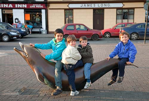
Enjoy the kid-friendly scene around the bronze statue of the beloved bottlenose dolphin, Fungie (FOON-ghee), who moved into Dingle Harbor in 1983 and was a fixture for 37 years. Seeming to revel in human attention, Fungie became a local celebrity. He served as a training buddy for local swimmers, a companion to fishermen, and greeter to boats in Dingle’s bay. His gregarious personality made him the darling of the town’s tourist trade. Hardy little tour boats thrived by offering passengers the chance of seeing Fungie up close. Sadly, Fungie was last seen in October 2020. Dingle’s resident dolphin is gone, but he’s definitely not forgotten.
From the Fungie statue, look straight out. Dead ahead on the distant hill is the Eask Tower. While it serves the useful purpose of marking this hidden harbor for those far out at sea, it was built primarily as a famine-era make-work project. A bit to the right, the big, yellow 18th-century manor house across the harbor was owned by Lord Ventry, the dominant English landlord of the time, and is now a school. The pyramid-shaped mountain in the distance is Mount Eagle, marking Slea Head at the end of the Dingle Peninsula.
Now pan left along the waterline. The building with two big basement doors is a boathouse. At high tide, boats would float in, and at low tide they’d be dry-docked for repairs. Beyond the boathouse and the harbor wall is the mouth of Dingle Harbor and the open sea. The booking office for harbor and boat tours faces the statue (see “Activities in Dingle,” later).
• Your walk is over. For a little extra charm, stroll straight ahead to the end of the dock for a salty view, a look at the fishing boats, and a chat with a fisherman or two.
Sights in Dingle
▲Short Harbor Walk from Dingle
▲Harry Clarke Windows
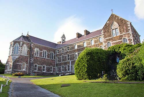
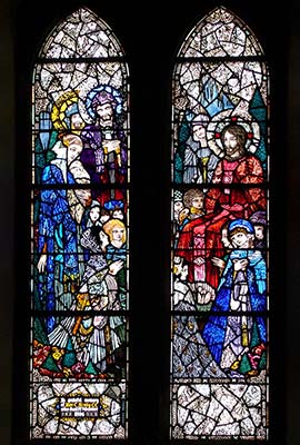
Just behind Dingle’s St. Mary’s Church stands the former Presentation Sisters’ convent, now home to the Díseart (DEE-shirt) Institute of Education and Celtic Culture. The sisters of this order, who came to Dingle in 1829 to educate local girls, worked heroically during the famine. The convent contains the beautiful Neo-Gothic Chapel of the Sacred Heart, built in 1884. The chapel was graced in 1922 with 12 windows—the work of Ireland’s top stained-glass man, Harry Clarke. Long appreciated only by the sisters, these special windows—showing scenes from the life of Christ—are now open to the public. The convent has become a center for sharing Christian Celtic culture and spirituality. While Harry Clarke’s neo-medieval windows are the big draw, it’s also worth noting the recently painted, charming art of Colorado native Eleanor Yates.
Cost and Hours: €3, unpredictable hours but likely Mon-Fri 10:00-13:00 & 14:00-16:30, closed Sat-Sun, +353 66 915 2476, www.diseart.ie.
Visiting the Chapel: Stop at the reception room to pick up a loaner description with a self-guided walk. Turn left down the hallway, go to the end, and climb the stairs to find the Chapel of the Sacred Heart, with the stained glass of Harry Clarke. While the windows behind the altar are Victorian, Clarke’s early-20th-century windows ring the chapel with six easy-to-read scenes. Clockwise from the back entrance, they are the visit of the Magi, the Baptism of Jesus, “Let the little children come to me,” the Sermon on the Mount, the Agony in the Garden, and Jesus appearing to Mary Magdalene. Each face is lively and animated in the imaginative, devout, neo-medieval, and fun-loving style of Harry Clarke. During Mass in the chapel, the Mother Superior would sit in the covered stall in the rear, while the sisters—filling the carved stalls—chanted in response.
Farther down this upstairs hallway is the Nano Nagle Room, with several more-recent murals by Eleanor Yates, telling the story of the wealthy Irishwoman Nano Nagle (1718-1784). One wall-sized mural shows the young, well-dressed aristocrat in a carriage in Paris, living the good life. But while there, she saw destitute people and felt moved to help them—so she became a nun and returned to Ireland.
Now head back down to the main level. Near the base of the stairs, go down the hall to find a big room with another large-scale work by Yates: a Last Supper fresco that pictures Dingle Harbor out the window.
▲Dingle Distillery Tour
In 2012, Dingle Distillery became the first independent distillery in Ireland to start casking spirits (challenging Jameson, Bushmills, and other big, well-established producers). These days, craft distillates are trendy, with more than 50 small producers popping up all over Ireland—but Dingle Distillery remains one of the best, and the most interesting to tour. They produce well-regarded single-malt and single-pot still whiskeys, as well as a very smooth vodka and a prizewinning gin.
The production facility, across the stone bridge at the far end of town (a pleasant 20-minute walk or quick drive from downtown), offers insightful tours that explain the process and include three different tastes. It begins with a little history lesson, followed by a tour of the areas where the whiskey is produced (including several huge copper stills), and ends at the tasting room for a signature drink. The distillery isn’t allowed to sell bottles of the finished product, but it’s available at liquor and duty-free stores around Ireland—and several local pubs carry the full line.
Cost and Hours: €18, daily 10:00-16:30, typically about 7 tours/day—check schedule and sign up on website, best to book online a day or two in advance as tours can fill up, www.dingledistillery.ie.
▲Oceanworld
This surprisingly engaging aquarium offers a little peninsula history and 300 different species of fish in thoughtfully described tanks, plus otters, penguins, butterflies, and more. This could be worth as much as ▲▲ for kids and maybe even for adults on a rainy day. It’s jam-packed in the summer; to avoid disappointment at busy times, book your entry time online a day or two ahead.
Cost and Hours: €19, kids—€13, family deals available; daily 10:00-18:00, last entry one hour before closing, shorter hours off-season; just past harbor on west edge of town, +353 66 915 2111, www.dingle-oceanworld.ie.
Visiting the Aquarium: The aquarium’s mission is to teach, and you’re welcome to ask questions. You’ll see local fish as well as a colorful Amazon collection, some rescue turtles, playful otters, and a steamy “butterfly oasis” chamber. There are two different penguin areas: one outside, near the otters (for more temperate Humboldt penguins), and one with polar penguins, where a dozen of the little tuxedo torpedoes dart underwater and splash up onto their fake Antarctic ice block. The shark tank has a couple of intimidating sand tiger sharks (plus Molly, a rescue sea turtle). The petting pool is fun; splashing attracts the rays, which are unplugged. Finish by walking through an “ocean tunnel” with fish swimming overhead.
Nearby: Just down the road past the aquarium, skip the attraction called Wave Dingle. Filling a former fish-processing plant, it has a series of four low-quality virtual films (on sea life, a Spanish Armada shipwreck, mythical sea beasts, and so on) and some paltry exhibits. Given the high price tag, it’s not worthwhile even on a rainy day.
▲Kingdom Falconry
Master falconer Eric leads encounters with hawks, falcons, owls, and an eagle. You can join the one-hour falcon experience (€23, March-mid-Oct daily at 12:00) or arrange a private experience (€250/up to 10 people; “hawk walk” at nearby beach-€110/2 people). For any of these, prebooking online is required (at Milltown House, just over the bridge west of town; +353 87 055 2313, www.kingdomfalconry.com).
Rainy-Day Sights Nearby
If you get hit with bad weather and could use some indoor activities, consider driving about an hour to Tralee (over scenic Conor Pass, if conditions allow), where you can tour the Kerry County Museum and/or the Blennerville Windmill, just outside town (both described at the end of this chapter). You can return on the easier, slightly faster N-86, making your trip a loop. While neither of these sights would be worth a big detour in fair weather, they can help round out a gloomy day.
ACTIVITIES
▲Short Harbor Walk from Dingle
This easy stroll along the harbor out of town—to the lighthouse and back—takes about 1.5 hours round-trip. Head east from the old roundabout (just past O’Flaherty’s pub) and walk uphill past the Texaco station. Just after Bambury’s B&B, take a right, then immediately bear left (toward the cell-phone tower). The road curls downhill and dead-ends at a tiny Irish Coast Guard station beside the bay. Turn left at the station, climbing the steps over the low wall and following the seashore path to the mouth of Dingle Harbor (passing Hussey’s folly, an empty two-story shell of a tower built by a 19th-century fat cat). Ten minutes beyond that is a two-story (white with red trim) lighthouse. Continue for another half-mile to dramatic views and an intimate little beach (portions of the trail may be closed due to cliff erosion).
▲Bike and Hike to Eask Tower
The bike-and-hike trek to Eask Tower, totaling about 10 miles round-trip, is a good compromise for those wanting more exercise than the mellow harbor walk to the lighthouse, but less sweat than biking the entire 30-mile Slea Head Loop. The lazy option: Skip the bike, drive to the trailhead, and walk up from there (allow about 1.5 hours round-trip for just the hike).
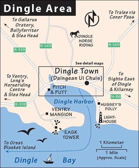
Rent a bike in town and pedal west past the aquarium, going left at the roundabout that takes you over the bridge onto R-559 toward Slea Head. After almost two miles, turn left at the brown sign to Holden’s Leather Workshop. A narrow leafy lane leads another two miles or so to a hut on the right marked Eask Tower (the tower looms on the bare hill above). Pay the small trail fee at the hut (if unattended, feed the honor box) and hike about a mile straight up the hill. It’s a steep trail. You’ll zigzag around sheep and tiptoe over their droppings. You’ll also need to navigate through (possibly climb) a couple of waist-high, metal-rung gates. After 45 minutes, you’ll reach the stone signal tower on the crown of the hill. Enjoy fantastic views of Dingle town (to the north) and Dingle Bay with the Iveragh Peninsula (home of the Ring of Kerry to the south). Spot the two jagged Skellig Islands off the distant tip of the Iveragh Peninsula.
Boat Trips
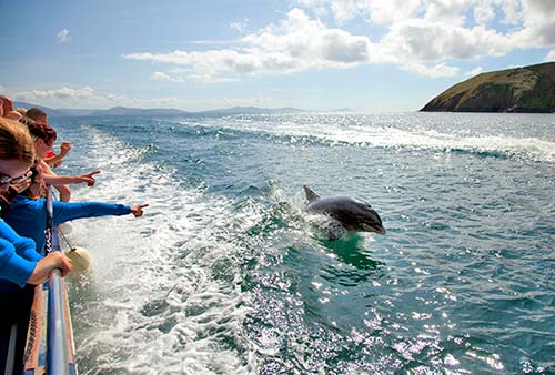
When hard times fell on the local fishing industry, hardworking captains converted to sightseeing operators. From April to September, a guerrilla flotilla of former fishing boats loads up with tourists and crisscrosses Dingle harbor. Most churn around the sheltered bay. Others offer three-hour “eco-voyages” beyond the mouth of the harbor to spy puffins, dolphins, and seals, and dependable transport to Great Blasket Island off the tip of the peninsula.
Dingle Dolphin Boat Tours, with three boats, offers a one-hour bay cruise (€15, at least 2/day in summer), a two-hour mini eco-tour focusing on coastal wildlife (€30, 2/day), and a three-hour sightseeing trip on a covered boat to the Blasket Islands to see cliffs, coastline, and wildlife (€60). Book all tours online (schedules vary with weather and tides, office in back corner of TI beside Fungie dolphin sculpture, +353 66 915 2626, www.dingledolphin.com).
Dingle Boat Tours covers a similar lineup at competitive prices. Their office is at the base of the large Dingle Marina jetty—not to be confused with the shorter commercial fishing pier (+353 87 672 6100, www.dingleboattours.com, info@dingleboattours.com).
Blasket Ferry shuttles visitors from Dunquin harbor at the far west end of the peninsula to Great Blasket Island (€35, runs April-Sept weather permitting, generally 4/day, call in advance to confirm and reserve, +353 87 448 8330, www.blasketferry.ie).
RIB Tours: In addition to traditional boat trips, newer companies are offering high-speed inflatable boat tours (a.k.a. RIB or Zodiac tours). Instead of plodding around on a big boat, you’ll strap into an inflatable-hulled smaller one and zip at top speed across the water. Dingle Sea Safari, with a ticket office facing the Fungie statue, is the dominant outfit (€65, 2.5 hours, at least 6/day in season, +353 86 193 7304, www.dingleseasafari.com).
Horseback Riding
Dingle Horse Riding can take you for a 2.5-hour trail ride (€150/person). More experienced riders can choose a full-day option or multiday excursion blending mountains and beaches (book online or call; to find it, follow Main Street out of Dingle, and turn right at the sign—for location see the “Dingle Area” map on here; +353 86 821 1255, www.dinglehorseriding.com).
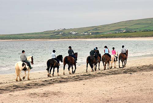
Long’s Horseriding Centre is farther out on the peninsula just past Ventry (sign on right)—an easy stop for drivers doing the Slea Head Loop (one-hour beach ride-€50, two-hour beach and mountain trail ride-€100; open Mon-Sat, closed Sun and off-season; for location see the “Slea Head Loop Drive” map on here, book online or via email, www.longsriding.com, info@longsriding.com). In either case, mountain rides are only for advanced riders, and all horses come with English-style saddles (no horns to hang on to—anyone with only Western saddle experience is considered a beginner).
Golf
Dingle Pitch & Putt has 18 scenic holes (ranging from 30 to 95 yards in length) that make a relaxing diversion for average duffers on a green headland overlooking the harbor. They also have a miniature-golf “crazy course” (€8, includes gear, cash only; daily 10:00-19:00, closed Nov-March; behind Milltown House about a 25-minute walk out of town—after crossing over the bridge, take the first left and then the first right; +353 87 934 6621).
Ceann Sibéal/Dingle Links, located out west near the wildly scenic tip of the Dingle Peninsula and the town of Ballyferriter, offers a round of golf in a hard-to-beat setting (€170, cheaper off-season, club rental €50; Baile an Fheirtearaigh, 9 miles west of Dingle town, for location see the “Slea Head Loop Drive” map on here; +353 66 915 6255, www.dinglelinks.com).
EAST OF DINGLE TOWN
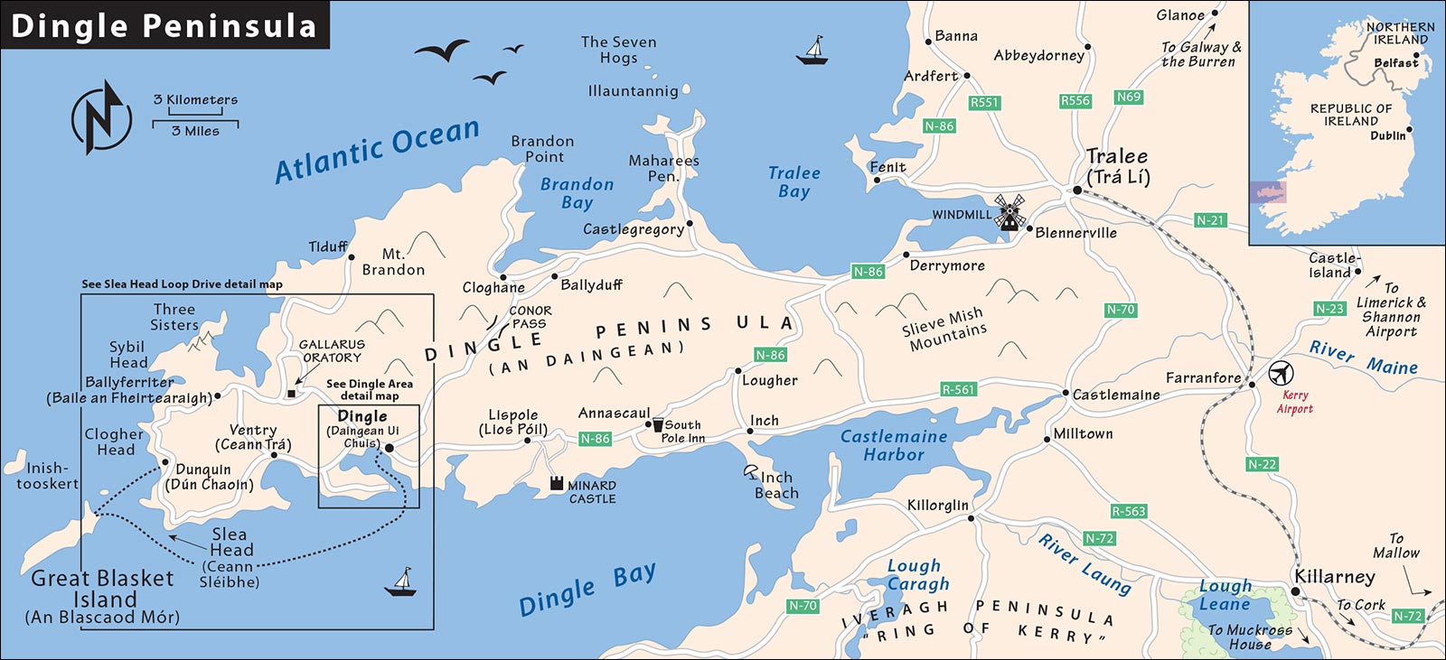
For locations, see the “Dingle Peninsula” map on here.
▲Minard Castle
Three miles southwest of the town of Annascaul (Abhainn an Scáil), off the Lispole (Lios Póil) Road, is the largest fortress on the peninsula. Built by the Knights of Kerry in 1551, Minard Castle was destroyed by Cromwell’s troops in about 1650. With its corners undermined by Cromwellian explosives, it looks ready to split—it’s no longer safe to enter this teetering ruin.
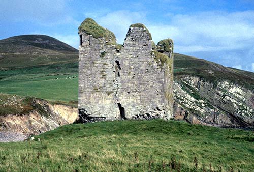
From the outside, look for the faint scallop in the doorway, the symbol of St. James. Medieval pilgrims would stop here before making the seafaring pilgrimage from Dingle to St. James’ tomb at Santiago de Compostela in northern Spain. Imagine the floor plan of the castle: ground floor for animals and storage, main-floor living room with fireplace, then a floor with sleeping quarters, and, on top, the defensive level.
The setting is dramatic, with the Ring of Kerry across the way and Storm Beach below. The beach is notable for its sandstone boulders that fell from the nearby cliffs. Grinding against each other in the wave and tidal action, the boulders eroded into cigar-shaped rocks. Pre-Christian Celts would carry them off and carve them into ogham stones to mark clan boundaries.
Next to the fortress, look for the “fairy fort,” an Iron Age fort from about 500 BC. Locals thought it unlucky to pluck stones from these ring forts, so they remain undisturbed, overgrown with greenery, all across Ireland.
South Pole Inn
This pub, once owned by modest-yet-heroic Antarctic explorer Tom Crean, is still open for business. You’ll see it as you pass through Annascaul on N-86 (at the bottom of a hill, on the left if you’re heading east). Consider dropping in to have a pint and peruse the walls of lovingly maintained photos devoted to Crean’s incredible adventures (see sidebar).
Inch Beach
This four-mile sandy beach was made famous by the movie Ryan’s Daughter. It’s rated a “Blue Flag” beach for its clean water and safe swimming (usually has a lifeguard in summer).
Nightlife in Dingle
▲▲▲Music in Dingle Pubs
Traditional pub music is Dingle town’s best experience. Even if you’re not into pubs, take an afternoon nap and then give these an evening whirl. Dingle is renowned among traditional musicians as an ideal place to perform. The town has piles of pubs that feature music most nights, and there’s never a cover charge—just buy a beer. The scene is a decent mix of locals, Americans, Brits, and Germans. Music normally starts at 21:30ish, and the last call for drinks is at “half eleven” (23:30), sometimes later on weekends. For a seat near the music, arrive early. If the place is chockablock with people, power in and find breathing room in the back. By midnight, the door is usually closed and the chairs are stacked.
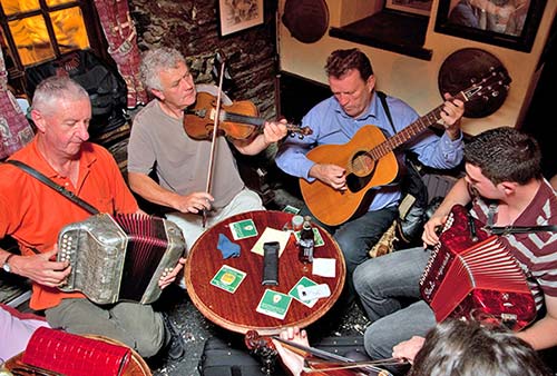
Make it a point to wander the town and follow your ear. Smaller pubs may feel a bit intimidating to a tourist, but rest assured that people—locals as well as travelers—are out for the craic. Irish culture is very accessible in the pubs; they’re like highly interactive museums waiting to be explored. If you sit at a table, you’ll be left alone. But stand or sit at the bar and you’ll soon be engulfed in conversation. Have a glass in an empty, no-name pub and chat up the publican. Pubs are no longer smoky but can be stuffy and hot, so leave your coat at home. I know it’s going to be a great trad music session when my eyeglasses steam up as I enter.
For some background, see “Traditional Irish Music” on here. For locations of the following pubs, see the “Dingle Center Restaurants & Pubs” map, later.
Dingle Pub Crawl
The best place to start a pub crawl is at O’Flaherty’s, the first music pub in Dingle, located on Bridge Street. Quietly intense owner Fergus O’Flaherty, a fixture since my first visit to Dingle, can belt out a song as he joins a varying lineup of loyal local musicians. Talented Fergus sings and plays a half-dozen different instruments during almost nightly traditional-music sessions. His domain has a high ceiling and is dripping in old-time photos and town memorabilia—it’s unpretentious, cluttered fun.
Moving up Strand Street, find John Benny’s (a recommended eatery as well). Its dependably good traditional-music sessions come with John himself joining in on accordion when he’s not pouring pints or explaining his extensive whiskey choices. Paddy Bawn Brosnan’s Pub (also on the Strand) has no food—just beer and sports. If a game is on TV—especially Gaelic football or hurling—you can watch it here with the locals. When they do have music, about three nights a week, it’s earlier—around 18:00.
Then head up Green Street. Dick Mack’s, across from the church, is nicknamed “the last pew.” Once a leather shop, today the pub sells only drinks and offers good live music, a fine snug, ample beer choices, and a fascinating ambience. Finn Mack, the current owner, focuses on whiskey and craft beers.
Green Street climbs to Main Street, where two more Dick Mack-type places are filled with locals deep in conversation (but no music): Foxy John’s (a hardware shop by day) and Curran’s (across the street, a small clothing shop by day). For more on each of these (and Dick Mack), see my Dingle Town Walk, earlier.
Wander down Main Street. The Dingle Pub seems designed for John Denver and Irish Rovers fans. It’s well established as the place for amplified folk-ballad singing rather than the churning traditional beat of an Irish folk session. Just downhill, Neligan’s is another lively traditional music session option with fun dance lessons for beginners on summer Monday nights. At the bottom of Main Street, An Droichead Beag (“Small Bridge” bar) offers live music nightly. These days, its dimly lit confines are popular with a younger, late-night crowd.
I’d finish my night at the Courthouse Pub (on The Mall, next to the old gray courthouse). This is a steamy little hideaway with low ceilings and high-caliber musicians who perform nightly at 21:00, and my favorite men’s room in Ireland—with kegs for urinals. Owner Tommy O’Sullivan is a guitar-strumming fixture on the trad-music scene. His wife, Saundra, is from Houston and also sings.
Off-Season: From October through April, the music hibernates. On weekends, your best bets are the An Droichead Beag, O’Flaherty’s, the Courthouse Pub, and John Benny’s. Check for winter performances of the “Other Voices” series at St. James’ Church (see next).
▲▲Folk Concerts at St. James’ Church
If you’re not a night owl, these are your best opportunities to hear Irish traditional music in a more controlled, early-evening environment. Top local musicians offer a quality evening of live, acoustic, traditional Irish music in the fine little St. James’ Church (100 seats), just off Main Street. If you prefer not to be packed into a pub with the distractions of conversation, these concerts are a good option. They are organized by local piper Eoin Duignan, whose command of the melodic uileann bagpipes is a highlight most nights. Surprisingly, this humble church is the home venue of the acclaimed “Other Voices” winter concert TV series that has drawn the likes of Amy Winehouse, Sinéad O’Connor, and Donovan (€15 in advance, €17 at the door; Mon, Wed, and Fri at 19:30, May-Sept only; +353 87 284 9656, www.duigo.com; see sign on church gate or, for more details or to book a ticket, drop by Paul Geaney’s Bar and Restaurant or Leac a Ré craft shop).
Sleeping in Dingle
Prices vary with the season, with winter cheap, and July and August tops.
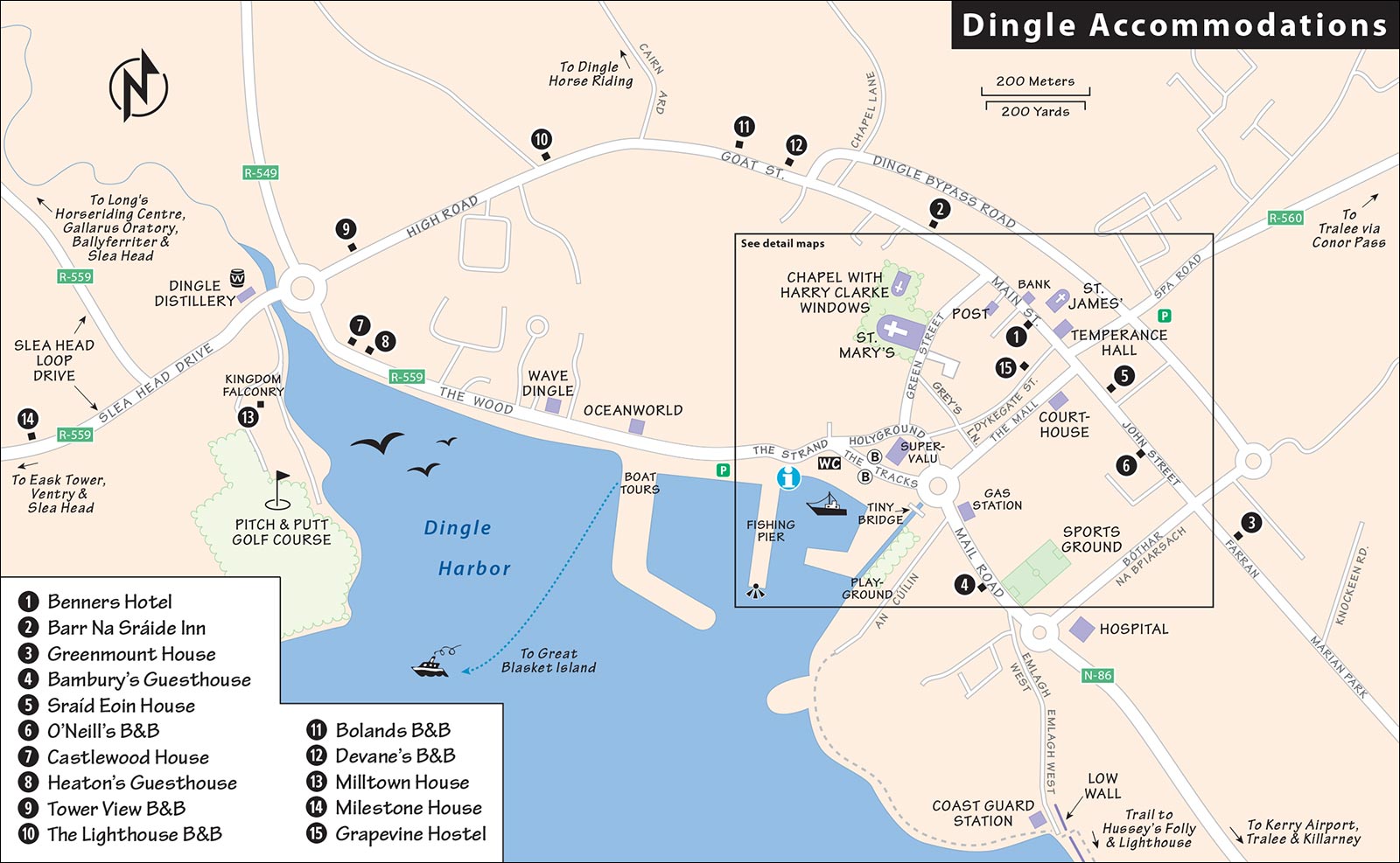
IN OR NEAR THE TOWN CENTER
$$$$ Benners Hotel was the only hotel in town a hundred years ago. It stands bewildered by the modern world on Main Street, with sprawling, antique-feeling public spaces and 52 abundant, overpriced rooms (elevator, parking, +353 66 915 1638, www.dinglebenners.com, reservations@dinglebenners.com).
$$$ Barr Na Sráide Inn (“Top of the Street” Inn) is central, pricey, stylish, and hotelesque, with 29 comfortable rooms (huge family room sleeps 5, self-service laundry, bar, parking, past McCarthy’s pub on Upper Main Street, +353 66 915 1331, www.barrnasraide.ie, info@barrnasraide.ie).
$$ Greenmount House, a lovely gem, sits among chilly palm trees at the top of town. A five-minute hike up from the town center, this guesthouse commands a fine view of the bay and mountains. Gary Curran runs one of Ireland’s best B&Bs, with 14 rooms and sprawling suites in a classy modern building with lavish public areas, wonderful breakfasts, and conscientious service (parking, laundry service, top of John Street, +353 66 915 1414, www.greenmounthouse.ie, info@greenmounthouse.ie).
$$ Bambury’s Guesthouse, hosted by cheerful Bernie Bambury, is big and modern with views of grazing sheep and the harbor. The 12 rooms are airy and comfy (on Mail Road, 2 blocks before the Texaco station; +353 66 915 1244, mobile +353 86 324 4281, www.bamburysguesthouse.com, bamburysguesthouse@gmail.com).
$$ Sraíd Eoin House offers five pleasant, upstairs rooms along John Street—which is what its name means in Gaelic (RS%, continental breakfast, family rooms, John Street, +353 66 915 1409, mobile +353 87 224 1087, www.sraideoinbnb.com, sraideoinhouse@hotmail.com, friendly Kathleen and Maurice O’Connor).
$$ O’Neill’s B&B is homey and friendly, with six nifty rooms on a quiet street at the top of town (cash only, John Street, +353 86 358 4439, www.oneillsbedandbreakfast.com, info@oneillsbedandbreakfast.com, Mary and Stephen O’Neill).
¢ Grapevine Hostel is small and central. It’s a relaxed place—not a party hostel—and offers the cheapest sleeps around (private rooms available, Dykegate, +353 66 915 1434, www.grapevinedingle.com, hostel@grapevinedingle.com).
BEYOND THE PIER
These accommodations are a 10- to 15-minute walk along the water from Dingle’s town center.
$$$ Castlewood House is a palatial refuge with 12 tasteful rooms, classy furnishings, and delicious breakfasts. The breakfast room and patio have a wonderful view of Dingle Harbor (parking, The Wood, +353 66 915 2788, www.castlewooddingle.com, info@castlewooddingle.com, Brian and Helen Heaton).
$$ Heaton’s Guesthouse, big, peaceful, and elegant, is on the water just west of town at the end of Dingle Bay—a five-minute walk past Oceanworld on The Wood. The 16 thoughtfully appointed rooms come with all the amenities (creative breakfasts, parking, The Wood, +353 66 915 2288, www.heatonsdingle.com, info@heatonsdingle.com, David Heaton).
$$ Tower View B&B is a big, modern home just outside of town on a lovely quiet lot. This kid-friendly mini farm rents nine fine rooms (family rooms, High Road, +353 66 915 2990, www.towerviewdingle.com, info@towerviewdingle.com, Aidan & Helen Murphy).
ABOVE TOWN
Arcing inland above the town’s western slope are three good lodging choices on a road that changes names three times in a half-mile. Starting from the corner of Green Street and Main Street (headed uphill) you’ll be on Goat Street, then Ashmount Terrace, then High Road. The front rooms in all of these places come with views but some street noise.
$$ The Lighthouse B&B is a cozy place with six prim rooms and wonderful views near the crest of the hill (family rooms, High Road, +353 66 915 1829, www.lighthousedingle.com, info@lighthousedingle.com).
$$ Bolands B&B is family-run with a traditional, welcoming atmosphere and eight unfussy rooms (family rooms, Goat Street, +353 85 714 2297, www.bolandsdingle.ie, info@bolandsdingle.ie, Breda & Michael Boland).
$$ Devane’s B&B is a good-value option that caters to the active bike-and-hike crowd. Its six simple but clean and practical rooms are close to town (Goat Street, +353 66 915 1193, mobile +353 86 061 8199, www.devanesdingle.com, devanegeraldine@gmail.com, Kevin & Geraldine Devane).
OVER THE BRIDGE, WEST OF TOWN
These options—better for drivers—are a 20- to 25-minute level walk along the Dingle Bay shore from town. They suffer from being located on the far side of a 50-yard-long unlit stone bridge with no sidewalks (making a walk back at night a bit dodgy). A taxi from town should only cost about €6. Both have parking and are in comfortable, modern buildings with attentive ownership adopting a “we try harder” attitude.
$$$$ Milltown House has 10 rooms, some with bay views. The casual vibe comes with a cozy in-house bar and two gentle-giant Irish wolfhounds dozing nearby. Kingdom Falconry shows off birds of prey in the front yard. With room to run, unusual animals, and its proximity to Dingle Pitch & Putt, kids enjoy this place (family rooms, The Wood, first left after crossing the bridge, +353 66 915 1372, www.milltownhouse.com, info@milltownhouse.com, Stephen McPhilemy and crew).
$$ Milestone House is an ideal option for longer stays. Friendly hosts Barbara and Michael Carroll converted a fine guesthouse into two separate self-catering apartments (upstairs apartment has 3 double rooms, ground-floor apartment has 2 doubles). Each one has its own small kitchen, laundry, and lounge, and basic breakfast fixings are provided—making this a great value, with independence yet B&B friendliness, for groups or families. The front yard sports a 4,000-year-old standing stone as an ancient territorial marker (3-night minimum, on road R-559, +353 66 915 1831, www.milestonedingle.com, milestonehousedingle@gmail.com).
Eating in Dingle
FINE DINING
All of these restaurants are good, but I’ve listed them in order of my personal preference. Some places offer good-value, multicourse, early-bird specials before about 18:00. Remember that while seafood is a treat here, so is the lamb.
$$$$ Out of the Blue Seafood-Only Restaurant is the locals’ choice for great fresh fish. Filling an unassumingly humble blue shed facing the water, its interior is bright and elegantly simple. The chalkboard menu is dictated by what the fishermen caught that morning. If they’re closed, there’s been a storm and the fishermen couldn’t go out. Dinners are delicious and artfully presented, and stick to their motto of “no chips.” Reserve ahead for this gem (daily, some outdoor picnic-table seating, just past the TI, facing the harbor on The Waterside, +353 66 915 0811, www.outoftheblue.ie).
$$$$ Chart House Restaurant serves contemporary cuisine in a sleek, well-varnished dining room just beyond the roundabout at the base of town. Settle back into the shipshape, lantern-lit space. The chef is committed to always offering a good vegetarian entrée (closed Tue, reservations wise, +353 66 915 2255, www.thecharthousedingle.com, Jim McCarthy).
$$$$ Lord Baker’s is the venerable elder among fine Dingle dining options. John Moriarty and his family concoct quality dishes served in an old-fashioned, refined, yet friendly atmosphere. If you’re looking for a classic Irish eating house...this is it (closed Sun and Thu, reservations smart, Main Street, +353 66 915 1277, www.lordbakers.ie).
$$$ James G. Ashe Pub and Restaurant, an old-fashioned joint, is popular with locals for its nicely presented, traditional Irish food and seafood at good prices. Check out the photos of Gregory Peck, who was related to the Ashe family and visited the pub often (closed Sun-Mon, Main Street, +353 66 915 0989).
LESS EXPENSIVE MEALS
While the top-end restaurants charge on average €25-40 for a seafood or steak entrée, you can eat well for €15-20 in Dingle’s pubs and international eateries. Many cheap and cheery lunch places close at 18:00. Most pubs stop serving food at about 21:00 (to make room for their beer drinkers and musicians).
$$ Fish Box connects generations of Flannery family fishing to this pleasant little brightly white-tiled fish restaurant. It feels modern, fresh, and trendy, with an avid following on Instagram. They take no reservations—arrive early, or put your name in and they’ll call you when a table opens up (closed Tue, takeout available, Green Street just up from St. Mary’s Church, +353 87 052 6896).
$$ Anchor Down is, essentially, Fish Box without a social media presence: a fresh fish option that’s easy on the wallet. The Sheehy family, who are local fishermen, supply their simple little cottage with a short list of the day’s catch (daily, closed Dec-Feb, up a lane off Strand Street, 3 The Colony, +353 87 756 8103).
$ Reel Dingle Fish & Chips is the best chippy in town, serving mostly takeout, but with a few stools. It’s not fast, because they cook the fish fresh to order. They serve generous portions—consider splitting—and are also good for burgers (closed Mon, near SuperValu supermarket on Holyground, +353 66 915 1713).
$$ John Benny’s Pub dishes up traditional Irish fare on the waterfront. John, the proprietor and a Dingle fixture since my first visits, takes his outstanding selection of whiskeys as seriously as his choice of quality local musicians. Come here for dinner and stay for a drink and great nightly live music (daily, music after 21:30, The Pier, +353 66 915 1215).
$$ Danno’s Restaurant and Bar is a sprawling and fun-loving eatery popular with tourists and locals for inexpensive but good burgers, fish-and-chips, and pub grub. Danno’s interior is a mix of railroad and rugby memorabilia. He offers some of the best outdoor seating in town with a heated and leafy patio out back (closed Mon-Tue, under the stone arch on Strand Street, +353 66 915 1855).
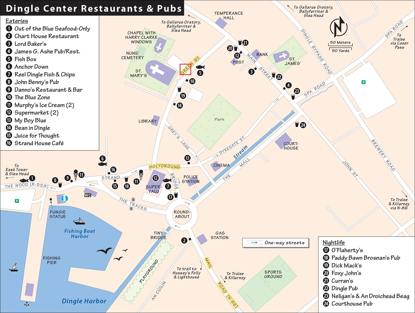
$$ The Blue Zone is a hip upstairs jazz-and-wine bar offering pizza, humongous salads, and an international cosmopolitan vibe. Tight, busy, and family-friendly, it’s a tasty alternative to Dingle’s pub grub and fish-dominated fare. Or just kick back and enjoy a late-night conversation over a glass of wine set to eclectic background music (closed Tue-Wed, Green Street across from St. Mary’s Church, +353 66 915 0303).
Ice Cream: For two decades, Murphy’s ice cream has been a Dingle favorite for its local flavors, including Irish brown bread, Dingle sea salt, chocolate whiskey, and even gin. These days, with nationwide expansion, it’s gotten very expensive and the quality is slipping a bit, but it’s still the best ice cream in town. They have two branches 100 yards apart near the waterfront—if one’s closed, check the other (daily, both on Strand Street).
Picnic Supplies: The big SuperValu supermarket/department store, at the base of town, has everything and stays open late (daily). Smaller groceries, such as Centra up on Main Street (daily), are scattered throughout the town. Consider a grand-view picnic out on the end of the newer pier (as you face the harbor, it’s the pleasure-boat pier on your right). You’ll find picnic tables on the harbor side of the roundabout and benches along the busy harborfront.
CAFÉS WITH GOOD LUNCHES
If you’re looking for a central, relatively quick lunch, these coffee shops also serve good food. However, places tend to fill up quickly at lunchtime (as multiple tour buses arrive around the same time). Note that these places don’t serve dinner.
$ My Boy Blue is sleek and welcoming, with good coffee and a tempting menu of sandwiches and brunch dishes, such as avocado toast and pancakes (daily, behind the SuperValu supermarket on Holyground, +353 85 759 7156, www.myboybluedingle.ie).
$ Bean in Dingle is an inviting and hip coffee shop—it feels like a hub for young people, tucked on a back street near the top of town. They serve baked goodies and fresh sandwiches along with good coffee drinks (daily, Green Street).
$ Juice for Thought, a hole-in-the-wall on Strand Street, has no seating. But they have a healthy menu of fresh-pressed juices, sandwiches, bowls, and so on (closed Tue, Strand Street, +353 86 259 0289).
$ Strand House Café is a cozy spot hiding out above a big clothing store. They have a simple menu of lunch dishes (soup, sandwiches, salads), and their fresh-made pastry tempts you to hang out with an extra cup of coffee (daily, head into the centrally located Strand House on Strand Street and make your way upstairs, +353 66 915 2703).
ON SLEA HEAD DRIVE
If it’s open, $$ The Stonehouse is an appealing lunch or dinner option about 7 miles (12 km) west of Dingle on Slea Head Drive. They serve local specialties, from scones to fresh seafood and steak dishes, in a cozy atmosphere. Their front-porch outdoor tables are popular seaview perches on warm summer evenings (generally daily for lunch, July-Aug for dinner as well, may be closed in winter, for location see the “Slea Head Loop Drive” map on here).
The western half of the Dingle Peninsula is part of the Gaeltacht, where locals speak the Irish Gaelic language. In an effort to ward off English-language encroachment, all place names on road signs were controversially changed to Irish-only, though some are now back in English. As you travel along Slea Head Drive (known as Ceann Sléibhe in Irish), refer to this cheat sheet of the most useful destination names. A complete translation of all Irish place names is included in the Gazetteer section at the back of the Complete Road Atlas of Ireland by Ordnance Survey.
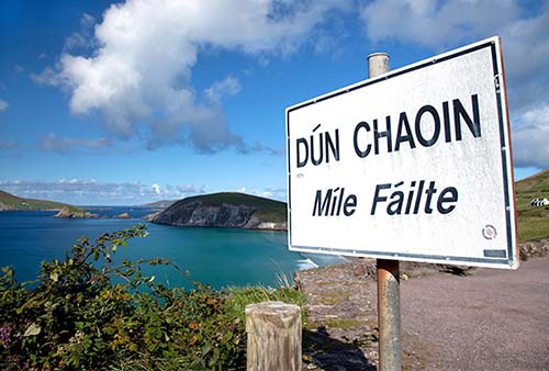
| English Name | Irish Gaelic Name |
| Dingle | Daingean Ui Chuis (DANG-un e koosh) |
| Ventry | Ceann Trá (k’yown—rhymes with “crown”—traw) |
| Slea Head | Ceann Sléibhe (k’yown SHLAY-veh) |
| Dunquin | Dún Chaoin (doon qween) |
| Blasket Islands | Na Blascaodaí (nuh BLAS-kud-ee) |
| Great Blasket Island | An Blascoad Mór (on BLAS-kade moor) |
| Ballyferriter | Baile an Fheirtearaigh (BALL-yuh on ERR-ter-ee) |
| Reasc Monastery | Mainistir Riaisc (MON-ish-ter REE-isk) |
| Gallarus | Gallaras (GAHL-russ) |
| Kilmalkedar | Cill Mhaoil-cheadair (kill moyle-KAY-dir) |
| Annascaul | Abhainn an Scáil (ow’en on skahl) |
| Lispole | Lios Póil (leesh pohl) |
| Tralee | Trá Lí (tra-LEE) |
Dingle Connections
Tralee (Trá Lí), 30 miles from Dingle, is the region’s transportation hub (with the nearest train station). Most bus trips make connections in Tralee.
From Dingle by Bus to: Galway (5/day, 6 hours, transfer in Tralee and Limerick), Dublin (3/day, 7 hours, transfer in Tralee and Limerick), Rosslare (2/day, 9 hours), Tralee (5/day, fewer off-season and Sun, 1.5 hours). Most bus trips out of Dingle require at least one or two (easy) transfers. Remember, buses stop on the waterfront behind the SuperValu (bus info +353 1 836 6111, www.buseireann.ie, or Tralee station at +353 66 712 3566; Tralee train info +353 66 712 3522). For more information, see “Tralee Connections” at the end of this chapter.
Slea Head Loop Drive
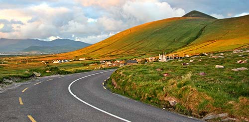
The gloriously green Dingle Peninsula is 10 miles wide and runs 40 miles from Tralee to Slea Head. The top of its mountainous spine is Mount Brandon—at 3,130 feet, it’s the second-tallest mountain in Ireland. While only a few tiny villages lie west of Dingle town, the peninsula is home to 50,000 sheep.
The Slea Head Loop, worth ▲▲▲, is a scenic road that lassoes the peninsula in about 30 miles (45 km). It’s best driven (or biked) in a clockwise direction (though narrow, it’s a two-way road, so be aware of oncoming traffic). It’s easy by car (about 1.5 hours total drive time, plus sightseeing stops), or a demanding five hours by bike. Or join a minibus tour (see “Tours in Dingle” on here).
As you navigate the loop, you’ll see lots of grass-fed Friesian (or Holstein) cows and the belted Galloway breed from Scotland (looking like they have a white blanket tossed over them). The only wild animal you’ll encounter is a rabbit. In spring or summer, you’ll likely enjoy a festival of flowers as you follow the blue signs with white squiggles—a stylized “WAW”—reminding you that this is the “Wild Atlantic Way,” a coastal route that winds all along Ireland’s western side.
PLANNING YOUR DRIVE
This loop begins and ends in Dingle. The route is littered with similar minor sights, plus two major ones (the excellent Blasket Centre and Gallarus Oratory). Aside from the big stops, the main attraction is simply the grand scenery, especially out at the tip of the peninsula.
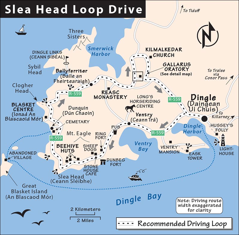
Tips for Drivers: You’ll stay on R-559 the entire way, following brown Slea Head Drive signs for most of the route (through kilometer 37). Most stops are right along the main road, but some require turnoffs. If using GPS, route the drive by sections, plugging in the next major stop. Or you can use your car’s odometer: I’ve given distances in kilometers, so you can follow along. To use these, set your odometer to zero at Oceanworld as you leave Dingle. Before departing each stop for the next, it’s helpful to read the next section and familiarize yourself with what’s coming up.
When to Go: The road is narrow and can be congested from mid-July to late August. It tends to be busiest midmorning, when other tourists and big tour buses are also on the road. Most of these bus tours finish in Dingle town in the early afternoon (around 13:30 or 14:00), which can be a good time to set out on this drive. Consider relaxing and exploring the town in the morning, having lunch, and then, just as the buses show up, clear out of the suddenly congested town and hit the less-congested road.
Tips for Cyclists: This route is best for confident, experienced cyclists; casual bikers often find it dangerous and stressful (the road is narrow, with high hedges, stone walls, and cliffs crowding the traffic). If biking, try to leave early (consider renting your bike the night before) to reduce the bus and car traffic you’ll encounter on the road.
FROM DINGLE TOWN TO VENTRY
Leave Dingle town west along the waterfront (0.0 km at Oceanworld). Driving out of town, on the left you’ll see a row of humble “two up and two down” cottages from a 1908 affordable-housing government initiative.
• On your left is...
Dingle Harbor (0.5 km)
Dingle Harbor has an eight-foot tide. The seaweed was used to make formerly worthless land arable. (Seaweed is a natural source of potash—organic farming, before it was trendy.) Across the River Milltown estuary is Dingle’s pitch-and-putt golf course. Look for the narrow mouth of this blind harbor (behind you, in the distance at the opposite end of the harbor) and the Ring of Kerry beyond that. Dingle Harbor is so hidden that ships needed the hilltop Eask Tower to find its mouth.
• At the roundabout, turn left over the bridge. On the far side, the large building on the right is...
Dingle Distillery (0.7 km)
This was the site of a corn-grinding mill in the 18th century (with a ghostly black waterwheel hiding behind it). Today it’s a modern warehouse that shelters the Dingle Distillery. They produce highly respected whiskeys and a prizewinning gin, which you can sample at various bars in town. To learn more about how distillates are made, take one of their well-presented, intimate tours (see “Sights in Dingle,” earlier).
Just beyond the distillery, on the right, you’ll pass the junction where you’ll complete this loop 30 miles from now. The gas station on your left is the westernmost on the peninsula (you won’t see another on this drive, so consider topping up the tank).
• After the gas station, climb slightly uphill to a row of B&Bs (on the right). The first of these, the recommended Milestone House, is named for the stone pillar in its front yard.
Stone Pillar (1.3 km)
This pillar (gallaun in Irish) may have been a prehistoric grave or a boundary marker between two tribes. Half the stone’s length is buried underground. This peninsula, literally an open-air archaeological museum, is dotted with more than 2,000 such monuments dating from the Neolithic Age (roughly 3000 BC) through early Christian times.
Another stone pillar stands in the field across the road (100 yards away, on the left). The pillar’s function today: cow scratcher.
• After driving through a wooded area, watch on the right side for an old, slate-roofed building behind a stone fence.
Ventry Estate (2.8 km)
The building on your right was a blacksmith shop that served the sprawling estate and mansion of Lord Ventry, whose family came to Dingle as post-Cromwellian War landlords in 1666. (You may know them as the villains in the 1992 film Far and Away.) The mansion (built in 1750, out of view and closed to the public) today houses an all-Irish-language girls boarding school.
As you drive by the estate, you’ll pass palms, magnolias, and exotic flora, which were introduced to Dingle by Lord Ventry. The Gulf Stream is the source of the mild climate, which supports subtropical plants (it rarely snows here). Fuchsias—imported from Chile and spreading like weeds—line the roads all over the peninsula and redden the countryside from June through September. About 75 inches of rain a year gives this area its “40 shades of green.”
• As you carry along and return to some sea views on the left, keep an eye out for the...
View of Skellig Michael (4.6 km)
Stay off the “soft margin” as you enjoy views (in the gaps between hedges) of Ventry Harbor and its long beach, to your right as you face the water.
Beyond the mouth of the harbor, on a clear day you may also spot distant Skellig Michael. This pyramid-shaped island holds the rocky remains of a sixth-century monastic settlement (described in previous chapter). Throughout the drive, keep an eye out for this pointy island.
In 1866, the first transatlantic cable was laid from nearby Valentia Island to Canada’s Newfoundland (see sidebar on here). Mount Eagle (1,660 feet), rising across the bay, marks the end of Ireland—and that’s where you’re heading.
• Next up is the town of...
Ventry (6.6 km)
In the town of Ventry—a.k.a. Ceann Trá (translated roughly as “beach head”)—Irish is the first language. Ventry is little more than a bungalow holiday village today. Urban Irish families love to come here in the summer to immerse their kids in the traditional culture and wild nature. A large hall at the edge of the village is used as a classroom where big-city students come to learn the Irish language.
Just past town, a lane leads left to a fine beach and mobile-home vacation community. An information board explains the history, geology, and bird life of the harbor. The humble trailer park has no running water or electricity. Locals like it for its economy and proximity to the beach. From here, a lane leads inland to Long’s Horseriding Centre (described earlier, under “Sights in Dingle”).
At the start of World War II (1939), a German U-boat churned into this bay and put 28 Greek sailors ashore (depositing them on neutral Irish soil). The Greeks were survivors from a merchant ship that the sub had sunk...not the kind of humanitarian gesture that German U-boat captains were known for making.
• Just after the main part of Ventry, you’ll pass through a low-lying green area. Soon a distinctive type of vegetation rises up on both sides of the road.
Rushes (7.3 km)
The bamboo-like rushes are the kind used to make the local thatched roofs. Thatching, which nearly died out because of fire danger, is more popular now that antiflame treatments are available. It’s expensive, as few qualified thatchers remain in Ireland. Black-and-white magpies fly overhead.
• Up next is a little “suburb” of Ventry, which I like to think of as...
Three Gs (8.5 km)
This crossroads has the “Three Gs”—God (a church), groceries, and Guinness. The pub just past the church is Paddy O’Shea’s. The Irish football star Páidí Ó Sé was a household name in Ireland. He won eight all-Ireland football titles for Kerry as a player from 1970 to 1988. He then trained the Kerry team for many years before further endearing himself to his fans by running this pub. A heroic statue remembers Paddy, who died in 2012.
Heading onward, the road bends sharply right, then left. Soon you come through another settlement. The building on the right that’s marked with an EU flag and surrounded by a tall net to keep the balls in is the village schoolhouse (10.7 km). In summer it’s used for Irish Gaelic courses for kids from the big cities.
• From here, as we head out of the Ventry area, the scenery crescendos.
FROM VENTRY TO SLEA HEAD
The next, short stretch of road runs just above the water, with views across to the Ring of Kerry and (on clear days) Skellig Michael. Along here are several minor prehistoric sites, including three different sets of iconic, stacked-stone beehive huts. Each one is operated by a local farmer and charges a modest admission fee. The hours for all of these are loose and similar: On good-weather summer days, they’re open from 9:00 until 18:00 or 19:00, but in shoulder season or bad weather, they may close earlier. Many are closed entirely in winter. Rather than pulling over at all of them, skim your options ahead of time and choose the ones that appeal the most. (Farther along, you’ll find lots of great scenery—and even better prehistoric sites, including the unmissable Gallarus Oratory.)
• Soon after the schoolhouse, look for the well-marked parking (on the left) for a...
Ring Fort (11.1 km)
The circular mound (which looks like a big round hedge, on the right side of the road) is a late-Stone Age ring fort. It was a petty Celtic chieftain’s headquarters—a stone-and-earth stockade filled with little thatched dwellings. Such mysterious sites survived untouched through the centuries because of superstitious beliefs that they were “fairy forts.” While this site is unexcavated, archaeologists have found evidence elsewhere that people have lived on this peninsula since about 4000 BC.
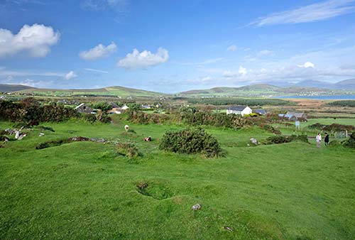
There are much better, bigger, and more intact (or excavated) examples of ring forts elsewhere in Ireland—especially around the Ring of Kerry, to the south; one in the Burren, to the north; and one near Derry, in County Donegal. But if this is your best opportunity to see one, you can pay to view the faint outlines of the fort (€2.50). You’ll also get a little basket of food so that you can feed and pet some very tame sheep and billy goats. Watch your step on the droppings.
• Less than a mile down the road, you come to...
Dunbeg Fort and Other Sights (12.5 km)
A big parking lot on the right serves several little sights in this area.
First, Dunbeg Fort (or Dún Beag in Irish, 50 yards downhill on the left) is made up of a series of defensive ramparts and ditches around a central clochan. Forts like this are the most important relics from Ireland’s Iron Age (500 BC-AD 500). Unlike the one we just passed, Dunbeg is excavated; however, it’s also structurally compromised. Violent storms in 2014 and 2017 caused a section of the fort to fall away into the sea. These days, a green fence prevents visitors from walking on top of it—or even getting close. To ease the disappointment, a 12-minute film plays across the road from the fort, at the top of the parking lot, and provides a bigger picture of the prehistory of the peninsula (€3.50, includes film, www.dunbeagfort.com).
The larger building across the road from the fort is the welcoming and recommended Stonehouse Café. This modern stone-roofed house was built to blend in with the landscape and the region’s ancient rock-slab architecture (AD 2000).
Roughly 50 yards farther along the road (then a 100-yard walk uphill, on the right), is a thatched cottage abandoned by a family named Kavanaugh during the famine (around 1848). With a few rusty and chipped old artifacts and good descriptions, it offers an evocative peek into the simple lifestyles of the area in the 19th century (€3). The owner, Gabriel, also runs working sheepdog demonstrations (in Irish for the dogs, English for tourists; €10 covers cottage and dog demo, book ahead by phone or email, +353 87 762 2617, www.dinglesheepdogs.com, dinglesheepdogs@gmail.com).
• Next up is the first of three sets of...
Beehive Huts (13.2 km)
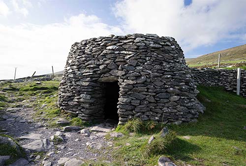
This first group of beehive huts (clochans) is a short, steep walk uphill (€3, WC). While reconstructed, these three mysterious stone igloos, which cluster within a circular wall, are a better sight than the similar beehive huts down the road and offer high-altitude views back over the landscape you’ve just driven through. This is perhaps the most classic and scenic of the three options; the only reason to wait is if you’d like to hold a little lamb along with your beehive hut visit (see later).
• Back in your car, you’ll ford a stream (14.0 km). There’s never been a bridge or a culvert here; this bit of road—nicknamed the “upside-down bridge”—was designed as a ford. Just beyond are...
Cashel Murphy Beehive Huts (14.4 km)
Just after the stream is the second set of beehive huts—a sight collectively called “Cashel Murphy.” If you drop €3 in the box, you can huff up the hill to see the foundations of five huts, surrounded by a wall—less intact than the ones earlier.
• You’ll barely be back in the car before reaching...
Yet More Beehive Huts (14.7 km)
This third set is signed The Last Beehive Huts and Hold a Baby Lamb. Aedan runs this family enterprise, where you can see more clochans, visit a little barn stocked with lambs, and use the WC—all for €4. (They also do sheepdog shows with prebooking, www.beehivehuts.com.)
There are three original, partly ruined huts just beyond the lamb barn. Immediately behind the farmhouse are two replicas. Higher on the hill is another intact one and the foundations of a double hut.
Before departing, look downhill at the rocky field between the road and the water. In the movie Far and Away, that’s where Lord Ventry evicted (read: torched) peasants from their cottages.
• Look across the bay at the Ring of Kerry in the distance, then pan right to see the Blasket Islands. We’re heading that way now.
FROM SLEA HEAD TO BALLYFERRITER
This is the most eye-poppingly scenic stretch of the drive, and one of the most picturesque drives in Ireland. We’re heading around the knob of land called...
Slea Head (16.0 km)
At Slea Head (Ceann Sléibhe)—marked by a crucifix, a pullout, and great views of the Blasket Islands (described later)—you turn the corner on this tour. On stormy days, the waves are “racing in like white horses.” You can pause here, but even better views are down the road.
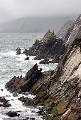
▲Viewpoint (16.7 km)
Pull into the little parking lot (at the stone etched with the words Dún Chaoin) for views of Great Blasket Island and Dunmore Head (the westernmost point in Europe) and to review the roadside map.
Great Blasket Island is an icon of traditional Irish culture. Because the islanders subsisted primarily on food from the sea, rather than potatoes, they survived the famine. The most traditional of Irish communities, about 100 people lived there until 1953, when the government evacuated the island (deeming it unsafe for residents). While the island is uninhabited today, small tour boats shuttle visitors from Dingle and from Dunquin Harbor (just ahead). To read more about this fascinating island, see the next section of this chapter. And to learn more, visit the excellent Blasket Centre (a few miles farther down the road).
As you drive on, notice the ruined stone houses (and the sheep oblivious to the amazing views). The scattered village just down the road was abandoned during the famine. Some homes are now fixed up, as this is a popular place these days for summer vacationers.
You can see more good examples of land reclamation, patch by patch, climbing up the hillside of Mount Eagle. Rocks were cleared and piled into fences. Sand and seaweed were laid on the clay, and in time it was good for grass. The created land, if at all tillable, was generally used for growing potatoes; otherwise, it was only good for grazing. Much of this farmland has now fallen out of use.
• Continue across the headland. Watch for the low stone wall on your left, which encloses the seaview...
Cemetery (19.0 km)
Residents of the Blasket Islands had no church or cemetery on the islands. On the left stretches their cemetery. The famous Blascaod storyteller Peig Sayers (1873-1958) is buried at its center.
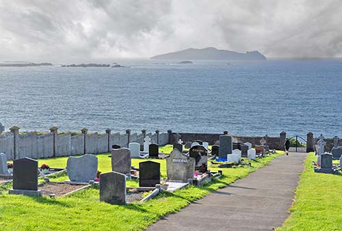
Just off this coast is the 1588 shipwreck of the Santa María de la Rosa of the Spanish Armada. And ahead is the often-tempestuous Dunquin Harbor. Blasket Island farmers—who on a calm day could row across in 30 minutes—would dock here and hike over the saddle and 12 miles into Dingle to sell their produce.
Hey! There’s a dead man floating out at sea. Oh, it’s just an island. (While its official name is The Sleeping Giant, that island has always been known to Blasket Islanders as “The Dead Man.”)
• Back on the road, on the left, at the Dunquin Head turnoff, a plaque celebrates the 30th anniversary of the filming of Ryan’s Daughter, while another notes that scenes from the Star Wars saga were filmed here. From here, a trail leads down to a wild beach. Continuing along the main road, you’ll cruise through Dunquin village. Nearing the end of town, watch on the left for the well-marked turnoff to...
▲▲The Blasket Centre (21.3 km)
A one-kilometer lane leads to the Blasket Centre. This top-notch museum—one of Ireland’s best cultural attractions, presented thoughtfully and with modern style—is an essential stop if you plan to visit the islands, or a good place to learn about them if you won’t be making the crossing.
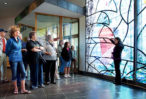
Cost and Hours: €5, daily 10:00-18:00, closed Nov-Feb, fine cafeteria, +353 66 915 6444, www.blasket.ie.
Visiting the Museum: The state-of-the-art Blascaod and Gaelic heritage center gives visitors the best look possible at the language, literature, and way of life of Blasket Islanders. The building’s award-winning design integrates the surrounding landscape into an artistic interpretation.
Giant stained-glass windows bedeck the entrance. From there, a long hallway, evoking a sloping village lane, leads to an almost sacred view of the actual island. You’re greeted on the right with rippling water, and on the left with inspiring quotes, on your way to an exceptional 15-minute video—a virtual visit to the island back when it was inhabited (shows on the half-hour).
Farther down the corridor are giant portraits and biographical sketches of Blasket authors, who documented their way of life. (The island had a remarkably strong literary tradition for such a tiny place.)
On both sides of the hall are additional exhibits. “Blasket Lives” covers various aspects of this unique lifestyle—from birth to marriage to death—with first-person accounts and artifacts. “Sound and Voice” immerses you in the rich sound of the Gaelic language. “Over the Threshold” displays everyday items from island homes. “On Sea and Land” explores the fishing tradition that saved the islanders during the famine. “On the Great Blasket” is a wraparound video of today’s island (perhaps inspiring you to pay a visit). And “The Slow Scattering” tells the story of how the population dwindled from a peak of 180 people in 1920 to zero after 1953. (The two biggest causes? Emigration and evacuation.)
At the end of the hall, you can simply gaze out the big windows at those rugged islands...and imagine. After touring the museum, you can follow the well-signed path to a viewing platform along the cliff, offering views to Great Blasket Island and the surrounding cliffs.
• Head back up to the main road, turn left, and follow it about another kilometer and a half. You’ll pass a tall, rocky pinnacle on your right, and a smaller one on your left. Just after you go between these, as the road bends to the right, watch for the pullout on the left.
▲Clogher Head Pullout (23.1 km)
The view from here is spectacular. Ahead, the road leads toward Mount Brandon, Ireland’s second-highest peak (at 3,130 feet). Panning to the left, you’ll see Butter Harbor (the name believed to originate from times when Vikings stopped here to grease up their hulls). Then spot the three swoopy peaks—the Three Sisters. Left of that is Sybil Head. The tiny black square you see on its summit is a watchtower from the days when Britain feared an invasion from Napoleon. The entire coast was lined with these, all within sight of each other so signal crews could relay a warning if under attack by the bloody French.
Ahead, on the right, study the top fields, untouched since the planting of 1845, when the potatoes didn’t grow, but rotted in the ground. The faint vertical ridges of the potato beds can still be seen. Before the famine, 40,000 people inhabited this peninsula. After the famine, the population was so small that there was never again a need to farm so high up. Today, only 10,000 people live on the peninsula.
From this pullout, a breezy 15-minute walk leads out to Clogher Head. The dirt road stretches off to the left and peters out after 200 yards. But it’s all open ground and easy to navigate. Just step carefully over bog puddles and head uphill through the rocky heather to the lumpy summit. There you’ll be rewarded with postcard-worthy panoramic views.
• Continue driving down the hill, into the landscape you just saw. The road narrows as you pass through the hardscrabble village of...
Ballyferriter (28.0 km)
Established by a Norman family in the 12th century, Ballyferriter is the largest settlement on this side of the Dingle Peninsula. After a few miles, you’ll reach the center of town. The pubs serve grub, the fine old church dates to the 1860s, and the old schoolhouse (on the left) is the Ballyferriter regional museum (Músaem Chorca Dhuibhne), with modest exhibits that provide the best coverage of this historic peninsula (€3, daily in season, by appointment only in off-season, +353 66 915 6333, www.westkerrymuseum.com). The early-Christian slab cross in front of the schoolhouse looks real. Tap it...it’s fiberglass—a prop from the Ryan’s Daughter bus-stop scenes. Across the street, next to the church, is the handy Your Stop market.
• Leaving town, we’re on the home stretch back to Dingle. But there’s still plenty to see between here and there.
FROM BALLYFERRITER TO DINGLE
While the best of the scenery is behind us now, some of the most engaging chunks of stony history—both medieval and prehistoric—line the road on the way back to Dingle.
• Keep on Slea Head Drive (R-559), following signs to Dingle. The road bends over a tiny yellow bridge, past a pub and microbrewery (on the right); 100 yards after that, watch for a tiny, unmarked paved road going uphill on the right (just after the yellow fence). Detour up this lane a few hundred yards to reach our next stop, on the right (no sign, but it’s surrounded by a stacked-stone fence).
Reasc Monastery Ruins (30.0 km)
This is the stony footprint of a monastic settlement dating from the 6th to 12th century (free, always open). The inner wall divided the community into sections for prayer and business (cottage industries helped support the monastery). In 1975, only the stone pillar was visible, as the entire site was buried. The layer of black tar paper (near the base of the walls) marks where the original rocks stop and the excavators’ reconstruction begins. The stone pillar is Celtic (c. 500 BC).
When Christians arrived in the fifth century, they didn’t throw out the Celtic society. Instead, they carved a Maltese-type cross over the Celtic scrollwork. The square building was an oratory (church), which is facing east—you’ll see an intact oratory at the next stop. The round buildings would have been clochans—those stone igloo-type dwellings.
One of the cottage industries operated by the monastery was a double-duty kiln. Just outside the wall (opposite the oratory, past the duplex clochan, at the bottom end), find a stone hole with a passage facing the southwest wind. This was the kiln—fanned by the wind, it was used for cooking and drying grain. Locals would bring their grain to be dried and ground, and the monks would keep a tithe (their 10 percent cut). With the arrival of the Normans in the 12th century, these small religious communities were pushed aside by a militaristic feudal system.
• Return to the main road and continue on. At the big Dingle Peninsula Hotel (32.0 km), turn left, following Gallarus signs and staying on Slea Head Drive. Soon after, turn right up the narrow lane to see the amazing Gallarus Oratory.
You have two options for parking. The first is at the unofficial visitors center (33.0 km), a private venture where €4 entitles you to park, see a short video, and use the WC. From here, you’ll trudge up through a field to the oratory. The second option is to continue a bit farther up the lane (at 33.4 km) to a tiny five-car pullout on the left. Parking here is limited but free, and a nicely tended, hedge-lined path leads through a gate 200 yards to the oratory.
▲▲Gallarus Oratory
Built about 1,300 years ago, the Gallarus Oratory is one of Ireland’s best-preserved early-Christian churches (free and always open). Shaped like an upturned boat, its finely fitted dry-stone walls are still waterproof. As you step in, notice how thick the walls are. A simple, small arched window offers scant daylight over where the altar would have stood. Picture the interior lit by candles during medieval monastic services. It would have been tough to fit more than about a dozen monks inside. Notice the holes once used to secure covering at the door, and the fine alternating stonework on the corners.
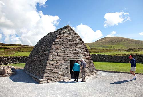
• From the oratory, return to the main road and continue to follow the brown Slea Head Drive signs. (Alternatively, if you want to skip the Kilmalkedar Church—the last stop on this tour—and go directly back to Dingle, continue up the narrow lane past the oratory parking, then turn right when you hit the bigger road.)
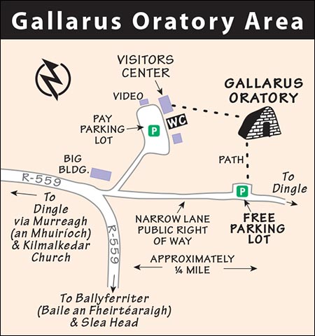
At the junction in the center of the next village, leave Slea Head Drive by taking a right on R-559 (signed with Dingle, 10 km). After a couple of minutes, you’ll pass a modern cemetery on your right. Soon after, on your left, a lane leads up past an older cemetery and the ruins of...
▲Kilmalkedar Church (37.3 km)
The ruined church (Cill Mhaoil-cheadair in Gaelic) was the Norman center of worship for this end of the peninsula. It was built when England replaced the old monastic settlements in an attempt to centralize their rule. The 12th-century church has a classic Romanesque arch and a well-worn cross atop its roof. The church fell into ruin during the Reformation. It’s surrounded by a densely populated graveyard (which has risen noticeably above the surrounding fields over the centuries).
In front of the church, you’ll find the oldest (late medieval) tombs. Two notable items flank the stone path about 30 yards in front of the entrance: on the right as you face the church, a stately early Christian cross (substantially buried by the rising graveyard and therefore oddly proportioned); and on the left, a much older ogham stone. This stone, which had already stood here 900 years when the church was built, is notched with the mysterious Morse code-type ogham script used from the third to seventh century. It may have marked a grave or a clan border, indicating that this was an important pre-Christian gathering place. The hole was drilled through the top of the stone centuries ago; people would come here to seal a deal by touching thumbs through it.
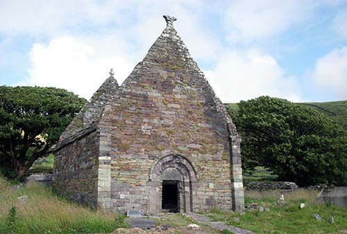
• From the church ruins, continue uphill, overlooking the water. From here, enjoy the...
Drive Back to Dingle
Another ancient “fairy fort” is on the right (38.0 km). The bay stretched out below you is Smerwick Harbor. In 1580, a force of 600 Italian and Spanish troops (sent by the pope to aid a rebellion against the Protestant English) surrendered at this bay. All 600 were beheaded by the English forces, which included Sir Walter Raleigh.
At the crest of the hill, you may see the belted Galloway beef cattle, with their white blankets. The spruce forest on the right was planted with government subsidies (to meet EU forest standards for minimizing Ireland’s carbon footprint).
From here, enjoy a long coast back into Dingle town (sighting, as old-time mariners did, the Eask Tower). Take a left past the Dingle Distillery, go over the bridge, and head back into Dingle. At 45 km, you’re back at Oceanworld where you started. Well done!
Blasket Islands
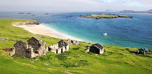
This rugged group of six islands off the tip of Dingle Peninsula seems particularly close to the soul of Ireland. The only one you can visit, Great Blasket Island, worth ▲▲, was once home to as many as 180 people. Life here was hard, but the sea provided for all, and no one went hungry. Each family had a cow, a few sheep, and a plot of potatoes and oats. They cut their peat from the high ridge and harvested fish from the sea. There was no priest, pub, or doctor. Because they were not entirely dependent on the potato, island inhabitants survived the famine relatively unscathed. To these folk, World War I provided a bonus, as occasionally valuable cargo washed ashore from merchant ships sunk by U-boats. Island residents formed the most traditional Irish community of the 20th century—the symbol of ancient Gaelic culture.
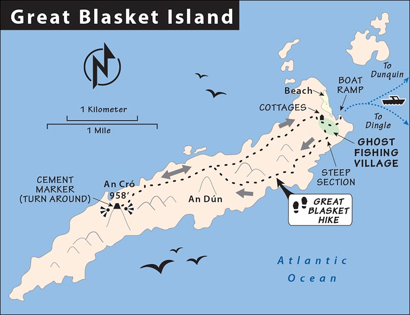
A special closeness to an island—combined with a knack for vivid storytelling—is inspirational. From this simple but proud fishing and farming community came three writers of international repute whose Gaelic works—basically tales of life on Great Blasket Island—have been translated into many languages. Peig (by Peig Sayers) and The Islandman (Thomas O’Crohan) are in shops everywhere. But the most readable and upbeat is Twenty Years A-Growing (Maurice O’Sullivan), a somewhat-true, Huck Finn-esque account of the author’s childhood and adolescence and of island life as it was a hundred years ago.
The population dwindled until the government moved the last handful of elderly residents to the mainland in 1953. Today Great Blasket is little more than a ghost town overrun with rabbits on a peaceful, grassy, three-mile-long poem.
Tips for Visitors: Before you go, learn all the historical context at the Blasket Centre on the mainland near Dunquin (see here) and spend some time on the excellent website of the Office of Public Works, devoted to both the island and the visitors center (www.blasket.ie).
The Office of Public Works offers free guided tours of the old village (inquire when you arrive on the island). For a tour around the island, contact Celtic Nature Walking Tours, based in Dingle (see listing on here).
There are no modern WCs on the island. And there are no eateries (bring a picnic). But you can overnight here in a simple rental cottage (see listing below).
GETTING THERE
In summer, various boats run between Dingle town and the Blasket Islands, with a stop of anywhere between 3.5 and 6 hours to explore Great Blasket. The ride traces the spectacular coastline all the way to Slea Head. Competing boats offer similar services from Dingle town and operate when there’s enough demand. The tricky landing at Great Blasket Island’s primitive and slippery little boat ramp makes getting off a challenge, and landing is virtually impossible in wet weather. Boats generally depart from the marina pier in Dingle at 9:00 or 11:00 and return from Great Blasket at 15:00 or 17:30. Boats also go from Dunquin Harbor at the western end of the peninsula to the Blasket Islands (book ahead; see Blasket Ferry listing on here). For details on all of these options, see the boat tour listings on here.
Schedules are soft—reconfirm the day before. Hikers (bringing their own picnic) should take the early boat out and a late boat back. With a bit of planning, you can spend a half-day and really do the island justice. Nonhikers can put ashore for an hour or two just to explore the ghost-town ruins.
VISITING GREAT BLASKET ISLAND
Since ferries can’t dock directly on the island, passengers are brought from the ferry to the boat ramp via a small RIB/Zodiac boat. These boats bring visitors ashore at the abandoned village, next to the beach, at the east end of the island (be careful of the slippery tidal muck as you get off the RIB). Be sure to reconfirm the return boat schedule with the crew before you disembark. Those arriving on early boats may be treated to the sight of dozens of gray seals lounging on the beach (dangerous to approach). Upon arrival ask the Office of Public Works guide on shore when the next guided walk of the abandoned village starts; those here to hike can start their trek immediately if it’s a long wait.
Great Blasket Hike: Given decent weather, this is one of my favorite hiking destinations in Ireland (but wear good shoes, rain or shine). The long (roughly 3.5 miles), thin island is flanked by easy-to-follow hiking trails across blankets of moss on a treeless terrain, making it simple to wander on your own.
If it rained the day before, the moss will retain the moisture and you’ll be stomping on wet sponges. But given dry weather, it’s an ideal experience with intoxicating views in all directions.
Think of the island as a giant hog’s-back running generally northeast to southwest, with parallel trails running along the south-facing and north-facing slopes. It’s possible to hike up successive taller summits (the tallest, An Cró, is 950 feet). An easy loop circles the lowest and closest ridge, linking the south- and north-flank trails (do this if you’re short on time). Beyond that junction, the trail becomes a single heather-clumped path that heads right up the ridge to the two taller summits.
The only steep section of the hike is the first hundred-yard slope, behind the abandoned village, that you’ll take to reach the flanks of the ridge. I like to take the south-facing trail outbound with the morning light and save the north side for the return, when the afternoon sun brings parts of the trail out of the shade.
You could simply hike out for an hour and then hike back (or split whatever amount of time you have between your start time and your village-ruins tour or boat departure). You’ll know you’ve reached the third summit when you encounter a stubby hip-high concrete pylon marker (there’s no need to go farther, as the views are best from here).
SLEEPING ON GREAT BLASKET ISLAND
You can really get away from it all on Great Blasket Island. No phone, no lights, no cars. Not a single luxury. Like Robinson Crusoe (or Gilligan), it’s primitive as can be.
$$$$ Great Blasket Accommodation is the only lodging or modern amenity on the otherwise uninhabited island. This very basic, off-the-grid, seasonal crash pad is in an unforgettable setting at the top of the fishing-village ghost town on the east end of the island. There are five cottages, each with two bedrooms, kitchenette with basic provisions, living room, and bathroom (no electricity, Wi-Fi, or hot water; bring your own food, closed off-season, +353 86 057 2626 or +353 86 313 5098, www.greatblasketisland.net, info@greatblasketisland.net, Billy O’Connor).
Tralee
While Killarney is the tour-bus capital of County Kerry, Tralee (Trá Lí in Irish, both pronounced Tra-LEE) is its workaday market and transit hub (pop. 24,000). For drivers zipping between Dingle and Galway, this amiable town near the base of the Dingle Peninsula is worth an hour’s stop.
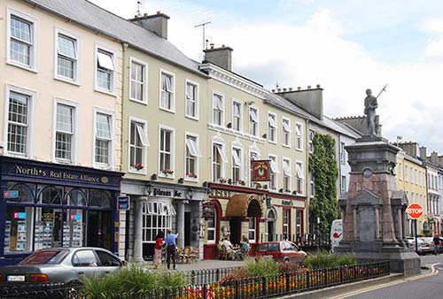
Orientation to Tralee
Tralee has a main street enjoyable for strolling, and a central park that’s home to the Kerry County Museum. The TI is in the basement of the museum (daily 9:00-13:00 & 14:00-17:00).
The town comes alive for the famous Rose of Tralee International Festival, usually held in mid-August. It’s a celebration of arts and music, culminating in the election of the Rose of Tralee—the most beautiful woman at the festival (no matter which country she was born in, as long as she has Irish heritage).
Sights in and near Tralee
Kerry County Museum
Easily the best place to learn about life in Kerry, this museum (located in Ashe Memorial Hall in the center of town) has three parts: Kerry slide show, museum, and a walk through a faux-medieval town.
Cost and Hours: €5; daily 9:30-17:30, Sept-May Tue-Sat 9:30-17:00, closed Sun-Mon; +353 66 712 7777, www.kerrymuseum.ie.
Visiting the Museum: Head upstairs and get in the mood by relaxing for 10 minutes through the continuous slide show of Kerry’s spectacular scenery. Then wander through 7,000 years of Kerry history in the museum (starting in Room 4). It starts with good background info on the archaeological sites of Dingle, progresses through Viking artifacts found in the area, and goes right up to modern times and independence. Good coverage is given to adventurous Kerryman Tom Crean, who survived three Antarctic expeditions with Scott and Shackleton (see sidebar on here). Also covered (in Room 1, at the top of the stairs) is the tragic life of humanitarian Roger Casement, a 1916 Easter Rising gentleman rebel who was captured on a nearby beach and later executed. Next head to the basement for the most elaborate of the museum’s exhibits: the “Medieval Experience,” in which you stroll back in time on a re-creation of Tralee’s Main Street circa 1450. The life-size dioramas and mannequins of medieval life are garish and a bit corny, and the explanations are thin, but it’s a fun experience...as the many County Kerry field-trip groups will attest.
Before leaving, horticulture enthusiasts will want to ramble through the rose garden next to the museum.
▲Blennerville Windmill
On the western edge of Tralee, just off the N-86 Dingle road, is the little village of Blennerville, a major port for America-bound emigrants during the Great Potato Famine. It was also the home port where the Jeanie Johnston was built. (This modern-day replica of a 19th-century ship is now docked and tourable in Dublin—see here). You won’t see that ship here, but you will see a big windmill with a surprisingly engaging museum.
The still-functioning windmill (from 1780) is one of just a few surviving wind- and water mills that were built around Ireland to grind grain for Britain. This somewhat offbeat sight is made very meaningful by the excellent one-hour tour, which offers a touch of history of the town, the famine, and the engineering of the windmill itself.
Cost and Hours: €10 includes one-hour tour, €5 for just a quick look at the windmill; June-Aug daily 9:30-17:30; off-season Tue-Sat 9:30-17:00, closed Sun-Mon and all of Nov-March; last entry one hour before closing, tours depart about hourly at the top of the hour—it’s smart to book ahead on their website, +353 66 712 1064, www.blennerville-windmill.ie.
Background: After losing its American colonies in 1776, Britain looked for a closer source of grain—one that would also enrich British (rather than American) ship captains. And so they built windmills like this one, all over Ireland, to grind grain that fed Britain as that country steamed into the Industrial Age. In a sense, the American Revolution worsened Ireland’s plight during the Great Potato Famine: Even as Irish peasants starved, Britain still expected its grain—which continued to be shipped out.
Visiting the Museum: The tour begins with a small exhibit and a seven-minute film that sets the stage. Then your guide takes you out to the windmill to explain how it works. The life of a miller was difficult: Inhaling flour severely reduced life expectancy, and there was a real risk of all that fine powder in the air catching fire and causing an explosion. (That’s why windmills have windows for light—candlelight was too dangerous—and why the working gears alternate metal and wood: Metal on metal could create sparks.) You’ll also learn how many of the phrases we use every day—from the obvious (“run of the mill”) to the surprising (“damsel in distress”)—have their origins in windmills.
Finally, your guide brings you back inside to walk through a wonderful world of model trains (in honor of the steam-train line that once ran from right outside the window to Dingle), plus an assortment of historic bric-a-brac...each item with a story to tell.
Tralee Connections
Travelers headed for Dingle using public transportation will likely find themselves passing through Tralee.
BY PUBLIC TRANSPORTATION
From Tralee by Train to: Dublin (every 2 hours, 6/day on Sun, 1 direct in morning, otherwise change in mellow Mallow, 4 hours, arrives at Heuston Station), Killarney (8/day, 35 minutes). Info: www.irishrail.ie.
By Bus to: Dingle (6/day, fewer off-season and on Sun, 1 hour), Galway (8/day, 4 hours), Limerick (7/day, 2 hours), Doolin/Cliffs of Moher (5/day, 5 hours), Ennis (6/day, 3.5 hours, change in Limerick), Rosslare (3/day, 7 hours with changes), Shannon (7/day, 3 hours), Dublin (5/day, 6 hours). Tralee’s bus station is across the parking lot from the train station. Info: www.buseireann.ie.
BY PLANE
Kerry Airport is a 20-minute drive from Tralee and a one-hour drive from Dingle (code: KIR, www.kerryairport.ie). It’s just off the main N-22 road, halfway between Killarney and Tralee. Dingle Shuttle Bus is your best connection to Dingle town (must reserve in advance, €30-40/person one-way depending on number of passengers, minimum 3 passengers, +353 087 250 4767, www.dingleshuttlebus.com). You can also connect to the airport via taxi (€35 from Tralee, €90 from Dingle) or bus (3/day to Dingle via Tralee). Kerry Airport has flights to Dublin, as well as international destinations, including London.
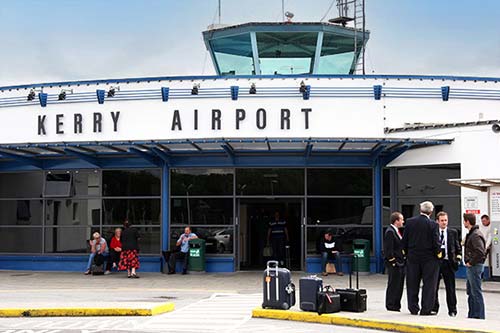
ROUTE TIPS FOR DRIVERS
If you’re driving to Dingle, you have two choices as you enter the neck of the Dingle Peninsula: the narrow-but-scenic Conor Pass road; or the faster, easier N-86 through Lougher and Annascaul (Abhainn an Scáil).
If you’re driving from Dingle, heading north straight to Galway, the inland Limerick route is fastest and cheapest (minimal tolls). But if you’re going to the Cliffs of Moher and the Burren, the 20-minute Killimer-Tarbert ferry connection allows you to avoid the 80-mile detour around the River Shannon and is more scenic (€23/carload, departs hourly, June-Sept every 30 minutes; generally departs at :30 past the hour going north and on the hour going south—check timetables online; no need to reserve, +353 65 905 3124, www.shannonferries.com).
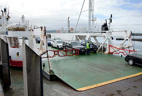
As a scenic drive from Dingle, Conor Pass is popular. You’ll twist up out of town until you reach a well-marked summit viewpoint looking back over Dingle and, in the other direction, over Tralee Bay and Brandon Bay. Continuing on over the pass and downhill, the road narrows through a brief, dramatic, one-lane stretch with moss-covered stone walls on one side and sheer cliffs on the other. Near the end of this white-knuckle section, you can pull over at a roadside waterfall; consider the fun five-minute scramble to a dramatic little glacier-created lake.