ROTTERDAM
The Dutch say that money is made in Rotterdam, divvied up in The Hague, and spent in Amsterdam. The country’s second-biggest city (with 660,000 in the center and about a million in the metropolitan area), Rotterdam has a long history as the Netherlands’ muscular moneymaker. Its strategic position at the delta of multiple major European rivers has made it a lucrative trading point for centuries. Today, it’s home to Europe’s busiest port, among the biggest in the world. They say that in Rotterdam, shirts are sold with the sleeves already rolled up.
The city had a particularly tumultuous 20th century. Its highly strategic port earned it complete destruction—down to its very foundations—during World War II. When the time came to rebuild, Rotterdammers decided to leave their salty old town as a memory and started from scratch to build a boldly modern city. Ever since, the city has been—and remains—a stimulating urban showcase of architectural experimentation, with buildings big and small designed by a Who’s Who of contemporary architects. You’ll see wildly creative and futuristic train stations, libraries, market halls, office towers, bridges, subway stations, and apartment complexes that push the envelope of science fiction. But the city also respects its past, with a few historic buildings mixed in and lots of stories to be told.
Strolling Rotterdam’s sleek pedestrian malls, ogling its fantastical skyline, browsing for a meal on its eclectic shopping streets, or cruising its busy harbor, you’ll experience another slice of the Netherlands. A visit to Rotterdam makes it clear: For Dutch urbanites, the days of milkmaids and wooden shoes are long gone.
PLANNING YOUR TIME
Big, intense Rotterdam works well as a side-trip from Delft (or even from Amsterdam or Haarlem): Ride the train in and poke around for a few hours, following my self-guided walk (or bike ride). With more time, take a harbor cruise (to see the busy port) or an architectural bike tour (to appreciate its rich array of creative buildings). If you’re desperate for cute canals, ride the Metro to the historic Delfshaven quarter. A half-day is enough for a good first look, but with additional time, there’s certainly more to see in this modern, multicultural city.
Orientation to Rotterdam
Rotterdam sprawls along both banks of the Maas River. But the central zone—on the north bank, with most of the important sights and architectural landmarks—is fairly compact. A loop from the train station to the river and back again is a long-but-doable walk or an easy bike ride.
TOURIST INFORMATION
The handiest TI branch is in a small, blocky structure inside Rotterdam Centraal station’s cavernous main hall (daily 9:00-18:00). The main branch is downtown at Coolsingel 114 (from 9:30, +31 10 790 0185, www.rotterdam.info). Their inexpensive map is good enough to get you around for the day.
ARRIVAL IN ROTTERDAM
In Rotterdam’s cutting-edge Centraal train station, a wide concourse crosses beneath the train platforms. Safe, secure, pricey lockers are at the “back” end of the train station (they’re on the right, tucked under track 16, behind a closed door—look for Kluis). To head into the city center, follow Centrum and Stationsplein signs. When you pop out into the main hall, the TI kiosk is on the left, beneath the huge video screen and just before the main doors. My self-guided walk begins inside this hall.
HELPFUL HINTS
Bike Rental and Tours: In this spread-out city, getting around on two wheels can be a smart choice. Guided options change from year to year; the TI can tell you the latest, or try Bike & Bite for a four-hour ride with six food-tasting stops (€85, www.bikeandbite.nl). For independent cycling, Zwaan Bike Rentals is a block from the train station, with a variety of bikes and e-bikes. From the main plaza directly in front of the station, turn right and go a block down the busy boulevard—called Weena—to #705 (Mon-Fri 8:30-18:00, Sat-Sun from 9:00, +31 10 412 6220, www.czwaan.nl—reserve online for better prices). If you rent a bike, you can store your bag here for half the price of the train-station lockers. Centrum Bikes has rentals near the river at Schiedamsedijk 54A (Tue-Fri 9:00-18:00, Sat-Mon from 10:00, +31 6 1179 4721, www.rentabikerotterdam.nl).
Water Taxi: Rotterdam has a memorable and affordable water-taxi service. Fast taxi boats shuttle between Leuvehaven, Veerhaven, the skyscraper zone’s Hotel New York, and several other points (€5 one-way, every 10 minutes, www.watertaxirotterdam.nl).
GETTING AROUND
While I’ve designed this chapter in the order of a long loop walk through the city, public transit can help you zip directly to certain sights (such as the harbor cruise or Delfshaven). As you exit the train station, look left for a row of tram platforms (#7 heads to the harbor cruise dock at Erasmus Bridge, direction: Willemsplein, ride to end of line; #4 goes to Delfshaven, direction: Marconiplein). There’s also an entrance to the Metro in the plaza in front of the station (the trip to Delfshaven requires a change at Beurs). Public transportation is covered by a single ticket (€4.50 for up to a two-hour ride, use a contactless card or device), day pass (€9.50, www.ret.nl), or the Zuid-Holland Tourist Day Ticket (€15.50, https://touristdaytickets.com).
Rotterdam Walk
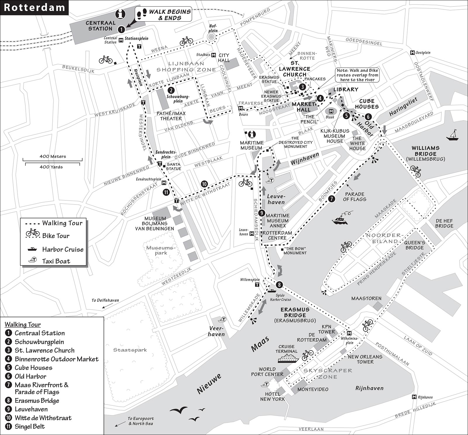
This four-mile self-guided walk takes you through the shopping zone of Rotterdam and past some of its most dynamic architectural treasures to the river, then loops you back to the landmark Erasmus Bridge (where you can catch the harbor cruise) before heading back up to the station.
Length of This Walk: You could do it at a brisk pace in about four hours (without stops for sightseeing or taking the harbor cruise), but it’s also a useful spine for spending the entire day in the city. If four miles is too much, I list some places where you can head back early—at the Maas Riverfront/Williams Bridge, Erasmus Bridge (tram stop), and Rotterdam Centre tower (Metro stop).
Bike Variation: Rotterdam is spread out, and this walk is lengthy. To speed things up, consider renting a bike near the station (see “Helpful Hints,” earlier). You can link most of the stops on this walk by bike but will need to walk your bike through pedestrian-only zones. On two wheels, a brisk and even more scenic route to the Erasmus Bridge is to pedal across the red Williams Bridge (Willemsbrug), then head to the southwestern tip of Noordereiland for a great view of the bridge and skyscrapers. From here, loop back around and take the Queen’s Bridge (Koninginnebrug) to the far side of the river, where you’ll pedal south to the Erasmus Bridge (see map). Cross it and follow the rest of the walk from there.
• We’ll begin inside the grand main arrivals hall of Rotterdam’s...
1 Centraal Station
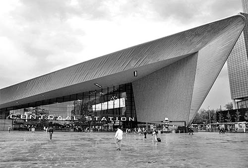
The city’s sleek, futuristic, gigantic (430,000-square-foot) train station—opened by King Willem-Alexander in 2014—is a marvel in itself. A quick and easy ride from The Hague, Delft, Dordrecht, and many fine little bedroom communities, Rotterdam’s station accommodates more than 100,000 daily commuters (and a few tourists). Stand under its soaring roof—which makes travelers seem like ants—and take it all in. The enormous screen high on the wall—the size of a tennis court—plays video clips of Rotterdam life and its busy harbor; below that sits the TI.
Head straight out the main doors into the vast plaza in front of the station, called Stationsplein. Walk to the busy road and turn 180 degrees to appreciate the swoop of the station’s roofline. Shaped like an arrow (or perhaps the Starfleet emblem), it marks Rotterdam as a city of the future—in strong contrast to Amsterdam, which revels in being a city of the past. (The station’s futuristic signage only reinforces what sure seems like an intentional Star Trek homage.) The angled glass pavilion to your left leads to an underground park-and-ride garage...not for cars, but for 5,000 bicycles. You’ll also see a yellow M marking an entrance to what was the first Metro stop in the country (from 1968). Tucked around the right side of the station are platforms for trams that fan out across the city.
Turn around (with the station at your back) and look left and right, up and down the busy cross-boulevard called Weena. After Rotterdam was leveled by Hitler’s Blitzkrieg, postwar city officials sent architects to Washington, DC, for inspiration. This street (and others like it) feels more like an American-style “downtown” zone than a European street. Some are even laid out according to specific American dimensions and proportions. While skyscrapers seem to be popping up randomly all over Rotterdam, they’re carefully zoned; this boulevard is one of four central axis streets where tall towers are permitted.
• Cross Weena and head straight down Kruisplein (through the big, pedestrian-friendly median, with grassy parks on both sides) for two short blocks. Enjoy the architectural harmony. Even the landscaping plays along—notice how the trees are groomed to grow with a uniform V. After the second parking pavilion, turn left down the street in front of the red tower. You’ll emerge into one of many bold Rotterdam public spaces.
2 Schouwburgplein and Central Shopping Zone
Named for the giant theater building (Schouwburg) that sits at its far end, Schouwburgplein is also ringed by a giant Pathé/IMAX theater and other entertainment venues. The red crane-like lampposts evoke the busy port that made this city wealthy. At night, the lights embedded in the square simulate floating through the Milky Way. And on a sunny day, the big green plastic lounge chairs invite loitering.
Continue straight ahead and head down the pedestrian-only street called Korte Lijnbaan (under the big Lijnbaan sign, toward the copper-topped tower; cyclists must dismount and walk their bikes). This is just one leg of the Lijnbaan, a network of completely pedestrianized shopping streets that burrow through downtown Rotterdam. In the postwar boom of the 1960s and 1970s, several European cities pedestrianized downtown streets for shoppers—but Rotterdam’s Lijnbaan was the first, created in 1953.
After one block, you reach a big intersection with a small statue of rasslin’ bears in the center. Our walk proceeds to the right from here (down Lijnbaan), but first, pause and look straight ahead at Rotterdam’s City Hall (one block ahead and across the street). Dating from 1917, it’s one of a handful of old Rotterdam structures that wasn’t destroyed in World War II. (The Germans, who knew they’d need a headquarters in the city, intentionally spared it—but if you get close, you can still see bullet holes from the fighting.) Today it’s a popular place for weddings, and it houses the office of Rotterdam’s mayor. If you’d like to detour, you’re welcome to step inside this civic palace and enjoy the Art Deco space under the cupola—so slathered in symbolism. Also in the lobby is a plaque honoring George Marshall (father of the Marshall Plan), placed there as a thank you for all the money the US gave the city to rebuild after World War II. It sums up the brilliant mission of the Marshall Plan with these simple words: “The only way to win a war is to prevent it.”
Back at the bears, head south (right) down Lijnbaan. While not quite “charming,” this zone is very user-friendly; daydream about doing your shopping here instead of at a suburban mall. After two blocks, at Van Oldenbarneveltplaats (with the tram tracks), turn left and follow an even more enticing shopping zone called the Beurstraverse, where a swooping green canopy dips gracefully under a busy street.
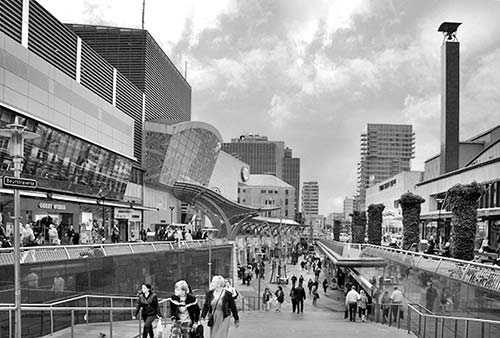
Continuing straight up the stairs after the tunnel, you’ll wind up on Hoogstraat. This is known as Rotterdam’s “High Street”: It’s a major shopping thoroughfare, and it’s literally high—it sits upon a dike. As you browse, keep in mind that this was the heart of Rotterdam’s old town until 1940. Imagine that this area looked much like Amsterdam, with canals lined by old buildings before the bombs fell.
• After crossing the wide canal, you’ll see a church steeple on your left behind a modern building. Head up little Wijde Kerkstraat to reach the square in front of the church.
3 St. Lawrence Church (Laurenskerk)
This is the oldest surviving structure in Rotterdam (completed in 1525)—a rare survivor of the 1940 Nazi bombing campaign. The church’s nondescript exterior belies its vast, pristine interior with a huge organ. There’s not much to see inside, but if you enter, be sure to look up to see a roof that was clearly built by a city of shipbuilders—it feels like you’re huddled beneath an overturned boat (€3, Tue-Sat 10:00-17:00, closed Sun-Mon).
Grotekerkplein, the “Great Church Square” in front of St. Lawrence, has a statue of Rotterdam native Desiderius Erasmus (1466-1536), who was born in a house nearby (now gone). This humanist philosopher and satirist grew nervous when his like-minded friend, Thomas More, was beheaded by the English king. So, to evade a similar fate, Erasmus traveled far and wide—to Italy, England, Belgium, Switzerland, and beyond. He forged the notion of being a European—a citizen of the world, not tied to a single nationality. In this way, Erasmus is the intellectual forebear of the European Union, which named its highly successful foreign-study program after him. On the pedestal, in Dutch, a famous Erasmus quote is inscribed: “The entire world is your fatherland.” (Several other major landmarks in this city are named for Erasmus, including Rotterdam’s main university and its landmark bridge.)
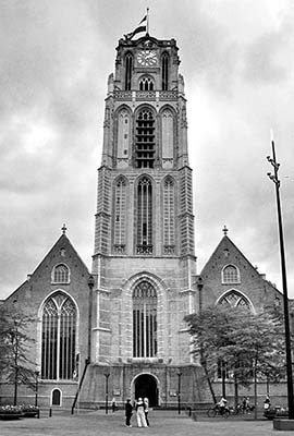
Retracing your steps toward Hoogstraat, veer left along the side of the church into a peaceful little garden square with a newer Erasmus Monument (dedicated in 2016). It has the outline of a stepped-gable house and is covered with excerpts from his writings.
• Continue past the garden square and turn right at the next opening between the buildings. You’ll emerge back on Hoogstraat, across from a long, grassy square.
Turn left and continue down Hoogstraat. A few doors down, on the left, is Poffertjessalon Seth—a local favorite for their traditional tiny pancakes, made-to-order with powdered sugar and lots of butter before your very eyes. A small order (10 for €4) is plenty for two people and worth it for the cooking demo alone.
At the end of the grassy square, you reach a vast, empty concrete zone surrounded by striking architecture.
4 Binnenrotte Outdoor Market, the Market Hall, and Modern Architecture
On Tuesdays and Saturdays (and less so on Sundays), Binnenrotte street is lively with an outdoor market: food, clothing, housewares, flowers, and so on. This is a good chance to shop around for a snack or meal. The market sits upon the original “Rotter-dam”—the dam on the Rotte River, which runs underground perpendicular to the Hoogstraat axis. As you’re browsing, tune into these buildings:
On your right, just past a modern apartment tower, is Rotterdam’s strikingly modern Market Hall (Markthal, Mon-Sat 10:00-20:00, Fri until 21:00, Sun 12:00-18:00). Inside, beneath the grandiose arch, is a bustling food market (conveniently protected from the elements, a plus in this famously drizzly city). Arcing above and around that are 230 apartments—some with ideal views of what’s fresh today, and others with terraces overlooking the city. Step inside this cathedral for shoppers and look up at the wildly colorful ceiling tiles. The market is a foodie’s festival with both local-traditional and fancy-international stalls and restaurants, some with skybox seating.
Back outside, continue straight ahead to the City Library (the blocky white building with yellow tubes). The exterior is reminiscent of Paris’ Pompidou Center and its “form follows function” style, while the interior reminds us that functionality is a very good thing for people using these buildings. Head inside (Mon 13:00-21:00, Tue-Fri 10:00-21:00, Sat 10:00-17:00, Sun 13:00-17:00, Hoogstraat 110, www.bibliotheek.rotterdam.nl). First, simply appreciate the space: Peering up into the atrium, see the many levels (with funky 1970s-style lampshades) that reach up through the structure, like a well-stocked warehouse of knowledge. But this is more than a library—it’s a thriving and well-used community center. The information desk hands out brochures about local events, and you’ll also find pay WCs, handy cafés, a life-size chessboard busy with retirees and kids, and a music library. Members get a world of benefits. Imagine funding a library like this with a levy in your hometown.
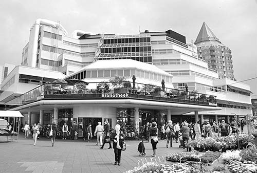
• Exiting the library building, turn left and walk toward the unmistakably pointy-topped building that locals have dubbed “The Pencil.” (There was really no other option.) The next stop on our walk is the blocks jutting out at its base.
The big white industrial arch (which marks the busy Rotterdam Blaak tram-and-Metro hub) is nicknamed “The Manhole Cover” or “The UFO.” Walk up the gap between the library and “The Pencil.” Look back at the Market Hall (best view) and then follow the reddish ramp up into the...
5 Cube Houses (Kubuswoningen)
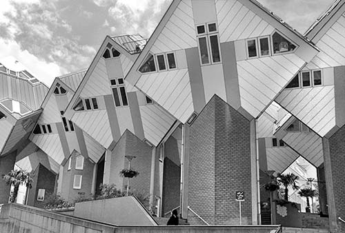
In the late 1970s, architect Piet Blom turned urban housing on its ear with this bold design: 39 identical yellow cubes, all tilted up on their corners, and each filled with the residence of a single family. Taken together, the Cube Houses look like dozens of dice in mid-toss. If Rotterdam has a single icon representing its bold approach to postwar architecture, this is it.
For a good look, follow the museum signs into the courtyard in the middle of the complex. Shops fill the gray boxes at the base, while people live in the yellow tops. The circle of angled cubes facing each other around this courtyard facilitates connections among neighbors. Inside each cube, the space is a bit awkward in places, but more functional than you might guess. Each cube has three floors: kitchen and living room downstairs, two bedrooms and one bathroom upstairs, and atop the ladderlike stairs in the summit, a cramped but relaxing sun lounge that feels made-to-order for reclining and gazing up at the stars. Everything is custom-designed to maximize efficient use of the odd space—cheap IKEA furniture just won’t fit. To get a look inside one of the cubes, visit the Kijk-Kubus Museum House (at #70, €3, daily 10:00-18:00, www.kubuswoning.nl).
• From the main courtyard, carry on over the busy street (find the long yellow cube corridor, beyond the entrance to the museum house). At the far end, just past the Stayokay hostel, take eight steps down on your right and enjoy a view of Rotterdam’s...
6 Old Harbor (Oudehaven)
This mostly modern re-creation is what’s left of the harbor that was the basis for Rotterdam’s early prosperity. Today it’s a bustling social zone, its embankments lined with inviting al fresco cafés and restaurants. You’ll see a few houseboats and a shipyard used for repairing historic vessels.
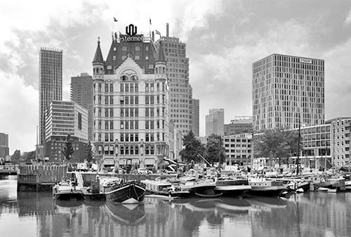
Directly across the harbor is The White House (Het Witte Huis), another rare example of a surviving prewar building. When it was built in 1898, this structure was Europe’s tallest building, at about 140 feet. It was inspired by American skyscrapers of the time...with the addition of frilly Jugendstil (Art Nouveau) turrets. In the 1970s, there were plans to build a superhighway right through the Old Harbor area, but local demonstrations kept this historic zone intact.
• Follow the ramp down and curl around the left side of the Old Harbor, passing some enticing outdoor tables—handy if you’re ready for a drink or snack. At the end of the harbor, pause at the little drawbridge to appreciate the great view of the harbor and White House. (The towers just beyond mark another harbor, Leuvehaven, where we’ll be later.)
Continue straight ahead, cross the busy street, and duck under the bridge’s flyover, then bear right to the boardwalk, with a great viewpoint of the...
7 Maas Riverfront
The Maas River begins in France (where it’s called the Meuse) and flows through Belgium, merging with several other rivers (including the Rhine) on its way to the sea. As you face the river, to the left (upstream) are Belgium, France, Germany, and Switzerland, and to the right (downstream)—past ever-larger harbors—is the North Sea.
You’re standing next to the big, red Williams Bridge (Willemsbrug). In the distance, just to the right, is the green, industrial-style bridge called De Hef. Before 1992, this rail drawbridge was part of the only train line through the city—so passengers would have to wait patiently while it went up and down.
Across the river is the island neighborhood called Noordereiland, whose low-lying buildings were largely spared the bombs of World War II and retain a certain historic charm today. This evokes what much of Rotterdam’s center might look like had Hitler not made an example of the city. In the near foreground is a curiously entertaining black-iron modern-art installation by Auke de Vries.
Panning right, you’ll see several big towers surrounding the Erasmus Bridge—where we’re headed next. If you’re on a bike, now’s the time for a long, scenic detour pedaling over this bridge and along Noordereiland. If you’re tired and want to head back to the station, you can retrace your steps through the Cube Houses complex to the Blaak tram/Metro hub (where you can take tram #21 in direction: Schiedam Woudhoek or #24 in direction: Holy to get back to Centraal station).
But if you’re on foot and ready to see more, turn right and head about a half-mile (15 minutes) south along the Parade of Flags—a line of about 200 flags representing the nationalities of the citizens who make up this city’s multiethnic population. Much of the harborfront stroll is through a fine manicured park, with ever-changing views of the skyline across the river.
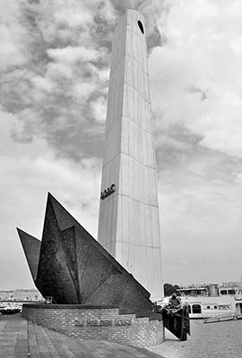
Nearing the Erasmus Bridge, you’ll see a towering monument. From the land side, it looks like a nondescript gray tower with a hole in the top. But circling around to the riverfront park, its symbolism is more apparent: It resembles a ship’s prow, cutting through the water. Officially the National Monument for the Merchant Marine, but nicknamed “The Bow” (De Boeg), this honors all seamen from Allied countries who were killed in World War II. If you find it a bit too abstract, you’re not alone: The sailors lashed together at the bottom of the monument were added later to inject it with a bit more humanity.
• At the monument, head inland to reach the drawbridge. Crossing it, turn left (toward the water) to head back down to the base of the bridge.
8 Erasmus Bridge (Erasmusbrug) and Rotterdam’s Skyscraper Zone
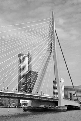
Built in 1996, this icon of Rotterdam created an essential link between the north and south banks of the Maas River. Its huge, 450-foot-tall tower, at the south end, planted a flag for the then-underdeveloped part of the city—which has (thanks largely to the bridge) exploded into a “downtown” zone of commerce.
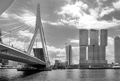
At the base of the bridge, an attraction branded as Remastered promises an immersive hour-long trip through digitally remixed Dutch art. It’s pricey and likely not worth your time on a short visit to Rotterdam. On a fine day, however, you might want to break up your walk with a harbor cruise from the Spido company, which has been sailing since 1919 (see “More Sights in Rotterdam,” later). From this point, take a visual tour of Rotterdam’s modern skyline. (You can do this while waiting for your tour boat to depart, or in lieu of the cruise; if you’re on foot, note that the views get better the farther down the embankment you go, with the best just before the Veerhaven harbor—a rare bit of Old World charm.)
At the far end of the bridge stands a lineup of creations—nicknamed “Manhattan on the Maas”—by the top architects working on this planet today. Many of these buildings were completed after 2000 and are engineered to sit upon pylons driven deep into the marshy riverfront soil. From left to right, find these buildings: First, behind the bridge (with the Deloitte logo), the Maastoren is one of the greenest—it actually creates a surplus of energy by harnessing tidal power. The small cluster of buildings nearby are municipal and cultural institutions (court, customs, and theater)—placed here intentionally to spur development. Then comes the midrise, KPN Tower by Renzo Piano (best known for Paris’ Pompidou Center). The dots embedded in the side can illuminate and display patterns for a lightshow. Next is the De Rotterdam building—three independent towers with separate purposes (hotel, local government, and apartments) that share a unified base. This was designed by world-famous Rotterdam native Rem Koolhaas, who also created Rotterdam’s Kunsthal, Porto’s Casa de Música, and Seattle’s Central Library. The tall, sandstone-colored New Orleans tower is by the Portuguese architect Álvaro Siza Vieira. In the next clump of two buildings, the gray, round World Port Center is by Lord Norman Foster (famous for Berlin’s Reichstag dome; he also designed the plan for this entire peninsula and renovated the low-lying cruise terminal), while the multicolored Montevideo (look for the M on the roof) is by the Delft-based Mecanoo firm. As you might guess, the real estate on this peninsula is 100 percent committed for future projects; architects are already trying to figure out ways to build new structures on the water itself. Stay tuned.
The much lower-lying building at the tip of land (with the copper-domed turrets) is the jarringly old-fashioned Hotel New York. This was built in 1901 as the world headquarters of Holland America Line—which, back then, catered primarily to immigrants seeking a better life in the New World. Passengers would undergo rigorous health screenings in this building, and if found to be contagious, they’d be quarantined in the shipyards. To commemorate the place where so many soon-to-be-former Europeans last set foot on their home soil, today the grassy park in front of the hotel is decorated with street names from New York City. (If you’d like a closer look, you can catch a water taxi across the river from the nearby Veerhaven harbor, or from the Leuvehaven harbor, which we’ll visit next.)
Looking far to the right, you can see the beginnings of Rotterdam’s busy port. The “Europort” was the largest in the world until 2004, when it was surpassed by both Singapore’s and Shanghai’s. From the Erasmus Bridge, it’s more than 20 miles to the North Sea—and virtually every inch is lined with heavy industry. Each year, around 30,000 oceangoing ships stop here, hauling over 450 million tons of cargo. The plodding ships are weighted down with petroleum products, chemicals, and pharmaceuticals. This is also the biggest oil port on the planet, with five separate refineries.
• If you’re ready to return to the station from here, it’s easiest to head for the Willemsplein tram stop, just above the Spido boat dock; as this is the end and start of the line, any tram from here will bring you back to the station.
Or, to continue our walk, head back the way you came and proceed straight past the drawbridge you crossed earlier, up Schiedamsedijk. You’ll pass under the black, top-heavy Rotterdam Centre tower and the Leuvehaven Metro stop (another option for a quick return to the station). Just beyond, step down to dock level (at the 40,000-pound anchor) and walk alongside the historic port area called...
9 Leuvehaven
When Antwerp was taken over by fiercely pro-Catholic Spanish invaders in the late 16th century, Rotterdam welcomed Protestant refugees seeking safe harbor. And those refugees built this harbor—named for Leuven, Belgium. Today it’s a strangely picturesque mix of old and new, with a few historic harbor buildings and a rash of glittering towers that try to keep to the footprints of the original street plan.
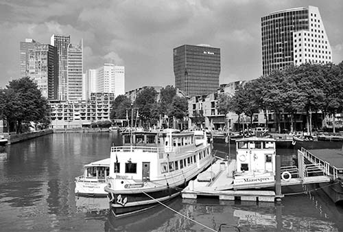
Along the way, you’ll pass a modern annex for the Maritime Museum (Maritiem Museum); the main building is a couple hundred yards up ahead, at the far end of the dock. Together, they offer an interesting look at Rotterdam’s busy port, as well as some engaging children’s exhibits (www.maritiemmuseum.nl). Stroll this embankment to peruse an open-air collection of historical ships and equipment that will be especially interesting to sailors.
Near the end (just before the red lighthouse), a gangway crosses the harbor. For a scenic detour, follow it. Along the way, you’ll pass a water-taxi station—one of many stops in Rotterdam that lets you connect various waterfront areas (for example, from here—for €5—you can ride over to the Hotel New York for a closer look at the skyscraper zone).
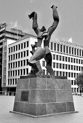
At the end of the gangway, back on dry land, turn left and walk toward the giant main building of the Maritime Museum. In the plaza between here and there is the poignant statue De Verwoeste Stad (The Destroyed City), commemorating Rotterdam’s WWII destruction. An anguished figure—his heart pierced by a void—flails his arms, face frozen in a Guernica scream. This monument is an important symbol of this city, which is defined by the architecture built upon the blank canvas caused by that harrowing destruction.
• Backtrack down the Leuvehaven embankment toward the tall cranes. Here you can use the crosswalk to cross the busy street and head up Schilderstraat; after two blocks, the street angles left a bit and becomes...
10 Witte de Withstraat
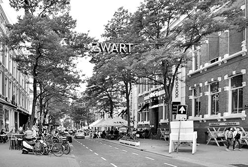
This lively, tree-lined street is an ideal place to browse boutiques, window-shop, or restaurant-hunt. For all those 200 flags along the waterfront, here we have the actual people they represent. It’s funky but still accessible, with a rainbow of eateries: shoarma, döner kebab, Indonesian, burgers, hipster cafés, spit-and-sawdust pubs, and more. It also has several art galleries and fashion boutiques. Relax, linger, and enjoy...our walk is almost finished. To really kick back, you’ll find two Dutch “coffeeshops” near the end selling marijuana. The one just around the corner (Coffeeshop the 4 Floors at Eendrachtsweg 29A) is most inviting.
• You’ll pop out at a canal, which marks the...
11 Singel Belt
Singel means “moat,” and this north-south stretch of grassy canals defines the edge of what was old Rotterdam. From here, you have several options.
Directly across the street (through the canal belt), on the left, is the city’s top art collection at Museum Boijmans Van Beuningen (www.boijmans.nl)—with the big Picasso in front. From this anchor, several additional museums sprawl south (back toward the river), surrounding Museumpark. (Especially notable is Depot Boijmans, with its mirrored exterior and rooftop restaurant.) Modern artworks, starting with a Rodin, line the canal all the way back to the train station.
To return to the train station, you can hop on a tram (#7; the Museumpark stop is immediately to your left where Witte de Withstraat hits the Singel belt). Or you can walk along these pleasant canals for about three-quarters of a mile to reach the station.
After one long block, you’ll reach the Eendrachtsplein Metro stop, where you can catch a train out to the cute, cobbled Delfshaven zone (described later, under “More Sights in Rotterdam”).
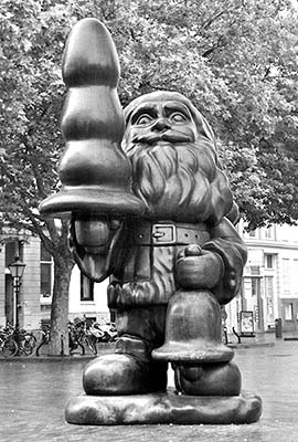
A couple of blocks farther along the Singel belt, you enter a small square called Eendrachtsplein. The Oude/Nieuwe Binnenweg cross-street (with some more buildings that survived the 1940 bombing) is another good place to browse for restaurants and is also known for its (sometimes outside-the-box) modern art and sculpture. For example, soon after the Metro stop, in the square on the right, look for another Rotterdam landmark by American sculptor Paul McCarthy (the piece is officially named Santa Claus). But what is Santa Claus holding—a misshapen Christmas tree, a giant ice-cream cone, or a sex toy? (Locals call the statue “The Butt-Plug Gnome.”) Originally designed for the Schouwburgplein—the square we saw near the start of this walk—the sculpture pushed the bounds even of Rotterdam residents’ sense of tolerance and propriety. After hiding it away in a museum for a few years, they moved it here as a compromise. The neighborhood now celebrates the gnome and his accessory (whatever it is) on banners and baubles strung down the street.
• With that image vivid in your mind, continue straight along the Singel belt. Before long, you’ll see the unmistakable outline of Centraal station, straight ahead.
More Sights in Rotterdam
Most of the main sights in town are described along my self-guided walk. But here are some additional options.
▲Harbor Cruises
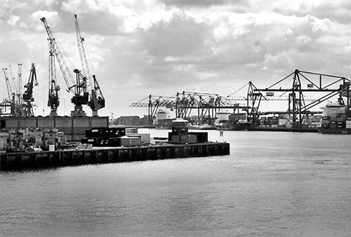
The Spido company runs 75-minute cruises that offer a good look at part of Rotterdam’s vast port. These sleek boats—with indoor and outdoor areas, a fully stocked bar, and WCs—broadcast a quadrilingual recorded commentary over the loudspeakers. Cruises depart from near Rotterdam’s landmark Erasmus Bridge. You’ll see the sprawling Staatspark (marked by the Euromast tower), several innovative waterfront housing blocks, and one small section of the bustling port, with stacks upon stacks of containers and a forest of busy cranes. While interesting, a little of this trip goes a long way, and the tour can get a bit boring. But if you view it as a nice chance to relax on a sunny boat deck while cruising through Europe’s busiest port, it’s fun and illuminating.
Cost and Hours: €17.50; April-Sept daily 9:30-17:00, departs about every 45 minutes, fewer departures off-season, confirm schedule at www.spido.nl; Willemsplein 85, +31 10 275 9988.
Getting There: From the train station, you can either zip there directly on tram #7 (get off at the Willemsplein stop, at the end of the line), or follow my self-guided walk for a look at Rotterdam old and new en route to Spido’s departure point.
▲Delfshaven
One of the few well-preserved bits of Rotterdam’s golden age wasn’t even part of Rotterdam—it was the port for Delft. Lacking its own outlet to the sea, Delft was given this harbor, which is still connected to Delft’s town center by six miles of canals. Strolling along here, you can imagine the Pilgrims setting sail. You’d never know that modern Rotterdam is just around the corner.
Getting There: Delfshaven is on the outskirts of Rotterdam’s center, but it’s easy to reach on the Metro: Ride line A toward Schiedam Centrum or Vlaardingen West, line B toward Hoek van Holland Haven or C toward De Akkers, and get off at the Delfshaven stop. From Centraal station this requires a transfer at Beurs (on line D); for nicer scenery, you could ride tram #4, but it’s less frequent.
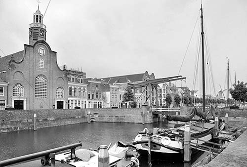
Visiting Delfshaven: Exit the Metro following signs for Uitgang—Historisch Delfshaven. You’ll pop out in the middle of a busy immigrant neighborhood. Walk east on Schiedamsweg for about three blocks and you’ll emerge at the top of historic Delfshaven (on your right)—an idyllic canal pulled straight out of a Vermeer painting: old boats, a cantilevered drawbridge, and even a windmill still churning away in the distance. Wander and explore, going up and down Voorhaven canal and over the bridges. Next to the main drawbridge is the Pilgrim Fathers Church (Oude of Pelgrimvaderskerk), where the Pilgrims prayed the night before setting sail for the New World on August 1, 1620. (Their ship, the Speedwell, had to be swapped out for the Mayflower in England before continuing to Plymouth Rock.) If it’s open, step inside to catch some history (www.pelgrimvaderskerk.nl). For more on the Pilgrims’ time in Holland, see the sidebar on here. The parallel Achtershaven canal, one block east, is half charming, half more modern.
Eating in Rotterdam
To grab a bite along the course of my self-guided walk, you have several great options to browse for a meal (in order):
The modern Market Hall (Markthal) is filled with tempting eateries, either for a quick stand-up bite or a sit-down meal. Around the Old Harbor (Oudehaven), just below the Cube Houses, you’ll find an inviting array of restaurants with waterfront seating. Witte de Withstraat is simply a delight to browse, with a wide variety of places to eat and drink, many with living room-like outdoor dining. If you’ve made it all the way through the walk, Oude Binnenweg is another pedestrianized street lined with places where you can grab a bite before heading back to the train station.
Rotterdam Connections
BY TRAIN
Trains depart from Rotterdam’s Centraal station at least every 15 minutes and head north to Delft (15 minutes), The Hague (30 minutes), Leiden (35 minutes), Haarlem (1 hour), and Amsterdam (4/hour on express ICD train, 45 minutes; slower trains stop at all of the above, 75 minutes). Trains also head to Utrecht (4/hour, 40 minutes), where you can change to reach Arnhem (1.5 hours total). To reach Antwerp—where you can connect to other Belgian destinations—you can take the slower, cheaper IC train (hourly, 1 hour) or the speedy, expensive Eurostar (hourly, 30 minutes—but reservations are required and the cost is about triple). To reach London, take the Eurostar (9/day, 3.5 hours direct or 4 hours if transfer required in Brussels; reservations required, www.eurostar.com).