AMSTERDAM CITY WALK
From Centraal Station to Spui Square
2 Damrak
3 Stock Exchange (Beurs van Berlage)
5 Royal Palace (Koninklijk Huis)
8 De Papegaai Hidden Church (Petrus en Paulus Kerk)
10 Begijnhof
13 Flower Market (Bloemenmarkt)
14 Koningsplein and a Herring Stand
Amsterdam today looks much as it did in its golden age, the 1600s. It’s a retired sea captain of a city, still in love with life, with a broad outlook and a salty story to tell.
Take a Dutch sampler walk from one end of the old center to the other, tasting all that Amsterdam has to offer along the way. It’s your best single stroll through quintessentially Dutch scenes, hidden churches, surprising shops, thriving happy-hour hangouts, and eight centuries of history.
Orientation
Length of This Walk: Allow about two hours.
When to Go: The walk is best during the day, when churches and sights are open. After about 17:00 you’ll find three major stops (the hidden church, the Begijnhof, and the herring stand) closed.
Alert: Beware of silent transport—trams and bikes. Walkers should stay off the tram tracks and bike paths, and yield to bell-ringing bikers.
Royal Palace: €12.50, daily 10:00-17:00 but hours can vary for official business.
New Church: Price varies depending on current exhibit, daily 11:00-18:00.
De Papegaai Hidden Church: Free, Mon-Sat 10:00-16:00, Sun until 14:00.
Amsterdam Museum: Typically a highlight of this walk, this wonderful museum is now closed for a major renovation (its collection is displayed at the H’ART Museum, described on here).
Begijnhof: Free, daily 9:30-18:00.
Tours:  Download my free Amsterdam City Walk audio tour.
Services: You can find WCs at fast-food places and in the Kalvertoren shopping mall.
OVERVIEW
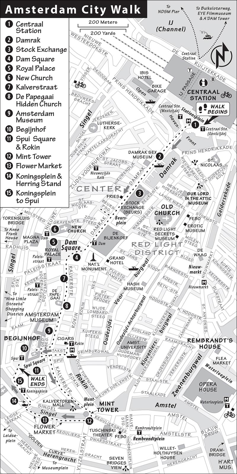
This walk starts at the central-as-can-be Centraal station and ends at Spui Square. You’ll head down Damrak to Dam Square, continuing south down Kalverstraat to the Mint Tower (Munttoren), then waft through the flower market (Bloemenmarkt) before dropping by the herring stand on Koningsplein and circling back to Spui. The route basically follows the central tramline, so to zip from any spot to anywhere else, simply hop on tram #2 or #12. Trams #2 and #12 also continue to the Rijksmuseum (and Van Gogh Museum).
The Walk Begins
1 Centraal Station
Here, where today’s train travelers enter the city, sailors of yore disembarked from seagoing ships. They were met by street musicians, pickpockets, hotel runners, and ladies carrying red lanterns. Centraal station, built in the late 1800s, sits on reclaimed land at what was once the harbor mouth. With warm red brick and prickly spires, the station is the first of several Neo-Gothic buildings we’ll see from the late 19th century, the era of Amsterdam’s economic revival. One of the station’s towers has a clock dial; the other tower’s dial is a weather vane. Watch the hand twitch as the wind gusts in every direction—N, Z, O, and W.
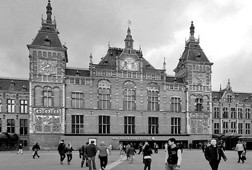
Let’s get oriented: nord, zuid, ost, and west. Facing the station, you’re facing north. Farther north, on the other side of the station, is the IJ (pronounced “ay”), the body of water that gives Amsterdam access to the open sea. (While some people, even locals, refer to this as a river, technically it’s a channel.)
Now turn your back to the station and face the city, looking south. The city spreads out before you like a fan, in a series of concentric canals. Ahead of you stretches the street called Damrak, which leads—like a red carpet for guests entering Amsterdam—to Dam Square a half-mile away. That’s where we’re headed.
To the left of Damrak is the city’s old (oude) town. The crown-topped steeple of the Old Church (Oude Kerk) marks the center of that neighborhood. That historic quarter has long been the Red Light District ( see the Red Light District Walk chapter). Closer to you, towering above the old part of town, is the domed St. Nicholas Church. It was built in the 1880s, when Catholics—after about three centuries of oppression—were finally free to worship in public.
To the right of Damrak is the new (nieuwe) part of town, where you’ll find the Anne Frank House and the peaceful Jordaan neighborhood.
The train station is the city’s transportation center. Many trams leave from out front. Beneath your feet is a newish Metro line. In the “Golden 1990s” when the economy was booming, Amsterdam committed the city to a grand infrastructure expansion to accommodate the tens of thousands of people living in North Amsterdam, the fast-growing suburb beyond the IJ. Today that investment is paying off, and this plaza, while providing a people-friendly welcome to the city, also works as an efficient transit hub.
For a peek at the results—either now or sometime later in your visit—you could duck into the station, turn left, find the IJpassage hallway that leads under the tracks all the way to the back of the station, then carry on straight ahead to the bank of the IJ. From here, you can scan the horizon of the district called Amsterdam-Noord—the formerly sleepy area across the river and now the city’s hottest construction zone, with a mix of sleek glass skyscrapers, wild modern architecture, and postindustrial chic. It’s dominated by the angular, horizontal roofline of the EYE Filmmuseum, and the tall A’DAM Tower, with its bulky observation deck.
Back on the Damrak side of the station, on your far right, in front of Ibis Hotel, is a huge, multistory parking garage—for bikes only. Biking in Holland is the way to go—the land is flat, distances are short, and there are designated bike paths everywhere. The bike parking garage is free, courtesy of the government, and intended to encourage this green and ultra-efficient mode of transportation.
Another handy mode of transportation: trams, which run quickly through the city center. Notice there are stops to either side of you; from here, the particularly useful trams #2 and #12 zip efficiently through the town center to the famous museums (Rijks and Van Gogh) to the south.
• Let’s head out. With your back to the station, start walking south into the city to the head of Damrak. Be aware of trams and bikes as you cross the street. Train yourself to avoid wandering into the red bike lanes; cyclists have the right of way...and they take it.
Keep going south straight along the right side of the street, following the crowds on...
2 Damrak
This street was once a riverbank. It’s where the Amstel River flowed north into the IJ, which led to a vast inlet of the North Sea called the Zuiderzee. It’s this unique geography that turned Amsterdam into a center of trade. Visualize the physical layout of this man-made city: built on tree-trunk pilings, protected by dikes, and laced with canals. Location, location, location. Boats could sail up the Amstel into the interior of Europe, or out to the North Sea, to reach the rest of the world. No wonder that St. Nicholas, protector of water travelers, was the city’s patron saint.
As you stroll along Damrak, look left. There’s a marina, lined with old brick buildings. Though they aren’t terribly historic, the scene still captures a bit of golden age Amsterdam. Think of it: Back in the 1600s, this area was the harbor, and those buildings warehoused exotic goods from all over the world.
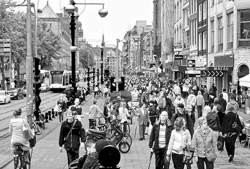
All along Damrak, you’ll pass a veritable gauntlet of touristy shops. These seem to cover every Dutch cliché. You’ll see wooden shoes, which the Dutch used to wear to get around easily in the marshy soil, and all manner of tulips; the real ones come from Holland’s famed fresh-flower industry. Heineken fridge magnets advertise one of the world’s most popular pilsner beers. There are giant wheels of cheese, marijuana-leaf hats, team jerseys for the Ajax football (soccer) club, and memorabilia with the city’s “XXX” logo. You’ll likely hear a hand-cranked barrel organ and see windmill-shaped saltshakers. And everything seems to be available in bright orange—the official color of the Dutch royal family.
At the Damrak Sex Museum at Damrak 18, you’ll find the city’s most notorious commodity on display (museum described on here). As a port town catering to sailors and businessmen away from home, Amsterdam has always accommodated the sex trade.
Continue up Damrak (noting the canal boats on your left) for more touristy delectables. You’ll pass places selling the popular local fast food: french fries. Here they’re called Vlaamse friets—Flemish fries—since they were invented in the Low Countries. The stand at Damrak 41 is a handy spot, with a mix of locals and tourists stopping to dip their fries in mayonnaise (not ketchup).
Farther up Damrak, you’ll pass many restaurants. It quickly becomes obvious that, here, international cuisine is going local. Restaurants serving rijsttafel, a sampler of assorted Indonesian dishes, are especially popular, thanks to the days when the Dutch East Indies were a colony. Amsterdammers on the go often grab a simple sandwich (broodje) or a pita-bread wrap (shoarma) from a Middle Eastern takeout joint.
Remember, we’re walking along what was once the Amstel River. Today, the Amstel is channeled into canals and its former mouth is covered by Centraal station. But Amsterdam remains a major seaport. That’s because, in the 19th century, the Dutch dug the North Sea Canal to create a shorter route to the open sea. These days, more than 100,000 ships a year dock on the outskirts of Amsterdam, making it Europe’s fourth-busiest seaport (giant cruise ships stop here as well). For all of Amsterdam’s existence, it’s been a trading center.
• The long brick building with the square clock tower, along the left side of Damrak, is the...
3 Stock Exchange (Beurs van Berlage)
This impressive structure, a symbol of the city’s long tradition as a trading town, was built with nine million bricks. Like so many buildings in this once-marshy city, it was constructed on a foundation of pilings—some 5,000 tree trunks hammered vertically into the soil. When the Beurs opened in 1903, it was one of the world’s first modernist buildings, with a geometric, minimal, no-frills style. Emphasizing function over looks, it helped set the architectural tone for many 20th-century buildings. Note how the reliefs celebrate the worker—it was a time of “capitalism with a heart” (free trade but with a greater respect for workers).
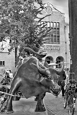
Make your way to the end of the long, century-old building. Amsterdammers have gathered in this neighborhood to trade since medieval times. Back then, “trading stock” meant buying and selling any kind of goods that could be loaded and unloaded onto a boat—goats, chickens, or kegs of beer. Over time, they began exchanging slips of paper, or “futures,” rather than actual goods. Traders needed moneychangers, who needed bankers, who made money by lending money. By the 1600s, Amsterdam had become one of the world’s first great capitalist cities, loaning money to free-spending kings, dukes, and bishops.
When you reach the end of the building, look across the square called Beursplein, which houses the stock exchange. In 1984, the Beurs building was turned into a cultural center, and the stock exchange moved next door to the Euronext complex—a joint attempt by France, Belgium, and the Netherlands to compete with the power of Britain’s stock exchange. See the stock price readout board. How’s your Heineken stock doing? Green means it’s going up, and red means it’s losing value. Amsterdam still thrives as the center of Dutch business and, besides Heineken, is home to Shell Oil, Philips Electronics, and ING Bank.
Directly opposite Beursplein on Damrak (at #68) is Beurspassage, a fancy, faux Art Nouveau shopping passageway. Dip in here and wander down and back to notice the symbols of the city. Fill your water bottle in the mouth of a fish. Enjoy the marble floor, the chandeliers and Tiffany lanterns, and the mosaic ceiling depicting a primordial soup with all the stuff you’d find tossed into a canal, from old bike tires to Van Gogh’s ear.
• Back out on the main drag, continue up Damrak until it opens into Dam Square. Make your way—carefully—across the street to the cobblestone pavement. Stand in the middle of the square (in front of the white pillar) and take it all in.
4 Dam Square
This is the historic heart of Amsterdam. The city got its start right here in about the year 1250, when fishermen in this marshy delta settled along the built-up banks of the Amstel River. They built a damme, blocking the Amstel River and creating a small village called “Amstel-damme.” To the north was the damrak (“outer harbor”), a waterway that led to the sea. That’s the street we just walked. To the south was the rokin (“inner harbor”), for river traffic inland—and nowadays another busy street. With access to the sea, fishermen were soon trading with German riverboats traveling downstream and with seafaring boats from Stockholm, Hamburg, and London. Land-trade routes converged here as well, and a customs house stood in this spot. Dam Square was the center of it all.
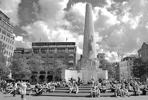
Today, Dam Square is still the center of Dutch life, at least symbolically. The Royal Palace and major department stores face the square. Mimes, jugglers, and human statues mingle with locals and tourists. As Holland’s most recognizable square, this is where political demonstrations begin and end.
Circling the Square: Pan the square clockwise and take in the sights, starting with the Royal Palace—the large domed building on the west side. To its right stands the New Church (Nieuwe Kerk); it’s located on the pedestrian-only shopping street called Nieuwendijk, which runs parallel to Damrak and stretches all the way to Centraal station. Panning past Damrak, see the proud old De Bijenkorf (“The Beehive”) department store. (The store’s cafeteria on the top floor is a great place to rise above it all for a light meal; see here.)
Farther right, the Grand Hotel Krasnapolsky has a lovely circa-1900 glass-roofed “winter garden.” The white obelisk is the National Monument, built in 1956 to honor WWII casualties. When the Nazis occupied Holland from 1940 to 1945, they deported some 60,000 Jewish Amsterdammers, driving many—including young Anne Frank and her family—into hiding. The “Hunger Winter” of 1944-1945 killed thousands of Dutch and forced many to survive on little more than tulip bulbs. This obelisk—with its carvings of the crucified Christ, men in chains, and howling dogs—remembers the suffering of that grim time and is also considered a monument for peace.
A few blocks behind the hotel is the edge of the Red Light District. To the right of the hotel stretches the street called the Nes, lined with some of Amsterdam’s edgy live-theater venues. Panning farther right, find Rokin street—Damrak’s southern counterpart, continuing past the square. Next, just to the right of the touristy Madame Tussauds, is Kalverstraat, a busy pedestrian-only shoppers’ mall.
• Turn your attention to the most imposing building on the square.
5 Royal Palace (Koninklijk Huis)
Despite the name, this is really the former City Hall. In medieval times, this was where the city council and mayor met. Amsterdam was a self-governing community that prided itself on its independence and thumbed its nose at royalty. In about 1650, the old medieval Town Hall was replaced with this one. Its style is appropriately Classical, recalling the democratic Greeks. (That’s a nice message, but the government was really more like an oligarchy, ruled by rich and powerful trading families.) The triangular pediment features denizens of the sea cavorting with Neptune and his gilded copper trident—all appropriate imagery for sea-trading Amsterdam. The small balcony (just above the entry doors) is where city leaders have long appeared for major speeches, pronouncements, executions, and (these days) for newly married royalty to blow kisses to the crowds.
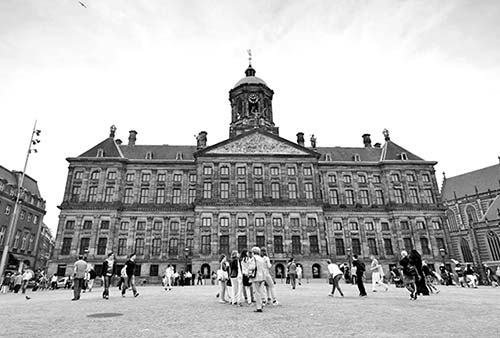
Today, the palace remains one of the four official residences of King Willem-Alexander and is usually open to visitors (see here).
• A few paces away, to the right as you’re facing the Royal Palace, is the...
6 New Church (Nieuwe Kerk)
Though called the “New” Church, this building is actually 600 years old—a mere 100 years newer than the “Old” Church (in the Red Light District). The sundial above the entrance once served as the city’s official timepiece.
This church is where many of the Netherlands’ monarchs are married, and all are “inaugurated.” (Dutch royals are not crowned, as they never actually wear the official crown.) If you pay the expensive fee to go inside, you’ll see a spacious and well-lit yet bare interior (occupied by a new art exhibit every three months) that looks quite different from the Baroque-encrusted churches found in the rest of Europe.
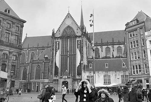
In 1566, clear-eyed Protestant extremists throughout Holland marched into Catholic churches (including this one), lopped off the heads of holy statues, stripped gold-leaf angels from the walls, urinated on Virgin Marys, and shattered stained-glass windows in a wave of anti-Catholic vandalism.
This iconoclasm (icon-breaking) of 1566 started an 80-year war against Spain and the Habsburgs—who, at the time, controlled the Netherlands—which eventually led to Dutch independence in 1648. Catholic churches like this one were converted to the new dominant religion, Calvinist Protestantism (today’s Dutch Reformed Church). From then on, Dutch churches downplayed the “graven images” and “idols” of ornate religious art.
• From Dam Square, head south (going down the pedestrian mall just to the right of Madame Tussauds).
7 Kalverstraat
Kalverstraat (strictly pedestrian-only—even bikers need to dismount and walk) has been a traditional shopping street for centuries. But today it’s notorious among locals as a noisy, soulless string of chain stores. For smaller and more elegant stores, try the adjacent “Nine Little Streets” shopping district (De Negen Straatjes). Only about four blocks west of Kalverstraat, it’s where 200 or so shops and cafés mingle along tranquil canals.
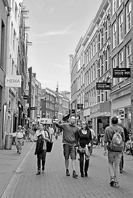
• About 100 yards along, keep a sharp eye out for the next sight (it’s fairly easy to miss): On the right, just before and across from the McDonald’s, at #58, is...
8 De Papegaai Hidden Church (Petrus en Paulus Kerk)
This Catholic church—with a simple white interior, nice carved wood, and Stations of the Cross paintings (try reading the Dutch captions)—is an oasis of peace amid crass 21st-century commercialism. It’s not exactly a hidden church (after all, you’ve found it), but it still keeps a low profile, as it dates from an era when Catholics in Amsterdam were forced to worship in secret.
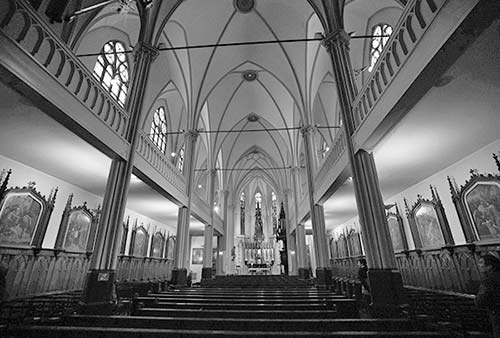
In the 1500s, Protestants were fighting Catholics all over Europe. As a center for trade, Amsterdam made an effort to put business above ideological differences, doing business with all parties. But by 1578 the division had become too wide to straddle, and Protestant extremists took political control of the city. They expelled Catholic leaders and bishops and outlawed the religion. Catholic churches were stripped of their lavish decoration and converted into Dutch Reformed churches. Simultaneously, the Dutch were rising up politically against their (Catholic) Spanish overlords, and eventually threw them out.
For the next two centuries, Amsterdam’s Catholics were driven underground. While technically illegal here, Catholics could worship so long as they practiced in humble, unadvertised places, like this church. ( Nearby in the Red Light District is an even more poignant hidden church; see the Our Lord in the Attic Museum Tour chapter.)
This church gets its nickname from a parrot (papegaai) carved over the entrance of the house that formerly stood on this site. Now, a stuffed parrot hangs in the nave to remember that original papegaai.
Today, the church asks visitors for a mere “15 minutes for God” (so says the sign: een kwartier voor God)—an indication of how religion has long been a marginal part of highly commercial and secular Amsterdam.
• Continue south on Kalverstraat for about 100 yards. At #92, where Kalverstraat crosses Wijde Kapel Steeg, look to the right to find an archway that leads to the entrance and courtyard of the Amsterdam Museum.
9 Amsterdam Museum
The ▲▲ Amsterdam Museum—the city’s history museum—is just through this door, but it’s closed for several years for a major renovation. If you’d like to see highlights of the collection, they’re temporarily on display at the H’ART Museum (see here).
Also closed is the museum’s public corridor, the Amsterdam Gallery (formerly known as the “Civic Guards Gallery”), which is lined with group portraits of Amsterdam’s citizens from the golden age to modern times.
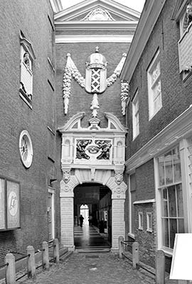
Pause at the entrance to the museum complex to view the archway. On the slumping arch is Amsterdam’s coat of arms—a red shield with three Xs and a crown. The X-shaped crosses represent the crucifixion of St. Andrew, the patron saint of fishermen. (And here you thought the three Xs referred to the city’s sex trade.) They also represent the three virtues of heroism, determination, and mercy—symbolism that was declared by the queen after the Dutch experience in World War II. (Before that, they likely symbolized the three great medieval threats: fire, flood, and plague.) The crown dates from 1489, when Maximilian I—a Habsburg emperor—also ruled the Low Countries. He paid off a big loan with help from Amsterdam’s city bankers and, as thanks for the cash, gave the city permission to use his prestigious trademark, the Habsburg crown, atop its shield.
Below that is a relief (dated 1581) showing boys around a dove, asking for charity, a reminder that this building was once an orphanage.
• Continue down Kalverstraat to #128, after which a small lane on the right, Begijnensteeg, leads directly to the old door of the Begijnhof. (Admission into this sweet little haven is free but limited to 50 people at a time.)
10 Begijnhof
This quiet courtyard, lined with houses around a church, has sheltered women since 1346 (and is quite a contrast with the noisy Kalverstraat just steps away). For centuries this was the home of a community of Beguines—pious and simple women who removed themselves from the world at large to dedicate their lives to God. When it was first established, it was like an island just for women—a circle of houses facing a peaceful courtyard, surrounded by water.
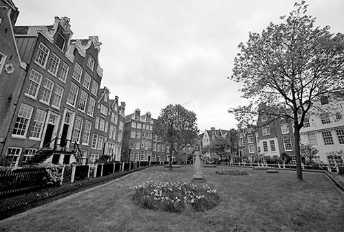
As you enter, keep in mind that this spot isn’t just a tourist attraction; it’s also a place where people live. Be considerate: Don’t photograph the residents or their homes, be quiet, and stick to the area near the churches.
Begin your visit by walking to the far end and finding the statue of one of these charitable sisters, standing in a green lawn just beyond the church. The Beguines’ ranks swelled during the Crusades, when so many men took off, never to return, leaving society with an abundance of single women. Later, women widowed by the hazards of overseas trade lived out their days as Beguines. Poor and rich women alike turned their backs on materialism and marriage to live here in Christian poverty. And though obedient to a mother superior, the members of the lay order of Beguines were not nuns. The Beguines were very popular in their communities for the unpretentious lives they led, with a Christ-like dedication to serving others. They spent their days deep in prayer and busy with daily tasks—spinning wool, making lace, teaching, and caring for the sick. In quiet seclusion, they provided a striking contrast to the more decadent and corrupt Roman Church, inspiring one another as well as their neighbors.
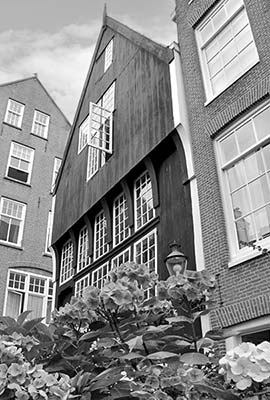
The statue of the Beguine faces a black wooden house, at #34. This structure dates from 1528 and is the city’s oldest. Originally, the whole city consisted of wooden houses like this one. They were eventually replaced with brick houses to minimize the fire danger of so many homes packed together.
Now turn your attention to the brick-faced English Reformed church (Engelse Kerk, over your right shoulder), built as a Catholic church in 1420 to serve the Beguine community. But then, in 1578, Catholicism was outlawed and the Dutch Reformed Church took over many Catholic monasteries. Still, the Begijnhof survived; in 1607, this church became Anglican. The church served as a refuge for English traders and religious separatists fleeing persecution in England. Strict Protestants such as the famous Pilgrims found sanctuary in tolerant Amsterdam and may have worshipped in this church. They later moved to Leiden, where they lived for a decade before sailing to religious freedom in America (see sidebar).
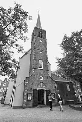
If the church is open, step inside, grab an English info sheet, and head to the far end, toward the stained-glass window. It shows the Pilgrims praying before boarding the Mayflower. Along the right-hand wall is an old pew (with columns and clock) they may have sat on, and on the altar is a Bible from 1763, with lotſ of old-ſtyle ſ ’s. Also of note is the front pulpit, carved of wood. It’s by Piet Mondrian, the famous Dutch abstract artist, and was one of his first professional gigs. As you exit, look to the left of the door for a 1607 proclamation about a sermon preached here that the Pilgrims may have heard.
Back outside, find the Catholic church, which faces the English Reformed Church. Because Catholics were being persecuted when it was built, this had to be a low-profile, “hidden” church—notice the painted-out windows on the second and third floors. Step inside, through the low-profile doorway. This church served Amsterdam’s oppressed 17th-century Catholics, who refused to worship as Protestants. It’s decorated lovingly, if on the cheap (try tapping softly on a “marble” column). Amsterdam’s Catholics must have eagerly awaited the day when they were legally allowed to say Mass (that day finally came in the 19th century).
Today, Holland still has something of a religious divide, but not a bitter one. Amsterdam itself is, like many big cities in the West, pretty un-churched. But the Dutch countryside is much more religious, including a “Bible Belt” region where 98 percent of the population is Protestant. Overall, the Netherlands is divided fairly evenly between Catholics, Protestants, and those who see Sunday as a day to sleep in and enjoy a lazy brunch.
Step back outside. The last Beguine died in 1971, but this Begijnhof still thrives, providing subsidized housing to about 100 single women (mostly Catholic seniors). The Begijnhof is just one of a few dozen hofjes (little housing projects surrounding courtyards) that dot Amsterdam.
• Leave the way you entered, turn right, and head for a leafy, cobbled square.
11 Spui Square and Rokin
Lined with cafés and bars, Spui Square is one of the city’s more popular spots for nightlife and sunny afternoon people-watching. Its name, Spui (rhymes with “now” and means “spew”), recalls the days when water was moved over dikes to keep the place dry.
We’ll finish our walk at the far-right end of this square. But for now, head two blocks to the left, crossing busy Kalverstraat, to the bustling street called the Rokin. Across the Rokin you can see the entry to the new north-south Metro line and a small black statue of Queen Wilhelmina daintily riding sidesaddle. Remember that in real life, she was the iron-willed inspiration for the Dutch resistance against the Nazis.
Big, old-fashioned canal cruises depart from the Rondvaart Kooij dock across the water, in the yellow canal house (see “Big, Traditional Tour Boats” on here).
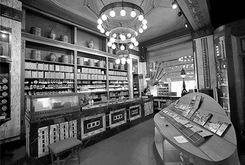
Turn left on the Rokin and walk up 50 yards to the House of Hajenius (at Rokin 92, with the red awning). This temple of cigars is a “paradise for the connoisseur,” showing “175 years of tradition and good taste.” To enter this sumptuous Art Deco building with painted leather ceilings is to step back into 1910. Go inside and take a deep whiff. Don’t be shy—the place is as much a free museum for visitors as it is a store for paying customers. It’s a world of pipes, cigars, a classy smoking lounge, and—farther back—tins of pipe tobacco that they proudly blend (lift the lid, take a whiff, and compare several). The personal humidifiers allow locals (some famous) to call in an order and have their cigars waiting for them at just the right humidity. Above the street entry door, humidifier pipes pump moisture into the room.
From Hajenius, backtrack to the busy pedestrian mall, Kalverstraat, and turn left on it to continue south. Just before the end of this shopping boulevard (at #206, on the right), you’ll see the modern Kalverpassage and the Kalvertoren shopping mall. Enter and go deeper within to find a slanting glass elevator. You can ride this to the recommended top-floor Blue Amsterdam Restaurant, where a coffee or light lunch buys you something that’s rare in altitude-challenged Amsterdam—a nice view.
• Back out on the street, at the end of Kalverstraat, stands the...
12 Mint Tower (Munttoren)
This tower marked the limit of the medieval walled city and served as one of its original gates. In the Middle Ages, the city walls were girdled by a moat—the Singel canal. Until about 1500, the area beyond here was nothing but marshy fields and a few farms on reclaimed land. The Mint Tower’s steeple was added later—in the year 1620, as you can see written below the clock face.
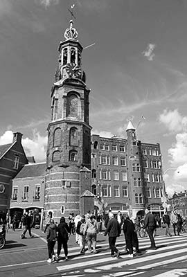
Today, the tower is a favorite within Amsterdam’s marijuana culture. Stoners love to take a photo of the clock and its 1620 sign at exactly 4:20 p.m.—the traditional time to quit work and light one up. (On the 24-hour clock, 4:20 p.m. is 16:20...Du-u-u-ude!)
Before moving on, look left (at about 10 o’clock) down Reguliersbreestraat. Midway down the block, the twin green domes mark the exotic Tuschinski Theater. Here you can see current movies (subtitled in Dutch) in a sumptuous Art Deco setting. If you like, take a quick detour to check out its lobby, and imagine this place in the Roaring ’20s. Wa-a-ay at the end of the long block (where you see trees) is Rembrandtplein, another major center for nightlife.
• Hook right around the Mint Tower, cross the canal, then turn right and walk west along the south bank of the Singel canal. It’s lined with the greenhouse shops of the...
13 Flower Market (Bloemenmarkt)
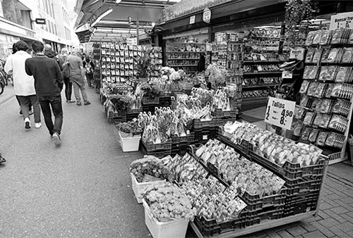
The stands along this busy block sell cut flowers, plants, bulbs, seeds, garden supplies, and flower-oriented souvenirs and knickknacks. Browse your way along while heading for the end of the block.
The Flower Market is a testament to Holland’s longtime love affair with flowers. The Netherlands is by far the largest flower exporter in Europe and a major flower power worldwide. If you’re looking for a souvenir, note that certain seeds are marked as OK to bring back through customs into the US. (However, locals advise that this touristy flower market may not be the best place to buy; for guidance, see the Shopping in Amsterdam chapter.)
• The long Flower Market ends at the next bridge, where you’ll enter a square named Koningsplein (King’s Square), with a characteristic herring shop.
14 Koningsplein and a Herring Stand
Pleasant Koningsplein square hosts the popular and recommended Frens Haringhandel outdoor haringhandel (herring stand). This is a great place to choke down a raw herring—a fish that has a special place in every Dutch heart. After all, herring was the commodity that put Amsterdam on the trading map. It’s also what Dutch sailors ate for protein on those long, ‘round-the-globe voyages.
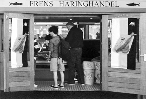
Throughout the Netherlands, old-fashioned fish stands like this one sell herring sandwiches and other fishy treats. Herring thrive in the shallow North Sea waters surrounding the Netherlands, and they’re a delicacy here. While it seems the Dutch eat herring “raw,” the fish is actually cured in salt (soaked for five days in an oak cask filled with a mild brine solution). Herring is caught fresh during the May/June fishing season and immediately preserved. Before the days of deep freezing, this curing process was a big deal. But these days, even Dutch herring connoisseurs admit that they can’t tell what’s fresh or frozen—and you get great herring all year.
Step up to the shop and see what’s on ice. While herring is the star, you’ll also see garnalen (little shrimp), zalm (salmon), makreel (mackerel), paling (eel), and krabsalade (crab salad). Most are available as a broodje (sandwich). And every Dutch kid’s favorite is kibbeling (deep-fried breaded cod) with a tasty tartar-like sauce.
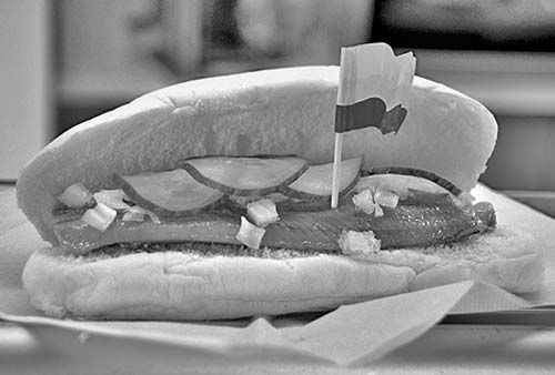
When ordering herring, you have choices. The easiest and most practical for novices is the sandwich (broodje, tucked into a soft roll with pickles and raw onions), while purists prefer their herring unadulterated. If you go with straight herring, your big decision is Rotterdam-style (pick it up by the tail, dredge it in chopped raw onions, and lower it into your mouth, all in one go) or Amsterdam-style (cut up in toothpick-friendly hunks, also with onions). Between the fish and the onion, herring ought to come with breath mints.
• Lick your fingers—it’s time to finish our walk.
From Koningsplein you have several options. The noisy and congested Leidsestraat leads straight to the museum zone; for a more pleasant walk to the museums, follow Leidsestraat just across the next canal (Herengracht), then go left along the canal and take the first right at Nieuwe Spiegelstraat. This long street, much of it lined with art galleries and inviting shops, leads directly to the Rijksmuseum (you’ll see the grand museum in the distance). Or, from near Koningsplein, you could catch tram #2 or #12 either to the museums or back to Centraal station.
But we’ll finish off by following the Singel canal back to Spui Square.
15 From Koningsplein to Spui
With your back to the flower market, walk along the canal (with the water on your left). Follow the tram tracks as they bend around to the right and lead you to Spui.
As you walk, consider that the Singel is wide today because it was the moat and wall of the city back in the Middle Ages. In about 1620, during the golden age period of building and expansion, the wall was torn down and the city expanded with the new town across the canal to your left.
The canalside street you’re enjoying was, until recently, congested with cars. Today the lanes are for bikes, trams, and people. In a few years there’ll be no more fossil-fuel-powered traffic in the city—the trams are already electric, all the boats will be electric...and bikes will rule.
And notice, for a minute, the bikes. The Dutch take biking very seriously. They may not wear helmets, yet they place great importance on road safety: Bikes are considered equal to cars and must follow the same rules. Stiff fines are given to those biking in pedestrian zones or looking at their phones while pedaling. Little Dutch kids grow up on bikes. At about age 10, they take a biking exam. When a fifth grader passes this exam, it’s like a coming-of-age...their world just got bigger and more real. (The most dangerous thing on an Amsterdam road is a tourist on a bike.)
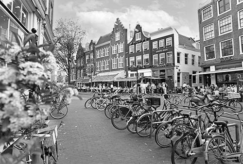
When you finally get back to Spui, listen to the sounds of the city: people talking over drinks at the café, bike gears changing, the brrring of the bells, the chatter of the birds. Does the square seem spacious? Rather than 200 cars, within view are 200 bikes. At least for the Dutch, this is the urban environment of the future.