ÅLESUND AND THE GEIRANGERFJORD
Ålesund • “Troll Country” Scenic Drive • Geirangerfjord
Activities from Geiranger Town
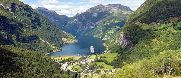
North of Bergen and the Nutshell zone are two popular and pretty destinations: Ålesund, one of Norway’s most attractive cities, with a colorful Art Nouveau streetscape and a mountaintop viewpoint overlooking its many islands; and the Geirangerfjord, a dreamy fjord that’s relatively undeveloped and unspoiled...except for the giant cruise ships that come and go all summer long. Between these two appealing destinations, you’ll have your choice of scenic fjord and mountain-pass drives—most notably the famous Trollstigen road, corkscrewing its way nearly 2,800 feet above sea level.
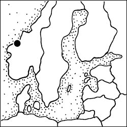
If you have time to go beyond the Oslo-Nutshell-Bergen spine, this area ranks just below the Sognefjord sights, and above Stavanger and the Setesdal Valley.
Ålesund
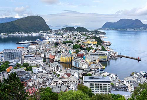
Ålesund (OH-leh-soont), built on a scattering of islands at the mouth of a northwestern fjord, might just be Norway’s prettiest town. That’s thanks in large measure to a devastating 1904 fire that forced the fishing settlement to rebuild virtually from scratch. Providentially, the eye-pleasing Art Nouveau style was all the rage in Europe at the time. The result is a gorgeous small city that melds urbanity and nature as only the Norwegians can. Especially when viewed from its mountain, Aksla (a steep hike or easy drive above town), it’s easy to get swept up in Ålesund’s beauty.
The town is compact and easy to see; if you’re ambitious, you may be able to fill a day with its sights, but more likely you’ll just enjoy strolling the tidy core and waterfront embankments. The leading city of the mountainous Sunnmøre region, Ålesund is close enough to the popular Geirangerfjord and scenic Trollstigen road to be a handy home base or jumping-off point for this part of Norway. Because it’s a very popular cruise port, the ship call schedule largely dictates the town’s metabolism. When a couple of big boats are in town, it’s jammed; the next day, when there are none, it’s all yours.
Orientation to Ålesund
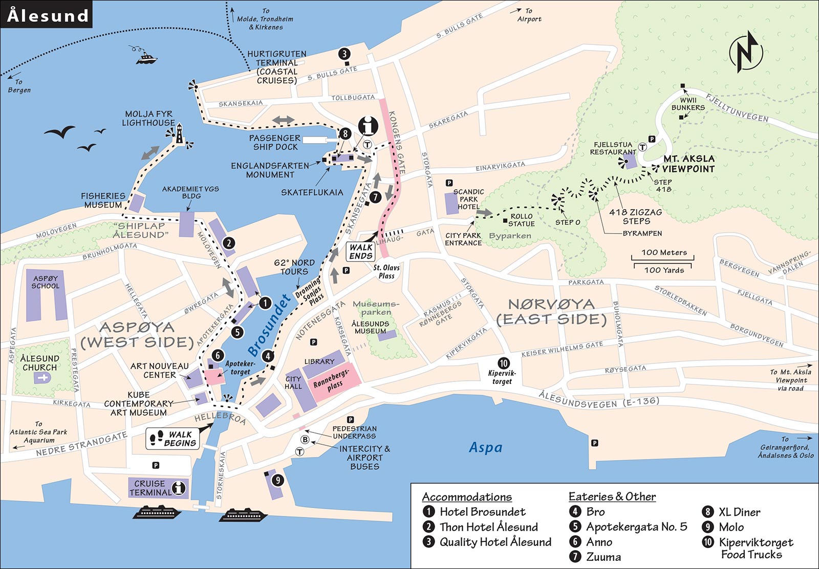
While the city (pop. 52,000) spreads over numerous islands and islets connected by bridges and tunnels, you’ll spend most of your time in the compact town center, which is itself split by the waterway called Ålesundet (but known locally as Brosundet—“Bridge Strait”). The west half of the city center is on the island Aspøya, and the east side (huddled around the base of Mount Aksla) is on Nørvøya; they meet at the Hellebroa bridge, right in the heart of town.
TOURIST INFORMATION
The TI, which also covers surrounding areas, is along the Skateflukaia quay, on the eastern embankment (daily 8:30-18:00, +47 70 30 98 00, www.visitalesund.com).
Tours and Activities: The TI can fill you in on things to do in and near Ålesund and acts as a hub for local sightseeing companies. Popular options include town walking tours (historical overview or Art Nouveau-themed); day trips to outlying sights; and longer, all-day packages to the Geirangerfjord, Trollstigen, and more. While these tend to focus on cruise ship passengers, independent travelers are also welcome.
This city is a fine place to get on the water: You can rent a kayak, take a kayak tour, or join a high-speed RIB tour out to nearby islands and fjords (operated by 62º Nord, visit their office on the eastern embankment or see www.62.no, +47 40 43 04 59).
ARRIVAL IN ÅLESUND
Drivers will find well-signed lots near the center. The airport (code: AES) is 10 miles north of town, on Vigra Island. Buses meet arriving flights for the 125-NOK trip into town (arriving at the same location as intercity buses); a taxi into town costs about 500 NOK (either way, it’s a 20-minute drive). Intercity buses stop along the busy road near the cruise terminal, an easy five-minute walk from the center. Arriving by bus or ship, simply put your back to the water, walk straight ahead, cross the busy street, and carry on to the Hellebroa bridge, in the heart of town and the start of my self-guided walk.
GETTING AROUND ÅLESUND
You can easily reach almost everything mentioned here by foot. But to get to some worthwhile outlying sights (including the Geirangerfjord), take advantage of Ålesund’s fine network of buses and ferries, operated by Fram (https://en.frammr.no [URL inactive]). The “Travel Like the Locals” section of their website outlines how to use public transportation rather than buy package excursions.
PLANNING YOUR TIME
On a quick visit, I’d begin by strolling the two embankments through the middle of town: first, the east side, with the TI; then the west side, with the Art Nouveau Center, KUBE, and Fisheries Museum, followed by a quick detour to Ålesund Church. If you have time and energy, hike up (or take a taxi) to the top of Mount Aksla for the classic town view.
Ålesund Walk
The best activity in town—worth ▲▲—is free and easy: strolling the Brosundet waterway that cuts through the heart of the city center. Both sides of the Brosundet are worth wandering. We’ll begin by walking up the west side, with most of the sightseeing. Then we’ll cross back over the Hellebroa bridge and head up the east side, with fine views. At the end, you can detour up to the mountaintop viewpoint. To trace our route, see the “Ålesund” map, earlier, and for advice on visiting the major museums and sights along the way, see “Sights in Ålesund,” later.
• First, get oriented by standing on...
Hellebroa Bridge
Find a quiet spot to stand along the bridge’s railing and take in this beautiful city’s unique layout. The narrow canal that flows beneath your feet is actually a strait (sund) between two of the many islands that constitute Ålesund. This waterway is what gave the city its name: “Eel Strait,” for the way it slinks and curves through town (ål means “eel”). To the west is the island of Aspøya, and to the east is Nørvøya.
• Head across the bridge to the west side of the canal.
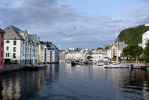
West Side
Immediately next to the bridge, the small waterfront square called Apotekertorget features two statues celebrating the hardworking Norwegians who built Ålesund. First, on the pillar, is the Boy Fisherman (Fiskergutten)—an apprentice in the trade that allowed this hardy seafaring settlement to thrive. A few steps away is a smaller statue of the Herring Wife (Sildekona)—a reminder that, once those fish were caught, they had to be processed. And that work fell to local women, along with keeping the home fires burning, raising the children, and mourning husbands and sons lost at sea.
Fronting this square, you can’t miss the beautiful turreted, stone building of the Art Nouveau Center, the most worthwhile sight in town. It fills the former Swan Pharmacy (Svaneapoteket—notice the golden swan above the corner entrance), a particularly well-preserved example of the Art Nouveau-style buildings that were built as Ålesund resurrected itself from its devastating 1904 fire. The boxy building to its left is KUBE, a contemporary arts center.
From here, the street called Apotekergata follows the canal a block inland. As you stroll the next few short blocks, appreciate the cancan of colorful Art Nouveau facades. Looking uphill, corner turrets frame steep streets. Looking downhill, gaps between the buildings periodically reveal beautiful views to the other side of the Brosundet.
Soon you’ll reach two particularly grand waterfront buildings that make up the recommended Hotel Brosundet. Pass the green one, then swing left with the street to go by its main entrance, in the bright yellow building. Bear slightly left and follow narrow Molovegen alongside the big stone wall. You’ll pass the big Thon Hotel Ålesund, pop out again at the water, and walk under the big, white Akademiet VGS school building.
Here you reach the rare bit of town that wasn’t burned in the 1904 fire. The few wooden shiplap buildings that survive here give an idea of what Ålesund would have looked like before that catastrophic event.
The big white building on the seaward side of the street is home to the Fisheries Museum (Fiskerimuseet), which tells the story of this city’s primary industry. Near the entrance to the museum, a stony pier jabs out into the water, with a red lighthouse (Molja Fyr) at its tip. Walk out to this lovely viewpoint, with great vistas back on the town (and Mount Aksla overhead—notice the steep, zigzag trail to the restaurant on top) and, in the opposite direction, out to some of the many islands that make up Ålesund.
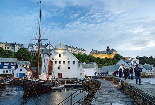
From here, you can retrace your steps to the bridge. Or, carry on along the water, following Molovegen (roughly “Pier Way”) past more wooden buildings through an increasingly residential area. The gigantic yellow building, hulking on the hilltop overhead, is the Aspøy Skole schoolhouse. Go as far as you like, then circle back to the town center.
On your way back toward the bridge, consider detouring just a few short blocks inland for a visit to the Ålesund Church, the stout stone structure capping a hill on this side of town (limited hours, so make sure it’s open before making the trip).
• Now cross over the Hellebroa bridge to the east side of the canal, passing a popular fish-and-chips stand.
East Side
This side of town, a bit more urban and crowded, is hemmed in by Mount Aksla, rising up just a few blocks inland. Just below and beyond the fish-and-chips joint, terraced gardens lead past the recommended Bro restaurant. Head down toward the water here. Near the restaurant’s entrance, watch for the easy-to-miss ramp that leads down to floating docks. Walking along these docks will take you most of the way along this embankment while offering great views of the colorful houses across the Brosundet.
Also along here, you’ll pass a few places that specialize in kayak tours and rentals—an idyllic way to explore this water-bound city. One of these is 62º Nord, whose large, white booking office fills a point jabbing out into the canal.
Keep going along the water, and soon you’ll reach the quay Skateflukaia. Here you’ll find the TI and some handy restaurants (see “Eating in Ålesund,” later).
At the tip of the quay stands a monument to the Englandsfart (the Norwegian word for boats—and—people crossing the North Sea to Britain during World War II). During the Nazi occupation, Ålesund was a hotbed of resistance activities with close ties to the Allies in Britain—so much so, it was sometimes called “Little London.” Ålesund became a popular jumping-off point for people escaping across the North Sea to Britain. The monument honors the 320 Norwegians who died in this attempt...and the 3,300 who succeeded and went on to fight with the Allies.
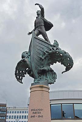
Carrying on, you’ll pass the floating dock for local passenger ferries, then some popular outdoor restaurants. You can follow the water all the way out to the tip of the pier, until you’re a very short distance (as the crow flies) from the squat lighthouse just across the Brosundet.
Looking out to sea, you may be tempted to take a cruise along the Norwegian coast—stopping off at all those offshore islands, atmospheric fjords, and charming towns. And, come to think of it, Ålesund is all three of those things. Conveniently, the Hurtigruten coastal cruise liner—which does exactly this trip, all the way up past the Arctic Circle—stops right along the giant pier to your right, twice daily.
Head back the way you came toward the Skateflukaia quay. Once you reach the TI, detour a block inland, then turn right on Kongens Gate—a charming, traffic-free, shop-lined street with lots of fine Art Nouveau architecture. Follow Kongens Gate a couple of blocks to Lihauggata, where stairs lead up to the town’s upper streets and eventually to the trail up to the Mount Aksla viewpoint.
• To hike up to the viewpoint, see the Mount Aksla listing under “Sights in Ålesund,” next. If you’re saving the hike for later, your walk ends here. To return to the center, continue ahead on Kongens Gate, then bear right to get back to the Hellebroa bridge.
Sights in Ålesund
CITY CENTER
The Art Nouveau Center, KUBE, and Fisheries Museum are all managed by the Viti Foundation (www.vitimusea.no) and share a single ticket (110 NOK).
▲Art Nouveau Center (Jugendstilsentret)
This small but charming museum offers a worthwhile look at the Art Nouveau style (here called Jugendstil, “Young Style”) that shaped Ålesund’s rebuild in the first decade of the 20th century. The museum itself is located in a 1907 Art Nouveau building that was once a pharmacy and a residence.
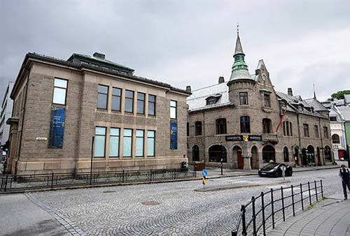
Hours: Daily 11:00-17:00, Nov-April closed Mon, café, Apotekergata 16.
Visiting the Museum: The ground floor entryway re-creates the woodsy decor of the old-time pharmacy that once filled this space; shelves that held medications now show off slinky Art Nouveau objects for sale. The exhibit kicks off with a 15-minute “time machine” presentation that thoughtfully tells the story of the city’s 1904 fire and subsequent rebuilding. Upstairs, you’ll see a few period rooms (including a genteel dining room) and lots of Art Nouveau objects, from furniture to teaspoons to jewelry to tapestries (local textile artist Frida Hansen specialized in these).
Down in the basement is a small exhibit on the city’s Art Nouveau architecture and a tunnel leading to the KUBE contemporary art museum next door. It’s covered by the same ticket—so you might as well walk through to check out the changing exhibitions of modern and contemporary art. In summer, exhibits typically include additional examples of Art Nouveau.
Fisheries Museum (Fiskerimuseet)
This museum, in a giant wooden shed along the western embankment, tells the story of how cod, herring, and other fish helped put Ålesund on the map and kept it affluent. Exhibits trace the development of boats and navigational tools, and detail the importance of barrel-making to overseas trade (70 NOK, or covered by Art Nouveau Center ticket, open daily in summer until 16:00, typically closed off-season, Molovegen 10).
Ålesunds Museum
This museum, on the east side of the canal directly under Mount Aksla, relates town history and shows off vintage dentist, hairdresser, and shoemaker shops/offices (75 NOK, Mon-Fri 11:00-15:00, Sat-Sun from 12:00, Rasmus Rønnebergs Gate 16, www.aalesunds.museum.no).
Ålesund Church (Ålesund Kyrkje)
A couple of blocks uphill from the Art Nouveau Center stands yet another building that was erected after the 1904 fire. This church, however, is in a stony Romanesque style, its exterior faced with Norwegian marble. The interior—with its round, barrel-shaped nave and similarly round windows—is austere, except for a riot of gilded Art Nouveau frescoes, carvings, and other decorations surrounding the altar area. The stained glass, by the same artist, is also worth a look. The windows on the south (left) side of the nave feature fishing themes, which help tie this Norwegian city to the 12 apostles.
Cost and Hours: 50 NOK; limited hours tied to cruise arrivals—when a big ship is in town, it’s likely open 10:00-15:00; closed entirely mid-Sept-April; Kirkegata 22, +47 70 16 53 00.
▲▲Mount Aksla Viewpoint
The classic view of Ålesund—and one of Norway’s most prized postcard shots—looks down from the precipitously steep little mountain called Aksla, which rises up 620 feet from downtown. The hilltop is dominated by the giant Fjellstua viewpoint/restaurant, which has operated here since 1903 (open daily). It greedily charges 100 NOK admission for the classic view from its terrace (with stair-free access). Or you can hike down 70 steps below the restaurant to a free view that’s just as good. From either spot, you’ll be rewarded with a sweeping panorama over the rooftops and islands of Ålesund.
Getting There: Hardy visitors enjoy the hike up to the mountaintop. The steepest, most direct, and most popular route is to head straight up from the city park, Byparken, just above the town center, on a zigzag trail with 418 steps. Byparken itself is a delightful place for a stroll, with lots of small hills, viewpoints, and a statue of Rollo, a local Viking. You’ll enter the park from Lihauggata street—from Kongens Gate, climb up a few short flights of stairs, continue uphill, pass the giant Scandic Parken Hotel (on your left), then make your way through a gate into the park. Cut through the park to find the well-marked path that leads to stairs spiraling up to the top. Railings make the going easier. Don’t miss the Byrampen viewing platform about halfway up the steps. On top you’ll find other trails, more views, and two WWII bunkers.
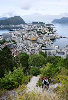
Beware that the stairs can be extremely congested when cruise passengers are in town. It can be better to wait until crowds clear out, later in the day. Or you can opt for a much longer, more gradual hike that wraps around the back of the mountain; the TI can advise you on that route.
You can also take a taxi; plan to pay a hefty 250 NOK for a one-way trip (for up to 4 people). A hop-on, hop-off bus makes a stop at the viewpoint but operates only when cruise ships are in town (check at www.citysightseeing.com or ask at the TI).
If you have a car, you can drive to the top. It’s tricky and twisty, so follow signs carefully: Leave the city center on Røysegata, which becomes Borgundvegen, and watch on the left for brown Aksla (and sometimes Fjellstua) signs leading up on residential streets and across the wooded mountaintop. Keep tracking those signs, and you’ll find a small, free parking lot on a bluff just above the restaurant. Note that this road can be miserably jammed with tour buses, especially in the morning when cruise ships arrive, so time your visit accordingly.
OUTER ÅLESUND
Several popular attractions are found on Ålesund’s outlying islands (easy for drivers; some reachable by public bus or ferry). The Atlantic Sea Park (Atlanterhavsparken) is an expansive saltwater aquarium at the western edge of Hessa Island, just west of downtown (check the otter, penguin, and seal feeding schedules online; www.atlanterhavsparken.no). Sunnmøre Museum is a sprawling open-air folk museum with a boat hall on Gåseid Island, east of downtown (www.vitimusea.no). Alnes Lighthouse (Alnes Fyr) is farther afield, a few islands west of downtown, offering a pensive locale with views out to sea (art gallery and café, www.alnesfyr.no). And the heavily promoted Devoldfabrikken is an outlet mall filling a repurposed old factory, on yet another island south of downtown—reachable by public ferry directly from the cruise port (www.devoldfabrikken.no).
Sleeping in Ålesund
All three of these hotels are modern and comfortable, with lots of rooms—many facing the water, with views (typically for an extra charge).
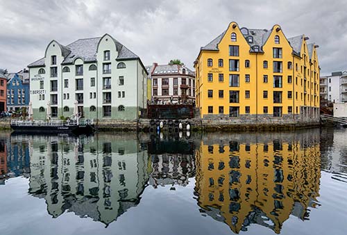
$$$$ Hotel Brosundet is the classic choice—it fills a bright waterfront yellow building that’s the centerpiece of every photo of the city. In this former warehouse, plus the green building next door, you’ll find 128 quirky, tight, but characteristic rooms—many with views over the Brosundet. (The 129th “room” is in the red lighthouse at the end of the pier by the Fisheries Museum.) The rustic-chic lobby—with a dramatic atrium, open fireplace, cozy wood-beamed breakfast room, and delightful winter garden—seems designed for just hanging out (elevator, sauna, Apotekergata 1-5, +47 70 10 33 00, www.brosundet.no, post@brosundet.no).
$$$$ Thon Hotel Ålesund, just up the street from the Brosundet, offers an equally good location, less rustic charm, and more cookie-cutter comfort in its 174 rooms (elevator, Molovegen 6, +47 70 10 20 80, www.thonhotels.com).
$$$ Quality Hotel Ålesund, in a quiet location near the TI and next to the Hurtigruten dock, has 131 predictably comfortable rooms and an inviting terrace looking out over outlying islands. As the back side faces a dreary urban street, it’s worth paying extra for views over the water (elevator, Sorenskriver Bulls Gate 7, +47 70 16 00 00, www.strawberry.no, q.alesund@strawberry.no).
Eating in Ålesund
$$$$ Bro (“Bridge”) goes big time for this small city, with delicately assembled plates of New Nordic-inspired cooking served under the heavy beams of a waterfront warehouse. Canadian-born chef Skyler Milner makes creative use of local ingredients and international know-how. It’s pricey (emphasizing fixed-price, multicourse meals), and the service can be uneven, but it’s Ålesund’s finest dining option. Reserve ahead (dinner only, closed Sun, Notenesgata 1, +47 70 30 81 81, www.brobro.no).
$$$ Apotekergata No. 5, downstairs in the green building of the Hotel Brosundet, has a cozy, atmospheric waterfront setting and a short, tempting, fish-focused menu of modern Norwegian dishes (dinner only, closed Sun, the name is the address, +47 70 11 45 00, www.apotekergata5.no).
$$ Anno, just off the main bridge, serves good and affordable pizzas in a contemporary space or out on a beautiful square (open Mon-Fri for lunch and dinner, Sat late lunch or dinner only, closed Sun, Apotekergata 9b, +47 71 70 70 77, www.anno.no).
Near the TI: Two modern, popular places are on the east embankment. $$$ Zuuma is popular for Japanese fusion cuisine (dinner only, closed Sun, Skansegata 20, +47 70 12 70 70, www.zuuma.no). $$$ XL Diner focuses on fish and specializes in rehydrated cod—the staple that kept Norwegian sailors sailing, and fishermen wealthy, during Ålesund’s boom time—prepared in modern ways (dinner only, closed Sun, on the Skateflukaia quay, near the TI, at Skaregata 1B, +47 70 12 42 53, www.xldiner.no).
Brewpub at the Cruise Port: $$ Molo Brew, facing the little harbor at the main cruise port, is an industrial-strength brewpub. They have 25 beers on tap, burgers and other pub food, and tons of outdoor seating (Tue-Fri from 15:00, Sat-Sun from 13:00, closed Mon, Keiser Wilhelms Gate 2B, +47 40 43 68 83, www.molobrew.no).
Kiperviktorget Food Trucks: The modern, urban square called Kiperviktorget, facing the water a long two blocks beyond the hulking city hall building, has a smattering of appealing food trucks and budget eateries. This is a great place to browse for an affordable, fast meal. The lineup may change, but popular choices often include burgers, Thai, Greek gyros, and churros (sporadic hours—open when it’s busy and nice out, mostly lunch-only).
“Troll Country” Scenic Drive
This heavily touted area, with more than its share of dramatic scenery, sits between Ålesund and the Geirangerfjord, above the town of Åndalsnes. The main attraction is the Trollstigen (“Troll Ladder”): a famous, unforgettably twisty stretch of road that corkscrews up 11 hairpin turns, past sheer rock faces and waterfalls, to a breathtaking viewpoint. If driving between Ålesund and the Geirangerfjord, the Trollstigen is the way to do it. You can also easily day-trip to the Trollstigen from anywhere in this chapter; it’s a very popular shore excursion for cruises arriving in Ålesund, Geiranger, or Åndalsnes. Yes, it’s kitschy...if you’re looking to pose with a giant troll, you’ll find plenty here. But nothing (other than low visibility) can dampen the magic of the Trollstigen.
Ålesund to the Geirangerfjord
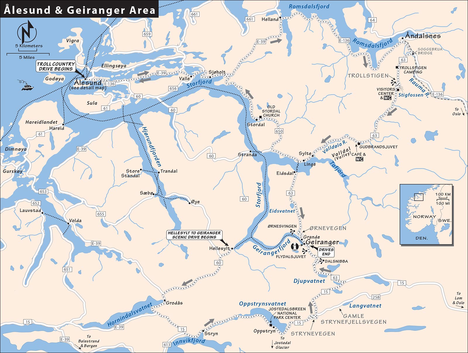
The one-way drive from Ålesund to Åndalsnes, then over Trollstigen, and finally on to the Geirangerfjord, takes about four hours (not counting ample photo stops). Or, to make it a loop day-trip, after the Trollstigen, you could double back to Ålesund along the Storfjord (allow about 6 hours total, 200 miles). While this trip can be done in either direction, I’ve narrated it starting in Ålesund.
Ålesund to Åndalsnes
Leave Ålesund on E-136 toward Åndalsnes, a midsize town about 1.5 hours to the east. About 20 miles (and 30 minutes) later, between Valle and Sjøholt, you’ll enjoy grand views across the vast Storfjord—which from here, fragments into many smaller fingers as it protrudes deeper into the Norwegian hinterland. While it’s pretty, make good time on this stretch—you’ll want it for more striking sights later.
Stay on E-39 and head away from the water after Sjøholt. You’ll cross over a saddle of land, then follow the Romsdalfjord over bridges and through tunnels into the small town of Åndalsnes. If you want to skip Åndalsnes altogether and head right to the Trollstigen, look for the turnoff to E-136 (direction: Dombås) at the intersection just before town, amidst gas stations and big box stores.
The town itself, dominated by its cruise dock, is functional and scenically set. Most everything is concentrated right by the water: the modern, angular Norwegian Mountaineering Center (Norsk Tindesenter), offering adventure activities and exhibits on this hardy landscape (www.tindesenteret.no), and the pricey, brief Romsdalgondolen cable-car ride up to a high-mountain viewpoint (www.romsdalen.no). $$$ Sødahlhuset is a classy café with good coffee and cakes as well as vegetarian-friendly cuisine (daily, Gamle Romsdalsvegen 8, www.sodahlhuset.no).
Trollstigen Pass
The dramatic drive called the Trollstigen is one of Norway’s—and Europe’s—most thrilling. It’s unmistakably stunning; in clear weather, it’s an experience worth ▲▲▲.
Leaving Åndalsnes on E-136, you’ll follow the Rauma River before turning right across the Soggebrua bridge (road 63, marked for Valldal, Geiranger, and Trollstigen). You’ll gradually gain altitude as soaring, sharp, steep cliffs rise up on either side of the road—a curtain of rock called the Trollveggen (Troll Wall). The cliffs weep with dozens of tall, skinny waterfalls as you drive past sod-roofed camping cabins. Shortly before the road begins its steep ascent, the Trollstigen Camping complex on the right has some giant trolls to pose with. (They also sell “troll ice”—which, near as any layperson can tell, is just soft-serve ice cream.)
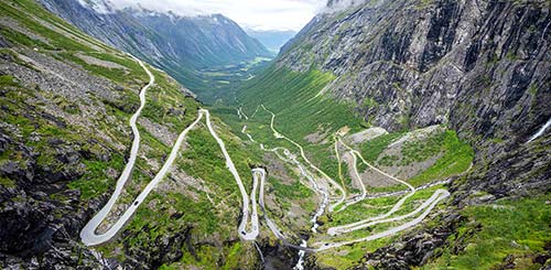
Soon you begin climbing up toward a zigzag road scaling the cliff in front of you. Ignore the “information” turnoff on the right, and proceed another quarter-mile to an unmarked pullout offering a grander overview of the road you’re about to conquer. Visually trace your route as it doubles back on itself again and again, crosses a stone bridge under a thundering waterfall, and then climbs higher still. Consider that until this road opened in 1936, Åndalsnes and Geiranger were linked only by a true “troll ladder”: A rugged and steep footpath.
Time to make the drive. Be alert: There are few pullouts, the road is narrow, and big buses and unskilled drivers are traveling in both directions. About halfway up, on the right, look for the worthwhile pullout immediately before the stone Stigfossbrua bridge. Here you can peer up at the thundering Stigfossen waterfall and, higher still, to an observation deck cantilevered dramatically over your head—high, high above.
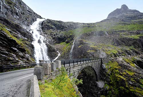
Now carry on uphill, until you finally crest the rocky cliffs, cross over a barren, tundra-like terrain, and summit at 2,788 feet. Whew! Here you’ll find a sleek, glass visitors center with a giant parking lot, WCs, a café, gift shop, and a paved path to two different viewpoints. A (mostly level) path takes you to the first viewpoint, with mountains all around you, the top of the waterfall below your feet, and in the distance the valley you just traversed (but no views of the hairpin road itself).
For an even better panorama, continue farther (about 5-10 minutes) to a second viewpoint that takes in the entirety of the spilled-spaghetti mountain road you just twisted up, with the waterfall churning below you, nearby peaks soaring overhead, and, farther away, the green and tranquil valley.
Valldal Valley
From the Trollstigen summit, carry on about 12 miles (25 minutes), then pull over on the left at the parking lot for the Gudbrandsjuvet ravine. From here, it’s a short and mostly level walk over a modern metal walkway to a view terrace over the churning Valldøla River. The gorge is carved so deeply into the rock that you can barely see the water between the canyon walls. Just over the bridge is a café with good cinnamon rolls and a WC.
Fortified, continue on down into the Valldal valley. Pastoral and pretty, this area is known among Norwegians for its many berry-growing patches and roadside stands selling fresh fruit, especially strawberries. About nine miles after Valldal, you’re back at sea level again, where the valley meets a branch of the Storfjord at the village of Sylte.
Sylte to Ålesund or Geiranger
In Sylte, turn right and follow the waterfront road for a couple more miles to a ferry dock just past the village of Linge. Here you are faced with a choice: Make a loop back to Ålesund, or head to the Geirangerfjord.
To Ålesund via the Storfjord (about 50 miles and 1.5 hours by the most direct route): Carrying along the water toward Ålesund on road 650, you’ll soon cut inland and pass through a valley. Curving back toward the fjord, soon before the town of Stordal, you’ll pass the Old Stordal Church (Rosekyrkja), whose unassuming exterior gives no hint of the lushly painted interior, every inch of which is covered with colorful vining acanthus, grapes, roses, and biblical motifs (70 NOK, open usually 11:00-16:00 in summer, www.rosekyrkja.com). Past Stordal, the road begins following the Storfjord proper. At Sjøholt, you’ll rejoin the main E-136 road back to Ålesund.
To Geirangerfjord via Ørnevegen: Start by hopping on the little ferry over the fjord to Eidsdal (2-4/hour, 10-minute crossing, no reservations possible or necessary). Driving off the ferry in Eidsdal, follow road 63 for about 10 miles as you gradually ascend to a high plateau. You’ll pass a lovely mountain lake, Eidsvatnet, ringed by docks and summer cottages.
Soon after, you’ll begin spiraling toward the Geirangerfjord on the famous Ørnevegen (Eagle Road), with another 11 vertiginous switchbacks. Ørnevegen was built in 1955 to connect remote little Geiranger to the rest of Norway through the frigid winter months. Notice that each tight turn has its own name: Bjørkhaugsvingen, Årsethaugsvingen, and so on. At one of the highest hairpins (around 2,000 feet), the Ørnesvingen (Eagle Bend) viewpoint offers breathtaking panoramas (watch for the small parking area tucked alongside the bend). Cross the road to the modern platform for your first glimpses high over the Geirangerfjord; a rocky set of stairs leads up to a higher vantage point.
From here, the road twists down to the fjord, the little settlement of Grande (with its big hotel and campgrounds), and the town of Geiranger, at the deepest point of the Geirangerfjord.
Geirangerfjord
The nine-mile-long, 2,000-foot-deep Geirangerfjord (geh-RAHN-gher-fyord), an offshoot of the long Storfjord, snakes between the cut-glass peaks of western Norway. Tucked amid cliffs one observer termed the “most preposterous mountains on the entire west coast,” the Geirangerfjord is simply stunning. Compared to other famous Norwegian fjords, it’s largely undeveloped: Between the teensy communities at either end (Geiranger, at its innermost point; and Hellesylt, where it meets the Storfjord), you’ll find only cliffs, waterfalls, and a few remote, scattered farms.
All of this beauty makes the Geirangerfjord a magnet for cruise ships, hundreds of which call at the town of Geiranger during the relatively short summer season. When even just one big ship is in town, the population of this village of about 250 can increase more than tenfold, and things get very crowded.
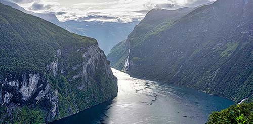
Most of this chapter is focused on the one-street Geiranger town, the hub for all fjord activities. The smaller settlement of Grande, 1.5 miles away at the base of the Ørnevegen scenic road, has a big hotel/restaurant and a couple of campgrounds. From here, there’s no civilization along the fjord until the village of Hellesylt—at the mouth of the Geirangerfjord, and the end point of ferry cruises.
GETTING THERE
Independent travelers have to work hard to reach the Geirangerfjord, and its popularity and limited services conspire to drive up prices. But anyone adventurous enough to get here will appreciate the scenic routes in and out and be richly rewarded with crystal-clear air, sparkling water, and snow-capped peaks.
By Car: You can drive to the Geirangerfjord via a variety of extremely scenic routes from all over Norway. From Ålesund and the west, take the stunning Trollstigen, then the Ørnevegen (see my “Troll Country” Scenic Drive, earlier).
From points east, such as Lom, it’s just a one-hour drive west on highway 15 to the turnoff for Geiranger. You’ll approach the Geirangerfjord on super-scenic highway 63, which passes two stunning viewpoints (Dalsnibba and Flydalsjuvet). To reach Lom from Oslo, you can drive via Lillehammer and the Gudbrandsdal valley; from the Sognefjord, drive along the Lustrafjord, then up the Sognefjellsvegen scenic road (see the previous chapter).
From the south—Bergen, or possibly Balestrand on the Sognefjord—you can take E-39 north, to Byrkjelo, travel over the mountain pass road Utvikfjellet (FV-60) to Visnes, pick up highway 15 east over the Strynevegen scenic road, then turn off on highway 63 over to Geiranger. (The second half of this route is described under “Scenic Hellesylt-Geiranger Drive” on here.)
By Bus: The Geirangerfjord is not easily connected by bus to other parts of Norway. But if you’re determined enough to figure it out, https://en.frammr.no [URL inactive] is a good resource (select “Travel Like the Locals”).
By Boat: Geiranger Fjordservice runs all-day, round-trip boat service from Ålesund up the Geirangerfjord. You can ride round-trip or hop off and overnight in Geiranger (830 NOK one-way, 1,660 NOK round-trip, 3 hours each way; in summer departs at 9:00, free time in Geiranger town from 12:00-14:00, arrives back in Ålesund at 17:00; +47 70 26 30 07, www.geirangerfjord.no).
By Cruise Ship: Many visitors come to the Geirangerfjord on a cruise ship. Some ships do a “technical call” in Hellesylt before arriving in Geiranger, allowing excursions to do a one-way scenic route (independent travelers are typically not allowed to disembark at Hellesylt). For port information, see www.stranda-hamnevesen.no.
PLANNING YOUR TIME
Drivers on a Norwegian road trip could reasonably do a one-night stopover in Geiranger between scenic drives, combined with a ferry or RIB trip along the fjord. While the trip in and out—whether by car or by boat—is incredibly scenic, there’s relatively little to actually do in Geiranger town other than bask in the views and maybe go for a steep hike. The only real sight in town, the Norwegian Fjord Center, can be seen in an hour or less.
With two nights and a full day, settle in and relax, maybe rent a kayak or go for a hike, and consider taking your car on the ferry from Geiranger to Hellesylt, then enjoy the long view-filled drive back to town via the Strynevegen scenic road.
Geiranger Town
The main road through Geiranger comes into town from Grande, passes the ferry dock and cruise terminal, then twists up past the town church, a churning waterfall, the big Hotel Union, and the Norwegian Fjord Center. Higher up, the road becomes even more scenic as it curls above the tree line. Down along the waterfront, you’ll find lots of tourist services and eateries, the town grocery store, the past-its-prime Hotel Geiranger, a campground, and (next to the river) a trailhead for the scenic Fosseråsa waterfall trail.
TOURIST INFORMATION
Geiranger’s TI, run by Geiranger Fjordservice, is in a standalone building in the heart of the harborfront area near the cruise dock. They can book local activities and help you sort through your options for hikes (daily 9:00-17:00 in summer, shorter hours off-season, pay WCs out back, +47 70 26 30 07, www.visitgeiranger.com).
Taxis are expensive but available if needed (call +47 40 00 37 41).
ARRIVAL IN GEIRANGER TOWN
Whether arriving by cruise ship, by ferry from Hellesylt, or by tour boat from Ålesund, you’ll land in Geiranger’s harborfront. Giant cruise ships moor just offshore from the town center, and a long, floating pier allows passengers to walk right into town. The ferry dock is just beyond these piers, and passenger boats from Ålesund arrive nearby.
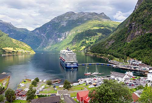
Near the end of the boardwalk area is the TI. From here, you can continue along a lane lined with sod-roofed huts housing tourist shops and eateries. Eventually you’ll reach a big, parking-lot square surrounding the Joker grocery store (with an ATM). The town sprawls immediately overhead, reachable by a steep, switchbacked road. For a more scenic ascent through town, use the Fosseråsa waterfall trail by continuing a few minutes toward the campground at the far end of the waterfront. After crossing the bridge, turn left to find the well-signposted path.
Sights in Geiranger Town
▲Fosseråsa Waterfall Trail
This wonderful trail follows a waterfall gorge up from sea level to the Norwegian Fjord Center, then carries on upward high above town. You can follow it as far as you like; at a minimum, it’s the best way to reach the upper part of town.
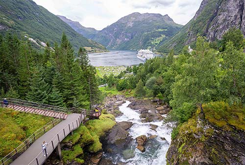
To find the trailhead, head past the campground at the far end of the waterfront, cross the bridge, and turn left to find the well-signposted path. The first leg climbs up a metal walkway (with 327 steps) for about 15-20 minutes as it follows steeply alongside the Storelva River waterfall, with strategically positioned viewpoints at the most scenic stretches. You’ll pop out at the Norwegian Fjord Center.
If you’d like a more ambitious hike, the path carries on uphill—carefully track Fosseråsa signs. Follow the main road for a short stretch, then watch on the left for an unpaved road that enters a forest and becomes a path. From here, you’ll climb steeply up—partly on stone staircases built by Nepali sherpas—to Westerås Gård, a farm at about 1,030 feet above the fjord (see “Shelf Farms,” later).
For an even more intrepid hike, you can turn right at the Westerås cottages and continue following the marked Fosseråsa trail all the way up to the Storsæterfossen waterfall (1,800 feet above the fjord).
Norwegian Fjord Center (Norsk Fjordsenter)
Overlooking Geiranger’s rushing waterfall at the top of town, this modern facility and its exhibits illuminate the geology, hardscrabble lifestyles, and cultural history of Norway’s fjords. You’ll see replicas of typical fjordland homes and costumes, and learn about the traditional steamships that tied fjordside communities together when nothing else did. Exhibits tell how the first tourists visited the Geirangerfjord in 1869; about the flora and fauna of the countryside—from elk to porpoise to hawk; and about the only-a-matter-of-time threat of the “Åkernes crack,” poised to send a tsunami screaming toward Geiranger. If that stresses you out, watch the restful nine-minute film of grand Geirangerfjord scenery. While pricey, the center makes a good rainy-day activity.
Cost and Hours: 145 NOK, daily 9:00-19:00, Nov-April 10:00-16:00, at the top of town across the road and waterfall from the big Hotel Union—best to walk up on the Fosseråsa waterfall trail, Gjørvahaugen 35, inviting café in lobby, tel. 70 26 38 10, www.fjordsenter.com.
Activities from Geiranger Town
Geiranger town is the jumping-off point for a wide array of excursions, services, and activities (bus trips, RIB and kayak tours, helicopter rides, and so on). Keep in mind that you’ll be competing for limited space with thousands of cruise passengers. It’s smart to research your options and make arrangements well in advance. Geiranger Fjordservice, which also runs the TI, has a near monopoly on providing tourist activities: Peruse the offerings on their website (www.geirangerfjord.no) or in person at the TI.
For a narrated description of what you’ll see on a Geirangerfjord cruise, area driving tours, and more sightseeing options outside of Geiranger, see “Sights on the Geirangerfjord,” at the end of this section.
▲▲Boat, Ferry, and RIB Trips
Getting out on the Geirangerfjord—between Geiranger town and Hellesylt—is the area’s single best activity, and there are lots of ways to do it. Geiranger Fjordservice offers a variety of cruises from Geiranger on a passenger-only boat: the one-hour version covers the most scenic four miles of the fjord (530 NOK, 4/day in summer), while the 1.5-hour version includes the entire thing—nine miles, all the way to Hellesylt (580 NOK, 2/day in summer).
There’s also a high-speed Fjordsafari cruise (on a RIB or Zodiac-style inflatable boat), which zips to stunning views along the fjord (700 NOK, about 45 minutes, hourly in summer). Even some cruise passengers—who see the same scenery on their sail-in and sail-away—enjoy taking these trips for the speed and up-close views of cliffs and waterfalls.
The final option is the car ferry—with deck space up top for walk-ons—that trundles from Geiranger town to Hellesylt (about one hour each way; passenger—345 NOK one-way or 520 NOK round-trip, car—690 NOK one-way, 8/day in each direction in summer, April-mid-Oct only, book at www.fjordtours.com or www.norwaysbest.com). This ferry is designed for one-way travelers looking to disembark in Hellesylt; sightseers would do better to take one of the cruises described above.
Note for Drivers: While the ferry from Geiranger town to Hellesylt takes just one hour, there is no fjordside road for a fast return; instead, you’ll have to drive about 80 miles and 2.5 hours through scenic mountains to get back to Geiranger. This isn’t a bad thing, if you have the time—it’s gorgeous in good weather, and a handy way to see the scenic highway 63 as you drop back down into Geiranger. (For the route, see “Scenic Hellesylt-Geiranger Drive,” later).
▲Panoramic Bus Rides
These brief tours are handy for carless visitors wanting to reach the high-altitude views over Geirangerfjord. For a quick visit, the 1.5-hour Panorama Tour reaches the Ørnesvingen and Flydalsjuvet viewpoints (400 NOK); if you have more time and great visibility, it’s worth stepping up to the three-hour Panorama Exclusive Tour that adds the sky-high Dalsnibba viewpoint (600 NOK). Skip the hop-on, hop-off bus, run by CitySightseeing—their frequency is extremely limited and the buses tend to be jam-packed.
E-Car Rentals
For more independence, you can rent a tiny (and I mean tiny) electric vehicle that feels like a moped with a carlike outer frame. Two people cram into the tiny vehicle—toboggan style—and follow a pre-recorded audio track as you drive yourself through town and to upper viewpoints (900 NOK/1 hour—choose between Flydalsjuvet or Ørnesvingen, 1,700 NOK/2 hours—enough time for both of these, 2,300 NOK/3 hours lets you drive all the way up to Dalsnibba; office at Gjørvahaugen 35—above the cruise port area and TI, +47 45 50 02 22, www.emob.no).
Kayaking
You have two options: You can prebook a kayaking tour through Geiranger Fjordservice. Or you can rent a kayak to explore on your own (380 NOK/1 hour, 560 NOK/up to 3 hours). Boats are available first-come, first-served, and sell out quickly when cruise ships arrive; to find the kayak center, face the fjord and go around its left side, about a mile around the shoreline to the campground.
Other Activities
Mountain biking is another popular choice. Geiranger Adventure rents bikes and ebikes, and will drop you off at a high mountain road so you can coast back down to the fjord (tel. 47 37 97 71, www.geiranger-adventure.no). An adventure park with a zip line and via ferrata course sits at the top end of town (www.exploregeiranger.no).
Sleeping in Geiranger Town
There are only a few options in town, and they’re pricey. Note that most of my recommendations are high on the hill above the town center; only the expensive Union Hotel is really walkable (and even that is steeply above the harbor—use the Fosseråsa waterfall trail). If you’re without a car, ask about arranging a pick-up at the boat dock or spring for a pricey taxi. Also consider options in Grande, a 1.5-mile drive around the fjord in a more tranquil setting (listed later).
$$$$ Hotel Union is the grand dame of Geiranger, perched a few switchbacks above town, across the road from the Norwegian Fjord Center. It has a plush lobby, 197 rooms offering predictable big-hotel comfort, a spa, a swimming pool, two restaurants, a café, and professional service (Geirangervegen 101, +47 70 26 83 00, www.hotelunion.no, booking@hotelunion.no).
$$$$ Hotell Utsikten (“View”), just below the Flydalsjuvet viewpoint and too far to comfortably walk into town, is smaller and family-run. It has 29 small rooms at a tight bend in the road; some come with fjord views, for a higher price, and all have some road noise (restaurant, Geirangervegen 348, +47 70 26 96 60, www.hotell-utsikten.no, post@hotell-utsikten.no).
$$$ Lunheim is a classic guest house where chatty Ian and Inge (who are generous with travel advice and cultural insights) rent five simple rooms, each with its own bathroom. Rooms share a kitchen and a pleasant lawn out front, both with great views over the fjord. This simple, friendly choice is high above town (just below the Utsikten hotel), but they’ll come get you at the boat dock (Geirangervegen 345, +47 97 12 97 99, www.lunheim-geiranger.no, post@lunheim-geiranger.no).
$$$ Westerås Gård, the rustic shelf farm high above town, has five freestanding cabins, two apartments, and one small room (Geirangervegen 320, +47 92 64 95 37, iwester@online.no).
$$ Hole Hytter is a simple budget choice, above town at the head of the road leading to the Westerås farm. They rent 15 humble cabins in various sizes, all with bathrooms and kitchens (Geirangervegen 329, +47 70 26 30 30, www.holehytter.no, post@holehytter.no).
IN GRANDE
The tiny fjordside settlement of Grande, just a few scenic minutes from Geiranger, has a giant, fancy hotel and a pair of classy, tranquil campgrounds with adorable cabins.
$$$$ Grande Fjord Hotel towers over the village and is a classic fjord hotel with 46 rooms (plus two suites in the modern annex). Rooms in the main building have old bones, but are updated and comfortable, and the hotel is run with class. The views are grand indeed, and the Jacuzzi deck is a great vantage point for enjoying the Geirangerfjord (elevator, free parking, excellent top-floor Hyskje restaurant; +47 70 26 94 90, www.grandefjordhotel.com, post@lunheim-geiranger.no).
$-$$ Campgrounds and Cabins: Between the Grande Fjord Hotel and the mellow fjord itself are two adjacent campgrounds and a green lawn filled with campers happily fishing and grilling out by the water. The campgrounds—both good—rent campsites and delightful, self-contained cabins for two to six people, all with fjord-view terraces, modern amenities, and Norwegian coziness. Even if you’re not a camper, these cottages are an affordable and memorable alternative to a hotel in an idyllic location. Compare your options at Grande Hytteutleige (www.grande-hytteutleige.no) and Geirangerfjorden Feriesenter (www.geirangerfjorden.net).
Eating in Geiranger Town
These options are within a short walk of the cruise port and ferry dock, down along the water.
$$$ Brassierie Posten, next to the TI, serves big dishes in a cozy space or at outdoor tables on the fjord. The food can be hit-or-miss, but it’s handy (daily for lunch and dinner, Geirangervegen 4, + 47 70 26 13 06, www.brasserieposten.no).
$$ CaféOlé, along the shed-lined main street just above the waterfront, occupies what was Geiranger’s first grocery store. Today it’s a simple choice for lunch (daily, Maråkvegen 19, +47 70 26 32 30). $$$ Olebuda, upstairs, is a bit more formal, with table service and a nice terrace (daily for lunch and dinner, +47 90 55 63 24).
$ Fiskekaka, a few steps from CaféOlé, is a great spot for delicious, takeaway fish cakes served in various ways. It’s a modern touch in this traditional town (daily, Geirangervegen 10, +47 92 07 78 88).
$ Geiranger Sjokolade makes its own chocolates and sells desserts, ice cream, and hot chocolate in a cozy fishermen’s-shed setting (daily, Maråksvegen 29, +47 96 72 52 05, www.geirangersjokolade.no).
Rustic Farm Dining: $$$ Westerås Gard has both a cozy, rustic dining room and an outdoor terrace with views over the valley. It’s busy at lunch with cruise passengers who hike up for the day; at dinner, it’s quieter, and reservations are required (Geirangervegen 320, +47 92 64 95 37).
In Grande: A short drive or long walk around the fjord, $$$$ Hyskje (on the top floor of the recommended Grande Fjord Hotel) has a bright, airy interior, professional waitstaff, and sweeping views in both directions over the fjord. The short menu of satisfying dishes features local ingredients prepared with flair. While primarily for hotel guests, it’s worth calling ahead to see if they can seat you (daily for lunch and dinner, +47 70 26 94 90, www.hyskje-gastronomi.no). Before or after dinner, stroll through the delightful fjordside campgrounds that sprawl across the shelf below the hotel.
Sights on the Geirangerfjord
The real reason to come to Geiranger town is to get out. Here are the top experiences on and above the fjord.
▲▲Cruising the Geirangerfjord
The calm waters of the Geirangerfjord are the main draw of this region. Cruise ships come each early morning, then head out again each afternoon; all day long, RIB boats swirl and swarm around the big, chunky ferries. Here’s what you’ll see as you sail from Geiranger toward Hellesylt:
Leaving Geiranger town, on your right you’ll pass the charming little settlement of Grande—with a giant hotel towering over humble campgrounds. Directly above Grande, the scenic Ørnevegen road zigzags dramatically high up the mountain, on its way to the Trollstigen and Ålesund.
Just past Grande is Gjerdefossen, the first in a string of waterfalls you’ll see on the right (north) side. Next up is Bringefossen, followed by the famous Seven Sisters cascade (Dei Sju Systrene), tumbling 800 feet down a long, craggy swath of gray granite. Facing the Seven Sisters is The Suitor (Friaren), which sputters endlessly in a futile attempt to impress the maidens across the way. (Supposedly the waterfall forms a bottle shape, because perennial rejection has driven the would-be suitor to drink.)
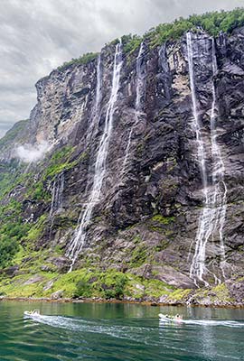
Again on the right, look for the very tall and skinny Brudesløret, the Bridal Veil. Across the way is Ljosurdfossen, the last of the major falls along the Geirangerfjord.
After passing these falls, look back. On the south side, about halfway up the cliff, and farther back in the fjord, you might be able to spot the shelf farm of Skageflå—a popular destination for hikers. Next to the Seven Sisters is another shelf farm, Knivsflå.
You’ll carry on down the fjord, with tree-covered hills on one side and stark, jagged rock cliffs on the other. On the right, a gash called Devil’s Crevice cuts deeply into the rock wall.
Farther up the fjord—not visible from here—is a dangerous crack in the cliffs called Åkernes, more than 230 feet deep and growing by several inches each year. Scientists warn that when (not “if”) a part of the mountain decides to slough off into the fjord, a devastating tsunami will sweep up the Geirangerfjord. A 200-foot-tall wave could hit Geiranger town itself—giving inhabitants just a few precious minutes to get to high ground. (For a Norwegian disaster flick depicting what that might look like, check out 2015’s The Wave (Bølgen)...but maybe wait until after you’ve left the Geirangerfjord.)
The fjord widens as it approaches the bend into Sunnylvsfjorden, the next branch of the Storfjord. Straight ahead, snowcapped mountains tower. Just before the end of the Geirangerfjord, on the north side, is Matvika (roughly, Food Inlet). This precise location has a sunny, favorable microclimate that’s ideal for growing fruit and keeping goats to make cheese. A farm did just that until 1961 (today, it’s a vacation rental).
The boat turns left and heads for Hellesylt, leaving the Geirangerfjord behind. For more on the town of Hellesylt, and the scenic drive that brings you back to Geiranger from there, see later.
▲▲Geirangerfjord Scenic Viewpoints
You can’t drive to (or out of) the Geirangerfjord without taking a scenic route. And even those who come and go by sea find it’s worth getting high above the fjord to enjoy these views. None of these is easy to reach by public transport; without a car, you can take a bus tour, pay for a pricey taxi, or rent an e-car or e-bike (see “Activities from Geiranger Town,” earlier).
Above Grande—Ørnevegen (Eagle Road) to Ørnesvingen Viewpoint: From the small, fjordside community of Grande (just outside Geiranger town), highway 63 twists dramatically northward up from the fjord toward Eidsdal. For a description, see here.
Above Geiranger Town—Flydalsjuvet and Dalsnibba: To the south, highway 63 scrambles up from the Geirangerfjord to two fantastic viewpoints offering quintessential Geiranger panoramas.
From town, as the road spirals higher and higher, views alternate from the fjord to lush upland valleys. After several switchbacks, you’ll pass the turnoff for the Westerås Gård shelf farm (worth a detour up the dirt road for views and a snack or lunch—see “Shelf Farms,” later).
For the best possible view of Geiranger town and its fjord, continue on to Flydalsjuvet (car parking spaces below and above the main viewpoint—shortly after passing the Utsikten hotel, free WCs). Stairs lead up to the modern viewing platform, which stares straight down a 260-foot-deep gorge toward the fjord. Hardy hikers also enjoy scrambling (at their own risk) out on the rock outcrops below the official viewpoint.
Keep zigzagging uphill. On the left, a pullout offers waterfall views. As you carry on uphill toward Dalsnibba, the road becomes rockier, grayer, and more troll-friendly. Cresting a lunar-like plateau, watch on your right for glaciers topping the mountains. Locals use this view as a barometer for deciding whether to make the trip to Dalsnibba: If you can see the glaciers, the viewpoint should be clear; if they’re socked in, Dalsnibba probably is, too.
At the Djupvasshytta roadside restaurant, turn off for the Nibbevegen toll road to Dalsnibba. It’s about three miles to the summit, at nearly 5,000 feet (also called the Geiranger Skywalk, WCs, café, www.dalsnibba.no). From here, you can peer way, way down to the corner of the Geirangerfjord, including the Ørnevegen road twisting up from the far end. Just as impressive are the views down over the road you’ve just driven up and those across the valley to the deep-blue glaciers of adjacent mountains.
From here, you can head back the way you came down into Geiranger. Or, to loop around to the Hellesylt ferry at the far end of the Geirangerfjord, turn left at the base of the Nibbevegen road (at the Djupvasshytta lodge) and drive to the junction with highway 15. Here turn right, toward Stryn (but make sure the ferry is running and you have a ticket reserved before making the drive; see “Scenic Hellesylt-Geiranger Drive,” later). Another option is to turn left on highway 15, toward Otta and Grutli, to drive in about an hour to Lom, with its famous stave church, in the Jotunheimen Mountains (see the Gubrandsdal Valley and Jotunheimen Mountains chapter).
Shelf Farms
Because the cliffs rise directly from the deep—leaving precious few patches for fjordside settlements—any relatively flat surfaces high on the mountain walls were once occupied by tidy, lonesome, and aptly named “shelf farms.” Despite a short growing season, brutally cold winters, and the constant threat of rockslides, many of these farms were active well into the 20th century; most are now abandoned. But a few are accessible to visitors curious to learn more about intrepid Norwegian fjord lifestyles.
The easiest shelf farm to visit hovers directly above Geiranger town: Westerås Gård (also spelled Vesterås), with a recommended restaurant and accommodations. You can hike up to Westerås from Geiranger town on the Fosseråsa waterfall trail (described earlier), or drive up a few switchbacks above the fjord (watch on the left for the small road by Hole Hytter cabins).
Other farms are even more remote, perched high above the fjord waters, and reachable only by boat and a steep hike. To visit Skageflå, you can book a boat to drop you off down below, then follow the vertical trail straight up (figure about an hour if you’re in shape). You can either walk back down to return by boat, or hike (about 3-4 hours) from Skageflå all the way back to Geiranger (details through Geiranger Fjordservice and the TI; see also www.skagefla.no).
Hellesylt
This pleasant village is notable mainly as the end point of the scenic ferry ride that begins in Geiranger town and traverses the entire Geirangerfjord. If you’re passing through, it’s worth a quick look. Just up from the ferry dock, an impressively wide and powerful waterfall tumbles through the town center (with a picturesque little mill shack perched on the rock next to it). Across the bridge, the shiplap town center is tidy and romantic, with a few shops and basic eateries; the best is the $$ Boutique Bar and Café. Closer to the water is a basic pizzeria, a gas station with fast food, souvenir shops, a school building with pay WC, and a small grocery store.
To reach a viewpoint looking toward the mouth of the Geirangerfjord, drive five minutes outside town on highway 60 (toward Ålesund).
Scenic Hellesylt-Geiranger Drive
After the one-hour scenic ferry ride from Geiranger town to Hellesylt, there’s no easy drive back to where you began. You can either get right back on a return ferry to Geiranger, or take a long, scenic route through a series of striking landscapes, dropping back down to Geiranger on the twisty road past the Dalsnibba and Flydalsjuvet viewpoints (a handy way to see this area, if you haven’t yet)—about 80 miles and 2.5 hours total. This route is popular with excursions for many cruise ship passengers disembarking in Hellesylt.
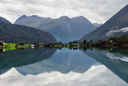
Leave Hellesylt on highway 60, turning left toward Stryn. After about 30 minutes of pretty farmland, you’ll reach the town of Grodås, where the road runs into E-39 (turn left, toward Bergen and Stryn) and curves along the shore of Hornindalsvatnet—Europe’s deepest lake, at more than 1,600 feet. Driving away from the lake and crossing a bridge, you’ll turn left on road 15 and cross a saddle of land to the Innvikfjord, soon reaching the town of Stryn—industrial down along the water, but pretty and traditional on the hills above.
From Stryn (following signs for Otta), the scenery begins to crescendo—and doesn’t stop for the rest of the trip. First, you’ll follow the Stryn River valley, whose broad turquoise waters widen into Oppstrynsvatnet lake, reflecting dreamy farms and idyllic wood-frame homes. Near the end of the lake, in the picturesque village of Oppstryn, you pass the Jostedalsbreen National Park visitors center, with information about the giant glacier that tops the towering mountains on your right.
As you continue away from the lake, you’ll begin to gain some altitude on a scenic, winding pass road called Strynevegen. Near the top, you’ll see the turnoff (marked by a brown sign) for Gamle Strynefjellsvegen—the old road that crosses the mountains between west and east Norway. Now replaced by a series of tunnels on highway 15, the historic road has been preserved as a designated tourist route, treasured for its hand-built drystone walls and individually placed “guard stones.” If you have an extra hour, you could consider taking this instead of the modern route we’re about to travel.
Just after the old road turnoff, the main road plunges into a series of long tunnels, interspersed with breathtaking, rocky, above-the-tree-line landscapes. Exiting the third long tunnel, you have a choice: Continue ahead to carry on to the Jotunheimen mountains (Lom is just an hour straight ahead on highway 15) and down to the Lustrafjord—both described in other chapters. Or, you can turn left at the brown sign for Geiranger (highway 63). After crossing more rocky landscapes, at the far end of the Djupvatnet lake, the Djupvasshytta lodge marks the turnoff for the scenic Dalsnibba road. For a detailed description of this section of the drive, see here.