GUDBRANDSDAL VALLEY & JOTUNHEIMEN MOUNTAINS
Lillehammer • Lom • Jotunheimen Mountains Scenic Drive
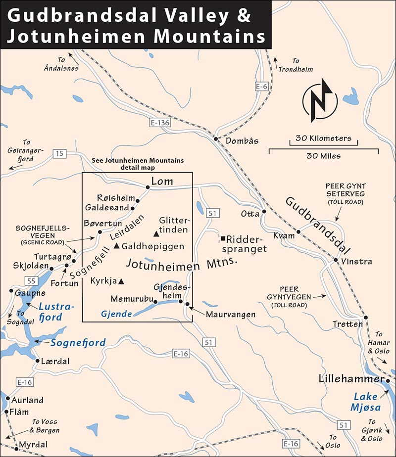
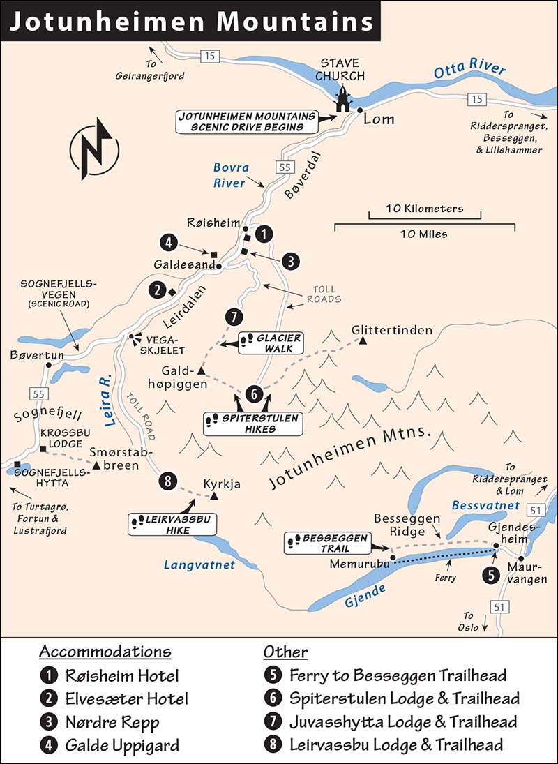
Map: Gudbrandsdal Valley & Jotunheimen Mountains
Jotunheimen Mountains Scenic Drive
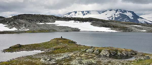
While Norway’s fjords get all the love, don’t underrate its soaring mountains. Virtually the entire interior of the country is rippled with dramatic peaks, but one area that’s particularly handy to see is the overland stretch between Oslo and the Lustrafjord. Starting mellow in the Gudbrandsdal Valley and reaching a crescendo in the Jotunheimen Mountains, this area is perfect for drivers seeking a scenic meander.
After an introductory stop in Lillehammer, with its fine folk museum, you can ogle one of Norway’s most dramatic stave churches in Lom, then spend the night in a log-and-sod farmstead-turned-hotel, tucked in a quiet valley under Norway’s highest peaks. Next, Norway’s highest pass takes you on an exhilarating ride through the heart of the myth-inspiring Jotunheimen. From here, a famously scenic road hairpins down to the Lustrafjord and Sognefjord country, or you can carry on west to Geirangerfjord (each covered in its own chapter).
PLANNING YOUR TIME
With two days you can cover a good slice of this region and continue on to the Sognefjord. With a car, I’d spend my time like this:
Day 1: Leave Oslo early, and spend midday at Lillehammer’s Maihaugen open-air folk museum for a tour and picnic. Drive up the Gudbrandsdal Valley, stopping at the stave church in Lom. Stay overnight in the Jotunheimen countryside.
Day 2: Drive the Sognefjellsvegen scenic road over the mountains, then down along the Lustrafjord, stopping to visit the Dale Church and the Nigard Glacier. End your day with an overnight in your choice of fjord towns, such as Solvorn or Balestrand (most of these stops are covered in the previous chapter).
With Less Time: This plan can be condensed into one (long) day if you skip the Nigard Glacier side trip.
Alternatively, if you’d like to head to Geirangerfjord, it’s a quick and ridiculously scenic 1.5-hour drive west from Lom.
With More Time: Outdoor enthusiasts could easily spend five or six days in this region.
GETTING THERE
A car is best, but it’s also possible to see this area without wheels.
By Car: It’s 2.5 hours from Oslo to Lillehammer and 3 hours after that to Lom. If you’re driving a stick, use low gears and lots of patience both up (to keep the engine cool) and down (to save your brakes). Uphill traffic gets the right-of-way, but drivers, up or down, dive for the nearest wide part of the road whenever they meet. Ask backseat drivers not to scream until you’ve actually been hit or have left the road.
From Oslo to Lillehammer: Wind out of Oslo following signs for E-6 (not to Drammen, but for Stockholm and then to Trondheim). In a few minutes, you’re in the wide-open pastoral countryside of eastern Norway. Norway’s Constitution Hall—Eidsvoll Manor—is a five-minute detour off E-6, several miles south of Eidsvoll in Eidsvoll Verk (described on here; follow signs to Eidsvoll Bygningen). Then E-6 takes you along Norway’s largest lake (Mjøsa), through the town of Hamar, and past more lake scenery into Lillehammer.
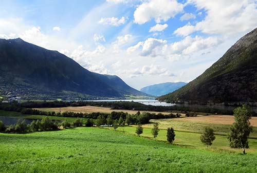
From Lillehammer to Jotunheimen: From Lillehammer, signs to E-6/Trondheim take you north, up the bucolic valley of Gudbrandsdal (en route to Otta and Lom), with fine but unremarkable scenery. Along the way, a pair of toll-road side-trips (Peer Gyntvegen and Peer Gynt Seterveg) loop off the E-6 road. While they sound romantic, they’re basically windy, curvy dirt roads over high, desolate heath and scrub-brush plateaus with fine mountain views. They pale in comparison with the Sognefjellsvegen road between Lom and the Lustrafjord (described later this in this chapter).
At Otta, exit for Lom and continue along highway 15. Halfway to Lom, on the left, look for the long suspension bridge spanning the milky-blue river—a good opportunity to stretch your legs, and a scenic spot to enjoy a picnic. Soon after is the turnoff to take highway 51 south to Besseggen, if you’re interested in that demanding hike. Otherwise, just stay on highway 15, and soon you’ll be in Lom.
By Train and Bus: Trains run from Oslo to Lillehammer (almost hourly, 2.25 hours, just 1.75 hours from Oslo airport) and from Lillehammer to Otta (5/day, 1.5 hours). In Otta, buses meet some trains for travelers heading from Otta to Lom (1-2/day, 1 hour) and onward from Lom to Sogndal (1-2/day late June-Aug only, road closed off-season, 3.5 hours; confirm schedules in advance).
Gudbrandsdal Valley
The Gudbrandsdal Valley is the tradition-steeped country of Peer Gynt, the Norwegian Huck Finn. This romantic valley of timeworn hills, log cabins, and velvet farms has connected northern and southern Norway since ancient times. While not as striking as other parts of the Norwegian countryside, Gudbrandsdal offers a suitable first taste of the natural wonders that climax farther north and west (in Jotunheimen and the Sognefjord). Throughout this region, the government subsidizes small farms to keep the countryside populated and healthy.
Lillehammer
The de facto capital of the Gudbrandsdal Valley, Lillehammer is a pleasant winter and summer resort town of 27,000. It’s best known for its brush with Olympic greatness as the host of the 1994 Winter Olympics. Today Lillehammer is largely a jumping-off point for Gudbrandsdal Valley adventures, and the logical place to break up the long drive between Oslo and the Jotunheimen region. If you have time to spare here, spend it at the excellent Maihaugen open-air folk museum.
Orientation to Lillehammer
The town has happy, old woody pedestrian zones (Gågata and Storgata) to stroll. Lillehammer’s two most worthwhile sights, Maihaugen and the Olympics Museum, are located together, up the hill behind the center of town. High above are Lillehammer’s famous ski jumps.
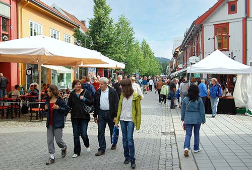
Tourist Information: Lillehammer’s TI is inside the train station (Mon-Fri 8:00-17:00, Sat-Sun 10:00-15:00; shorter hours and closed Sun off-season; Jernbanetorget 2, +47 61 28 98 00, www.lillehammer.com).
Sights in Lillehammer
▲▲Maihaugen Open-Air Folk Museum (Maihaugen Friluftsmuseet)
This idyllic park, full of old farmhouses and pickled slices of folk culture, provides a good introduction to what you’ll see as you drive through the Gudbrandsdal Valley. Anders Sandvig, a local dentist, started the collection in 1887 (he originally displayed artifacts in his waiting room). You’ll divide your time between the fine indoor museum at the entrance and the sprawling exterior exhibits. Summer is busy with crafts in action and people re-enacting life in the past, à la Colonial Williamsburg. There are no tours, so it’s up to you to initiate conversations with the “residents.” Off-season it’s pretty dead, with no live crafts and most buildings locked up.
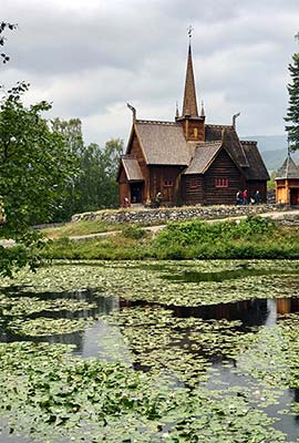
Cost and Hours: 190 NOK in summer, 145 NOK off-season; 25 percent discount when combined with Olympics Museum; mid-May-Sept daily 10:00-17:00; Sept-mid-Oct Tue-Sun 11:00-16:00, closed Mon; off-season Tue-Fri 11:00-15:00, closed Sat-Mon; +47 61 28 89 00, www.maihaugen.no.
Getting There: Signs direct drivers uphill from downtown Lillehammer to pay parking at the museum. Without a car, from the train station, it’s a fairly steep 20-minute walk. To avoid the steep part of the walk, catch the bus from in front of the train station (#B7, 1/hour; 44 NOK one-way, pay driver). From the Maihauvegen stop, it’s a 10-minute, mostly level walk (follow the busy Maihaugvegen road).
Visiting the Museum: Upon arrival, ask about special events, crafts, or musical performances. A screen shows what’s going on in the park. A helpful handout features a map of the outdoor area indicating which buildings are open and if there are actors inside. To hit all the highlights, follow the walking route on the map.
The outdoor section, with 200 buildings from the Gudbrandsdal region, is divided into three areas: the Rural Collection, with old sod-roof log houses and a stave church; the Town Collection, with reconstructed bits of old-time Lillehammer; and the Residential Area, with 20th-century houses that look like most homes in today’s Norway. In the 1980s house, a bubble-gum-chewing girl enthuses about her new “wireless” TV remote and plays ABBA tunes from a cassette-tape player. The 1930s house was the childhood home of Norway’s Queen Sonja, and was moved here from Oslo in 2018. It was in this house that Sonja and King Harald courted and their engagement was announced in 1968.
The museum’s excellent “We Won the Land” exhibit (at the entry) sweeps you through Norwegian history from the Ice Age to the Space Age. The Gudbrandsdal art section shows village life at its best. And you can walk through Dr. Sandvig’s old dental office and the original shops of various crafts- and tradespeople.
Eating: Unless you plan to spend the entire day at the museum Lillehammer’s town center (a 20-minute walk below the museum) is a better choice for lunch. If you do eat here, the museum welcomes picnickers and has a cafeteria serving warm and cold dishes, but in summer it can be overcrowded with busloads of tourists. In the Town Collection, a small café may serve traditional rømmegrøt, a sour cream porridge (open only in summer).
Norwegian Olympics Museum (Norges Olympiske Museum)
This museum is located in the lower ground floor of Maihaugen’s main building. With plenty of English explanations, an emphasis on Norwegian athletes, and an endearingly gung-ho Olympic spirit, it’s worth a visit on a rainy day or for sports fans.
Cost and Hours: 145 NOK, 25 percent discount when combined with Maihaugen Museum; same hours and arrival instructions as Maihaugen; +47 61 28 89 00, https://eng.ol.museum.no.
Visiting the Museum: The exhibit starts by tracing the ancient history of the Olympics, then explores the role the games have played as a peace builder in the world. A panoramic screen shows clips from various Olympic ceremonies, helping to put you in the Olympic spirit before you enter the main room, which holds various displays covering the winter Olympics in Oslo (1952) and Lillehammer (1994). Screens show Norway’s golden moments in winter sports, and other sections cover the Paralympics, Olympic fashion, and a history of Norwegian skiing. On your way out, you’ll pass a tribute to Norwegian water-sports and track-and-field athletes.
Ski Jumps (Lysgårdsbakkene)
Perched on the hillside above Lillehammer are the two Lysgårdsbakkene ski jumps, used in the 1994 Olympics. In winter they’re the site of an annual World Cup competition and other events, and in summer they’re sprayed with water, allowing jumpers to practice on them—so there’s a chance you’ll see flying skiers no matter the season. The main attraction here, though, is the panoramic view from the top. In summer you can ride up in a ski lift (65 NOK, May-mid-June Sat-Sun 9:00-16:00, mid-June-Aug daily 9:00-18:00); year-round you can get a workout by climbing the 936 steps (www.olympiaparken.no/en).
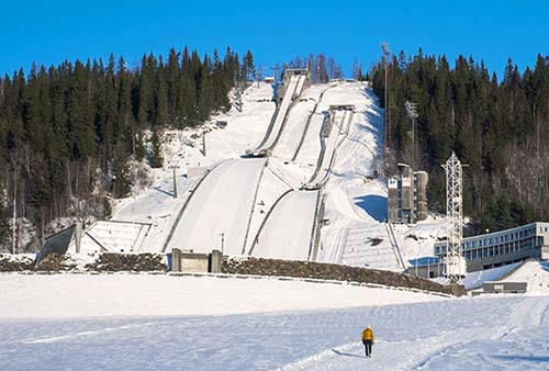
Getting There: The base of the ski jumps is a 30-minute, slightly uphill walk from the Maihaugen Museum (follow Maihaugvegen north to Birkebeinervegen). Or you can get there by bus from the train station: In summer ride bus #B7 to the Ersgård stop. From there follow the Lysgårdsvegen road and veer left onto a gravel road that leads to the base of the ski jumps. In the winter take bus #B2, #B3, or #B6 to Håkons Hall and walk 10 minutes uphill from there.
Sleeping in Lillehammer
I prefer sleeping in the more scenic and Norwegian-feeling Jotunheimen area (described later). But if you want to spend the night here, Lillehammer has some good and handy options near the train station.
$$ Aksjemøllen Hotell, true to its name, is situated in an old mill along the little stream running through Lillehammer. A boutique hotel with 58 comfortable and modern rooms, it’s more cutesy-cozy and less businesslike than other Lillehammer hotels in this price range (elevator, a block below Gågata at Elvegata 12, +47 61 05 70 80, www.aksjemollen.no, post@aksjemollen.no).
$ First Hotel Breiseth is a business-class hotel with 89 rooms in a handy location directly across from the train station (free parking, Jernbanegaten 1, +47 95 97 94 34, www.firsthotels.no/breiseth, breiseth@firsthotels.no).
¢-$ Vandrerhjem Stasjonen, Lillehammer’s youth hostel, is upstairs inside the train station. With 100 beds in 35 institutional but new-feeling rooms—including 16 almost hotel-like doubles—it’s a winner (elevator, Jernbanetorget 2, +47 61 26 00 24, www.stasjonen.no, lillehammer@hihostels.no).
Eating in Lillehammer
CAFÉS
Except where noted, these are open for lunch only (until about 17:00). All are located within a block or two of Storgata.
$ Lillehammer Bakeri serves freshly made salads and sandwiches in a old industrial building tucked just off the main drag. They have seating inside and out; outdoor tables have a view of the little stream (closed Sun, Mesnakvartalet 15, +47 94 06 32 82, www.lillehammerbakeri.no).
$$ No9 is a charming place known for its homemade cakes and mouth-watering open-faced shrimp sandwiches (closed Sun, Jernbanegata 9, www.no9kafeogbutikk.no).
$$$ Parkkaféen, a casual parkside café with a whopping 300 outdoor seats, is a favorite with the locals on a sunny day (there’s also indoor seating). The menu mixes Norwegian, Asian, and Mediterranean influences—it’s good for soup, salad, or something more substantial. To get here, follow the main drag east and take a right at the corner of the park (daily for lunch and dinner, closed in winter, Søndre Park 26, +47 61 25 08 85, www.parkcafen.no).
RESTAURANTS
These are good options for dinner (no lunch).
$$$ LYNG Mat and Bar serves up multicourse fixed-price meals featuring seasonal fish and meat dishes that put a modern twist on traditional Norwegian cuisine. The intimate, dimly lit dining room is a five-minute walk from the train station (closed Mon, reservations smart, Nymosvingen 2, +47 90 61 77 74, www.lyngmatogbar.no/english).
$$ Bryggerikjelleren is a microbrewery with Norwegian-inspired, locally sourced pub grub (including elk burgers and reindeer pizza). From the point where the main pedestrian drag (Gågata) crosses the little stream running downhill through town, walk up Elvegata street to its end (closed Sun-Tue, Elvegata 19, +47 95 01 91 08, www.lillehammermikrobryggeri.no).
Jotunheimen Mountains
Norway’s Jotunheimen (“Giants’ Home”) Mountains feature the country’s highest peaks and some of its best scenic hikes and drives. This national park stretches from the fjords to the glaciers. Play roller-coaster with mountain passes, go for hikes both rugged and easy, wind up scenic toll roads, step inside a giant stave church, and sleep in a time-passed rural valley. After getting your fill of mountain thrills, twist back down to sea level—over the highest road north of the Alps—to continue your journey along the shores of the Lustrafjord.
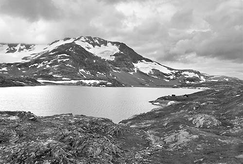
This area has lots of crossroads villages, but the only real town is charming, low-key Lom, the gateway to the mountains.
Lom
Lom, the main town between Lillehammer and the Sognefjord, is primarily a modern ski resort, but has its own charm. A turgid mountain river tumbles furiously through its middle; dark-stained wooden buildings line its main street; and cute houses scamper up the hills in every direction. Fortunately, locals had the wisdom to develop the town itself across the river from its main landmark: one of Norway’s most striking stave churches, an 850-year-old masterpiece standing elegantly alone atop a gently wooded promontory.
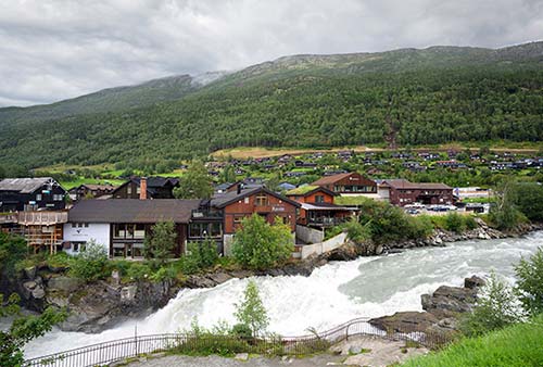
The church is well worth a visit—even a detour—and while you’re here, the town itself warrants a wander, too. On the white town flag, notice the spoon. Nestled here in the mountains, Lom gets less rainfall than other towns, so locals once used oversized spoon-like shovels to spread water over their fields. In the parking lot in front of the supermarket (on the main roundabout), a multilevel fountain—with water gushing through channels from the top to the bottom—commemorates Lom’s farmers and their clever irrigation techniques.
Lom is also a practical place to stock up on supplies, grab a snack or a meal, go for a quick stroll, and stretch your legs before your onward journey. If you’re heading toward the Sognefjord on the Sognefjellsvegen scenic road, Lom is your last chance for gas or cash—there are no gas stations or ATMs until you reach the fjord, 50 miles away.
Orientation to Lom
Lom (pop. 2,200) feels like a hub of civilization tucked in the mountains, but it’s still small and compact. Its main roundabout (surrounded by the TI, pay WCs, a beloved bakery, two gas stations, and a big supermarket/Vinmonopolet alcohol store) is right next to the bridge that crosses the churning Bovra River. Over that bridge, you can’t miss the evocative steeple of Lom’s stave church. Across the street from the church are the Norwegian Mountain Center and an open-air folk museum.
Arrival in Lom: For my recommended driving route from Lillehammer to Lom, see here. Park in the big, free lot by the landmark church, and explore the rest of the town by foot from there.
Tourist Information: Lom’s excellent TI is a good source of information for hikes and drives in the Jotunheimen Mountains (daily 10:00-18:00, Mon-Sat until 21:00 in peak of summer, just across the bridge from the church—facing the main roundabout, Bergomsvegen 17, +47 61 21 29 90, www.visitjotunheimen.no).
Sights in Lom
▲▲Lom Stave Church (Lom Stavkyrkje)
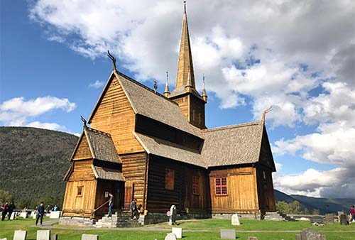
Dating from 1158, Lom’s big stave church is breathtaking to behold—rising up from a field across the river from the town center, with a mountainous backdrop. Although it’s been extensively renovated and added on to across the ages, it remains a striking example of a Nordic stave church. A small museum in the big building across the parking lot holds a few artifacts. For more about stave churches, see the sidebar on here.
Cost and Hours: 100 NOK, June-late Sept daily 9:00-16:00, late July-mid-Aug until 19:00, closed off-season except for private tours—see next, +47 40 43 84 86, www.lomstavechurch.no.
Tours: Docents offer frequent tours of the church. You can often tag along or eavesdrop on a tour already in progress, or if they’re not too busy, they can show you around for free. If you’re visiting off-season, when the church is officially closed, you can call ahead to arrange a tour for a small group (80 NOK/person, 800-NOK minimum, +47 48 16 55 27).
Visiting the Church: The church is surrounded by a dry-stone wall with a turreted gate. Entering the churchyard through this gate feels like stepping back in time. Take in the exterior of the majestic, insistently vertical structure—pointing up dramatically toward the heavens. It’s slathered in black tar (to help preserve the centuries-old wood) and decorated with frilly elements—most notably the dragon’s-head, gargoyle-like protrusions from the corners, intended to ward off evil spirits. Delicate tracery surrounds the doorways, and red frames make the windows pop against the black wood. While the core of the church dates from the mid-12th century, much of the structure you see today (including the tall spire and the round apse at the right end) was added in the 17th century.
Buy your ticket at the left end of the building, then head inside. The humble interior is still used by locals for services (notice the posted hymnal numbers). Traditionally, men sat on the right, women on the left, and prisoners sat with the sheriff in the caged area in the rear.
Standing in the middle of the nave, look overhead to see the earliest surviving parts of the church, such as the circle of X-shaped St. Andrew crosses and the Romanesque arches above them. High above the door (impossible to see without a flashlight—ask a docent to show you) is a painting of a dragon- or lion-like creature—likely an old Viking symbol, possibly included here to smooth the forced conversion to Christianity. When King Olav II (later to become St. Olav) swept through this valley in 1021, he gave locals an option: Convert or be burned out of house and home.
The apse (the round area behind the altar) was added in 1240, when trendy new Gothic cathedrals made an apse a must-have accessory for churches across Europe. Lepers came to the grilled window in the apse (on the left) for a blessing. When the Reformation hit in 1536, the original decorative paintings were whitewashed over. Transepts, pews, and windows were added in the 17th century. And the circa-1720 paintings were done by a local pastor’s son.
Now that you’ve seen the interior, step out into the tidy, thought-provoking graveyard and do a slow walk around the outside of the church. Notice that the graves are lovingly tended, with a little garden patch in front of each one bearing fresh flowers, and many of the dates are fairly recent.
Nearby: The big black building across the parking lot houses the gift shop/church museum (10 NOK, typically open same hours as church, closed off-season). Its one-room exhibit celebrates 1,000 years of the stave church—interesting if you follow the loaner English descriptions. Inside you’ll find a pair of beautiful model churches, headstones and other artifacts, and the only surviving stave-church dragon-head “steeple.” In the display case near the early 1900s organ, find the little pencil-size stick carved with runes, dating from around 1350. It’s actually a love letter from a would-be suitor. The woman rejected him, but she saved them both from embarrassment by hiding the stick under the church floorboards beneath a pew...where it was found in 1973.
If the church has you in a pensive mood, you can walk down the gravel path behind it to find a rustic wooden footbridge. This takes you across the river, then up into the modern town; you can turn right at the main road, then walk across the modern bridge to return to the church.
Norwegian Mountain Center (Norsk Fjellsenter)
This slick facility, in the modern, sod-roofed building across the road from the church, has a desk with information about local mountains and hikes; a café; a gift shop; and a relaxing lounge area for loitering. It also has a permanent exhibit, called “Spellbound” (Bergtatt), which promises to trace the history of the people who have lived off the land in the Jotunheimen Mountains from the Stone Age to today. In reality, it’s a dry hodgepodge, hopping between a wide range of topics: exhibits about mountain geology, mountaineering equipment, fateful accidents and rescues, stories of three Englishmen who wrote about their Norwegian mountain adventures in the 1880s, a replica of a modern mountain-hiking hut, a life-sized stuffed mammoth, and a “science center” that teaches about mountain weather and climate change. The “Frozen in Time” exhibit displays archaeological finds uncovered by receding glaciers, including a 1,300-year-old ski and a 3,400-year-old shoe made of reindeer hide. While the exhibit tries hard and is nicely kid-friendly, it’s not worth the price of entry for those with only a casual interest.
Cost and Hours: Exhibit-145 NOK; center open daily 10:00-16:00, longer hours July-mid-Aug; Brubakken 2, +47 61 21 16 00, www.norskfjellsenter.no.
Nearby: On the hill behind the museum, you’ll see several rustic, sod-roofed buildings of Lom’s open-air folk museum (bygdamuseum). While the museum closed recently due to lack of funding—and may not reopen by the time you read this—you can still stroll around the old houses to see them from the outside.
Adventure Park
If you enjoy adventure activities, you’ll find plenty—including a zip line, wooden tower for climbers, and mini golf—at Aktiv Lom, just outside town on the road toward Lillehammer (www.aktivilom.no). They can also book glacier tours, cave trips, and stand-up paddling.
NEAR LOM
The Besseggen Trail is about 90 minutes by car east, then south of Lom. For more options in the opposite direction, see the Jotunheimen Mountains Scenic Drive (the road to the Sognefjord), outlined later in this chapter.
Besseggen Trail
This thrilling but potentially hazardous trail offers a breathtaking opportunity to walk between two lakes separated by a narrow ridge and a 1,000-foot cliff. It’s one of Norway’s most beloved hikes, which can make it crowded in the summer. You’ll take a boat ride, then hike along a ridge—with a blue lake (Bessvatnet) on one side and a green lake (Gjende) on the other—keep your balance! The nine-mile trail links the boat dock at Memurubu back to the parking lot at Gjendesheim; plan on a seven- to eight-hour hike.
Getting There: From highway 15 (the road between Lom and Lillehammer), about 15 miles west of Lom, turn south down highway 51 to Maurvangen. You’ll follow highway 51 about 30 miles and turn right to Gjendesheim to park your car. At Gjendesheim, catch the boat to Memurubu, where the path starts at the boat dock. Because the boat runs sporadically, time your visit carefully (20-minute ride, 3 morning departures/day, check schedules and prebook the boat ticket at www.gjende.no, +47 91 30 67 44).
Nearby: Along highway 51, about halfway between the main road and Gjendesheim, you’ll pass the popular Ridderspranget (“Knight’s Leap”)—a very easy walk along a scenic gorge. It’s named for a local legend in which a knight hops over the gorge—but modern-day hikers are strongly discouraged from re-enacting this dangerous feat.
Sleeping and Eating in Lom
I find it more appealing to sleep in the nearby countryside (see next section). But Lom has some good places to eat, one of which doubles as a fine boutique hotel.
$ Bakeriet i Lom (“Bakery in Lom”) is, despite its simple name, a popular and delicious destination for pastries. It sits next to and a bit below the town bridge, across from the TI, and offers an array of both pastries and sandwiches (daily until 17:00, Sognefjellsvegen 7, www.bakerietilom.no). In summer, they also have appealing outdoor seating and serve wood-fried pizzas (daily until 19:00).
$$$$ BrimiBue, just uphill and at the opposite end of the price spectrum, is a high-end foodie splurge in a sleek, modern building. They have lunch in summer, and year-round they offer fixed-price, set-menu dinners. The food is local, seasonal, and changes every day (daily, lunch in summer only, dinner year-round, reservations required for dinner, +47 46 85 42 62, www.brimibuehotel.no). It’s also a boutique $$$$ hotel, renting 14 modern, comfortable rooms—worth considering if the options listed next sound too rustic for your tastes.
Sleeping near Lom
Lom has a handful of hotels (including the high-end BrimiBue, mentioned above). But the most authentic, traditional, and appealing way to overnight in this area is at a rural rest stop deep in the countryside. The places listed here—even the pricier options—are rustic and traditional rather than slick and modern; set your comfort expectations appropriately. But they’re all memorable and feel oh so “Norwegian mountains.” The cheapest places may follow the Norwegian tradition of charging extra for sheets and cleaning. All of these are on highway 55 south of Lom, toward Sognefjord, in this order: Røisheim, Nørdre Repp, Galde Uppigard, and finally Elvesæter (all within about 20 minutes of Lom). For locations, see the “Jotunheimen Mountains” map on here.
$$$$ Røisheim, in a marvelously remote mountain setting, is an expensive storybook hotel composed of a cluster of centuries-old, sod-roofed log farmhouses. Its posh and generous public areas are filled with antiques. Each of the 20 rooms (in 14 buildings) is rustic yet elegant, with fun “barrel bathtubs”; many have four-poster or canopy beds. Some rooms are in old, wooden farm buildings—stabburs—with low ceilings and heavy beams. The deluxe rooms are larger, with king beds and fireplaces. For the price point, it isn’t exactly plush, but rates include a delightful traditional breakfast, where guests are encouraged to pack their own sandwiches for lunch. Perhaps the best reason to stay here is for the delicious, four-course dinner with local flavors served nightly at 19:30—well worth the extra price (open May-Sept, 10 miles south of Lom on highway 55, +47 48 23 79 31, www.roisheim.no, post@roisheim.no, Lise and Kjetil).
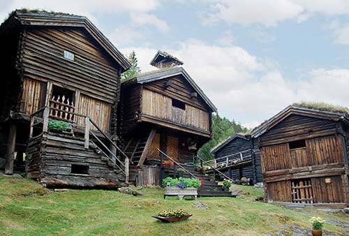
$ Elvesæter Hotel has its own share of Old World romance, but is bigger, more affordable, and more restrained. Delightful public spaces bunny-hop through its traditional shell, while its 200 beds sprawl through nine buildings. The Elvesæter family has done a striking job of retaining the historic character of their medieval farm, even though the place is big enough to handle large tour groups. Renovated “superior” rooms are modern but sterile; older, cheaper “standard” rooms are well-worn but more characteristic (open May-Sept, family rooms, good three-course dinners, swimming pool, farther up highway 55, just past the village of Galdesand, +47 61 21 20 00, www.elveseter.no, info@elveseter.no). For more about the giant column you’ll see out front, see here.
$ Nørdre Repp is a tidy, new-feeling roadside B&B at a sheep farm with six simple but modern and clean rooms sharing three toilets, a shower, and a woody lounge. Modern and comfortable, it’s a great value sweetly run by Bente and Geir (about 10 miles south of Lom, +47 40 52 66 26, nordre-repp@hotmail.com).
¢ Galde Uppigard is a farm dating back to the 1300s, across the river from the village of Galdesand and owned by the Galde family since the 16th century. They rent four simple cottages (ranging from 1-5 bedrooms); all but one have their own bathroom and kitchen. While not fancy, it’s an idyllic farm setting, and guests have access to a museum-like cabin with rustic furniture and classic, traditional decor (Mundgjeldsvegen 52—cross the bridge at the end of Galdesand, after the youth hostel, then loop back and look for signs; +47 93 29 17 38, www.galde.no, arne.galde@yahoo.no).
Jotunheimen Mountains Scenic Drive
Most of the best views, thrilling byways, and exciting hikes in this area cluster along highway 55—from Lom south to the Sognefjord. The drive from Lom to Skjolden—the first fjordside town—is only about 50 miles, and can be done in about 1.5 hours without stops. But it’s an incredibly scenic 50 miles—one of Norway’s most dramatic drives, and worth ▲▲. And spinning off this spine are some even more scenic toll roads, several of which get you up close to the highest mountain north of the Alps, Galdhøpiggen (8,100 feet) and provide access to great hikes. Most of my recommended accommodations in this area are right along this road as well.
PLANNING YOUR DRIVE (AND HIKES)
This drive follows highway 55 from start to finish, but also includes detours to a few of the Jotunheimen’s best scenic byways—which can add lots of miles, and potentially lots of hours on hiking trails. You won’t have time to do it all, so prioritize and be realistic about what you can fit in. If you’ll be stopping off for long hikes or glacier walks, this area warrants an overnight (or longer; see recommendations under “Sleeping Near Lom,” earlier).
For tips on how to organize your time once you reach the Lustrafjord, see Day 2 of the “Planning Your Time” section at the beginning of this chapter.
Hiking: Options in the Bovra River Valley include an eight-hour trek to the summit of Galdhøpiggen, near Røisheim; guided ice cave and glacier excurisons from near Galdesand; and a strenuous five-hour round-trip to Krykja from the Leirdalen valley. On the Sognefjellsvegen scenic road, there’s a two-hour “adventure trail” at Krossbu, and a half-mile, level lake walk at Sognefjellshytta.
Note that some of these hikes are quite demanding—be clear on the difficulty level before you set out. If you plan to do any challenging hikes, or just want some tips on your route, it’s worth stopping by the TI or the Norwegian Mountain Center in Lom; both offer excellent maps and advice for drivers and hikers.
Lom to Skjolden
Starting in Lom, head south on highway 55. If your tank is low, be sure to fuel up before you head out—there’s no gas between Lom and the fjord.
BØVERDAL—THE BOVRA RIVER VALLEY
Lom to Røsheim
Leaving Lom and heading along the Bovra River Valley (Bøverdal), you’ll be treated to bucolic farmland scenery. The mountains around you and in front of you get bolder and higher as you leave civilization behind. About nine miles after leaving Lom, you’ll approach the settlement of Røisheim—now a rustic-chic luxury hotel (described earlier, under “Sleeping near Lom”).
Hiking Detour: From Røisheim, an 11-mile toll road (125 NOK) takes you to the Spiterstulen mountain hotel/lodge (3,600 feet) in about 30 minutes. This is the best destination for serious all-day hikes to Norway’s two mightiest mountains, Glittertinden and Galdhøpiggen (8 miles round-trip, 5 hours up and 3 hours down, doable without a guide; get details at the lodge before setting out). Or consider a guided, two-hour glacier walk (+47 61 21 94 00, www.spiterstulen.no).
Røsheim to Galdesand
Stay the course on highway 55. A couple of miles after Røisheim, you’ll reach the village of Galdesand. This is sometimes called “Bøverdal,” because it’s the location of the Bøverdal youth hostel, as well as a small grocery store and a pretty wooden church.
Hiking Detour: In the middle of Galdesand, you’ll see the turnoff on the left for a private toll road (150 NOK) that takes you in about nine miles and 40 minutes to Juvasshytta lodge—the highest (6,040 feet) and closest you can get to Galdhøpiggen by car (road and activities open in summer only—typically late May-early Sept). From the updated lodge (which also has accommodations), you can take a variety of excursions to nearby glaciers and ice. The highly promoted “Climate Park 2469” excursion is a guided hike to a cave burrowed deep into 7,000-year-old ice, decorated with ice sculptures illustrating Norse mythology (2/day mid-June-mid-Aug, then some weekends through mid-Sept, book ahead at www.klimapark2469.no). The lodge also offers guided six-hour hikes across the glacier to Galdhøpiggen’s summit and back (4 miles each way, +47 61 21 15 50, www.juvasshytta.no).
Galdesand to Elvesæter
Back on the main highway 55, carrying on from Galdesand, you’ll pass a scenic gorge on the right. Shortly after, you’ll come upon the wooden settlement of Elvesæter. This hotel (described earlier, under “Sleeping near Lom”) is worth a stop even if you’re not staying here to ogle the towering Sagasøyla (Saga Column) that stands near the road. It was started in 1926 to celebrate the Norwegian constitution, and was intended to stand in front of Oslo’s parliament building—but the project stalled after World War II (thanks to the artist’s affinity for things German and membership in Norway’s fascist party). The column was eventually finished and erected on this spot in 1992. While you’re here, consider wandering through the hotel’s over-the-top Norwegian-folksy public spaces.
Elvesæter to Leirdalen
Leaving Elvesæter, pass through a flat valley. After about five miles, as you begin to gain altitude, and the river drops below you into a scenic gorge. Watch for the Vegaskjelet viewpoint on the left, with vistas over the Leirdalen Valley—capped at the end with the Kyrkja peak.
Hiking Detour: At the Leirdalen Valley viewpoint, the scenic toll road (110 NOK) takes you in 11 miles and about 30 minutes to the Leirvassbu mountain lodge at 4,600 feet, with great views and easy walks. From here a serious six-mile round-trip hike goes to the lone peak, Kyrkja (“The Church,” 6,600 feet), whose spire looms like a sanded-down Matterhorn on the horizon (allow 5 hours).
Leirdalen to the Sognefjellsvegen
Back on highway 55, after passing the Leirvassbu turnoff, you’ll notice that you’re beginning to gain some serious altitude. You’re now heading up the fabled...
SOGNEFJELLSVEGEN SCENIC ROAD
Norway’s highest pass (at 4,600 feet, the highest road in northern Europe) is a thrilling drive through a cancan line of mountains, then down to the Lustrafjord (the northern arm of the Sognefjord). Centuries ago, the farmers of Gudbrandsdal took their horse caravans over this difficult mountain pass on treks to Bergen. Today, the road is still narrow, windy, and wild (and usually closed mid-Oct-May).
Ascent to Bøvertun
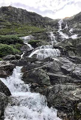
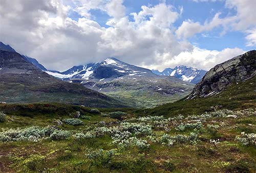
Beyond the Leirdalen Valley viewpoint, the terrain becomes rocky as you twist up into a lake-filled valley, then through a mild canyon with grand waterfalls. Passing the abandoned sod-roofed settlement called Bøvertun, you’re above the tree line, enjoying a “top of the world” feeling. In this rocky valley, you see troll faces in every cliffside.
You’ll continue to twist up and up, past waterfalls. Notice the signs that track your altitude progress in moh (meters over sea level). The tall, skinny poles that tower over either side of the road help mark the route even during the heavy snows of winter.
Krossbu (with Hiking)
A few miles on, you reach the big, red lodge at Krossbu. If you’d like a hardy (but not too hardy) hike and can handle the altitude, consider pulling over at the lot just below the lodge. Here you’ll find a trailhead for a 3.5-mile “adventure trail” giving you a taste of glacier-shaped scenery on the way up to the mountain called Smørstabbreen (about 820 feet of elevation gain; figure about 2 hours round-trip if you’re in shape). From the top, you’ll enjoy views over the surrounding landscape, then you can head back to where you started.
Sognefjellshytta (with More Hiking)
After Krossbu, you’ll twist up a few more switchbacks, and in just a couple of miles reach the striking mountain hut called Sognefjellshytta. This is well worth a stop for its modern, angular, glassed-in architecture that joins two existing lodge buildings with an appealing indoor-outdoor atrium. It’s big but cozy, and an ideal pit stop: Here you’ll find a snack-and-drink bar, WCs, temporary art installations, and cozy sofas for taking a break from the long drive. Near the hut, you’ll notice several dramatic cairns—neat, towering stacks of stones. These cairns, numbering over 300 in total, were erected long ago along the highest and most inclement 10-mile stretch of the route you’re driving now, to help travelers find their way across this desolate terrain. (The road for cars was not completed until 1938.) You’ll also see lots of smaller, makeshift piles of stones, but authorities discourage making your own cairns, out of respect for the original ones.
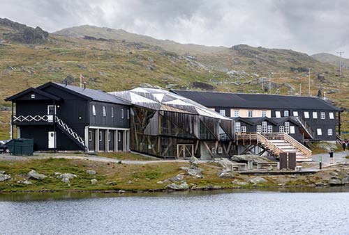
Sognefjellshytta is also the base for several hikes, including an easy and rewarding stroll around a corner of the nearby lake. Head out back to find the level, well-maintained trail. A bridge links to the opposite side of the lake, where the trail emerges at a parking lot, then loops back along the road. The loop itself is brief (just over a half-mile), but ties into several more ambitious hikes (get advice at the hut).
Mefjell
About a mile after the Sognefjellshytta, at Mefjell, on the left side of the road is a modern rock art installation by local artist Knut Wold; it requires hiking a couple of miles across the rocky terrain to see it all. Across the road is a monument with quotes (in Norwegian) from both Henrik Wergeland and Henrik Ibsen about the Sognefjellsvegen. From here, you’ll carry on for about seven more miles high above the tree line—past giant, moody lakes with peaks all around. Be sure to stop, get out, look around, and enjoy the lavish views.
Descent to Skjolden
Now you’ll begin your descent in earnest—conquering 10 hairpin turns between Turtagrø and Fortun. (The tiny village of Fortun has the first gas station since Lom—and also the last one for a while.)
Finally, just before you descend to the fjord, the terrain changes, and you reach a pullout on the right, next to a hilltop viewpoint—offering your first glimpse of the fjord. The Lustrafjord village of Skjolden is just around the bend (and down several more switchbacks).
Entering Skjolden, continue following highway 55, which now traces the west bank of the Lustrafjord. If you haven’t had enough of high-mountain experiences, there’s another fine one nearby: the hike to the Nigard Glacier near Lustrafjord. For more on this, and the other sights from here on out, see here.