MONTENEGRO
The Bay of Kotor • Kotor • The Montenegrin Interior • The Budva Riviera
Montenegrin Interior Driving Tour
If Dubrovnik is the grand finale of a Croatian vacation, then Montenegro is the encore. One of Europe’s youngest nations awaits just south of the border, with dramatic scenery, locals eager to show off their unique land, and a rough-around-the-edges appeal.
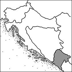
Crossing the border (with passport ready), you know you’ve left sleek and tidy Croatia for a place that’s gritty, raw, and a bit exotic. While Croatia’s showpiece Dalmatian Coast avoided the drab, boxy dullness of the Yugoslav era, less-affluent Montenegro wasn’t so lucky. Between the dramatic cliffs and time-passed villages, you’ll drive past grimy, broken-down apartment blocks and some truly unfortunate concrete architecture. Montenegro is a noticeably poorer country than its northern neighbor.
In some ways, there are two Montenegros: the remote, rugged, rustic mountaintop kingdom that feels culturally close to Serbia; and this chapter’s focus, the sun-drenched coastline of strategic importance that has attracted a steady stream of rulers over the millennia. At one point or another, just about every group you can imagine has planted its flag here—from the usual suspects (Venetians, Austrians, Russian czars) to oddball one-offs (Bulgarian kingdoms, Napoleon’s Ljubljana-based Illyrian provinces). In spite of their eclectic lineage, or maybe because of it, Montenegrins have forged a unique cultural identity that defies many of the preconceived notions of the Balkans. Are they like Serbs or Croats? Do they use the Cyrillic or the Roman alphabet? Do they follow the Roman Catholic rite or the Eastern Orthodox one? Yes, all of the above.
Since Montenegro gained independence in 2006, its coast has become a powerful magnet for a very specific breed of traveler: multimillionaires from Russia and the Middle East, who have chosen to turn this fledgling country—with its gorgeous coastline—into their very own Riviera. The Tivat airport is jammed with charter flights from Moscow, signs along the coast advertise Russian-language radio stations, and an extravagant luxury-yacht marina caters to the rich near Tivat (Porto Montenegro, www.portomontenegro.com). And so Montenegro finds itself in an awkward position: trying to cultivate an image as a high-roller luxury paradise while struggling to upgrade its lagging infrastructure. Glittering new €500-a-night boutique hotels suffer power and water outages. Lower your expectations, and don’t assume that a fancy facade and high prices come with dependable quality.
Still, nothing can mar the natural beauty of Montenegro’s mountains, bays, and forests. For a look at the untamed Adriatic, a spin on the winding road around Montenegro’s steep and secluded Bay of Kotor is a must. The area’s main town, also called Kotor, has been protected from centuries of would-be invaders by its position at the deepest point of the fjord—and by its imposing town wall, which scrambles in a zigzag line up the mountain behind it. Wander the winding streets of Kotor, drop into some Orthodox churches, and sip a coffee at an al fresco café.
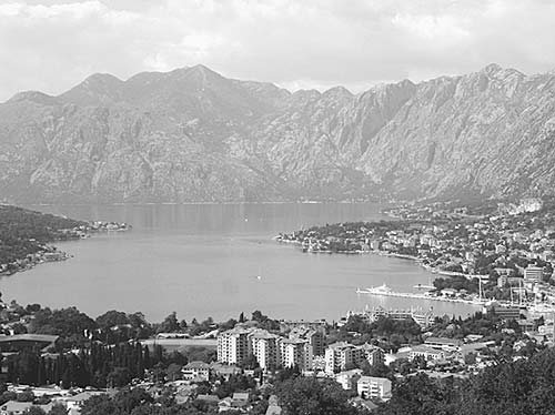
With more time, romantics can corkscrew up into the mountains to sample the Balkans’ best smoked prosciutto at Njeguši, look out over nearly the entire country from the summit mausoleum at Lovćen, and visit the original capital of the country at Cetinje; beach bums can head for the Budva Riviera; and celebrity seekers can daydream about past glories at the striking hotel-peninsula of Sveti Stefan.
GETTING TO MONTENEGRO
This chapter is designed for day-tripping to Montenegro from Dubrovnik; all of the sights are within about a three-hour drive of Dubrovnik, and within about an hour of one another. If you’re arriving in Montenegro by cruise, see the “Cruising into Kotor” sidebar, later.
By Car: Driving is the best option, giving you maximum flexibility for sightseeing, but be aware of possible border delays (see “Border Tips,” later). I’ve narrated a self-guided driving tour of the Bay of Kotor, and another for the most accessible slice of the Montenegrin interior. Even if you don’t have a rental car during your Dubrovnik visit, consider renting one just for the day to visit Montenegro. Perhaps the most satisfying option is to hire your own Dubrovnik-based driver to bring you here (my favorites are recommended on here). While this is a splurge (around €300 for the day), you can try to team up with other travelers to share the cost.
By Bus: Bus service between Dubrovnik and Kotor is good in the summer (at least 5-6/day). The trip is usually listed as lasting approximately two to three hours; however, depending on your timing, border delays can easily add an hour or more. (This may be even more significant now that Croatia has joined the open-borders Schengen zone.) Buses are less frequent off-season. It’s usually possible to day-trip from Dubrovnik to the town of Kotor, but it’s a long day on the bus: The first morning bus departs Dubrovnik around 7:15, usually arriving in Kotor between 10:00 and 11:00 (depending on the border). In summer, there may be additional midmorning buses, but these can be even more susceptible to border delays. From Kotor, return buses typically depart at 14:40 and around 16:00, getting you home in time for dinner; occasionally there are later departures. As the schedule is always in flux, confirm times carefully at the Dubrovnik TI or bus station, or check https://getbybus.com (the Montenegrin site https://busticket4.me is also useful). Sit on the right side of the bus on your way to Montenegro and the left side on the way home.
It’s also possible to take a bus from Montenegro to Mostar in Bosnia-Herzegovina; it’s a long journey via Trebinje in the mountainous interior (9 hours), or somewhat shorter via Dubrovnik (5.5 hours). For details, see “Kotor Connections,” later.
By Excursion: As a last resort, consider taking a package excursion that follows basically the same route covered in this chapter (sold by various travel agencies in Dubrovnik; see here).
PLANNING YOUR TIME
Assuming you have your own car, for a straightforward one-day plan, drive to Kotor and back; figure about 9 to 10 hours total, including driving time and sightseeing stops. To extend your time—either to spend the night or to get home late—you can add as much Montenegro as you like.
Get an early start. To avoid lines at the border, I’d leave Dubrovnik as early as 7:30 in peak times. It takes about two hours to drive from Dubrovnik to Kotor (add about 1.5 hours if you stop in Perast for the boat trip out to the island). Kotor is worth two or three hours. From Kotor, you can return directly to Dubrovnik (about 1.5 hours if you use the ferry shortcut—see the “Lepetane-Kamenari Ferry” description later in this chapter); or drive another hour up to Njeguši and Cetinje in the Montenegrin interior (plus at least one hour more for Lovćen), or a half-hour to the Budva Riviera (from either place, figure about 2.5-3 hours back to Dubrovnik). To cram everything into one extremely long day, you can do Dubrovnik-Perast-Kotor-Lovćen-Cetinje-Budva Riviera-Dubrovnik.
BORDER TIPS
As Montenegro has become more popular with day-trippers from Dubrovnik, its border with Croatia has become a crowded bottleneck, with potentially long waits. Now that Croatia has joined the Schengen open-borders zone (in 2023), this has become an outer border of the entire EU; locals are not sure how this will impact border waits, but it could make things worse.
The main Croatian-Montenegrin border is at Debeli Brijeg. When it’s not busy, this border is relatively straightforward—just stop, have your passport scanned, and show your car’s “green card” (proof of insurance). There can be long delays here on very busy days, especially on Saturdays in August, and to a lesser degree in July and early September. On the busiest days, the line can be hours long; however, locals in Dubrovnik tend to exaggerate how often the border is seriously backed up. Long waits are rare outside of the morning crush of tour buses.
To avoid the worst waits, you have three options: get an early start (reach the border by 8:00, which means leaving Dubrovnik around 7:30—the best option); get a later start (leaving Dubrovnik around 9:00); or use the secondary crossing, called Konfin, which is generally less busy. Big buses are not allowed at Konfin, but savvy locals know about it, so on the busiest days, it can be backed up too. While the Konfin border might save you time, it’s a bit less straightforward (with a few turnoffs rather than a straight shot on the main road) and takes a few more miles. I’ve narrated a scenic route (“Konfin Border Detour”) in my self-guided driving tour, later. Once you’ve crossed into Montenegro, if you’re finding that the roads are unpleasantly crowded, you could reverse the loop of my driving tour for a “reverse commute” (explained later).
Afternoon Delays: The Debeli Brijeg border crossing can also be severely delayed coming back to Dubrovnik in the afternoon. (Lines are worst in summer around 16:00 or 17:00, when a long chain of excursion buses all heads back at the same time.) If this happens, use the secondary (and typically less crowded) Konfin border crossing. To avoid delays, some people like to make their way back to Dubrovnik in the early afternoon, perhaps stopping for dinner in Konavle; others prefer to linger for dinner in Kotor and come back later, after the lines have thinned out.
TOURS IN MONTENEGRO
While taking a tour or hiring a driver from Dubrovnik is a popular option, if you really want the Montenegrin perspective, consider hiring a local guide here. I spent a great day learning about this area from Stefan Đukanović, an energetic, knowledgeable guide who speaks good English and has an infectious enthusiasm for his homeland. Hiring Stefan is a great value. The catch is that he can’t come and get you in Dubrovnik, so it works best if you drive yourself to Montenegro (or hire a driver to bring you) and pick him up when you arrive. Stefan is also an excellent choice if you’re arriving in Kotor by cruise ship. If he’s busy, he may send you with his brother, Đukan, or his father, Miro (guiding only: €90/half-day, €110/day, extra for driver if going outside Kotor; several shore excursions possible—contact for details and rates; +382 69 297 221 or +382 69 369 994, www.miroandsons.com, djukan@t-com.me).
The Bay of Kotor
With dramatic cliffs rising out of the glimmering Adriatic, ancient towns packed with history and thrilling vistas, an undeveloped ruggedness unlike anything in Croatia, and a twisty road to tie it all together, the Bay of Kotor, rated ▲▲, represents the best of Montenegro. To top it off, it’s easy to reach by car from Dubrovnik (don’t forget your passport).
Bay of Kotor Driving Tour
The Bay of Kotor (Boka Kotorska—literally the “Mouth of Kotor”) is Montenegro’s most enjoyable and convenient attraction for those based in Dubrovnik. This self-guided day trip—worth ▲▲—narrates the drive from the Croatian border to the town of Kotor, in the Bay of Kotor’s deepest corner. If you’re doing the drive in peak summer season, consider following the middle section of my itinerary in reverse to avoid crowds; I’ll tell you precisely where you need to deviate to do the route in reverse.
The Montenegrin border is about 40 minutes south of Dubrovnik. Simply follow the main coastal road south (signs to Ćilipi), past Cavtat and the airport.
From Dubrovnik to the Border
As you leave Dubrovnik, the jagged cliffs on your left eventually give way to a pastoral countryside called Konavle (meaning “canal,” recalling how the Romans built aqueducts through this area to supply their settlement at today’s Cavtat). This farming region—effectively Dubrovnik’s hinterland—was badly damaged during the Yugoslav Wars, when the Yugoslav People’s Army invaded from the south, forcing villagers to flee to safety in Dubrovnik. But it’s bouncing back and is home to many appealing konobas (taverns) serving traditional local food. To stop off here (perhaps for dinner at the end of your Montenegro day), see “Konavoski Dvori” on here.
Soon after the turnoff for the Bosnian border, on the right, you’ll pass Kupari, with one of the few buildings in the area that still have war damage. Originally Tito’s villa, the building later became a vacation home for Yugoslav military officers. Now it’s a ruin, awaiting investors.
From Kupari, you’ll curl around the picturesque Bay of Cavtat, where some of the world’s richest people tie up their yachts. Partway along the bay, after the village of Plat, you’ll pass (on the left) an electrical plant, which harnesses the power of an underground river to generate more than enough clean energy for the entire city.
After the pleasant resort town of Cavtat (described on here), then the airport, you have the option of turning off (on the right, toward Molunat) to take advantage of the less crowded border crossing at Konfin (described next). Otherwise, just cruise along the main road until you reach the primary Debeli Brijeg border crossing. (If there’s a line when you arrive, it’s easy to backtrack to the alternate crossing: Just after the town of Gruda, follow signs for Pločice, then Vitaljina, then Herceg Novi, joining up with the route described next.)
As you approach the border, enjoy the many cypress trees that punctuate the landscape here; locals brag that this small area has the most cypresses in all of Croatia.
Optional Konfin Border Detour
If you’re doing this drive in the peak of summer, or you arrive at the primary border crossing and find a lengthy line, then consider this slightly longer and more scenic route that takes you to the usually uncongested secondary border, at Konfin.
Soon after passing the airport, take the turnoff on the right for Molunat. You’ll pass through a tranquil, nearly Tuscan landscape of pointy cypresses, vineyards, olive groves, and fig trees. Just before the village of Radovčići, on the right, watch for Kojan Koral, a horse farm that hosted movie-star equines for Game of Thrones. They offer horseback rides and ATV safaris (https://kojankoral.com).
Farther along, you’ll enjoy good views (on the right) down on the dramatic, elongated peninsula of Molunat. Notice that the H-shaped peninsula forms two protected bays. The larger bay, facing north (toward Dubrovnik), is used to harbor ships in winter, while the smaller, south-facing bay is better in summer.
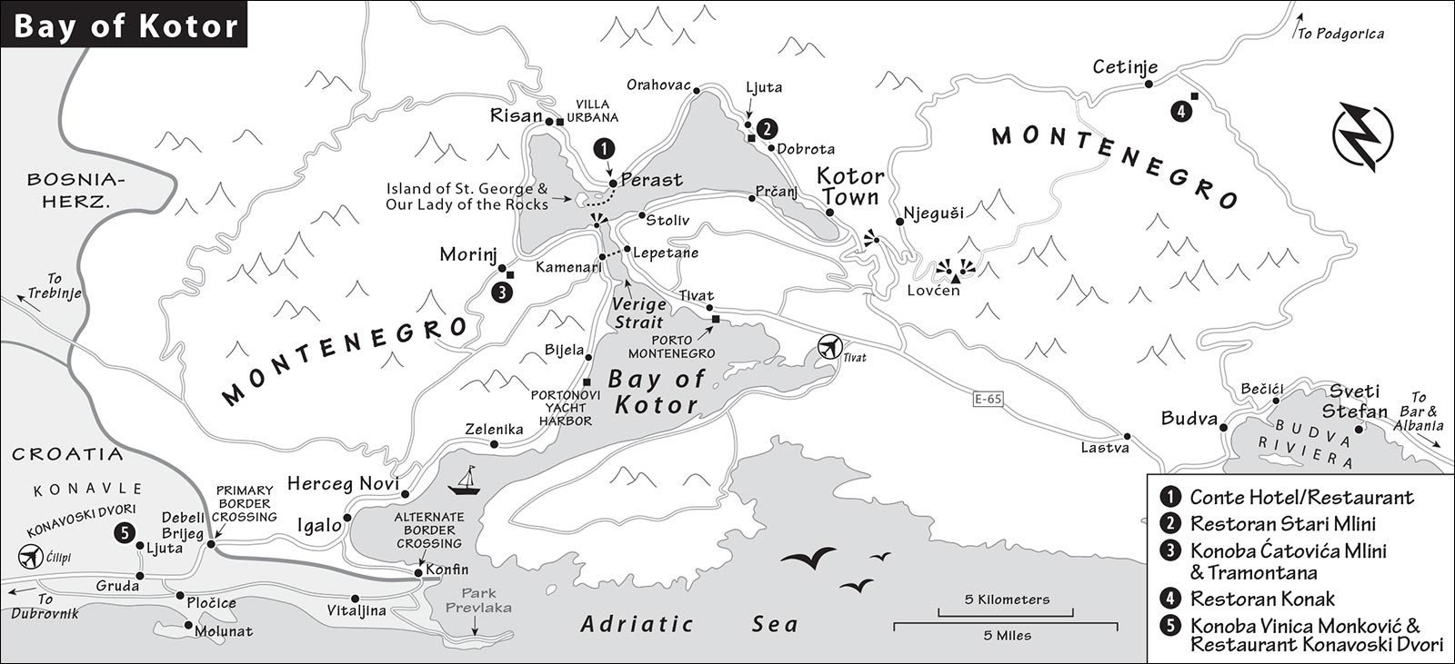
When the road reaches a T-intersection, turn left for Dubrovnik and Park Prevlaka, then follow signs right for Đurinići, then right again for Vitaljina. As you continue on this road—through the villages of Đurinići, Višnjići, and Vitaljina—high on the mountains to your left is the point locals call Tromeđe (Three Borders), where Croatia, Bosnia-Herzegovina, and Montenegro converge.
Continue straight along this road all the way to the border, following signs for Herceg Novi and GP Konfin. You’ll pass a turnoff on the right for Park Prevlaka, an old Austro-Hungarian and Yugoslav army fortress that has been converted into a park; you can see it at the tip of the peninsula poking out on your right—the southernmost point in Croatia.
Before long, you’ll arrive at the Croatian border post, and then the Montenegrin one. After entering Montenegro, you’ll curve along the small bay into Igalo, where you can resume the self-guided driving tour; see “Igalo,” next.
• From either border, you can make it to Kotor in about an hour without stopping, but with all the diversions en route, you should plan for much more time. Navigating on this tour is really simple: It’s basically the same road, with no turnoffs, from Dubrovnik to Kotor. First, you’ll approach the coast at the town called...
Igalo
Driving through Igalo, keep an eye out (on the right) for a big concrete hotel called Institut Dr. Simo Milošević (no relation to war-criminal Slobodan). This internationally regarded spa is one of the world’s premier treatment facilities for arthritis and nerve disorders. Especially popular among Scandinavians, it can host more than 1,000 patients at once. Yugoslav President-for-Life Tito had a villa nearby and took treatments here.
• A couple of miles beyond Igalo, you enter the biggest city you’ll see today...
Herceg Novi
The drab economic and industrial capital of the Bay of Kotor, Herceg Novi (with 25,000 people) is hardly the prettiest introduction to this otherwise striking landscape. Herceg Novi flourished during the Habsburg boom of the late 19th century, when a railroad line connected it to Dubrovnik, Sarajevo, and Vienna. Back then, Austrians vacationed here—but more recent development has been decidedly less elegant than the Habsburgs’. While there is a walled Old Town core to Herceg Novi, it’s not worth stopping to see; skip the turnoff for the town center, carrying on along the main road toward Budva.
Passing above Herceg Novi’s Old Town, keep an eye out on the right for the town’s stout 15th-century fortress, which was built by the Ottomans, who controlled this area but never made it deeper into the bay.
Also watch for tropical trees in Herceg Novi. Locals pride themselves on their particularly mild climate, sheltered by the fjord. They claim that it never drops below 50 degrees Fahrenheit. Town symbols include banana trees and the mimosa flower, which blooms all winter long. Each February, as much of Europe (and most of Montenegro) is under a blanket of snow, Herceg Novi proudly hosts a Mimosa Festival. Microclimates along the coast make a big difference; Montenegrins know that the very best watermelons come from Ulcinj, and the best pomegranates from Bar (these are nicknamed “horse teeth” for their huge seeds).
Despite its tropical cachet, Herceg Novi is basically a mess. (Don’t worry—the drive gets much prettier later on.) Why so much ugliness compared to Croatia? For one thing, Tito viewed Croatia’s Dalmatian Coast as a gold mine of hard Western currency—so he was inclined to keep it Old World-charming. But in Montenegro, a heritage of corruption and bribery spurred some unfortunate construction. (“Would five thousand dinars convince you to ignore my new hotel’s code violations?”) Today, Montenegro is encouraging the construction of top-end resort hotels to lure high rollers from around the world (such as Daniel Craig’s James Bond, who came to “Montenegro” to join a poker tournament at the Casino Royale—actually filmed in the Czech Republic). But this new development is poorly regulated, threatening to turn Montenegro into a charmless, concrete Costa del Sol-style vacation zone. Enjoy the Bay of Kotor’s pristine areas (which we’ll enter soon) while you still can.
• As you go through Herceg Novi, at the roundabout, follow signs for Budva, Kotor, and Trajekt/Ferry.
After the tunnel, you’ll pass through Zelenika, once the end of the line for the Habsburg rail line from Vienna, which first brought tourism to this area. The road you’re traveling today—built in 1956 by Tito to lash together his new nation—goes from here all the way north to Slovenia. As you carry on through a few more dreary towns, entertain yourself by gazing across the strait on your right to look for caves burrowed into the cliff face at sea level. These once provided shelter for Yugoslav warships. Also along this cliff, you’ll see naval barracks.
On the right, watch for the blink-or-you’ll-miss-it turnoff to the Portonovi luxury yacht harbor. If you’re depressed by the gloomy blight of Montenegro so far, it may be worth pulling off here for a few minutes just to peek at the snazzy development: It’s a “new port” indeed, where a high-end marina faces a huge plaza ringed by posh condos and shops. This little bubble of glam, surrounded by gloom, highlights the contrast between über-rich and hardscrabble-poor that characterizes the Montenegrin coast.
Back on the main road, in Bijela, you’ll soon pass a striking contrast to the nouveau riche you’ve just witnessed: a big industrial shipyard on your right, with rusted, hardworking ships.
Eventually, you’ll emerge into a more rustic setting. This fjordside road is lined with fishing villages, some now developed as resorts (including a few with severe communist-era touches). Each waterfront house seems to have its own little boat dock sticking out into the glassy water.
Soon you come to the town of Kamenari, where a ferry crosses the narrow strait to Lepetane. At this point, if the traffic is moving right along and congestion is minimal, keep going along the main road. (You’ll come back across on this ferry later.)
However, if you find yourself stuck behind a column of slow-moving tour buses (most likely in summer) and want to break out of the rut, consider reversing the direction of the remaining loop. To do this, take the ferry now from Kamenari to Lepetane and drive to Kotor to sightsee there. (Choose between the scenic but slow road to Kotor through Prčanj and the faster road through Tivat.) Then return from Kotor to Dubrovnik by way of Perast, Risan, and so on (reversing the order of the remaining stops), back to Kamenari.
• If you stick to the next route I outline, watch for a convenient pullout on the right two minutes after leaving Kamenari (just after the Kostanjica sign and likely packed with tour buses, by the Verige 65 restaurant—tempting but typically closed in the morning) and stop to check out the narrowest point of the fjord, the...
Verige Strait
Any would-be invaders had to pass through this strategic bottleneck to reach the port towns inside the bay. It’s narrow enough to carefully monitor (not even a quarter-mile wide), but deep enough to accommodate even today’s megaships (more than 130 feet deep). Because this extremely narrow strait is easy to defend, whoever controlled the inside of the fjord was allowed to thrive nearly unchecked.
Centuries before Christ, the Bay of Kotor was home to the Illyrians—the mysterious ancestors of today’s Albanians. In the third century BC, Illyrian queen Teuta spanned this strait with an ingenious shipwrecking mechanism to more effectively collect taxes. To this day, many sunken ships litter the bottom of the bay. (Teuta was a little too clever for her own good: Her shrewdness and success, not to mention her encouragement of piracy, attracted the attention of the on-the-rise Romans, who seized most of her holdings.)
In later times, chains were stretched across the bay here to control the entrance (the name Verige comes from a Slavic word for “chain”). Later still, the Venetians placed cannons on either side of the strait, with a clear shot at any entering ships. Looking across the wide part of the bay, notice the town of Perast (by the two islands). Perast—where we’ll be stopping soon—was also equipped with cannons that could easily reach across the bay. This extensive defense network succeeded in keeping the Ottomans—and any other would-be invaders—out of the bay.
• Continue driving around the fjord. You’ll pass through the village of...
Morinj
This town is known for two starkly different reasons. First, it’s the home of a recommended restaurant with fine food in a gorgeous setting (Konoba Ćatovića Mlini); another, more casual eatery sits nearby (both described later, under “Eating in Kotor”). Surrounding the restaurant—and throughout the town center—are ponds where you can watch bubbles constantly simmering up from underground springs. This is actually an outlet of a river that originates in Bosnia-Herzegovina and runs underground to this point.
But remember: This is a land of contrasts. Morinj’s second claim to infamy is that it was the site of a concentration camp for Croat prisoners captured during the 1991-1992 siege of Dubrovnik. Some 300 civilians from in and near Dubrovnik were forcibly brought here, where they lived in horrifying conditions. After the war, six of the guards from this camp were convicted of war crimes. For this reason, understandably, many Croatians don’t enjoy stopping off at this otherwise idyllic spot.
• After going through Morinj and some other small villages, you’ll pass through the larger resort town of...
Risan
Back in Greek times, when the Bay of Kotor was known as Sinus Rhizonicus, Risan was the leading town of the bay. Later, during the Illyrian queen Teuta’s brief three-year reign, Risan was her capital. Today the town is still home to the very scant remains of Teuta’s castle (on the hilltop just before town), but it’s mostly notable for its giant, abandoned communist eyesore—Hotel Teuta.
In the town center, historians may want to turn off to the left (at the brown Rimski Mozaiki sign) for a quick look at a few partly intact mosaic floors of the second-century-AD Roman Villa Urbana (€5, Tue-Sun 8:00-20:00, off-season 10:00-16:00, closed Mon year-round). You’ll enter through a small modern building to access the large, covered footprint of the villa. Between the knee-high stone walls are mosaics of checkerboards and stylized marine life (including calamari), as well as—most significant—a small mosaic of reclining Hypnos, the god of dreams.
• Continue on to Perast. Read ahead to “Arrival in Perast,” next, and be ready for your parking options. (If you’re in a hurry to reach Kotor—perhaps planning to return to Perast later in the day, when it may be less crowded—you can just stay on the main road, which goes above the town center, avoiding the congestion.)
Perast
Called the “Pearl of Venetian Baroque,” little Perast is a handy and scenic spot to stretch your legs, consider a boat trip to an evocative island, and maybe have a meal or a drink with postcard views. It’s very busy with day-trippers and cruise passengers for a reason: This long, skinny, entirely waterfront settlement is arguably the most pleasant stopover on the entire bay beyond the town of Kotor. The crowds peak between 10:00 and 13:00; if it looks mobbed as you approach, consider doubling back here on your way home later for a quieter visit (though that doesn’t allow enjoying different scenery and taking the Lepetane-Kamenari ferry).
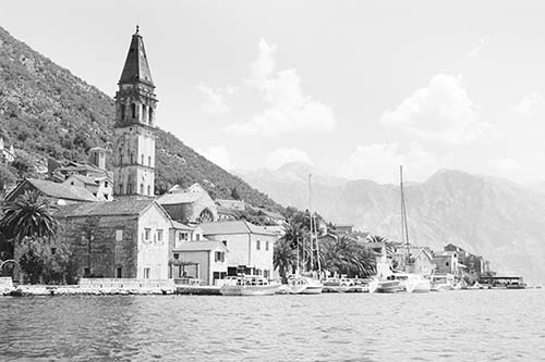
Arrival in Perast: Visiting cars typically are not allowed to drive all the way through the waterfront town center (and you wouldn’t want to anyway, since it’s an extremely narrow, essentially one-lane road that somehow tries to accommodate two directions of traffic). Instead, you’ll park just outside the town center and walk along the water about 10 minutes to the heart of town. To reach the handiest (pay) parking lots, turn off for the town center as you approach town and look for parking signs. Another option is to stay on the main road and watch for the parking lot just after the turnoff, slightly above town; here you can pay one price both for parking and for a boat ride to the island.
Visiting Perast: Remember that Perast, with its cannons aimed at the Verige Strait across the bay, was an essential link in the Bay of Kotor’s fortifications. In exchange for this important duty, Venice rewarded Perast with privileged tax-free status, and the town became extremely wealthy. Ornate mansions proliferated here during its 17th- and 18th-century heyday. But after Venice fell to Napoleon, and the Bay of Kotor’s economy changed, Perast’s singular defensive role disappeared. With no industry, no hinterland, and no natural resources, Perast stagnated—leaving it a virtual open-air museum of Venetian architecture.
Go to the tallest steeple in town, overlooking a long and narrow harborfront square. Perast is centered on its too-big (and incomplete) Church of St. Nicholas—dedicated to the patron saint of fishermen. It was originally designed to extend out into the sea (the old church, still standing, was to be torn down). But Napoleon’s troops came marching in before the builders got that far, so the plans were scuttled—and this massive partial-church was instead simply grafted on to the existing modest church.
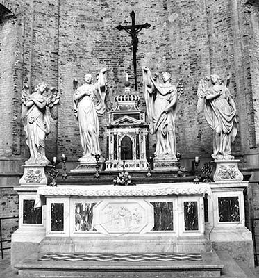
While it’s free to enter, you’ll get only as far as the small sanctuary unless you pay to visit the treasury (€2; sporadic hours, generally daily June-Sept 9:00-18:00, until 14:00 off-season and closed Dec-March except by request; closed during Mass). In the treasury’s collection of relics and icons, look for the priceless crucifix from the school of the 18th-century Venetian artist Giovanni Battista Tiepolo (in the center display case), with Jesus on one side, Mary on the other, and saints all around. Beyond the treasury is what was to be the main apse (altar area) of the unfinished massive church (notice it’s at a right angle to the altar of the existing smaller church). The rough, unadorned brick walls make it clear that they didn’t get very far. Check out the model of the ambitious but never-built church. The Baroque main altar is by Bernini’s student Francesco Cabianca, who lived in this area. The small room at the end displays old vestments. You can pay €1 to climb the church tower for the view.
I’d skip the Town Museum, farther down the waterfront (fills a grand old hall with paintings, furniture, model ships, and other historical bric-a-brac). As you stroll through town, simply enjoy the huge waterfront views, noticing how top-end luxury hotels have encroached on formerly rustic Perast—such as the five-star Smjeka Palace, now the Heritage Grand Hotel, with a private beach pad and pool.
Eating in Perast: For a seafront meal, window-shop the restaurants with seating out on the water. $$$ Conte, filling a pier in the middle of town, is a classic choice with big views (+382 67 257 387).
• Before leaving Perast, take a close look at the two islands just offshore (and consider paying a visit).
St. George (Sv. Đorđe) and Our Lady of the Rocks (Gospa od Škrpjela)
These twin islands—one natural, the other created by townspeople—come with a fascinating story.
The Island of St. George (the smaller, rocky island with trees and a monastery—closed to tourists) was once part of the fortification of the Bay of Kotor. Nearby was an underwater reef with a small section poking above the surface. According to legend, two fishermen noticed a strange light emanating from the reef in the early-morning fog. Rowing out to the island, they discovered an icon of Our Lady. They attempted to bring it ashore, but it kept washing back out again to the same spot. Taking this celestial hint, local seamen returning home from voyages began dropping rocks into the bay in this same place. The tradition caught on, more and more villagers dropped in rocks of their own, and eventually more than a hundred old ships and other vessels were loaded with stones and intentionally sunk in this spot. And so, over two centuries, an entire island was formed in the middle of the bay.
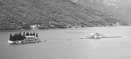
Flash forward to today’s Our Lady of the Rocks (the flat island with the dome-topped Catholic church). In the 17th century, locals built this Baroque church on this holy site and filled it with symbols of thanks for answered prayers. Today, you can pay a small fee to enter both the church and the attached museum (€2, May-Oct daily 9:00-18:00, off-season opens sporadically with boat arrival). You’ll likely meet tour guides Davorka, Nataša, Sandra, or Ljubica, who may be able to show you around.
Begin inside the church to explore the wealth of items donated by appreciative locals: silver votive plaques, many of them with images of ships in storms or battles, given by appreciative sailors who survived; 1,700 silver and gold votive plaques from other grateful worshippers; 68 canvases by local Baroque painter Tripo Kokolja; and, over the doors flanking the altar, a huge collection of dried wedding bouquets given by those who had nothing else to offer (the church is a popular place for weddings). Take a close look at the main altar. That legendary icon, which refused to budge from this spot, still caps the altar today. The faithful squeeze into the very tight space behind the altar, where a hole in the back of the structure lets them reach through and touch the original reef where the icon was found.
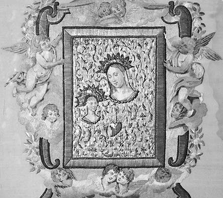
The adjacent museum is an entertaining mishmash of items. To get oriented, study the models of both islands. The artificial one—the one you’re on—is shaped vaguely like a boat. The collection comprises a wide range of ancient artifacts, including a glass case displaying fragments dating—staggeringly—from 3500 BC (found in the hills just above Perast). There’s also a small modern-art gallery with various depictions of the two islands created by artists who came here and were inspired by this place; paintings of ships commissioned by local sailors (notice that most have a saintly image of Mary and the Baby Jesus hovering nearby); a small collection of weaponry; and votive items donated by local women. Upstairs, near the gift-shop counter, look for the amazing embroidery made by a local woman who toiled over it for more than 25 years. She used her own hair for the hair of the angels—which you can see fade from brown to gray as she aged (beginning at around 3 o’clock and going clockwise, you’ll see the subtle change in color).
Getting There: Boats to Our Lady of the Rocks leave continuously with demand from various points along the Perast waterfront. The trip takes just a few minutes, and you’ll typically be given around a half-hour to see the island before returning. The going rate is €5/person round-trip, but Zoran offers an RS% discount—€4/person if you show this book. Zoran’s boats, which depart from directly in front of St. Nicholas’ Church, are marked either Luna or Perast.
• When you’re ready to move on, continue driving around the fjord. After the large town of Orahovac, you’ll see part of the bay roped off for a mussel farm. These farms, which you’ll see all day, do best when located where mountain rivers spill into the bay. And a hundred or so yards later, you cross a bridge spanning the don’t-blink-or-you’ll-miss-it...
Ljuta River
According to locals, this is the shortest river in the world—the source is under the cliff just to the left of the bridge, and it meets the sea just to the right. Short as it is, it’s hardly a trickle—in fact, its name means “Angry River” for its fierce flow during heavy rains. The river actually courses underground for several miles before emerging here. Like the Karst area south of Ljubljana, this is a karstic landscape—limestone that’s honeycombed with underground rivers, caves, and canyons.
• Immediately after the bridge, look for the turnoff (on the right) to the recommended Restoran Stari Mlini (“Old Mill”)—a tranquil spot for a meal or drink. Fittingly, the restaurant sits right where the river comes tumbling out—the perfect spot to harness that hydropower.
Continuing along the fjord, as you pass through the town of Dobrota, look across the bay to the village of...
Prčanj
This town is famous as the former home of many centuries’ worth of wealthy sea captains. When the Bay of Kotor was part of the Austrian Empire, Emperor Franz Josef came to Prčanj. Upon being greeted by some 50 uniformed ship captains, he marveled that such a collection of seafarers had been imported for his visit...not realizing that every one of them lived nearby.
• Keep on driving. When you see the giant moat with the town wall, and the smaller wall twisting up the hill above, you’ll know you’ve arrived in Kotor (described later).
Before leaving Kotor, make a decision about where you want to go next. You have three basic options: Budva Riviera, the mountainous Montenegrin interior, or back to Croatia (see the next section).
Continuing past Kotor’s Old Town, you’ll follow the edge of the fjord. At the far end of town (and the fjord), you’ll come to a roundabout. Bearing left at the roundabout takes you toward the handy tunnel to the Budva Riviera—or, along this same road, if you turn right after the cemetery and just before the tunnel, you’ll take the extremely twisty road up, up, up into the Montenegrin interior (Lovćen, Njeguši, and Cetinje).
Once you’re finished in Montenegro, it’ll be time to head to the...
Lepetane-Kamenari Ferry
To return to Dubrovnik, you can go back the way you came. Or, for a quicker route with different scenery, consider the ferry that cuts across the narrow part of the fjord (between the towns of Lepetane and Kamenari).
From Kotor, you have two options to reach the ferry dock in Lepetane. The easiest option is to leave Kotor, bear left at the roundabout at the far end of town, and take the tunnel toward Budva. Once through the tunnel, follow signs into Tivat, and continue straight through Tivat on the main road to reach Lepetane, which is a few miles beyond the end of town. Or, for a more challenging but more scenic route, simply turn right at the roundabout and continue driving on the waterfront road clockwise around the bay (through Prčanj and Stoliv) until you land in Lepetane. This road is extremely narrow (one lane, with an Adriatic shoulder) and can be exhausting. However, it also offers grand views back across the fjord at Kotor, Perast, and other picturesque towns you came through earlier.
No matter how you approach, remember that “ferry” is trajekt (it’s also signed for Herceg Novi—the city across the bay). The boat goes continuously (in slow times, you may have to wait briefly for enough cars to show up), and the crossing takes just four minutes (it takes longer to load and unload all the cars than it does to cross). A small car and its passengers pay €5 each way.
On your way back to Dubrovnik after the ferry, if there are long lines at the primary border crossing—or you want a quieter, more scenic return—use the Konfin alternate crossing described earlier: After exiting Igalo, just before the border, take the first left after the Hipermarket and Petrol gas station (following small yellow sign to Višnjići)—watch for the turnoff on the left that’s marked granićni prijelaz Konfin. From the Konfin border, follow signs to Dubrovnik (on back roads at first, later merging with the main road).
Kotor
Butted up against a steep cliff, cradled by a calm sea, naturally sheltered by its deep-in-the-fjord position, and watched over by imposing fortifications, the town of Kotor is as impressive as it is well protected. Though it’s enjoyed a long, illustrious history, today’s Kotor is a time-capsule retreat for travelers seeking an unspoiled Adriatic town.
The ancient town of Catarum—named for the Roman word for “contracted” or “strangled,” as the sea is at this gnarled fjord—was first mentioned in the first century AD. Like the rest of the region, Kotor’s next two millennia were layered with history as it came under the control of foreign powers: Illyrians, Romans, Serbs, Venetians, Russians, Napoleonic soldiers, Austrians, Tito’s Yugoslavia...and now, finally, Montenegrins. Each group left its mark, and Kotor has its share of both Catholic and Orthodox churches.
Through all those centuries, Kotor avoided destruction by warfare. But it was damaged by earthquakes—including the same 1667 quake that leveled Dubrovnik (known here as the “Great Shaking”), as well as a devastating 1979 earthquake from which the city is still cleaning up.
With an extremely inviting Old Town that seems custom-built for aimless strolling, Kotor is an idyllic place to while away a few hours. Though it’s sometimes called a “little Dubrovnik,” Kotor is more low key, less ambitious, less historic, flatter, and much smaller than its more famous neighbor. The locals—and visitors—seem to like it that way.
Orientation to Kotor
Kotor (or Cattaro in Italian) has a compact Old Town shaped like a triangle. The two sides facing the bay are heavily fortified by a thick wall, and the third side huddles under the cliff face. A meandering defensive wall climbs the mountainside directly behind and above town. While only 3,000 people live within the Old Town walls, greater Kotor has a population of about 12,000.
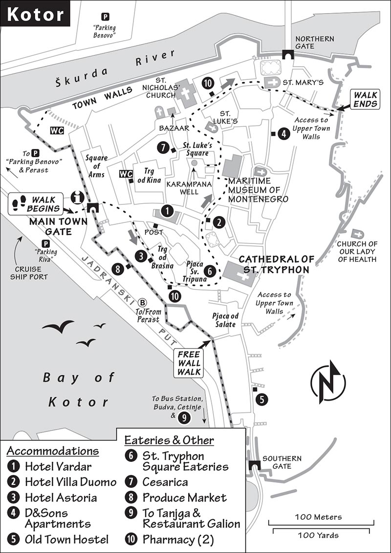
The Old Town’s mazelike street plan is confusing, but it’s so small and atmospheric that getting lost is more fun than frustrating. The locals mostly ignore addresses, including the names of streets and squares. Most Old Town addresses are represented simply as “Stari Grad” (Old Town) and a number, useless if you’re trying to navigate by streets. Even more confusing, a single square can have several names—so one map labels it Trg od Katedrale (Cathedral Square), while another calls it Pjaca Sv. Tripuna (Piazza of St. Tryphon). My advice: Don’t fret about street or square names. Simply navigate with a map (in this chapter, or from the TI) and by asking locals for directions. Thanks to the very manageable size of the Old Town, this is an easy task.
TOURIST INFORMATION
The TI is in a kiosk just outside the Old Town’s main entrance gate (daily 8:00-20:00, Nov-April until 18:00, +382 32 325 950, https://kotor.travel).
ARRIVAL IN KOTOR
By Car: Approaching town, you’ll first see Kotor’s substantial wall, which overlooks a canal. You can park in one of two pay lots, which are both priced around €1/hour: “Parking Riva,” along the bay immediately across from the main gate, is the closest to the Old Town and slightly more expensive (to the right just after crossing the bridge by the wall); “Parking Benovo” is in the lot across the canal (on the left just before the bridge by the wall—you’ll be sent back here if the first lot is full). Both are easily walkable from the Old Town entrance. Be sure you’ve parked legally; while locals brazenly leave their cars anywhere they like, tourists get towed without remorse.
By Bus: The bus station is about a half-mile (10-minute walk) south of the Old Town. Arriving here, simply exit to the right and walk straight up the road—you’ll run into the embankment and town wall. Buses to and from Perast stop even closer to the Old Town.
Sights in Kotor
Because of its tangled alleys and irregular street plan, Kotor feels bigger than it actually is. But after a few minutes of strolling, you’ll discover you’re going in circles and realize it’s quite compact. (In fact, aimless wandering is Kotor’s single best activity.) As you ramble, keep an eye out for these key attractions. I’ve listed them roughly in the order of a counterclockwise route through town, beginning outside the main entrance gate. Allow about one hour for this loop.
▲Main Town Gate (Glavna Gradska Vrata)
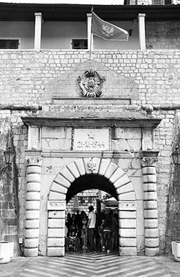
The wide-open square fronting the bay and waterfront marina now welcomes visitors. But for centuries, its purpose was exactly the opposite: As the primary point of entry into this heavily fortified town, it was the last line of defense. Before the embankment was built, the water came directly to this door, and there was only room for one ship to tie up at a time. If a ship got this far (through the gauntlet we saw back at the Verige Strait), it was carefully examined here again to levy taxes before its passengers could disembark. This double checkpoint was designed to foil pirates who might fly the flag of a friend to get through the strait, only to launch a surprise attack once here. (The pirates’ primary booty wasn’t silver or gold, but men—kidnapped for ransom, or, if ransom wasn’t paid, as slaves to row on ships.)
Check out the pinkish gate. The oldest parts of this gate date from 1555. It once featured a Venetian lion, then the double-headed eagle of the Habsburg Empire. But today, most of the symbolism touts Tito’s communism (notice the star and the old Yugoslav national seal at the top). The big date (November 21, 1944) commemorates this area’s liberation from the Nazis by Tito’s homegrown Partisan Army. The provocative Tito quote (tuđe nećemo svoje ne damo) means, roughly, “Don’t take what’s ours, and we won’t take what’s yours.”
• Notice the TI in the kiosk just to the left of the gate. Then go through the gate into town. You’ll emerge into the...
Square of Arms (Trg od Oružja)
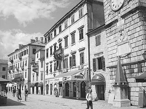
Do a quick spin-tour of the square, which is ringed with artifacts of the city’s complex history. Look to the left, and you’ll see a long building lined with cafés. This was once the palace of the rector, who ruled Kotor on behalf of Venice. Princes could watch the action from their long balcony overlooking the square, which served as the town’s living room. Later, the palace became the Kotor Town Hall. Beyond the long building, two other buildings poke out into the square (on either side of the lane leading out of the square). The one on the right is the Venetian arsenal, the square’s namesake. The yellowish one on the left is the “French Theater,” named for its purpose during the time this area was under Napoleon’s control.
If you walked all the way to that far (left) end of this square, you’d find a staircase leading you to an upper terrace overlooking the harbor out front. From there, you could follow a narrow walkway along the top of the city’s seaward wall (watch out for bolts and lights sticking out of the wall). Stick with me for now on this walk—but consider circling back here later to finish up your town visit with that free wall walk.
Directly across from the gate you just came through, you’ll see the town’s bell tower, one of Kotor’s symbols. The odd triangular structure at its base was once the town pillory, where wrongdoers would be chained and subjected to public ridicule of the rudest kind imaginable. In the little recessed square just right of that, you’ll spot the recommended, copper-roofed Hotel Vardar.
• Walk down the long part of the square directly ahead of where you entered (toward Hotel Vardar). Take the broad lane angling off to the right (paved with red-and-white-striped tiles), which leads past mansions of Kotor’s medieval big shots. Cross a square (Trg od Brašna) and turn left down the little lane at its end. After one short block, you’ll hit Pjaca Sv. Tripuna (a.k.a. Trg od Katedrale), home to the...
▲Cathedral of St. Tryphon (Katedrala Sv. Tripuna)
Even though most of today’s Kotorians are Orthodox, Kotor’s most significant church is Catholic. According to legend, in 809, Venetian merchants were sailing up the coast from Nicea (in today’s Turkey) with the relics of St. Tryphon—a third-century martyr and today’s patron saint of gardeners. A storm hit as they approached the Bay of Kotor, so they took shelter here. Every time they tried to leave, the weather worsened...so they finally got the message that St. Tryphon’s remains should remain in Kotor.
Cost and Hours: €3, daily 9:00-18:00, possibly later in summer; Mass on Sun at 10:00.
Visiting the Cathedral: Take in the cathedral’s exterior. The church has been rebuilt after four different earthquakes—most extensively after the 1667 quake, when it achieved its current Renaissance-Baroque blend. That earthquake, which also contributed to Dubrovnik’s current appearance, destroyed three-quarters of Kotor’s buildings. A fire swept the city, and bodies of the dead attracted rats (and with them, the plague)—a particularly dark chapter in Kotor’s history.
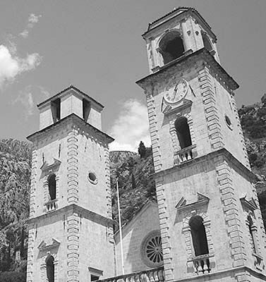
Why are the two towers different? There are plenty of legends, but the most likely answer is that restorers working after 1667 simply ran out of money before they finished the second one. Notice the Church of Our Lady of Health way up on the hill above this church—built in thanks to God by survivors of the plague (it also serves as part of the town fortifications—described later).
Inside, the nave of the church has stout columns; surviving Byzantine-style frescoes under the arches, all that’s left of paintings that once covered the church; and a fine 15th-century silver-and-gold altar covered by a delicate canopy.
But the best part is the reliquary upstairs. Find the stairs near the cathedral’s main entrance and walk up to the chapel. Behind the Baroque altar (by Bernini’s student Francesco Cabianca, whose work we saw in Perast) and the screen are 48 different relics. In the glass case in the center of the back wall is St. Tryphon—his bones are in a silver casket, and his head is in the golden chalice next to it.
In the small room up the stairs, examine the fascinating icon of the Madonna and Child from the 15th century (it’s in a freestanding wooden frame with a crucified Jesus on the other side; to find it, you may have to look around back). The painting exemplifies this town’s position as a bridge between Western and Eastern Christianity: The faces, more lifelike, are Western-style (Catholic) Gothic; the stiff, elongated bodies are more Eastern- (Orthodox) and Byzantine-style. From here, take a slow walk around the upper gallery of the church to see its displays of relics (such as arms and feet covered in silver), paintings, vestments, and other ecclesiastical items. At the front end, you can step out onto the balcony between the twin steeples.
• Exit the church and angle right through the square to the street near City Restaurant, marked by trees. In a block, you’ll wind up on a little square that’s home to the...
Maritime Museum of Montenegro (Pomorski Muzej Crne Gore)
As with so many Adriatic towns, Kotor’s livelihood is tied to the sea. This humble museum covers three floors and explores that important heritage. As you climb the stairway, notice the evocative maps and etchings of old Kotor. Portraits of salty swashbucklers, traditional costumes, and 98 coats of arms representing aristocratic families who have lived here (ringing the main room upstairs) are all reminders of the richness of Kotor’s history. You’ll see a display of rifles and swords (some with fun ornamental decorations illustrating the art of killing) and lots of model ships. The museum is housed in the Gregorina Palace, one of dozens of aristocratic mansions that dot the Old Town—yet another reminder of the historically high concentration of wealth and power in this little settlement.
Cost and Hours: €5, includes English audioguide; May-Sept Mon-Fri 9:00-18:00, closes earlier off-season, Sat-Sun until 13:00 year-round; on Trg Grgurina, +382 32 304 720, www.museummaritimum.com.
• Turn right out of the museum and make a right again on the first lane. After 20 yards, you’ll pass a well on your left called the...
Karampana
This well served as Kotor’s only public faucet until the early 20th century. As such, it was also the top place in town for gossip, like the office water cooler. It’s said that if your name was mentioned here, you knew you had arrived. Today, though the chatter is no longer raging on this square, the town’s gossip magazine is called Karampana. And although the pump still works (swing the pendulum once and keep it there), it’s usually disconnected to prevent tourists from swinging it back and forth too aggressively.
• Continue straight past the well into the next square...
▲St. Luke’s Square (Trg Svetog Luke)
There are two Serbian Orthodox churches on this pretty square, each with the typical Orthodox church features: a squat design, narrow windows, and portly domes. Little St. Luke’s Church (Crkva Sv. Luka), in the middle of the square, dates from the 12th century. Locals debate long and hard whether St. Luke’s was originally built as a Catholic church or an Orthodox one. (Although it looks Orthodox, it was constructed at a time when even Catholic churches were built in the Orthodox style.) Regardless of its origin, during the Venetian era the church did double duty as a house of worship for both. These days, it’s decidedly Orthodox. Step into the humble interior (free, daily 10:00-20:00, Nov-April 8:00-13:00 & 17:00-19:00).
The bigger and much-newer St. Nicholas’ Church (Crkva Sv. Nikola) was built in 1909—because of its Neo-Byzantine design, it has similarly spherical domes and slitlike windows (free, same hours as St. Luke’s).
Before entering, notice how the Orthodox crosses on the steeples of St. Nicholas’ Church differ from the cross seen in Roman Catholic churches (known as a Latin cross). In addition to the standard crossbar, Orthodox crosses often also have a second, smaller crossbar near the top (representing the I.N.R.I. plaque that was displayed above Jesus’ head). Sometimes Orthodox crosses also feature a third, angled crossbar at the bottom. Many believe that rather than being nailed directly to the cross, Jesus’ feet were nailed to a crossbar like this one to prolong his suffering. The slanted angle represents Jesus’ forgiveness of the thief crucified to his right (the side that’s pointing up)...and suggests where the unrepentant thief on his left ended up.
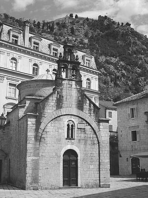
Stepping into these (or any other Orthodox) churches, you’ll immediately notice some key differences from Catholic churches: no pews (worshippers stand through the service as a sign of respect); tall, skinny candles (representing prayers); and a screen of icons, called an iconostasis, in the middle of the sanctuary to separate the material world from the holy world (where the Bible is kept). For more about Orthodox worship, see the sidebar on here.
Before continuing, enjoy this square’s lazy ambience. The big building fronting the square is a music school, and the students practicing here fill this already pleasant public space with an appealing soundtrack.
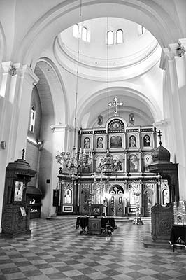
• Go down the street to your left as you face St. Nicholas and keep an eye out for the banners announcing the Kotor bazaar, on your right. In the ruins of a Dominican monastery destroyed in the 1667 quake, you’ll find a little marketplace selling souvenirs.
If you continue down the street, you’ll wind up back at the Square of Arms—where you can find those stairs up for the short walk on top of Kotor’s seaward wall. But first try getting lost, then found again, in Kotor’s delightful maze of streets.
The town’s final attraction is above your head. To go there directly, face St. Nicholas’ Church, turn right, and walk straight for two blocks until you reach St. Mary’s Church (named for one of four Catholic saints who came from the Bay of Kotor, which some faithful locals call the Bay of Saints). If you skirt the church along its right side—down the narrow lane with two arches—you’ll find the entrance to the town walls.
▲▲Town Walls (Gradske Zidine)
Kotor’s fortifications begin as stout ramparts along the waterfront, then climb up the sheer cliff face behind town in a dizzying zigzag line. If there’s a more elaborate city wall in Europe, I haven’t seen it. A proud Kotorian bragged to me, “These fortifications cost more to build than any palace in Europe.”
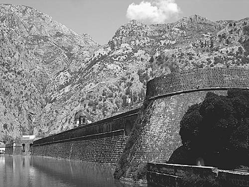
Imagine what it took to create this “Great Wall of Kotor.” The wall is nearly three miles long and sits on some extremely inaccessible terrain. It was built in fits and starts over a millennium (9th-19th century, though most of it was completed during the Venetian occupation in the 17th and 18th centuries). Its thickness varies from 6 to 50 feet, and the tallest parts are 65 feet high. Sections higher on the hill—with thinner walls, built before the age of gunpowder—are the oldest, while the thick walls along the water are the most recent. It was all worth it: The fortified town survived many attacks, including a two-month Ottoman siege in 1657.
If you’re in great shape, consider scrambling along the walls and turrets above the Old Town.
Cost and Hours: Entry to the walls is €8, generally open daily 8:00-20:00.
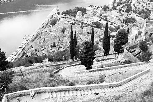
Hiking the Walls: If you go all the way up to the top fortress and back again, it’ll take around an hour and a half round-trip (depending on how fast you go). This involves climbing 1,355 steps (an elevation gain of more than 700 feet)—don’t overestimate your endurance or underestimate the heat. (“Am-I-that-out-of-shape?” Tourists routinely find themselves winded and stranded high above town.) Bring plenty of water, along with a hat and sunscreen, and wear sturdy shoes. The footing can be quite tricky here (you’ll notice this as you hike up to the entrance): The many marble stairs are slippery even when dry, polished to a high shine by the feet of centuries of visitors. This can be especially treacherous on your way back down (if you have hiking poles, bring them). The terrain alternates between these stairs, tramps, and plenty of rough, rocky patches.
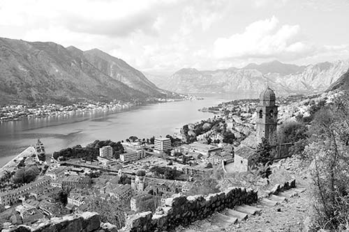
It’s best to tackle the walls clockwise. (Even if you’re not doing the hike, you can visually trace this route.) Find the entrance at the back-left corner of town (near St. Mary’s Church, through the alley with the two arches over it). Pay the entry fee and begin hiking up. On the way up, you might see the sign explaining that the fortress reconstruction was funded by the United States in 2004—if you’re a US taxpayer, consider this hike your tax dollars at work.
First climb as high as the Church of Our Lady of Health (Crkva Gospe od Zdravlja). This is the halfway mark—about 20 minutes from the base at a good pace. While some believe this church has miraculous healing powers, everyone agrees it offers some of the best views down over Kotor.
From this church, you can either cut back down toward the Old Town, or—if you’re not exhausted yet—keep hiking up to the tippy-top Fortress of St. John (figure another 30 minutes from the church, if you’re in decent shape). Built on the remains of fortifications from the Illyrians (you can scan the third-century-BC remains just beyond the fort), this was the headquarters for the entire wall network below it. There’s not much to see here, but it is fun to play “king of the castle” exploring the ruined shell—and the views, with 360 degrees of Montenegrin cliffs, are spectacular.
Once you’ve finished touring the wall, enjoy your reward: a downhill walk with head-on views of the Bay of Kotor. On the way down, watch your footing on the slick rocks. (The ticket seller warned me that he’s often seen people wipe out on the very last step on their way down—so exhausted after the demanding hike that they let their guard down.) At the round terrace below the church, you can head to the right (back the way you came); or, for a different path, head left following powder magazine signs, then down (right) at the fork.
Boat Trips
From the embankment in front of the Old Town, you’ll see posters advertising boat trips out on the Bay of Kotor, including to Perast and its island (€20) and to a more distant “Blue Cave.” If you have plenty of time here and want to get out on the water, you can chat with salespeople along here to understand your options.
Sleeping in Kotor
Kotor is an enjoyable place to spend the night. (Given its popularity as a cruise port, and among side-trippers from Dubrovnik, only a tiny fraction of visitors bother to sleep here.) However, the town comes with a good bit of nighttime noise from boisterous bars. Assume it’ll be loud anywhere, try requesting a quiet room when you book...and pack earplugs.
$$$ Hotel Vardar, smack-dab in the middle of the Old Town, has 24 rooms with mod bathrooms. This classic old copper-roofed hotel has been renovated from top to bottom, leaving it tastefully chic and at the top of this price range. While convenient, the dead-central location can come with some noise, especially on weekends—request a quieter room (elevator, Stari Grad 476, +382 32 325 084, www.hotelvardar.com, info@hotelvardar.com).
$$$ Hotel Villa Duomo is a stylish refuge just down the street from the cathedral. The 13 stony-chic rooms share an interior terrace where breakfast is served in good weather (includes breakfast, elevator, Stari Grad 385, +382 32 323 111, www.villaduomo.com, villaduomo@yahoo.com).
$$ Hotel Astoria is a midrange boutique hotel with nine handy rooms right in the heart of town (includes breakfast, elevator, Trg od Pošte, +382 32 302 720, www.astoriamontenegro.com, kotor@astoriamontenegro.com).
$ D&Sons Apartments has six good, upscale apartments along an atmospheric, café-lined lane at the back edge of the Old Town (no breakfast but kitchenettes, Stari Grad 490, +382 69 050 094, www.dandsons.com, dandsons@gmail.com, Dražan).
¢ Old Town Hostel is a budget option in the Old Town, filling a stony, labyrinthine 13th-century building with options ranging from 10-bed dorms to overpriced private rooms. There’s youthful conviviality in the lounge and an inviting pool (no breakfast but kitchen in each room, Stari Grad 284, +382 68 437 471, www.hostel-kotor.me, info@hostel-kotor.me).
Eating in Kotor
In coastal, Italian-influenced Kotor, the cuisine is similar to Croatia’s: seafood, pasta, and pizza. There are a few local specialties to look for, and at the top of the list is Njeguški pršut, the delicious smoked ham from the village of Njeguši high in the mountains above town (described later, under “The Montenegrin Interior”). While pršut (prosciutto) is beloved throughout the Balkans, Njeguški pršut’s rich, salty, smoky flavor is something special. It goes well with the local cow’s cheese—smoked, of course.
Montenegro produces some surprisingly good (and expensive) wines. The biggest producer in the country—and one of the biggest in the Balkans—is Plantaže Podgorica, which corks up some 20 million bottles each year. While that kind of volume often doesn’t come with quality, Plantaže’s vintages are quite good and worth trying (if not impossible to avoid). The most popular red-wine grape is the dry, medium-bodied vranac (VRAH-nahts), which is distantly related to Italian primitivo, Californian zinfandel, and Croatian plavac mali. For white, you’ll see the dry, fruity krstač (kur-STACH), similar to riesling.
As far as choosing restaurants in Kotor, there’s not much to recommend. Truly great cuisine is rare here—I’d just settle for something scenic and functional. For a better-quality, memorable meal in a romantic setting, drivers can consider heading to Konoba Ćatovića Mlini or Restoran Stari Mlini (described later).
On St. Tryphon Square: Several eateries cluster around St. Tryphon Square, facing the cathedral. Many of these are tourist traps, so come here for the view and ambience rather than a good value. $$ The Square Pub, though basic, has a slight edge for its reasonable prices and point-blank cathedral views.
Local Fish: Buried deep in the Old Town, $$$ Cesarica offers unpretentious seafood in a casual, stony interior. They enjoy bragging that the owner, Petar, was a fisherman, so he has a line on the freshest ingredients (daily 9:00-23:00, Stari Grad 375, +382 69 049 733).
Market: Just outside the Old Town wall, facing the harbor, is a lively open market that hops each morning (typically 9:00-14:00, busiest on Sat). This is a great place to gather ingredients for a picnic, including lots of local cheeses and the delicious local prosciutto, Njeguški pršut.
Cool Hangouts at the South End of Town: If you’d like to find a chill spot for a drink or a meal, wander down the street below the cathedral (to the southern tip of town). In this less touristy area, the Old Town Hostel anchors a fun little pod of clubs and simple eateries (including the wine bar Vinograd and The Nitrox, a “diving and rock bar”). This can be a fun stretch to explore.
Just Outside the Old Town, Around the Harbor
For a couple of other interesting dining possibilities, leave the Old Town, turn left, and curl around the harbor about five minutes.
$$ Tanjga is your very rustic and lowbrow option for a huge platter of local grilled meat specialties. This place would never pass health codes back home—it’s not for the squeamish—but it’s practically a place of pilgrimage for adventurous meat lovers willing to go with the flow. Entering, you’ll survey a glass display case with a staggering variety of meats. Assemble your dream platter—owner Boris will grab your picks barehanded and slap them on a plate. Then, while they’re grilling it up, find a seat either in the cramped interior or out on the back terrace, overlooking a grubby parking lot with cats begging for scraps. If you’ve read this far, you’ll enjoy one of the biggest and most delicious carnivorous feasts this region has to offer (daily 10:00-22:00, easy to miss—look for it along the roadside strip on your right just after you leave the harbor, +382 69 863 836). For a primer before you go, read the “Balkan Flavors” sidebar on here.
$$$ Restaurant Galion is a good choice for a scenic splurge away from the tight streets of the Old Town. With a menu of seafood and pastas, it feels elegant—with indoor and outdoor seating looking across the harbor at the town and city walls (daily 12:00-22:00, Šuranj bb, +382 32 325 054). To find it, just stay along the water (even as the road veers away from it).
NEAR KOTOR
These very scenic eateries are situated on or near the bayside road, handy for dinner on your way back to Croatia. The first two sit in oasis-like settings near running water, which helps keep them cool during the hot summer months. (For similar restaurants just over the Croatian border in Konavoski Dvori, see here.)
In Ljuta
$$$$ Restoran Stari Mlini has a cozy interior and wonderful outdoor seating scattered around a spring-fed stream near an old, namesake water mill. Surrounded by trickling water, you’ll dine on local cuisine, with an emphasis on seafood; if you prefer freshwater fish, they also have trout. Go for a scenic stroll on the premises—through the woods, over rustic bridges, and out to the bay—to find the pools of sea bass and trout (daily 12:00-23:00, +382 32 333 555).
Near the Verige Strait, in Morinj
$$$$ Konoba Ćatovića Mlini is a memorable place worth the trek. Hiding in a sparse forest off the main fjordside road, this oasis is situated amidst a series of ponds, streams, waterfalls, and bubbling springs, with both indoor and outdoor seating. The traditionally clad waiters are stiffly formal, mindful of the restaurant’s good reputation. Family-run for 200 years, it’s a local institution, yet it feels like a well-kept secret. Reservations are essential in summer (extensive wine list, daily 12:00-21:00, +382 32 373 030, www.catovica-mlini.com). At the town of Morinj, watch for burgundy Konoba Ćatovića Mlini signs leading away from the water.
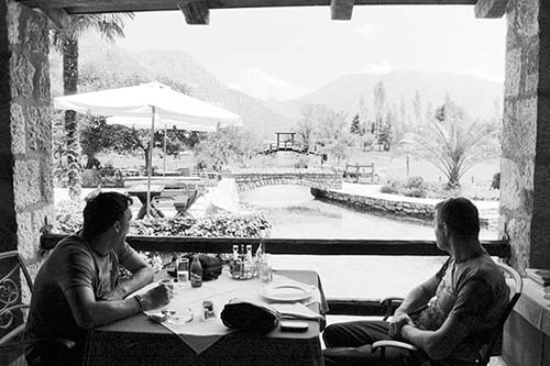
$$ Tramontana is a more affordable, still very scenic option overlooking a beach with grand fjord views, right along the main waterfront road on the way out of Morinj (daily 8:00-24:00, +382 68 737 737).
Kotor Connections
From Kotor by Bus to: Perast (hourly, usually at :20 past the hour, every 2 hours on Sun, 30 minutes, departs from small bus stop near Old Town rather than bus station—the same bus continues to Herceg Novi in about 1 hour), Budva (2-3/hour, 40 minutes), Cetinje (2-3/hour, 1.5 hours), Dubrovnik (5-6/day in summer, less off-season, 2-3 hours—or much longer with border delays), Mostar (2-3/day via Trebinje—likely at 11:00 and 22:00, 9 hours; also 1/day via Dubrovnik—likely at 14:40, 5.5 hours), Zagreb (1/day overnight—usually departs at 18:00, 13-16 hours). Bus info: +382 32 325 809, www.autobuskastanicakotor.me.
The Montenegrin Interior
Although Montenegro is trying to cultivate a glitzy beach-break cachet, for most of its history it has been thought of as a rugged mountain kingdom. Although the coast—the focus of most of this chapter—was traditionally Venetian or Austrian, the true heart of Montenegro beats behind the sheer wall of mountains rising up from that seafront. And romantics, caught up in misty Balkan fantasies, still think of this inland area as the “real” Montenegro.
While the Bay of Kotor is the most accessible and appealing part of the country, those with more time might enjoy a detour up into the mountains. I’ve outlined a route that takes you to the historic capital of Cetinje—a dull little town in its own right, but a good excuse for a mountain joyride—with some optional stops and detours en route. You could do this whole loop in about 2.5 hours without stopping (about an hour from Kotor to Cetinje, then another hour to Budva, then a half-hour back to Kotor)—but if you want to go up to Lovćen, or stop to stretch your legs in Njeguši or Cetinje, allow more time.
Montenegrin Interior Driving Tour
The Road into the Mountains
The road to Cetinje twists you up the mountain face that stretches high above Kotor—it’s an incredibly scenic, white-knuckle drive. (Particularly because it can be clogged with cruise excursion buses, timid drivers may want to skip it.)
From Kotor, leave town toward Budva (bearing left at the roundabout). At the edge of Kotor, after the cemetery but before the big tunnel, take a right (marked for Cetinje) and begin your ascent. Cresting the first hill, go left to get to Cetinje (also marked for Njeguši). You’ll wind up and up on 25 switchbacks; each of these is numbered, but the lower ones have been graffitied over. The road is a souvenir from the Habsburg era (1884). While Venetian rule brought sea trade, Austrian rule brought fortresses and infrastructure. After switchback #13, you’ll pass an old customs house marking the former border between the Austro-Hungarian Empire and the Kingdom of Montenegro—a reminder that the coastline was not historically an integral part of Montenegrin cultural identity. As you near the top, past the sign for Njeguši, look across the canyon to the left to spot the impossibly rough little donkey path that once was Cetinje’s connection with the coast...like a tenuous umbilical cord tethering the mountainous interior to the outside world.
As you crest the hill, the vegetation changes—you’re high above the Adriatic, with commanding views of Kotor and its bay (and great photo-op pullouts; the best is at the very top). Continuing inland, you find yourself in another world: poor, insular, and more Eastern (you’ll see more Cyrillic lettering). Country farmhouses sell smoked ham, mountain cheese, and medovina (honey brandy).
Reaching the top of the road, you’ll pass a turnoff on the right for Lovćen. This is a longish detour (figure 15 minutes each way from here, plus a 300-stair climb from the parking lot to the monument). But if the weather’s clear and time allows, it’s well worthwhile (see next).
Otherwise, you’ll wind up passing through a broad plain and the hamlet of Njeguši (described soon).
Lovćen
Lovćen (LOHV-chen) is the 5,738-foot peak, with slopes covered in thick forests, that gave this country its name (“black mountain”). The mountain is capped by a mausoleum, built in 1971, for the beloved Montenegrin king Petar II Petrović-Njegoš (1813-1851), with sculptural works by the great Croatian artist Ivan Meštrović and sweeping panoramic views over a huge swath of Montenegro. Lovćen and its mausoleum appeared as the national icon on the emblem of the Yugloslav-era Socialist Republic of Montenegro (Slovenia chose Mount Triglav, Croatia the sea, and Bosnia-Herzegovina...its towering smokestacks). During the Tito days, Lovćen was a must on the grand tour of iconic Yugoslav sights. Today, while largely forgotten by many, it still offers a thrilling mountaintop-viewpoint experience and some beautiful statues. For Yugoslavia nostalgists, it’s easily worth ▲▲.
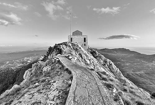
Cost and Hours: €5, daily 9:00-17:00, shorter hours off-season.
Visiting Lovćen: You’ll twist up the road, park (near the café and WCs), then hike up 300 stairs—mostly through a tunnel carved into the rock. Emerging at the top, you’ll enter the austere mausoleum of Petar Njegoš, stoically guarded by Ivan Meštrović-carved caryatids in traditional Montenegrin dress. Inside are more Meštrović sculptures, including a statue of Petar himself with an eagle.
Then loop around back (don’t miss Petar’s actual tomb, hiding in the lower level) and walk on the narrow causeway to the circular viewpoint. From here, you have stunning views over almost the entire country. Straight ahead, you can see one part of the Bay of Kotor. To the left, between the peaks, is the shimmering Adriatic. And to your right stretches the Montenegrin interior. Visually follow the road in the valley below you from left to right, from Njeguši to Cetinje; in the background looms the sprawling modern capital city of Podgorica. Farther to the right you’ll see Lake Skadar, which extends far into neighboring Albania (the mountains on the horizon).
After visiting Lovćen, you’ll retrace your route back down the mountain to rejoin the main road. Turn right to continue to...
Njeguši
The humble-seeming village of Njeguši (NYEH-goo-shee) is actually well known among Montenegrins, with two very important claims to fame. This was the hometown of the House of Petrović-Njegoš, the dynasty that ruled Montenegro for much of its history (1696-1918). The family’s favorite son was Petar II Petrović-Njegoš (1813-1851), who is honored by the mausoleum that hovers high above in Lovćen (described earlier). Aside from ruling the country, Petar II is remembered most fondly as a great poet and playwright—sort of the Montenegrin Shakespeare.
Njeguši is also famous for producing its own special type of air-dried prosciutto, called Njeguški pršut. Locals explain that, because this meadow overlooks the sea on one side and the mountains on the other, the wind changes direction 10 times each day, alternating between dry mountain breeze and salty sea air—perfect for seasoning and drying ham hocks. For good measure, the pršut is also smoked with beech wood. (While this prosciutto is delicious, foodie purists point out that the meat itself is hardly top quality—if so, Montenegrins wouldn’t obscure its flavor with so much smoke. In fact, while most of the pork used to be locally raised, you’ll notice a striking lack of pigs these days; now that raw ingredient is mostly imported.)
The blocky, white buildings lining the road that look like giant Monopoly houses are actually smokehouses, jammed with five layers of hanging ham hocks—thousands of euros’ worth—silently aging. (More industry than you realize hides out in sleepy villages.) A couple of traditional restaurants at the heart of the village are happy to serve passing tourists a lunch of this local specialty, or you can sample it at the market back down in Kotor. For more on pršut, see the sidebar on here.
From Njeguši to Cetinje
Continuing through Njeguši toward Cetinje, you’ll twist up into more mountains—soon arriving in an even more rugged and inhospitable landscape than you passed on the road that brought you here from the coast. Eyeing this desolate scenery, you can understand why the visiting Lord Byron said of this place, “Am I in paradise or on the moon?” Along the mountain road that drops you down into Cetinje, each rock has the phone number of a vulture-esque road-repair service (auto slep) spray-painted onto it. Low-profile plaques mark the sites of Tito-era ambush assassinations. Keep an eye out (on the horizon to the right) for the pointy peak of Lovćen, described earlier.
Soon you reach the outskirts of...
Cetinje
Cetinje (TSEH-teen-yeh)—the historic “Old Royal Capital” of Montenegro—is a fine but fallen-on-hard-times little burg that sits cradled in a desolate valley surrounded by mighty peaks. The home of the Montenegrin king since the 15th century, the city was destroyed and rebuilt several times. Under Tito, it provided shoes and refrigerators for the country, but when Yugoslavia disintegrated, so did the viability of Cetinje’s economy. Many of its younger generation have left for employment along the coast in the tourism industry.
Park in the town center and stroll the main street (called—what else?—Njegoševa). At the end of this drag is the main square (Balšića Pazar), surrounded by low-key sights with sporadic opening hours: the Ethnographic Museum (traditional costumes and folk life), Historical Museum (tracing the story of Montenegro), Njegoš Museum (dedicated to the beloved poet-king Petar II Petrović-Njegoš), and National Museum, which honors King Nikola I, who ruled from 1860 until 1918. While his residence is as poor and humble a royal palace as you’ll see in Europe, Nikola I thought big. He married off five of his daughters into the various royal families of Europe.
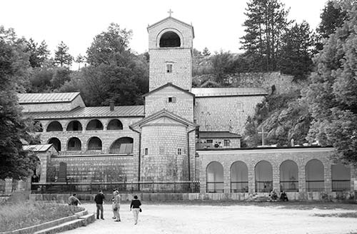
A short walk from the palace is the birthplace of the town, Cetinje Monastery. It’s dedicated to St. Peter of Cetinje, a legendary local priest who carried a cross in one hand and a sword in the other, established the first set of laws among Montenegrins, and inspired his people to defend Christian Montenegro against the Muslim Ottomans. The monastery also holds the supposed right hand of St. John the Baptist. You are free to wander respectfully through the courtyard and church of this spiritual capital of Serbian Orthodox Montenegro.
From Cetinje Back to the Coast
To avoid backtracking down the same twisty road you came up, consider heading more directly back toward the coast from Cetinje. Just follow signs for Budva. A few miles outside Cetinje along this road, look for the good $ Restoran Konak, which serves up tasty traditional dishes with indoor and outdoor seating (daily 8:00-23:00, +382 41 241 241).
Continuing along this road, you’ll pop out high above the Budva Riviera. Looking out to sea, you’ll spot the distinctive peninsula of Sveti Stefan off to the left and the town of Budva to the right. If you have more time, linger along the coast to visit these sights (described next). Otherwise, head right to return to Kotor or Dubrovnik.
The Budva Riviera
Montenegrins boast, “Croatia’s got islands, but we’ve got beaches!” Long swaths of coarse-sand and fine-pebble beaches surround the resort town of Budva, just south of Kotor. This 15-mile stretch of coast, called the Budva Riviera, is unappealingly built up with a mix of cheap and luxury resort hotels—making it pale in comparison to the jagged saltiness of the Bay of Kotor or the romantic tidiness of Dalmatia. This region is a mecca for super-wealthy Russians staking their claim to this patch of Adriatic seafront. But the area isn’t without its charms. Aside from the pleasant Old Town of the region’s unofficial capital, Budva, you’ll discover a near-mythical haunt of the rich and famous: the highly exclusive resort peninsula of Sveti Stefan, an alluring view from afar, but virtually impossible for nonguests to visit. For me, more time in Kotor or an earlier return to Dubrovnik would be more satisfying than the trek to the Budva Riviera. But beach lovers who have plenty of time and a spirit of adventure will find this area merits a look.
GETTING TO THE BUDVA RIVIERA
Budva is about a 30-minute drive south of Kotor. The easiest approach is to continue past Kotor along the fjord, left at the roundabout, then through the tunnel (following Budva signs). First, you’ll reach the town of Budva (turn right at the traffic light, following brown Stari Grad signs to the Old Town; parking is well marked in a modern complex next to the Old Town). Continuing around the bay, you’ll pass the busy, modern resort cluster of Bečići before reaching Sveti Stefan.
Sights on the Budva Riviera
Between the strings of resort hotels are two towns that deserve a quick visit.
Budva
The Budva Riviera’s best Old Town has charming Old World lanes crammed with souvenir shops and holiday-making Serbs and Russians. While less appealing than Kotor, Budva at least offers a taste of romance between the resort sprawl.
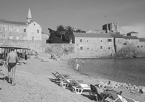
Budva began as an emporium (market and trading center) for Greek seamen, and extremely valuable jewelry uncovered here indicates that some important people spent time here. Today, Budva’s layout is simple and intuitive—a peninsula (flanked by beaches) with a big Venetian-style bell tower.
From the parking lot, head inside the Old Town walls and wander up the main drag, Njegoševa. At the tip of town, you’ll pop out into a small café-lined square with a Catholic church (on the left, with an unusually modern 1970s mosaic behind the altar depicting St. John preaching on the Montenegrin coast) facing the Orthodox Holy Trinity Church, with gorgeous and colorful Orthodox decorations inside. Beyond that is a huge citadel that’s imposing on the outside but dull on the inside; it’s not worth paying to tour its museum of model ships, antiquarium (old library), restaurant, and less-than-thrilling sea views.
Sveti Stefan
Like a mirage hovering just offshore, the famously exclusive luxury hotel that makes up the resort peninsula of Sveti Stefan beckons curious travelers to come, see, snap a photo...and then wish they’d spent more time elsewhere. While scenic, there’s not much to actually experience at Sveti Stefan (unless you’ve got deep pockets to rent a room); it’s a great photo op, but it disappoints many who make the trip.
Once an actual, living town (connected to the mainland only by a narrow, natural causeway), Sveti Stefan was all but abandoned after World War II. The Yugoslav government developed it into a giant resort hotel in the 1950s. As old homes were converted to hotel rooms, the novelty of the place—and its sterling location, surrounded by pebbly beaches and lush scenery—began to attract some seriously wealthy guests.
During this resort’s heyday, in the 1960s and 1970s, it ranked alongside Cannes and St-Tropez as a place to see and be seen on Europe’s beaches. You could rent a room, a house, a block of houses, or even the entire peninsula. Anonymity was vigilantly protected, as the nicest “rooms” had their own private pools (away from public scrutiny), lockable gates, and security guards. Lured by Sveti Stefan’s promise of privacy, celebrities, rock stars, royalty, and dignitaries famously engaged in bidding wars to decide who’d be granted access to the best suites: Whoever put the most money in a sealed envelope and slipped it to the manager won. (According to local legend, Sly Stallone’s money talked.) Guests were pampered—indulged no matter how outrageous their requests. Sophia Loren, Kirk Douglas, Doris Day, and Claudia Schiffer are just a few of the big names who have basked on Sveti Stefan’s beaches.
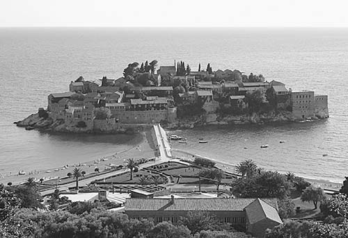
By the late 2000s, Sveti Stefan had experienced a dramatic decline. The Yugoslav Wars scared visitors away, its cachet faded, and the resort grew a bit rough around the edges. Then the Indian company Aman Resorts swept in with ambitious plans to restore the island to its former status as one of the world’s most exclusive, crème-de-la-crème resorts (www.aman.com). However, the hotel was hit hard by the Covid-19 pandemic, and it may or may not have reopened by the time you visit. Even when it’s open, guards carefully monitor the causeway, letting only guests (no exceptions, don’t bother asking) cross over into the fantasy world of Sveti Stefan. If you’re desperate to check it out, you can reserve a table at the expensive restaurant. If you want to relax on the beaches flanking the causeway, most areas charge around €50 per person for the day, but there are a few free areas—ask the guard for pointers.
Across the water from Sveti Stefan, on its own little cove, is one of Tito’s former vacation villas (Villa Miločer, also part of the Aman resort). From here, you can enjoy the promenade that runs from the beach in front of the villa and to the next cove; eventually, this path will let you stroll along the water all the way to Budva.
Getting to Sveti Stefan: Sveti Stefan is just three miles beyond Budva. Coming around the bay from Budva (following signs toward Bar), you’ll pass above the peninsula on the main road, watching for the well-marked pullout on the right that offers classic views. After snapping your photos, if you want to get closer, continue down and turn off to the right, following signs to Hotel Sveti Stefan; you can park in the pay lot and walk along the beach as far as the causeway.
From Sveti Stefan to Dubrovnik: Figure 1.5 hours to the Croatian border (if you go via Tivat—rather than Kotor—and use the shortcut ferry between Lepetane and Kamenari, described earlier in this chapter), then another 45 minutes to Dubrovnik.