NEAR BRUGES: FLANDERS FIELDS
These World War I battlefields, about 40 miles southwest of Bruges, remain infamous in military history. In Flanders Fields, the second decade of the 20th century saw the dawn of modern warfare: machine guns, trenches, poison gas, and a war of attrition. The most intense fighting occurred in the area called the Ypres Salient, a nondescript but hilly—and strategic—bulge of land just east of the medieval trading town of Ypres. (Ypres is pronounced EE-preh, but the Flemish call it Ieper and pronounce it EE-per.) Over a period of three and a half years, hundreds of thousands of soldiers drew their last breaths here. Fields and forests turned first into trenches and battlefields, and then into desolate, muddy wastelands, devoid of life.
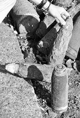
Today, visitors driving through this part of Flanders will pass countless artillery craters, monuments and memorials, stone markers of this advance or that conquest, and war cemeteries alternating with pastureland. Farmers here pull rusty relics of World War I from the earth when they till their fields. Many locals have their own garage collection of “Great War” debris fished out of a field. Human remains are regularly disinterred, with every effort made to identify the fallen soldier and notify any surviving family.
If you’re interested in this chapter of history, you can visit several Flanders Fields sights in a one-day side trip from Bruges or Ghent (best by car or guided tour). The most important and accessible sights are the pleasant market town of Ypres, with its impressive In Flanders Fields Museum; the town of Passchendaele, with a nearby museum (humble but interesting); and Tyne Cot Cemetery, where thousands of enlisted men from the British Commonwealth are buried and honored. Because most of the fighting here involved British Commonwealth troops, the majority of visitors are Brits, Canadians, Australians, and New Zealanders, for whom the stories of Flanders Fields are etched, like names on gravestones, into their national consciousness. You’ll notice on maps that many places have English names—often anglicized approximations of the Flemish names (Passiondale for Passchendaele) or evocative new names (Mount Sorrow, Hellfire Corner).
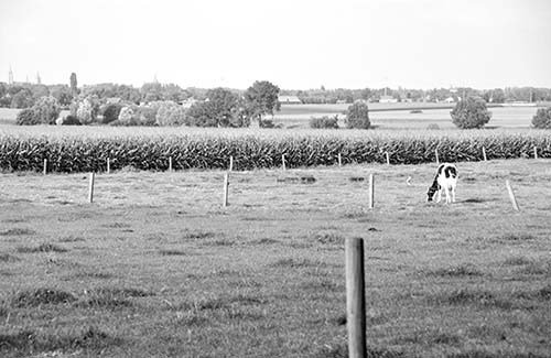
Between the sights, you’ll drive through idyllic Belgian countryside, streaked with cornfields, dotted with pudgy cows, and punctuated by the occasional artillery crater—now overgrown with grass or trees, or serving as a little pond.
GETTING THERE
To see the scattered sights around Ypres, you’ll need to rent a car or take a tour (from Ypres or Bruges). It’s also possible to connect several sights by bike from Ypres, either with or without a tour. Be aware that road signs and transportation timetables use the Flemish “Ieper,” not “Ypres.”
By Tour: To delve into Flanders Fields, your best bet is to take a tour. Several companies based in Ypres run tours of the area, each looking at the war through a slightly different lens and stopping at off-the-beaten path sites you’d likely not find on your own. For information on these tours—which include half-day, full-day, and multiday options, some tailored to your own interests—check the Ypres TI website (www.toerismeieper.be). I’ve had excellent experiences with Jacques and Genevra at Flanders Battlefield Tour, Ypres-fbt.com. If you’re coming from Bruges, you may find it more convenient to take the Quasimodo big-bus tour (described on here).
With a Guide: Roger van Buynder can pick you up in Ghent or Bruges and take you on a thoughtful and comprehensive tour of the Ypres Salient (+32 495 120 517, roger.van.buynder@gmail.com). Bruges-based guide Sylvie Brems will tour you through the battlefields and Ypres in your car (+32 478 822 978, sylvie.brems@gmail.com).
By Car: Here are two possible one-day plans for seeing the sights listed in this chapter. From Bruges, to make a beeline to Ypres, head south on the A-17 expressway all the way to A-19 and head west, following Ieper Centrum signs. After touring Ypres’ museum and visiting the Menin Gate, you can explore the countryside sights that most interest you, consider returning to the Menin Gate for the Last Post at 20:00, then head back to Bruges (fastest route between Ypres and Bruges: A-19 expressway east to the A-17 interchange near Kortrijk, then zip north on A-17).
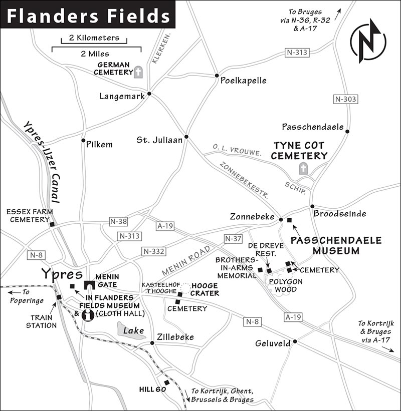
For a slower, more scenic route, leave A-19 before Ypres at the Zonnebeke-Beselare exit and navigate to Hill 60 as a first stop (see “Near Ypres,” later). The rest of the sights in order trace a northern loop before dropping into the town itself.
By Bike: The flat or gently rolling terrain around Ypres lends itself to cycling, and dedicated bike paths and quiet lanes, well signed with a system of numbered “nodes,” make it easy to explore (you can find apps to assist—start at www.flandersbybike.com or www.routen.be). The Ypres TI sells maps suggesting specific routes. BikingBox, near the Menin Gate, rents regular bikes and e-bikes and offers a variety of tours (daily, by appointment only off-season, Menenstraat 15, +32 477 59 23 82, https://bikingbox.be). Raida, nearby at #36, is another good place to rent bikes (closed Mon, +32 57 271 919, www.raida.cc).
Public Transportation to Ypres: You can get to Ypres by train from Bruges (hourly, 1.5 hours with a transfer in Kortrijk) or from Ghent (direct hourly, 1 hour).
BACKGROUND
Because American forces played a relatively minor role in the fighting at Flanders Fields, its history is obscure to many visitors from the US. This section will get you up to speed.
From 1830, Belgium was established as an independent and neutral state—an essential buffer zone to protect European peace, surrounded by four big powers: France, Prussia, the Netherlands, and Britain. After defeating France and unifying in 1870, Germany was on the rise—an upstart powerhouse hungry for overseas colonies to fuel its growing economy. Germany amassed an intimidating army while the rest of Europe worriedly watched. Some European nations scrambled to ally themselves with their neighbors against potential German encroachment; others threw in with Germany. Because many alliances were secret, and often conflicting, no one knew for sure exactly where anyone else stood. As H. G. Wells said, “Every intelligent person in the world knew that disaster was impending and knew no way to avoid it.”
On June 28, 1914, while on a visit to Sarajevo, the heir to the Austro-Hungarian throne, Archduke Franz Ferdinand, and his wife were assassinated by a teenage terrorist working for Bosnian Serb separatists. The Austrians held Serbia responsible and declared war. Germany joined Austria, and Russia (allied with France) backed Serbia. Through an intricate web of alliances—which ironically had been created to prevent war—soon most of Europe was drawn into the conflict. On August 4, 1914, Germany sent some 800,000 troops across the border into neutral Belgium en route to France. By August 20, they had already taken Brussels, and four days later they were in western Flanders.
The Germans expected to blow through the country quickly. But the small Belgian army—less than a quarter the size of the German army—pushed back hard, as they waited for British reinforcements to come from across the Channel. In the Battle of the Yser (IJzer) River, the Belgians opened a sea gate to flood a low-lying plain just before a German advance. This diverted the German effort slightly to the south, around Ypres.
Ypres was an ordinary town, but its surrounding, mostly flat terrain and modern weaponry turned it into a perpetual battlefield. This conflict saw the advent of the machine gun—an invention that, before the war, was called “the peacekeeper” because it was assumed that no sane commander would ever send his boys into its fire. With the machine gun, even the slightest gain in elevation was a strategic advantage. From any ridge, machine guns and artillery could mow down enemy troops—advancing armies were sitting ducks. Consequently, the low-lying ridges just east of Ypres—which came to be known as the Ypres Salient (the French term for “bulge”)—saw some of the fiercest fighting of World War I.
The First Battle of Ypres, in October and November 1914, began when German troops attempted to invade the town. It became a priority of the Allies—Belgians, French, and British Commonwealth troops—to hold the Germans at bay. Both sides sustained huge losses, but the German troops—mostly inexperienced young conscripts who had underestimated the opposition—were devastated; to this day, Germans call the battle Kindermord, “Massacre of the Innocents.”
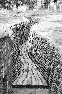
Both sides regrouped and prepared for a harsh winter. They dug trenches, as it was human nature for soldiers ducking machine-gun bullets to burrow down. Separated by as little as 50 yards, enemy armies were close enough to offer each other a Gesundheit! after each sneeze. It was during this time that the famous “Christmas Truce” took place, in which German soldiers erected little candlelit Tannenbaums beside their trenches and even approached the English trenches with gifts, kind words, and a pick-up soccer game.
During the Second Battle of Ypres, in spring 1915, the Germans used poison gas for the first time on a large scale, catching the Allies off guard. Chlorine gas (a.k.a. bertholite) reacts with moisture in the lungs to form hydrochloric acid—choking soldiers from the inside out. It was also one of the first times flamethrowers were used in battle. Still, the Germans were unable to take the town. By May 1915, the opposing forces were deadlocked near the town of Passchendaele, seven miles east of Ypres; for two years, little progress was made in either direction.
Although the Western Front appeared to be “all quiet,” each side fortified its positions. The Germans established an elaborate network of five successive trenches, connected to and supplied by one another with perpendicular “switches.” They built stout fortresses with flat tops, designed to protect troops from British artillery while allowing them to quickly emerge to man nearby machine-gun nests. These flat-top German fortresses—which you’ll see everywhere—were dubbed “pillboxes” (the Germans used the pillbox design again in World War II, but with a rounded top—which better withstood artillery blasts). The British opted for underground wooden tunnels, called “dugouts,” and reserved concrete bunkers for more specialized use as command posts and shelters for the wounded.
In the summer of 1917, the Allies attempted their own offensive against the newly strengthened German lines. This was the Third Battle of Ypres (a.k.a. the Battle of Passchendaele). The British tunneled deep beneath German lines, planted explosives, and in one cataclysmic blast detonated 19 sites along Messines Ridge east of Ypres. The sound of the explosion was said to have been heard as far away as London—but it was more likely the barrage of gunfire that followed. After a sustained two-week artillery bombardment of German positions, some four million projectiles turned the countryside into a desolate wasteland. One soldier said that “the earth had been churned and rechurned”; another termed it “as featureless as the Sahara.”
The British infantry then took to the battlefield, going over the tops of the trenches—only to face barbed wire, machine-gun fire, dangerously exposed high ground, and liquid mud. The devastation of the shelling, combined with historic rainfall, turned the Ypres Salient into a sea of mud. With the ground like quicksand, troops and tanks could barely move, and the British gained only two of the four miles they needed to conquer. This battle was the first time the Germans used mustard gas, which blistered skin on contact.
As fall approached, heavy rains continued to deluge the area, but British soldiers made inroads, bunker by bunker. Their goal was the destroyed village of Passchendaele, perched on a modest ridge with a strategic view over the flat lands below. The village’s name literally meant “passing the valley,” but the Brits dubbed it “Passiondale”...the valley of suffering. Menin Road, which connected Ypres to Passchendaele (now road N-37), was the focus of much warfare—especially the intersection dubbed “Hellfire Corner.”
In the end, British forces never succeeded in taking Passchendaele; Canadian forces finally took it in November 1917. By this point, each side had lost about a quarter of a million men in what had become a battle of attrition.
Two pivotal events took place during the winter of 1917-1918: The United States entered the war on the side of the Allies; and Germany agreed to a separate peace with Russia, allowing it to steer more men and resources to the Ypres Salient. In spring 1918, the Fourth Battle of Ypres (a.k.a. the Battle of the Lys) saw German forces trying to push through to the town of Ypres before US troops could arrive. Always innovative on the battlefield, the Germans introduced an elite squad of storm troopers (Stosstruppen, literally “shock troops”)—lightly armed but well-trained and highly mobile special units tasked with breaking through enemy lines.
But by late April, the German advance stalled for lack of supplies. Meanwhile, American troops had arrived, and by the fall of 1918, in the Fifth Battle of Ypres, Allied forces made huge gains. Less than a month later, Armistice Day (November 11, 1918) brought an end to the war to end all wars...until the next war.
World War I claimed the lives of an estimated nine million people; about one million were killed, wounded, or declared missing in action here in the Ypres Salient. In the century since, Flanders Fields has become a compelling destination for the descendants of the soldiers who fought here. As you tour the place, keep in mind that everything you see—every building, every tree—dates from after 1918.
Poppies were the first flowers to bloom in Ypres’ ravaged landscape after the war. And today, this far-western corner of Belgium is blooming once more, having adopted that flower as a symbol of sacrifice and renewal.
Sights in Flanders Fields
YPRES TOWN
About 40 miles southwest of Bruges is the town most English speakers call Ypres. By the end of the war, Ypres was so devastated that Winston Churchill advocated keeping it in ruins as a monument to the travesty of warfare. But locals did rebuild, resurrecting its charming main market square (Grote Markt), watched over by the grand and impressive Cloth Hall (which houses the In Flanders Fields Museum). Today’s Ypres is a pleasant market town (Saturday morning is market day), with a steady stream of mostly British tourists interested in the WWI sights.
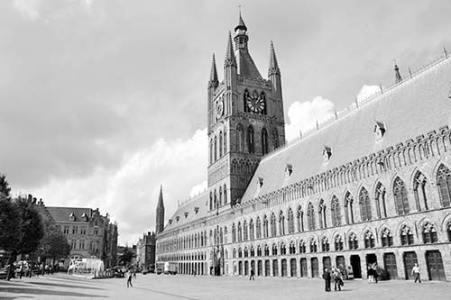
Tourist Information: The helpful TI, downstairs in the Cloth Hall, has information on tours (below the museum, Mon-Fri 9:00-18:00, Sat-Sun from 10:00, shorter hours off-season, +32 57 239 220, www.toerismeieper.be).
Helpful Hints: There’s free parking at the train station and pay parking on the main market square, next to the Cloth Hall (3-hour limit). If you’re exploring on your own, get a local guidebook and map to point you to the many additional sights beyond what I list (several are available at local bookstores and tourist offices). For practical information about the area, see FlandersFields.be.
▲▲In Flanders Fields Museum
Using artifacts and thoughtful presentations, this excellent museum offers a moving look at the battles fought on the Belgian front near Ypres. The focus is not on strategy and commanders, but on the people who fought and died here, and features personal testimony about life in the trenches.
Cost and Hours: €12; Mon-Fri 10:00-18:00, Sat-Sun until 17:00, off-season 10:00-17:00 and closed Mon, closed most of Jan; last entry one hour before closing, audioguide-€2, in the Cloth Hall at Grote Markt 34, +32 57 239 220, www.inflandersfields.be.
Visiting the Museum: Upon entering the high-tech displays, you’ll receive a bracelet. Once you register it, some of the exhibits are tuned to your age, gender, and country. One display shows aerial photos of the region today, which you can then select and swipe to see what it looked like from the air during the war.
Throughout the museum, large video panels show actors portraying eyewitnesses to the events of the war. One panel has Germans justifying gas attacks, followed by a different German describing the aftermath—“even the insects died.” In a small theater is a moving exhibit featuring doctors and nurses talking about treating the wounded and dying.
Nearby: The Cloth Hall’s belfry (231 steps to the top, €2 extra) offers a panoramic view of the surrounding countryside.
▲Menin Gate
This impressive Victorian archway is an easy two-block walk from the museum (past the end of Grote Markt). Built into the old town wall of Ypres, it’s etched with the names of British Commonwealth victims who fought here. It marks the Menin Road, where many Brits, Canadians, Aussies, and Kiwis left this town for the battlefields and trenches, never to return. The gate is formally a mausoleum for “the Missing,” 54,896 troops who likely perished at Flanders Fields but whose remains were never found.
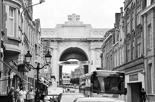
To honor the hundreds of thousands of British subjects who gave their lives, every night under the arch at 20:00, a Belgian bugle corps plays the “Last Post” to honor the dead. Arrive under the arch by at least 19:30 to get the best view (police block off the area to cars starting at 19:00).
NEAR YPRES
The sights listed here, which trace the salient north around Ypres, are just the beginning. You can’t drive a mile or two without passing a monument or memorial. Tranquil forests open into clearings with eerily rippled contours—overgrown trenches, pockmarks, and craters. Certain nondescript ponds and lakes are actually flooded artillery craters. Joining a tour or hiring a guide helps you find some of the more out-of-the-way remnants of the war. If you’re exploring on your own, get a guidebook on the region.
Hill 60 and the Caterpillar Crater
In the early morning hours of June 7, 1917, 19 sites along the Messines Ridge east of Ypres were exploded by tons of explosives laid deep underground, killing thousands of Germans immediately, spreading shock and terror among survivors, and turning hills into craters. It was the largest explosion in warfare the world had seen, and it remained arguably the largest until the detonation of the atomic bombs at Hiroshima and Nagasaki during World War II. Two years earlier, the British had assembled large numbers of mining specialists—including coal miners and gold miners from as far away as Australia and Canada—into expert tunneling units that could dig deep galleries through the Flanders clay. The explosions beneath German positions signaled the start of the Battle of Messines (part of the Second Battle of Ypres), in which the British used the newly perfected technique of “creeping barrage”: artillery shelling that preceded advancing infantry. (This also made the terrain very difficult to get through, and soldiers wearing packs weighing 60 pounds or more might simply drown in the mud.) The heaving and broken landscape here still bears the scars of this tactic.
Cost and Hours: Free and always open; Zwarteleenstraat 75, about 3 miles southeast of Ypres; from A-19, take the Zonnebeke-Beselare exit, jog south on N-303 to N-8 (toward Ypres), then turn left on Pappotstraat, right on Wervikstraat, and follow signs to the parking lot on Zwarteleenstraat.
Visiting the Site: The area around the craters has been left raw and unrestored to commemorate the immense destruction and loss of life here—many undiscovered bones still lie beneath the soil. Signboards are posted with information and historical photos, but mostly it’s about wandering the woods and absorbing the devastation. A wooden walkway from the parking lot and entrance area leads to the deep depression that was once Hill 60—a coveted German position with a good view across to Ypres. Look for metal beams placed in the walkway to show the locations of the German and Allied frontlines: astonishingly close. Other frontline markers you’ll find here and throughout former Flanders battlefields are elm “remembrance trees,” planted in 2015. A red enclosure around a tree indicates a German position, and a blue enclosure indicates an Allied one.
You can leave the wooden walkway to walk along dirt paths past old tunnel entrances and bunkers—including a large, well-preserved German pillbox (eventually taken by the Allies) thoughtfully adorned with poppies and crosses left by visitors. Across the railroad tracks is the round crater, now filled with water, known as the Caterpillar—for the shape of the hill that once stood here. It’s a peaceful setting for reflection on the violence that permanently marked both landscapes and lives.
Hooge Crater
This giant flooded crater, about three miles east of Ypres, was created by successive mine explosions detonated in turn by both German and British forces—including the Messines Ridge explosions. The strategic high ground around the crater (where a château used for a time as British headquarters once stood) switched hands repeatedly throughout the war.
Today the Hooge Crater area has a large British Commonwealth cemetery with about 6,000 graves—about 60 percent of which are “known unto God.” Across the road is the Hooge Crater Museum, a touristy exhibit with information about the fighting here (€9, Wed-Sat 10:00-18:00, Sun until 21:00, closed Mon-Tue, Meenseweg 467, +32 57 468 446, www.hoogecrater.com). Hiding out in the woods just down the road is a hotel/restaurant called Kasteelhof ’t Hooghe, where you can pay €1 to stroll around the adjacent crater-pond and see some trenches and old bunkers—one of which is accessible (restaurant closed Sat-Sun, Meenseweg 481, www.hotelkasteelhofthooghe.be).
Nearby: € De Dreve restaurant, run by Johan and Edith Vandevalle, makes a very interesting lunch stop (daily until late, closed Wed off-season, just off A-19 at Lange Dreve 16, +32 478 558 758, www.dedreve.be). Johan is an amateur archaeologist—ask if you can go upstairs to see his small, homegrown collection of uniforms, tools, weapons, grave markers, and other artifacts.
In the restaurant, notice hats hanging along the walls. These have been left as tokens of respect—primarily by visiting Australians, for whom he is a kind of hero. In 2006, during excavations for a pipeline near here, a body was discovered that had been meticulously wrapped, arms lovingly folded across the chest. Johan, who was supervising the excavation, became determined to discover this soldier’s identity. Eventual DNA testing confirmed that it was the body of an Australian named John Hunter, who was killed in the 1917 Battle of Polygon Wood. His younger brother James had carefully laid him to rest and resolved to come back and give him a proper burial (but when James returned after the war, the body could not be found). John was reburied, with a ceremony attended by Australian family members, in the Buttes New British Cemetery near Polygon Wood. Johan spent the next decade and a half raising money and commissioning artwork for a large, poignant “Brothers in Arms” memorial across the street from his restaurant (one artwork includes text from the Dire Straits song).
▲Passchendaele Museum
Though it’s less high-tech, this exhibit supplements the In Flanders Fields Museum well with a focus on the Third Battle of Ypres (also known as the Battle of Passchendaele), which took place over about 100 days in 1917. Though the Allies could claim victory at the end, the ground they had gained—at the expense of hundreds of thousands of lives—was won back by the Germans the following year.
Cost and Hours: €11.50, includes audioguide, daily 10:00-17:30, last entry one hour before closing, closed mid-Nov-Jan, Berten Pilstraat 5a, in Zonnebeke about 5 miles east of Ypres and 2 miles west of Passchendaele, +32 51 770 441, www.passchendaele.be.
Visiting the Museum: Presented chronologically beginning on the top floor of a chalet-like mansion and continuing into the basement, this museum details each advance and retreat, from the first German boot on Belgian soil to Armistice Day. You’ll see displays of uniforms, medical instruments, and objects illustrating day-to-day life at the front. One exhibit explains—and lets you sniff—the four basic types of poison gas used here. You can lift a typical soldier’s 60-pound backpack and put on a heavy metal German breastplate worn to deflect bullets.
You’ll walk through a simulation of the wooden underground “dugout” tunnels used by British forces as their headquarters (built after artillery fire had scorched the ground above so badly there was nothing left). An immersive-experience room with videos on all four walls places you in the middle of the battlefield as the terrible chronology unfolds—and a tally of the dead runs wildly with each new surge.
Outside, you’ll walk through a reconstruction of the shallow trenches that zigzagged along No Man’s Land. Note how later trenches had slotted walkways so that soldiers didn’t have to wade through mud.
Finally, back inside the museum, you can explore the fates of various people during the war, and hear video testimony from WWI veterans—Brits, Aussies, Kiwis, and Canucks—on what it was like at Passchendaele. Behind the museum are memorial gardens—each in the shape of a poppy—dedicated to the countries that fought here.
▲Tyne Cot Cemetery
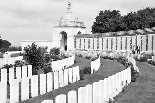
This evocative cemetery is the final resting place of 11,961 British, Canadian, Australian, New Zealander, South African, and other British Commonwealth soldiers. It was named for a blockhouse on this site that was taken by British forces, who nicknamed it “Tyne Cottage” after the river in North England.
Cost and Hours: Free, visitors center open daily 10:00-18:00, closed Dec-Jan, just northeast of Zonnebeke, off of N-37 toward Passchendaele, about 6.5 miles east of Ypres, www.cwgc.org.
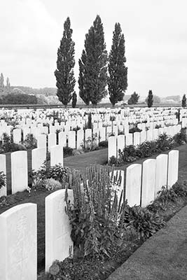
Visiting the Cemetery: The cemetery grounds hold three German pillbox bunkers and seemingly endless rows of white headstones, marked with a soldier’s name and his unit’s emblem (such as the maple leaf of Canada). Many graves are marked simply “A soldier of the Great War, known to God.” The long list of names and ages of the deceased are announced over speakers.
In the center of the cemetery, near the tallest cross (marking the location of Tyne Cottage), notice the higgledy-piggledy arrangement of graves. During the war, when this cottage was a makeshift medic station, this area became an impromptu burial ground. Any cemetery that’s neat and symmetrical—like the surrounding headstones—dates from after the war.
Running along the top of the cemetery is a wall inscribed with the names of 34,857 “officers and men to whom the fortune of war denied the known and honoured burial given to their comrades in death.” The visitors center has a few artifacts and exhibits about the fighting here.
German Military Cemetery (Deutscher Soldatenfriedhof) at Langemark
A relatively rare site dedicated to the invaders of this region, this is where 44,324 Central Powers soldiers are buried (along with two Brits who were originally misidentified). Compared with the gleaming British Commonwealth cemeteries nearby, it’s dull and drab. That’s because the Treaty of Versailles that concluded World War I forbade German WWI cemeteries from using white stones. Instead, dark horizontal stones mark the graves. As you wander the cemetery, under tall oaks, you’ll notice many Slavic names: Troops were sent to fight here from the far eastern corners of the multiethnic Austro-Hungarian Empire. In the center is a mass grave, bounded by a low wall of gray basalt, with 25,000 soldiers (cemetery located on the northern outskirts of Langemark, about five miles north/northeast of Ypres).
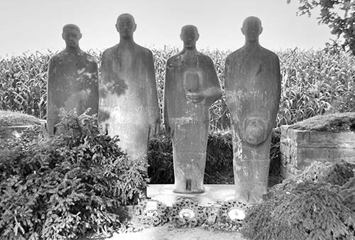
Essex Farm Cemetery
If you have time, stop at this cemetery near the Ypres-IJzer Canal just north of Ypres (on N-369, also known as Diksmuidseweg, just before N-38). It’s where Canadian soldier and surgeon John McCrae wrote his famous poem “In Flanders Fields” (see sidebar, earlier), establishing the name now commonly used for these tragic battlefields, and inspiring the use of poppies as symbols of remembrance. McCrae served as a surgeon at what was known as an “advanced dressing station” on this site, and wrote the poem after burying a young friend. A memorial commemorates his poem, and reconstructed bunkers nearby give an idea of the conditions under which he and other doctors worked. The cemetery here was started during the war, which explains the haphazard layout of many of the graves. If you see a small crowd gathered at one particular gravestone, it is likely the burial place of the youngest known soldier to die in the Great War: Valentine Strudwick, an English boy killed in action nearby when he was just shy of 16. Thinking—as many did—that he was signing up for a grand adventure, he lied about his age in order to enlist.