THE JULIAN ALPS
Vršič Pass • Soča River Valley • Bovec • Kobarid
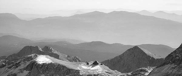
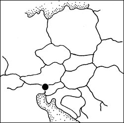
The countryside around Lake Bled is plenty beautiful. But to max out your Slovenian mountain experience, head for the cut-glass peaks of the Julian Alps. The northwestern corner of Slovenia—within yodeling distance of Austria and Italy—is where mountain culture has a Slavic accent.
The Slovenian mountainsides are laced with hiking paths, blanketed in deep forests, gurgling with intensely colorful rivers, and speckled with ski resorts and vacation chalets. And in the center of it all is Mount Triglav—ol’ “Three Heads”—Slovenia’s national symbol and, at 9,396 feet, its tallest mountain.
The single best day in the Julian Alps is spent driving up and over the 50 hairpin turns of breathtaking Vršič Pass (vur-SHEECH) and back down via the Soča (SOH-chah) River Valley, lined with offbeat nooks and Hemingway-haunted crannies. As you curl between the peaks, you’ll enjoy stunning high-mountain scenery, whitewater rivers with superb fishing, rustic rest stops, thought-provoking WWI sights, and charming hamlets.
A pair of Soča Valley towns watches over the region. Centrally situated Bovec is all about good times (it’s the whitewater-adventure sports hub), while Kobarid has Old World charm and attends to more serious matters (WWI history). Bovec and Kobarid are pleasant, functional, and convenient home bases for lingering in this gloriously beautiful region. I’ve also recommended a handful of countryside hotels and tourist farms.
PLANNING YOUR TIME
Most visitors do this area as a satisfying surgical strike on a full-day side trip from Lake Bled or Ljubljana. But there’s plenty here to make it worth slowing down and spending a night (or even longer). If you’d like to take advantage of the Soča Valley’s hiking trails, evocative WWI historical sites, and many adventure sports (especially river rafting on the Soča), and have some flexibility for the ever-changing weather, give yourself multiple nights.
Crowd Challenges: In the summer (July-Aug), this area can be very crowded with Slovenian vacationers. On peak-season weekends, some of the Vršič Pass parking lots (such as next to the Russian Chapel or at the summit) fill up, making it impossible to pull over and look around. The best advice is to avoid doing this trip in high summer, especially on weekends; if you have no choice, anticipate crowds, allow yourself a little extra time, and pack along some patience.
GETTING AROUND THE JULIAN ALPS
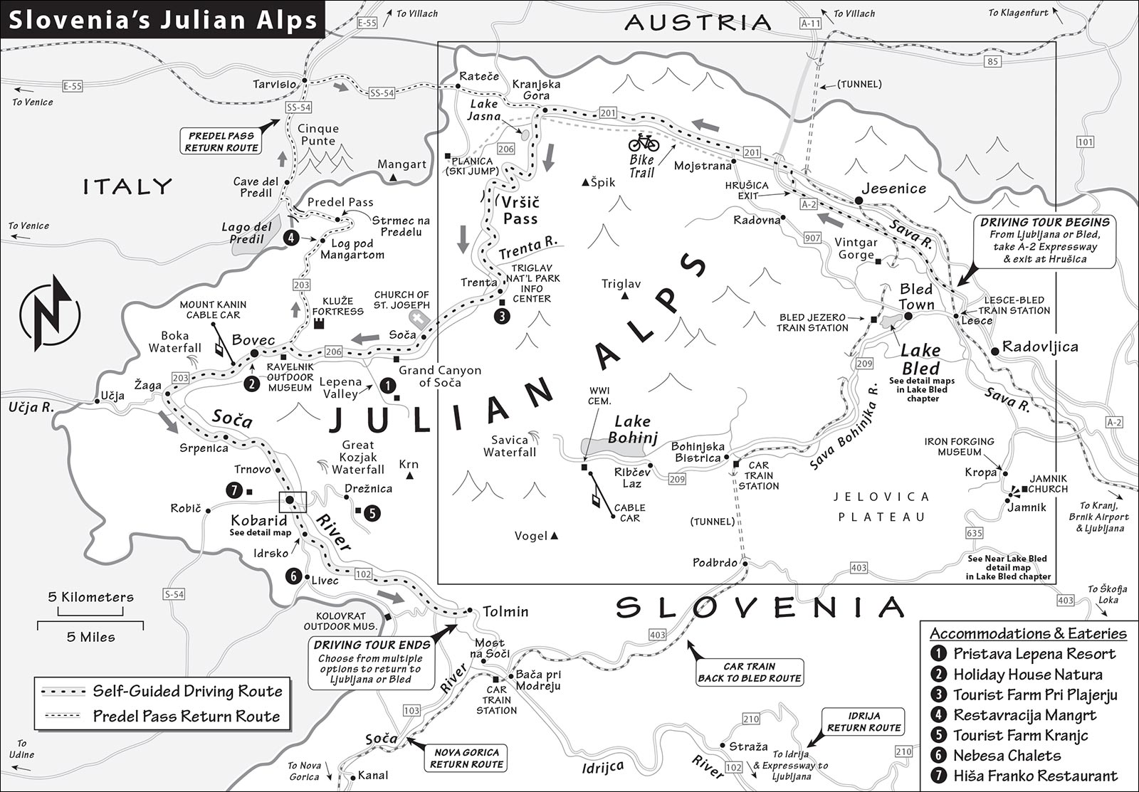
The Julian Alps are best by car. Consider renting a car here, if only for the day, to achieve maximum mountain thrills. I’ve included a self-guided drive that incorporates the best of the Julian Alps: Vršič Pass (usually open May-Oct) and the Soča Valley.
If you’re without your own wheels, hiring a local guide with a car can be a great value, maximizing not only what you see but also what you learn. Or you can choose a cheaper but less personalized day-trip excursion from Bled. (See “Tours at Lake Bled,” in the previous chapter.)
In the summer, a public bus more or less follows my driving-tour route over the Vršič Pass. These buses usually depart from Kranjska Gora, at the base of the pass, and reach Bovec in about two hours (and Kobarid about an hour later; 4-6/hour in summer). Be aware that most direct connections from Ljubljana to Bovec, Kobarid, and other Soča Valley towns skip Vršič Pass and instead take a lower-altitude, less thrilling route to the south, via Idrija (1-2/day, about 4 hours total). If you have your heart set on experiencing the Vršič Pass, do your homework to find a route that includes that road (likely via Kranjska Gora; current schedules are at www.ap-ljubljana.si or https://getbybus.com).
Julian Alps Drive
VRŠIČ PASS LOOP
This all-day, self-guided drive—rated ▲▲▲—takes you over the highest mountain pass in Slovenia, with stunning scenery and a few quirky sights along the way. From waterfalls to hiking trails, WWI history to queasy suspension bridges, this trip has something for everyone.
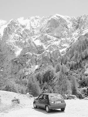
Most of the Julian Alps are encompassed by Triglav National Park (Triglavski Narodni Park). This drive starts and ends in either Bled or Ljubljana, going over the Vršič Pass and through the Soča River Valley. While it’s not for stick-shift novices, all but the most timid drivers will agree that the scenery is worth the many hairpin turns. Frequent pullouts offer plenty of opportunities to relax, stretch your legs, and enjoy the vistas.
Planning Your Drive: This drive can be done in a day (about 5 hours of driving), but consider spending the night along the way for a more leisurely pace. You can return to your starting point, or do this trip one-way as a very scenic detour between Bled and Ljubljana. These rough estimates do not include stops: Bled to the top of Vršič Pass—1 hour (30 minutes more from Ljubljana; add about 30 minutes round-trip for Planica ski-jump detour), Vršič Pass to Trenta (start of Soča Valley)—30 minutes, Trenta to Bovec—30 minutes, Bovec to Kobarid—30 minutes, Kobarid to Ljubljana or Bled—2 hours.
The best sources of information are the Bled TI (see the Lake Bled chapter), the Triglav National Park Information Center in Trenta, and the TIs in Bovec and Kobarid (described later in this chapter). Local TIs hand out good, free maps covering this area, and sell more detailed ones. If the pass is closed—or so clogged with traffic that you want to avoid it—you can still access the Soča Valley by looping around through Italy and taking the Predel Pass—a route nearly as scenic as this main option. Just reverse the Predel Pass route described on here.
From Bled or Ljubljana to Vršič Pass
From Bled or Ljubljana, take the A-2 expressway north, enjoying views of Mount Triglav on the left as you drive. About 10 minutes past Bled, you’ll approach the industrial city of Jesenice, whose iron- and steelworks once filled this valley with multicolored smoke. (It was nicknamed the “Detroit of Yugoslavia.”) Many of these old factories closed in the 1980s, and the air is much cleaner now.
Just after the giant smokestack with the billboards, the little gaggle of colorful houses on the right (just next to the freeway) is Kurja Vas (“Chicken Village”). This unassuming place is locally famous for producing hockey players: 18 of the 20 players on the 1971 Yugoslav hockey team—which went to the World Championships—were from this tiny hamlet.
As you zip past Jesenice, keep your eye out for the exit marked Jesenice-zahod, Trbiž/Tarvisio, Kr. Gora, and Hrušica (it’s after the gas station, just before the tunnel to Austria). When you exit, turn left toward Kranjska Gora and Trbiž/Tarvisio (yellow sign).
Just after the exit, the big turquoise building surrounded by tall lights was the former border station (the overpass you’ll go under leads into Austria). Locals have fond memories of visiting Austria during the Yugoslav days, when they smuggled back forbidden Western goods. Some items weren’t available at home (VCRs, Coca-Cola, designer clothes); other goods were simply better in Austria (chocolate, coffee, dishwasher soap).
Just after the exit, you’ll cross the Sava River. The main river of the former Yugoslavia, this 600-mile-long waterway begins in these mountains, flows past Ljubljana and Zagreb, defines the Croatian-Bosnian border, and finally joins the Danube in Belgrade. According to some geologists, the Balkans begin on the south bank of the Sava.
Slovenes brag that their country—“with 56 percent of the land covered in forest”—is Europe’s second-greenest. As you drive toward Kranjska Gora, take in all this greenery...and the characteristic Slovenian hayracks (recognized as part of the national heritage and now preserved). The Vrata Valley (on the left) is a popular starting point for climbing Mount Triglav. Paralleling the road on the left is a “rails-to-trails” bike path—converted from an old railway bed—that loops from here through Italy and Austria, allowing bikers to connect three countries in one day.
About two miles from the highway turnoff, at the intersection in Dovje, watch on the right for the statue of Jakob Aljaž, who actually bought Triglav—back when such a thing was possible (he’s pointing at his purchase). About five miles later, in Gozd Martuljek, you’ll cross a bridge and enjoy a great head-on view of Špik Mountain.
From here, it’s about three miles to Kranjska Gora, a leading winter resort particularly popular with Croatian skiers. As every Slovene and Croatian wants a ski bungalow here, this area has some of the highest property values in the country.
Entering Kranjska Gora, you’ll see a turnoff to the left marked for Bovec and Vršič, which leads cars up to the pass. But winter sports fanatics (or anyone, on a clear day) may first want to take a 30-minute detour to see the biggest ski jump in the world, a few miles ahead at Planica: Stay straight through Kranjska Gora, then turn left at signs for Planica. You’ll drive in along a row of eight dizzyingly high ski jumps to the modern, wood-clad Nordic Center (pay parking), with 360-degree views of alpine scenery. Today’s competitors routinely set new world records (currently 832 feet) on the outrageously steep ski-flying jump directly across from the Nordic Center. Thrill seekers who’d like to get a small taste of that experience can invest €29 (or €49 for a tandem run) in the adrenaline-pumping zipline that runs parallel to the jump. For something lower-impact, explore the Nordic Center, which has an info desk, WCs in the basement, a café with a sunny terrace, a small alpine-sports museum (overpriced and skippable for nonenthusiasts), and a wind-tunnel skydiving simulator (free entry to Nordic Center, daily July-Sept 9:00-18:00, March-June and Oct until 17:00, winter until 16:00, www.nc-planica.si). In the lower stairwell, peek through the window into the parking garage—where, in summer, artificial snow is pumped in for cross-country ski practice.
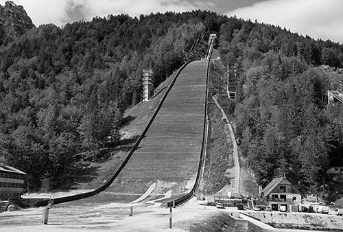
Before leaving Planica, ponder this: From this spot, you’re a few minutes’ walk from both Italy and Austria.
Back in Kranjska Gora, follow the signs for Vršič. You’ll pass (on the right) a lovely alpine lake called Jasna, created by damming the runoff-fed Pišnica streams that flow down the mountain toward the Sava. This is a popular place for fly-fishing and swimming (look for the tall, wooden diving structure). On the lakeshore, watch for the bronze Golden Horn statue (similar to one at Lake Bohnj)—a popular photo op. The touristy restaurants and cafés here are some of the last you’ll see for a while.
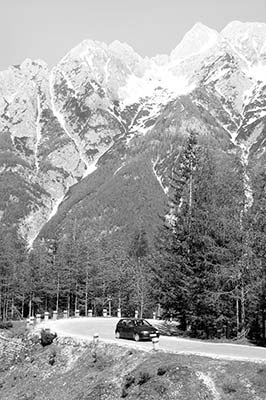
Before long, you’ll officially enter Triglav National Park and come to the first of this road’s 50 hairpin turns (24 up, then 26 down)—each one numbered and labeled with the altitude in meters. Notice that the turns are cobbled to provide better traction. If the drive seems daunting, remember that 50-seat tour buses routinely conquer this pass...if they can do it, so can you. Better yet, imagine—and watch for—the bicyclists who regularly pedal to the top. The best can do it in less than 30 minutes—faster than driving.
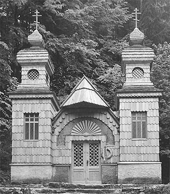
After switchback #8, with the cute waterfall, park your car on the right and hike up the stairs on the left to the little Russian Orthodox chapel. This road was built during World War I by at least 10,000 Russian POWs of the Austro-Hungarian Empire to supply the Soča Front. The POWs lived and worked in terrible conditions, and several hundred died of illness and exposure. On March 8, 1916, an avalanche thundered down the mountains, killing hundreds more workers. This chapel was built where the final casualty was found. Take a minute to pay your respects to those who built the road you’re enjoying today.
Back on the road, continue up, up, up the switchbacks. As you smell the clutch burn, be glad it’s a rental. After #16, keep an eye out (on the left) for Tonkina Koča—one of many mountain huts situated partway up the road, where hikers can pause for a break, a rustic meal, or even an overnight (its deck is a nice place to nurse a drink; open mid-June-mid-Sept, +386 41 396 645).
Just beyond, after #17, look up as high as you can on the cliff face to see sunlight streaming through a “window” in the rock. This natural formation, a popular destination for intrepid hikers, is big enough for the Statue of Liberty to crawl through.
Mount Triglav (“Three Heads”) stands watch over the Julian Alps, and all of Slovenia. Slovenes say that its three peaks are the guardians of the water, air, and earth. This mountain defines Slovenes, even adorning the nation’s flag: You’ll often see the national seal, with three peaks (the two squiggly lines under it represent the Adriatic). Or take a look at Slovenia’s €0.50 coin.
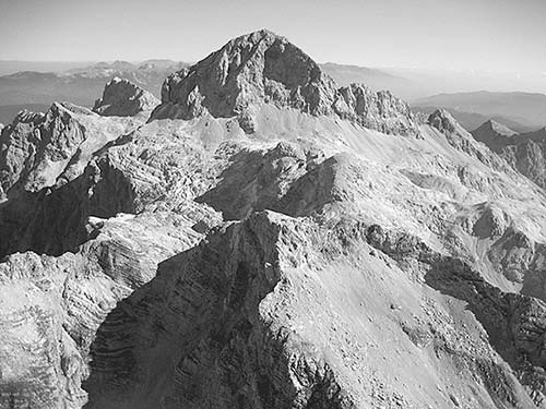
From the town of Bled, you’ll see Triglav peeking up over the ridge on a clear day. (You’ll get an even better view from nearby Lake Bohinj.)
It’s said that you’re not a true Slovene until you’ve climbed Triglav. One native took these words very seriously and climbed the mountain 853 times...in one year. Climbing to the summit—at 9,396 feet—is an attainable goal for any hiker in good shape. If you’re here for a while and want to become an honorary Slovene, befriend a local and ask if he or she will take you to the top. Or join a tour; several local companies specialize in summiting visitors.
If mountain climbing isn’t your style, relax at an outdoor café with a piece of cream cake and a view of Triglav. It won’t make you a Slovene...but it’s close enough on a quick visit.
After #22, at the pullout for Erjavčeva Koča restaurant, you may see tour-bus groups making a fuss about the mountain vista. They’re looking for a ghostly face in the cliff wall, supposedly belonging to the mythical figure Ajda. This village girl was cursed by the townspeople after correctly predicting the death of the Zlatorog (Golden Horn), a magical, beloved, chamois-like animal. Her tiny image is just above the tree line, a little to the right—try to get someone to point her out to you (you can see her best if you stand at the signpost near the road). The picnic tables here are one of the best places along this drive for a do-it-yourself feast.
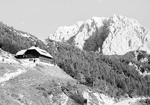
After #24, you reach the summit (5,285 feet). Consider getting out of the car to enjoy the views. Hike up to the Tičarjev Dom hut for a snack or drink on the grand view terrace. On the right, a long gravel chute gives hikers a thrilling glissade. (From the pullout just beyond #26, it’s easy to view hikers “skiing” down.) If you have time and energy to burn, consider hiking from the summit about 20 minutes uphill to the Poštarski Dom (“Postman’s Lodge,” with good food). Along the way, you’ll see the ruins of a cable-car line, which ran supplies between here and the valley floor during World War I.
As you begin the descent, keep an eye out for old WWI debris. A lonely guard tunnel stands after #28, followed by a tunnel marked 1916 (on the left) that was part of the road’s original path. A bit later, watch for the turnoff at the right, at a little gravel parking lot with a picnic table (labeled Viewpoint Šupca). From the platform viewpoint, you can see mountain valleys formed in two different ways: To the left, the jagged V-shaped Soča Valley, carved by a raging river; and on the right, the gentle U-shaped Trenta Valley, gouged by a glacier.
Continuing down, you’ll see abandoned checkpoints from when this was the border between Italy and the Austro-Hungarian Empire. At #48 is a statue of Julius Kugy, an Italian botanist who explored the alpine flora of this region.
At #49, the road to the right (marked Izvir Soče) leads to the source of the Soča River. If you feel like stretching your legs, drive about five minutes down this road to a restaurant parking lot. From here, you can take a challenging 20-minute uphill hike (which includes some stretches where you’ll cling to guide wires) to the Soča source. This is also the starting point for the well-explained, 12-mile Soča Trail (Soška Pot), which leads all the way to the town of Bovec.
Nearing the end of the switchbacks, follow signs for Bovec. Crossing the Soča River, you begin the second half of this trip.
From Vršič Pass to Soča River Valley
During World War I, the terrain between here and the Adriatic made up the Soča (Isonzo) Front. As you follow the Soča River south, down what’s nicknamed the “Valley of the Cemeteries,” the scenic mountainsides tell the tale of this terrible warfare. Imagine a young Ernest Hemingway driving his ambulance through these same hills (see sidebar).
But it’s not all so gloomy. There are plenty of other diversions—interesting villages and churches, waterfalls and suspension bridges, and more. Perhaps most impressive is the remarkable clarity and milky-blue color of the Soča itself, which Slovenes proudly call their “emerald river.”
After switchback #49, you’ll cross a bridge, then pass a church and a botanical garden of alpine plants (Alpinum Juliana, summer only).
At long last—well after you think you’re done with the pass—you finally reach the last Vršič switchback (#50), which sends you into the village of Trenta. As you get to the cluster of buildings in Trenta’s “downtown,” look on the left for the Triglav National Park Information Center, which also serves as a regional TI (May-Oct daily 10:00-18:00, closed Nov-April, +386 5 388 9330, www.tnp.si). The €6 museum here provides a look (with English explanations) at the park’s flora, fauna, traditional culture, and mountaineering history. An AV show celebrates the region’s forests, and a poetic 15-minute slideshow explains the wonders and fragility of the park (included in museum entry, ask for English version as you enter).
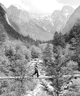
After Trenta, you’ll pass through a tunnel; then, on the left, look for a classic suspension footbridge. Pull over to walk out for a bounce, enjoying the river’s crystal-clear water and the spectacular mountain panorama. Or you can take your pick among many such bridges for the next several miles; the best is coming up soon (I’ll point it out).
About five miles beyond Trenta, in the town of Soča, is the Church of St. Joseph (with reddish-brown steeple, tucked behind the big tree on the right). During World War II, an artist hiding out in the mountains filled this church with patriotic symbolism. The interior is bathed in Yugoslav red, white, and blue—a brave statement made when such nationalistic sentiments were dangerous. On the ceiling is St. Michael (clad in Yugoslav colors) with Yugoslavia’s three WWII enemies at his feet: the eagle (Germany), the wolf (Italy), and the serpent (Japan). The tops of the walls along the nave are lined with Slavic saints. Finally, look carefully at the Stations of the Cross and find the faces of hated Yugoslav enemies: a lederhosen-clad Hitler (pulling a rope to lift up the cross; fourth from altar on left) and Mussolini (seated, as Herod; first from altar on right).
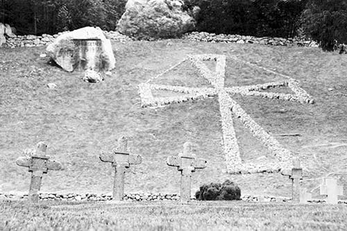
Behind the church, above the lovingly tended town graveyard, the stylized cross on the hill marks a WWI cemetery—the final resting place of some 1,400 Austro-Hungarian soldiers who were killed in action. Notice one small corner of the main cemetery (just before the WWI section) that’s marked with a red star and labeled Padli Borci Nov (Our Fallen Fighters). These are the graves of local Partisans who—two generations later—fought alongside Tito to force out the Nazis (notice the death dates: 1943, 1944, 1945).
For another good example of how the Soča River cuts like God’s band saw into the land, stop about two minutes past the church at the small gravel lot (on the left) marked Velika Korita Soče (Grand Canyon of Soča). While the entire Soča Valley is dramatic, this half-mile stretch, 30 to 50 feet deep, is considered the most impressive. Venture out onto the suspension bridge over the gorge. If the water’s high, notice the many side streams pouring into the churning river in a series of mini-waterfalls. For more views, cross over the bridge and hike down along the treacherously uneven and narrow rocky path downstream to another bridge.
Just beyond the suspension bridge is the turnoff (on the left) to the Lepena Valley, home of the recommended Pristava Lepena ranch, with accommodations, a restaurant, and Lipizzaner horses (see “Sleeping in Bovec,” later). If you head up this valley, you’ll find a big gravel pullout on the right (marked Velika Korita) that lets you cross another springy bridge over a particularly wide stretch of the river. This is a popular place for those who enjoy hiking up alongside the “Grand Canyon” we passed earlier (about 5 miles round-trip, uneven terrain).
A few miles after the Lepena Valley turnoff, watch on the left for the large barn (marked Žičnica Golobar). Pull over here if you’d like a close look at one of the stations for a primitive, industrial cable-car line, which was used mostly for logging.
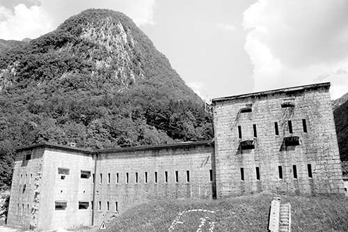
Soon you’ll exit the national park, pass a WWI graveyard (on the left), and come to a fork in the road. The main route leads to the left, through Bovec. But first, take a two-mile detour to the right (marked Trbiž/Tarvisio and Predel/Kluže), where the WWI Kluže Fortress keeps a close watch over the narrowest part of a valley leading to Italy (free to enter main courtyard, €3 for exhibit about local history and nature; June-Sept daily 9:00-17:00, may be open later in July-Aug, likely closed Oct-May). In the 15th century, the Italians had a fort here to defend against the Ottomans. Five hundred years later, during World War I, Austrians used it to keep Italians out of their territory. Notice the ladder rungs fixed to the cliff face across the road from the fort, allowing soldiers to get up to the mountaintop quickly.
Back on the main road, immediately after the Kluže turnoff, watch for the gravel pullout on the left (look for the green sign with old photos). To see some original WWI-era fortifications, pull over here and hike on the gravel path 10 minutes through the woods to reach the Ravelnik Outdoor Museum. Here you can see trenches dug into the dirt and rocks, abandoned pillboxes, rusty sheds, and other features of an evocative wartime landscape. Though not entirely typical of Soča Front embattlements—which were mostly high on the mountaintops—Ravelnik offers a more accessible taste of those times. (For a more authentic, mountaintop outdoor museum, drive 30 minutes beyond Kobarid and up to Kolovrat—described on here.)
Continue following the main road to Bovec, which saw some of the most vicious fighting of the Soča Front. The town was hit hard by earthquakes in 1994, 1998, and 2004, but today it’s been rebuilt and is the adventure-sports capital of the Soča River Valley, famous for its whitewater activities. For good lunch stops in Bovec, turn right at the roundabout as you first reach the town; you’ll pass Martinov Hram’s inviting restaurant terrace on the right, and soon after, the outdoor tables for Thirsty River brewery, with tempting food stands nearby (for details, see “Eating in Bovec,” later). But if you’re not eating or spending the night in Bovec, you could skip the town entirely (continue along the main road to bypass the town center).
About three miles past Bovec, as you cross the bridge (with the yellow Boka sign), look high up on the rock wall in the gorge to your right to spot the Boka waterfall, which carves a deep gutter into the cliff as it tumbles into the valley. (Can’t find it? Keep an eye on the left side of the cliff, tucked back in a nook.) Hardy hikers can climb up for a better view of this fall—the trailhead is just after the bridge on the right—but it’s a strenuous hike.
Head south along the spectacularly turquoise river. When you pass the intersection at the humble village of Žaga, you’re just four miles from Italy. Continuing south, you’ll pass a pullout (just before Srpenica) that is a popular put-in point for kayaking trips along the river.
After Srpenica, you’ll pass the huge TKK factory complex, which produces a wide range of chemicals.
Carry on a few more miles. Soon you’ll see signs for Kobarid, home to a sleepy main square and some fascinating WWI sights. Don’t blink or you’ll miss the Kobarid turnoff on the right (just before the big tower advertising the local creamery). Exit here, and you’ll drive into town past the highly recommended Kobarid Museum, which tells the tale of the WWI-era Soča Front. Farther along, you’ll reach the tidy main square, a good place to park—pay at the meter or on your phone—and then explore town or walk back to the museum. Driving up to the Italian mausoleum that hovers over the town is a must. (These sights are described later, under “Sights in Kobarid.”)
Leaving Kobarid, continue south along the Soča to Tolmin. (For a steep, scenic detour to some poignant WWI sites, you can turn off in Idrsko to reach the Kolovrat Outdoor Museum—described on here.) Notice the architecture transitioning from a woodsy Austrian vibe to more stony Italian (this area was historically Italian).
Before you reach Tolmin, decide on your preferred route back to civilization...
From the Soča River Valley to Ljubljana
There are two ways to complete a loop trip back to Ljubljana through more varied scenery. The first route is faster and more scenic; the second route is longer and a bit smoother. Either option brings you back to the A-1 expressway south of Ljubljana, and will get you to the city in about two hours. To reach Bled, follow either route, then carry on northward for another hour. (For more direct routes to Bled, see the next section.)
Idrija Route: This ruggedly scenic approach takes you along ever-narrower valleys and through the charming town of Idrija. Begin by driving through Tolmin on the main road, following the Soča River to Most na Soči. Enjoy the valley scenery as you twist through the hills, following the Idrijca River. About 40 minutes after Most na Soči, you’ll reach the outer limits of the town of Idrija (EE-dree-yah), well known among Slovenes for its tourable mercury mine (www.muzej-idrija-cerkno.si), delicate lace (čipko), and tasty žlikrofi (filled dumplings, like ravioli). Idrija (pop. 6,000) feels like a once-gloomy post-industrial city that’s enjoying renewed life (www.visit-idrija.si). If you’re ready for a bite, several restaurants in town offer a chance to sample žlikrofi; I ate well at $ Gostilna Mlinar, a guesthouse high above town (try their sampler plate of three types of žlikrofi; closed Mon-Wed; turn left at the bridge just before you enter Idrija, then twist up the narrow road, watching for the guesthouse on the right at the very top of town, +386 5 377 6316). From Idrija, it’s another 30 minutes to the expressway (at Logatec); from there, you can head north to Ljubljana in less than 30 minutes.
Nova Gorica Route: This route, which swings to the southwest, starts at the roundabout before you reach Tolmin (head to the right, toward Nova Gorica). Along this road, you’ll pass a hydroelectric dam and go under a 1906 rail viaduct that once connected this area to the port of Trieste. In the charming town of Kanal, you’ll cross over the Soča on a picturesque bridge. Farther along, the striking Solkan Bridge (another link in the Trieste rail line) is the longest single-span stone arch bridge in the world.
About 40 minutes from the Tolmin area, you arrive in Nova Gorica. This fairly dull city is divided in half by the Italian border (the Italian side is called “Gorizia”). Because Italians aren’t allowed to gamble in their hometowns, Nova Gorica is packed with casinos—including Europe’s biggest. Rocks spell out the words NAŠ TITO (“Our Tito”) on a hillside above town—a strange relic of an earlier age. From Nova Gorica, you can hop on the H-4 expressway, which links easily to the main A-1 expressway (from here, it’s about an hour to Ljubljana, and 30 minutes farther to Bled). The road from Nova Gorica to Ljubljana takes you through the heart of the Karst region—famous for its wineries and caves.
From the Soča River Valley to Bled
Car Train Option: The fastest route from Tolmin to Bled is to load your car onto a “Car Train” (Autovlak, a.k.a. “Motorail”) that cuts directly through the mountains. The train departs from Most na Soči (just south of Tolmin, along the Idrija route just described) and arrives at Bohinjska Bistrica, near Lake Bohinj, about 45 minutes later (€14/car; departs 4/day, including handy afternoon departures at 14:45 year-round and 18:43 in high season; confirm schedule at the Bled TI before making the trip, www.slo-zeleznice.si). Reservations are not necessary, but plan to arrive at the train station about 30 minutes before the scheduled departure to allow time to load the car. Note: The train can be quite jerky and bumpy, and you’re required to stay inside your car the entire time. If you’re claustrophobic, prone to motion sickness, or both, consider giving this train a miss. For others, it’s a hoot.
To get to the car train, drive through Tolmin to Most na Soči. About a mile past Most na Soči, watch on the right for the big bridge over the river, marked for Čepovan and železniška postaja (train station). Cross the bridge and turn right to find the train station; once there, go around the far-left side of the long station building and drive up the ramp to wait your turn to load. After the train takes off, you’ll cross a scenic viaduct, then twist through the mountains, going through multiple tunnels, including a final 10-minute passage from Podbrdo beneath the mountains to Bohinjska Bistrica, where you’ll unload your car. From there, it’s less than a half-hour drive back to Bled, or a 10-minute drive (in the opposite direction) to Lake Bohinj.
Through Italy via Predel Pass: Although this route requires some backtracking, it also includes a fun detour through Italy—and some different scenery. From Kobarid, drive back the way you came (through Bovec), then turn off for the Kluže Fortress, marked for Predel and Italy. In a few miles, after passing the fort, the road curves up through two small villages (first Log pod Mangartom—with a recommended restaurant—then Strmec na Predelu). Continue past the ruined fortress and cross the Italian border (there’s generally no need to stop). Then curl down a few hairpin turns past the end of tranquil, scenic Lake Predel, and continue straight through the industrial city of Cave del Predil (overhead are the five rounded peaks of the Cinque Punte formation) and along the valley road, following signs for Slovenia. Approaching Tarvisio, turn right (continuing to follow signs for Kranjska Gora and Slovenia); from here, it’s about a half-hour (10 miles) back across the Slovenian border to Kranjska Gora. This is where you first began your ascent of the Vršič Pass—just retrace your steps back to Bled.
Other Driving Routes: The fastest route (about 2 hours) essentially follows the car-train route, but goes over rather than through the mountains. This route is partially on a twisty, rough, poor-quality road (go through Tolmin, turn off just after the train station at Bača pri Modreju to Podbrdo, then from Petrovo Brdo take a very curvy road through the mountains into Bohinjska Bistrica and on to Bled). For timid drivers, start out on the Idrija route toward Ljubljana (described earlier), but turn off in Straža (before Idrija—watch for turnoff to Cerkno) toward Gorenja Vas, Skofja Loka, and Kranj, then continue on to Bled.
Bovec
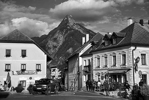
The biggest town in the area, with about 1,600 people, Bovec (BOH-vets) has a happening main square and all the tourist amenities. It’s best known as a hub for whitewater adventure sports. While not exactly quaint, Bovec is pleasant enough to qualify as a good lunch stop or overnight home base. Functional and handy, it’s a nice jolt of civilization wedged between the skyscraping alpine cliffs.
Orientation to Bovec
TOURIST INFORMATION
The helpful TI is just a few steps off the main square (July-Aug daily 8:30-19:00; Sept daily 9:00-17:00; June and Oct Mon-Fri 8:30-16:00, Sat-Sun 9:00-13:00; shorter hours off-season; Trg Golobarskih Žrtev 8, +386 5 302 9647, www.soca-valley.com).
ARRIVAL IN BOVEC
The main road skirts Bovec, but you can turn off (watch for signs on the right) to go through the heart of town, then rejoin the main road farther along. The turnoff road goes right past the main square, Trg Golobarskih Žrtev, with the TI, various tour companies, and eateries.
Parking is tight in high season (May-Sept). Your best bet is to drive into town, and then, when you reach the main square, make a sharp right turn uphill, then turn right again just before the church (following the P 80 m sign). This leads you to a big gravel parking lot a five-minute walk downhill to town. To park a bit closer, try the big parking lot behind the Mercator supermarket (on the left just before the main square). Both lots may charge to park in high season—check signs carefully.
Activities near Bovec
As the de facto capital of Slovenia’s “Adrenaline Valley,” Bovec offers many opportunities to enjoy the nature all around it. For great mountain views of the surrounding terrain, simply hike five minutes up (or drive) to the church at the top of town.
Adventure Sports
An ever-changing roster of local adventure-travel companies run a variety of tours that will get you out on the rushing, crystal-clear waters of the Soča River. The Bovec TI is a good source of information. Well-established tour outfits include Bovec Šport Centar (www.bovec-sc.si) and Soča Rafting (www.socarafting.si), but it’s also a good idea to consult recent online reviews. Most of these activities come with some degree of risk; use common sense and investigate the company’s safety record.
The main options are rafting, kayaking, and hydrospeeding (a masochistic variation on boogie boarding—lying face-down on a short surfboard and shooting headfirst toward the rapids). The official season is March 15 until October 31, but from an adrenaline perspective, these activities are best in spring—when the water is highest. The river is tamer in summer; by fall, water levels are very low.
When conditions are ideal, most rafting companies put in near the Boka waterfall (just downriver from Bovec) and pick up at the village of Trnovo ob Soči. (When water levels are low, companies put in near Sprenica instead.) Most rafting trips last about 2.5-3 hours, with about 1.5 hours actually on the river and extra time to swim.
Kayaking is available at various points along the river, with a dramatic range in level of difficulty; the TI’s free river map outlines your options and notes areas that are unsafe. To get a glimpse of kayakers, hang out at Napoleon Bridge, just outside Kobarid.
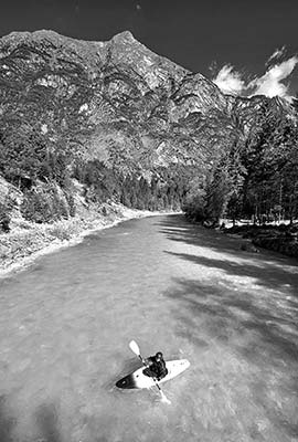
The most popular place for canyoning—a risky activity that involves wading and rappelling in rushing rivers, always with a guide—is in Canyon Sušec, about halfway between Bovec and Kobarid.
The Soča River is also popular for fishing, predominantly for the endemic marble trout. Only fly fishing is allowed; some areas are catch-and-release, and all areas require a permit.
Other popular activities include skydiving and paragliding, biking (including electric mountain bikes), ziplines (there’s a course above Bovec and another high in the Učja Valley), and even—gasp!—golf (Bovec has a 9-hole course, www.golfbovec.si).
Sightseeing Flights and Skydiving
Bovec’s little airport is used mainly for skydiving flights (see www.skydivebovec.com). But Janez Let runs scenic sightseeing flights (+386 41 262 726, www.janezlet.si).
Kanin Cable Car
A cable car slo-o-owly trundles visitors 7,200 feet above sea level to near the summit of Mount Kanin, which overlooks Bovec and a scenic swath of the Soča Valley. On a clear day, you can see all the way to the Adriatic. Up top, you can walk around an irregular limestone landscape (but watch your step—there are some extremely deep hidden crevasses) and pay extra to try out a fixed-anchor (a.k.a. via ferrata) climbing course.
Cost and Hours: €25 round-trip, 35 minutes each way, hours sporadic and weather-dependent but typically June-mid-Sept daily 8:00-16:00, Sat-Sun only in shoulder season, bottom station is just outside Bovec near the road to Kobarid, www.kanin.si.
Sleeping in Bovec
Dobra Vila and Hotel Sanje ob Soči are situated near the turnoff from the main road into central Bovec (about a 10-minute walk into town). Martinov Hram and Stari Kovač are closer to the main square, in the town center.
$$$ Dobra Vila, run with class by Juri, has 11 boldly stylish yet classic rooms, a large back terrace, and a garden sauna. You’ll stay in a gorgeously restored former telephone office that feels like a sophisticated whisper of ages past (air-con, Mala vas 112, +386 5 389 6400, www.dobra-vila-bovec.si, welcome@dobra-vila-bovec.si).
$$ Hotel Sanje ob Soči means “Dreams by the Soča”—which describes both what you’ll do here and the vision that entrepreneurial owners Boštjan and Valentina have for their sleek, modern, spa-like lodgings. The 10 rooms and nine apartments fill a pine-clad, Scandinavian-feeling shell on the edge of Bovec. The rooms—all with terraces, and each one named for the mountain that dominates its view—are fairly simple and Ikea-furnished (breakfast extra, air-con, children’s play area, Mala vas 105a, +386 5 389 6000, mobile +386 31 331 690, www.sanjeobsoci.com, info@sanjeobsoci.com).
$ Martinov Hram has 12 nice, modern rooms over a popular restaurant a few steps from Bovec’s main square. While the rooms are an afterthought to the busy restaurant (reception at the bar), they’re comfortable (rooms on sunny side have air-con, Trg Golobarskih Žrtev 27, +386 5 388 6214, www.martinov-hram.si, sara.berginc@gmail.com).
$ Stari Kovač B&B is your basic budget option, with eight apartments in an old-feeling guesthouse with woody charm, a steep block downhill from the main square (breakfast extra, cash only, Rupa 3, +386 5 388 6699, mobile +386 41 646 427, www.starikovac.com, info@starikovac.com).
NEAR BOVEC
$$$ Pristava Lepena is a relaxing oasis hiding out in the Lepena Valley just north of Bovec. This place is its own little village, with a series of rustic-looking but comfy cabins, a restaurant, an exercise room, a kids’ play area, an outdoor swimming pool, a sauna/whirlpool, and resident Lipizzaner horses and mountain goats, plus a children’s farm with chickens and rabbits. The 16 cozy rooms have wood-burning stoves and all the amenities (closed mid-Oct-March except around Christmas and New Year, multinight stays preferred, lunch and dinner extra; just south of the village of Soča, exit the main road at the sign for Lepena, then follow signs to Lepena 2; +386 5 388 9900, mobile +386 41 671 981, www.pristava-lepena.com, info@pristavalepena.com).
$$$ Holiday House Natura, run by sweet Jelena, is a rustic yet comfortable five-person home with a kitchen, dining terrace, and two bedrooms perched on a ridge just outside of Bovec, with a small farm just outside your front door and sweeping views over the valley. This is an ideal spot to escape into nature while still being just a short drive from town (Ravni Laz 6, +386 41 832 774, www.bovechouse.com, bovecavantura@gmail.com). They also have an apartment in Bovec.
$$ Tourist Farm Pri Plajerju is on a picturesque plateau at the edge of Trenta (at the bottom of the Vršič Pass road). Run by the Pretner family (gregarious Marko is a park ranger, shy Stanka is “the boss”), this organic farm raises sheep and rents five apartments in three buildings separate from the main house. There are also “hikers’ rooms” where you sleep on hay mattresses and share a bathroom with other close-to-nature guests. The location, deeper in the mountains, makes it a bit less convenient for side-tripping—it’s 30 minutes to Bovec and an hour to Kobarid (breakfast and dinner extra; watch for signs to the left after coming over the pass and going through Trenta, Trenta 16a; +386 5 388 9209, mobile +386 41 600 590, www.eko-plajer.com, info@eko-plajer.com).
Eating in Bovec
In addition to the predictable fare, Bovec specializes in mountain food, including trout, lamb, foraged wild mushrooms, and the stick-to-your-ribs melty cheese fritter called frika. The local dessert is bovški krafi—dumplings stuffed with local-grown dried and chopped-up miniature pears (Martinov Hram is a good place to try this dish).
$$$ Martinov Hram, run by the Berginc family (sisters Sara and Suzi), has an inviting outdoor terrace under a grape trellis. Inside, the nicely traditional decor pairs well with regional specialties and homemade bread (closed Mon; on the main road through Bovec, just before the main square on the right at Trg Golobarskih Žrtev 27; +386 5 388 6214).
Brewpub and Alpine Street Food: $ Thirsty River is an inviting microbrew tasting room with a wonderful location right on Bovec’s main square. The basic interior is rustic and cozy, but in good weather, the outdoor tables will kill your momentum (as will the excellent beers; long hours daily). In summer, a row of little wooden sheds is set up along the road nearby, serving up appealing street food. The best of these is $ Bovec Kitch’n (Bovška Kuhn’ca), where Bojan and daughter Anja serve up delicious, filling portions of hearty mountain foods, with lots of mushrooms and melted cheese, plus local trout and lamb (roughly May-Sept daily 16:00-20:00, closed off-season, +386 41 695 744). When closed, the sign reads Sem šel po gobe (“I went mushroom hunting”).
NEAR BOVEC
$$$$ Restavracija Mangrt is well worth the scenic 15-minute drive from Bovec. It fills a cozy traditional inn with chef Tomaž Sovdat’s delicious modern food, driven by local ingredients and culinary traditions, but with modern flourishes. The service is also excellent. Book ahead (you can do it online) before making the drive (Thu-Fri 18:00-22:00, Sat-Sun 12:00-15:00 & 18:00-22:00, closed Mon-Wed, Log pod Mangartom 57, +386 41 219 332, www.restavracijamangrt.si). To get here, from the intersection just east of Bovec, follow the valley past the Kluže Fortress to the idyllic mountain town of Log pod Mangartom. The restaurant is right along the main road in the heart of the village.
$$$$ Pristava Lepena—a recommended hotel listed earlier—is also open to nonguests for meals in their big, rustic dining room. Although pricey, a meal here comes with a beautiful 15-minute drive and a peek at the lovely Lepena Valley (daily 12:00-22:00).
Bovec Connections
From Bovec by Bus to: Kobarid (6/day Mon-Fri, 2-3/day Sat-Sun, 30 minutes), Ljubljana (see “Getting Around the Julian Alps,” earlier, for connections via the Vršič Pass and Kranjska Gora, or via Idrija).
Kobarid
Kobarid (KOH-bah-reed) feels older, a bit smaller (pop. 1,090), and a bit more appealing than its big brother Bovec. This humble settlement was immortalized by Ernest Hemingway, who drove an ambulance in these mountains during World War I. He described Kobarid as “a little white town with a campanile in a valley. It was a clean little town and there was a fine fountain in the square.” Sounds about right. Even though Kobarid loves to tout its Hemingway connection, historians believe that Papa did not actually visit Kobarid until he came back after the war to research his book.
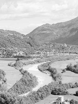
Aside from its brush with literary greatness, Kobarid is known as a hub of information about the Soča Front (with an excellent WWI museum, a hilltop Italian mausoleum, and walks that connect to surrounding sites). You won’t find the fountain Hemingway wrote about—it’s since been covered up by houses. You will find a modern statue of Simon Gregorčič (overlooking the main intersection), the beloved Slovenian priest-poet who came from and wrote about the Soča Valley.
Orientation to Kobarid
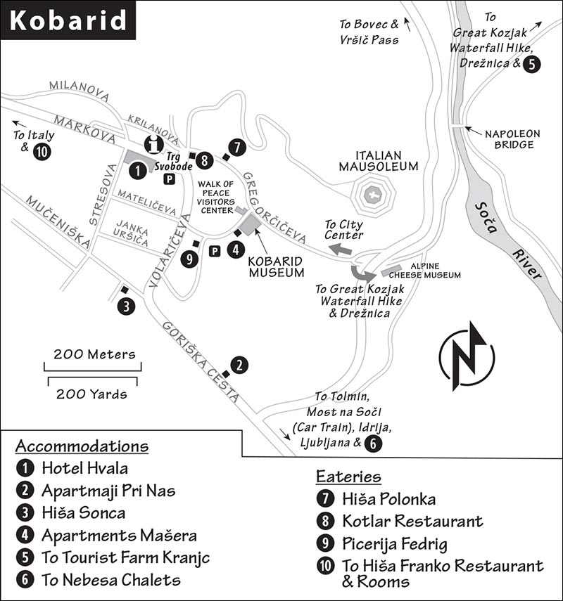
The main road, Gregorčičeva, cuts right through the heart of little Kobarid, bisecting its main square (Trg Svobode).
TOURIST INFORMATION
The TI has good information on the entire area (July-Aug daily 9:00-19:00; June and Sept Mon-Fri 9:00-17:00, Sat 9:00-16:00, Sun 9:00-13:00; off-season shorter hours and closed Sat and/or Sun; on the main square at Trg Svobode 16—follow the white footprints behind the statue of Gregorčič, +386 5 380 0490, www.soca-valley.com).
ARRIVAL IN KOBARID
Driving into town from Bovec, watch carefully on the right for the poorly marked first turnoff into Kobarid (if you miss the turnoff, just carry on a bit longer, then turn right later to reach the main square). Turning into town, you could make a sharp left to reach the cheese factory (marked by the big modern tower) and Great Kozjak Waterfall trail, or continue straight ahead to pass the Kobarid Museum, then the main square. You’ll find pay parking on the main square, from which it’s an easy five-minute stroll back to the museum (pay by phone at the meter). Another parking lot is behind the museum, next to a playing field.
Sights in Kobarid
▲▲Kobarid Museum (Kobariški Muzej)
This old-school but world-class museum—worth ▲▲▲ for history buffs—offers a haunting look at the tragedy of the Soča Front. The tasteful exhibits, with good English descriptions and a pacifist tone, take an even-handed approach to the fighting—without getting hung up on identifying the “good guys” and the “bad guys.” The museum’s focus is not on the guns and heroes but on the big picture of the front and the stories of the common people who fought and died here.
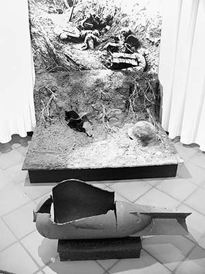
Cost and Hours: €8, daily 9:00-18:00, July-Aug until 20:00, Oct-March 10:00-17:00, Gregorčičeva 10, +386 5 389 0000, www.kobariski-muzej.si.
Tours: History buffs can call ahead to arrange a private tour of the collection or the sights outside. You can also arrange a guide through the Walk of Peace Visitors Center, listed later.
Visiting the Museum: The entry is lined with hastily made cement and barbed-wire gravestones, flags representing all the nationalities involved in the fighting, and pictures of soldiers and nurses from diverse backgrounds who were brought together at the Soča Front. The rooms in this front part of the museum typically show good temporary exhibits about the war.
Buy your ticket and ask to watch the English version of the 20-minute film on the history of the Soča Front (informative but dry, focused on military history).
The first floor up is divided into several rooms, which you’ll tour counterclockwise. The White Room—filled with rusty crampons, wire-cutters, pickaxes, and shovels—explains wintertime conditions at the front. What looks like a bear trap was actually used to trap enemy soldiers. The Room of the Rear shows the day-to-day activities away from the front line, from supplying troops to more mundane activities (milking cows, washing clothes, getting a shave, lifting weights, playing with a dog). Peruse the case of personal effects that troops carried to the front line. The somber and heartbreaking Black Room commemorates the more than one million casualties of the Soča Front. Horrific images of war injuries juxtaposed with medals earned prompts the question, was it worth it? Nearby is a display case of artificial limbs. The little altar was purchased by schoolchildren, who sent it to the front to offer the troops some solace. The door—etched with personal messages from troops—was relocated here from a military prison near Kobarid.
Through the door marked The Krn Range Room (also on the first floor up), pass the small model of the mountaintop war zone and find your way to the Kobarid Rooms, which trace the history of this region from antiquity to today. High on the wall, look for the timelines explaining the area’s turbulent past. In the second room, a timeline shows wave after wave of invaders (including Ottomans, Habsburgs, and Napoleon). In the next room, above a display case with military uniforms, another timeline shows the many flags that flew over Kobarid’s main square during the 20th century alone.
On the top floor, you’ll see a giant model of the surrounding mountains, painstakingly tracing the successful Austrian-German Blitzkrieg attack during the Battle of Kobarid. Crawl into the small cave and press the button to hear a patriotic song about a soldier, who reads a letter he’s written to his family.
▲▲Italian Mausoleum (Kostnica)
The 55 miles between Kobarid and the Adriatic are dotted with more than 75 cemeteries, reminders of the countless casualties on the Soča Front. One of the most dramatic is this mausoleum, overlooking Kobarid. The access road, across Kobarid’s main square from the side of the church, is marked by stone gate towers with the word Kostnica—one tower is topped with a cross and the other with a star for the Italian army.
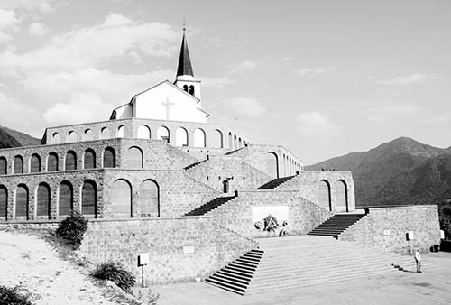
Take the road up Gradič Hill—passing Stations of the Cross—to the mausoleum. Built in 1938 (when this was still part of Italy) around the existing Church of St. Anthony, this octagonal pyramid holds the remains of 7,014 Italian soldiers. The stark, cold Neoclassical architecture is pure Mussolini. Names are listed alphabetically, along with mass graves for more than 1,700 unknown soldiers (militi ignoti).
Walk behind the church and enjoy the view. Scan the WWI battlements high on the mountain’s rock face. Incredibly, troops fought on these treacherous ridges; civilians in the valleys only heard the distant battles. Looking up and down the valley, notice the “signal churches” evenly spaced on hilltops, each barely within view of the next—an ancient method for quickly spreading messages or warnings across long distances.
If the church is open, go inside and look above the door to see a brave soldier standing over the body of a fallen comrade, fending off enemies with nothing but rocks.
When Mussolini came to dedicate the mausoleum, local revolutionaries plotted an assassination attempt that they believed couldn’t fail. A young man planned to suicide-bomb Mussolini as the leader came back into town from this hilltop. But as Mussolini’s car drove past, the would-be assassin looked at his fellow townspeople around him, realized the innocent blood he would also spill, and had a last-minute change of heart. Mussolini’s trip was uneventful, and fascism continued to thrive in Italy.
The valley in Slovenia’s northwest corner—called Soča in Slovene and Isonzo in Italian—saw some of World War I’s fiercest fighting. In a series of 12 battles involving 22 different nationalities along a 60-mile-long front, 300,000 soldiers died, 700,000 were wounded, and 100,000 were declared MIA. In addition, tens of thousands of civilians died. A young Ernest Hemingway, who drove an ambulance for the Italian army in nearby fighting, would later write the novel A Farewell to Arms about the battles here.
On April 26, 1915, Italy joined the Allies. A month later, it declared war on the Austro-Hungarian Empire (which included Slovenia). Italy unexpectedly invaded the Soča Valley, quickly taking the tiny town of Kobarid. For the next 29 months, Italy launched 10 more offensives against the Austro-Hungarian army, which was encamped on higher ground on the mountaintops. None of the Italian offensives was successful, even though the Italians outnumbered their opponents three to one. This was unimaginably difficult warfare—Italy had to attack uphill, waging war high in the mountains, in the harshest of conditions. The fighting coincided with the most brutal winter in a century. Some 60,000 soldiers were killed by avalanches.
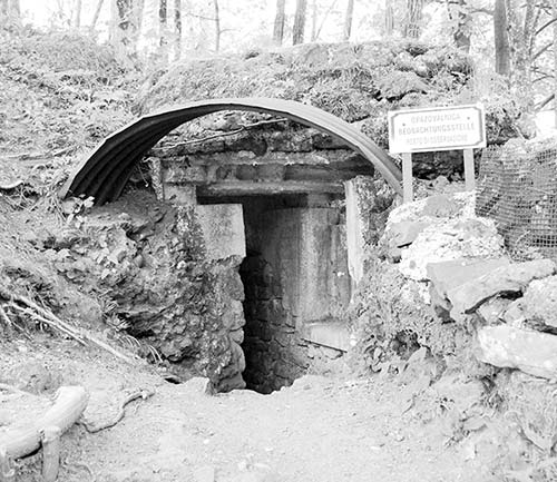
Why would people fight so fiercely over such inhospitable terrain? At the time, Slovenia was the natural route from Italy to the Austro-Hungarian capitals at Vienna and Budapest. The Italians believed that if they could hold this valley and push over the mountains, Vienna—and victory—would be theirs.
On October 24, 1917, Austria-Hungary and Germany launched a counterattack that sent 600,000 soldiers down into the town of Kobarid. This crucial twelfth battle of the Soča Front, better known as the Battle of Kobarid, caught the Italian forces off guard. Within three days, the Italians were forced to retreat. The Austrians called their victory the “Miracle at Kobarid.” But Italy felt differently. The Italians see the battle of Caporetto (the Italian name for Kobarid) as their Alamo. To this day, when an Italian finds himself in a mess, he might say, “At least it’s not a Caporetto.”
A year later, Italy came back—this time with the aid of British, French, and US forces—and easily retook this area. On November 4, 1918, Austria-Hungary conceded defeat. After more than a million casualties, the fighting at Soča was finally over.
Near the mausoleum, you’ll see a small, skippable museum displaying items from WWI that have been discovered in the area.
Alpine Cheese Museum
This humble exhibit, at the big Planika (“Edelweiss”) dairy at the edge of town, examines the history of cheesemaking in this area since ancient times. It’s part of a larger facility that also includes a supermarket (stocked with ample local dairy products) and a very local-feeling café. The museum is inside the big barn across the parking lot.
Cost and Hours: €5, Mon-Sat 10:00-12:00 & 15:00-17:00, closed Sun and Oct-April, Gregorčičeva 32, +386 5 384 1013, www.mlekarna-planika.si. To get here, turn right into Kobarid, then take the sharp left that leads you down beneath the underpass to the cheese factory (marked by the tall modern tower).
▲Great Kozjak Waterfall (Veliki Kozjak) Hike
For a rewarding, fairly easy hike, consider trekking to the Great Kozjak Waterfall—a dramatic cascade that plunges 50 feet through a narrow cavern into a beautiful pool. It’s just over a mile each way from the parking lot; allow 1.5 hours total to linger and explore. Far from undiscovered, Great Kozjak can be crowded during peak season—in summer, time your visit early or late.
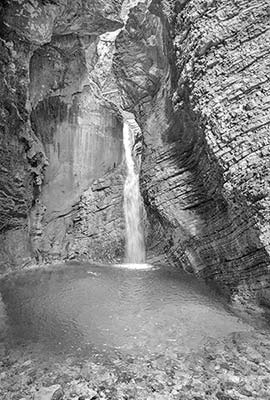
Cost and Hours: €4, daily 8:00-20:00.
Getting There: The waterfall is across the river from Kobarid’s town center. While it’s easier and more rewarding to start at the official trailhead parking lot, you can walk all the way there from Kobarid (adds about 20 minutes each way). On foot or by car, follow brown signs for Slap Kozjak under the main road, over the Napoleon Bridge, and then left at the fork. After Kamp Koren, watch on the left for the turnoff to the big waterfall parking lot (payment required). You’ll carry on along the gravel road by foot the rest of the way.
Hiking to the Waterfall: Leaving the parking lot, the gravel road passes colorful beehives and cheese stands before a steep descent toward the Soča. The riverbank is a popular swimming, sunbathing, and picnic area. You’ll pass a fun, bouncy suspension bridge, then reach the stone bridge over the “Little Kozjak.” From here, follow the Kozjak stream uphill to the payment hut (signs for Slap Kozjak/Waterfall), noticing the clarity of the water. Hiking upon rocks, over little bridges, and up stone steps, you’ll hear the big waterfall before you see it. The footing can be wet and slippery in some points, with a cable in the rock wall you can grab for stability. But that powerful cascade is a satisfying payoff for the effort. You’ll head back out the way you came in.
WWI Sights near Kobarid
Several outdoor museums in the area let you get close to the places where the fighting actually occurred. Some are reachable by car, while others require a challenging mountain hike.
▲Walk of Peace (Pot Miru)
This walking route—which extends more than 140 miles from these mountains all the way to the Adriatic—is designed to link museums, cemeteries, churches, and other sites related to the warfare of the Soča Front. But it also introduces visitors to all aspects of the region’s culture and natural sites. To learn more about shorter hikes along its route, and the many outdoor museums and cemeteries in this region, visit the Walk of Peace Foundation Visitors Center, across the street from the Kobarid Museum. They hand out good, free maps and booklets, and sell a fine guidebook to WWI sights in the area. Tour their engaging, state-of-the-art exhibition, with additional temporary exhibits upstairs (free, July-Aug Mon-Fri 9:00-19:00, Sat-Sun 10:00-13:00 & 14:00-19:00, shorter hours spring and fall, closed Nov-March—but you can try knocking on weekdays, Gregorčičeva 8, +386 5 389 0167, www.potmiru.si). They can arrange guides to join you for part of the walk. Contact them at least one day ahead to check their schedule and/or arrange a tour.
Kobarid Historical Walk
This shorter walk to WWI sights around Kobarid is well explained by the free brochure available at the TI, museum, and visitors center (3 miles, mostly uphill, allow 3-5 hours; or you can just do a shorter, easier stretch along the river, 1-2 hours).
▲Kolovrat Outdoor Museum
For drivers (especially those headed to points south) who want a vivid, high-altitude look at what life was like along the Soča Front, this is perhaps the area’s best outdoor museum (worth the detour and ▲▲ for anyone interested in the Soča Front). It’s located high on a ridge—straddling Slovenia and Italy—about 30 minutes from Kobarid, manageable on the way to the Karst, Goriška Brda, Venice, or Croatia.
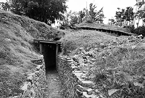
This area—an Italian-built mountaintop fortification—is free and always open. The gentle pasture sprawling away from the parking area is scattered with half-ruined concrete bunkers; if you walk through this area and keep going, you’ll be in Italy in five minutes. Most interesting is the hilltop above, where trenches carved into the rock have been excavated and restored. Peer out through strategically placed viewpoint slits and imagine the impossibly difficult life of the soldiers stationed along the Soča Front.
Getting There: Leave Kobarid on the main road toward Tolmin. Just a mile out of town, in the village of Idrsko, turn right toward Livek and twist up, up, up the hillside. At the far end of the village of Livek, watch for brown Kolovrat signs to the left. Following this road, you’ll drive along a mountain spine for about five miles, watching for the small parking area and information boards for Kolovrat. When you’re ready to leave the museum, carry on along the same road, then turn left at the fork to wind back down into Tolmin.
Sleeping in Kobarid
My first listing is right on the main square. The others hide on side streets about a block off the main road through town.
$$ Hotel Hvala is the only real hotel in town. Run by the Hvala family, its 32 contemporary rooms are faded but central; the cheaper “mansard” rooms are on the top floor. The mural on the wall in the elevator shaft tells the story of the Soča Valley as you go up toward the top floor (some rooms with air-con, elevator, Trg Svobode 1, +386 5 389 9300, www.hotelhvala.si, info@hotelhvala.si).
$ Apartmaji Pri Nas (“Our Place”) has six stylish apartments in a pleasant suburban home along the main road that skirts the town center. They also have two little modern freestanding cabins (no breakfast but kitchens in each unit, air-con, Goriška Cesta 5, +386 31 377 585, www.pri-nas.si, prinas.kobarid@gmail.com).
$ Hiša Sonca (“House of the Sun”), in a cheery, yellow house along the main road, has two comfortable, air-conditioned rooms (sharing a well-equipped kitchen, a “salt spa” with infrared sauna, and lots of stairs) and one big apartment that sleeps up to seven. My favorite place in Kobarid, it’s well run by Natalija, who has another apartment in her home a block closer to the town center (breakfast extra, cash only, laundry service, 2 blocks from main square at Mučeniška 1, +386 31 664 253, www.apartmakobarid.com, hisasonca@gmail.com).
$ Apartments Mašera has six spacious rooms, plus four apartments (all with kitchens and a balcony or terrace) in a big, sprawling building tucked behind the Kobarid Museum (breakfast extra, air-con, Gregorčičeva 10, +386 5 389 1210, www.apartments-masera-si.book.direct [URL inactive], apamasera@gmail.com, Martin and Petra).
IN THE MOUNTAINS HIGH ABOVE KOBARID
Rustic Village Farm Stay: One of my favorite Soča Valley accommodations hides in a tiny village a twisty 10-minute drive up from Kobarid’s main square. $ Tourist Farm Kranjc is a remote but scenic working sheep farm with eight comfortable rooms, organic meals prepared with homegrown produce, and a huge view terrace. This farm—which feels traditional, but has modern style (including a wellness/spa/sauna area)—is a bit less convenient to the sights, but it’s ideal if you want to huddle high in the mountains (dinner extra, air-con, also ask about their “glamping” cots with private bathroom, Koseč 7, +386 5 384 8562, +386 41 946 088, www.turizem-kranjc.si, info@turizem-kranjc.si, Urška and the Kranjc family). It’s in the village of Koseč. From Kobarid, leave town by crossing the Napoleon Bridge (toward Kamp Koren and Great Kozjak Waterfall). Just after that bridge, turn left and twist up to Drežnica, where you’ll turn right to reach Koseč. Upon entering the village, look for signs directing you up the steep road to the left.
Eating in and near Kobarid
While Kobarid has a handful of good eateries, foodies make a pilgrimage for Hiša Franko—just outside town.
$$ Hiša Polonka (“Blue House”), a side project of the people who run the esteemed Hiša Franko (see next), is my favorite stop in town. Conveniently located on the road between Kobarid’s main square and the museum, this is the place for well-prepared traditional, local fare (including microbrews) at reasonable prices. The vibe is pubby and casual; the service is relaxed (Thu-Fri 17:00-22:00, Sat-Sun from 12:00, closed Mon-Wed, Gregorčičeva 1, +386 5 995 8194).
$$$ Kotlar Restaurant, on the main square, has a classy interior that sprawls around the prow of a faux sailboat. The emphasis is on seafood and locally sourced meats. It’s a handy, central place for a meal when other options are closed (daily 12:00-23:00, Trg Svobode 11, +386 5 389 1110, www.kotlarkobarid.com).
$ Picerija Fedrig serves up basic but good pizzas (flexible hours but usually Mon-Tue 17:00-21:30, Wed-Sun from 12:00, shorter hours and closed Mon-Tue off-season, Volaričeva 11, +386 5 389 0115).
MICHELIN-STARRED FINE DINING NEAR KOBARID
$$$$ Hiša Franko, a five-minute drive outside of Kobarid, is becoming internationally known as Slovenia’s top restaurant. Chef Ana Roš (profiled on Chef’s Table and named World’s Best Female Chef 2017) has a deep respect for locally sourced ingredients and Slovenian alpine culinary tradition. But she’s also experimental, injecting international touches into her cooking. Sommelier Valter Kramar elegantly pairs Slovenian wines with each course. You’ll want to book far ahead for modern Slovenian cuisine at its very best (fixed-price meals only, Thu-Sun 12:00-16:00 & 19:00-23:00, closed Mon-Wed, Staro Selo 1, they also rent rooms, +386 5 389 4120, www.hisafranko.com, info@hisafranko.com). To reach Hiša Franko, leave Kobarid following signs for Italija and Robič, and look for the restaurant’s sign on the right.
Kobarid Connections
From Kobarid by Bus to: Bovec (6/day Mon-Fri, 2-3/day Sat-Sun, 30 minutes), Ljubljana (see “Getting Around the Julian Alps,” earlier, for connecting to Ljubljana via the Vršič Pass and Kranjska Gora, or faster via Idrija).