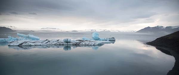
THE RING ROAD
Hringvegurinn
Sights in the Skagafjörður Area
Sleeping in the Skagafjörður Area
Sleeping and Eating in Húsavík
Sleeping and Eating in Egilsstaðir
Southeast Iceland Towns and Sights
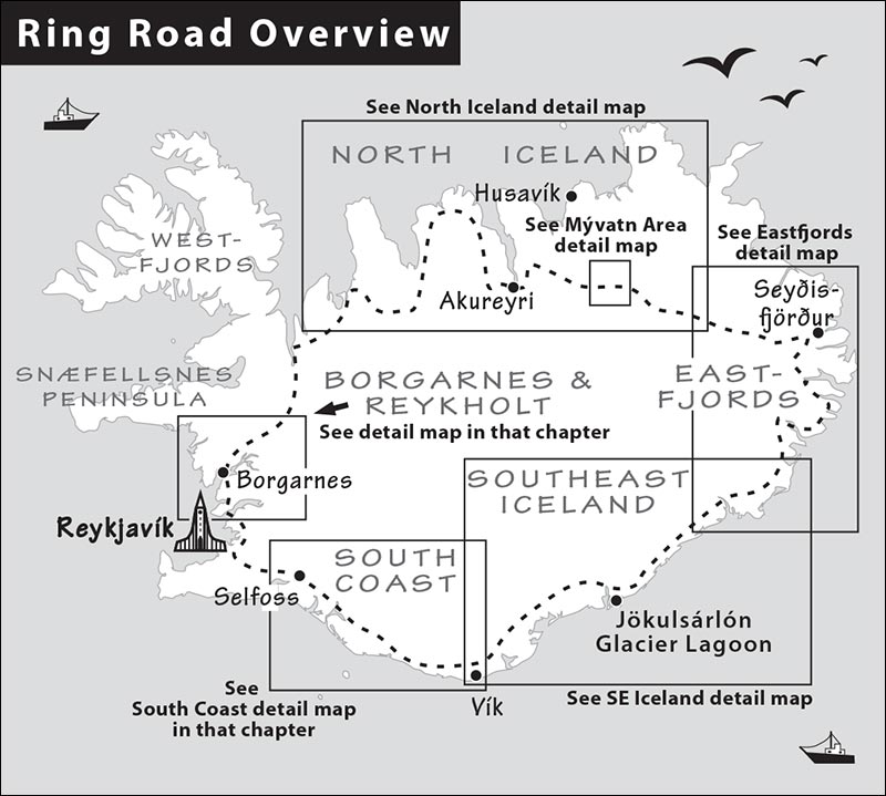
Circling the Ring Road is the ultimate Icelandic road trip. You’ll see the country in all its moods: the deep valleys and fjordside hamlets of the north, the not-quite-bustling second city of Akureyri, the volcanic landscape around Mývatn, the desolate Eastfjords, the glacial landscape of the southeast, and the gentle, green South Coast. Be prepared for long days behind the wheel, but they’ll deliver a marvelous payoff—all of Iceland’s scenic highlights, in one big loop.
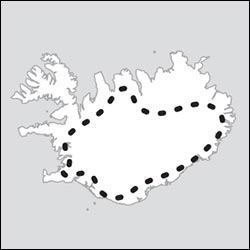
In this chapter, I outline the best five- to seven-day self-guided drive around the Ring, with plenty of suggestions for those with more time. Note that the South Coast, Borgarnes, and Reykholt Valley day trips described earlier in this book are basically part of the Ring Road, and two others—the Golden Circle and Westman Islands—can easily be spliced into your Ring Road journey. With even more time and ambition, you could tack on a detour to the rugged and lonely Westfjords.
A week spent traveling Iceland’s Ring Road is an epic journey unlike any other. Let’s go!
Ring Road Drive
Driving the Ring Road is a complex road trip that deserves serious planning. Use the day plans that follow as a guide as you customize your journey based on your interests, stamina, and time.
The entire 800-mile circuit requires a minimum of about 20 hours of driving—but that doesn’t account for the many worthwhile detours and sights that sit off the Ring. You’ll drive an extra hour or two to reach some of the top sights, such as the best towns (Siglufjörður and Húsavík in the north, and Seyðisfjörður in the Eastfjords) and the most impressive natural sights (Dettifoss and Stuðagil canyon). To get a sense of the pace you’ll need to keep, figure about 30 total driving hours, and divide by the number of days you’ve allotted (with five days, you’ll average six hours a day behind the wheel).
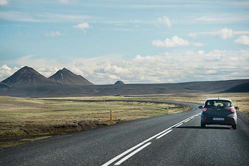
PLANNING YOUR DRIVE
It’s possible to do the loop in as few as five days (and four nights)—but that requires very long driving days and skipping a lot of sights. If you can, aim for seven leisurely days. This allows you to really savor the trip and avoid one-night stands. The itineraries suggested here assume you’ll sleep in Reykjavík at the beginning and end of your trip (though with some strategic planning and convenient flight schedules, you could head from Keflavík airport straight into the Ring).
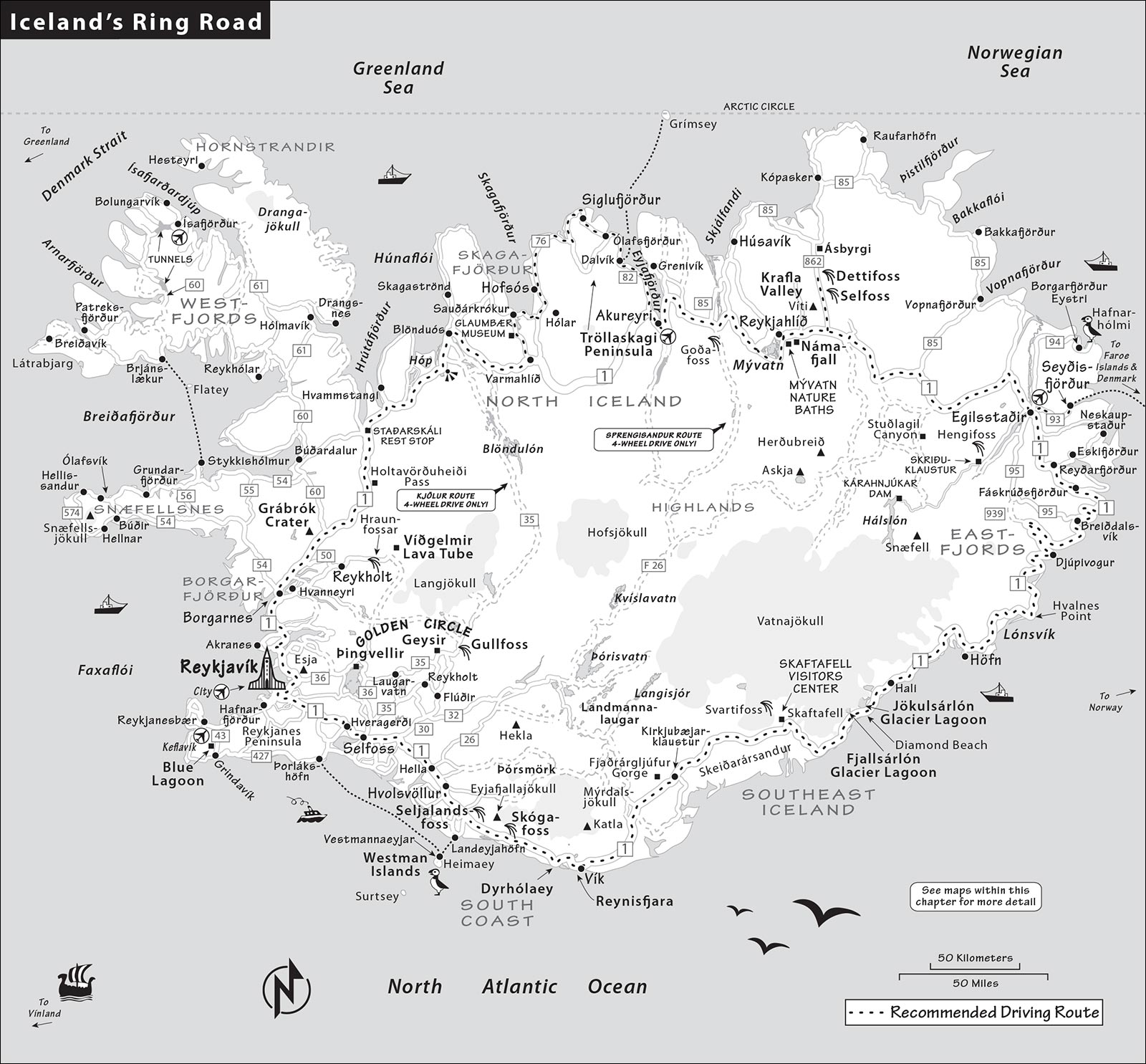
The Ring in Five Days or More
Note that this plan and the closing times I list are for summer (mid-May to mid-Sept); off-season hours can be significantly shorter, and some roads may be closed.
Day 1: From Reykjavík to Skagafjörður
| 9:00 | Leave Reykjavík, heading for Borgarnes (1 hour) on highway 1 |
| 10:00 | Tour the Borgarnes Settlement Center |
| 11:15 | Head to Grábrók crater (30 minutes) and hike to the top; have a picnic lunch there or eat at the Hraunsnef country hotel |
| 13:30 | Continue north to Glaumbær (2.5 hours) |
| 16:00 | Visit the Glaumbær open-air museum (closes at 18:00) |
| Evening | Eat dinner in or near Sauðárkrókur, then end your day with a soak at the Hofsós infinity pool (40 minutes from Glaumbær, closes at 21:00) |
| Sleep | In the Skagafjörður countryside |
Extra Overnight: There are two appealing destinations along this route that could warrant an overnight. The most rewarding is the Snæfellsnes Peninsula (an hour’s detour from the Borgarnes area) to get a quick sample of that region (see the Snæfellsnes Peninsula chapter). Another option is to sleep in the Borgarnes area to explore nearby sights (especially the area around Reykholt). See that chapter for details.
With More Time...
True road warriors can add on all or part of the 530-mile loop around the wild, sparsely populated Westfjords (see the previous chapter).
Day 2: Around Tröllaskagi to Akureyri and Mývatn
You could make a beeline to Akureyri on highway 1; but it’s worth the extra time to loop around the Tröllaskagi Peninsula and stop off in Siglufjörður.
Extra Overnight: If I were to add another night anywhere on this itinerary, it’d be in the Mývatn area. Extra time here helps you fit in more of the fascinating volcanic and geothermal sights around Mývatn, a visit to Húsavík (with a good whale museum and thermal bathing options), or a whale-watching trip from either Akureyri or Húsavík.
Akureyri, between Skagafjörður and Mývatn, is another candidate for an extra overnight. This buys you more time for the Tröllaskagi area (including the Icelandic Emigration Center in Hofsós) and for Akureyri itself (great municipal swimming pool and a wide choice of restaurants).
Day 3: From Mývatn to the Eastfjords
| Morning | See any Mývatn sights you missed yesterday, including the baths and the geothermal sights just east of the mountains (or consider driving 45 minutes each way to visit the charming port town of Húsavík and its whale museum); eat lunch before heading out, or take your chances with the limited options between Mývatn and the Eastfjords (your next destination) |
| 12:30 | Begin your drive east to Dettifoss (about an hour), and explore that spectacular waterfall |
| 14:30 | Continue toward the Eastfjords; it’s two hours to Egilsstaðir (handy for food or gas), then another 30 minutes to the appealing town of Seyðisfjörður |
| 17:30 | Arrive in Seyðisfjörður, enjoy dinner, and rest up for tomorrow’s long Eastfjords drive |
| Sleep | In Seyðisfjörður (or Egilsstaðir) |
With More Time...
If you’re not in a hurry to get to Seyðisfjörður (or Egilsstaðir), consider replacing the trip to Dettifoss with a longer detour to Stuðagil (2 hours from Mývatn; allow another 2 hours to visit) for its waterfall and dramatic basalt-columned canyon.
Day 4: Along the Eastfjords to the Southeast
This is easily the most challenging—and most scenic—day of driving on this itinerary. Don’t underestimate how long it takes to curve along all those beautiful fjords. Keep in mind that the most interesting sights are concentrated at the end of the day, in glacier country—you’ll want enough time to savor them. Overnight options here span a two-hour stretch of road; the farther you go tonight, the less you’ll have to drive tomorrow.
Extra Overnight: Spending a second night in Southeast Iceland’s glacier country can help break up two long driving days. This is particularly tempting if you’re interested in glacier activities or hiking at Skaftafell. Otherwise, you may prefer to overnight on the South Coast instead.
Day 5: Along the South Coast to Reykjavík
If you’re staying near Skaftafell, consider an easy morning nature hike there (or get up an hour earlier to hike all the way up to Svartifoss waterfall). Or, if you’ve slept near the glacier lagoons, do a cruise first thing this morning, before heading west.
| Morning | Wrap up glacier country activities, then drive west to the town of Vík, on the South Coast, aiming to get there by lunchtime (about 3.5 hours from Höfn, 2.5 hours from Jökulsárlón glacier lagoon, or 2 hours from Skaftafell, including a few brief photo stops) |
| 13:00 | Lunch in or near Vík, then go 10 minutes farther to stroll the black sand beach at Reynisfjara |
| 14:30 | Drive south along the coast (1 hour), stopping at Dyrhólaey promontory (for big coastal views), Skógar (for its waterfall and folk museum), and the South Coast’s top sight, Seljalandsfoss waterfall |
| 17:00 | Continue west, and if you have time, consider a quick stop at the Lava Center in Hvolsvöllur (20 minutes past Seljalandsfoss, closes at 18:00) |
| Evening | Drive to Reykjavík (1.5 hours), having dinner en route or in the city (late) |
| Sleep | Collapse in Reykjavík. You did it! |
Extra Overnight: Adding an overnight on the South Coast allows more time on the morning of Day 5 for glacier lagoon cruises and Skaftafell hikes, and lets you spread the South Coast sights over two days, breaking up the long drive back to Reykjavík. If you add more than just one night here, other options include a Westman Islands day trip (see Westman Islands chapter), a trek to Þórsmörk (see end of South Coast chapter), or a Golden Circle loop (see Golden Circle chapter)—which works on your way back to Reykjavík (but adds quite a bit of time to your return journey).
With More Time...
If you’re adding time and don’t mind a series of one-night stays, I’d prioritize this way:
With a sixth day, add a second night in the Mývatn area.
With a seventh day, add a night on the South Coast.
With an eighth day, add a detour (and an overnight) to see the Snæfellsnes Peninsula.
With a ninth day, add an overnight in Southeast Iceland, the Borgarnes area, or Akureyri.
With even more time, spend a second night in one (or more) of these areas: Seyðisfjörður, in the Eastfjords; the charming northern towns of Húsavík and Siglufjörður; or in one of the destinations listed above.
Ring Road Tips
For an overview on driving in Iceland, including common road hazards and a map with driving times, see the Practicalities chapter.
Book Accommodations Far in Advance: Reserve your Ring Road accommodations far, far ahead—as far out as you can—as places fill up months in advance for summer (and can be more expensive the longer you wait). If you’re traveling in the peak months of July and August, consider booking your rooms by January at least. This is particularly the case in some remote areas—glacier country in the southeast, Seyðisfjörður in the Eastfjords, and Mývatn—where the supply of accommodations simply isn’t up to the demand.
Where to Sleep: The trickiest part of your Ring itinerary is figuring out where to stay overnight. Depending on how much time you have, you may end up with a string of one-nighters. Be flexible on location; for example, when looking for Mývatn accommodations, you might find better prices and availability in nearby Húsavík (or in the countryside in between). Seyðisfjörður is a wonderful little town, but if it’s full, functional Egilsstaðir is just 30 minutes away.
My recommended lodgings in this chapter are reliable but look online for additional options. As Iceland races to meet surging demand, new places are opening up all the time. It’s smart to peruse Airbnb, Booking.com, and HeyIceland.is for well-reviewed alternatives.
Another option is to camp, with either a campervan or a tent. Campgrounds are scattered all over the Ring Road. Camping gives you a little more freedom to change your itinerary on the fly (for more on campervans and camping, see here).
When to Go (and When Not to Go): The best time to drive the Ring Road is between mid-May and mid-September. Don’t drive the full Ring anytime from November to March. April and October are chancy; icy conditions or a closed mountain pass could block your progress and derail your itinerary. Late September and early May along the Ring are fairly reliable, but you may encounter slippery roads or a freak snowstorm at higher elevations—and businesses may have limited hours (some are closed entirely). Regardless of when you travel, keep a close eye on the road-conditions map at Road.is.
Two- or Four-Wheel Drive? Iceland is paving its roads faster than this book can keep up with (especially on routes to tourist-oriented sights). In summer, rent a two-wheel-drive car; you won’t need four-wheel drive if you’re sticking to my recommended route. The entire Ring is paved, and the most rewarding detours are either paved or on maintained gravel roads. For an up-to-date map showing which roads are paved and unpaved, go to Road.is and click on “Road Info Viewer.”
Clockwise or Counterclockwise? The Ring works well in either direction, but this chapter describes the route clockwise. The northwest quarter of the Ring is the least spectacular, so doing the trip clockwise lets you build to ever-greater highlights.
Navigating: This loop is mostly along highway 1, making it hard to get lost. However, many of the best sights are a short detour off that main road. Keep a close eye on signage—even if you’re just sticking to highway 1—and anticipate your next turnoff. Þjóðvegur, meaning “highway,” usually refers to highway 1.
WCs: Even though distances between destinations can be long, you shouldn’t have trouble finding WCs on your drive. In the countryside, your best (or only) WC option will be at a gas station, restaurant, or at a parking lot or café for a major sight. These WCs are usually free (if there’s a charge, you can pay by credit card).
Eating Along the Ring: Decent and even some memorable options are scattered along the Ring Road. But good places are few and far between; if you’re stretching your driving days late into the evening, don’t wait too long to find dinner. Even in a town that’s midsized, by Icelandic standards, restaurants may stop serving by 21:00 or earlier.
Not Enough Time to Drive? If you don’t want to drive the entire Ring Road but want to get a quick look at the north, a good plan is to fly from Reykjavík City Airport to Akureyri (Icelandair flights depart 4/day and take 45 minutes, www.icelandair.com) and home-base there for a few days, day-tripping by rental car, public bus, or excursion to places like Siglufjörður and Mývatn (each less than 1.5 hours away). Egilsstaðir, in the Eastfjords, is also reachable by plane from Reykjavík, with rental cars available at its airport (one-hour flight).
Ring Road Excursions: If you want to do the Ring but don’t want to drive it yourself, consider a guided bus tour. Family-run GJ Travel offers an eight-day Ring tour (www.gjtravel.is); other reputable companies include NiceTravel.is and SeasonTours.is.
West Iceland
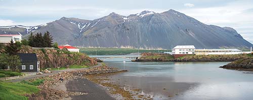
Your Ring Road journey begins with a spin through West Iceland—the region called Borgarfjörður. This area has some fine sights, charming towns, and dramatic scenery. The two most worthwhile sights are the Settlement Center in the beautifully set town of Borgarnes and the fun-to-climb crater called Grábrók.
REYKJAVÍK TO SKAGAFJÖRÐUR
For more on this region—including a map, specific driving instructions from Reykjavík, and a complete rundown of the area’s sights—see the Borgarnes and Reykholt Valley chapter. This leg takes about 4.5 hours without stopping.
• Drive north from Reykjavík along highway 1, following signs for Borgarnes, Akureyri, and 1n. About one hour from Reykjavík, a bridge crosses into...
Borgarnes
This fine town of 2,000 people perches on a little peninsula facing sheer scree cliffs. Borgarnes (BOHR-gahr-NESS) has some historical ties to the early Icelandic sagas (especially the colorful warrior-poet Egill); you can learn more about him and the earliest days of Iceland’s habitation in the Settlement Center, which is well worth an hour (described on here).
Additional sights cluster about a half-hour east of Borgarnes, in the area near Reykholt (thermal springs and waterfalls, family-friendly goat farm, spa-like thermal pool, lava cave, and a medieval Icelandic research center—all described in the Borgarnes and Reykholt Valley chapter). But for those blitzing the Ring, all are skippable.
• To continue directly along the Ring Road, head north from Borgarnes on highway 1. After about 30 minutes, along the road on your left, you can’t miss the towering crater called Grábrók. The parking lot is also on the left, immediately after the crater.
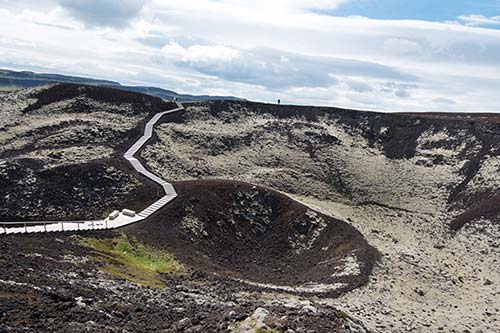
Grábrók Crater
Climbing to the top of Grábrók takes about 30-45 minutes round-trip and offers grand views over the region (for details on the crater and the lunch spot listed next, see here).
Lunch Options: Consider getting lunch just past Grábrók at the chic, country-farm hotel $$$ Hraunsnef before heading north over the mountains. Otherwise, pack a picnic to eat at Grábrók. Two basic, roadside rest stops lie between here and Skagafjörður (see the next section).
• After visiting the crater, get back on highway 1 north, tracking the scenic Norðurá river.
From Grábrók to Blönduós
As you approach the pass over Holtavörðuheiði (Hill-Cairn Heath), the farms thin out and the road climbs, finally cresting the pass at almost 1,400 feet.
Coming back down, you’ll see the small Hrútafjörður (Ram Fjord) spread out before you. Just before the road meets the fjord, you’ll hit $ Staðarskáli, a big rest-stop complex (free WC; hot dogs and burgers, good takeaway sandwiches and salads; long hours daily, www.nat.is/stadarskali).
Stick with highway 1 as you skirt north along the fjord, then turn east. About 40 minutes in, watch on the right for a strange grouping of hillocks called Vatnsdalshólar, thought to be the result of a prehistoric landslide. Another 15 minutes on highway 1 across a relatively flat landscape brings you to Blönduós, a small town along the Blanda river known to most Icelanders for its speed traps. There are a few restaurants here, including $$ B&S (daily) and the simpler $ Húnabúð (closed Sun), both next to the big N1 gas station (free WC) at the top of town. If you need to stretch your legs, take a loop around the unique modern church (on the other side of B&S) designed by local architect Maggi Jónsson.
From Blönduós to the Skagafjörður Area
As you make the trip over the mountain range from Blönduós to the Skagafjörður area, you’ll be crossing into North Iceland. From here, you have a couple of route options.
Highway 744 to Sauðárkrókur or Hofsós (40-60 minutes): If you’re in a hurry to reach either of these towns, highway 744 is faster, lower in altitude, and nicely scenic.
Highway 1 Bypass to Varmahlíð (40 minutes): This equally scenic road follows the lovely Blanda river through a pastoral valley, then crosses Vatnsskarð pass to the hamlet of Varmahlíð (VAR-mah-HLEETH, Warm Slope, pop. 140), with a gas station, recommended accommodations, swimming pool, and regional TI (in the sod-roofed, wooden house in the gas station parking lot at the highway junction, daily in summer, +354 455 6161, www.visitskagafjordur.is).
About a mile before town is a turnoff to Víðimýrarkirkja, a turf church constructed of sod laid in a herringbone pattern (one of just six remaining in Iceland). Although a church has stood here since the 12th century, this one dates from 1834 and is still used for weddings and Christmas Eve services (1,000 ISK, 2,300 combo-ticket with Glaumbær Museum—must visit the same day, Tue-Sun 12:00-18:00, closed Mon).
From Varmahlíð, turning left on highway 75 takes you to the area’s most interesting sight, the Glaumbær Museum (less than 10 minutes), and the town of Sauðárkrókur (20 minutes); the road eventually connects with highway 76, which runs through Hofsós (45 minutes from Varmahlíð) and the Tröllaskagi Peninsula. All of these are described in the next section.
Or, from Varmahlíð you can continue along highway 1 to the bigger city of Akureyri (1 hour). Note that if you stay on highway 1, you’ll bypass the Skagafjörður altogether—which would be a shame.
North Iceland
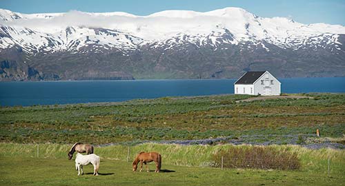
North Iceland is a delight, with beautiful fjords, the scenic Tröllaskagi Peninsula, Iceland’s pleasant second city of Akureyri, and the country’s most accessible volcanic area at Mývatn. If this area were a bit closer to Reykjavík, it would be swamped with tourists. But it isn’t...so it’s not.
Planning Tips: Those without enough time to do the entire Ring could simply fly from Reykjavík to Akureyri, rent a car there (or do excursions) for two or three days of side-tripping, then fly back to the capital. (Driving here from Reykjavík is about six-plus hours one way.) The official tourism website, NorthIceland.is, offers a wealth of information.
Skagafjörður Area
Skagafjörður (SKAH-gah-FYUR-thur, Peninsula Fjord) is the name of this broad fjord and of the valley at its head. This picturesque seaside area has a few humble towns (Hofsós is the most interesting) and several intriguing islands just offshore.
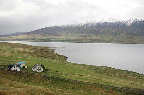
There are enough attractions here to keep you busy for several hours—including one of Iceland’s most interesting folk museums, at Glaumbær; the informative Icelandic Emigration Center, in Hofsós; and a tranquil valley that was an important site in the early days of Icelandic Christianity, at Hólar. The area also has several horseback riding options, and a rare Icelandic river suitable for rafting.
Planning Tips: The Skagafjörður area is sparsely populated and not well developed for tourism. Compared to some of the country’s more mainstream destinations, you may need to lower your standards a little. If you make good time getting to this area, you could visit the Icelandic Emigration Center in Hofsós (open until 18:00 in summer); take a dip in that town’s relaxing, thermally fed infinity pool overlooking the fjord (open until 21:00 in summer); then grab dinner on your way back to your accommodations.
Sights in the Skagafjörður Area
These sights are listed in the order you’ll approach them on highways 75 and 76 from the main Ring Road. For directions, see “From Blönduós to the Skagafjörður Area” on here.
▲▲Glaumbær Museum
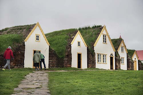
Inhabited until 1947 and a museum since 1952, this classic turf farmstead (pron. GLOYM-bire) shows how Icelanders lived for centuries, with limited access to timber for building and fuel. Larger and better preserved than other similar farm museums in Iceland, Glaumbær offers an informative, intimate look at traditional Icelandic lifestyles. It rates ▲▲▲ for those interested in Icelandic history.
Cost and Hours: 2,000 ISK, 2,300 ISK combo-ticket with Víðimýrarkirkja—must visit the same day, free for kids under 18; late May-late Sept daily 10:00-18:00; off-season until 16:00; guided tours by appointment only—15,000 ISK for small groups; on highway 75 (less than 10 minutes north of highway 1 at Varmahlíð), +354 453 6173, www.glaumbaer.is, byggdasafn@skagafjordur.is.
Background: The first sod house on this site dates to the early 1100s. That original structure was built using remains from an even earlier farm, from the 10th and 11th centuries (more remains lie underground beneath the grassy field just below the farmstead). This is thought to have been the farmstead of Guðríður Þorbjarnardóttir, also known in the sagas as Guðríður the Far Traveler, a Viking woman who ventured to the New World and Rome. (You’ll find a statue of her in the neighboring churchyard.) Of course, earthen buildings are always changing, and the sod must be renewed every few decades; while there are some medieval bits and pieces buried deep inside the structure, the version of the house you’ll see is more typical of the 19th century.
Visiting the Museum: Get up close to the grass-roofed structure to see how it was constructed. Because there were few trees left in Iceland, farmsteads were built from expertly cut chunks of sod. The corner posts and roof beams were wood—and often an early settler’s most valuable possessions.
Here the walls of the farm are made of sod and driftwood, with timber fronts and stone foundations. Study the herringbone pattern used to pile up the layers of sod. The tops of the houses are covered with grass—the original roof garden. While the facades give the impression of separate buildings, inside the rooms are all connected.
Posted English descriptions explain each room. At the front of the house are the nicest (and least troglodyte-style) rooms, reserved for guests. From there, a long, tight hallway with earthen walls (essentially a subterranean tunnel) connects additional rooms: the kitchen, with a fire fed by dried sheep dung or peat, and various pantries and storage rooms. Here you’ll see big barrels of animal innards (preserved in whey) and skyr—a nutritious yogurt-like food that’s long been an Icelandic staple.
At the back of the complex, you’ll pop into the fascinating baðstofa—the communal living and sleeping room, where workers slept, two to a bed. Women—who did delicate spinning and knitting work—got the bunks with better light, near the windows. The smaller, more genteel room on the left was for the farmer and his wife; the one on the right was for children (notice the loft bed, with a step).
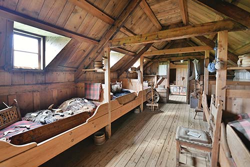
In each bedframe, a wooden panel engraved with prayers is slotted into the side. This board (called a rúmfjöl) could be pulled out and balanced on your lap to use as a tabletop. Also look for the lidded pot (askur) on a little shelf above each bed; every person had their own personal pot from which they ate every meal. Imagine spending a long, dark, cold winter in here, huddled around the dim light of a candle. People stored personal items under their pillows—the only place that was strictly off-limits to everyone else. You might see some children’s “toys” laid out on a bed—mostly animal bones and horns.
Back outside, you can peek into a few more rooms that held farming tools. The farm even had its own little blacksmith’s workshop.
Before leaving the turf house, consider this: Many of the Icelanders you’ll meet today will tell you that their grandparents grew up in sod-roofed houses like this one. Glaumbær is a beautiful time warp—and a poignant reminder of how dramatically Iceland has since leapt into the contemporary world.
Eating: The sod houses sit between a modern church and two late-19th-century timber houses that were moved here in recent decades. In one of them, the cozy $ Áshús café and tearoom offers soup, sandwiches, cakes, and a tasting plate of traditional Icelandic smoked and preserved foods “served in the manner of our mothers and grandmothers” (closes 30 minutes before the museum). There are usually temporary exhibits upstairs.
Nearby: You can drive or walk up to the small wooden church on the hill beyond the farmstead. In the graveyard, look for the statue of Guðríður in a ship, carrying her son Snorri on her shoulder. According to the sagas, Guðríður (born on the Snæfellsnes Peninsula around the year 980) and her husband Þorfinnur Karlsefni Þórðarson followed Leifur Eiríksson’s route to Vinland. They lived there for a time, possibly in Newfoundland, before returning here with their son, Snorri—the first European born in the Americas. Snorri was among the first Icelanders to adopt Christianity and may have built a church here for Guðríður after she returned from a years-long pilgrimage to Rome.
Sauðárkrókur Town
The provincial center of Sauðárkrókur (SOY-thowr-KROH-kur, Sheep River Bend, pop. 2,500) enjoys a spectacular fjordside setting about 15 minutes north of Glaumbær. It’s convenient for gassing up or grabbing a meal, but it’s also a nice place for a bird-watching or boat excursion—or just a simple stroll through a workaday Icelandic town.
This is almost a one-street town: Its main drag, Aðalgata, is a couple of blocks inland from the waterfront highway (where highway 744 becomes highway 75). Park near the recommended Sauðárkróksbakarí bakery (the town’s pride and joy), and wander a few blocks with the water on your right, past a few restaurants and a thrift shop (where you might find a cheap Icelandic sweater). You’ll eventually reach a slick building (on your left), which hosts a small TI, a good café, and the “1238: The Battle of Iceland” virtual-reality exhibit. Kids (and kids at heart) enjoy virtually throwing spears and rocks in a VR reenactment of the 13th-century battle of Örlygsstaðir (3,400 ISK, daily 10:00-17:00, winter until 16:00 and closed Sun; café closes one hour before exhibit, www.1238.is).
Eating in Sauðárkrókur: $$$ Kaffi Krókur has a big, bright interior and offers pizza, burgers, and some vegan options, plus a few traditional Icelandic dishes with ingredients sourced from local farms (daily, Fri for lunch only, Aðalgata 16, +354 453 6454). $$ Hard Wok Café serves an acceptable approximation of Asian and Mexican dishes, plus pizza, in a pleasant setting (daily, Aðalgata 8). $ Sauðárkróksbakarí is a popular bakery in a beloved building that’s housed a slew of bakeries since 1800. This one serves pastries and basic sandwiches, with inviting seating both indoors and out (daily, Aðalgata 5, www.saudarkroksbakari.net). There’s also a supermarket in town.
Hólar Village
Hólar (HOE-lar, Hills), a pretty settlement at the upper end of a small valley, is a scenic detour if you have an hour to spare and an interest in Iceland’s history (from highway 76, turn off onto highway 767 for about 10 minutes/8 miles).
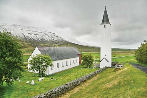
The center of Iceland’s northern bishopric up until 1800, Hólar had one of the country’s first printing presses and is now home to a small college (Hólaskóli), an 18th-century church (the oldest stone church in Iceland), and a little turf-roofed house that you can wander through.
Driving through Iceland in summertime, especially along the country’s southern coast, you’ll pass vast purple fields of Nootka lupine—a flowering plant with tall, tidy stalks and puffy purple petals. The plant was introduced from North America to Iceland in 1945 to combat erosion and to enrich the depleted soil. For some Icelanders, picture-perfect lupine is a point of pride, and many regional tourism websites promote it as a sightseeing must and a photographer’s dream. The bright purple flowers pop against Iceland’s striking green mountains, white waterfalls, gray clouds, and deep blue water.
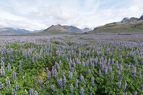
But in some parts of the country, lupine is controversial. Lupine seeds spread far and wide, and the plant’s aggressive roots can suffocate the root systems of native plants. Invasive lupine is crowding out delicate native species such as Icelandic heath, the loss of which in turn is threatening Iceland’s native heath bees. National parks are taking action—most notably, Skaftafell and Vatnajökull, where park officials and locals alike are actively destroying fields of lupine to protect what lies beneath. Most important, they’re trying to conserve the area’s distinctive gray moss, which covers younger lava fields throughout the southern parts of Iceland. While the topic is a hot one, most agree that it’s critical to keep lupine out of the national parks and the Highlands in the interior. But for now, there’s no official country-wide policy on lupine. It’s up to landowners to decide if it’s friend or foe.
Hólar was home to a colorful and important bishop, Guðmundur Arason (1161-1237). An orphaned, disabled ascetic, Guðmundur devoted himself to the poor and needy. After he became bishop of Hólar, Guðmundur gathered a motley crew of desperately needy people, whom he sustained with church wealth. He became known as “Guðmundur the Good.” However, his unusual ways—and his assertion of the judicial powers of the Catholic Church—drew attention from the chieftains. The two factions came to blows, and Guðmundur was at various times imprisoned or sent into exile.
About 300 years later, another Hólar bishop—Jón Arason—was the main holdout against the Protestant Reformation. Jón was eventually executed at the headquarters of the other old Icelandic bishopric, Skálholt (on the Golden Circle).
Hofsós Village
On the east side of the fjord—about 40 minutes from Glaumbær, or 30 minutes from Sauðárkrókur—the village of Hofsós (HOFF-sohs, Temple Estuary, pop. 170) merits a stop, especially for anyone of Icelandic descent. A one-time summer trading center, it got its start in the 18th century but never developed into a large town. Today it’s a village with a fine location perched on a bluff overlooking the fjord. (The late Icelandic-Minnesotan author Bill Holm, who some will remember from his appearances on A Prairie Home Companion, spent summers in Hofsós and wrote about the town in The Windows of Brimnes.)
The core of the village (with the swimming pool and recommended guesthouse) is separated from its old port by the outflow of the big Hofsá river. To reach the port area—with the main buildings of the Emigration Center—either loop all the way around on the road, or park by the Retro Mathús restaurant and take the footbridge.
Icelandic Emigration Center (Vesturfarasetrið): This is the main sight in town—worth ▲, or ▲▲▲ if you have Icelandic ancestry (1,800 ISK, free for kids under 12, June-Aug daily 11:00-18:00, Sept-May by appointment, +354 453 7935, www.hofsos.is, hofsos@hofsos.is). It fills three historic buildings on the old port.
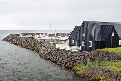
You can buy your ticket in either the light green house or the big black building on the port side of the bridge. The black building houses the genealogy library, an exhibit about an Icelandic settlement in North Dakota, and may have some temporary exhibits.
In the green house, low-tech but thorough exhibits tell the story of the 20,000-some Icelanders who emigrated to the Americas from 1870 to 1914—a time when a series of volcanic eruptions, earthquakes, lower temperatures, and a general lack of prospects conspired to make life in Iceland very difficult, particularly in the north. In 1860, more Icelanders died than were born. At the same time, changes in Icelandic law made it possible for landless workers to leave traditional farming work in search of other opportunities.
Those who left went mainly to Canada, where part of Manitoba became known as “New Iceland”; many others wound up in the Dakotas. Of particular interest is the story of the 35 Icelanders who emigrated to Brazil. This group included Magnús Söndahl, who was 12 when his family emigrated. Eventually, his daughter, Nanna, would become a women’s rights pioneer in Brazil, becoming only the second woman in her state to earn her medical license. In 1996, she visited Hofsós as the last living member of the first generation of Icelanders born in Brazil. She is credited with preserving the history of Icelandic settlers there.
Upstairs, you’ll see a typical seamen’s home—a Þurrabúð (dry house)—and, in the basement, get a glimpse of life at sea and what the emigrants found when they reached the New World. Back on the main level, peek into the back room across from the WCs, where the museum’s owners operate an Icelandic flag factory—the only one in the country.
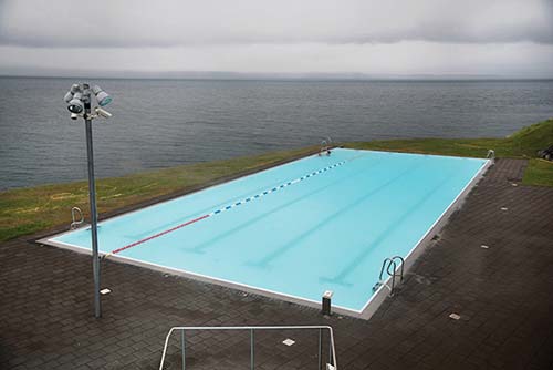
Thermal Swimming Pool: Hofsós has a fine, large municipal pool, which opened in 2010 as a gift to the village by two very wealthy Icelandic businesswomen. Entirely outdoors, the complex has both a big, warm infinity pool, with unobstructed views over the fjord, and a small hot pool. If you have time for only one community thermal pool on your Ring drive, this is a good choice—small, user-friendly, scenic, reasonably priced, and in an area with few other evening diversions (1,175 ISK, 350 ISK for kids under 18, generally daily in summer 9:00-21:00, +354 455 6070, www.facebook.com/sundlauginhofsosi).
Basalt Columns: Beyond the parking lot (to the left of the pool) is a steep trail that leads to some striking basalt columns that rise up from the sea. The stepped path is safer than it looks, but those with a fear of heights should hold the rope along the way. These cliffs, called Staðarbjörg, were historically thought to be the capital of the area’s elf community.
Eating in Hofsós: The only real eating option is the casual $ Retro Mathús, filling a cozy house down near the footbridge, with a short but appealing menu of fish, pizza, and burgers, plus some vegan options (daily, Mon for dinner only, +354 497 4444).
Sleeping in the Skagafjörður Area
Accommodations in Sauðárkrókur town are basic; instead, opt for a nearby countryside place. Another option is to carry on about 1.5 hours farther to sleep in Siglufjörður, near the tip of the Tröllaskagi Peninsula (with some excellent accommodations—see recommendations later in this chapter).
Overlooking the Skagafjörður Valley: $$$$ Guesthouse Hofsstaðir is a cozy oasis perched on a postcard-perfect ridge, with cut-glass peaks in one direction and the broad estuary of the Skagafjörður valley in the other. Well run by former chef Tóti and Guðný, the guesthouse has 30 rooms in several log-cabin-like buildings (all with private bath and views) and a relaxing, upscale vibe (+354 453 7300, www.hofsstadir.is, info@hofsstadir.is). Their good $$$ restaurant, open to all, has an appealing menu and sells homemade syrups and jams (daily for dinner only, reserve ahead off-season). Coming from Sauðárkrókur on highway 75, turn right at the T-intersection with highway 76 (signed for Reykjavík and Akureyri); the guesthouse is a few minutes south.
$ Helluland Guesthouse has five charming and tidy rooms that share two bathrooms in a restored farmhouse overlooking the valley. The welcoming staff, cheery dining room, and Scandinavian-influenced lounge add to the cozy ambience. Wake up early to watch the horses come in—usually around 8:00 (no breakfast, +354 780 2034, www.helluland.is, info@helluland.is). If you’re in a pinch, their neighbor, $ Icelandic Horse Tours, has three simple rooms that share a kitchen (also offers horse tours, +354 847 8577, www.icelandhorsetours.com, info@icelandhorsetours.com, Luka). To reach either, head east from Sauðárkrókur on highway 75. After crossing the bridge, immediately turn right on highway 764 (marked Hegranes); the guesthouses are on the left after two miles (about 5 minutes on the unpaved road). Helluland Guesthouse is the big white house next to the horse barn; the three rooms rented by Icelandic Horse Tours are in the red house down to the right.
Near Glaumbær: On highway 75 just a few minutes south of the Glaumbær Museum, $ Syðra-Skörðugil Guesthouse offers five bright rooms with shared bath and kitchen access. They also run horse tours, including the option to ride from here to the museum (family rooms, hot tub, +354 893 8140 for Elva or +354 897 0611 for Flora, www.sydraskordugil.is, info@sydraskordugil.is).
In Varmahlíð: At the junction of highway 1 and highway 75—a short drive south of Glaumbær—sits $$$ Hótel Varmahlíð. It’s overpriced with 19 spacious yet old-school rooms, but it’s crisp and clean, and may have beds when others are full. It’s convenient if you’re skipping Skagafjörður and just need a place to sleep before continuing east (family room, restaurant open daily for dinner, +354 453 8170, www.hotelvarmahlid.is, info@hotelvarmahlid.is).
$$$ Hestasport Cottages (Horse Sport Cottages) rents seven well-kept cottages, each with private bath, circling a shared outdoor hot tub in a grassy meadow on the hill above the junction. There’s also an apartment with a private hot tub. Check-in is in a blue building off highway 1 before you reach the junction (no breakfast, look for Hestasport sign on the right, they also run horse tours, +354 453 8383, www.riding.is/cottages, info@riding.is, Katja).
In Hofsós: The simple $$ Sunnuberg Guesthouse fills a humble house right in the heart of the village (facing the little grocery/gas station). Its five basic rooms have private baths but are nothing fancy—no frills and no breakfast, though you can use the kitchen to make coffee (Suðurbraut 8, +354 893 0220, book by phone or email at gisting@hofsos.is).
Skagafjörður to Akureyri
When you’re ready to head from the Skagafjörður area to Akureyri, you have two choices. My preference is to invest some time taking one of Iceland’s classic scenic drives: north around the tip of Tröllaskagi Peninsula (Troll Peninsula). Otherwise, you can simply drive inland on highway 1 over a mountain pass to Akureyri.
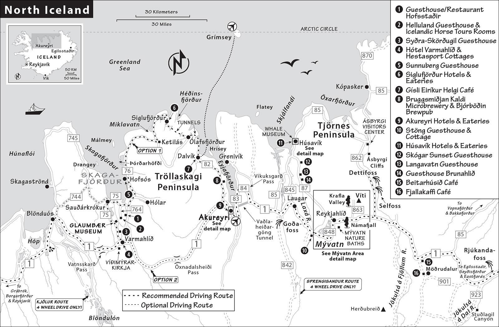
Option 1, Tröllaskagi (about 115 miles, 2.5 hours): This route stays at lower altitudes as it hugs the northern coast through the towns of Hofsós, Siglufjörður, Ólafsfjörður, and Dalvík, before heading south along Eyjafjörður to Akureyri. The road is very scenic the entire way and well worth the extra time. (For a detailed description of the Tröllaskagi route, see below.)
Option 2, Straight Shot on Highway 1 (about 60 miles, 1 hour): From Varmahlíð, highway 1 heads southeast over the Öxnadalsheiði pass (1,800 feet). The road is good, fast, scenic, and fun to drive, but can easily get snow in April and October (or even May and September). Near Akureyri, it broadens out into a fine green valley under jagged mountain peaks.
Which Route to Take? The attractive coastal route runs along the sea (and Siglufjörður will tempt you to stop), but you’ll sacrifice some time in Akureyri and Mývatn. If you have a night in Akureyri, or a second night near Mývatn, the Tröllaskagi detour is easier to justify. The faster inland route buys more time in Akureyri, and—if continuing onward the same day—gets you into the Mývatn area earlier (you’ll be glad to have more time for its many wonderful sights).
The choice also depends on your departure point in Skagafjörður. If you sleep as far north as Hofsós, continuing north around the coastal route is only about 30 minutes slower than backtracking to highway 1 (not counting sightseeing stops).
Tröllaskagi Peninsula
The mountainous Tröllaskagi (TREW-tlah-sky-ee) is flanked by two fjords, Skagafjörður and Eyjafjörður. The scenic route around the peninsula’s tip curves above the sea and skirts deep glacial valleys. As you drive, you’ll be tempted to stop for photographs (use the strategically placed, scenic picnic pullouts). Two of the towns on this route—Hofsós and Siglufjörður—have good museums that merit an hour or two of your time. The drive around the peninsula—from the heart of the Skagafjörður area to Akureyri—takes about 2.5 hours.
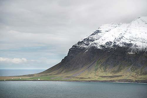
• From Varmahlíð or nearby, head north to highway 76.
Hofsós North to Siglufjörður
About 15 miles from the base of the fjord is the tiny village of Hofsós, with its fine Icelandic Emigration Center and small but tempting thermal swimming pool, overlooking the fjord. (For more on Hofsós, see earlier in this chapter.)
Continuing north, look out to the dramatic offshore islands: In good weather, you’ll be able to see the more distant Drangey, a popular destination for birders. If it’s socked in, you might pick out a pair of closer-in islands: the table-like Þórðarhöfði (technically a peninsula, connected to the mainland by a sandbar), then Málmey. See the sidebar, earlier, for more on these islands.
As the road curves right around one of the peninsula’s fingers, gaze out to sea and contemplate that you’re looking toward the Arctic Circle.
• As you approach the Miklavatn lagoon, at the scenic valley junction called Ketilás, you hit a T-intersection; turn left to stay on highway 76 (marked Siglufjörður).
Curl up along the water, with nice views back on the mountainous coastline. As you climb toward the topmost part of the peninsula, the road may alternate abruptly between paved and unpaved (signs will give you a warning). Steady as you go, carrying on through the spectacular scenery. This is the northernmost point of this drive—and perhaps the farthest north you’ll ever be in your life.
• The road starts to wind along the high bluffs over the sea, takes you through a short one-lane tunnel, and then deposits you in the adorable town of Siglufjörður.
▲▲Siglufjörður and the Herring Era Museum
The town of Siglufjörður (SIG-loo-FYUR-thur, Mast Fjord, pop. 1,200), with its worthwhile Herring Era Museum, is reason enough to tour Tröllaskagi. Sheltered from the sea on a short fjord, and dramatically flanked by high peaks, Siglufjörður has a tidy charm and a pioneer spirit.
Siglufjörður Town: The town’s harborfront provides a lovely stroll, and colorful homes scamper up the hillside above town (with protective avalanche barriers topping the mountains above). There’s a free parking lot at the old harbor downtown, right before you reach the landmark Sigló Hótel and a short walk from the Herring Era Museum. Public WCs are at the adjacent campground, and a TI is in the library on the main square (unpredictable hours, but generally open Mon-Sat in summer, closed Sun, +354 467 1555, info@fjallabyggd.is).
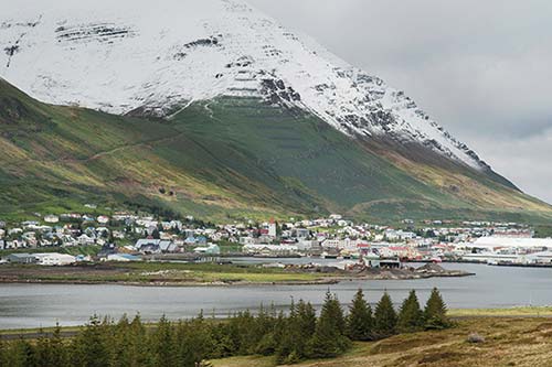
Fish is what put Siglufjörður on the map. Practically no one lived here until the mid-19th century, when locals started to use the good harbor as a trading post and shark-fishing base. In 1903, Norwegian fishermen established this place as a hub for herring, and the town boomed as a sort of “Atlantic Klondike” through the first half of the 20th century—until overfishing caused herring stocks to collapse.
It’s hard to overstate how big and bustling Siglufjörður was during those herring salad days. Its harborfront was jammed with piers, stacked with thousands of barrels of salted herring. The port bristled with the masts of hundreds of boats and stank with the odor of fish-processing stations. The population swelled to over 3,000.
Salted herring—which was highly nutritious and traveled well—was exported across Europe and to the United States. (It was especially prized during the world wars.) For a time, herring represented up to half of Iceland’s total export income. In fact, the wealth generated by Siglufjörður’s herring operation helped make Iceland financially independent—and, soon after, politically independent—from Denmark. But by the late 1960s, the herring shoals had disappeared for good, and Siglufjörður’s population crashed. The burg you see now is sleepy, with a little fishing and more and more tourism.
Siglufjörður does a beautiful job of celebrating the women who muscled Iceland into economic independence, one fish at a time: the so-called herring girls who worked at the salting stations. The Icelandic answer to Rosie the Riveter, Siglufjörður’s herring girls are remembered as proto-feminist icons who, through their hard work and persistence, strengthened this community in the early 20th century. They also set the stage for advances in both women’s rights and workers’ rights. When the herring girls staged a strike here in 1925, their male employers quickly moved to settle it, realizing how critical they were to the local industry.
Herring Era Museum (Síldarminjasafn): Among Iceland’s most engaging, this museum has exhibits filling three large, historic buildings, right along the main road (just past Sigló Hótel toward Akureyri). It’s well worth an hour (or more) of your time. I never knew the herring industry could be so fascinating (2,200 ISK, free for kids under 15, June-Aug daily 10:00-18:00, May and Sept 13:00-17:00, Oct-April by appointment, private tours available—email to schedule a time, occasional salting demos—check schedule online or email to confirm times, Snorragata 10, +354 467 1604, www.sild.is, safn@sild.is).
Begin at the red building at the left end of the row—the Salting Station (a.k.a. Róaldsbrakki, from 1907). Before heading inside to buy your ticket, check out the work stations near the stairs. You’ll see the white tables where the herring girls worked—cutting and gutting each fish (and dropping them in the wooden chute), then carefully slicing up and salting them before piling them into barrels. On occasion, to preserve the tradition of herring processing, the museum offers live demonstrations and tastings out here. Peek into the warehouse at ground level, where the salting line and storage areas were, to find a good exhibit about the making of the barrels.
Inside the building, upstairs, on the right, find the panoramic photograph of the embankment out front—now so sleepy—lined with countless herring-filled barrels. This Norwegian-owned factory (one of 23 salting stations in town) could crank out 30,000 barrels of salted herring in a year. Also on this level, you’ll peruse introductory exhibits and peek into the offices of a typical herring company—where the money poured in.
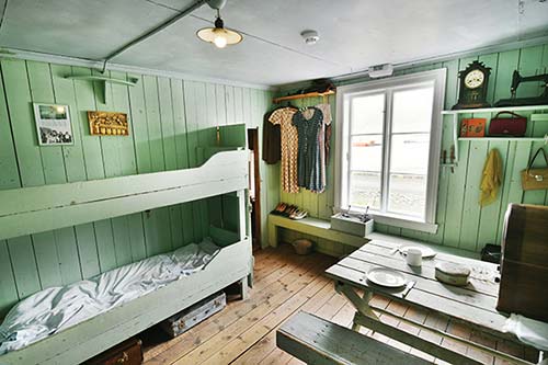
Climb the creaky stairs for the highlight of the museum: the living quarters for the herring girls who lived and worked here, 50 at a time, through the herring season. All summer long, the young women worked outdoors, rain or shine. You’ll see the shared kitchen and rows of dorm beds (each bed often shared by two women), with clothes still hanging from hooks and music playing on the radio. Handwritten lyrics from love songs are still scratched into the walls. Herring girls didn’t work particular shifts but were “on call” throughout the season—anytime the herring boats returned, they got to work, sometimes for 20 hours straight, to process the herring before it went bad. (One former herring girl—who still visits the museum on occasion—said she once worked for 34 hours straight.) These hardworking women were paid by the barrel; the male dockworkers who assisted them were paid by the hour.
One more small staircase leads up to the attic, where equipment hangs from the rafters.
Next, head to the multicolor-fronted building next door, the Fish Factory—a jumble of heavy machinery where some of the catch was processed into oil or fishmeal for animal feed. You’ll see everything from an old hand press to motorized equipment powered by a huge diesel engine. The exhibits upstairs help tell the story.
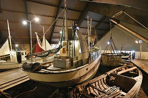
Finally, enter the large Boathouse, distinguished by its three roofs, where you can stroll through an impressive life-size re-creation of the jammed harbor at its peak, circa 1950. Step into shacks decorated with antique pulleys, lanterns, nets, buoys, and other tools. Walk around on the decks of the largest boat (the Týr), imagining this scene multiplied a hundredfold on the harbor out front. Before heading outside, pay your respects at the colorful statue of a herring girl, sitting by her barrel on the dock next to one of the ships.
Sleeping in Siglufjörður: One of Iceland’s most appealing high-end, fjordside hotels, $$$$ Sigló Hótel fills a picture-perfect building on the waterfront in the middle of town. Everything is done with class, from its 68 harbor-view rooms to its stay-a-while atrium bar/lounge. If you’re going to splurge on an Icelandic fjord, do it here (private hot tub and sauna, on-site restaurant open for dinner only, Snorragata 3, +354 461 7730, www.keahotels.is/siglo-hotel, siglo@keahotels.is).
$$ Hótel Siglunes, a few short blocks away in a residential zone, is a homey place (well run by proud Hálfdán) with 17 bright and cheery rooms (most with private bathrooms). Downstairs, an inviting belle époque-style lounge and bar features a nice mix of antiques and local artists’ work (family rooms, hot tub, bikes available, recommended restaurant, Lækjargata 10, +354 467 1222, www.hotelsiglunes.is, info@hotelsiglunes.is).
Eating in Siglufjörður: Sigló Hótel runs the two eateries in the colorful sheds around the harbor. Of these, the popular $$ Torgið (The Square), in the yellow building, spans two floors. The high-ceilinged, more convivial downstairs has cozy tables surrounding a fireplace. The quieter upstairs tables have chairs made from barrels. They offer decent pizza, burgers, and some fish options (daily for lunch and dinner, +354 467 2323). Just across the way in the red building, $ Kaffi Rauðka serves lighter fare (daily until 18:00). A block north is the little main square (directly under the church) where you’ll find $ Fish & Chips, a family-run shop serving fresh-caught fish (daily until 17:00, closed Sat-Sun, +354 467 1172). If you’re around at dinnertime, venture a block farther to the recommended $$ Hótel Siglunes, which serves inventive Moroccan-fusion cuisine (reservations recommended, daily for dinner only, see hotel contact info, earlier).
• As you leave Siglufjörður, head south.
South to Dalvík
From Siglufjörður, you’ll drive up on a headland (scenic pullout on the left), then disappear into a long tunnel. After 2.5 miles, you’ll pop out at a virgin lake, Héðinsfjarðarvatn, a good picnic spot.
From here, you’ll immediately enter an even longer tunnel (4.5 miles), eventually surfacing at the town of Ólafsfjörður.
• Passing through Ólafsfjörður, the road becomes highway 82 and follows alongside the fjord.
Leaving Ólafsfjörður (picnic pullout on the left), you’ll begin to gain altitude and go through an older one-lane tunnel with pullouts. A sign at the tunnel entrance indicates who has the right-of-way (hint: the white arrow means it’s you). Cars coming toward you have pullouts on their right. Just take your time, keep an eye out for headlights, and rest assured they’ll pull over.
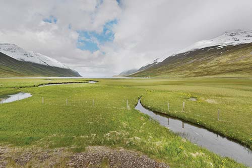
You’ll emerge along the shore of Eyjafjörður (Island Fjord)—whose name is inspired by its resident island, Hrísey, which you can’t miss ahead of you, just offshore. Wind down along the mossy, stony hillside to the flat plain below, flanked by a serrated row of snow-topped peaks.
• Next stop, Dalvík.
From Dalvík to Akureyri
Pulling into the town of Dalvík (Valley Bay), you’ll drive along its busy harbor. Where the road bends right and heads inland, consider stopping at the $ Gísli Eiríkur Helgi café. This relaxed and inviting coffeehouse is named for three comically “backward brothers” of Icelandic lore (look for their odd tools on the walls and blacked-out dining room inside). The café has great view seating upstairs; sells good coffee, cakes, and sandwiches; and puts on an excellent lunchtime soup-and-bread buffet (daily until 17:00 in summer, Grundargata 1, +354 666 3399; Heiða and Bjarni also run a hostel and rent cottages, https://dalvikhostel.is).
• Continue south on highway 82.
Beer pilgrims might consider a short detour at Árskógssandur (Riverwood Sands, about 10 minutes past Dalvík). This is home to Bruggsmiðjan Kaldi, Iceland’s oldest microbrewery (since 2006), which offers one-hour tours of its factory (3,500 ISK, includes samples and souvenir glass, book ahead by email, +354 466 2505, www.bruggsmidjan.is, bruggsmidjan@bruggsmidjan.is). A short drive away is their fancy brewpub, Bjórböðin, with tastings of locally produced beers, a limited menu, and an upscale beer spa—where for 17,900 ISK you can immerse yourself in the hoppy stuff (brewpub closed Mon, spa closed Sun-Mon, reserve ahead for the spa, +354 414 2828, www.bjorbodin.is).
• Highway 82 dead-ends at highway 1 (the Ring Road proper), about 20 miles beyond Dalvík. From the T-intersection where highways 82 and 1 meet, it’s six more miles to Akureyri.
Akureyri
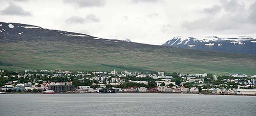
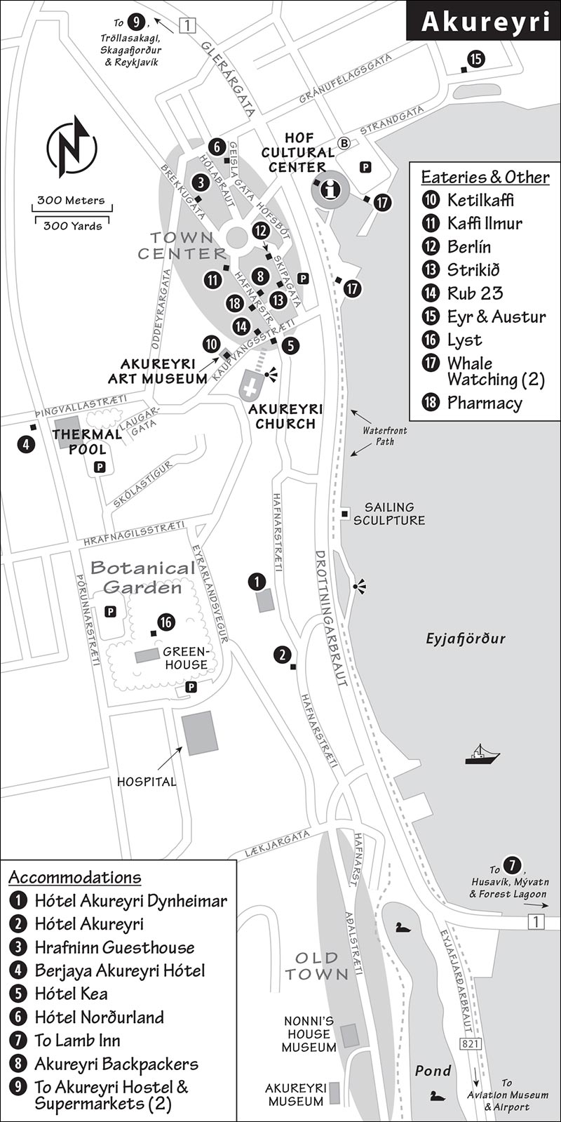
Akureyri (AH-kuh-reh ree; Field Spit), with just over 18,000 people, qualifies as Iceland’s second city and the unofficial capital of North Iceland. In many ways, Akureyri is a mini Reykjavík. Its pint-sized, pedestrian-friendly town center has an artsy vibe, heart-shaped red traffic lights, and small outposts of big Reykjavík shops. There’s a mini church designed by Guðjón Samúelsson (architect of Reykjavík’s Hallgrímskirkja), a mini ship statue similar to the Sun Voyager in Reykjavík, and even its own mini Pond (south of town, near the airport). On the hill above downtown is the botanical garden and city pool, and across the fjord is the Forest Lagoon, one of Iceland’s newest and most tempting thermal baths.
Like any second city, Akureyri has its own proud identity. The town is a jolt of prosperity and commerce wedged between the many sleepy Ring Road villages. And its setting, right along the deep Eyjafjörður, easily one-ups Reykjavík’s. Arriving in this modest metropolis can be culture shock after a few days of small towns and tiny villages. The city’s history is very short, as there was little settlement here until the late 19th century. Fishing is the mainstay of the economy, and there’s also a small university and a hospital.
Though a perfectly pleasant place, Akureyri doesn’t have a lot of sightseeing. On a quick trip around the Ring Road, it’s best as a handy stop for a meal and a short stroll. With a little more time, poke into its striking church, wander its botanical garden, or enjoy its large thermal swimming pool complex (the botanic gardens, the pool, and the Forest Lagoon thermal bath are open late). And if you’re interested in whale watching, this is a great place to do it (though it’s arguably better in Húsavík, a bit farther along the Ring, and easier in Reykjavík).
Orientation to Akureyri
Whether you’re coming from the Tröllaskagi Peninsula or directly across the mountains from Skagafjörður, you’ll approach Akureyri on southbound highway 1. This main road carries you right through the center of town, and then turns to cross the fjord just before Akureyri’s Pond.
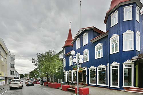
Tourist Information: You’ll find Akureyri’s TI in the Hof cultural and conference center, a striking, round building designed to look like basalt columns—you can’t miss it as you drive in. The staff is helpful and well informed (June-late Sept daily 8:00-16:00, shorter hours off-season, free WC, Strandgata 12, +354 450 1050, www.visitakureyri.is).
Parking: You can park for free in the Hof cultural center lot. Pay lots in downtown Akureyri use the Parka and EasyPark apps (enforced Mon-Fri 10:00-16:00).
Pharmacy: There’s a handy Apótekarinn pharmacy on the main shopping street (closed Sat-Sun, across from the recommended Akureyri Backpackers hostel at Hafnarstræti 95, +354 460 3452, www.apotekarinn.is).
Sights in Akureyri
Town Walk
Begin by exploring the vest-pocket town center, a pleasant grid of streets lined with good restaurants and touristy shops (including branches of Eymundsson bookstore and upscale clothing store 66° North). It takes just a few enjoyable minutes to wander here and get your bearings.
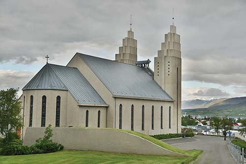
Up for a climb? In the town center, with your back to the water, follow the steps that lead up to the hill-capping Lutheran Akureyri church (Akureyrarkirkja), with Art Deco lines and a crushed-volcanic-rock facade. As you keep climbing, look out for the town’s fun knitted trash covers. Farther up the hill is a nice park, followed by the local thermal pool.
For a long and level stroll (a good idea on Sundays, when most shops are closed), head back to the water and turn right along the waterfront path. You’ll wander past some modern apartments (and likely see even more under construction), and continue for about 20 minutes to Akureyri’s old town and mini Pond. Just before the Pond, the time-stamped original settlement of Akureyri stretches a few short blocks with traditional block houses and a few museums, including Nonni’s House, the childhood home of beloved Jesuit priest Jón “Nonni” Sveinsson. (Sveinsson’s Nonni und Manni books about two Icelandic boys were made into a TV show in the 1980s.) The waterfront path continues to the airport and museums nearby (and beyond). On a nice day, it’s a fun opportunity for a bike ride (ask the TI about bike rentals).
From the Pond and old town, head back toward the town center on Hafnarstræti, passing more traditional homes. You could follow this street all the way back to the center. But consider turning left onto Lækjargata and follow signs to the town’s impressive botanical garden (described next).
Akureyri Botanical Garden (Lystigarður Akureyrar)
Akureyri’s top attraction, especially on a sunny day, is its botanical garden. This city park—compact but smartly designed and impeccably maintained—showcases northern plants (all labeled). Its pleasant, recommended café, in the middle of the park, is a handy landmark. Uphill and to the left, you’ll find a little arctic garden, with mountain flora planted in a pretty rockery. Downhill from the café is planted with lusher Icelandic and Arctic flora.
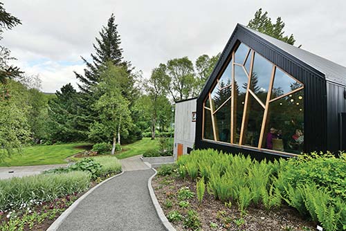
Cost and Hours: Free, June-Sept daily 9:00-22:00, facilities closed off-season but garden open, between Eyrarlandsvegur and Þórunnarstræti, free parking by the south and northwest entrances, WC, +354 462 7487, www.lystigardur.akureyri.is.
▲Akureyri Thermal Pool (Sundlaug Akureyrar)
Akureyri’s fine thermal swimming pool has extensive outdoor areas, including an ambitious waterslide. If you have yet to try an Icelandic pool, this sprawling complex is a fun place to start.
Cost and Hours: 1,200 ISK, 290 ISK for kids ages 6-17, June-Aug Mon-Fri 6:45-21:00, Sat 8:00-21:00, Sun 8:00-19:30, shorter hours off-season, corner of Þingvallastræti and Þórunnarstræti at the top of town (north of the botanical garden), access the parking lot from Hrafnagilsstræti (south of the pool), +354 461 4455, www.visitakureyri.is.
▲Forest Lagoon (Skógarböð)
Just a five-minute drive across the fjord from Akureyri is the area’s high-end geothermal bath experience. Nearly unnoticeable from town, this lagoon on the fjord’s edge is surrounded by the birch and pine trees of the Vaðlaskógur forest. Though the place is more touristy than local, it’s still a relaxing treat. Nurse a drink from one of two swim-up bars, and enjoy peek-a-boo views of the mountains and fjord from the large infinity pool. Dip into a smaller, hotter pool, bake in a dry sauna, and test your endurance in the cold-plunge pool. End your visit at the woody bistro that serves brunch and other light meals. A free shuttle runs to and from several spots in Akureyri: the Hof cultural center, Kea Hotel, and Berjaya Akureyri Hotel (check website for times).
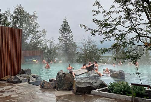
Cost and Hours: 5,690 ISK if booked in advance (more for last-minute bookings), 3,290 ISK for kids 6-15, daily 10:00-24:00; towel rental-900 ISK, bistro daily until 21:00, Vaðlaskógur +354 585 0090, www.forestlagoon.is.
Akureyri Museums
If you have the time, consider one of Akureyri’s museums. Right in the town center, the Akureyri Art Museum displays an eclectic mix of mostly Icelandic art across three airy floors. It’s a little sparse and light on information, but it’s enjoyable on a rainy day (2,000 ISK, June-Aug daily 10:00-17:00, Sept-May from 12:00, free tours in English every Thu at 12:30, recommended restaurant, +354 461 2610, www.listak.is).
Several museums lie just south of the center. Top of the list is the Icelandic Aviation Museum (Flugsafn Íslands), in a building at the airport (1,500 ISK; mid-May-mid-Sept daily 11:00-17:00, off-season Sat 13:00-16:00 and by appointment, +354 461 4400, www.flugsafn.is). There’s also a city history museum, an engineering museum, and a motorcycle museum. For details, ask at the TI.
Whale Watching, Island Hopping, and Other Excursions
Whale watching and other excursion boats line up at the waterfront. It’s best to book ahead. Well-established companies include Elding (www.elding.is) and Ambassador (www.ambassador.is [URL inactive]). Expect to pay around 13,000 ISK for a classic three-hour cruise and 22,000 ISK for a two-hour high-speed RIB trip. Keli does a slightly cheaper tour in an old oak boat (www.keliseatours.is).
Akureyri is also a hub for day trips (by boat or plane) to the little island of Grímsey, on the Arctic Circle (see the “Islands in North Iceland” sidebar, earlier).
An excursion can make it easier to link up Akureyri with the worthwhile sights around Mývatn. Star Travel (www.startravel.is), The Traveling Viking (www.ttv.is), and Saga Travel (www.sagatravel.is) all run day tours (20,000-30,000 ISK).
Sleeping in Akureyri
You could do worse than sleeping in Akureyri, which feels like a return to civilization for Ring drivers. The town is also a good base for day trips: Head to lake Mývatn one day, to Siglufjörður the next, and so on.
In the Center: The top choice—and one of Iceland’s most unique stays—is $$$$ Hótel Akureyri Dynheimar. This former movie theater rents 16 classy rooms, with famous movie quotes outside each door and a record player in every room. The lounge and hallways maintain a classic movie-theater ambience with old posters, floor lighting, and dark walls covered in art and splashed with neon. The same owners run the nearby $$$ Hótel Akureyri (70 rooms) as well as the $$ Hrafninn Guesthouse (12 rooms) on the other side of town (check-in for all three accommodations is at Dynheimar, breakfast extra—served at main hotel, bike rental, Hafnarstræti 73, +354 462 5600, www.hotel-akureyri.com, hotelakureyri@hotelakureyri.is). Next door to Dynheimar, check out the hotel’s Urban Farm greenhouse, where they grow greens for local restaurants.
$$$$ Berjaya Akureyri Hótel, with 99 well-designed rooms, offers big-hotel comfort in a hilltop location. It’s in a residential zone, across from the swimming pool (Þingvallastræti 23, +354 518 1000, https://icelandhotelcollectionbyberjaya.com, akureyri@icehotels.is).
$$$ Hótel Kea, part of an upscale chain, has 104 business-class rooms right below the church steps, putting all of Akureyri at your doorstep. Rates are slushy but can be a good deal. The hotel faces the main road, so light sleepers should request a quieter room at the back (family rooms, breakfast extra, elevator, restaurant, Hafnarstræti 87, +354 460 2000, www.keahotels.is, kea@keahotels.is).
$$ Hótel Norðurland has 41 comfortable rooms with private baths and a mod lounge just a few blocks off the harbor (no elevator, Geislagata 7, +354 462 2600, www.hotel-nordurland.is, booking@hotel-nordurland.is).
Cheaper Option Outside Town: In the idyllic countryside 10 minutes south of Akureyri, $$ Lamb Inn is on a working family farm called Öngulsstaðir, owned by Jóhannes, who was born and raised here. It has 18 straightforward rooms in a converted cowshed, all with simple, prefab-like bathrooms. They have a hot tub for guests, and a good dinner-only restaurant serving award-winning lamb raised right here (family rooms, Öngulsstaðir 3, +354 463 1500, www.lambinn.is [URL inactive], lambinn@lambinn.is).
Hostels: Akureyri has two hostels: one on the main shopping street, and one just on the outskirts of town. ¢ Akureyri Backpackers is a bit pricier but has a more personal touch, an ideal location, and a decent restaurant downstairs (private rooms, Hafnarstræti 98, +354 571 9050, www.akureyribackpackers.com, akureyri@backpackers.is). ¢ Akureyri Hostel is more traditional and hands-off, with 50 beds, plus bungalows and cabins (Stórholt 1, +354 894 4299, www.akureyrihostel.com, hostelak@hostelak.is).
Eating in Akureyri
In the Town Center: Housed in the bottom floor of the Akureyri Art Museum, $$ Ketilkaffi serves upscale brunch dishes all day, along with sandwiches made with their homemade sourdough bread. They also serve healthy soups, bowls, and smoothies, plus wine and cocktails in the evening (daily until 18:00, Kaupvangsstræti 8, +354 869 8378).
$$ Kaffi Ilmur (Aroma Café) is a casual place filling one of Akureyri’s oldest houses on a hillside a few steps above the action on Hafnarstræti. The menu ranges from heartier mains (like beef, lamb, and salmon) to lighter fare (like salads, soups, and sandwiches). On a nice day, the outside seating is delightful (daily until 18:00, Hafnarstræti 107b, +354 571 6444).
$ Berlín, with a cozy, tight, hipster vibe, is a popular breakfast and lunch spot serving cheap salads and sandwiches (daily until 18:00, Skipagata 4, +354 547 2226).
$$$ Strikið fills the top floor of a downtown “high-rise” (in Akureyri, that’s five stories). Ride the elevator up to the modern Nordic bistro, which has an eclectic menu of surf, turf, and vegetarian dishes—including a set three-course menu for dinner. While quite pricey at dinner, they offer good lunch specials with a view (daily, reservations smart, Skipagata 14, +354 462 7100, www.strikid.is).
For top-end dining, $$$$ Rub 23 has a reputation even among Reykjavík urbanites for its grill-focused Asian-fusion food and sushi (dinner daily from 17:30, Mon-Fri also open for lunch, reservations smart, across the street from the church steps at Kaupvangsstræti 6, +354 462 2223, www.rub23.is).
On the Waterfront: Just beyond the Hof cultural center and facing the cruise port, $$$ Eyr brings some class to an otherwise unremarkable area. It’s in a large, traditional-style building—a stark contrast to its chic, modern interior. The elegant decor is matched by the menu, which offers contemporary takes on classic dishes. Choose from small plates and main courses, or opt for the three-course menu (daily, reservations smart, Strandgata 49, +354 440 6600, www.eyr.is [URL inactive]). Down a hallway is the small but equally trendy $$ Austur pizza joint (daily, same contact info as Eyr).
In the Botanical Garden: At the center of the garden is $ Lyst, serving sandwiches, salads, soup, and pastries in a striking picture-windowed building (late May-late Sept daily, Eyrarlandsvegur 30, +354 869 1369).
Supermarkets: Bónus is along the main road as you drive into town from the west (Langholt 1). There’s also Nettó, in the Glerártorg mall, also along the main road.
Akureyri Connections
Akureyri is a transportation hub for the north and is well connected to Reykjavík by bus #57 (2/day except 1/day on Thu and Sat, 6 hours to Reykjavík’s Mjódd station, www.straeto.is). In summer (June-mid-Aug), these buses run Sun-Fri (no buses Sat): #57 to Goðafoss (30 minutes), Mývatn (45 minutes), and Egilsstaðir (a hub for the Eastfjords, 3.5 hours); and #78 to the fjordside town of Siglufjörður (1.5 hours; for the best views, sit on the right on the way up, and the left on the way back) and Húsavik (1.5 hours). Schedules fluctuate (and are reduced off-season), so double-check departure times at the TI. Long-distance buses stop at the Hof cultural center.
You can also fly in less than an hour from Reykjavík City Airport to the Akureyri airport, about two miles from the center (car rental and taxis available; look for flights at www.icelandair.com).
Akureyri to Mývatn
It’s about 60 miles (1-1.25 hours) from Akureyri to Mývatn.
Leaving Akureyri: From Akureyri, highway 1 crosses the fjord at the Pond and turns north along the opposite shore (a pullout offers views across the fjord to the city). Immediately following the pullout, you’ll reach a roundabout and a choice: scenic pass or toll tunnel. In all but terrible weather, I’d take the scenic pass rather than paying for the tunnel, which only saves about 10 minutes.
Option 1—Scenic Pass: If you follow signs to Grenivík/Svalbarðseyri (highway 83), the road climbs steeply away from the fjord. Stay right at the Y onto highway 84 to cross Víkurskarð Pass (1,100 feet), then rejoin highway 1. Víkurskarð is beautiful in summer but treacherous in snow.
Option 2—Toll Tunnel: If instead you follow signs to Egilsstaðir/Mývatn/Húsavík, you’ll enter the four-mile-long Vaðlaheiðargöng toll tunnel and barrel straight under the mountain. There are no toll booths: Rental-car drivers are expected to pay online (1,650 ISK in advance or within three hours, 2,150 ISK thereafter—and likely a fine from your rental-car company; easy to register in advance and pay at www.veggjald.is).
• It’s about 45 minutes from Akureyri to our next stop, Goðafoss. Rejoining highway 1 (or emerging from the tunnel), you’ll drive through lightly forested foothills that open into a valley. Just after a large lake (Ljósavatn—Mirror Lake—nice pullout), a turnoff on the left (highway 85) leads to Húsavík. But we’ll continue another five minutes across the rocky landscape to reach...
▲Goðafoss Waterfall: This pretty, horseshoe-shaped waterfall on the Skjálfandafljót river is not so high (only 40 feet), but it is quite broad (100 yards). There are two parking lots, one on each side of the falls, with paved walkways and viewpoints along both sides. It takes just a couple of minutes to walk to the best views. The west parking lot has no services but is typically less crowded and gives you access to the tidepool-like rocks at the top of the falls, and perhaps the best overall view of the cascades. The east lot is beyond the gift shop/café (with WC) and has steps down to a rocky beach at the base of the falls (use caution; the steps are not always safe). You can return to the highway to drive between the two, or use the pedestrian bridge.
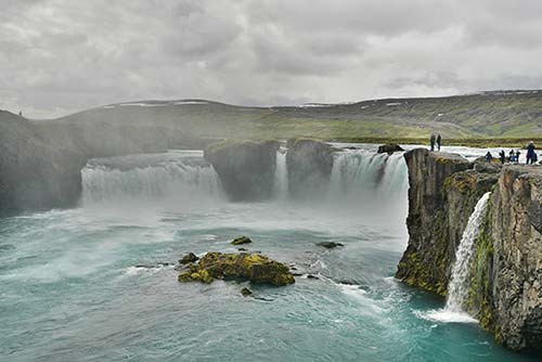
Scholars’ best guess is that the waterfall was named after crags on the river’s east bank that resemble pagan idols (goð). One legend is that the name commemorates Iceland’s conversion to Christianity in AD 1000: Supposedly, local law speaker Þorgeir Ljósvetningagoði was assigned to choose whether Iceland would remain pagan or (under great pressure from Norway) become Christian. Þorgeir chose to have Iceland convert. He became a Christian, came home, and allegedly threw his carved pagan statues into this waterfall—giving it the name Waterfall of the Gods (Goða-foss). For more on Þorgeir, see here.
• From Goðafoss, the road climbs over a low pass called Fljótsheiði (800 feet). You’ll pass another turnoff for Húsavík (highway 845), then drop down to the small settlement of Laugar.
Laugar to Mývatn: There’s not too much to see in this sparsely populated countryside. You’ll pass a few farms and drive along the shore of a desolate lake, then along a small river, Laxá. The river is famous as the site where, in 1970, almost two hundred locals took matters into their own hands and blew up a small controversial dam they had opposed. Over a hundred individuals “confessed” to the crime and refused to say who did what, making prosecution difficult.
• About an hour from Akureyri, you’ll reach the junction of highways 1 and 848. Carry straight along on highway 848.
You’re just west of lake Mývatn. From here, follow highway 848 counterclockwise as it loops around the south and east shore of the lake, with several attractions (described next).
From Mývatn, it’s a 45-minute detour north on highway 87 to the bayside town of Húsavík (described on here).
Mývatn
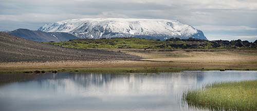
Mývatn (MEE-vahtn; n almost silent; literally “Midge Lake,” after the tiny gnats that thrive here) is one of Iceland’s most impressive natural areas. The big lake—about 14 square miles, broad and shallow—has an intriguingly ragged coastline, with lots of bays and islets.
The real draw here is the terrain surrounding the lake. The lakeshore is dotted with a delightful array of volcanic features, from burst-bubble pseudocraters, to otherworldly pillars, to a climbable ash crater. And a short drive away are a geothermally active valley and premium thermal baths. The entire area is ringed by striking flat-topped mountains. With its accessible size, remote location, and diversity of easy nature hikes, Mývatn feels like Iceland’s Yellowstone.
Note that the Mývatn area lacks a real town, but the appealing small town of Húsavík is just a 45-minute drive north. Húsavík is worth a detour (and can be a good place to stay, if Mývatn is full or if you’re interested in whale watching; see here).
Orientation to Mývatn
Mývatn is the name of the lake, but also refers to the entire area (which Icelanders call Mývatnssveit). Sights are scattered around the lake, which is ringed by two roads. Highway 1 runs along the west and north side, with few sights other than Sigurgeir’s Bird Museum. Highway 848, on the south and east sides, is more interesting, especially along the 10-mile stretch between the hamlets of Skútustaðir and Reykjahlíð. Another cluster of sights lines the stretch of highway 1 that runs east away from the lake, toward the Eastfjords.
Most settlement around the lake is on dispersed farms. Reykjahlíð (RAYK-yah-HLEETH, Steamy Slope), at the lake’s northeast corner, is the closest Mývatn comes to a village, with about half of the region’s population—a whopping 200 people. It has a small supermarket, a bank, a gas station, a health center, and a few streets with houses. Skútustaðir (SKOO-tu-STAH-theer), on the southern shore, has the visitor center, a church, and gas pumps, next to a farm. Both areas have a couple of hotels and restaurants; farm stay guesthouses and cafés are scattered in between.
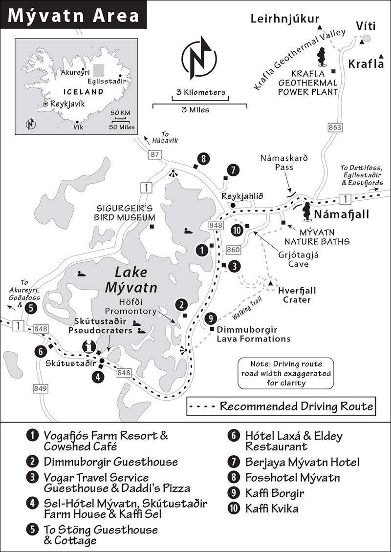
Tourist Information: The Gígur Visitors Center in Skútustaðir, staffed by knowledgeable rangers from Vatnajökull National Park, offers maps, hiking advice, and ranger walks (check schedule online or ask on arrival). A small but worthwhile exhibit explains the lake’s geology and biology (daily in summer 9:00-18:00, WC, +354 470 7110, www.vjp.is). The website VisitMyvatn.is is also helpful.
By the time you visit, there may be a new bike path around the entire lake—ask at the visitors center. You can rent bikes at the recommended Hótel Laxá (see later).
Tours and Activities: GeoTravel runs a wide range of tours, including jeep tours to the giant Askja volcanic caldera, deep in the Highlands south of Mývatn—only reachable by 4x4 vehicle (+354 464 4442, https://geotravel.is). Mývatn Tours can also take you to the crater by bus (www.myvatntours.is). Mýflug Air runs sightseeing flights over the region (www.myflug.is). Various local companies offer horseback riding, including Safari Horse Rental (www.safarihorserental.com).
Eating: This area has no stand-alone “destination” restaurants, but upscale hotels have emerged with high-end dining rooms to match. I’ve listed a few more practical choices that are convenient to the sights. Try to sample two local products that are often served together: sweet, dark rye bread that’s buried underground and baked with natural thermal heat, then topped with decadent, smoked lake trout.
Dealing with Midges: You may want to wear a net to protect yourself from midges flying into your nose, ears, or mouth (see sidebar). You can bring one from home or buy one locally (sold at area supermarkets and the visitors center in Skútustaðir). Don’t bother using insect repellent: The bugs aren’t out to bite you—they’re just a nuisance.
Sights near Mývatn
AROUND THE SOUTH AND EAST SHORE
These sights surround the lakefront. I’ve listed them in the order you’ll encounter them driving counterclockwise from Skútustaðir (southwest) to Reykjahlíð (northeast) along highway 848.
▲Skútustaðir Pseudocraters
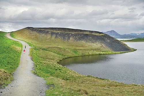
At the tiny settlement called Skútustaðir, you reach the first of many striking volcanic sights at the lake. Park at the large and well-signed Gígur Visitors Center (see earlier), then walk the half-mile “Crater Trail” loop between the road and the lake, through the pseudocraters (also called “rootless cones”). These grassy dimples are not real volcanic craters. They’re all that’s left of what had been giant bubbles in molten lava: Water under the lava boiled into steam, rose to the surface, and popped. A paved walkway leads to the top of the nearest crater, then metal stairs lead down to a gravel path. You’ll see these metal steps lead up to the rims of several of the craters. The trail is a loop, ending at a smaller parking lot down the street from the visitors center and main parking lot. A longer path (Bird Trail, 1.5 miles) splits off about halfway around the loop (allow an hour).
Eating at Skútustaðir: Across the street from the endpoint of the Crater Trail (by the smaller, lower parking lot), $ Kaffi Sel serves cheap, simple meals and a handy, lunchtime soup-and-bread buffet. You can also sample their homemade craft beer; try the Vindbelgur IPA, named after the local mountain and made with the area’s famous bread that’s baked underground (daily until 17:00, +354 464 4164). The restaurant inside $$ Sel-Hótel Mývatn has a more substantial lunch buffet for about double the price (daily). Just behind Sel-Hótel Mývatn, the recommended Skútustaðir Farm House sells homemade ice cream made from their own cow’s milk (daily until 19:00, look for Skútaís sign).
For a memorable splurge, try $$$$ Eldey, inside the recommended Hótel Laxá. It has perhaps the area’s best food, using locally sourced ingredients. It’s smart to make reservations, particularly for a view table (daily for dinner only, +354 464 1900, www.hotellaxa.is/en/eldey)
• To continue around the lake, follow the lakeside road counterclockwise. Within a few miles you’ll leave grassy rolling hills and enter a lunar landscape covered by an ancient lava flow. As you come up over a rise, watch on the left for a pullout overlooking a lagoon that’s filled with serrated lava islands. As you look out over the water, notice the wooded peninsula to the north (on your right). This is...
Höfði Promontory
For years, a local couple worked to reforest this small peninsula and to create sheltered walking trails with views of the lake and the lava columns that rise up from it. It makes a nice 30-minute stop on a pleasant day, offering panoramic views over the region (park in the lot just beyond the pullout mentioned above). Midges love it here. If you’re here when they are, wear a net or prepare to spit midges.
• On the land side of the road, a little farther north (toward Reykjahlíð), watch for the turnoff for our next stop, which sits about a half-mile off the main road.
▲▲Dimmuborgir Lava Formations
Literally the Dark Castles, Dimmuborgir (DIM-moo-BOR-geer) is a fantasyland of spectacular pillars and crenellated formations. It’s the most satisfying place around the lake for an easy nature walk, and it’s fun for kids—with a little imagination, a rock easily becomes the face of one of the numerous Yule Lads (mischievous Christmas trolls) said to spend summers in these caves. Locals walk through reciting their favorite folk tales, including that of Gammur, an eagle that’s the guardian spirit of North Iceland.
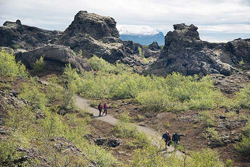
The Dimmuborgir formations originated when everything here was underwater. From the lakebed, magma leaked upward and solidified, forming spiky, stalagmite-like columns. Well-marked, paved trails lead through Dimmuborgir. The shortest walk takes only 15 minutes (passing by “Spoon Lick Cave”), but you could easily spend two hours here. A marker above the parking lot identifies the surrounding peaks. Entrance and parking are free (pay WC at the café, cards accepted); if you visit early or late, it will be less crowded.
Eating at Dimmuborgir: Above the Dimmuborgir parking lot, $$ Kaffi Borgir has a soup-and-bread lunch buffet and a short menu of main dishes. Their “bread in a bucket” is baked in the ground for 24 hours. If you can handle the midges, their outdoor seating is atmospheric (daily, closed off-season, +354 461 1144, www.kaffiborgir.is).
• Returning to highway 848, continue north, watching for Hverfjall signs. A gravel road leads 1.5 miles to the parking lot for...
▲▲Hverfjall Crater
The vast, dry Hverfjall crater (KVER-fyahtl, sometimes spelled Hverfell) rises just east of the lake—you can’t miss it. It’s what’s known as a tephra volcano—composed of volcanic ash and small debris, created in an eruption about 2,900 years ago. It’s big: The cone-shaped mountain itself is over a mile wide and 550 feet tall, and the crater is a half-mile in diameter.
From the parking lot (suggested parking fee—scan the QR code, pay WCs—cards accepted, info boards), a path leads up the gravel slope of the mountain to the rim, where there’s an excellent view down into the broad crater and back toward the lake. The hike up is a good workout but isn’t too steep and takes about 20 minutes one-way. Allow another 1.5 hours to hike the crater’s two-mile perimeter. In strong winds, the walk up isn’t much fun, and the loose soil can start to fly around; otherwise, your effort will be rewarded.
Eating near Hverfjall: Just north along the road toward Reykjahlíð is $$$ Cowshed Café, with a country-chic vibe and tasty farm-to-table cooking; it’s my favorite choice for a meal in the area (it’s part of the recommended Vogafjós Farm Resort). It’s in a souped-up barn with views of the lakeshore and mooing cows—you can see the milking area through a window. If you just need a coffee-and-cake break, sit in their elegant lounge. Outside tables get you closer to the cows—and you may get more cow than you bargained for (daily in summer, closes earlier off-season, reservations for dinner recommended, +354 464 3800, www.vogafjosfarmresort.is).
Because Mývatn sits along the gap between the Eurasian and North American tectonic plates, the area is very active geothermally. Relatively recent volcanic eruptions—about 2,500 years ago—shaped the landscape here: A powerful eruption created the Hverfjall crater, and vast amounts of lava from a fissure (vent) eruption poured out, blocking a river (creating the lake), then flowing down the valley toward Akureyri.
The lake is protected as a nature reserve, and boating is restricted. The water is shallow and calm; ducks and other migratory water birds breed around the lake and its surrounding wetlands. Far from the sea, the area has slightly warmer, drier, and less windy summers than other parts of the country.
Unfortunately, these conditions make it a perfect home for midges (mý), the aquatic insects after which the lake is named. They don’t bite (this distinguishes them from the nasty midges common in Scotland, no-see-ums in the US, and sandflies in Australia). But Mývatn’s midges (in the chironomid family) do swarm—in such numbers during the summer, especially in windless conditions, that locals sometimes wear nets over their heads to stop the little things from getting into their ears, mouths, and noses.
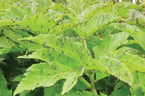
Mývatn is also home to black flies (Simulium vittatum), which do bite. Fortunately, these are mostly concentrated in the less touristed western end of the lake and the Laxá river, and with luck, you won’t encounter them at all. (They’re also found elsewhere in Iceland.)
Mývatn has plenty of biodiversity beyond its bugs and birds. The lake itself is rich in nutrients and has an abundance of aquatic life. Mývatn and a lake in Japan are the only places on earth known to support kúluskítur (marimo), an unusual algae that forms into lovable green, softball-size spheres. Unfortunately, the balls have mostly disappeared from Mývatn in the last few years, although you may find one being tenderly cared for at Sigurgeir’s Bird Museum.
• The next stop is best reached from highway 1 (see complete directions below).
Grjótagjá Thermal Cave
Tucked in the middle of nowhere a few minutes’ drive from the lake is a hidden cave filled with natural thermal waters. It gets more attention than it deserves for being a filming location for Game of Thrones (the romantic retreat where Jon Snow and Ygritte, ahem, violated the oath of the Night’s Watch). While skippable for most, curious GoT fans may find the brief detour justifiable. You’ll park next to a buckled ridge of lava, where rocky footing leads down to a steaming pool. Watch your step—there are no guardrails or barriers—and getting in the water is forbidden. Another path leads to the top of the lava formation, where you can see the crevasse stretching into the distance.

Getting There: Grjótagjá is most easily accessed from highway 1, just east of the lake but before the turnoff for Mývatn Thermal Baths; watch for the small Grjótagjá sign. From the turnoff, it’s a quick 1.5-mile drive to the parking lot. It’s also possible to hike here from Hverfjall and Reykjahlíð.
ON THE NORTHWEST SHORE
Sigurgeir’s Bird Museum (Fuglasafn Sigurgeirs)
Mývatn is famous among birders, who marvel at the more than 115 species that can be found here (including 30 types of ducks)—making it one of the richest birding areas in the world. This museum, worth ▲ for birders, offers an opportunity to examine hundreds of taxidermy specimens up close (as well as an extensive egg collection). Display cases show off a striking diversity of birds, including nearly every bird found in Iceland and many that migrate here to breed. Webcams and telescopes let you observe live birds on the lake, and the staff loves to advise visitors. A second, smaller building displays a boat once used to ferry passengers across the lake.
The collection is named for avid birder Sigurgeir Stefánsson, who lived on this farm and collected most of the specimens you see (usually birds that were already deceased). Nature did not return his kindness, as at age 37 Sigurgeir drowned during a freak storm on the lake. But his legacy—and his passion—live on here. Because the museum’s opening hours are inconsistent, it’s smart to call ahead of your visit.
Cost and Hours: 2,400 ISK, June-Aug typically daily 12:00-17:00, April-May daily 14:00-16:00, closed in winter, on road 8735 at the farm called Ytri-Neslönd—signposted off highway 1, +354 464 4477, www.fuglasafn.is.
GEOTHERMAL SIGHTS JUST EAST OF MÝVATN
On and near highway 1 going east from the lake are several other worthwhile attractions—most of them related to the geothermally active landscape. You might find it simplest to fit these in on your way from Mývatn to the Eastfjords, but it’d be a shame to rush them. Since they’re all within 10 miles of the lake, you can easily double back if you’re staying nearby.
• Along highway 1, five minutes from Reykjahlíð (and before Námaskarð pass), watch for Jarðböðin signs on the right to reach...
▲Mývatn Nature Baths (Jarðböðin við Mývatn)
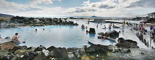
This premium swimming pool is one of Iceland’s original upscale thermal bath experiences. Imagine the Blue Lagoon, but a bit more modest, less crowded (maximum capacity is about 430), and about half the price. The baths’ outdoor lagoon is beautifully designed: two big pools with natural contours, rocky walls, and fine views over the volcanic countryside. The water here is naturally heated excess from a nearby geothermal power station (at Bjarnarflag) and has a slightly sulfurous odor. The baths are open late, making this an ideal spot to unwind after a long day driving the Ring or exploring Mývatn. It’s not quite luxurious or spa-like, but for many, these baths are an enjoyable compromise between some of Iceland’s more expensive baths and a standard municipal pool. Locals enjoy it, too. The industrial complex across highway 1 (at the turnoff for the baths) is a former geothermal power plant.
Note that the Mývatn Nature Baths are slated for a major expansion; check online to confirm it will be open when you visit.
Cost and Hours: 6,490 ISK—reservations recommended, free for kids under 13, daily late May-Sept 10:00-23:00, off-season 12:00-22:00, towel rental—850 ISK, often referred to as Jarðbaðshólar on maps and signs, +354 464 4411, www.myvatnnaturebaths.is.
Eating at the Baths: The complex has a good cafeteria, $ Kaffi Kvika (Magma Café), with indoor and outdoor seating overlooking the lively lagoon (no bath ticket required). There are extremely limited lunch options (other than picnicking) between here and the Eastfjords, so consider stopping here on your way out of the area (open same hours as pool). You’re not allowed to eat your own food on the premises.
• Just past the baths, you’ll crest the small Námaskarð pass. Watch on the right (after the steep initial climb) for a pullout with a commanding panoramic view over the entire Mývatn area. Coming down the other side of the pass, a turnoff on the right leads in a couple hundred yards to the...
▲▲▲Námafjall Geothermal Area
The steaming, bubbling, brightly colored landscape of Námafjall (NOW-mah-fyahtl)—which is also sometimes called Hverir (Hot Springs) or Hverarönd—is one of Iceland’s most accessible and impressive geothermal areas. While it lacks a spouting geyser, it’s far more colorful and in a more impressive setting than Geysir on the Golden Circle—and it’s much less crowded, with very few ropes and signs (use caution and stay on the trodden paths). Parking costs a hefty 1,200 ISK (pay with the EasyPark app or at the machines, no WCs).
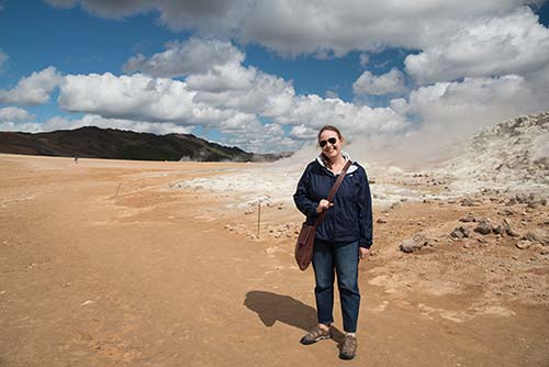
Park and step outside—getting slapped in the face with pungent hydrogen sulfide fumes. Then plug your nose and explore this compact, astonishingly diverse landscape. You’ll see fumaroles (like little stacked-rock ovens spitting steam), bubbling pools and mud pots, and a terrain brushed in a rainbow of vivid colors. Groundwater seeps deep down through the earth, where it encounters magma and is immediately shot right back up to the surface in the form of steam. Once emitted, it releases the sulfur that fills the air and coats the ground in its distinctive yellow patina.
The mountainside just beyond the plain also has steaming vents; with extra time, you can hike up the trail for a closer look and for views back over this landscape. The sulfur deposits in this area were once mined for gunpowder (náma means “mine”).
• A quarter-mile farther on, detour north onto paved highway 863. This five-mile-long road passes through a steaming landscape, linking several worthwhile attractions.
▲▲Krafla Geothermal Valley
The volcano Krafla (KRAH-plah), at the end of this valley, was active as recently as the 1980s; now the valley is the site of a geothermal power plant (notice the pipeline and electric cables on your left).
• As you head up the valley, keep an eye out on the right for a...
Showerhead: Sticking up from the ground, a single showerhead stands lonely in the middle of a volcanic plain. It appeared overnight several years ago—perhaps as a prank or art installation—but it really is hooked up to natural thermal water. Stop and give it a try.
• Continuing up the valley, you can’t miss the simmering...
Krafla Geothermal Power Plant: This plant taps into superheated liquid deep underground to generate electricity. Its modest, summer-only visitors center (the big red building) has exhibits and a brief film about the geothermal power process (free entry, WCs, and coffee; June-mid-Sept daily 10:00-17:00, closed off-season, www.landsvirkjun.com).
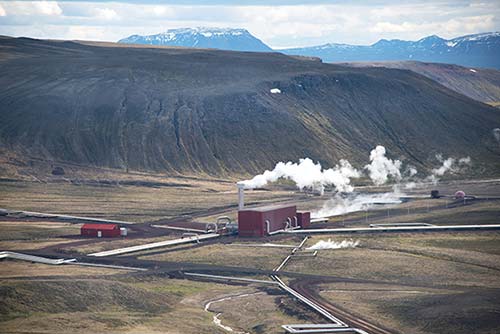
• After leaving the power station, there’s a parking lot on the left at the head of a marked path that takes you across a lava field to the...
Leirhnjúkur Volcanic Cone: Meaning literally Clay Peak, this low volcanic cone formed during eruptions around 1980. Volcano buffs enjoy the full hiking circuit here—all the way around the mountain. It takes about three hours and includes colorful pools, still-steaming lava formations, and more. To get a quick feel for the place, walk out to the mountain and back (about 15 minutes each way, partly on boardwalks); you’ll see some mud pots and fumaroles.
• Continuing on the main road past the Leirhnjúkur parking lot, look for a pullout on the right with info boards and a stunning view back over the valley. Then drive to the end of the road and the...
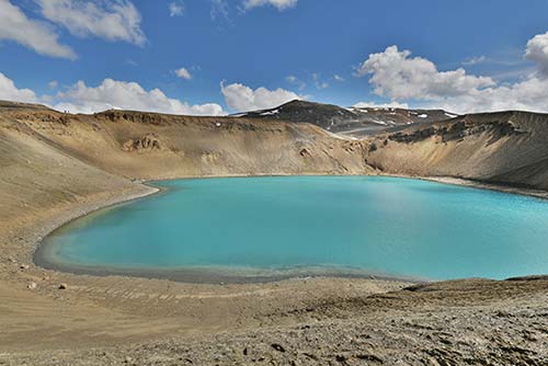
Víti Crater: This unearthly volcanic crater with a lake inside was formed during eruptions in the 1720s. You’ll park and walk uphill to the rim, with fantastic views over the colorful walls and water. From here, a path leads partway around the crater. Víti (Hell) is big, wild, and an altogether powerful and forbidding sight.
Sleeping near Mývatn
Reserve your rooms well ahead, as places can book up very quickly. If things are booked solid, stay in Húsavík—a pleasant waterfront town a 45-minute drive north (described later). Camping is allowed only at designated sites.
I’ve listed simpler places first. A few are budget-friendly and ideal for those who want a more personal experience. If you’re looking for a high-end stay, see the “Splurge Hotels” section, later.
ON THE EASTERN SHORE
$$$$ Vogafjós Farm Resort, near all the major sights, is a family-run working farm with 24 good, tidy rooms with private baths in three newer log-house buildings. Reception and breakfast are at the recommended Cowshed Café restaurant (+354 464 3800, www.vogafjosfarmresort.is, vogafjos@vogafjos.is).
$$$$ Dimmuborgir Guesthouse has eight simple rooms (with private bathrooms and a shared kitchen) in a main building and several prefab wooden cottages (with private baths and kitchenettes). It’s loosely run and a bit overpriced but family-friendly (Geiteyjarströnd 1, +354 464 4210, www.dimmuborgir.is, info@dimmuborgir.is).
$$ Vogar Travel Service feels like summer camp. They run a basic guesthouse (20 rooms with shared bath, 8 rooms with private bath, breakfast extra) in several buildings, a campground, and Daddi’s pizza joint. They’ll do laundry for anyone—drop off in the morning to pick up 24 hours later (family rooms, south of Reykjahlíð on highway 848, +354 464 4399, www.vogartravelservice.com).
ON THE SOUTHERN SHORE, AT SKÚTUSTAÐIR
$$$$ Sel-Hótel Mývatn, a family-run place, has 56 overpriced business-class rooms that feel designed for tour groups and conferences. What it lacks in charm it makes up for in amenities and views—two hot tubs, a sauna, and some rooms with nice views of the pseudocraters. They also run the neighboring shop that houses a tiny post office, recommended Kaffi Sel (see “Eating at Skútustaðir,” earlier), and a pub—the latter two serving homemade craft beer. The on-site restaurant caters to groups (elevator, +354 464 4164, www.myvatn.is, myvatn@myvatn.is).
$$ Skútustaðir Farm House, tucked behind the Sel-Hótel complex, is family-run, with 14 modern rooms (six with private bathrooms) in a mix of old and new buildings, plus a stand-alone cottage and a small apartment (laundry facility, +354 464 4212, www.skutustadir.is, book by email at info@skutustadir.is, Sofia).
IN THE COUNTRYSIDE TO THE WEST
$$ Stöng Guesthouse and Cottage is a working farm a couple of miles down an unpaved side road, on the way from Goðafoss to Mývatn. Their 24 rooms are spread among a main building (from the 1920s), a motel, and cottage-style outbuildings on land that’s been in the family since 1870. It’s not as spiffy as other options, but it’s less expensive and guests can use the two hot tubs. Older rooms in the main building have a shared bath; private-bath rooms are more modern but still basic (breakfast extra at cottages, closed Nov-March, restaurant with traditional dinners, +354 896 6074, www.stong.is, stongmy@stong.is).
SPLURGE HOTELS
Surprisingly for the remote locale, Mývatn has a few luxury hotels, tastefully designed to blend in with the landscape. Each takes special care to be environmentally friendly (in this area, they’re required to be). The first place is in Skútustaðir, while the other two are within a few minutes of each other on the northern shore at Reykjahlíð. Booking well in advance can sometimes mean lower prices.
$$$$ Hótel Laxá, on the south end of the lake, a few minutes west of the pseudocraters, is the classiest option. The moss-green and volcanic-black decor is an understated reflection of the surrounding landscape. Their recommended restaurant, Eldey, is also the best of the bunch (rental bikes, Olnbogaás 1, +354 464 1900, www.hotellaxa.is, hotellaxa@hotellaxa.is).
$$$$ Berjaya Mývatn Hotel looks basic from the outside, but its 59 industrial-chic rooms are bright and creatively decorated (most with impressive views). Wandering this sprawling place can feel like navigating a city metro station: The different wings are color-coded, but thoughtful art and design make the hotel fun to explore. They have a friendly bar, casual lunch offerings, and more formal dinners (family rooms, breakfast extra, elevator, two hot tubs, +354 594 2000, https://icelandhotelcollectionbyberjaya.com, myvatn@icehotels.is).
$$$$ Fosshotel Mývatn is perched dramatically on a hill, with views of the lake, mountains, and local sheep. Their 92 rooms are elegant but simple—you’re paying for the views (breakfast extra, bar, restaurant, sauna, +354 453 0000, www.islandshotel.is, myvatn@fosshotel.is)
BETWEEN MÝVATN AND HÚSAVÍK
These places are scattered along highway 87 between Mývatn and Húsavík. For locations, see the map on here.
$$$ Skógar Sunset Guesthouse, on a remote ridge about 15 minutes south of Húsavík, has four tidy prefab rooms (with private bathrooms and kitchenettes) on a sleepy family farm (no breakfast, +354 845 3757, https://skogar.inn.fan, ornsig66@simnet.is or book on Airbnb).
$ Langavatn Guesthouse has four rooms with shared bathrooms in the main building, a cabin, and a chalet with views of the lake (dinners available, +354 852 8222, www.langavatn.com, info@langavatn.com).
$ Guesthouse Brunahlið, on a farm near Húsavík’s geothermal power plant, rents three comfortable rooms with kitchenettes and barbecue access (no breakfast, Brúnahlíð Aðaldalur Þineyjarsveit, +354 893 9596, https://brunahlio.inn.fan).
Húsavík
Húsavík (HOOS-ah-VEEK, pop. 2,200), north of Mývatn, is a sweet burg with perhaps Iceland’s prettiest harbor, facing the snowcapped mountains across the fjordlike Skjálfandi bay. For visitors with time to linger, Húsavík offers a pleasant real-town vibe, a handful of appealing restaurants, two thermal bathing opportunities, a colorful town church, a good whale museum, and some of Iceland’s best whale watching. If you’re enjoying long summer days and want to take an evening side-trip, Húsavík is pleasant enough to warrant the drive from Mývatn. It’s also a good fallback home base when rooms around Mývatn are all booked up.
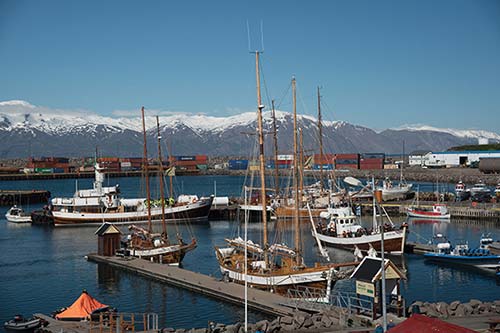
Called Húsavík (House Bay) by the Vikings who arrived here in AD 870, this is considered the earliest named place in Iceland. Much later, the Apollo astronauts came here to study geology. And more recently, Húsavík was the setting for the 2020 Will Ferrell/Rachel McAdams movie, Eurovision Song Contest. The song their characters sing—an ode to their hometown of Húsavík—was nominated for an Oscar.
Getting There: From Mývatn, Húsavík is about a 45-minute drive (35 miles) north on highway 87 from near Reykjahlíð. As you leave the lake area, you’ll pass through a bulging volcanic landscape interspersed with hardy sheep farms. Then you’ll traverse a stark terrain, with few settlements. The landscape eventually gets greener, and soon you’ll run into the picturesque Skjálfandi bay. Turn right onto highway 85 and carry on into town. From Akureyri, you can reach Húsavík from highway 1 by turning north on highway 85 before Goðafoss, or highway 845 after the falls (about an hour and 80 miles either way).
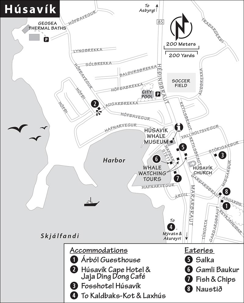
Orientation to Húsavík: This little town is simple. The main road coasts downhill to the town center and a handy parking lot on the harbor. Everything I mention (except for the Geosea Thermal Baths) is within a five-minute stroll. The Húsavík Whale Museum ticket desk serves as a basic town TI (see also www.visithusavik.com).
Sights in Húsavík
▲▲Whale Watching
About as far north as you can get in Iceland, Húsavík is one of Iceland’s top whale-watching destinations. Several well-established companies have sales kiosks overlooking the harbor. The atmospheric option is a characteristic wooden fishing boat repurposed for whale-watching trips. (The fishing industry collapsed around 1990, and the emergence of whale watching helped make up for the shortfall and save these old boats.) The faster, exciting option is a high-speed RIB (rigid inflatable boat). A standard three-hour trip costs around 11,500 ISK. The main operators include North Sailing (www.northsailing.is), Gentle Giants (www.gentlegiants.is), and Salka Whale Watching (www.salkawhalewatching.is).

▲Húsavík Whale Museum (Hvalasafnið á Húsavík)
This thoughtful museum, housed in an abandoned slaughterhouse, offers an informative look at Iceland’s native whales. You’ll first learn about whale evolution—including the surprising hypothesis that whales may have evolved from a four-legged, hoofed land mammal (an artiodactyl) that lived some 50 million years ago. You’ll then see an actual jawbone of a sperm whale and find several good children’s areas. But the museum’s highlight is upstairs, where you’ll find the skeletons of 10 whale species, including narwhal, sperm, humpback, orca, and pilot. The biggest skeleton—in the side hall on the main floor—is an 80-foot-long blue whale. Locals stress that these specimens were not hunted but died of natural causes, washed up on beaches, and were removed and preserved by the museum (except for the narwhal, which was donated by the Inuit in Greenland). Anytime a beached whale corpse appeared around Iceland, locals called the museum to come cart it away.
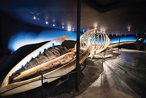
Rounding out the exhibits are art installations related to whales and an unapologetic overview of the history of whaling in Iceland, including a film with archival footage of workers processing and rendering slabs of blubber. For more on this controversial topic, you can head upstairs to watch the documentary Bloody Tradition: Agree to Disagree, about whale hunting in the Faroe Islands (call ahead for showtimes).
Cost and Hours: 2,200 ISK, free for kids 16 and under; April-Oct daily 9:00-18:00, Nov-March daily 10:00-16:00; Hafnarstétt 1, +354 414 2800, www.hvalasafn.is.
Húsavík Church (Húsavíkurkirkja)
Húsavík’s unusually colorful and interesting town church dates from 1907 (you can’t miss its pointy steeple along the main street as you come into town). It’s worth a look inside to see one of the most appealing church interiors in this land of humble and utilitarian churches. Stout beams intersect in the middle of the ceiling, like perpendicular boat hulls, all painted in cheery colors. Rather than a pulpit, there’s a simple lectern, shaped like an open book. Notice the c. 1930 painting over the altar depicting the resurrection of Lazarus...set in Iceland (see the backdrop of lava rock). The people in the painting are all locals who lived in Húsavík and knew the artist.
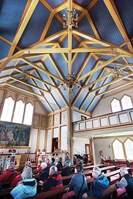
Eurovision Song Contest Movie Sights
Fans of the 2020 Netflix musical-comedy Eurovision Song Contest: The Story of Fire Saga (a must-watch if you plan to come here) can hunt out a few local landmarks. The bookstore facing the harbor has an outdoor poster with some lyrics from the Oscar-nominated song about Húsavík. On the hill around the right side of the harbor is the Jaja Ding Dong Café (named for another song in the movie); in the back room you might find an exhibition about the movie and the Eurovision Song Contest itself, including several original costumes worn by Will Ferrell and Rachel McAdams (2,000 ISK, open long hours daily, at the far end of the road called Laugarbrekka overlooking the harbor, www.eurovisionhusavik.com). On a grassy hill by the café parking lot, look for the three little red elf houses, replicas of the ones Rachel McAdams’ character visited in the movie. The view from this hill over the harbor is also beautiful.
▲▲Geosea Geothermal Sea Baths
With two infinity pools overlooking Skjálfandafló bay and mountains looming across the water, this small but modern bath is one of Iceland’s most scenic commercial baths; you may even spot whales in the bay below you. The clifftop pools are pumped full with mineral-rich seawater warmed by underwater vents. The place is popular among both tourists and locals, but with a limit of 160 bathers, it’s more intimate than many other premium baths. Also on-site are a cold wading pool, a steam room, and a swim-up bar. Reservations are smart: You won’t want to miss a soak in this spectacular setting. If you’re visiting in winter, the baths are an atmospheric spot from which to look for the northern lights.
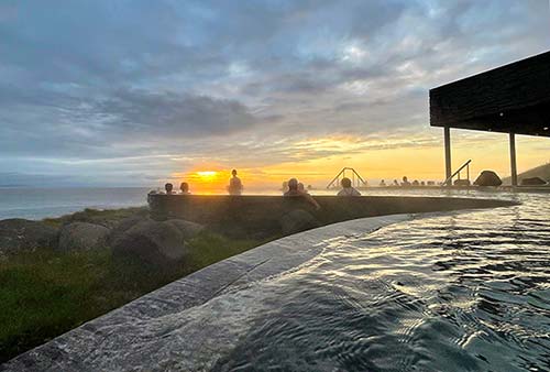
Cost and Hours: 5,990 ISK, daily June-Aug 12:00-23:00, off-season 12:00-22:00, towel rental-1,190 ISK, coffee shop, a 20-minute uphill walk (or 3-minute drive) from the harbor at Vitaslóð 1, +354 464 1210, www.geosea.is.
Húsavík City Pool (Sundlaug Húsavíkur)
Less expensive (and more family-friendly) than Geosea, the Húsavík city pool has a large outdoor section, a smaller children’s pool, hot tubs, a sauna, and water slides (1,100 ISK, Mon-Fri 6:45-21:00, Sat-Sun 10:00-18:00, just north of the harbor at Laugarbrekka 2, +354 464 6190).
Sleeping and Eating in Húsavík
Accommodations in Húsavík are limited; if the following places are booked up, consider my recommended guesthouses and farm stays between here and Mývatn (see here).
Sleeping in Town: $$ Árból Guesthouse, a couple of blocks up from the harborfront, has nine contemporary rooms with shared bathrooms in a beautifully maintained early-1900s wood-frame house (formerly owned by a beloved police officer and his large family—check out the photo in the stairway). The place is immaculate, and every detail has been carefully considered (Ásgarðsvegur 2, +354 464 2220, www.arbol.is, arbol@arbol.is).
$$ Húsavík Cape Hotel, on the hill above town, rents 19 rooms with exploration-themed artwork in a simple but peaceful compound (family rooms, breakfast buffet extra, Laugarbrekka 26, +354 463 3399, www.husavikhotel.com, info@husavikhotel.com). They also rent a fresh, modern apartment for those staying three or more nights (apartment@husavikhotels.com).
In a Pinch: $$$$ Fosshotel Húsavík, a big, modern chain hotel a couple of blocks behind the church, is a fine—if overpriced—option if my other recommendations are full (family rooms, breakfast extra, restaurant, +354 464 1220, www.islandshotel.is, husavik@fosshotel.is).
Sleeping Outside Town: $$ Kaldbaks-Kot, set in a hand-planted grove of trees, is a lovely little countryside compound of 17 jewel-box wooden cottages (sleeping 2-10 people, all with private bathrooms and mini kitchenettes). It’s in a gorgeous setting, perched just above a private lake busy with birds a few minutes’ drive outside Húsavík (hot tubs, breakfast extra, laundry service, +354 892 1744, www.kaldbakskot.com, bookings@cottages.is).
$$ Laxhús, just a few minutes outside town, is a row of stark-white, prefab units that sit in a lonely field like an art installation. All have kitchenettes and private baths, and some have small decks and views of the sea and mountains (no breakfast, +354 464 1099, search “Laxhús Húsavík” on Booking.com).
Eating in Húsavík: Overlooking the busy pier, $$$ Salka is a good all-around choice for high-end Icelandic cooking in a bright setting (daily, Garðarsbraut 6, +354 464 2551). Closer to the water, facing the harborfront, $$$ Gamli Baukur is pricey but atmospheric, with an après-whale-watch ambience. On a sunny day, its outside tables are Húsavík’s most appealing, and the woody nautical interior is cozy anytime. The menu features tacos, fish stew, and other seaside dishes (daily, Hafnarstétt 9, +354 464 2442). There’s also a sling-’em-out $ Fish & Chips stand on the harbor. A block up in town, $$ Naustið specializes in seafood dishes. It fills a bright yellow house and has inviting outdoor seating, but no views (daily, Ásgarðsvegur 1, +354 464 1520).
Mývatn to Eastfjords
It takes about two hours, nonstop, to drive the 110 miles from Mývatn to Egilsstaðir, the gateway to the Eastfjords. This relatively short stretch takes you over a wild, uninhabited highland (at 1,700 feet) that can be snowy well into spring. Two worthwhile detours can stretch out your drive time: The impressive Dettifoss waterfall adds two hours (one for driving, and another to hike around the falls), and the dramatic Stuðlagil canyon adds up to three hours (one for driving, one for hiking, and another to enjoy the canyon). Coastal Seyðisfjörður, a more interesting place to overnight than Egilsstaðir, is 30 minutes farther. So all told, expect at least five hours en route from the shores of Mývatn to the shores of Seyðisfjörður.
Avoid the temptation to take the longer northern route (along highway 85) from Mývatn to Seyðisfjörður via Kópasker. Devote time to Iceland’s far northeast corner only if you’re spending several weeks here.
Be aware that blowing sand can sometimes kick up between Mývatn and Egilsstaðir; check the forecast before setting out.
From Mývatn to Dettifoss
• From the lakefront settlements around Mývatn, head east on highway 1 over Námaskarð pass. Once you leave the Krafla Valley, there are limited services (and virtually no civilization) for nearly two hours (there are portable toilets at the Dettifoss parking lot and a gas station/café/WC about 45 minutes later).
About 12 miles (15 minutes) east of Krafla, watch for the turnoff on the left for paved highway 862 and drive about 15 miles (20 minutes) to the parking lot for the Dettifoss falls. Note that there’s a second turnoff to Dettifoss a bit farther east on highway 864, a poorly maintained, rutted gravel road without a bridge to the falls. If you’re following your GPS, be sure it’s directing you to the west riverbank down highway 862; it may be called “Dettifoss (West Side).”
▲▲Dettifoss Waterfall
Iceland’s second-largest river, Jökulsá á Fjöllum (Glacial River in the Mountains), flows north 130 miles from the edge of the Vatnajökull glacier—Iceland’s largest—to the Greenland Sea. Along the way it traverses some of Iceland’s most dramatic canyons and waterfalls, including the powerful, thundering Dettifoss (DEH-tih-foss).
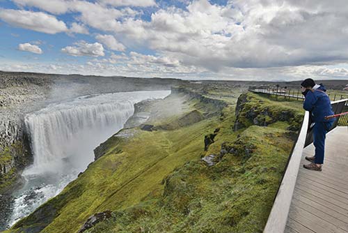
Both broad (340 feet) and high (150 feet), Dettifoss is as big as a football field. It sends 50,000 gallons of water rushing over its parapets every second. The gorge below the falls (Jökulsárgljúfur) was carved by a cataclysmic glacial flood. Like Gullfoss on the Golden Circle, you’ll view Dettifoss from above.
From the parking lot (free, always open, pit toilets), you’ll walk 15 minutes (about a mile) along a well-marked path to the overlook. The walk in—through a stony plain with basalt columns—is part of the fun. Finally you reach the falls, which rumble into their canyon, spitting up a misty cloud (often with a rainbow). There are two viewpoints: The lower one, reached via a metal staircase and trails across slippery rocks, gets you fairly close to the top of the falls. A ridgeline trail leads to the upper viewpoint, with boardwalks and a viewing platform, for the big-picture view.
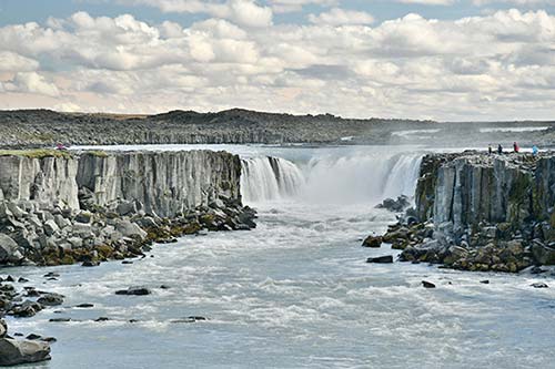
About halfway between the falls and the parking lot, watch for a third trail; this one splits off and heads upriver about 10 minutes to a slightly smaller waterfall called Selfoss. The head-on views of this fall are impressive (if more distant than Dettifoss), but the walk also rewards you with epic views of the strikingly wide Jökulsá á Fjöllum as it flows between the two falls. Glacial sediment can make the water seem milky or even muddy. The riverbanks are striped with bold, vertical basalt ledges—some of which are sloughing off—and a few black sand beaches are tucked between the rapids.
Downstream from Dettifoss is yet another waterfall, Hafragilsfoss, which is almost as broad and high as Dettifoss itself; it’s difficult to reach without a 4x4 vehicle, and best skipped.
From Dettifoss to Egilsstaðir
• Leaving Dettifoss, return to the main road and continue east. Soon, you’ll cross a scenic, single-lane white suspension bridge across Jökulsá á Fjöllum—the river that flows over the Dettifoss waterfall. From here, it’s about 80 miles (1.5 hours) through a stark, almost lunar landscape, essentially Iceland’s “Big Sky Country.” As you proceed, keep an eye on your right for the tabletop mountain called...
Herðubreið: Iceland’s answer to Norway’s Pulpit Rock is a tuya—a steep, flat-topped volcano created when molten rock pushed up through a glacier. Just behind Herðubreið—but not visible from here—is Askja, a volcanic crater lake buried deep in Iceland’s interior, and one of the country’s most famous remote and scenic destinations.
A pullout on the left leads to a viewpoint looking back over the flats, with info boards explaining how an eruption changed the landscape from farmland to this barren plain.
If you’re in a pinch, there are a couple of places for refreshments (and one for gas) between Mývatn and Egilsstaðir: one right off the highway, and another a few minutes off the main road. About 24 miles (30 minutes) after the Dettifoss turnoff, watch on the right for road 901, signed Möðrudalur.
On the corner are a couple of gas pumps and the charming $ Beitarhúsið café, in a rustic log cabin. They have all the usual basics (coffee, soups, sandwiches) and the local specialty—“love balls” (āstarpungar), a fried sweet dough with raisins (daily, WC free for customers). About five miles farther down this road is the tiny Möðrudalur settlement. There you’ll find Fjalladýrð, a working farm with a campsite, guest rooms, a shop, views of Herðubreið, and the café $$ Fjallakaffi, which also makes love balls and offers an adventurous menu of lunch items such as moss soup (+354 471 1858, www.fjalladyrd.is). Each place claims to have the best love balls; if you have the time, judge for yourself (see “North Iceland” map for locations).
• Continue along the desolate plain. As you start to descend and the hills get greener, you’ll see where the Jökulsá river carved a canyon through the mountains on your right. If you have time for a stunning detour (those in a rush can do it in an hour), slow down as you approach the junction with highway 923—it’s an extreme hairpin turn to the right toward Stuðlagil canyon (described next). Continue down the mostly unpaved 10-mile road.
As you approach the canyon, you can either head to the canyon overlook (allow an hour) or lose the crowds by hiking down to the canyon floor (ideally 2-3 hours)—see the listing below for details. (There’s a pullout before a one-lane bridge with signage explaining how to visit the area—but don’t trust it.)
▲▲ Stuðlagil Canyon
This dramatic canyon, lined with massive basalt columns, is worthwhile even for those who simply drive to the cliffside viewpoint and back (allow an hour). But the canyon (Iceland’s deepest) rewards those who hike down 30 minutes to its floor, with up-close views of the Stuðlafoss waterfall. For hikers, nature lovers, and photographers, this is a ▲▲▲ experience. If you have time to picnic and linger, this could be one of your most memorable Ring Road experiences.
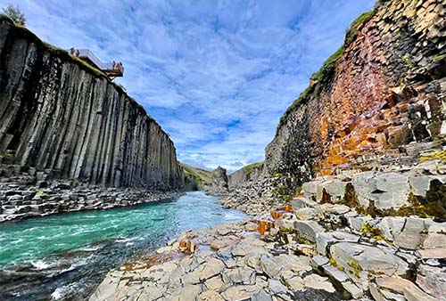
What makes this canyon especially fascinating is that it was revealed only recently by the construction of a new dam (completed in 2007)—and only discovered by tourists around 2016. The dam project diverted the once-deep flowing Jökulsá á Dal river here into a tunnel for hydroelectric power, exposing the previously submerged basalt columns and leaving behind a shallow river of turquoise water. The area continues to be developed as a tourist sight, and services are being added every year. Before visiting, check details locally. For more on the story of Stuðlagil and the dam that unveiled this canyon, see the sidebar on here.
When to Visit: To see the river at its turquoise peak, visit in early summer (June-July). A reservoir near the Kárahnjúkar dam can overflow in late summer (depending on the year’s rainfall), sending milky-white and brown glacial water into the streams, turning the river a less impressive color. Even then, it’s worth seeing the canyon for its striking 100-foot basalt column cliffs, which curve and bend almost horizontally along the cliff face in some places.
Visiting the Viewpoint: Exiting highway 1 onto highway 923, you’ll slowly make your way 10 miles south on the mostly unpaved road high above the canyon. The road is easy to drive, but you may need to slow down to dodge sheep that mosey into your path. Eventually, you’ll see a sign to stay right for the Grund viewpoint. The parking lot (free) has pay WCs (cards accepted), a small store, and a food truck.
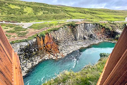
From here, it’s 237 steps down a steep stairway to the viewpoint that juts out over the canyon, offering sweeping views in both directions (and below to those who’ve hiked down to the canyon bottom).
Stuðlafoss and Canyon Hike: From highway 923, at the turnoff for the Grund viewpoint, turn left at the sign marked Klaustursel and head down the hill until you reach a bridge. Cross over and immediately turn right to go up, up, up to the parking lot (which will likely have a WC and other services by the time you visit). The road may be rough and unpaved, but it’s doable in any car.
From the parking lot, it’s a short walk to the Stuðlafoss waterfall, which cascades over a wall of basalt columns. From the falls, it’s a 1.5-mile walk on a wide trail to where the canyon opens up and you get your first glimpse of the river below. There are a couple of places where it’s relatively easy to get to the canyon floor—but rocks can be slick, so take it slow. Once you reach the water’s edge, you can wander to the right, where a small beach is perfect for picnicking. Or head to the left, find your favorite column, and gaze up in wonder at one of Iceland’s “newest” natural treasures.
• As you head back to highway 1 and turn right, you’re now in the heart of...
Jökulsá á Dal: You’ll wind your way down the picturesque, lush green valley of the Jökulsá á Dal (literally “Glacial River in the Valley”; sometimes called Jökulsá á Brú), following the turquoise river with waterfalls all around, then drop down into the Eastfjords. A few minutes past a tiny one-pump gas station, you’ll come to the only waterfall in this stretch that has a pullout. The 420-foot Rjúkandafoss (on the left) is worth a brief stop for the short walk to a viewpoint.
• Where the road bends and crosses the river, stay on highway 1 and drive toward the panorama of snowcapped peaks, up over a rocky plateau, eventually crossing the wide Lagarfljót river to reach the large town of...
Egilsstaðir (Egill’s Farm): This functional hub and gateway to the Eastfjords has gas stations and some decent places to eat or spend the night in a pinch. But for even better scenery and a legitimately charming town, I’d continue on to Seyðisfjörður.
From Egilsstaðir to Seyðisfjörður
Your drive is not quite over—you’re 30-45 minutes from Seyðisfjörður. (For more on both towns and a map of the area, see the next section, “Eastfjords.”)
• From Egilsstaðir’s main intersection (at the N1 gas station), turn left to stay on highway 1 (marked Reyðarfjörður) and drive up through the residential part of town. After just a half-mile—as you crest the hill—turn left onto highway 93, marked Seyðisfj (with a ferry icon). After another half-mile, turn right to stay on highway 93 (also marked Seyðisfj).
Over the Fjarðarheiði Pass: Here begins an unexpectedly scenic drive—the stunning road that summits Fjarðarheiði (Fjord Heath). This road is frequently snow-covered and sometimes closed in April and October, and anytime, it can be socked in. You’ll curve up switchback after switchback, gaining altitude (and gasping at the lack of guardrails) before disappearing into a mystical landscape of mountaintop ponds. When conditions are right—even into the summer—icebergs bob in the big Heiðarvatn (Heath Lake; a handy pullout on the left allows a lakeside photo op). You’ll crest the pass at 2,030 feet, and then begin the slow switchback descent down to the fjord. The road wraps around on itself several times, tying neat little bows around craggy cliffs and gushing waterfalls (the Fjarðará river goes over nearly two dozen falls on its way down the mountain).
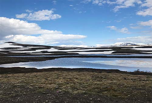
• Returning to sea level, you pull into artsy Seyðisfjörður.
Eastfjords
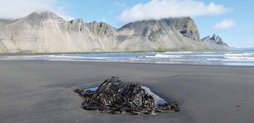
Iceland’s remote, sparsely populated east is as scenic as it is lonesome. Its coast is slashed with a dozen deep, steep fjords, with very few tunnels and no bridges to speed your progress. Wrapping around fjords is very slow going, making this the most tedious (albeit scenic) stretch of the Ring Road. You can easily drive for miles without ever seeing another car.
The most interesting stop here is the charming fjordside town of Seyðisfjörður and the no-brainer choice for an overnight. The nearby long, skinny lake called Lagarfljót, with a few middling sights, can also be worth a visit. But with limited time, don’t linger here: From this area, you’ll turn south, tracing the long, jagged shoreline to Southeast Iceland and glorious glacier country.
Cruise ships have discovered the Eastfjords. At certain times, you’ll be sharing this remote corner of the country with hundreds of fellow travelers. Don’t be surprised to turn a bend and see a small cruise ship or two hovering in the middle of a fjord.
Planning Tips: Seyðisfjörður has an excellent assortment of hotels and restaurants, making it an ideal overnight stop (plan ahead—accommodations book up early). Egilsstaðir, 30 scenic minutes away, is a good backup; you can still zip over to Seyðisfjörður for a quick look and a meal. It’s good to know which day the Norröna ferry to Denmark departs from Seyðisfjörður (schedules at www.smyrilline.is)—the night before, Seyðisfjörður, and even Egilsstaðir, are particularly lively and crowded. A good resource is the regional TI website, East.is.
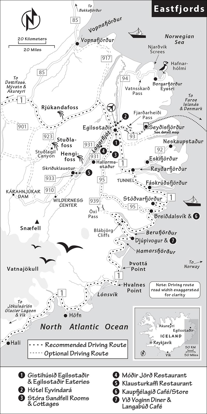
Egilsstaðir
The workaday community of Egilsstaðir (AY-ill-STAHTH-eer, pop. 2,500), the largest in the east, lacks Seyðisfjörður’s charm, but it enjoys a fine setting along the lovely Lagarfljót lake. You’ll find a big swimming pool, supermarkets, and other services—making it a good place to stock up before your long onward journey.
Tourist Information: You’ll find a helpful regional TI one street above the main road, inside the bustling Egilsstaðir campground office (June-Aug daily 7:00-23:00, Sept-May daily 8:30-12:30, WC, bike rental, www.visitegilsstadir.is).
Sights near Egilsstaðir
Lagarfljót
This deep lake is so long and skinny that it can be thought of as a broad river—as reflected by its name (LAH-gar-flyoht, Lake River). Lagarfljót feels like Iceland’s answer to Loch Ness. It even comes with its own Nessie-style legend: The Lagarfljót Wyrm. The story goes that a young girl placed a slug in a box with a golden ring, hoping it would increase her gold. But when the slug grew instead of the ring, she threw it into the water—where it got bigger and bigger, wreaking havoc on lakeside settlements. Finally, the Wyrm was chained to the bottom of the lake, where it (supposedly) still sits.
For most travelers, glimpsing Lagarfljót as you drive through Egilsstaðir is enough. But if you’re spending the night in Egilsstaðir, consider a drive along Lagarfljót.
Driving Along the Lake: It’s about a 35-minute drive from Egilsstaðir to Skriðuklaustur, the settlement near the lake’s south end. A few sights cluster here, but most are closed off-season—call or check in Egilsstaðir before heading out. From Egilsstaðir, drive seven miles south on highway 95, then split off on highway 931, which runs along the lake’s east bank before crossing over to the west side. You’ll soon see a turnoff on the right (signed Jaðarsvegur), where you could detour for a stop at the recommended Móðir Jörð organic farm restaurant (vegan and vegetarian options only; see listing, later). You’ll eventually drop down along the lakeshore, pass the national forest at Hallormsstaður (where they’ve successfully reforested 280 square miles), then cross a bridge over the lake, where you can choose among several sights.
To reach the Hengifoss waterfall (HEN-KEE-foss), turn left after the bridge (still highway 931); you’ll see the Hengifoss parking lot immediately on the right (free parking and WCs—and possibly more services by the time you visit). It’s a steep, 1.5-mile hike (about an hour one-way; wear sturdy shoes) up a gorge to reach the 390-foot waterfall, Iceland’s second highest (www.hengifoss.is). The waterfall is unique for its distinctive red layers that ring the canyon behind the falls.
The trail to the falls is a loop: Taking the path to the left affords better views. As you hike up, you’ll have to carefully cross some potentially slippery rocks and a small stream. A boardwalk then takes you as far as you should go (don’t cross the ropes to get closer to the falls).
Heading back down on the opposite side of the waterfall, you’ll get great views of the canyon’s basalt columns. If the Hengifoss food truck is stationed at the bottom, reward yourself with their “grandma’s waffles” or some lamb soup.
To reach the little settlement of Skriðuklaustur (Landslide Monastery), head south past the bridge over the lake (where highway 931 becomes highway 933) and drive five minutes, turning left after you pass the boxy building housing the excellent Vatnajökull National Park visitors center (June-Aug daily 10:00-17:00, shorter hours off-season, hiking advice, ranger walks, and other activities, +354 470 0840, www.vjp.is—select Snæfellsstofa location).
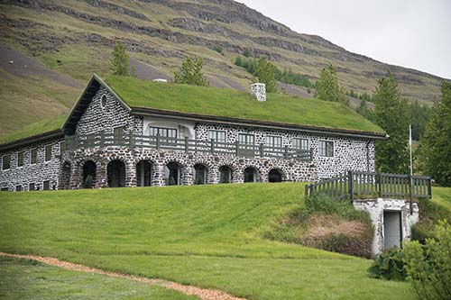
The sights in Skriðuklaustur are a bit underwhelming. There’s Gunnarshús, the home of author Gunnar Gunnarsson (1881-1975), who made a name for himself in Denmark and Germany writing popular books about Iceland, and the scant remains of the Skriðuklaustur monastery, the final Catholic monastery built in Iceland before the Reformation (c. 1493).
For lunch consider the top-notch $$$ Klausturkaffi, downstairs in the Gunnarshús. This wonderful little spot is run by a mother-and-daughter team, who lay out a buffet of traditional, homemade Icelandic dishes. It’s a filling, delicious, and memorable meal (June-Aug daily until 18:00, shorter hours April-May and Sept-Oct, +354 471 2992).
South from Skriðuklaustur: With even more time, you could continue south of town and up the valley, where there are some natural thermal pools, a museum about Iceland’s Highlands, an abandoned farm with a crank-it-yourself cableway bridge, a closer look at Snæfell (Iceland’s tallest mountain not covered by a glacier), and plenty of hiking options. For details, ask at the TI in Egilsstaðir, the national park visitors center in Skriðuklaustur, or stop in at the Wilderness Center, a 20-minute (10-mile) drive on partly unpaved roads past Skriðuklaustur (good café, +354 440 8822, www.wilderness.is).
If you stay an extra night in Egilsstaðir and are interested in environmental issues or dams, you could continue south to the big dam at Kárahnjúkar, in Iceland’s reindeer country (though the animals don’t always show themselves). Before you go, read the sidebar on here.
▲Day Trip to Hafnarhólmi Puffin Marina
For those with a little extra time, it’s worth day-tripping from Egilsstaðir or Seyðisfjörður to the tiny coastal village of Borgarfjörður Eystri (also called Bakkagerði), a good hour to the northeast. A five-minute drive beyond the village, the little islet of Hafnarhólmi, connected by a harbor, is home to a large puffin colony in summer (generally mid-April to mid-Aug, free parking, WCs, good café). Wooden steps take you up a rocky outcrop to see puffins up close. A boardwalk to the left leads to an enclosed viewing hut; continuing up the stairs to the right affords views of more puffins—and possibly some nesting ducks and arctic terns. Linger on the boardwalk and watch puffins buzz overhead, snag fish, and waddle into their burrows.
The entire village comprises 180 residents, a traditional turf house (500 ISK, daily 13:00-16:00), a few guesthouses, a grocery store, and a good restaurant and brewery at the town’s “resort” (www.blabjorg.is). A popular music festival held in the dilapidated herring factory draws crowds in July (http://braedslan.is).
The drive to Borgarfjörður Eystri traverses the scenic 1,400-foot Vatnsskarð Pass. After an uneventful 20-minute drive across the plain on highway 94, look out for a green shack on the left (with some chairs and flower pots) that at first glance looks like a café. For a quirky pit stop, safely pull over and head inside the green hut: You’ll find “Kiddi’s Vending Machine,” a couple of solar- and wind-powered vending machines with snacks and temporary tattoos set up by local Kristinn Kristmundsson (you may see his photo as you enter). It’s fun to browse the many notes on the wall left by previous visitors and to try getting the snack vending machine to work (it’ll likely only accept coins). Don’t get your hopes up—even after following the many instructions, you might still come up empty-handed.
A few minutes later, you’ll follow a series of switchbacks up, up, up to the crest of the pass (pullout with pit toilet, trailheads, and expansive views—look for Dyrfjöll mountains with their glacier-cut “door”). From the pass you wind around the sheer fjord headland. Look for a pullout on the left (easier on the way back, when it’s on your right) with an info board that tells the story of the “monster of the scree” and this historically dangerous road (it was only paved in 2019). Before the road was surfaced, drivers had to navigate a narrow track of loose rock below the Njarðvíkurskriður—the Njarðvík Screes.
Sleeping and Eating in Egilsstaðir
Sleep here only if Seyðisfjörður is full, you’re in a rush, or the roads are questionable; Egilsstaðir spares you the challenging drive over Fjarðarheiði pass.
$$$$ Gistihúsið Egilsstaðir, on the site of the original Egilsstaðir farm, looks simple from the outside but has 50 sharply decorated rooms, some with views (near the lakefront just off the town’s main intersection, full spa, Egilsstöðum 1-2, +354 471 1114, www.lakehotel.is, hotel@gistihusid.is). Up above town—just before you head up the road to Seyðisfjörður—is $$$ Hótel Eyvindará, with 30 rooms and six cottages in a rustic, forested setting (breakfast extra, Eyvindará 2, +354 471 1200, www.eyvindara.is, eyvindara2@simnet.is). For an even more rustic experience a little farther out of town, family-run $ Stóra Sandfell Rooms and Cottages has 10 cottages with kitchenettes (some with private bath) in a wooded setting with mountain views. They also offer horse tours (no breakfast, Stóra-Sandfelli 3, +354 471 2420, www.storasandfell.is, info@storasandfell.is).
Eating in Egilsstaðir: For an easy roadside meal, $ Bókakaffi—in Fellabær, right along highway 1—is a cozy bookshop/café that serves an inviting weekday lunch of soups and savory crêpes and a late afternoon coffee-and-cake buffet (closed Sun, watch for it below and to the right immediately before crossing the bridge into Egilsstaðir, on Helgafell). Across the parking lot from the TI, $$ Salt Café & Bistro has standard fare (pizza, burgers, sandwiches) along with some fish and Asian offerings. It’s a good option on Sundays, when Bókakaffi is closed (daily, Miðvangur 2, +354 471 1700). The recommended Gistihúsið Egilsstaðir hotel also has a pricey but good restaurant, $$$ Eldhúsið, that’s open to nonguests. You’ll find a Bónus supermarket on highway 1, near the town’s main junction.
A little outside of town, along Lagarfljót, $$ Móðir Jörð (Mother Earth), at the Vallanes Organic Farm, serves up excellent vegan and vegetarian meals and offers a daily lunch buffet (June-Aug daily, reservations required for dinner, +354 471 1747, www.modirjord.is).
Seyðisfjörður
The most appealing town in eastern Iceland, Seyðisfjörður (SAY-this-FYUR-thur, pop. 700) is a delightful hybrid. It’s a gritty, workaday port, where the Norröna car ferry from Denmark injects Iceland with a weekly fix of international car-trippers (and the occasional big cruise ship). But it’s also, per capita, Iceland’s most artistic corner, with a youthful, creative spirit. Fortunately, these two factions wear their peeling paint and rust equally well. Postindustrial decay just looks right in Seyðisfjörður.
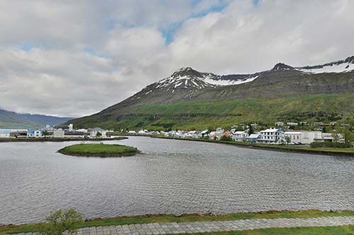
The town—with a fine harbor at the innermost point of a 10-mile-long fjord—was built up by Danish merchants in the mid-19th century; it boomed around the turn of the 20th century thanks to Norwegian-run herring fisheries. Many fine buildings survive from this time, when Seyðisfjörður also became the terminus for the telegraph cable connecting Iceland to Europe. As herring stocks collapsed, the town went into slow decline.
Fortunately, the town took an artistic turn—largely thanks to German-Swiss artist Dieter Roth (1930-1998), who moved to Iceland in 1957 and later founded an art academy here. Today, Seyðisfjörður’s art programs attract young people from across Iceland and abroad, giving this tiny, remote community an unexpectedly cosmopolitan vibe. A top-notch sushi restaurant and a bustling microbrew pub face each other across the rainbow-painted main street.
While light on sights, Seyðisfjörður is an enjoyable place to simply wander and explore. The town has more than its share of services for travelers, thanks to the regular ferry and cruise-ship traffic. It’s a very relaxing place to immerse yourself in the Eastfjords for a scenic drink, a meal, or an overnight.
Tourist Information: The TI is inside the ferry terminal, but save yourself a trip by checking their excellent website (+354 472 1551, www.visitseydisfjordur.com).
Sights in Seyðisfjörður
Town Walk
Get your bearings in this little burg with this brief spin tour and stroll. Begin just across the bridge from the supermarket and Hótel Aldan, by the black obelisk honoring Otto Andreas Wathne—a Norwegian entrepreneur who helped develop the town.
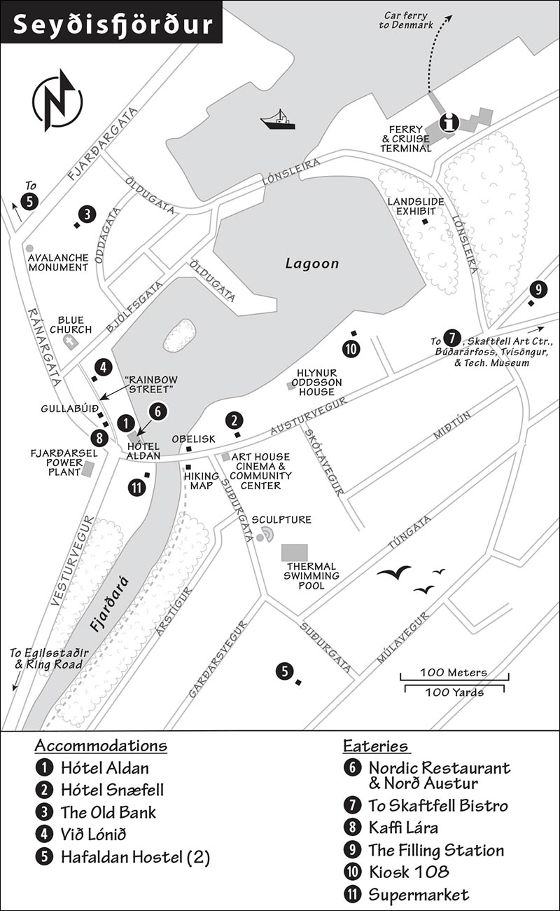
Spin Tour: Look out over the little lagoon, and find the white tower and glass gangway for cruise ships, which have started docking here more frequently. Also putting in here once a week is the Norröna car ferry from the Faroe Islands and Denmark. The ferry, the town’s main industry (along with cruise tourism), is an important plot point for the popular Icelandic TV series Ófærð (Trapped), which is set in Seyðisfjörður.
Look farther right and up the road, which runs along the fjord past the Hótel Snæfell and below a pretty waterfall. For some remote seaside beauty, you can walk (or drive) as far as you like along this road, which extends 10 miles to the end of the fjord.
Next, spin right to look up into the little town center. On the left is an art-house cinema and community center that hosts small art exhibits. The gray and red blocky building is the town’s fine thermal swimming pool. Standing out front is an abstract sculpture, called Útlínur, that represents the outline of the fjord. This sculpture is one of many reminders of how important art is in this remote hamlet (you’ll see more as you wander). Uphill and just to the right of the swimming pool, the classic old red building—once the town hospital—is now its youth hostel. The little rust-colored marker across the street from you (by the Fjarðará river) identifies area peaks, and a signboard beyond that outlines local hikes.
Stroll: Now let’s stretch our legs. Cross the bridge, veer right at Hótel Aldan, and walk up the pretty “rainbow street” toward the town church. This colorful stretch captures Seyðisfjörður’s creative spirit. Painted a few years back by civic-minded locals to simultaneously celebrate Pride month and brighten the town, it’s become a beloved fixture. Tourists wear it out, so every few months the pavement is washed down by the fire department and repainted, often by high school kids.
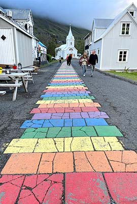
On the left you’ll pass the local pub, which is the place in town to sample Icelandic microbrews. The next house, slathered in black-and-white graffiti, is a gifty boutique called Gullabúið. Across the way is an arts-and-crafts shop with a corrugated metal facade. Corrugated metal is a popular building material both here and in Reykjavík, as it protects against wind, horizontal rain, and fires (among other things). At the end of the street is the photogenic, but often closed, Blue Church (Bláa Kirkjan), which hosts weekly concerts in summer (www.blaakirkjan.is).
A block behind the church is Snjóflóð (Avalanche), a monument made with the mangled girders of a factory that was swept away by an avalanche in 1996. Scenic as they are, the steep mountain walls around Seyðisfjörður come with a steep price: the danger of being buried by snow or mud. In December 2020, a massive landslide on the other side of the lagoon destroyed more than a dozen homes and damaged the Technical Museum of Iceland (including much of its collection). You may find an outdoor exhibit close to the cruise-ship terminal with a moving tribute to some of those affected (www.thelandslideproject.com). Amazingly, despite it being the largest landslide in Iceland’s history to hit a residential area, no one was killed.
From here, it’s a pleasant 15-minute stroll clockwise around the lagoon. You’ll enjoy looks at local homes and backyards, and great views back over town (with wonderful reflections in the right light). To extend the walk to the pretty little town waterfall (Búðarárfoss), when you reach the main road (Austurvegur), turn left, then look for the path just after the stream.
Otherwise, turn right on Austurvegur and loop back toward town. Along this stretch, you may catch a glimpse of an artfully decorated house close to the water. It belongs to local artist/philosopher Hlynur Oddsson, who makes art out of any object he can get his hands on—driftwood, bones, feathers, wire, boat materials, and so on. You can approach the house to take a closer look, but be respectful—if you enter the property or take photos, he requests a donation (1,000 ISK, $5, or €5). Check out some of his favorite quotes on the objects that line the house. Consider yourself lucky if you happen to meet him.
Artistic Sights and Museums
If you’re lingering here, you can explore a variety of artistic sights. A 15-minute hike up a steep hillside (above the Brimberg seafood factory) is Tvísöngur, a “sound sculpture” made of interconnected concrete huts that resonate in a five-tone harmony. The Skaftfell Center for Visual Art often has exhibits on view (optional donation). They also guide tours through the House of Geiri, the former home of a local artist (summer only, closed Mon, http://skaftfell.is).
The town is also home to the Technical Museum of East Iceland, housed in a machine shop, where you can learn about everything from town history to its original telegraph (1,500 ISK, May-Sept daily 11:00-17:00, Oct-April by appointment, https://tekmus.is).
Hikes, Bikes, Kayaks, and More
Ask your hotelier (or the folks at Hótel Aldan if you’re just here for the day) for information on hikes, rental bikes and kayaks, boat tours, and fishing trips. It seems everyone in town has a side gig, and the lineup changes from year to year.
Avid hikers can attempt to climb the Bjólfur mountain, with stunning views over the fjord (1,970 feet; you can hike steeply up from the avalanche barriers on the Fjarðarheiði road), or the Seven Peaks that surround the fjord. An easy four-mile loop starts near the bridge and loops to the Fjarðarsel power plant and across the valley floor back to town.
Sleeping in Seyðisfjörður
Remember, Seyðisfjörður can fill up on the night before the weekly ferry leaves—book well ahead for those days. Hótel Aldan is the only one of these listings to serve breakfast (a pricey but extensive buffet). It’s open to nonguests and is where virtually every tourist in town winds up each morning. Otherwise, consider breakfast at the excellent Filling Station café just past the lagoon (see “Eating in Seyðisfjörður,” below), or buy breakfast items at the supermarket.
Hótel Aldan offers the town’s only real hotel rooms, divided between two historic buildings. Check in at their reception building in the heart of town (can’t miss it, by the bridge), and they’ll direct you to one of two annexes: $$ Hótel Snæfell, a creaky old house on the waterfront with 12 contemporary rooms, or $$$ The Old Bank, with nine bigger rooms and more amenities, in a residential area (breakfast extra, served at the reception building at Norðurgata 2, +354 472 1277, www.hotelaldan.is, hotelaldan@simnet.is). They also rent two apartments with kitchenettes.
$$ Við Lónið (By the Lagoon), well run by charming Maggý, has eight beautifully appointed, modern-minimalist rooms (all with private bath). It’s right along the rainbow street facing the lagoon and fjord (fjord-facing rooms are quieter and have a balcony for a bit more, no breakfast, +354 899 9429, www.vidlonidguesthouse.com, info@vidlonidguesthouse.com). Maggý is proud of her town and happy to offer suggestions for dining and activities.
¢ Hafaldan Hostel, part of the Hostelling International network, runs a tight ship at its two branches: They have 34 beds in the wonderfully creaky and family-friendly old hospital building, and 18 more near the old harbor (reception at old hospital location at Suðurgata 8, private rooms available, no breakfast, +354 611 4410, www.hafaldan.is, seydisfjordur@hostels.is).
Eating in Seyðisfjörður
Hótel Aldan has two pricey but excellent eateries in its reception building (at Norðurgata 2) in the heart of town (reservations recommended for both): $$$ Nordic Restaurant, on the main floor, has a nicely rustic, casual atmosphere and modern Icelandic fare, including fresh fish dishes and good salads (May-Sept daily, cheerful outdoor seating in good weather, +354 472 1277). Their big deck out front is popular just for a drink on a nice evening (order at the bar inside). Upstairs, $$$$ Norð Austur (North East) has exceptional sushi and other Japanese-Icelandic fusion dishes in a cozy setting. The ingredients are fresh, the chefs are talented, and the ambience is top-notch (June-Sept Wed-Sun for dinner only, closed Mon-Tue, +354 787 4000, www.nordaustur.is).
$$$ Skaftfell Bistro is a trendy restaurant-bar below the Center for Visual Art, a short walk around the fjord from downtown. Even their Icelandic dishes come with a French or Mediterranean twist, and many of the inventive options are made with locally sourced ingredients. Try the arctic char ceviche if it’s on the menu (closed Sun, reservations smart for dinner, Austurvegur 42, +354 472 1633). There’s a library in the back with some of Dieter Roth’s art books.
$ Kaffi Lára (named for the house’s former resident)—also called “El Grillo” for the local beer on tap—is a boisterous bar right along the little main street, serving basic pub grub. On weekends, it’s open very late and rollicking, with occasional live music (daily, Norðurgata 3, +354 472 1703).
$ The Filling Station is an unexpectedly delightful place at the Orkan gas station at the top of the lagoon. They serve excellent breakfast and brunch—and pizza some evenings—in a light-filled space decorated with plants (daily until 15:00, plus open Wed-Thu evenings at 18:00 for pizza).
Funky Drinks with a View: At Kiosk 108, Czech artist Monika has turned a rusty old ship’s helm into the trendiest cocktail bar in town. With a cozy, art-strewn interior and outdoor tables facing the lagoon, it’s a memorable spot for a pre- or post-dinner drink (closed Sun, no food except desserts, Austurvegur 17b, +354 869 4224). If you don’t find it on Austurvegur, it may have moved locations on the lagoon. Ask—or just look around.
Supermarket: Stock up on picnic or breakfast supplies at Samkaup Strax (marked Kjörbúðin), right at the bridge in the center of town (open daily).
Eastfjords to the Southeast
The drive along the Eastfjords, from Seyðisfjörður to Southeast Iceland, is a long but scenic day. Following my recommended route, it’s about 145 miles (3.5 hours nonstop) to the lighthouse at Hvalnes point, which marks the shift to the southeast landscape, and 175 miles (4 hours) to Höfn—the biggest town in the southeast region. If you want to continue beyond Höfn before stopping for the night, it’s another 45 minutes to accommodations near the glacier lagoon at Jökulsárlón, and 45 minutes beyond that to Skaftafell National Park.
Before leaving Egilsstaðir, it’s smart to stock up on supplies, use the WC, and get gas. Services are sparse for the rest of the day. From Egilsstaðir, you have two options for continuing south:
Highway 1: The scenic main route along highway 1 hugs the coast and is paved all the way; it’s the route I recommend (and detail below). From Egilsstaðir, the road runs down to the sea at Reyðarfjörður; from there, the highway continues through a tunnel and along the coast.
Highway 95 (summer only): This inland route is shorter than highway 1 but less scenic. It climbs up to 1,500 feet over a pass, descending to the coast near Breiðdalsvík. You could then take the shortcut along highway 939, called Öxi—a sometimes-steep gravel road that climbs even higher, to 1,800 feet. Taking Öxi shaves about 30 miles off the trip, but only a little time, as you’ll need to drive slowly. (If you’re weighing the choice, check out videos of driving Öxi on YouTube, and look at current road conditions at Road.is.)
From Egilsstaðir to Reyðarfjörður
• From Egilsstaðir’s main intersection (at the N1 gas station), take highway 1 (marked Reyðarfjörður) southeast. (Coming from Seyðisfjörður, you can bypass Egilsstaðir as you drop down from the pass.) You’ll curve down a long, grooved valley, framed by craggy mountains rutted with tumbling waterfalls. Finally you hit your first fjord at...
Reyðarfjörður (Baleen-Whale Fjord): The fjord is home to an industrial town of the same name (pop. 1,100). When you’re still a mile or so outside town, watch on the right for the turnoff to stay on highway 1 (marked Fáskrúðsfjörður and Höfn). You’ll cut across a few thin rivers and enjoy views across the fjord of the town of Reyðarfjörður. The aluminum smelter located here gives Reyðarfjörður a more diverse economic base than usual in a small Icelandic village, and more jobs—a key to keeping young people here (for more, see the sidebar on here).
• From Reyðarfjörður, you’ll go through a nearly four-mile tunnel, then drive down toward—but not through—the village of Fáskrúðsfjörður.
Fjordside Villages
Long ago, Fáskrúðsfjörður (Austere Fjord, pop. 660) resupplied French boats fishing off Iceland; the town honors its history with both Icelandic and French on its street signs.
• At the fork as you approach town, turn right to stay on highway 1 (marked Stöðvarfjörður), crossing a single-lane bridge over a rocky riverbed.
Now settle in for a looooong drive—a couple of hours, at least, cutting in and out of deep fjords and passing scattered farms. Each fjord is anchored by a sparsely populated little village. These hardscrabble communities debate whether to keep schools open and services alive.
First up is dramatically sited Stöðvarfjörður (pop. 200), with a visitors center, free WC, and shop with locally made crafts (daily 11:00-17:00 in summer, www.austurland.is). Next door, handy little Saxa is a guesthouse/café/gas station. The town also has a little museum (Steinasafn Petru) that displays the rock collection and garden of a dearly departed local woman (www.steinapetra.is).
Next, Breiðdalsvík (Wide-Valley Bay, pop. 140) is wider and less scenic—notice it’s a vík (bay) rather than a fjörður (fjord). If you need a pit stop, turn left off highway 1 onto a spur to reach the town, nestled under a rocky outcropping (with the cozy, artsy $ Kaupfjélagið café/general store). This town is better developed for tourism than some, and even has some accommodations and a spiffy website (www.breiddalsvik.is). Note that, at Breiðdalsvík, highway 95 rejoins highway 1.
You’ll cross the bay on a long causeway, curve around the headland (good pullout at Streitisviti lighthouse), then follow the road, separated from the sea by pastures.
Next you’ll enter Berufjörður, a long, skinny fjord with virtually no settlement at all and fish farms in the water below eroded peaks. On the left (just after Þiljuvellir farm), watch for Blábjörg—naturally blue cliffs that rise above a black pebble beach. A parking area and steps down to the beach let you examine the volcanic rock spotted with blue-green minerals.
Continuing around the fjord, geology buffs will want to make a quick stop at the Teigarhorn natural monument, where mineral rock formations known as zeolites were once mined (https://teigarhorn.is). Even zeolite neophytes will find it enjoyable for a stroll on a nice day. Note that it is illegal to remove stones from the monument.
• At the far end of Berufjörður, you’ll pass the towering, pyramid-shaped Búlandstindur mountain, then reach...
Djúpivogur
Djúpivogur (DYOOP-ih-VOH-ur, Deep Cove, pop. 500, plus a herd or two of reindeer in early summer) is considered the last town of the Eastfjords. With its idyllic harbor huddling under beautiful views of grand peaks, it’s a natural place to take a break.
Drive down to the harbor, where $$ Við Voginn is an updated diner-style eatery perched on a little hill with views over the fishing boats. They serve excellent fish-and-chips and burgers (open daily, weekday lunch specials, +354 478 8860). Across the way, the red barn-like $ Langabúð is a historic building from 1790, housing a café and museum (the museum desk doubles as the town TI). A small Kjörbúðin grocery store and gas station sit on the main street, and an outdoor art installation rings the old fishing port with 34 giant stone bird eggs, representing each breed in the region (the largest belongs to the red-throated diver, the town’s official bird; follow signs to Eggin í Gleðivík).
If you feel like lingering, Djúpivogur is a haven for rock hounds, with tiny rock gardens and showrooms. Look for Jón Sigurðsson, who enthusiastically shows off his personal collection and workshop (Hammersminni 10, up the road to the right, between the hotel and recommended Við Voginn).
• From Djúpivogur, you’ll leave the fjords in your rearview mirror. It’s another 45 minutes to Hvalnes point.
From the Fjords to the Southeast
With the fjord towns behind you, you’ll curl around two more windswept bays—Hamarsfjörður (Crag Fjord), where the angled layers of the mountains look like a sinking ship, then Álftafjörður (Swan Fjord, speckled with islands)—with stunning views of cascading mountains receding to the horizon.
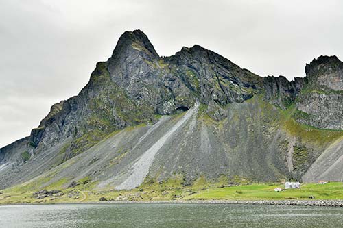
At Álftafjörður, if you’re lucky, you may spot some of its namesake migratory whooper swans. Near the end of the fjord you’ll pass the little point called Þvottá, where, in the tenth century, a missionary sent by the king of Norway first arrived to Christianize the Icelanders. This “Washing River” (as its name means) is where the missionary baptized his first Icelander.
Just after, you’ll round the bend of the last of the Eastfjords, pass the Stapinn sea stack (with a good photo pullout), then reach the point of land marked by the Hvalnes lighthouse. Here the landscape begins to change. You’re no longer in fjord country, but in the glacial world of Southeast Iceland.
To continue your drive to Höfn—the biggest population center for about 300 miles (about 30 minutes away)—and through the rest of the southeast, see the next section.
Southeast Iceland
Southeast Iceland is glacier country. The rugged, 200-mile-long coastline is shaped by Vatnajökull, Iceland’s (and Europe’s) biggest glacier. It is massive: By volume, Vatnajökull (VAHT-nah-YUR-kutl, Lakes Glacier) contains more water than Africa’s Lake Victoria, and by area, it’s larger than the state of Delaware. Greedy with its superlatives, Vatnajökull is also home to Iceland’s highest peak (Hvannadalshnúkur, 6,900 feet). This is one big chunk of ice.
It takes a couple of hours just to drive around the southern flanks of this gigantic glacier. (This thing is so big, a waterfall we passed days ago—Dettifoss—drains from it.) You’ll never see the glacier all at once; most of its bulk hides behind the mountaintops. Throughout Southeast Iceland, the Ring Road tightropes between Vatnajökull and the open Atlantic. You’ll cross many broad beaches of pebbles, ground up and washed out by glaciers, and get a good look at several glacier tongues, stretching down from the top of the big ice monster and lapping at the lowland valleys.
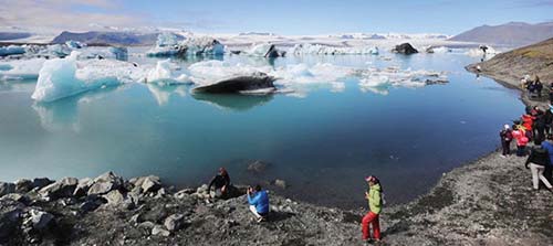
Southeast Iceland has a few widely scattered sights, including some spectacular natural wonders. The highlights are glacier lagoons, where icebergs bob in dreamy pools: the famous (and quite touristy) Jökulsárlón, and the lesser-known and smaller Fjallsárlón. Near Jökulsárlón is the so-called Diamond Beach, where glittering chunks of ice often wash up on a velvety black sand beach.
To get up close to all that glacial scenery, visit the Skaftafell wilderness area, which offers a variety of hikes, from easy to strenuous. And the main town of this area, Höfn, is a practical, peninsular little burg whose restaurants specialize in the delectable local specialty, humar (langoustine).
Planning Tips: You’ll likely want to spend a night in this area to rest up between two long days of driving. Accommodations are sparse, so book well ahead. While Höfn is the only real town in Southeast Iceland—and has some good accommodations—it’s at the region’s easternmost end, so sleeping there makes the next day’s onward drive that much longer. From a practical point of view, you may be better off dining in Höfn, then continuing farther west to a hotel farther south. You’ll find accommodations around Hali and Jökulsárlón, 45 minutes past Höfn (allowing you both a late evening and early morning look at the glacier lagoon), and in the Skaftafell area, another 45 minutes beyond that. Sleeping nearer the glacier is also handy if you’re dancing around bad weather.
Glacier Activities: It’s best to reserve ahead for many activities in this area, including boat trips on the glacier lagoons, hiking or snowmobiling across a glacier, or visiting an ice cave. For details on your options, see the Icelandic Experiences chapter. Do some homework and book your activity a few days ahead, as soon as weather reports become reliable but before tours sell out (most tour companies have online calendars showing available slots). Consider booking your activity for the morning after you overnight in the southeast (avoiding a stressful drive to make a late-afternoon appointment).
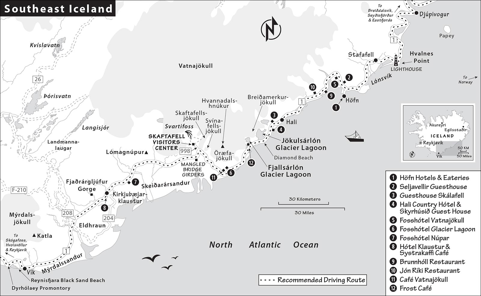
Southeast to South Coast
Driving from where Southeast Iceland begins (at Hvalnes point) to Vík (which kicks off the South Coast) is about 200 miles—or about four hours of driving, nonstop. Some of Iceland’s most impressive natural sights are here, but they’re spread out, with long stretches of road in between. In this section I describe the drive between Hvalnes point and Vík. For detailed descriptions of the towns and sights recommended along this route, see the “Southeast Iceland Towns and Sights” section later in this chapter. For locations, refer to the “Southeast Iceland” map.
Sandstorm Alert: The most dangerous area for potentially car-damaging sandstorms along the Ring Road is the section between Skaftafell and Vík, where you’ll pass through wide stretches of sand. If windy conditions are forecast, try to avoid this area.
Hvalnes Lighthouse: Rounding the bend from the Eastfjords at Hvalnes point is a glorious introduction to the glacial scenery of the southeast. The simple orange tower of the Hvalnes lighthouse, barely visible from the road, welcomes visitors to this area. Notice the more intense surf crashing on the rocks—rather than the gentle lapping of Eastfjords waves.
Lónsvík Bay: Immediately after the lighthouse, there’s a pullout at the end of an astonishingly long, far-as-the-eye-can-see, natural causeway along the bay of Lónsvík.
Continuing around the bay, notice that the landscape has shifted from mossy cliffs and green fields to massive, sloping mounds of loose pebbles and flat, rocky expanses. (Bunkers on the right side of the road block rockslides.) The water changes colors, as mineral-murky glacial runoff mixes in shades of green, blue, and yellow.
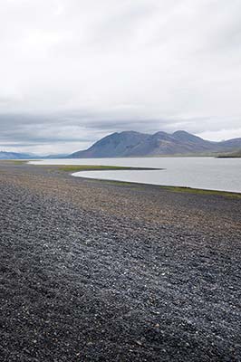
Just past the settlement of Stafafell, you’ll use a one-lane bridge to cross the first of many glacial riverbeds. These distinctive waterways—where centuries-old ice finally melts and runs off to the ocean—are always shifting.
• At the far end of Lónsvík bay, you’ll pass between scree-sloped mountains and through a short tunnel. Popping out the other side, straight ahead you’ll get your first glimpse of a glacier: the Hoffellsjökull tongue of Vatnajökull. Soon after—about 15 minutes later—you reach the turnoff (on the left, highway 99) for the town of Höfn.
From Höfn to Hali: As it’s the biggest population center for more than 100 miles in either direction, Höfn is good for a break—gas up, use the WC, and have a meal. For suggestions on places to eat in Höfn, see “Southeast Iceland Towns and Sights,” later. Otherwise, there are a couple of options past town.
Beyond Höfn, the roadside guesthouse/restaurant Brunnhóll has a popular ice-cream counter and café (lunch and dinner; on the left). If you’re passing through in the evening, for a better meal, carry on about a mile farther to the recommended $$ Jón Ríki brewery/restaurant (dinner only; on the right, at Hólmur farm).
Just after Jón Ríki, on the left after a bridge, a pullout offers good views of the not-so-distant glacier. About 35 miles (45 minutes) past the Höfn turnoff, on the left, is a building shaped like a long bookshelf, at the little settlement of Hali, with a hotel, guesthouse, cafeteria-like café, and museum honoring a local author (see here).
• About 10 minutes beyond Hali, sweeping glacial views open up across the desert-like plain.
Glacier Lagoons and Tongues: Watch for the big parking lot (on the right, immediately before a white suspension bridge) for the stunning Jökulsárlón glacier lagoon—a must-stop to gape at the icebergs. Then get back on highway 1, cross the bridge, and immediately turn left to reach Diamond Beach, where—when conditions are right—small icebergs wash up on a black sand shoreline.
About 10 minutes farther, and easy to miss (since it’s not visible from the road), is another glacier lagoon, Fjallsárlón. This quieter and smaller lagoon has a better view of the glacier.
• Back on highway 1, cut across the boulder-strewn flats between glacier-topped mountains and coastline.
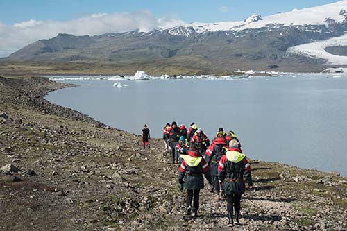
Along the way, you’ll notice the glacial tongues filling grooves in the mountains on your right. About 30 minutes past the lagoons, on the right, you’ll enjoy ideal views of Iceland’s tallest peak, Hvannadalshnúkur.
If you’re ready for a break, consider a stop at the unassuming but excellent $$ Café Vatnajökull, right off the highway near an N1 gas pump. It’s an artsy place with a comfortable main seating area and big windows—a cozy place to watch arctic terns swooping and diving outside (there’s a nesting ground nearby, so park close to the café, or you may get harassed by these oft-aggressive birds). The relaxing back room has couches and local art (daily, tasty sandwiches, soup, and pastries, +354 888 1788).
A few minutes beyond the café, look for a small turnoff to a gravel road (on the right, signed Svínafellsjökull). For a short, easy, and scenic hike, drive down the gravel path to a large parking lot. From here, follow the short trail to the base of the Svínafellsjökull glacier. After a half-mile, you’ll reach a steep hill. Climb to the top to see the glacier and its lagoon sprawl before you. Trails fan out from here in all directions.
• About 10 minutes past Hótel Skaftafell, just after a one-lane bridge, on the right, is the easy-to-miss turnoff for highway 998 and...
Skaftafell National Park: About 1.5 miles off the main road, you’ll reach the park’s visitors center (with WCs and a cafeteria; for more on the park, see later in this chapter).
A couple of minutes after the Skaftafell turnoff, on the left, watch for a pullout next to a pair of mangled girders. They’re all that’s left of a bridge that washed out in the fall of 1996: A volcanic eruption heated up a mountaintop lagoon of glacier water, which came rushing down the mountainside in a days-long flood that peaked at more than 10 million gallons per second. Such floods, called a jökulhlaup, are relatively common along Iceland’s southern coast. That’s partly why many of the bridges you’ll cross on this drive are wimpy one-lane ones, which can be easily replaced. These bridges also sit slightly higher than the roadbed. If there’s a flood, this makes it easier to cut out segments of the road to divert the rushing water and, hopefully, save the bridge.
• Continuing west, you’ll cross the extremely broad outwash plain called...
Skeiðarársandur (Spoon-River Sands): The majority of meltwater from Vatnajökull drains to the Atlantic from this delta, which covers 500 square miles—the largest such glacial drainage delta in the world. (Geologists worldwide sometimes call an outwash plain a sandur—borrowing the Icelandic word.) As you cross Skeiðarársandur, notice the extremely long one-lane bridge no longer in use. An eruption in 2011 caused the main watercourse to shift to the west (leaving this river a mere trickle), forcing construction of the two-lane bridge you’re driving on now.
Approaching the end of the sands, you’ll cross another two-lane bridge at the base of the beefy peak called Lómagnúpur. Here the landscape shifts to chunks of lava—striking, sharp-edge cliffs with lots of waterfalls, interspersed with a handful of farms tucked into velvety hillsides—and fields of purple lupine in summer (see the sidebar earlier in this chapter).
• Eventually, about 45 miles (nearly an hour) past the Skaftafell turnoff, you’ll come to a roundabout. If you need a break, take the second exit to pull into...
Kirkjubæjarklaustur: The lone point of civilization between Höfn and Vík, Kirkjubæjarklaustur (KEERK-yoo-bay-yahr-KLOY-stur; Church-Farm Monastery, pop. 120) is the place to gas up and grab some food. Exiting the roundabout, just follow the main street; you’ll reach a little building housing the busy $$ Systrakaffi café and a little grocery store.
• Back on highway 1, a few minutes past Kirkjubæjarklaustur, there’s a fine little natural area that’s good for stretching your legs. To reach it, just after leaving town, watch for the turnoff marked Holt and Fjaðrárgljúfur.
Fjaðrárgljúfur (Feather-River Canyon): About 10 minutes after the signed turnoff, you’ll reach the parking lot for this gently scenic gorge of soft, rounded hills grooved by a deep river (pay parking, WCs, picnic tables). From here you can hike up along the upper rim of the 1.5-mile-long, 300-foot-deep canyon, peering down into its unique formations. The canyon was most recently in the news after Justin Bieber shot a music video here (and nearby) in 2015. The pop star did everything Icelanders beg tourists not to do (rolled around in sensitive moss, went off trail to get close to waterfalls, and swam almost naked in a lagoon full of icebergs). Shortly thereafter, the canyon temporarily closed to prevent further damage to its delicate landscape.
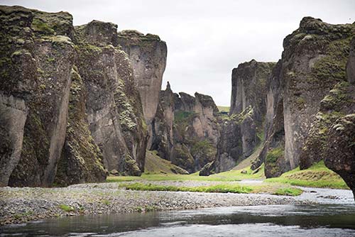
• From Kirkjubæjarklaustur, it’s about an hour (45 miles) to the next town, Vík.
The Road to Vík: You’ll pass through an alien landscape of bubbly lava rock blanketed with yellow moss—a world of molehills with pointy tops, alternating with purple lupine. Resembling a science experiment gone wrong, this is the Eldhraun lava field—at 218 square miles, the world’s largest lava flow, created in the 1783-1784 Lakagígar eruption (also referred to as the Laki fissure eruption, or the Skaftár Fires). Lava surged out of a 16-mile-long row of fissures and craters, with deadly consequences in Iceland and Europe. The ash and poisonous gas spewed far and wide, destroying farmland and killing half the region’s livestock. The years that followed were dubbed “the hardship of the haze.” Almost a quarter of Iceland’s population died from starvation.
Somewhere in there, you’ll see a pointy-ridged mountain, Hjörleifshöfði—it looks a bit like a sleeping stegosaurus. And soon you’ll begin to catch glimpses of the Mýrdalsjökull glacier on the horizon to your right.
Before long, you’re crossing another broad sandur (Mýrdalssandur). The row of cliffs on the left marks your next stop: the town of Vík, the gateway to the South Coast.
Southeast Iceland Towns and Sights
You’ll reach the following towns and sights as you drive south from Hvalnes to Vík via the route above.
▲Höfn
Höfn (pron. hurpn, with a nearly silent n; pop. 2,200) is the only real town in Southeast Iceland. Set on a narrow peninsula, this fishing-harbor town offers easy access to the Vatnajökull glacier, a supermarket, a good swimming pool, and some enticing places to eat. The harborfront, more practical than quaint, serves as a local tourism hub, with lots of restaurants, tour operators offering trips to the glacier, and a handy TI/national park visitors center called Gamlabúð (daily June-Aug 9:00-17:00, shorter hours off-season, up the stone stairs at Heppuvegur 1, good glacier exhibit, +354 470 8330, www.visitvatnajokull.is). The promontory beyond the harbor is a nature reserve. Summer flights on Eagle Air link Reykjavík City Airport to the small Hornafjörður Airport at Höfn nearly daily in about an hour (www.eagleair.is).
Sights in Höfn: Höfn’s best sight is the Vatnajökull glacier across the fjord. But if you have time in town, consider a walk on the pleasant paved trail along the peninsula’s east side. Walking north from the harbor offers views of the glacier across the mudflats; walking south brings you to the Ósland nature reserve (great for birders). Keep an eye out for models of planets as you walk—they’re part of a scale model of the solar system (the sun is on Ósland). There’s a simple Maritime Museum in an old Quonset hut near the harbor, and the town swimming pool has waterslides, hot tubs, and a steam bath (at Víkurbraut 9).
Eating in Höfn: This fishing town is crazy about the local delicacy, humar (langoustine—a smaller cousin of the American lobster), celebrating it with a weeklong festival in June and cooking it every which way. While you’ll pay royally to sample humar, it’s a justifiable investment.
Several seafood restaurants cluster near the harbor. The $$$$ Pakkhús Restaurant has a lively dining room upstairs, a cozy pub and outdoor seating downstairs, and a menu of humar and other specialties. If you really want to settle in for a memorable meal at the end of a long day’s drive, do it here (daily until 21:00, Krosseyjarvegur 3, +354 478 2280, www.pakkhus.is). Just up the hill above Pakkhús, the welcoming $$ Íshúsið pizzeria offers the standards, but their “Lobster Festival” pizza is tops (daily, Heppuvegur 2a, +354 478 1230, www.ishusidpizzeria.is).
For something simpler and cheaper, try the diner-style $ Hafnarbuðin, which sits in a little shack farther around the harbor. Order at the counter, then try to find a seat in the cramped interior or at the picnic tables outside. Their “langoustine baguette” is Iceland’s answer to a lobster roll (they also serve fish-and-chips, burgers, and milkshakes—a rarity in Iceland, daily, Ránarslóð 12, +354 478 1095).
Farther out, along the road toward highway 1, $$$ Kaffi Hornið is a convivial, reliable choice for comfort food in a log cabin (daily, Hafnarbraut 42, www.kaffihornid.is).
Eating near Höfn: A good dinner-only option, $$ Jón Ríki (Jón the Rich) is tucked at the back of a nondescript farming settlement called Hólmur, right along the Ring Road (about 20 minutes/17 miles west of the Höfn turnoff). This sociable, casual microbrewery/restaurant, in an artistically decorated barn, serves pizzas and local dishes but has inconsistent hours; if you have your heart set on it, call ahead to make sure it’s open (generally daily for dinner only in summer, +354 478 2063, www.jonriki.is).
Sleeping in and near Höfn: See the “Sleeping in Southeast Iceland” section, later in this chapter.
Hali Farm
The 20th-century Icelandic author Þórbergur Þórðarson was born on this farm in 1888. Þórbergur is most remembered for his humorous, self-deprecating essays and The Stones Speak, a memoir of his childhood in this isolated place, where the glacial rivers weren’t bridged until the 1970s.
The farm is now home to the Þórbergssetur museum (also called the Þórbergur Center), which is designed to look like a giant bookshelf containing Þórbergur’s works. Inside, an audioguide takes you through scenes from the author’s life. You’ll learn about the history of the property and its famous resident, and you can step into a re-created baðstofa (main room of a traditional farmhouse) and bedroom. The exhibit makes Þórbergur and his writings meaningful to outsiders—and it’s a good break from driving. (The building is also the reception for the recommended Hali Country Hótel—see “Sleeping in Southeast Iceland,” later.)
Cost and Hours: 1,500 ISK, includes audioguide, daily 8:00-20:00, café same hours, +354 867 2900, www.thorbergur.is.
Glacier Lagoons
▲▲▲Jökulsárlón
This glorious sight is one of Iceland’s best: a lagoon where giant, bobbing chunks of ice float in dreamy tranquility, in front of a glacier backdrop. The lagoon called Jökulsárlón (YUR-kurls-OUR-lohn, Glacier-River Lagoon) is also one of Iceland’s youngest natural features. It first appeared around 1935, as a lagoon filled the deep chute gouged out by the receding Breiðamerkurjökull glacial tongue (which continues to retreat about a foot per day, a pace that has increased dramatically over the last decades). The lagoon now covers seven square miles and reaches a depth of nearly 900 feet. If Breiðamerkurjökull disappears altogether, it would leave behind a 15-mile-long fjord.
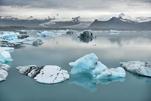
The lagoon’s temperature hovers just above freezing. Saltwater from the nearby Atlantic backs up the short Jökulsá river into the lagoon, which helps prevent it from freezing over. (The ocean rarely goes above about 45°F.)
You can view the icebergs easily from the shore, or (better) take a tour of the lagoon by boat or kayak. Occasionally seals swim up the outflow river and can be seen basking on the ice chunks. And seabirds, including arctic terns, nest nearby in the early summer. If you happen to wander too close to a nest, you could get dive-bombed.
Parking at the Glacier: As you approach the bridge at the turnoff for the main parking lot (on the right), you’ll see an overflow lot down to the left. It can be smart to park in the overflow lot, then take a short walk under the bridge for dramatic views as you approach the lagoon (parking-1,000 ISK, pay via the Parka app or at machines near the ticket office; the main Jökulsárlón lot, the overflow lot, and Diamond Beach are considered one payment zone—one payment allows for parking at all three lots on the same day). The parking fee does not cover the Skaftafell National Park area (the app is misleading on this); you’ll pay again at Skaftafell, though if you visit on the same day, you’ll get a 50 percent discount.
The glacier lagoon at Jökulsárlón is big and impressive, but for some visitors, it feels touristy and crowded. With multiple boats cruising its waters at once, the experience can lose some magic. I’d stop off to ogle the dramatic lagoon (and the nearby Diamond Beach), then carry on 10 minutes for a more intimate boat trip at Fjallsárlón. This often-overlooked lagoon is just as spectacular.
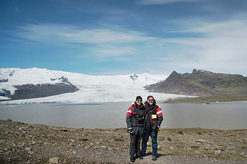
Whichever lagoon you visit, be extremely careful. Tempting as it might seem, trying to step out onto an iceberg that drifts near the shore is a terrible idea. The ice chunks can flip over, trapping you underneath, immersed in near-freezing water.
Chunks of ice the size of buildings can crack off the glacier with a sharp bang, like a gunshot. When they first calve off, the ice is a brilliant, deep blue. After just a few hours in the sun, the outer layer begins to melt, trapping tiny air bubbles and turning the surface white. Darker patches show where the ice dredges up sediments while grinding along the glacier bed. Because the grit stays put when the ice melts, icebergs grow darker as they age. All that sediment is what makes the lagoon’s water murky.
Like icebergs at sea, these chunks of ice extend far beneath the surface. What you see floating is generally only one-tenth of the iceberg. Occasionally the melting patterns make an iceberg unbalanced, until it suddenly flips over with a thundering splash. Like a living organism, the lagoon is always changing, with icebergs bobbing and drifting around the still water. They slowly decrease in size until they’re finally small enough for the current to carry them down the short Jökulsá river and out to the Atlantic.
If you’ve parked in the Jökulsárlón lots, don’t walk across the one-lane bridge to the beach (no matter how many people you see doing so—it’s not particularly safe). It’s better to drive to the beach lot.
Glacier Lagoon Boat Trips: At Jökulsárlón, you have three options for getting out on the frigid water—a large, slow-moving “amphibian boat” (6,300 ISK, 35-40 minutes); a smaller, faster RIB (13,900 ISK, 1 hour); or a kayak (see “Kayak Tours,” below). All three options should be booked as far in advance as possible.
On both the amphibian boats and RIBs, your captain/guide will narrate as the boat weaves between floating icebergs (RIBs reach as far as the glacier wall at the end of the lagoon). If you’re lucky, you’ll hear the glacier creak or see a chunk of ice break off. You’ll be provided with life jackets on either boat, and warm coveralls on the RIB. Either way, bundle up before heading out (close-fitting hat and gloves; tours run daily July-Aug 9:00-19:00, shorter hours off-season, no trips Nov-April, +354 478 2222, www.icelagoon.is).
On arrival at the lagoon, go to the ticket kiosk to trade your emailed receipt for a ticket, then proceed to your boat’s meeting point. Amphibian boats generally load close to the ticket kiosk; for the RIB you’ll first be directed to a changing cabin to get outfitted, then walk with your captain/guide about 500 feet to a small dock.
Kayak Tours: The adventurous (and environmentally conscious) might consider a kayak tour in the lagoon. You’ll get even closer to the icebergs and glacier, and you won’t be polluting the area with the exhaust of a regular tour boat. You may even see seals up close (typically about 13,000 ISK for a one-hour tour).
Eating at Jökulsárlón: A too-small $ café is to the right of the boat ticket kiosk, offering soup, sandwiches, and hot drinks (free WCs in trailers nearby). In peak season, you may also find food trucks and picnic tables at the far end of the parking lot.
▲▲▲Diamond Beach
This dramatic sight hides down a road just south of the bridge at Jökulsárlón (see here for directions). If conditions are right and the diamond-like icebergs litter the beach, it’s thrilling. But at other times, icebergs are nowhere to be found, and it’s just another black sand beach. As it’s a very quick detour from the main road, it’s definitely worth taking a look. Park (1,000 ISK—fee here also covers the lots at Jökulsárlón, no WC), then walk up the shifting slope and down again to the shore. Glittering icebergs of every size lie stranded on a fine black powder beach, like diamonds on display. By the time they reach these sands, many of the icebergs have been tumbled by currents and waves, leaving them shiny and smooth. The beach changes constantly: Sometimes the “diamonds” are many, other times they’re sparse, and sometimes you won’t see any at all. Sometimes they’re transparent, other times white, occasionally blue, and often there’s a mix of colors and sizes.
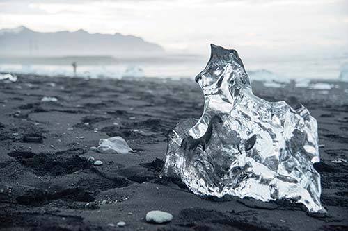
Be extremely careful exploring this area. The Atlantic coastline here is notorious for its sneaker waves. If you turn your back to the ocean or wade into the (frigid) water, you’re taking your life in your hands. But even from a safe distance, Diamond Beach takes your breath away.
▲▲Fjallsárlón
Fjallsárlón (FYATL-sour-lohn, Mountain-River Lagoon)—the Back Door alternative to Jökulsárlón—is just seven miles farther down the main road (10 minutes), but tucked out of sight (watch for the big Boat Tours and red Fjallsárlón sign). From the free parking lot—with a modern services building, including WCs, a decent café, and boat-trip ticket offices—you can hike up onto a little ridge for great views of the Fjallsjökull glacial tongue, with the lagoon in the foreground. This lagoon started to form about 20 years ago as the glacier receded up the slope. It’s smaller than Jökulsárlón (about one-fifth the size and one-third the depth), but that means you’re up closer to the glacier itself. On a nice day, you could pack a lunch and picnic by the lagoon.
Boat Trips: With Fjallsárlón’s smaller size, the 45-minute RIB cruises here feel more personal (allow an hour total, including time to gear up). Boat trips run nearly hourly through the summer. It’s best to book online a few days in advance. If you want to take your chances and just show up, you may have more luck around lunchtime (9,300 ISK, hourly tours run April-mid-Oct daily 9:30-18:30, +354 666 8006, www.fjallsarlon.is).
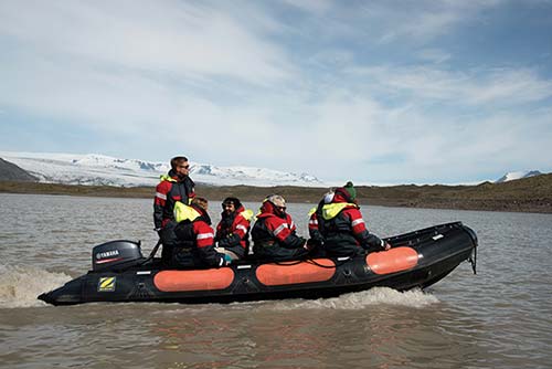
Eating at Fjallsárlón: The modern, inviting $ Frost Café offers a soup-and-bread option, salad bar, and sandwiches (daily in summer, free WC).
Skaftafell National Park
Skaftafell (SKAF-tah-fehtl) is part of the larger Vatnajökull National Park (watch for the turnoff for highway 998 from the Ring Road). Within the park are Iceland’s highest mountain, Hvannadalshnúkur (6,900 feet); the mountain’s Öræfajökull glacier; and the Skaftafellsjökull glacial tongue, which pokes down from Vatnajökull in the distance.
It’s 1,000 ISK to park in the sprawling lot (which teems with hikers on nice summer days). You can pay with the Parka app, at kiosks at the parking lot, or at the visitors center (know your license-plate number; 50 percent off if you’ve already paid for parking at Jökulsárlón—or vice versa if you start here). A short walk on a gravel path brings you to the visitors center, with some small exhibits about the area, a short film in English, and plenty of advice about local hikes (maps for sale, info boards describe hiking routes, typically open daily 9:00-19:00 in summer, shorter hours off-season, camping available, free WCs, +354 470 8300, www.vjp.is).
Eating at Skaftafell: A big, basic $ cafeteria with glacier views and outdoor seating serves uninspired salads, sandwiches, and main courses (daily in summer, 10:00-19:00 off-season). There’s also often a food truck in the parking lot near the campground.
▲▲Hiking at Skaftafell
Some people spend days hiking in this area, but even if you’re just passing through, it’s worth sampling one of the trails. Here are some popular choices, all of which begin from the Skaftafell parking lot (time and distance estimates are round-trip). Before heading out, be sure to get the hiking pamphlet from the visitors center, and be aware of local weather conditions. The last three hikes require a stiff uphill climb to the ridge called Skaftafellsheiði, which looms above the visitors center.
“Geology Trail” to Skaftafellsjökull (easy, 2.3 miles, 1 hour): The easiest and most popular choice, this loop hike (mostly over even and flat terrain, blue trail S1) takes you to the glacier tongue that runs off Vatnajökull. This is perhaps your best chance to get up close to a glacier without taking a lagoon cruise. (If you’re planning to hike at Sólheimajökull farther along the South Coast, this trail may be somewhat redundant.) Rangers lead free guided walks on this route three times a day in season—if you’d like to join one, look online (www.vjp.is) or check the posted schedule for the next departure.
From the visitors center, you’ll cut through a brushy “forest” of birch trees, cross a rocky field, walk along the base of a cliff, and go up the valley cut by the receding glacier. When you get to the glacier, conditions may allow you to walk up and touch it (but your path will likely be impeded by a river or pool of water). The glacier’s brown or black appearance comes from all the grit it picks up as it grinds down its valley.
Svartifoss (moderate, 2-2.5 miles, 1.5-2 hours): While only about 60 feet tall, Svartifoss (Black Waterfall) enjoys one of Iceland’s most dramatic waterfall settings, gushing over a cliff of basalt columns. While utterly spectacular, a visit requires a sturdy uphill hike (elevation gain of about 850 feet). Note that there are two routes to Svartifoss: Short and steep (red trail S2), or longer and more gradual (blue trail S2). Sort out your options at the visitors center.
Svartifoss-Sjónarsker-Sel (moderate, 3.5 miles, 2.5 hours): From Svartifoss, further hikes tempt those with more time and energy. One popular, moderate option links the waterfall to the fine viewpoint at Sjónarsker—overlooking the astonishingly broad Skeiðarársandur glacial river delta—and a traditional turf house at Sel (blue trail S2).
Svartifoss-Sjónarnípa (challenging, 4.5 miles, 3-4 hours): More ambitious is the demanding trail from Svartifoss across to the hillside to Sjónarnípa, which rewards the effort with stunning views over Skaftafellsjökull. Ignore the first right turn for Sjónarnípa before Svartifoss. At the split for the falls, look for the Sjónarnípa sign on the right (red trail S5/S6).
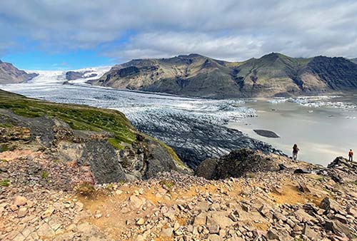
Glacier Walks and Ice Cave Tours
The area near the visitors center at Skaftafell is busy with huts and vans for various tour companies leading groups onto the ice. Excursions range from an hour in length to all-day walks. For these up-close glacier experiences, it’s best to book ahead. The following companies offer one or both activities: Glacier Journey (www.glacierjourney.is), Arctic Adventures (www.adventures.is), and Tröll Expeditions (www.troll.is). For glacier walks, Icelandic Mountain Guides (www.mountainguides.is) and Arctic Adventures (www.adventures.is) are more specialized. For more on glacier activities, see the Icelandic Experiences chapter.
Sleeping in Southeast Iceland
For locations, see the map on here.
In Höfn: The $$$ Milk Factory, along the road between Höfn and highway 1 (a long walk or short drive from the harbor), is a fun choice, renting 17 rooms in a former milk-processing plant with clean, tidy, modern style. Check out the photos in the lobby to see the factory in its heyday (family rooms, Dalbraut 2, +354 478 8900, www.milkfactory.is, reception@milkfactory.is). They also rent the clean and basic $$ Heppa Apartments downtown (2- and 3-bedroom apartments available, book through Booking.com).
$$$$ Charming but pricey Hótel Höfn, facing the ocean three blocks from the main road, is a rewarding splurge with a chic nod to its retro roots in its 65 rooms. It’s a 20-minute stroll to the harbor along the pedestrian promenade (no elevator, breakfast extra—includes homemade baked goods, chic dinner-only restaurant, Víkurbraut 20, +354 478 1240, www.hotelhofn.is, info@hotelhofn.is).
$$$ Berjaya Höfn Hotel is the other big-hotel option in town, with a large, modern lobby and 36 rooms—many with glacier views. It’s in a handy location just steps from the harbor (no elevator, breakfast buffet extra, Ránarslóð 3, +354 444 4850, https://icelandhotelcollectionbyberjaya.com, hofn@icehotels.is).
$$ Guesthouse Dyngja is a reliable, cheerful place with seven updated rooms (with shared bath) a few steps above the harbor (breakfast extra, family room with private entry, Hafnarbraut 1, +354 896 0702, https://guesthousedyngja.is, info@guesthousedyngja.is).
Just Outside Höfn: In a modern motel-style building, $$$ Seljavellir Guesthouse offers 20 practical rooms in a farm valley a few minutes north of Höfn. Each room has a private bathroom and patio. Some rooms come with glacier views; others have mountain views (just off highway 1, +354 478 1866, www.seljavellir.com [URL inactive], info@seljavellir.is).
Between Höfn and the Glacier Lagoons: Tucked beneath a huge mountain about a half-hour from Höfn or Jökulsárlón, $$$ Guesthouse Skálafell is a simple, family-run compound with 13 rooms and a cozy cottage. The three rooms in the main building share a bath; the rest have private baths (good dinners available, +354 478 1041, www.skalafell.net, info@skalafell.net, Sindri). The guesthouse shares a parking lot with the national park’s Hjallanes trailhead (1-, 3-, and 5-mile hike options).
$$$ Hali Country Hótel is big and functional, just a 10-minute drive east of the Jökulsárlón glacier lagoon by the Hali farm/Þórbergur Center (described on here). It has 35 rooms across three buildings fronting the ocean, plus three apartments with kitchenettes (reception and breakfast at museum, laundry service, +354 867 2900, www.hali.is, hali@hali.is).
$$ Skyrhúsið Guest House, part of the Hostelling International network, is just down from the Þórbergur Center. It offers 11 bright and basic rooms with shared bath (+354 899 8384, https://skyrhusid.is, skyrhusid@gmail.com).
Big Chain Hotels: For less personality but plenty of beds, you’ll find big branches of well-established Icelandic chains that cater mainly to tour groups. The Fosshotel chain has multiple branches (www.fosshotel.is): $$$$ Fosshótel Vatnajökull has 66 rooms just outside of Höfn (+354 478 2555, vatnajokull@fosshotel.is), $$$$ Fosshótel Glacier Lagoon is a splurge with 104 rooms beside a waterfall between Jökulsárlón and Skaftafell (+354 514 8300, glacier@fosshotel.is), and $$$ Fosshótel Núpar has 60 rooms about 20 minutes north of Kirkjubæjarklaustur (+354 517 3060, nupar@fosshotel.is). $$$ Hótel Klaustur has 57 rooms in the village of Kirkjubæjarklaustur (Klausturvegi 6, +354 487 4900, https://hotelklaustur.is, info@hotelklaustur.is).
South Coast
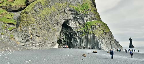
Iceland’s South Coast—stretching from Vík about 40 miles west to the Markárfljót river and Seljalandsfoss waterfall—is one of Iceland’s most enjoyable corners. Within this hour-long stretch you’ll encounter black sand beaches, scenic promontories, hikeable and touchable glaciers, a pleasant folk museum, and two spectacular waterfalls. On the way back to Reykjavík, there’s less to see, though the Lava Center is a good stop to learn more about volcanoes.
Planning Tips: If you’re rushing the Ring, you’ll have a busy day of sightseeing and a late drive back to Reykjavík. Spending a night here allows you to linger at the area’s attractions before returning to Reykjavík (or side-trip to the Westman Islands, an easy ferry ride from here).
VÍK TO REYKJAVÍK
For more specifics on the South Coast, see the South Coast chapter. Since that chapter is designed for day trips from Reykjavík, the sights are presented there from west to east—the opposite order for those completing a clockwise Ring tour. Below is a rough outline for visiting these sights, traveling from east to west.
The first part of the drive—from Vík to Seljalandsfoss waterfall—takes only about an hour (about 40 miles) but contains many hours’ worth of sightseeing. If you’re very selective, you can have a satisfying visit to this stretch in about 3-4 hours.
Once you leave Hvolsvöllur, it’s a fairly straightforward 1.5-hour, 70-mile drive to Reykjavík, with fewer temptations en route.
From Vík (where you’ll find gas stations and eateries), you’ll twist up and over a mountain pass. As you descend, watch on the left for the turnoff to the Reynisfjara black sand beach, with fabulous basalt formations, scenic sea stacks, handy beach café, and dangerous sneaker waves (five-minute drive from the main road on highway 215).
Just a bit farther along on highway 1, the turnoff for highway 218 leads five minutes to Dyrhólaey promontory, with fine views and a lighthouse hike (skippable for those in a rush—or in bad weather).
Continuing 25 more minutes, you’ll reach the turnoff for Sólheimajökull glacier (a five-minute drive from the Ring Road on highway 221). From the parking lot, it’s a 10-15-minute hike to the glacier; depending on conditions (and your own surefootedness), you can often walk right up to the glacier. But if you’ve already visited the glacier lagoons in the southeast, this is skippable.
Just past the Sólheimajökull turnoff, also on the right, is the settlement called Skógar, which has the striking Skógafoss waterfall and a fine folk museum.
From here, the road continues west in the shadow of Eyjafjallajökull, the volcano whose 2010 eruption famously disrupted European air travel. You’ll enjoy great views of the Westman Islands, with teeth-like cliffs hovering just offshore (for details, see the Westman Islands chapter).
Around 25 minutes (18 miles) after leaving Skógar, turn off on the right to highway 249 and the parking lot for the long and lovely Seljalandsfoss waterfall—where you can actually walk behind its tumbling torrent.
Back on highway 1, you’ll cross the Markárfljót river and curve inland—going through the humble communities of Hvolsvöllur, Hella, and Selfoss (with a small museum dedicated to chess legend Bobby Fischer, whose grave is nearby). Highway 1 cuts north past Hveragerði (with a satisfying pizzeria/brewery—see here), then switchbacks up and across the volcanic, desolate Hellisheiði plateau. Before you know it, you’re approaching the Reykjavík suburbs.
Hey...is that Hallgrímskirkja popping into view? Your epic Ring Road odyssey is finally at its end. Well done!