SNÆFELLSNES PENINSULA
Sleeping on the Snæfellsnes Peninsula
The long finger of the Snæfellsnes (SNIGH-fells-ness) Peninsula, poking out from Iceland’s west coast (north of Reykjavík), offers an “Iceland in a nutshell” experience. On an easy loop trip here, you’ll catch glimpses of glaciers, black sand beaches, lava-rock landscapes, epic fjords, bridal-veil waterfalls, climbable craters, basalt sea stacks, and charming fishing towns. While Snæfellsnes is not necessarily the best place in Iceland to experience each of these features, it’s perhaps the most convenient and compact place to get a little taste of everything.
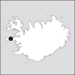
Snæfellsnes, meaning “Snow Mountain Peninsula,” is named for Snæfellsjökull, the glacier-topped volcano that looms up at its tip. The peninsula enjoys an Iceland-in-miniature geography: Its northern coastline is ruffled with fjords, similar to the country’s north and the Eastfjords. Its southern coastline features bald mountains over tapering scree skirts, laced with gorges and waterfalls, with little farms tucked here and there—much like Iceland’s South Coast. And its interior consists of rugged mountains. Snæfellsnes is also home to one of Iceland’s most recognizable landmarks, the mountain peak of Kirkjufell, an icon of Icelandic nature that rivals the Blue Lagoon as the poster child for tourism here.
Stunning natural sites aside, Snæfellsnes is deeply rooted in history as one of the earliest settled parts of Iceland. The air here is thick with the sagas, mixing historical chronicle and fantastical legend. (Brush up on the sagas before you go by reading the sidebar on here; for Snæfellsnes-specific sagas, read the sidebar later in this chapter.) Snæfellsnes’ main town, Stykkishólmur, is a pleasant harborside burg with some enjoyable sights and good hotels and restaurants. Taken together, Snæfellsnes is an appealing package, either as a jam-packed day trip from Reykjavík or—better—with an overnight or two.
PLANNING YOUR TIME
Snæfellsnes demands a lot of driving to be seen in a single day (about 6.5 hours, not including stops). You’ll need to be selective and plan on returning home to Reykjavík weary (and late).
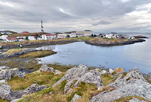
If you have just a couple of days for sights outside the capital area, a satisfying solution is to spend a night or two somewhere on the Snæfellsnes Peninsula. Many visitors to Iceland either do day trips from Reykjavík or commit a week (or more) to the Ring Road; Snæfellsnes represents the Goldilocks “just right” middle option. And Snæfellsnes’ relative remoteness can be seen as an asset, as it gets you away from the tourist crowds that hew close to the capital.
Snæfellsnes is also a reasonable (overnight) add-on to the first leg of your Ring Road loop: From Borgarnes, head up here for a night or two, before rejoining highway 1 and continuing around the island. Finally, Snæfellsnes is also a logical first stage on a journey up to the remote and rugged Westfjords—an easy ferry crossing away (see the next chapter).
On Your Own or with an Excursion: If you’re day-tripping, given the long round-trip from Reykjavík, it’s tempting to book an excursion and leave the driving to someone else. A typical itinerary takes 12 hours and costs around 18,000-20,000 ISK (depending on group size). You can go with any of the companies mentioned on here.
Snæfellsnes Drive
I’ve organized the sights of Snæfellsnes in a one-way, counterclockwise loop around the peninsula. If you’re doing it in two days, you can squeeze in just about everything mentioned here. If you must do it all in one day, you’ll need to skip some stops (I’ve noted which ones).
PLANNING YOUR DRIVE
Snæfellsnes in Two Days
A visit to Snæfellsnes is more satisfying with an overnight. This allows time to linger and fit in more stops—and it lets you flex with the always-unpredictable weather. I’ve roughed out some possibilities below, which you can adapt according to your interests.
Day 1
In the morning, head from Reykjavík up to Borgarnes (1 hour); if you’re intrigued by the sagas, you can tour this town’s Settlement Center (see the Borgarnes & Reykholt Valley chapter). Carry on north, with a quick stop at the Gerðuberg Basalt Cliffs. Then take the Vatnaleið road to the north coast to visit Stykkishólmur; wander and tour the town, consider a boat trip, and have lunch if you haven’t already. In the early afternoon, head to the Bjarnarhöfn Shark Museum for a taste of fermented shark. Then go west through Snaefellsnes’ fjord country to Grundarfjörður, where you can snap endless photos of the landmark Kirkjufell mountain. Sleep in the Grundarfjörður area or in Stykkishólmur (or head back down to Snæfellsnes’ south coast).
Day 2
Today is for Snæfellsjökull National Park. Head westward along the north coast, perhaps stopping for a photo op at Svöðufoss waterfall (just before Rif). Entering the national park just past Hellissandur, stroll Skarðsvík yellow sand beach, climb to the top of Saxhóll crater, walk down to Djúpalónssandur black sand beach, and enjoy the views of the Lóndrangar rock formations. If you enjoy spelunking, consider touring Vatnshellir Cave; if you prefer a scenic coastal walk, park in Arnarstapi and do the two-hour round-trip hike to Hellnar and back (with views of basalt formations the whole way). From here, make good time heading back to Reykjavík (about 2.5 hours), considering quick stops to see Rauðfeldsgjá gorge, the Black Church in Búðir, Bjarnarfoss waterfall, and/or seal spotting at Ytri-Tunga.
Extra Overnight: Spending a second night is a particularly good plan if you’d enjoy a rewarding but time-consuming visit to Snæfellsjökull glacier (by snowcat or on foot), or a boat trip on Breiðafjörður from Stykkishólmur.
Snæfellsnes in One Day from Reykjavík
Here’s a suggested whistle-stop schedule for those wanting to hit just the highlights of Snæfellsnes in one very long day. This is a highly selective plan, which skips many of the stops described in this chapter (or simply offers a quick glimpse as you whiz past). Assume you’ll have a late lunch, ideally in Hellissandur.
| 9:00 | Leave Reykjavík and head north on highway 1 to Borgarnes—a good place for a WC, coffee, and stretch-your-legs break |
| 10:30 | Carry on north, keeping an eye out for a peek at the Gerðuberg cliffs; then drive over Vatnaleið Pass to the Bjarnarhöfn Shark Museum (skipping Stykkishólmur) |
| 12:00 | After touring the Shark Museum, carry on westward through fjord country to Grundarfjörður, stopping just beyond the town center at Kirkjufellfoss for a short waterfall hike and Kirkjufell photo op |
| 13:00 | Continue west through the towns of Ólafsvík, Rif, and Hellissandur, stopping for lunch where you like (best at Gilbakki Kaffihús in Hellissandur) |
| 14:00 | Enter Snæfellsjökull National Park and loop around the tip of the peninsula, stopping to climb Saxhóll Crater and/or to walk along the Djúpalónssandur black sand beach (allow about 30 minutes each) |
| 15:30 | Pull over just past Malarrif lighthouse for a view of the Lóndrangar rock formations, then stop in Arnarstapi for a quick look at the seaside basalt formations (add an hour or more if you’ve booked a tour of the nearby Vatnshellir Cave) |
| 16:30 | Begin the 2.5-hour drive back to Reykjavík; you could make quick stops en route to see Rauðfeldsgjá gorge, the Black Church in Búðir, Bjarnarfoss waterfall, or seals at Ytri-Tunga (each adds 10-15 minutes to your return) |
| 19:00-20:00 | Arrive back in Reykjavík; for an earlier dinner, consider stopping in Borgarnes at the Settlement Center’s fine restaurant (see here); from there it’s about an hour’s drive to Reykjavík |
Snæfellsnes Tips
Choosing a Home Base: I’ve recommended accommodations scattered around the peninsula. Stykkishólmur is a handy hub and has the most services, but feels a bit farther from the national park sights at the far end of Snæfellsnes (see “Sleeping in Stykkishólmur” near the end of this chapter). Grundarfjörður is a nice compromise: smaller but just big enough to provide needed amenities, about 30 minutes closer to the national park, and in a scenic setting with fantastic views of Kirkjufell peak (see here). And Snæfellsnes’ sleepy south coast is a fine spot to settle into remote countryside and a bit closer to the main road back to Reykjavík (see “Sleeping on the Snæfellsnes Peninsula” at the end of this chapter). Anywhere you stay, restaurant options are limited—do a little homework, keep an eye on closing times (which may be earlier than you think), and for better restaurants, ideally book a dinner in advance.
Activities to Reserve: If you want to tour Vatnshellir Cave—the lava tube near the tip of Snæfellsnes—it’s wise to book a few days ahead in peak season (see here). Also arrange in advance for a snowcat tour or hike on Snæfellsjökull glacier (see here).
Weather and Road Conditions: All the roads on my described route are paved (though many of the detours and side roads are not). Still, in winter, any road can be icy. If you’re here outside of summer (or anytime in inclement weather), check the road conditions map at Road.is. If the weather is questionable, it can be more appealing to take a bus tour.
Seasonal Closures: The farther you get from Reykjavík, the less “year-round” places are. And Snæfellsnes is far enough that many of its restaurants, and even some accommodations and sights, may be closed off-season. I’ve listed hours for high season, which typically runs from late May through early September; outside of this time, expect closures (and call ahead before making any long journey to a particular place).
Snæfellsnes Loop
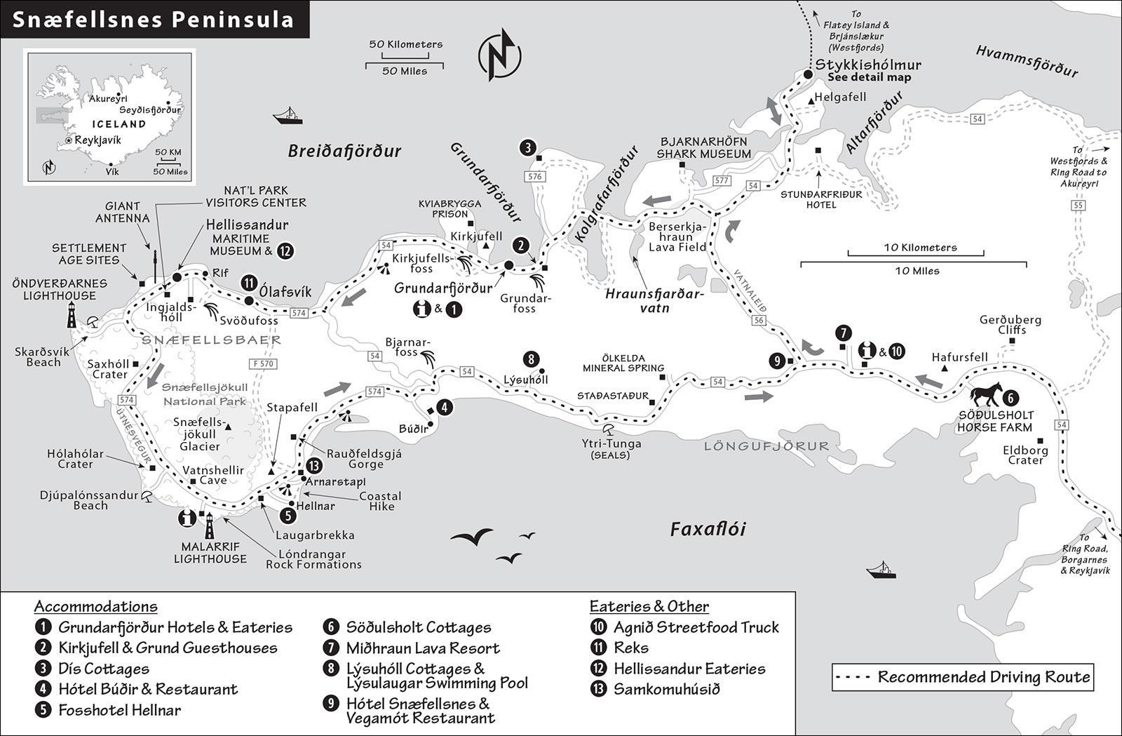
Snæfellsnes makes for a long day from Reykjavík: Count on 6.5 hours of driving round-trip, not including stops (that’s 130 miles each way to the tip of the peninsula and back). Below, I’ve linked the main stops with driving directions. My “Planning Your Time” itinerary suggestions, earlier, are designed to help you prioritize, depending on how much time you have. Pace yourself and be selective.
REYKJAVÍK TO STYKKISHÓLMUR (VIA BORGARNES)
Setting out from Reykjavík, take highway 1 north. (For details on the route between Reykjavík and Borgarnes, see here.)
▲Borgarnes and Northward
The endearing fjordside town of Borgarnes—facing a looming scree mountain from across its fjord—can be worth a quick visit if only to tour its Settlement Center and enjoy the views from Englishman’s Cove (here).
Leave Borgarnes north on highway 1. On the outskirts of town, turn left at the roundabout toward Stykkishólmur, on highway 54. You’ll follow this north for about a half-hour (27 miles). This is a flat, desolate, not particularly pretty landscape, with bogs, lakes, and scrubby vegetation. Soon you’ll see—looming up straight ahead, then on the left side of the road—the flat-topped Eldborg Crater, which rises nearly 200 feet above the surrounding lava field. With the evocative name “Fire Fortress,” it last erupted around 6,000 years ago. (While climbable, it requires a long hike; save your crater-climbing energy for Saxhóll, later on this drive.)
Carry on past Eldborg. Where highway 55 splits off to the right (marked for Búðardalur), continue along highway 54 as it bends to the left, and the landscape turns volcanic. Watch for the Velkomin á Snæfellsnes sign—officially welcoming you to the region.
• Soon, on the right side of the road, watch for the turnoff marked for Gerðuberg (and other places). Drive down this gravel road about a mile to where you’ll see pullouts offering access to...
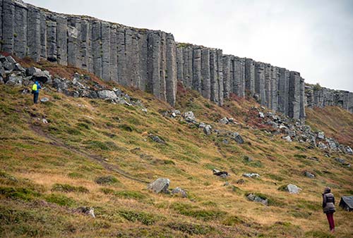
▲Gerðuberg Basalt Cliffs
This chain of basalt cliffs—a volcanic formation of interlocking hexagonal pillars that gradually splinter away from each other—is the longest in Iceland. (This shape inspired the roofline of Reykjavík’s landmark church, the Hallgrímskirkja.) From the road, surefooted visitors hike up the short, steep, muddy trail for a close look. Reaching a height of 50 feet, this evocative curtain of basalt stands sentry, as if guarding the stronghold of Snæfellsnes. While you’ve just come through some flat terrain, this sheer wall of rock suggests that you’ve reached one of Iceland’s tectonically, geothermally active zones.
Note: If you’re in a hurry, you can simply keep an eye out for this low, rocky ridge on the right side of the road (far less impressive from a distance, but you can still make out its unique shape).
• As you continue the drive, you’ll see the glacier-capped Snæfellsjökull volcano looming in the distance. About 10 minutes (or 10 miles) beyond the basalt cliffs, on the right, look for a little complex of tourist services: N1 gas pumps; a Snæfellsnes visitors center with pay WCs and free maps (daily 10:00-15:00, shorter hours off-season); you may also find the handy $ Agnið Streetfood truck, serving surprisingly tasty burgers, hotdogs, and salads.
A couple of minutes farther along, you reach the turnoff on the right for highway 56 (marked Stykkishólmur and Grundarfjörður). Turn right onto this road, which is also called...
Vatnaleið Road
Before heading up and over the Vatnaleið pass, consider stopping off at the crossroads, where the recommended Hótel Snæfellsnes runs the $$ Vegamót (“Crossroads”) restaurant (look for the red roof). They serve good cakes and a short menu of light meals and more expensive seafood specials (daily, shorter hours off-season, +354 788 9100).
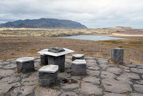
Carry on over Vatnaleið, which takes you in just 15 minutes or so from Snæfellsnes’ south coast to its north. On the ascent, you’ll pass pretty streams and waterfalls; descending, you enter a jagged lava-rock moonscape with red hills and distant views of Breiðafjörður—the vast body of water that defines the peninsula’s northern shore. Watch on the left for a viewpoint pullout, with picnic tables made from basalt columns—offering a stretch-your-legs view over this rocky landscape.
• Coming down the far side of the pass, you’ll reach a T-intersection with highway 54. To visit the town of Stykkishólmur, turn right and follow this road for about 15 minutes (11 miles). On your way into Stykkishólmur, you’ll pass through a low-lying rocky terrain of inlets and lakes. A few miles before town, watch on the right for the picturesque, rocky hill with the white church at its base, next to a lake. Called Helgafell (Holy Mountain), this superstition-infused site played a role in the sagas, was later home to an Augustinian abbey, and remains dear to Icelandic hearts.
But if you’re short on time and want to focus on Snæfellsnes’ natural sites, skip Stykkishólmur. Instead, turn left on highway 54, and pick up the tour below, under “Snæfellsnes North Coast.”
▲Stykkishólmur
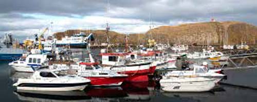
Snæfellsnes’ main town is little more than a smattering of historic houses facing a busy harbor, protected from the fjord’s waters by a picturesque basalt islet. If you’re staying overnight or taking the boat from here, Stykkishólmur is a fine place to spend time. And even if you aren’t, the town is worth a stroll. It enjoys a nice variety of restaurants, some worthwhile shops, and some pleasant but low-impact sights. For details on visiting Stykkishólmur, see the end of this chapter.
SNÆFELLSNES NORTH COAST
• Take highway 54 and follow it west. Just as you pass the junction with highway 56, you’ll enter a spiky lava-rock landscape called the...
▲Berserkjahraun Lava Field
This lunar landscape—draped with yellow lichen—was formed by volcanic eruptions around 4,000 years ago. Just off to the left is a legendary site known as Berserkjahraun, named for two doomed Berserkers—elite Viking warriors notorious for going into battle with no armor. (While today that word connotes a wild, uncontrollable attack, it comes from the Old Norse for “bear shirt,” which was all that protected these fighters from enemies.)
According to the sagas, during the early Settlement Age, two Berserkers—Halli and Leiknir—traveled here from Sweden and came to work for a local man named Styr. Halli fell in love with Styr’s daughter, but Styr would only give them permission to wed if the Berserkers completed what he thought would be an impossible task: building a bridle path through the middle of this lava field. Halli and Leiknir made short work of the job, and Styr was faced with the prospect of an objectionable son-in-law. So, when the Berserkers were done working, Styr offered them a break in a sauna, which turned out to be a trap...they were locked inside and boiled alive. History now knows the farmer as “Styr the Slayer.” Like many Icelandic legends, this tale likely contains a kernel of truth: Archaeologists have discovered the remains of two large men buried under a cairn in this area.
• Two miles after the junction with highway 56 (Vatnaleið), watch carefully on the right for the turnoff to road 577 (marked Helgafellssveit). If you’re intrigued by Iceland’s weirdest food, detour here to get a taste and to see how it’s made. Turn off and continue down this road, then turn left at the sign for Bjarnarhöfn. You’re heading for the little farm tucked at the base of the mountain. About two miles off the main road, you’ll reach the...
▲▲Bjarnarhöfn Shark Museum
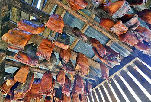
At this family-run farm, brothers Guðjón and Kristján make Iceland’s traditional “rotten shark” (hákarl). When they’re not hanging fermented slabs of shark to dry in their barn, they enjoy showing visitors through a museum lovingly stocked with their family’s traditional tools, exhibits on local bird life, and, of course, an education in fermented shark...plus a taste. The visit begins with an eight-minute video presentation, where one of the brothers or their associates describes the process (for details on this dish, see the sidebar on here). You’ll get to touch a shark’s sandpaper-like skin and run your fingers over its sawtooth-like jawbone. Then you’ll taste a tiny cube of hákarl, mounted on a little slice of rye bread (to help cut the flavor). Pro tip: It smells worse than it tastes, but the chewy texture and ammonia flavor (with some salty notes) can be off-putting. After the tour and tasting, head out back to see (and smell) the sheds where slabs of fermented shark hang from the rafters to dry.
Cost and Hours: 2,000 ISK, daily 10:00-17:00, closed Nov-March, +354 438 1581, https://bjarnarhofn.is.
Eating: The handy on-site $ café serves no shark but has a short menu of easy meals (burgers, fish-and-chips; open in summer only).
• Back on highway 54, carry on west, through...
▲▲Snæfellsnes Fjord Country
The views over the next several miles are stunning, as you cross two fjords on bridges, with towering mountains on both sides of the road. These fjords are all arms of the same big mega-fjord called Breiðafjörður—the aptly named “wide fjord” that separates Snaefellsnes from the Westfjords, to the north. (What’s the difference between a fjord and a bay? If its mouth is wider than it is long, then it’s a bay. Breiðafjörður has a wide mouth, but it’s still longer than it is wide.)
Crossing the first fjord, Hraunsfjarðarvatn, you’ll enjoy a grand view of cascading mountain peaks lined up above the waterline. The second fjord, Kolgrafarfjörður, is famous for its biodiversity; Arctic birds, seals, and even whales are spotted here.
After crossing a neck of land, you’ll begin driving along the broad bay of Grundarfjörður—framed at the far end by the tent-shaped ridge of Kirkjufell. As the road skirts along the black sand beach toward the town of Grundarfjörður, watch on the left for Grundarfoss—one of many grand waterfalls in Snæfellsnes, this one plunging 230 feet from the cliffs. (You can park in front of the gate and walk across the fields for a closer look.)
• Soon you reach the town of...
▲Grundarfjörður
While this midsize-by-Icelandic-standards town (pop. 900) isn’t much to see, it’s one of the most popular spots on Snæfellsnes for the classic views it provides of the nearby Kirkjufell peak.
Grundarfjörður’s proudest moment came three centuries ago, when Denmark designated it as one of Iceland’s original six trading towns in 1786. It cultivated strong trade connections with the French, who built a church in town. Today the main business is tourism: It’s a hub for food, drink, and accommodations.
Driving through town on the main road, watch on the left for the Saga Center, which houses a TI info desk, the town library, pay WCs, and two exhibitions: a 10-minute slideshow of historic town photographs (called Bæringsstofa) and a modest museum displaying some town artifacts. The most interesting items are a French cannon that washed up here around 1720 (likely from a whaling ship) and a fishing boat dating from 1913. There’s also a children’s play area and a reconstructed shop from the 1950s (free, daily 13:00-17:00, Grundargata 35, +354 438 1881).
Sleeping in Grundarfjörður: The town center has a few affordable guesthouses. $$$ Grundarfjörður Bed and Breakfast (part of the recommended Harbour Café, see later) rents eight basic, renovated rooms—all with private bathroom—in an otherwise unexciting building (includes breakfast at café, Nesvegur 5, +354 895 6533, 65ubuntu@gmail.com). $$ Helgrindur Guesthouse hides above a bank in a drab modern building just off the main street. It has six spacious rooms and a shared terrace with a Kirkjufell view (kitchenettes in room, no breakfast, Grundargata 350, +354 693 0820, https://helgrindur.tripcombined.com). $$ The Old Post Office Guesthouse (Gamla Pósthúsið) is just that: a family-run B&B filling a blocky red building with 11 rooms, all with private bathrooms and some with Kirkjufell views for no extra charge (shared kitchen but no breakfast, next to the local high school at Grundargata 50, +354 430 8043, www.topo.is, sigridur@tms.is). $ Guesthouse 43, across the street, is a simple budget choice. Sædís, who grew up in this house, has turned it into a fine little B&B with three homey rooms that share two bathrooms. She prefers bookings via Airbnb or Booking.com (laundry, Snæfellsnesvegur 43, +354 888 0232).
Sleeping Just Outside Grundarfjörður: Nearby, on the road leading into town, are the $$ Kirkjufell Guesthouse and Grund Guesthouse, family-run accommodations in two separate buildings with 25 spacious rooms between them (some with shared bathroom), plus apartments. Communication can be tricky, but the price is reasonable, the facilities are modern, and the views across the fjord to Kirkjufell are grand (no breakfast, +354 840 6100, https://guesthousekirkjufell.is, grundguesthouse@gmail.com. $$$ Dís Cottages features 10 freestanding, modern, boxy, well-equipped houses on a ridge with a view over the fjord and Kirkjufell. The location—about a 15-minute drive from town, where the road abruptly turns to gravel—is enjoyable for those who appreciate remoteness (small kitchenettes—B.Y.O. breakfast, Þórdísarstaðir 350, +354 892 7746, www.discottages.is, discottages@discottages.is, lovely Anne and owner Sæmundur).
Eating in Grundarfjörður: There’s only one good place for a real meal in town. $$$ Bjargarsteinn is a high-end mathús (house of food) occupying a charming 1908 house that was relocated from Akranes—85 miles away—to Grundarfjörður’s waterfront. The interior is drawing-room cozy, with big views of Kirkjufell filling the windows; in good weather, the views are even better from the tables outside. The food is traditional Icelandic presented with just the right amount of modern panache (daily for dinner only, reserve ahead, Sólvellir 15, +354 438 6770, www.bjargarsteinn.is).
$ Harbour Café, down near the harbor, offers the only real breakfast option in town (a pricey buffet), plus homestyle cooking (seafood, lamb, soups, and salads) for lunch and dinner (daily 7:30-21:00, Nesvegur 5, +354 546 6808).
In a pinch, you can grab a hot dog at the Mæstro food truck (summer only, across from the Saga Center/TI at Grundargata 33). Across the main road, the Kjörbuðin grocery is the village hub—with a little café with basic food, pharmacy, post office, and liquor store (Mon-Fri 9:00-18:00, Sat 10:00-17:00, Sun 12:00-17:00).
• About a mile outside of Grundarfjörður you’ll approach Iceland’s most famous pointy peak. There’s a view pullout on the right, but pass this and watch (just after a small lake) for the large, usually busy parking lot on your left. Pay to park and hop out for a better look at...
▲▲▲Kirkjufell View from Kirkjufellsfoss Waterfall
This waterfall with a mountain backdrop has quickly become one of the most famous natural vistas in all of Iceland. Immortalized in postcards, tourist brochures, the covers of guidebooks, and (under cover of snow) as Arrowhead Mountain in Game of Thrones, Kirkjufell (KIRK-yoo-fehtl) is perfectly sited on the Snæfellsnes coast. At the end of the last Ice Age, receding glaciers carved this mountain to a razor point that resembles a church steeple—earning it the name “Church Mountain.” It’s formed of still visible, alternating layers of lava and sedimentary rock. Even though only 1,520 feet tall, Kirkjufell is undeniably majestic.
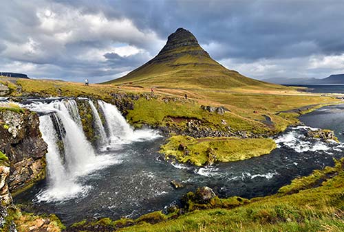
From the parking lot, walk a minute or two up the path on the right side of the waterfall. For the best views—with the waterfall in the foreground, and the peak towering behind—cross the bridge and circle around to the left, then look back down. Even when it’s a human traffic jam—as it often is—this view is well worth the walk.
• Before continuing west on highway 54, see if any horses are gathered at the base of the mountain across the road; if so, backtrack a very short distance toward town and pull off at the sign for Háls for a postcard photo: Icelandic horse and iconic mountain.
Along the North Coast
Now make good time, continuing west for about 25 minutes (14 miles). First, you’ll climb up to the headland, passing another dramatic castaway mountain on your right, connected at the far end by a narrow causeway. Tucked around the far side of this peninsula is the minimum-security Kvíabryggja Prison, which houses about two dozen inmates who are near the end of their sentences (with no fences—almost like a halfway house). Some of Iceland’s corporate bigwigs who were convicted after the 2008 economic crisis did time here. A controversy broke out a few years back when these wealthy prisoners were found to have fancier bicycles than their poorer cellmates. And in 2015, there was a “jailbreak” when two prisoners didn’t return from unstructured outdoor time by the appointed hour—the first escape in nearly 30 years. (They were captured the next day, several hours away at Þingvellir National Park.) The jail’s biggest problem: Confused tourists routinely drive up to the building mistaking it for a visitors center.
The highway eventually rounds the headland; here, if the weather is clear, use the pullout to enjoy your first (grand) views of Snæfellsjökull—the towering glacier-capped volcano that’s the centerpiece of the national park (see sidebar). This is the needle around which this bulb of land spins. If it’s socked in (as it often is), just keep an eye on your left—you’ll be getting glimpses of this mountain from various angles during the rest of this drive.
Coming down on the far side of the headland, you’ll follow a broad black sand beach, with lots of pretty waterfalls on your left. Look out over the broad Breiðafjörður for distant views of the Westfjords on the horizon.
• When highway 54 splits off to the left, carry on straight on road 574 (signed for a trio of humdrum towns: Ólafsvík, Rif, and Hellissandur).
Fishing Towns: Ólafsvík, Rif, and Hellissandur
Snæfellsnes’ north coast is home to a series of humble fishing towns. You’ll pass through three of them on your way to the national park. Each has a couple of intriguing landmarks, and taken together, they’ve scraped together a few good places for a meal.
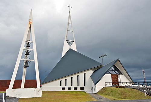
Ólafsvík: You’ll see this little village, huddled under its giant mountain (Ólafsvíkurenni), before you smell its fish-processing plants. Ólafsvík’s history goes way back—to 1687, when it received its trading charter. Today it’s a humble, workaday community with a unique, modern church—look for its open-work, pointy steeple rising above town. You’ll notice a recently built, beefy breakwater lining the road—a sobering reminder of the impact of rising seas.
For a good meal here, consider $$ Reks, filling a two-story log cabin-type building on the main road. It has a simple, woody, café-like interior and a menu of fish-and-chips, tacos, burgers, and pizza (Thu-Sun 12:00-20:30, Mon until 15:30, closed Tue-Wed, Grundarbraut 2, +354 436 6625, www.skerrestaurant.is).
Between Ólafsvík and Rif: For a classic Snæfellsnes view (if the weather is clear), about 2.5 miles out of Ólafsvík, watch on the left for an unpaved road leading to Svöðufoss—a waterfall that plunges 35 feet over a steep basalt cliff, with Snæfellsjökull on the horizon behind it. Follow the road about a mile to a parking lot, where a 10-minute path leads through the lava field to the falls.
Rif: This tiny, humble town has only one claim to fame: The Freezer, a boutique hostel/cultural center filling a cavernous old fish-processing factory a couple of blocks off the main road. They have run-down dorms, a cozy lounge with mismatched secondhand furniture, and frequent cultural events, from live music to movie nights and karaoke (nightly events July-Aug, sporadically at other times—check online, Hafnargata 16, +354 833 8200, www.thefreezerhostel.com). They also rent apartments in Hellissandur.
Immediately after Rif, a sign on the left points to Ingjaldshóll—a historic site (marked by a red-roofed church) a half-mile off the main road. History buffs may enjoy a quick stop in this place, where some say a young Christopher Columbus spent the winter of 1477 learning about the Icelanders’ journeys, five centuries earlier, to “Vínland”—the Americas. (There’s a painting of Columbus inside the often-locked church.) Near the church is a monument, with two stone pillars, honoring the poet and naturalist Eggert Ólafsson and his wife, Ingibjörg Guðmundsdóttur. If you look back toward the fjord between these rocks, you see the place (across the water, in the Westfjords) from where this newlywed couple embarked by boat in 1768...only to drown. Every Icelander learns by heart the poem (a blessing upon Iceland) that’s inscribed on the pillar.
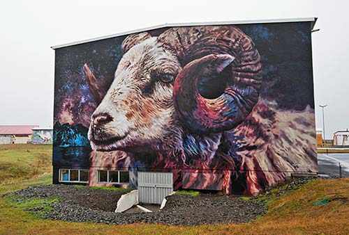
Hellissandur: Hellissandur has a surprising artistic flair, with its cluster of humble homes spray-painted with murals in every color of the rainbow. Take a quick spin through town to see them; don’t miss the huge painting of a ram near the bridge. (A map of the town murals is posted inside the recommended Gilbakki Kaffihús, described later.)
Hellissandur has one sight worth considering: The Maritime Museum (Sjóminjasafnið) is on the left side of the road, just past the main part of town. This modern museum features exhibits about sea life, geology, and local sea birds, and displays the oldest surviving fishing boat in Iceland (the Bliki, an eight-oared vessel from 1826). Outside are replicas of two interconnected sod-roofed fishermen’s cottages—step inside to see how humbly fisherfolk once lived, and don’t miss the stairs up to the sleeping loft in the attic. Surrounding the museum is a “Fishermen’s Garden” strewn with labeled artifacts, including the skeleton of a sperm whale (1,300 ISK, June-late Sept Tue-Sun 11:00-17:00, closed Mon, closed off-season, +354 844 5969).
At the end of town, in the modern, slanted-roof building on your left, is the National Park Visitors Center, with helpful staff, information, and exhibits about the park’s history and wildlife (daily 9:00-17:00, may be closed off-season, free WCs, café/restaurant, Sandhraun 5, +354 661 1500, www.snaefellsjokull.is).
Eating in Hellissandur: This town has two excellent eating options—one for lunch, the other for dinner. Charmingly run by sweet Anna, who built this house with her husband, $ Gilbakki Kaffihús is an ideal place for a coffee, cake, bagel, or delicious fish soup. This makes for a great “last chance” stop before entering the national park and circling around to the south coast; there’s not much between here and Hellnar (June-Aug daily until 17:00; closed Sept-May; at the entrance to town, +354 436 1001). The gray house perched on a ridge at the far end of town (on the left) is $$$ Viðvík, offering a fine-dining modern Icelandic menu that includes quality seafood. It’s well worth booking ahead if you’re staying nearby (dinner only, early May-late Sept, closed Mon-Tue and off-season, +354 436 1026).
• When you leave Hellissandur, you’ll pass rusted, metal Welcome signs as you cross the official boundary into...
SNÆFELLSJÖKULL NATIONAL PARK
The 65 square miles of Snæfellsjökull National Park (Þjóðgarðurinn Snæfellsjökull) are studded with many of the peninsula’s best attractions. As you continue along road 574 (called Útnesvegur), you’ll circle the peninsula’s glacier, Snæfellsjökull.
Just past the entrance to the park, on the right, you can’t miss the gigantic radio antenna—the highest long-wave radio antenna on earth—held in place by beefy cables. Towering at 1,350 feet, this is far and away the tallest structure in Iceland (and even taller than the Eiffel Tower). The tower is critical for maintaining communications with ships on rough seas.
Just past the antenna, you’ll drive by the tiny settlement where some tours depart for trips up to the glacier (see the “Snæfellsjökull” sidebar, earlier).
• About a mile after entering the park, a sign on the right points to Gufuskálavör and Írskrabrunnur, two sites with scant remains of...
Settlement Age Sites
Settlers inhabited Snæfellsnes early in Iceland’s history, back in the late ninth century. Subtle reminders of this period are hiding all over. A fence surrounds Írskrabrunnur (Well of the Irish), the remains of a water supply dating back to the late 800s. At Gufuskálavör, the ruins of a 14th-century fishing village are scattered about, including a stone shed where fishermen would hang their catch to dry (called fiskbyrgi).
• Back on road 574, where the road bends left, take the little turnoff on the right marked Öndverðarnes. Follow this paved road about a mile through the black, chunky terrain until you reach...
Skarðsvík Yellow Sand Beach
Volcanic Iceland has many black sand beaches...but a yellow one is rare enough to thrill Icelanders. This one—worth ▲ in great weather—is dramatically hemmed in by chunky black lava rock and is an inviting place to go for a stroll, listen to the surf, or take a break at a picnic table. On very sunny days, you may even see hardy locals swimming or sunbathing.
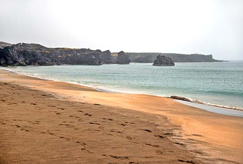
The rough road past Skarðsvík leads to the Öndverðarnes lighthouse, but it’s a longish drive and you can’t enter the building—I’d skip it.
• Carry on south through the national park. After about four miles, on the right, you can’t miss...
▲▲Saxhóll Crater
This jagged red crater—rising nearly 360 feet above the flat terrain—is one of Iceland’s most tempting to climb. If you have time for a quick hike (no more than 10 minutes each way), use the rust-red steps to hike up and peer down into the mouth of the crater; you’ll also enjoy sweeping views of the surrounding countryside and sea, plus distant views of Snæfellsjökull. (Warning: The climb is much harder in windy weather.)
• Back on the road, carry on another six miles. On the right, look for the turnoff for Hólahólar and Berudalur. If you drive about a half-mile down the unpaved road, you’ll land right in the middle of the Hólahólar crater.
Continue about 1.5 miles past the Hólahólar turnoff. (Don’t turn at the first blue sign for Djúpalónssandur, which is an access road for hiking trails.) Watch on the right for the Djúpalón 2 sign (also marked road 572). Turn off here and drive a mile or so down the road to...
▲▲Djúpalónssandur Black Sand Beach
This is a stunning opportunity to stroll on one of the best of Iceland’s countless black sand beaches. Djúpalónssandur was once home to a thriving fishing station—one of the busiest on Snæfellsnes, 60 boats strong. But today it’s entirely uninhabited.
From the parking lot (with WCs), follow Djúpalónssandur signs down the rightmost boardwalk; it’s about a 10-minute walk all the way to the water. You’ll hike through an evocative canyon of fanciful fairy chimneys—gnarled lava-rock towers reaching up to the heavens. You’ll emerge onto the beach at an information plaque, explaining the four large stones lined up nearby. These “lifting stones” (aflraunasteinar) were used to prove the strength of would-be fishermen. They range from fullsterkur (full strength, 154 kg) down to amlóði (weakling), at 23 kg. To qualify for work, you’d have to be able to lift the hálfsterkur (half strength, 100 kg) onto a waist-high platform. This tradition continues today in Iceland with “strongman contests” (aflraunakeppni), similar to the ones at Scottish Highland Games.
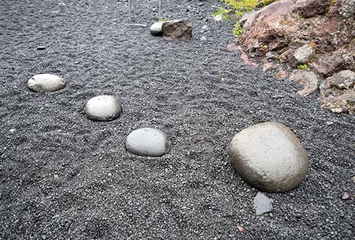
Now turn your attention to the much smaller rocks crunching underfoot: the beautiful, black lava “pearls” (djúpalónsperlur) that cover the beach. Feel how smooth they are, but don’t take any home—they’re protected by the Icelandic government.
Hike across the lava pearls toward the surf. The gnarled chunks of rusted metal strewn across the beach are the remains of the Epine, a British fishing trawler that washed up here in 1948. (Only five of the 19 crew members survived.)
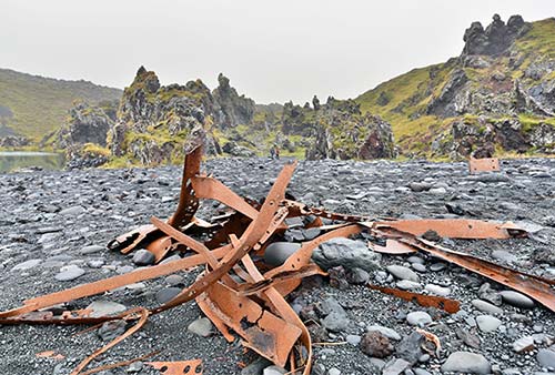
Cresting the rise, you could walk downhill the rest of the way to the waterline. But stay well back from the surf, as this beach has a wicked rip tide and dangerous sneaker waves. (Never turn your back on the surf.) But do look left and right, appreciating the jagged black sea stacks framing the beach.
Head left along the beach, to find a smaller, second beach. Just offshore is a tall sea stack (Kerling, or Crone) and on the left is a row of jagged peaks (Söngklettur, or Singing Rock). This is one of those places that some Icelanders believe is home to the “hidden people.” Superstitious locals are careful to stay quiet in this area and would never climb up on rocks like this. For more on the hidden people stories, see the sidebar on here.
• Back on the main road, carry on two miles, where you’ll see the building (on the left, with a parking lot just beyond) that’s the starting point for touring...
▲Vatnshellir Cave
Famous for having inspired Jules Verne, this lava tube—formed during a volcanic eruption 8,000 years ago—can only be visited on a 45-minute guided tour, which traverses about 650 feet of the cave, about 115 feet underground. The cave is chilly (always in the mid-30s Fahrenheit) and drippy, and requires climbing up and down about 130 slippery metal steps, plus navigating the uneven terrain of the cave floor itself—it’s best for the surefooted. Iceland has other more interesting volcanic caves (see here), but if this is your handiest opportunity to see one, Vatnshellir is worth 45 minutes. You could try just showing up and taking whichever tour is available next (if you have time to kill, there’s a lot to see within a few minutes’ drive). But in peak season, it’s smart to reserve ahead online—ideally a few days in advance.
Cost and Hours: 4,500 ISK, 2,000 ISK for kids 12-17, free for kids under 12; tours depart every half-hour daily in summer 10:00-18:00, last tour at 17:30, additional departures possible in peak season, fewer tours off-season; +354 787 0001, www.summitguides.is/vatnshellir-cave-tour. There are no WCs at the cave—the nearest are a few minutes’ drive away, at the national park visitors center (see next).
Visiting the Cave: You’ll be issued a helmet and a flashlight, then follow your guide down the metal spiral staircase into the cave. You’ll pass through three chambers. The first, uppermost chamber—called Bárðarstofa (Bárður’s living room)—features a “table” and “chair” belonging to the mythical half-giant linked to this area. Then you’ll carry on deeper, seeing various features—such as “lava stalactites” (formed in moments, rather than over eons), “shark’s tooth” stalactites, and red (iron-rich) lava flows trapped in time. At the cave’s lowest point, your guide will encourage everyone to turn off their flashlights—plunging you into absolute darkness.
• About 1.5 miles after the cave, on the right, watch for the turnoff to Malarrif. Stop here for a visitors center and for a look at the...
Malarrif Lighthouse (Malarrifsviti) and Lóndrangar Rock Formations
This stretch of coast is named for an old fishing settlement, Lóndrangar. Today, the area is known for its distinctive twin basalt pinnacles (246 and 200 feet tall) and the many birds that in summer occupy a nearby sea cliff (called Svalþúfa, this is another spot thought to be owned by the hidden people).
At the Malarrif lighthouse, you’ll find a visitors center (gestastofa). This is a handy place to take a break, use free WCs, and peruse a fine exhibit about the park’s geology (daily 10:00-16:30, +354 436 6888). From here, you can walk about a mile each way to the Lóndrangar rock formations (allow about 45 minutes round-trip; just walk with the water on your right, and as you do, keep an eye out for arctic foxes in the lava field and whales and seals in the water). In summer, free ranger-guided walks depart from here daily at 13:00 (1-1.5 hours).
If you don’t have time to hike out from Malarrif, carry on past that turnoff. About three-quarters of a mile later, just after you pass the Lóndrangar pinnacles, watch on the right for a parking lot marked with a tiny Svalþúfa-Þúfubjarg sign. From here, it’s a few minutes’ walk to an overlook with a sweeping view of the rock formations and coastline.
• Just past Lóndrangar, you exit the national park (góða ferð!). But there’s still much to be seen along the...
SNÆFELLSNES SOUTH COAST
You’ve rounded the bend and are headed back toward Reykjavík. Along the way, you’ll pass dramatic rock formations in the sea, towering mountains, wide and sandy beaches, and a smattering of offbeat Snæfellsnes sights.
• Immediately after leaving the park, you’ll reach two towns with stunning...
▲▲Basalt Sea Stacks, Arches, and Cliffs
This stretch of coast is blessed with breathtaking basalt formations. You can access them at two different towns, a couple of miles apart: Hellnar and Arnarstapi. If you’re short on time, simply make a quick stop for a peek (Arnarstapi’s formations are better). Otherwise, it’s well worth spending two hours on a gorgeous walk: Drive to Arnarstapi, walk about 45 minutes (about 2 miles) back to Hellnar, grab a bite at Samkomuhúsið restaurant, then walk back to your car.
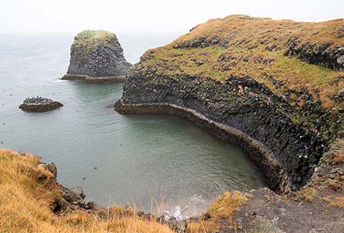
• Immediately before reaching the Hellnar turnoff—about three miles after the Lóndrangar viewpoint—pull off on the right to see...
Laugarbrekka: This middle-of-nowhere spot features a small statue honoring Guðríður Þorbjarnardóttir—a remarkably well-traveled Icelandic settler who managed to see much of the world...despite having been born on this humble, remote spot in the year 980. She made eight long sea voyages in her lifetime, including multiple trips to Greenland and to Vínland (now known as North America). She counted Leif “The Lucky” Erikson as her brother-in-law. She gave birth to what’s thought to be the first person of European origin born on American soil (her son, Snorri—whom she’s holding on her shoulder in the statue). Later in life she made a pilgrimage to Rome from her farmstead at Glaumbær (in Skagafjörður—see here). If you’re an avid traveler, you can pay your respects to Guðríður as a kindred spirit.
• It’s just a half-mile farther to the turnoff (also on the right) toward Hellnar. You’ll pass Bárðarlaug, a popular swimming pond (and supposedly the bathtub for the legendary giant Bárður Snæfellsás...more on him later).
Hellnar: This tiny village is a natural seaport and was once a thriving fishing village. Home to nearly 200 people in 1700, tourism is today’s main catch. Drive down to the parking lot on the bluff overlooking the sea, where you’ll get a taste of the formations that stretch from here all the way to Arnarstapi. The recommended Fosshotel Hellnar is above the port (see “Sleeping on the Snæfellsnes Peninsula” at the end of this chapter). Walk a few minutes on the trail just past the humble concrete shed burrowed into the hill for a glimpse at some chunky basalt formations just offshore, which teem with sea birds in the summertime. Tucked back in among those jagged crevices is a natural cave called Baðstofa. If you were to follow this trail for about 45 minutes, you’d reach Arnarstapi.
• To drive there, head back up to the main road, turn right, and carry on just one mile. You’ll drive along the bottom of the pyramid-shaped peak called Stapafell, then turn off on the right and head into...
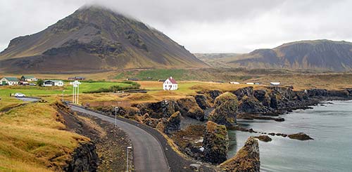
Arnarstapi: This little community, once a trading post, is tucked deep into a dramatic basalt landscape. Arnarstapi enjoys more grand views—this time of a perfectly formed volcanic sea arch.
On your way into town (road lined with tour companies and food trucks), watch on the right for the gigantic statue (built from stacked rocks) of Bárður Snæfellsás—the legendary half-man, half-giant who looms large in Snæfellsnes folklore. (For his story, see “The Sagas of Snæfellsnes” sidebar, earlier.) Facing the statue across the road is $$ Samkomuhúsið, a quirky place run by Ólina and her family. They serve lamb soup, fish, and Icelandic desserts in a dining room with mismatched furniture and funky art on the walls (lunch daily until 16:00, Sun until 15:00, Arnarstapavegur, +354 615 1962). Inside is also a little shop selling local art and handknitted crafts.
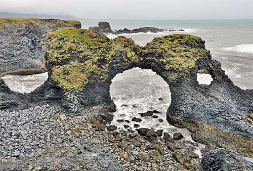
From the parking lot by the statue, trek on the path a few minutes across the fields to the coastline. From here, a natural stone arch rises up from the surf, and mind-bending basalt formations ripple along the shoreline in both directions. Walk along the coast as far as time and weather allow. For a shorter walk, turn left about 10 minutes to the town’s little harbor area, with a grand view of the towering Stapafell mountain peak. Below you, basalt cliffs swarm with noisy seagulls. Or, with more time, turn right and walk about 45 minutes one-way all the way to Hellnar, then back again.
Warning: If the arctic terns are nesting (commonly in the early summer), they might dive-bomb you relentlessly. They pull up just before impaling you with their beaks...usually. To avoid escalating the standoff, do your best to avoid nesting areas.
• Back on the main road, less than two miles after the Arnarstapi turnoff, on the left, is...
Rauðfeldsgjá Gorge
This extremely narrow volcanic gorge—carved by a river—is tucked back in the folds of a cliff. While it’s visible from the road, curious visitors can hike uphill about 5-10 minutes from the parking lot to the mouth of the gorge (good shoes are important here). While it’s impressive to peer up into this narrow, steep space, you won’t be able to go much deeper inside without wading through a river and hopping across stepping stones; if time is short, just enjoy the view from the parking lot.
Like so many things on Snæfellsnes, this gorge comes with a legend: Bárður Snæfellsás (whom we met back in Arnarstapi) had a daughter who enjoyed playing with a neighbor boy, Rauðfeldr (Red Cloak). One day they were horsing around on the shoreline when Rauðfeldr pushed her onto an iceberg, which floated offshore and wound up drifting all the way to Greenland. Furious, Bárður threw Rauðfeldr into the gorge that still bears his name.
• From the gorge, carry on east about 10 minutes (8 miles) through the lava field of Búðahraun. You’ll pass lonesome farms and eventually crest the top of the bluff; watch for a pullout on the right offering grand views back over the basalt coastline, Stapafell mountain, and Snæfellsjökull. A plaque explains that this was the home to Axlar-Björn—Iceland’s only axe murderer, who lived here in the 16th century (he’s buried back near the Hellnar turnoff; for his story, see “The Sagas of Snæfellsnes” sidebar, earlier).
Just beyond, another (unpaved) pullout on the right offers equally grand views across the coastal plains in the opposite direction.
Keep going; as the road flattens out, watch on the right for the optional turnoff to...
Búðir
Yet another charming seafront settlement, Búðir is famous for its landmark black church (Búðakirkja), picturesquely perched on a hill. It’s all that’s left of what was once a thriving trading post. The church, completed in 1850, is a favorite photo op, but there’s not much else to see here—it’s skippable if you’re running out of steam.
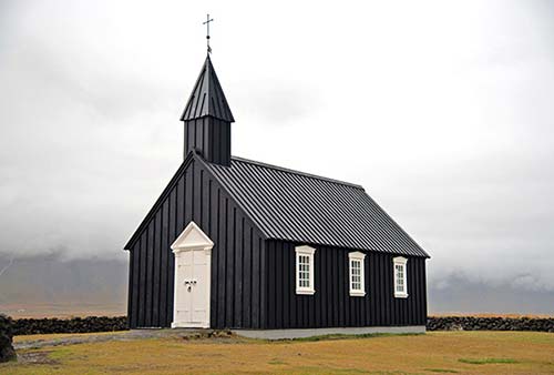
Along the road to the church, you’ll pass the big and swanky Hótel Búðir, a popular site for weddings. It’s also a good, if expensive, place to stay—see “Sleeping on the Snæfellsnes Peninsula” at the end of this chapter.
• At this point, with Snæfellsjökull receding in your rear-view mirror, it’s time to head...
BACK TO REYKJAVÍK
Just past the Búðir turnoff, the road hits a T-intersection with highway 54. Turn right (east) and follow this back toward Reykjavík and Borgarnes. (Or, if you want a speedy return to the Grundarfjörður area, you can turn left to cross the mountains.)
As soon as you get on highway 54, watch on the left for the Bjarnarfoss waterfall. If you aren’t waterfalled out, turn off on the small road (marked Bjarnarfoss) for a closer look at the water cascading onto basalt columns. From the parking lot, a paved path leads about five minutes through the field to the foot of the falls.
About five miles farther along highway 54, a turnoff on the left leads to Lýsuhóll, a little farmstead (with recommended accommodations; see the end of this chapter). Deep in the settlement is the small Lýsulaugar swimming pool (and its two hot tubs), fed by mineral- and algae-rich natural springs. This is a handy spot to unwind and splash in hot water after a long day’s drive (1,500 ISK, 500 ISK for kids 10-18, free for kids under 10, daily in summer 11:00-21:00, +354 433 9917).
Up next is the rock-strewn beach called Ytri-Tunga, known for the seals that bask here in summer, especially in June and July. (The sign may be missing, but look for the red house with the black roof.) Follow the unpaved road for about a mile to the little parking lot, where signs identify some of the seals often seen here. It’s a short walk from the lot to the sandy beach. The broad, sandy, golden-colored beaches along here—called Löngufjörur—are a popular place for horseback riding in cinematic scenery. If the weather’s good, you can look back to grand views of the Snæfellsjökull glacier.
About 2.5 miles beyond Ytri-Tunga, on the left, are a red-steepled church and a small monument marked Staðastaður—once the residence of Ari Þorgilsson (1067-1148). Ari the Wise (Ari fróði), as he’s called, was the author of the Book of Icelanders—a chronicle of the earliest settlers and a cornerstone of the sagas. Icelandic history buffs can pay their respects at his giant, symbolic gravestone.
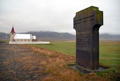
Two miles past Staðastaður, if you need a water refill, pull off (on the left) at the small farm of Ölkelda. Near the parking area with a Welcome to the Mineral Spring sign, a little faucet sticking out of the ground dispenses naturally carbonated, iron-rich water (donation requested). Despite the metallic taste, the sign assures you it’s very healthy—supposedly good for heart disease, lung disease, and diabetes. Notice the ground tinted red by the heavy iron deposits.
Eight miles farther along, you’ll reach the turnoff for highway 56 (Vatnaleið road) to the north coast. From this point on, you’re essentially retracing your steps: Take highway 54 about 40 miles (approximately 45 minutes) to the northern outskirts of Borgarnes, where you’ll turn right onto highway 1, head through the middle of Borgarnes, and continue about an hour to Reykjavík.
Or—if you’ve enjoyed Snæfellsnes enough that you’d like to extend your Iceland stay a week or so—turn left onto highway 1 and follow the Ring Road all the way around the island, 800 miles back to Reykjavík the long way. Why not?
Sleeping on the Snæfellsnes Peninsula
These are good choices for those who would enjoy settling deep into the peninsula’s countryside. For locations, see the “Snæfellsnes Peninsula” map near the beginning of this chapter.
$$$$ Hótel Búðir is a posh choice, in a gorgeous setting surrounded by water, with views to the southern mountains and all the way to the Snæfellsjökull glacier. If money is no object, consider one of the 52 luxurious rooms (including family rooms). Its $$$ restaurant—open to nonguests—is a fine spot for a high-end meal (daily for dinner, +354 435 6700, www.hotelbudir.is, budir@budir.is).
$$$$ Fosshotel Hellnar—a remote outpost of the Iceland-wide chain—has 39 small, sterile rooms perched above the port of Hellnar. While quite expensive, this is a handy home base for those focusing on the coastline around Hellnar and Arnarstapi. The dining room affords sweeping views over the water (+354 435 6820, www.islandshotel.is, hellnar@fosshotel.is).
$$$ Söðulsholt Cottages is a working horse farm run by Einar Ólafsson and his family. Tucked in the shadow of Hafursfell mountain where Snæfellsnes meets the mainland, they rent four modern cottages with views; they also offer horseback riding tours (+354 895 5464, www.sodulsholt.is, info@sodulsholt.is). Look for the turnoff on the south side of highway 54, about two miles west of the Gerðuberg cliffs.
$$$ Miðhraun Lava Resort is a tidy, cheery, family-run complex on a sheep and horse farm, with accommodations that mix classic and modern: simple, basic rooms with shared bathrooms in one of two houses, plus 10 well-equipped cottages sleeping up to six people each. It’s scenically set at the base of a mountain, with a restaurant and geothermal bath on site. Amenities include laundry machines, a children’s play area, and kitchens (breakfast extra, +354 893 3333, https://lavaresort.is, info@lavaresort.is). To reach it from highway 54, find the turnoff for Miðhraun between the Snæfellsnes visitors center/Agnið food truck and the Vatnaleið road.
$$ Lýsuhóll is a horse farm with 11 small, homey, and family-run cottages. They also offer home-cooked dinner for guests and horseback rides (breakfast and dinner extra, +354 435 6716, https://lysuholl.is, info@lysuholl.is, Jóhanna and Agnar).
$$ Hótel Snæfellsnes has 14 ground-level rooms with high ceilings, tile floors, and private bathrooms. Each room is named after a natural site or landmark in Iceland. The hotel’s location at the junction of highways 54 and 56 makes it a perfect starting point for a day-trip loop around the peninsula (recommended restaurant Vegamót on-site, +354 788 9100, www.hotelsnaefellsnes.com, info@hotelsnaefellsnes.com).
Stykkishólmur

Snæfellsnes’ main town may not quite be Iceland’s most charming fjordside settlement...but it tries. (And it wins “most entertaining name” award.) The smattering of colorful, traditional shiplap houses that face its harbor echoes the scattering of islets, rocks, and skerries that fill the broad bay beyond. Stykkishólmur’s natural harbor, protected by the basalt Súgandisey islet, put the town on the map for shipping and fishing (halibut and shellfish). Stykkishólmur has strong ties to Denmark, and still celebrates “Danish Days” each August.
Stykkishólmur (STIK-iss-HOLL-mur, pop. 1,195) has a critical mass of sights, accommodations, eateries, and services, making it a convenient home base and an enticing stopover. It is a popular springboard for heading out onto Breiðafjörður.
Orientation to Stykkishólmur
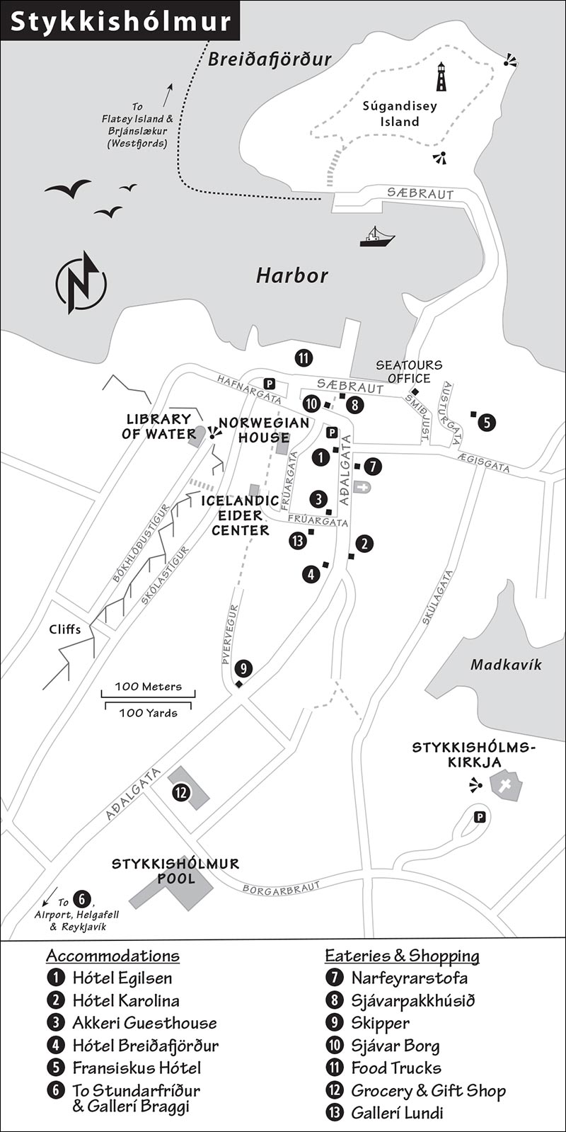
On the road into town, you’ll pass several key landmarks. After a string of gas stations (and a bakery on the left), watch on the right for the good town swimming pool (blue waterslide, set back from the road), then the Bónus supermarket, one of the few markets on the peninsula. (Turning right just before Bónus takes you up to the town’s landmark church, the Stykkishólmskirkja.) Carrying on along the main road, you’ll wind down into the town center and harbor area, where a few handy free parking lots make it easy to stow your car and explore.
Tourist Information: Stykkishólmur doesn’t have a true TI, but the Seatours booking office near the harbor hands out maps and answers questions (daily 8:00-18:00, Smiðjustígur 3, +354 433 2254, www.seatours.is).
Shopping: Stykkishólmur has some unique shops that may interest souvenir hunters. In the town center, the charming Gallerí Lundi has a nice assortment of local handicrafts (daily 12:30-18:00, shorter hours off-season, Frúargata 2). Gallerí Braggi sells artisan crafts and sweaters (Tue-Sat 9:00-11:00 & 13:00-16:00, Mon afternoons only, closed Sun, Aðalgata 28). There’s also a little gift shop next to the Bónus grocery store.
Sights in Stykkishólmur
For such a little town, strollable Stykkishólmur has some pleasant sights. Note that the Norwegian House and Library of Water are covered by a 2,220-ISK combo-ticket (buy it at the Norwegian House).
Norwegian House (Norska Húsið)
This blackwood-clad home, a block up from the harbor, was the first two-story, wood-frame house in the country and is the oldest building in town (from 1832). Árni Thorlacius (1802-1891), a wealthy merchant and owner of a fishing fleet, imported wood from Norway to build this house. The original grandfather clock still ticks and tocks as you enter, and Árni’s desk is still strewn with handwritten notes and accounts. The ground floor ticket desk/gift shop is modeled after an old-timey store; other rooms are galleries for local art. Upstairs, an exhibit covers the lives of Snæfellsnes teenagers and the youth culture of the 1900s up to the present.
Cost and Hours: 1,550 ISK; June-Aug daily 11:00-17:00, May 13:00-16:00, shorter hours off-season, Hafnargata 5, +354 433 8114, www.norskahusid.is.
Library of Water (Vatnasafn)
The modern, semicircular home that caps the rock above the harbor was the brainchild of American artist Roni Horn. Hike or drive up and step into the minimalist interior, where you’re greeted by sweeping views over the town rooftops and the waters of the Breiðafjörður—all refracted through giant, vertical, transparent columns. Each tube is filled with water from a different Icelandic glacier (an easy-to-miss legend in the hallway identifies them). It’s a bit pretentious and may not be worth the cost of entry for some, but the views from the house are wonderful (also, for free, from the bluff nearby).
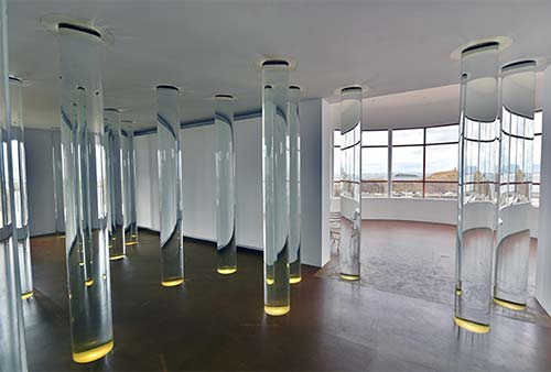
Cost and Hours: 900 ISK—buy ticket at the Norwegian House to get a door-entry code; June-Aug daily 11:00-17:00, shorter hours off-season; Bókhlöðustígur 19, +354 865 4516, www.west.is/en/service/library-of-water.
Icelandic Eider Center (Æðarsetur Íslands)
This quaint little exhibit lovingly tells the story of the local eider duck, its habitat in this corner of Iceland, and the production of eider duck down. (Taxidermied birds and an arctic fox look on as you visit.) Though the wall panels are in Icelandic, English booklets are on hand, and a 15-minute film describes this local trade: Every spring, farmers comb through eider nests to gather down feathers—the soft layer found under a bird’s tough outer feathers—shed by the birds and left in their nests. The farmers painstakingly dry, clean, and disinfect their harvest. Once it’s completely free of sticks and other debris, the down is processed and cleaned by hand to remove any remaining impurities. It takes about 60 eider nests——and a remarkable amount of manual labor—to produce one kilogram of incredibly light (and expensive) down. Locals claim that Icelandic eider duck down is the best natural insulation material in the world—and eco-friendly to boot.
Samples are on display so visitors can feel the soft, light down—both as a raw material and stuffed into pricey duvets, mittens, and pillows. The exhibit is run by a local company that sells and exports eider down products. If you need a little pick-me-up, they also sell coffee and tea.
Cost and Hours: Free, daily 13:00-17:00, Frúarstígur 6, +354 899 8369, www.eider.is.
Town Church (Stykkishólmskirkja)
Stykkishólmur’s dramatic, modern church (consecrated in 1990) caps a rocky bluff over town. Designed by architect Jón Haraldsson, it seems inspired by the bleached vertebrae of a whale, stretching up toward the heavens. Step inside to appreciate its beautiful, austere, harmonious interior: Lights dangle down from the ceiling, a looming pipe organ fills one wall, narrow windows offer peek-a-boo views over Breiðafjörður, and above the altar is a hauntingly beautiful painting of an ethereal Virgin Mary holding the Baby Jesus (by Kristín Gunnlaugsdóttir).
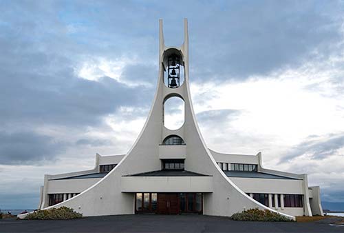
Cost and Hours: Free, daily 10:00-16:00, at the top of Borgarbraut—just head up the road next to the Bónus supermarket.
▲Súgandisey Island
From the harborfront, you can’t miss this little basalt island, which protects the town harbor from the bracing north wind. In good weather, it’s fun to stroll (or drive) out to the island and climb up to its summit—marked by a little orange lighthouse—for fine views back over town and the fjord. From the top, a trail leads down to the seaward side of the island, then loops back to where you began. This is a great activity for passing the time while waiting for a ferry—which loads up right next to the rock.
Boat Trips on Breiðafjörður
Fanning out from Stykkisholmur’s harbor is a bay speckled with islets that are, as locals like to brag, countless. This is part of Breiðafjörður, the vast body of water that separates Snaefellsnes from the Westfjords. If the weather’s good and you’re up for a boat ride, consider the popular Viking Sushi cruise offered by Seatours. After you sightsee through the fjord’s islands, your captain will pull up a super-fresh catch of critters—mussels, scallops, sea urchins, and so on—which you’ll eat raw, with chopsticks and wasabi (8,300 ISK for 2.5-hour trip; in summer, they occasionally run a shorter 1.5-hour trip for 6,300 ISK; +354 433 2254, www.seatours.is). Ocean Adventures offers a variety of boat tours for puffin watching and angling, plus private tours (9,000-13,000 ISK, 1-3 hours, +354 898 2028, https://oceanadventures.is).
Seatours also runs sightseeing trips to the tiny, remote island of Flatey, deep in the fjord. With year-round residents in the single digits, this tiny community (on an aptly named flat basalt rock) has a few colorful houses, a tiny library, a historic church, and—from about mid-July to mid-August—puffins and other sea birds. There’s not much to do on the island other than wander, relax, and birdwatch...but that’s just perfect for the travelers who choose to come here. In summer, you can also spend several hours on Flatey on your way across to the Westfjords (for details, see here).
Sleeping in Stykkishólmur
$$$$ Hótel Egilsen is a classy boutique hotel, filling a stately 160-year-old red house in the town center. Its 10 cozy rooms are a tasteful mix of old style and modern amenities, and the charming main-floor breakfast room/bar comes with locally made pottery and a little library (breakfast extra, Aðalgata 2, +354 554 7700, www.egilsen.is).
$$$$ Hótel Karolina, the sister hotel of Hótel Egilsen, is even more relaxing, with eight bright, airy rooms in a newly remodeled house that was once the town hospital. The stylish living/dining room is a peaceful place to lounge in dreary weather (breakfast extra, Aðalgata 7, +354 831 1806, www.syslo.is).
$$$ Akkeri Guesthouse is a winner, with six modern, tidy, well-priced rooms (with thin walls) in a cheery yellow house right in the town center (Frúargata 1, +354 844 1050, akkeri@simnet.is).
$$ Hótel Breiðafjörður is a lesser value—more a simple guesthouse than a hotel, it has 12 basic rooms (all with private bathrooms) along the main road (Aðalgata 8, +354 433 2200, www.hotelbreidafjordur.is [URL inactive]).
$$ Fransiskus Hótel is a former convent (there’s still a chapel just off the lobby). The 19 clean and classy rooms are just above the harbor, so many rooms come with views (family rooms, Austurgata 7, +354 422 1101, https://fransiskus.is, fransiskus@fransiskus.is).
Outside Stykkishólmur: $$ Stundarfriður, a hotel on a remote ridge a 15-minute drive from town, is a good countryside option, with seven rooms with pleasantly woody decor, plus some small cottages (along highway 54 at Hólar 1, +354 856 2463, www.stundarfridurehf.is, info@stundarfridur.is). To get here, turn off to the south where the road forks into Stykkishólmur, and follow the unpaved road to Stundarfriður.
Eating in Stykkishólmur
There are more places to stay than there are to eat in this town, and food options are expensive.
$$$ Narfeyrarstofa is a grand, traditional, old-school place that feels like an aristocratic living room (that’s what stofa means). They have a menu of traditional classics, plus a wide variety of burgers (long hours daily, reservations smart, Aðalgata 3, +354 533 1119, www.narfeyrarstofa.is).
$$$ Sjávarpakkhúsið (Ocean Goods Warehouse) fills just that, with a simple menu of local favorites, including Breiðafjörður mussels, arctic char, sole, and wolffish (ocean catfish). Their outdoor tables, facing the harbor, are the most enticing choice in town when the weather’s good (daily for dinner, reservations smart, Hafnargata 2, +354 438 1800, https://sjavarpakkhusid.is).
$$$ Skipper, along the main road into town, is a simple place (no view or ambience) serving pricey but tasty fish-and-chips, sandwiches, and seafood soup. It’s a bit cheaper and more casual than the two places listed above and is a good option when those are booked up (long hours daily, a block past the Bónus on your way into town on Þvervegur, +354 552 8004).
$ Sjávar Borg, on the ground floor of a hostel a block above the harbor, is one of the coziest, most inviting cafés on Snæfellsnes. They have good coffee and a wide variety of treats, plus breakfast and lunch items such as soups and sandwiches (long hours daily, Hafnargata 4).
Food Trucks at the Harbor: In good weather, you’ll usually find one or two tempting food trucks along the harbor, offering lower prices (typically June-early Sept only).
Groceries: Bónus, on the road into town, is the best place on the peninsula to stock up on groceries (generally daily until 18:00, Borgarbraut 1).