GOLDEN CIRCLE
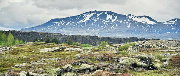
ÞINGVELLIR TO GEYSIR AND GULLFOSS
The Golden Circle is Iceland’s classic day trip. If you have just one day to see the Icelandic countryside from Reykjavík, this route offers the most satisfying variety of sightseeing and scenery per miles driven. And you’ll be in good company: Travelers dating back to the Danish king Christian IX, who visited Iceland in 1874, have followed the same route outlined in this chapter.
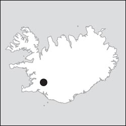
The Golden Circle loop includes this essential trio of sights: Þingvellir, a dramatic gorge marking the pulling apart of the Eurasian and North American tectonic plates (and also the site of the country’s annual assembly in the Middle Ages); Geysir, a bubbling, steaming hillside that’s home to Strokkur, Iceland’s most active geyser; and Gullfoss, one of Iceland’s most impressive waterfalls.
You can round out the trip by adding any of several minor sights, taking a dip in a thermal bath, having lunch on a dairy farm, or slurping some fresh tomato soup in a tomato-filled greenhouse. This chapter explains your options and links them with driving directions. As nearly everything lies along the simple loop road, navigating is easy.
Note that the Golden Circle loop is well trod and extremely touristy. Long lines of tour buses and rental cars follow each other around the route each day, but despite the crowds, the attractions hold their appeal.
On Your Own vs. Taking an Excursion: Driving the Golden Circle on your own is completely doable and offers maximum flexibility, but some find it more relaxing to join an organized bus trip. If you have the time, full-day tours are best (see the Beyond Reykjavík chapter for options). Half-day tours cost only slightly less and rush you through the sights.
Golden Circle Drive
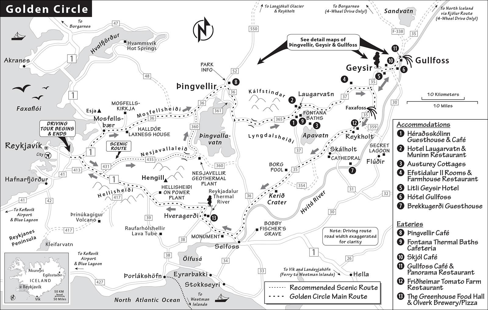
The entire 150-mile Golden Circle circuit involves about four hours of driving, not including stops. The basic self-guided route is simple: From Reykjavík, the first leg of the drive is a scenic hour to Þingvellir. After touring Þingvellir, it’s about an hour to the thermal fields at Geysir, then 10 minutes farther to the gushing Gullfoss waterfall. From there, you’ll backtrack to Geysir and circle back to Reykjavík in about 1.5-2 hours, passing a slew of lesser roadside attractions. My suggested route goes clockwise—starting with Þingvellir—but it can also be done in the other direction.
PLANNING YOUR DRIVE
Here’s a suggested plan (with stops) for those wanting to get an early-ish start and be home in time for dinner:
| 8:00 | Leave Reykjavík and head for Þingvellir national park, taking the scenic Nesjavallaleið route (1 hour) |
| 9:00 | Visit Þingvellir |
| 11:00 | Drive from Þingvellir to the village of Laugarvatn (30 minutes); have lunch here or nearby and consider a dip in the Fontana Thermal Baths |
| 13:00 | Head to Geysir geothermal field (20 minutes) and watch Strokkur erupt a couple of times |
| 14:00 | Drive to Gullfoss (10 minutes) and visit the waterfall |
| 15:00 | Head in the direction of Selfoss (1 hour), stopping briefly at Skálholt Cathedral and Kerið crater (or other sights along the way that interest you) |
| 16:30 | Return to Reykjavík (about 1 hour from Selfoss) |
Golden Circle Tips
This drive is peppered with additional sights and activities; you can easily alter my suggested plan to suit your interests. Before setting out, review your options, prioritize, and make a plan that hits what you want to see in the time you have. Here are some things to consider.
Dealing with Crowds: You’ll make the same “big three” stops (Þingvellir, Geysir, Gullfoss) as everyone else. You won’t be alone in enjoying the wide-open wonders...but there’s a joyful mood, and the crowds are part of the fun. Most people blitz through, seeing little more than those three—which leaves the rest of the route fairly crowd-free. Frankly, I wouldn’t overthink it. But if you’re set on avoiding crowds, leaving Reykjavík at 8:00 keeps you ahead of the rush (bus tours generally go clockwise and start arriving at the Þingvellir visitors center from about 8:30—most arriving before 10:00); in summer, when days are long, you could instead do this trip late in the day. Or, better yet, spend the night along the route so you can visit the top sights outside of peak tourist hours—see “Sleeping on the Golden Circle” at the end of this chapter.
Activities: Several activities along the Golden Circle require extra time—and, in some cases, reservations. The Silfra fissure, at Þingvellir, provides top-notch scuba or snorkeling opportunities (book well in advance—see details on here). Several horse farms are just outside Reykjavík, making it easy to incorporate horseback riding into your Golden Circle spin (again, this should be prearranged—see here). There are also several thermal baths along the way (see sidebar later in this chapter). If you plan to see the geothermal exhibit at the Hellisheiði Power Plant, note that it closes at 17:00 in peak season and even earlier in winter.
Evening Options: In the summer, some intrepid travelers—determined to wring the absolute maximum travel experience out of every moment—set out on this loop in the late afternoon...making the most of the abundant daylight. And since the major Golden Circle sights (Þingvellir, Geysir, Gullfoss) don’t technically “close,” you can visit them anytime—plus, they’re less crowded in the evening (some of the lesser sights and thermal baths do have closing times). Another fine evening activity is having a memorable dinner in the countryside at one of my recommended restaurants before returning to Reykjavík.
Weather and Road Conditions: The route crosses three mountain passes (Mosfellsheiði or Nesjavallaleið, then Lyngdalsheiði, and finally Hellisheiði). These passes can be icy and slippery, especially from October to April. Check the road-conditions map at Road.is before you start off. In treacherous conditions, take a bus tour and leave the driving to pros. If you do drive the Golden Circle in winter, it’s smart to set off from Reykjavík an hour before sunrise to get maximum value from the daylight hours.
Fill ’Er Up: Gas stations are few and very far between (going clockwise, the first one you hit is in Reykholt). Fill up before you start this road trip.
Name Note: Be aware that there are two Reykholts in Iceland: one here on the Golden Circle (with all the greenhouses) and the other about 100 miles away, east of Borgarnes (no vegetables).
Golden Circle Loop
Below, I’ve linked the main stops with driving directions. Let’s get started.
REYKJAVÍK TO ÞINGVELLIR
There are two ways to get from Reykjavík to Þingvellir: the scenic Nesjavallaleið road (1 hour on highway 435) or the Mosfellsheiði road (40 minutes on highway 36). Nesjavallaleið is my preferred route—but because of its high elevation, it’s open only from May to September. If it’s closed, it will appear in red on the road-conditions map at Road.is. The Mosfellsheiði route stays open all year.
Scenic Route via Nesjavallaleið
This rugged one-hour route climbs high up (to about 1,500 feet) over a craggy mountain range, descends steeply past the Nesjavellir geothermal plant, and then hugs the shore of Þingvallavatn lake. Most of Nesjavallaleið (NESS-ya-VAHT-la-layth) was built as a service road for a giant hot-water pipe that feeds Reykjavík’s heating system.
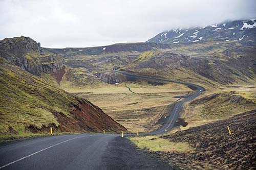
Start out by leaving Reykjavík south on highway 1 toward Selfoss and the South Coast. As the town thins out into countryside, turn left, following small signs for highways 431 (Hafravatn) and 435 (Nesjavellir); highway 431 becomes 435 on the way. Just after leaving the main road, you’ll pass a maximum-security prison. (In a country with, on average, fewer than two murders a year, it’s small—only about 40 cells.)
The road crosses the giant hot-water pipe, then curves around to follow straight along it. You’ll drive (through a lava field from an eruption a thousand years ago) parallel to the pipe—and some high-tension wires—for quite some time. The road rises and eventually hits a ridge, part of a volcanic system called Hengill; from here, the road climbs in a series of bends. Before the crest, you can stop at a pullout in the small, mountain-ringed Dyradalur valley, with signboards and picnic benches; an important path for travelers once led through the gully you see at the end of the valley (called Dyrnar, The Doors).
As you come over the ridge, you’ll see the Nesjavellir geothermal power station far below you. This plant, built in the early 1990s, sends 250 gallons of boiling water through the pipe to Reykjavík every second, and also generates electricity. For a better look, take the lane to the right; it dead-ends at a tiny viewpoint parking lot. The igloo-like structures mark places where a borehole was drilled. Each little pipe feeds into a bigger pipe. Steam marks little hot springs. (Another power plant, on the Hellisheiði heath near the end of this tour, has a real visitors center.)
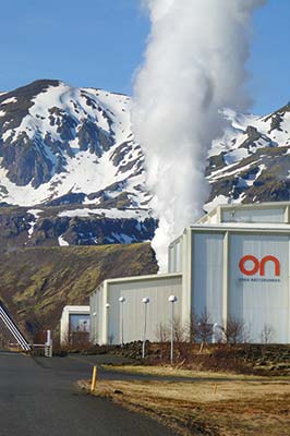
From here, the road descends steeply into the valley. At the T-junction with highway 360, turn left toward Þingvellir. (Note that if you’re doing the Golden Circle in reverse, highway 435 is signposted here only as Hengilssvæði.)
Now the road winds tightly along the shore of Þingvallavatn lake, with fine views, no guardrails, and several narrow, blind summits. You’ll pass some nice summer homes, built before construction was banned here. Eventually, the road leaves the lake, passes a lone farm (sheep, potatoes, hay, and horses), and ends at a junction with highway 36. Turn right. From here, it’s 4 miles to Þingvellir.
Alternative Route via Mosfellsheiði
If Nesjavallaleið is closed due to bad weather (typically Oct-April), take the main Mosfellsheiði route instead. While less scenic and less interesting, it’s more direct.
Start this 40-minute route heading north out of Reykjavík on highway 1 toward Borgarnes and Akureyri, then turn right on highway 36 just past the town of Mosfellsbær, following the Þingvellir signs. This leads up through Mosfellsdalur (Moss Mountain Valley) and over a low, broad pass (900 feet above sea level) to Þingvellir.
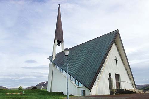
The Mosfellsdalur valley is still rural, with several horse farms. As you drive through, look left up the hillside (or turn up the side road called Mosfellsvegur) to see the unusual church called Mosfellskirkja, designed by architect Ragnar Emilsson in the 1960s. It’s full of triangular shapes—including the bell tower and roof—as a reference to the Trinity.
Note that this route passes by the former home of Iceland’s most famous author, Halldór Laxness (open to tourists; for details, see here). Otherwise, it’s a (fairly dull) straight shot to Þingvellir. When you begin to see Þingvallavatn lake—Iceland’s largest—on your right, you know you’re getting close.
▲▲▲Þingvellir
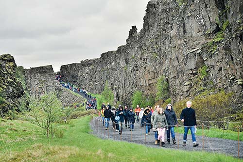
The gorge at Þingvellir (THING-VET-leer), dear to all Icelanders, is both dramatic and historic. It’s dramatic because you can readily see the slow separation of the North American and Eurasian tectonic plates—the earth’s crust is literally being torn apart. It’s historic because it was here at “Assembly Plains” (as its name means), about a thousand years ago, that chieftains from the different parts of Iceland began gathering annually to govern themselves (at a meeting called the Alþingi). Today, the area has been preserved as a national park. Visitors can walk along the rifts created by the separating plates, stand at the place where the original Icelanders made big decisions, hike to a picturesque waterfall, see a scant few historic buildings, and even snorkel or scuba dive in a flooded gorge. In summer, the area can be swarmed by annoying midges.
Cost and Hours: The natural site is always open and free, but you’ll pay 750 ISK to park. The visitors center features a skippable high-tech interactive exhibit explaining the geology, history, and nature of Þingvellir, and has free WCs and a gift shop/café (exhibit—1,000 ISK, free for kids under 18, visitors center open daily 9:00-17:30, +354 488 1800, www.thingvellir.is). Free one-hour guided tours in English depart daily June-Aug at 10:00 from the Þingvellir church and at 14:00 from the P1 parking lot. There’s a posted QR code to access local trail maps.
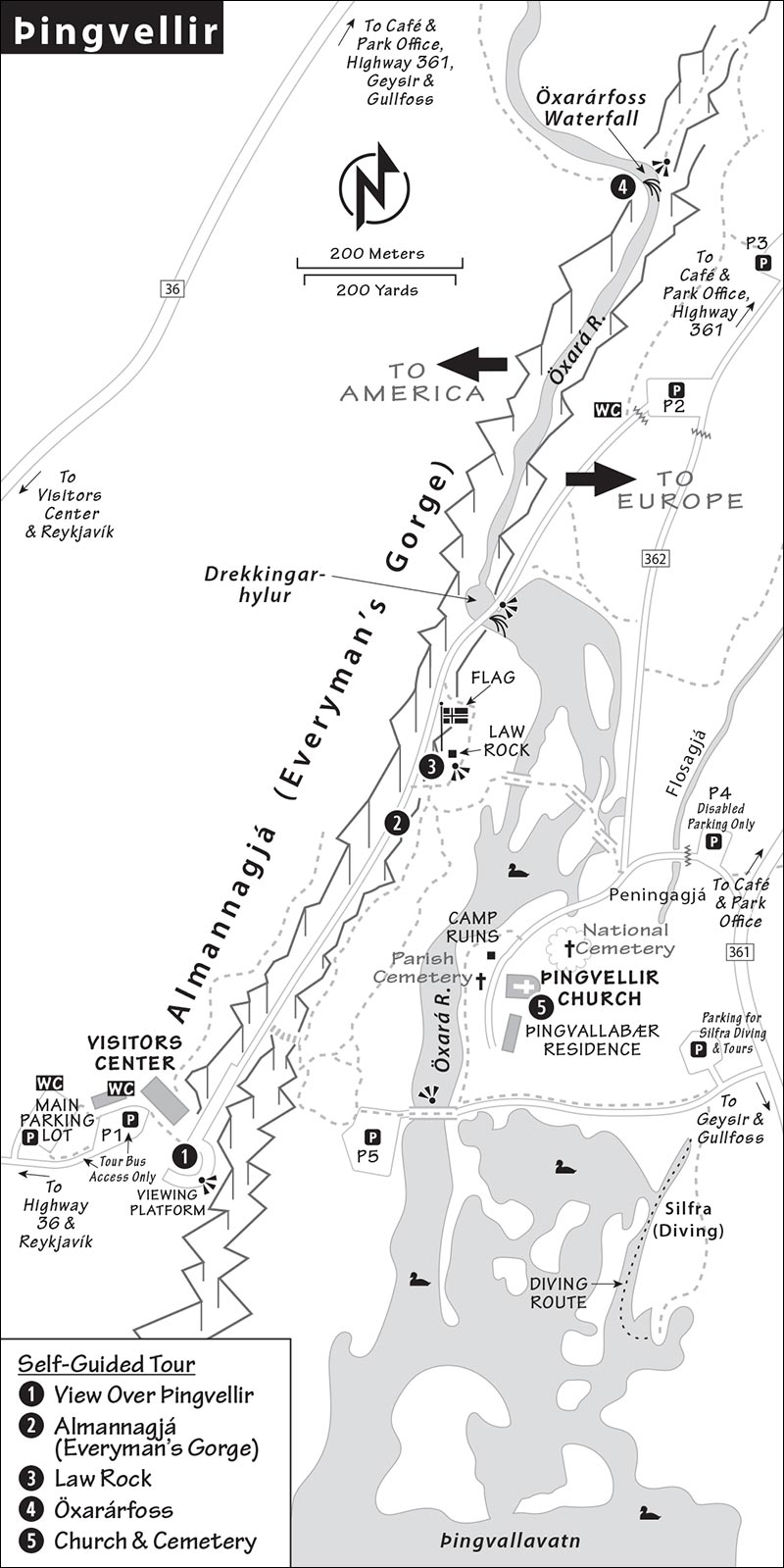
Arrival and Parking at Þingvellir: You can park on either the upper (west) or the lower (east) side of the Öxará river. The two sides are no more than a half-mile apart if you use the footbridges over the river, but it’s a five-mile drive by car.
The first turnoff you’ll reach (on your left) is for the main lot (sometimes called Hakið on maps). From here, it’s a short walk to the visitors center, WC, and starting point of my self-guided tour (to reach the visitors center, you’ll walk down a pedestrian path to the P1 lot, which is for tour buses only).
A camera records your license-plate number as you drive in; at pay machines (the main lot’s are in the visitors center), select “private car,” punch in your license-plate number, and pay by credit card.
If the main lot is full, try the smaller parking lots across the river: Continue north on highway 36 until you reach the intersection with the national park office/café, then turn right onto road 361. Keep right onto road 362, which leads south to P3, then P2 on the lower side of the valley. Parking lots P4 (disabled parking), P5, and the Silfra diving/tour lot are accessible from road 361: Continue south past the turnoff for 362; you’ll reach the turnoff, on the right, for P4, then farther along, the turnoff for Silfra parking and P5. These parking lots can be handy for hikers, divers, and picnickers. If you’re with a group, consider having the driver drop everyone off at P1; the driver can park at one of the lower lots and hike back up through the valley to meet you.
Length of This Visit: For a quick visit, you can enjoy the overview, hike the gorge, and see the Law Rock in less than an hour. Add a half-hour to hike up to the waterfall (about a mile one-way from the visitors center) and a half-hour to cross the river to the church (least interesting and skippable).
Eating: In good weather, Þingvellir is a nice place for a picnic. There are benches, wooded areas, and free portable WCs near P2. The $ café at the visitors center (at P1) sells premade sandwiches, ice cream, snacks, and hot and cold drinks. Otherwise, the only eatery nearby is the small $ café at the national park office a couple of miles away, at the junction of highways 36, 361, and 550 (daily).
Visiting Þingvellir: This plan assumes that you’re parking at the main lot and walking down to P1. The visitors center is helpful for geological and historical context but is otherwise skippable.
• From P1 and the visitors center, walk a few steps to the overlook with the railing.
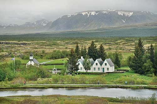
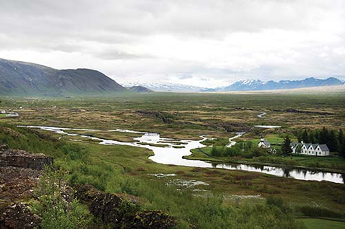
1 View Over Þingvellir: Look down at the lake and the land that’s subsided to its north. You can see how the Öxará (Ax River) empties into the lake. Þingvellir’s church (and some ruins of the old chieftains’ encampments) lies just across the river below you. The five-gabled farm building dates from 1930.
Directly below you is Þingvellir’s great fissure; look at how the North American and Eurasian tectonic plates are moving apart. Imagine pulling a big, chewy cookie apart very slowly; you’d start to see cracks in the dough, and eventually crumbs would start to slide into the gap. Here, you can see long, narrow fissures in the earth, running roughly north-south. The lake itself sits in the largest fissure of all. The lake bed (and the land to the north and south) has basically slid into the gap between the plates. It’s deep. In fact, the deepest parts of the lake bed are actually below sea level.
• Follow the boardwalk as it switchbacks down between the cliffs, descending through the little side channel that leads into...
2 Almannagjá (Everyman’s Gorge): As you walk, you’re tracing the boundaries of continents. To your left is America. To your right is Europe. (A geologist might say it’s not quite that simple but would agree that Iceland is half in Europe and half in America—and this is where they meet.)
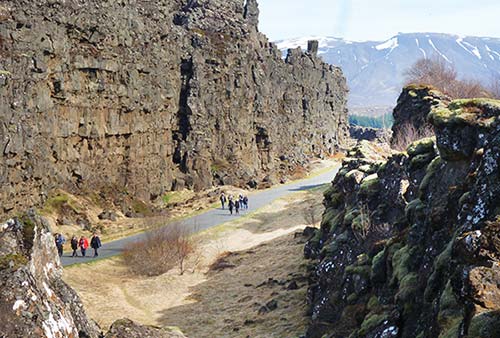
On the left, the vertical cliff face is rock as it was laid down by volcanic eruptions and compressed over the eons. On the right, you can see how the rock—once even with the cliff on your left—has fallen away into the gap due to the subsidence that also created the lake. On the right (fallen) side of the gorge, you can scramble out to various walkways and viewpoints.
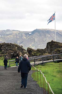
• As you approach the valley floor, follow the second boardwalk to the right to stand in the area just below the flagpole. This marks the likely location of the...
3 Law Rock (Lögberg): Within about 60 years of the first settlements, Iceland was home to roughly 15,000 people—almost all of them farmers, scattered across the island on isolated homesteads. In about AD 930, local chieftains began to gather at an annual meeting called the Alþingi (literally, “all-thing”), which took place more or less where you’re standing. For this reason, Þingvellir can be thought of as Iceland’s first capital. Today, this site remains important for Icelanders—it’s their Ancient Agora, their Roman Forum, their Independence Hall.
Gaze over the marshy delta below you and time-travel back a thousand years. It’s the middle of June, and you’re surrounded by fellow chieftains, some having traveled on horseback for more than two weeks over challenging terrain, just to be here. Each chieftain has brought along an entourage of þingmenn (assemblymen). The field below you is dotted with temporary turf huts—like a festival grounds, set up only in summer.
The meeting is about to begin, and you’re immersed in a hairy mosh pit of hundreds—maybe thousands—of unwashed Norsemen (and Norsewomen). The collective body odor is overwhelming. But for two weeks, you’ve all agreed to set aside your grudges and work together to find consensus on critical issues of the day. This is your one chance all year to learn the latest news and gossip. And while everyone’s here, there are sure to be some big parties, business wheeling and dealing, marriages arranged...and, quite likely, some duels. Merchants, tradesmen, and panhandlers are milling about, trying to drum up a little business. The whole event has a carnival-like bustle.
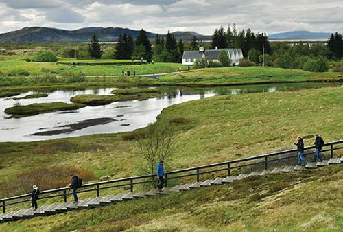
The crowd quiets with the appearance of the allsherjargoði (grand chieftain)—a direct descendant of Ingólfur Arnarson (who was, according to the sagas, the first Icelandic settler of Reykjavík). As the high priest of the Norse pantheon, the allsherjargoði calls the assembly to order and sanctifies the proceedings before the gods. Then the “law speaker” (lögsögumaður) takes his position at the Law Rock and recites the guidelines for the assembly, outlines the broad strokes of Icelandic law, and recaps the highlights of last year’s session. The acoustics created by the cliff behind him help bounce his voice across the throngs; other speakers, strategically located at the back of the crowd, carefully listen to, then repeat, whatever the law speaker says.
As the Alþingi continues, the law speaker also presides over the Law Council (Lögrétta) on the opposite riverbank. A more select group of chieftains reviews and debates existing legislation and weighs in on legal disputes, and the law speaker is responsible for memorizing whatever is decided. Eventually, Christianity brings literacy and the Latin alphabet, and the law speaker’s role gives way to that of a sort of “high attorney”—lögmaður.
The Alþingi gatherings took place as long as Iceland was independent. But things changed after 1262, when the chieftains entered into union with Norway—pledging fealty to the Norwegian king under an agreement called the Old Covenant. The Alþingi still convened annually at Þingvellir but morphed into an appeals court; it continued this way until 1798.
Þingvellir became a national park in 1930 to celebrate the millennial anniversary of the first Alþingi. And in 1944, the modern, independent Republic of Iceland was proclaimed right here. The stands below the flag are for official ceremonies; one of the information boards at the railing displays photographs of some of these ceremonies.
By the way, those original settlers couldn’t possibly have known that the place they selected for their gathering also happened to straddle America and Europe. They chose this site mainly because Þingvellir is fairly central (relatively accessible in summer from every corner of Iceland) and had ample water, grazing lands, and firewood to supply the sprawling gatherings. Its location along the cusp of continents is just one of those serendipities of history.
• Follow the boardwalk back to the wide gravel path straight ahead, and continue on this path to cross the river on a small bridge over a waterfall (the bottom end of Öxarárfoss, which we’ll visit next). To your left is Drekkingarhylur (Drowning Pool), where women accused of witchcraft were drowned between the late 16th and mid-18th centuries.
If you’re short on time, you could turn back here, but you’ll be missing out. Continue along the path. After about 300 yards, as you reach parking lot P2, keep left to stay on the gravel path (passing the WC). Follow this for a few minutes as it crests the rise to your left. Just over a hundred yards to your left is the large, picture-perfect waterfall called...
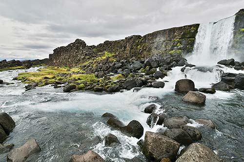
4 Öxarárfoss: This is where the river—which rises up on the plateau—plunges over the cliff face into the valley. Old sagas say that the early settlers changed the course of the river to improve the water supply at Þingvellir, but no one is exactly sure whether this is true and how that might have been done.
• You’ve already seen the most interesting parts of Þingvellir—you can head back the way you came (past the P2 lot). With more time, cross the footbridges on your left (below the Law Rock) to reach the...
5 Church and Cemetery: The current church was built in 1859, but churches have stood here for centuries. The original church was supposedly built using timbers sent to Iceland by Norway’s St. Olaf (King Olav II, 995-1030). If the church is open, step inside to see the humble, painted interior (generally closed Sept-May). Local parishioners lie in the small cemetery in front of the church. The multigabled house just beyond it, called Þingvallabær, was built in 1930 as a residence for the local priest, who was also the park warden. It’s now used for ceremonial functions.
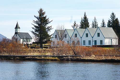
Behind the church, the round, elevated area up the stairs is a cemetery lot. This was planned as a resting place for national heroes, but the idea never took off, and only two people (well-known writers) were ever buried there.
Along the riverbank near the church, the mounds contain the remains of the temporary dwellings that were set up here each year for the annual assembly. From here, looking back the way you came, enjoy great views of the sheer cliff that defines the fissure.
• Between the church and the river, a waterside path allows further exploration. Following this path (and crossing a bridge back over the river) takes you to the P5 lot, where a steep shortcut (on a rocky path—and stairs—through the woods) leads back up to the main parking lots and the high viewpoint where you started. Also nearby is Silfra, a favorite destination of divers—described next. For an easier route back to the visitors center, backtrack along the river, take the bridge on your left to reach the Law Rock, and then hike back up through Everyman’s Gorge.
Silfra Snorkel or Dive Trip
One of the many fissures at Þingvellir, Silfra is renowned among snorkelers and scuba divers for its water clarity. Thanks to the purity of the glacial water that fills it, you can see underwater for more than a hundred yards.
To snorkel or dive in Silfra, you’ll need to join a tour (such as those offered by Dive.is, the largest operator—book well in advance). Snorkelers must be relatively fit and comfortable in the water, while divers need to be certified and experienced. There have been a few fatal accidents at Silfra in recent years (even involving snorkelers)—don’t overestimate your abilities.
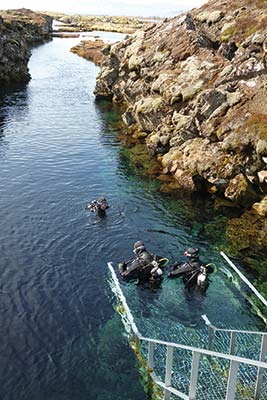
The water is a constant 35-39°F, so you’ll be outfitted with some serious gear: a neoprene dry suit, hood, gloves, fins, mask, and snorkel. (Some companies have basic changing cabins in the parking lot; otherwise, there’s limited privacy.) The suit keeps your body warm enough, but expect your face to go numb and your hands to get cold. After changing into your gear, you’ll walk a few minutes to the entry stairs and descend into the fissure with your guide. A gentle drift current slowly takes you along the fissure and into a lagoon, where you’ll need to kick against the current to U-turn to the metal exit stairs. You’ll be in the water for about 30-40 minutes.
Cost: 22,000 ISK for guided snorkeling, extra 7,000 ISK for pickup in Reykjavík, more for divers, +354 578 6200, www.dive.is.
Getting There: Silfra is at the lakeshore near the east bank of the river. The entry point to Silfra is between parking lots P4 and P5, just off road 361. Follow the directions to Þingvellir, but bypass the visitors center turnoff, and head to the intersection with the national park office/café. Turn right onto road 361 to reach this area; look for the designated parking lot on the right.
ÞINGVELLIR TO GEYSIR AND GULLFOSS
This section of the drive circles around the far end of the lake, where you can clearly see the intercontinental rift—as if a giant dropped his hoe and dredged out a tidy furrow between America and Europe.
• Leaving Þingvellir, return to highway 36 and continue east for about 10 minutes around the lake’s north shore, crossing smaller fissures and passing fishermen hoping to hook one of the lake’s famously big trout. Soon you’ll pass the intersection with road 361 (a right turn here takes you back to Þingvellir’s lower parking lots) and, immediately after that, the national park office, with a café on the left, and a campsite.
Continuing along the east side of the lake, you’ll reach a point where highway 36 turns off to the right. Stay straight toward Laugarvatn on highway 365. This road crosses an upland heath called Lyngdalsheiði (altitude: about 700 feet; if it’s closed, use highways 35 and 36).
On your left, enjoy some otherworldly, craggy mountain scenery—the Kálfstindar ridge. A half-hour after leaving Þingvellir, you leave the heath and descend to a village on a lake. At the roundabout, follow signs onto route 37 toward Geysir (not Selfoss) and enter sleepy, unassuming Laugarvatn.
Laugarvatn
Set by a small lake of the same name, Laugarvatn was long the home of Iceland’s college for sports teachers (the program has now been moved to Reykjavík), and it’s in a region popular with local vacationers. As you drive, you’ll see many summer cottages owned by the country’s labor unions for member use. Driving into the village, take the exit (right) by the recommended Héraðsskólinn Guesthouse and head down to the enticing, thatched Fontana Thermal Baths. There are hot springs in and around the lake, and Fontana, a nicely designed premium bath, makes good use of them.
▲Fontana Thermal Baths
Sitting right along the Laugarvatn lakeshore and built atop a natural hot springs, Fontana is one of Iceland’s handful of premium baths—a step up in comfort (and price) from municipal swimming pools, and a bit more tourist-oriented. For some, Fontana may be a good alternative to the Blue Lagoon—it’s cheaper, smaller (easier to navigate), less pretentious, and much less crowded; and it doesn’t require reservations. But it’s also more functional than spa-like, and it lacks the Blue Lagoon’s romantic, volcanic setting.
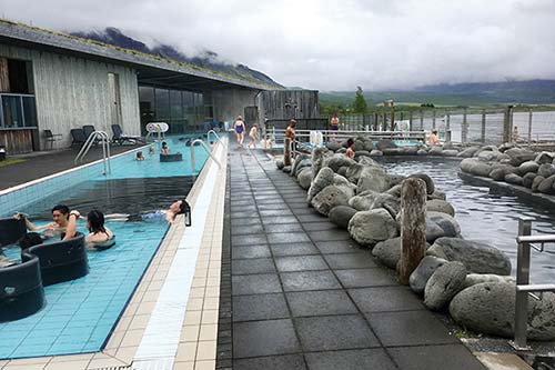
Beyond the visitors center—with a ticket desk, changing rooms, and a recommended cafeteria—is the outdoor bathing area, overlooking the lake. The complex has three modern, tiled pools, artfully landscaped with natural boulders, as well as a steam room (where you can hear the natural hot spring bubble beneath your feet) and a dry sauna. To cool off or for a change of pace, bathers are encouraged to take a dip in the lake.
Cost and Hours: 4,990 ISK, daily 10:00-21:00, Oct-May from 11:00, +354 486 1400, www.fontana.is.
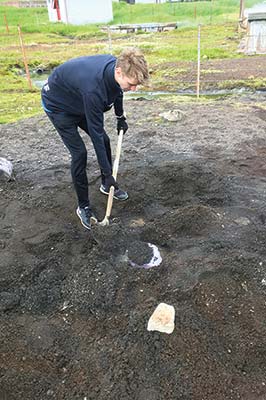
Thermal Bread Experience: Fontana follows the Icelandic tradition of baking sweet, dense rye bread right in the thermal sands at its doorstep. Twice daily, you can pay to join the baker for 45 minutes as they dig up a pot of bread, then taste it straight out of the ground (2,990 ISK, daily at 11:45 and 14:30—plus at 10:15 June-Sept). But note that you can eat the very same bread as part of their regular lunch buffet.
Nearby Thermal Beach: The lake in front of Fontana—heated by natural hot springs—is free to bathe in. Facing the lake, head right to find a small, black sand beach next to the fenced-off geothermal area (keep well clear of this area of boiling-hot water). The water near the springs is warm, but it gets colder as you go deeper. At a minimum, consider rolling up your pants and dipping your feet. On the wooden walkway between the geothermal plant and the lakeshore, notice—but don’t touch—little boiling pools in the mud.
Eating in Laugarvatn
The following places offer very good lunch options. There’s also a grocery store next to the N1 gas station.
$$ Fontana Thermal Baths cafeteria is in the bath’s entrance lobby and open to the public (no bath entry required). You can order from the menu or opt for their 2,190-ISK soup buffet (daily from 12:00, last lunch served at 13:45, dinner 18:00-21:00).
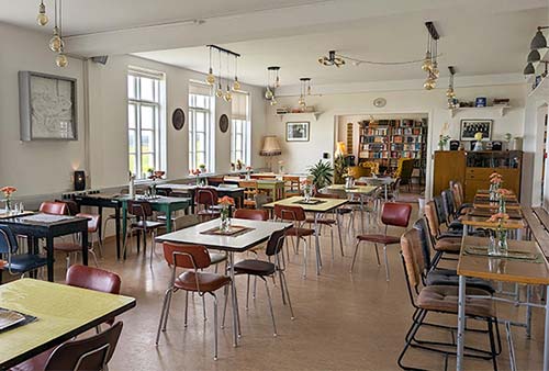
$$ Héraðsskólinn Café, at the recommended Héraðsskólinn Guesthouse, serves waffles and pastries in the morning; an inexpensive lunch of soups, salads, and sandwiches; and fish, meat, pizza, and vegetarian plates for dinner. The spacious dining room is filled with light and fun midcentury furniture (daily, hot meals available from 12:00, Laugarbraut 2, +354 537 8060).
$$ Efstidalur II Farmhouse Restaurant, 10 minutes beyond Laugarvatn, is on a large family-run dairy farm (with a recommended hotel) just off highway 37 on the left. Downstairs, a counter serves homemade ice cream. The upstairs restaurant, with windows overlooking the cows in the barn, serves burgers and pricier main courses, including seasonal specials. It’s a popular, bustling place—family-friendly and often crowded with groups. Their 2,950-ISK farm-to-table buffet of soup, bread, fancy spreads, and coffee is fast, affordable, and delicious (daily, well signposted up a gravel driveway, +354 486 1186, www.efstidalur.is). Even if you’re not hungry, Efstidalur II is worth a stop for a peek at an Icelandic farm.
• From Laugarvatn, highway 37 leads 20 minutes onward to the geothermal field at Geysir. On the right, just past Efstidalur II, notice the small farm that’s augmenting its income by harnessing geothermal power (just as wind turbines generate electricity on US farms). Soon, the road changes numbers to highway 35.
▲▲Geysir Geothermal Field
When people around the world talk about geysers, most don’t realize they’re referencing a place in Iceland: Geysir (GAY-seer), which literally means “the gusher.” While the original Geysir geyser is no longer very active, the geothermal field around it still steams, boils, and bubbles nonstop, regularly punctuated by a dramatic eruption of scalding water from the one predictably active geyser, Strokkur. This stop is pretty simple: Watch Strokkur erupt a couple of times, look at the rest of the field, and then continue on.
Cost and Hours: Free and always open.
Safety Warning: Make sure to keep young children close. Impress upon them that they should not touch any of the water, which is boiling hot, and that they must stay behind the ropes. At Strokkur, standing upwind will keep you out of any spray.
Arrival at Geysir: Approaching Geysir, you’ll see the geothermal field on your left and a visitors complex with parking lots on your right. Park as close to the geothermal field as you can (if you drive 100 yards past the hotel and take the lane to the left, you’ll find the spots closest to the geyser action).
Services and Eating: Across the road from the geothermal area is a commercial area with a clothing and souvenir store, free WCs, a golf course, a hotel, and a handful of restaurants. (I’d opt for one of the Laugarvatn eating options described earlier, or wait for Skjól Café, about 2 miles farther down the road.)
Visiting Geysir: The geothermal field lacks the boardwalks and other maintenance you would normally expect at a sight this popular. Outdoor signboards explain the geology.
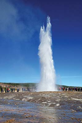
The area’s centerpiece is a geyser called Strokkur (Butter Churn), which erupts about every 5-10 minutes. The eruptions, which shoot about 50 feet in the air, are relatively short—in every sense—and won’t wow anyone who has seen Old Faithful at Yellowstone. What’s nice about Strokkur, though, is the short wait between gushes and how close you can get. Each eruption is a little different. It’s surreal to stand around in a field with people who have come from the far reaches of the globe just to share this experience...of staring at a water-filled hole in the ground. Everyone huddles in a big circle around Strokkur, cameras aimed, fingers twitching, waiting for the spurt. When it finally happens, it’s over in a couple of seconds, as abruptly as it started. (To record the entire spurt on video, stand on the high end and watch for the dome-shaped bubble that appears a second before it blows.)
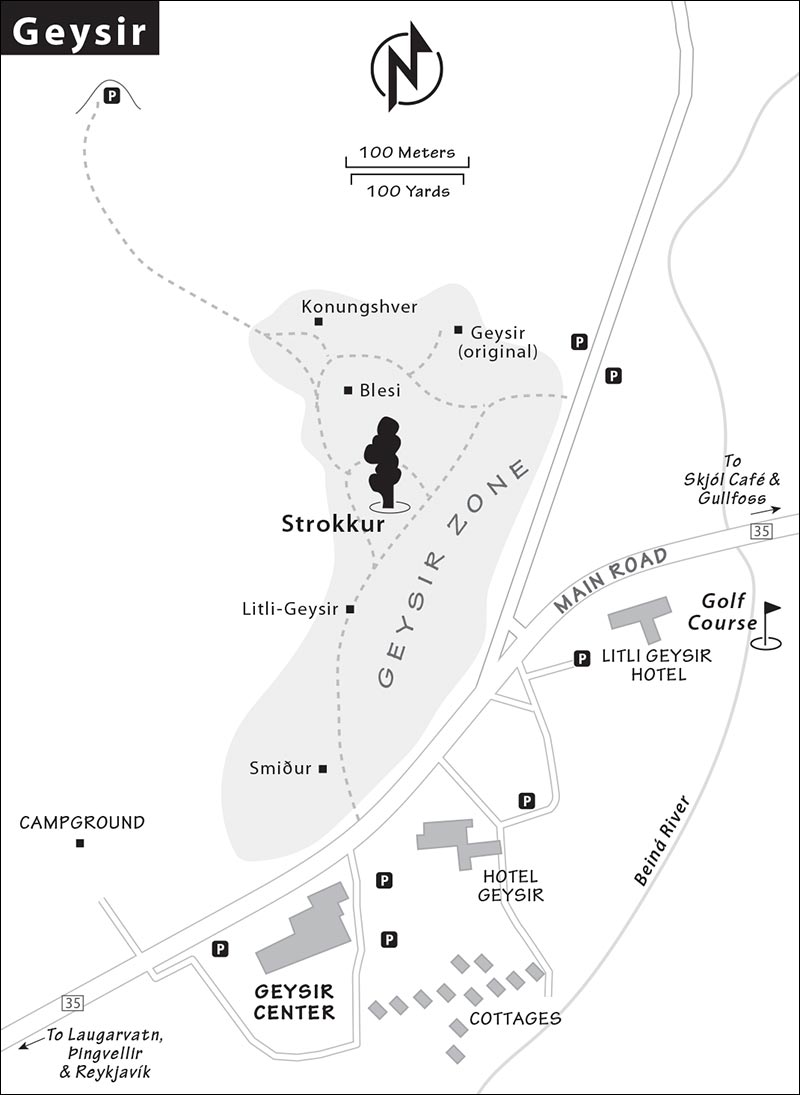
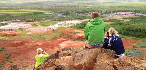
Just a few yards up the hill above Strokkur, check out the other fumaroles and hot pools, including Konungshver and the colorful Blesi. The miniature Litli-Geysir, along the path from the main parking lot, bubbles and boils but doesn’t erupt.
Steaming uneasily off to the side is the original “great” Geysir. This was the only one known to medieval Europeans and is the origin of the word geyser. It was dormant for most of the 20th century, but after a nearby earthquake in 2000, it started erupting occasionally. It blows higher and longer than Strokkur, but rarely and unpredictably, so don’t expect to see anything.
For a commanding view over the Geysir area, continue past Konungshver, climb over the stile, and make your way 10 minutes up to the top of one of the rocky outcroppings that overlook the geothermal field and surrounding terrain. Snowy glaciers loom to the east.
• From Geysir, continue to the Gullfoss waterfall, a straight shot 10 minutes onward along highway 35. Along the way you’ll pass $$ Skjól Café, next to a campground, serving good, affordable soup and splittable pizzas (daily, +354 899 4541).
▲▲Gullfoss Waterfall
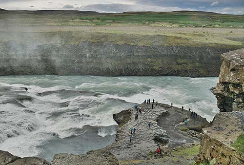
The thundering waterfall called Gullfoss (GUTL-foss) sits on the wide, glacial Hvítá river, which drains Iceland’s interior. The name means “Golden Falls” and gives this “Golden Circle” its name. The waterfall has two stages: a rocky upper cascade with a drop of about 35 feet, and a lower falls where the water plummets 70 feet straight down into a narrow gorge. Somewhat unusually for a waterfall, the gorge runs transverse to the fall line, effectively carrying the water off to the side. Dress warmly: Cold winds blow down the valley, and the spray from the falls can soak you. Winter visitors should watch for slippery areas. If you have ice cleats, this is a good place to put them on.
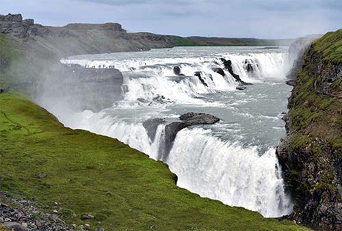
Cost and Hours: Free and always open, +354 486 6500, www.gullfoss.is.
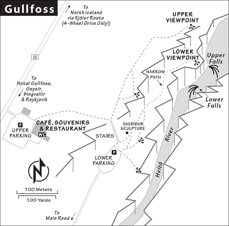
Arrival at Gullfoss: Two scenic walking paths, connected by a metal staircase, let you admire the falls; each has its own free parking lot and viewpoints. Both are worth seeing, but if you’re short on time, focus on the lower viewpoint, where you can get up close and feel the spray. To park there, watch for a blue P sign as you approach, and take the right turn to the lower parking lot. With more time, continue to the upper parking lot, with a huge tourist complex housing free WCs, eateries, and a massive gift shop.
Eating: The large $ café at the upper parking lot serves soup, salad, and sandwiches. Beyond the café and shop is the $$ Panorama Restaurant, with views out toward the waterfall.
Visiting the Waterfall: From the upper parking lot, boardwalks lead along the edge of the plateau, high above the falls, to two good upper viewpoint spots. On a clear day, you can see glaciers in the distance. The view upriver gives a sense of Iceland’s vast and lonely interior Highlands.
From here, stairs lead down to the lower viewpoint. This area gets you close to the falls. It’s closed in winter, when ice can make it dangerous (don’t try it). A narrow trail leads through the spray from the falls to a level area between the upper and lower stages of the waterfall.
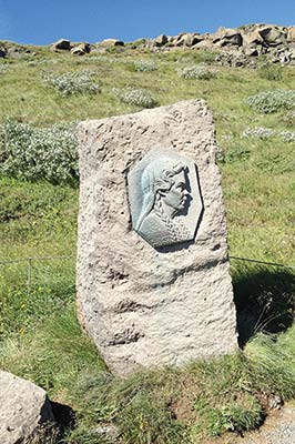
It would be easy to dam or divert the river above the falls for electricity generation. In the early 1900s, British investors tried to buy the waterfall and do just that, but their plans fell through. The government acquired the land, and the falls have been left in their natural state. Near the base of the staircase, look for the relief sculpture of Sigríður Tómasdóttir, a local farmer who helped thwart plans for the dam.
Near Gullfoss: Leaving Gullfoss, look to your right, where you’ll see the Langjökull glacier in the distance and get a sense of Iceland’s vast interior. This no-man’s-land, uninhabited and without roads, stretches over a hundred miles to Iceland’s north coast. After a couple of minutes (just past the Skjól Café), look for the Brú Horsefarm, where a farmer has created a little horse-petting experience (complete with a shack that sells “horse candy”—corn goodies to help you make friends with the young Icelandic horses).
GULLFOSS BACK TO REYKJAVÍK
You’ve seen the main three sights on the Golden Circle. This last stretch features a grab bag of interesting stops to consider on the way back to Reyjavík—waterfall, thermal pool, tomato farm, church, crater, and thermal river—but if you’re in a hurry, these are all skippable. It’s about 1.5-2 hours back to Reykjavík (direct), but even on a quick trip, I’d give it four hours with stops of your choice.
• The following sights are all on (or are short detours from) highway 35/highway 1 and the main Golden Circle route. From Gullfoss, return to highway 35 and pass by Geysir again. Shortly after Geysir, make a left turn to stay on highway 35 toward Reykholt and Selfoss (passing Faxafoss on the way).
Faxafoss
Just before Reykholt, you’ll see a tiny sign for Faxafoss on the left. Take the exit and enter the upper lot, where you’ll pay to park (park in the lower lot closer to the falls). Faxafoss is a lovely waterfall, but nothing on the scale of Gullfoss. Notice the fish ladder built alongside it for the convenience of spawning salmon. A small café with a view deck perches along the road from the upper lot.
• The next sight, the Secret Lagoon, is a 10-minute drive off the main Golden Circle route. From highway 35, just before the village of Reykholt, turn left at highway 359, signed Flúðir. Follow this about 5 miles across rolling plains, hills, and a couple of streams. The road merges with highway 30 as you roll into the small village of Flúðir. Watch on your left for the turnoff to Hvammur and Gamla Laugin; the Secret Lagoon is tucked amid the big greenhouses on your right.
Secret Lagoon (Gamla Laugin)
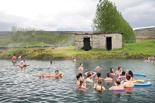
Claiming to be the oldest swimming pool in Iceland (from 1891), the Secret Lagoon is a big, rustic, three-foot-deep pool (which ranges from 100-104°F) in front of a dilapidated old house (with a modern entrance/changing facility). The pool is surrounded by an evocative thermal landscape; a boardwalk leads around the pool, past steaming and simmering crevasses. Greenhouses stand nearby. Compared to the over-the-top-romantic Blue Lagoon, or even Reykjavík’s municipal swimming pools, this is a very straightforward experience: Its proximity to the Golden Circle and clever marketing make it more popular than it probably should be. On the other hand, the bathers here seem very happy—sipping drinks, bobbing on colorful pool noodles, and enjoying this après-Golden Circle hangout. Far from “secret” (it’s included on several day tours from Reykjavík), the pool can get quite crowded with a younger clientele (especially after 15:00).
Cost and Hours: 3,600 ISK, daily 10:00-20:00, Oct-May until 19:00, last entry one hour before closing, +354 555 3351, www.secretlagoon.is. It’s smart to reserve ahead online—when it’s full, it’s full.
• Return the way you came—to highway 35 heading southwest toward Reykholt.
Reykholt, the Greenhouse Town
Iceland’s long dark winters, early frosts, and cool summers mean that many fruits and vegetables thrive only in greenhouses. Reykholt is one of several Icelandic towns where geothermically powered greenhouses cluster. They grow strawberries, cucumbers, peppers, herbs, and flowers—and at the Friðheimar farm (described next, open to nondiners), it’s all about tomatoes.
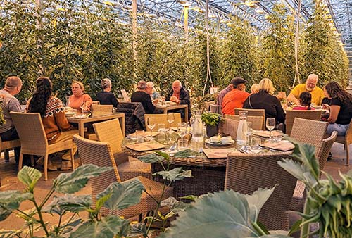
$$ The Friðheimar Tomato Farm Restaurant, a very popular tomato farm and eatery, offers lunch daily (12:00-16:00). You’ll dine right in the muggy warmth of the greenhouse, surrounded by rows of tomato plants, with pots of fresh basil on each table. The menu is brief: tomato soup with bread, fresh pasta with tomato sauce, and tomato ice cream or cheesecake with green tomato sauce. If you want just a quick bite or drink (or don’t have a reservation), you can squeeze into a spot at the bar, which serves tomato soup (no other mains) and a creative array of Bloody Marys. As the farm is popular with big bus groups, reservations are smart (along highway 35, in the village of Reykholt, +354 486 8894, www.fridheimar.is).
The farm also runs a classy and relaxing wine bar around the corner in a beautiful greenhouse with a leafy ceiling. If you’re just coming for the soup, you could head straight to the wine bar and enjoy a much more mellow dining experience (limited menu of other tomato-heavy snacks, daily from 13:00).
Even if not eating at the farm, you’re welcome to read their info boards and wander into the greenhouse. The Friðheimar farm has been in the family, growing tomatoes in greenhouses, for decades. Today, they claim to produce nearly half of all tomatoes in Iceland, shipping a ton of tomatoes to Reykjavík each day. Taking advantage of a hot spring above town, the greenhouse walls are lined with heat-radiating water pipes. This off-the-grid farm uses geothermal energy to produce electricity to power its lights, providing a kind of synthetic sunshine in the darkness of winter. And the greenhouse cleverly corrals all that goodness, nursing its sweet vegetables.
• To reach the next sight, a few minutes southwest of Reyhkolt, detour left onto highway 31, following Skálholt signs. The church is just over the hill and off to the right, overlooking a lake-and-mountain panorama.
Skálholt Cathedral
This church was the old seat of the bishopric of southern Iceland. The current church was built in the 1960s and is flanked by a retreat center run by Iceland’s Evangelical Lutheran state church. This low-key site is worth a few minutes if you want to mix something nongeological into your day.
Cost and Hours: Church entry—free, crypt—500-ISK donation requested; daily 9:00-18:00, pay WC in complex next to church.
Visiting the Church: As you drive up, you can see how the rich farmland around the church was able to support a medieval religious community. In the 1700s, this was one of the most densely populated—and most powerful—places in Iceland.
It’s peaceful here, with no tourist crowds. Almost nothing is left of the original buildings, many of which were destroyed by earthquakes in the late 18th century. The church is simple, with locally designed stained-glass windows and a thousand years of bishops listed on the back wall.
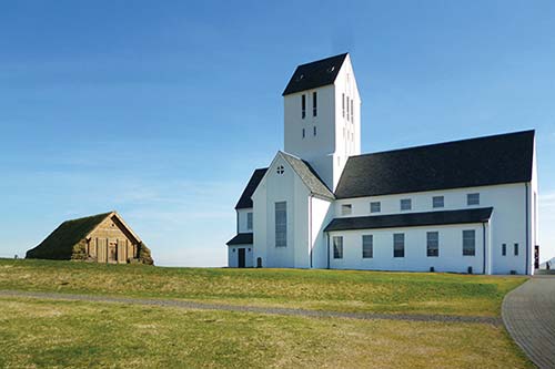
Downstairs, the crypt has a small exhibit of historical and archaeological artifacts, including a bishop’s stone coffin, dating to at least the 14th century. There’s also a period sketch of the 18th-century church, which survived the earthquakes but was torn down soon after. From the crypt, you can exit directly outdoors (open the door in the right-hand corner) through the only original part of the building, a short tunnel. An old-style, turf-roofed wooden chapel on the grounds is usually open (often with temporary exhibits).
• Backtrack to highway 35 and continue southwest to the town of Borg.
Borg Public Swimming Pool
In the tiny town of Borg (at the junction of highways 35 and 354), a simple community pool offers about the least touristy and most basic Icelandic swimming opportunity available. Look for the water slide just past the main turnoff into Borg.
Cost and Hours: 1,100 ISK; Mon-Thu 10:00-21:30, Fri-Sun until 18:00; late Aug-May Mon-Thu 14:00-21:30, Sat-Sun 10:00-18:00, closed Fri; +354 480 5530, https://sundlaugar.is.
• After passing Borg, watch for the little Kerið sign, which comes up very quickly (look for an Icelandic flag and people hiking along a ridge on your left as you approach).
▲Kerið Crater
The Kerið (KEH-reethe) crater is a volcanic cone that collapsed and filled with water after an eruption about 6,500 years ago—creating a tiny crater lake. It’s right next to highway 35, but you’ll see nothing without paying to climb the little hill. The crater is vividly colorful: red walls draped with green vegetation, overlooking deep aquamarine-blue water. You can see it in a single glance, take a half-hour to walk around the rim, or descend 150 feet down a set of stairs to the surface of the lake.
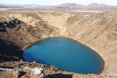
Cost and Hours: 450 ISK when staffed, not staffed at night or in darkness, +354 823 1336, www.kerid.is.
• Continue southwest from the Kerið crater toward Selfoss on highway 35.
Kerið Crater to Highway 1
Just before crossing a river, there’s a popular pizza joint on the right. After the river, you’ll drive past a dramatic slope on your right. Look at the mountainside to see the huge boulders that have tumbled down the slope over the ages—and see if you can spot the one lonely summer house taking its chances among them.
• When you finally reach highway 1, turn right for Reykjavík. (You’re skirting the town of Selfoss, known for having the grave of chess master Bobby Fischer (described on here). It’s about an hour’s drive from here back to Reykjavík.
Road safety is an issue here. Notice the road sign with wind direction and speed along with temperature. After that is a speed-camera warning...then the camera. On the left you’ll see 52 white crosses at the base of a conical hill. These commemorate motorists and pedestrians killed on this busy, poorly lit road—statistically one of Iceland’s most dangerous—between 1972 and 2006. Consider this a sobering reminder to drive with extra caution. (Farther along you’ll see two smashed cars with an indication of how many deaths there have been on Icelandic roads so far this year.)
▲Reykjadalur Thermal River
At the town of Hveragerði is the exit for this aptly named natural thermal area—literally “Steamy Valley.” For outdoorsy hiker/bathers, Reykjadalur (RAYK-yah-dah-lrr) is worth ▲▲. The hike to the river is just over two miles one-way along a well-maintained path, with a 600-foot elevation gain (allow at least three hours total for this experience).
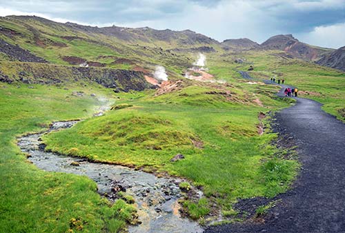
Stepping out of your car at the end-of-the-road parking lot, you’re surrounded by steaming hillsides. From here, cross the bridge, then hike approximately one hour up the valley. Eventually you’ll reach some basic changing cabins next to a hot stream. The water is shallow—you’ll need to lie down to be submerged—but wonderfully warm. Reykjadalur is far from undiscovered, so you’ll likely have plenty of company. Relax and enjoy the experience...but remember it’s an hour’s hike back down to your car.
Warning: Stay on marked paths at all times. This entire area is very geologically active, and anyone wandering off the path could end up stepping into a hidden underground pool of boiling water.
Eating in Hveragerði: Other than the river, the main reason to visit nearby Hveragerði is to eat at one of its inviting eateries on your way back to Reykjavík. As you drive on the main road into Hveragerði, you’ll see $$ The Greenhouse food hall (Gróðurhúsið) on your right, housing several enticing international food counters in a stylish and glassy space (long hours daily, Austurmörk 6, +354 464 7336). $$ Ölverk (Beerworks) is a friendly little microbrewery/pizzeria tucked in an industrial space a couple of blocks into town. In addition to a chalkboard menu of their own beers, and others by local brewers, they dish up decent pizzas from a brick oven. Casual and family-friendly, it works well for an easygoing dinner (daily, take the main road through Hveragerði and watch for the pizzeria on your right at Breiðamörk 2, +354 483 3030, www.olverk.is).
• Past the small town of Hveragerði, the road climbs steeply in a series of wide bends to a high upland plateau (1,200 feet above sea level) called Hellisheiði. This plateau separates southern Iceland from the Reykjavík area. About halfway across the plateau (the turnoff is clearly marked Hellisheiðarvirkjun), you’ll see pipes and steam from a geothermal plant that welcomes visitors.
Hellisheiði Power Plant (Hellisheiðarvirkjun)
This is the only one of Iceland’s seven geothermal energy plants where visitors can get a good look at the powerful turbine machinery at work. The hot water from the ground (which is piped to homes for heating) drives the turbines that generate electricity.
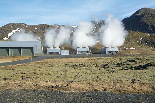
In the geothermal exhibit, you can see turbine rooms through big windows, read posters on how geothermal energy works, and watch a couple of films.
Cost and Hours: 1,971 ISK, daily 9:00-17:00, Nov-March until 16:00, confirm hours in advance; included one-hour guided tours run several times a day (last tour at 15:00, see details at their website); +354 591 2880, www.geothermalexhibition.com.
• From the power plant, it’s less than 30 minutes—across a lunar landscape—to Reykjavík. Your Golden Circle loop is finished.
Sleeping on the Golden Circle
For locations, see the map near the beginning of this chapter.
In Laugarvatn: $$$ Héraðsskólinn Guesthouse is hard to miss as you drive into Laugarvatn from Þingvellir, with its green gables and prominent location on a bluff above the lake (just above the Fontana Thermal Baths). This historic 1928 schoolhouse, designed by Guðjón Samúelsson of Hallgrímskirkja fame, is filled with light and offers generous, warmly decorated public areas (some decor is original from the schoolhouse) and a recommended in-house café. Its bright, clean rooms come with views (breakfast extra, family rooms, cheaper rooms with shared baths, elevator; Laugarbraut 2, 25 minutes to Geysir, 35 minutes to Gullfoss; +354 537 8060, https://heradsskolinn.is, reception@heradskolinn.is).
$ Hotel Laugarvatn, on the main drag, offers simple, comfortable, and economical rooms with big windows. Some rooms have views over the lake (breakfast extra, family rooms, laundry facilities, Dalbraut 10, +354 899 5409, www.hotellaugarvatn.is, info@hotellaugarvatn.is). The attached restaurant, $$$ Muninn, serves Icelandic specialties like lamb and salted cod (open daily for dinner).
Near Laugarvatn: $$ Austurey Cottages are six comfortable one-bedroom cabins plopped on a sheep farm owned by the same family since 1926. Here you’ll find peace and quiet (except for the occasional bleating sheep) and floor-to-ceiling windows offering wide-open vistas that, on a clear day, include volcanoes Hekla and Eyjafjallajökull (indoor kitchenettes, gas grills outside; located at Austurey 1, south of Laugarvatn near the shore of lake Apavatn in Bláskógabyggð; 10 minutes to Laugarvatn town and grocery store, 30 minutes to Geysir; +354 773 0378, www.austurey.is, austurey@austurey.is).
$$$$ Efstidalur II, home to the recommended Farmhouse Restaurant, is a fine place to get a hint of what life is like on a real Icelandic farm—with horses, cows, and dogs. They rent woody, cabin-like rooms—all with private baths—across several buildings; several rooms come with views over the valley (family room, breakfast extra, farm scents, horse rental, free parking, 10 minutes east of Laugarvatn on highway 37, 15 minutes to Geysir, +354 486 1186, www.efstidalur.is, info@efstidalur.is).
In Geysir: $$$ Litli Geysir Hotel, tucked away from the Geysir tourist hubbub, is a straightforward one-story hotel offering 22 tidy, modern rooms a short walk from the geothermal action. When booking, don’t mistake the good-value Litli for its big sister, the brash and pricey Hotel Geysir by the shopping center (breakfast served at the big hotel, look for parking lot on the right after you pass the shopping zone, 10 minutes to Gullfoss, +354 480 6800, book on Booking.com, geysir@geysircenter.is).
Near Gullfoss: $$$$ Hótel Gullfoss offers comfortable, good-size, modern rooms just minutes from its namesake falls. From the outside, this family-run hotel doesn’t exude a ton of charm, but inside, everything’s bright and fresh (off highway 35 a few minutes past Skjól Café, +354 486 8979, www.hotelgullfoss.is, info@hotelgullfoss.is).
Near Skálholt: $$$ Brekkugerði Guesthouse offers nine simple yet modern rooms in a quiet, woodsy setting amid pastures and greenhouses above the Hvítá river (flowing from Gullfoss upstream). Helpful and friendly host Haraldur is happy to answer questions and offer tips (cheaper rooms with shared bath, garden in back, free parking; at Austurbyggð 26—from highway 35, take the Skálholt exit to highway 31, pass the Skálholt Church, turn left onto Skúlagata, then right onto Brekkugerðisvegur, which leads straight onto Austurbyggð; 30 minutes from Geysir, +354 779 7762, www.brekkugerdi.is—or book on Booking.com, brekkugerdi@brekkugerdi.is).