BORGARNES & REYKHOLT VALLEY
Borgarnes and Reykholt Valley Drive
To the Reykholt Valley and Back
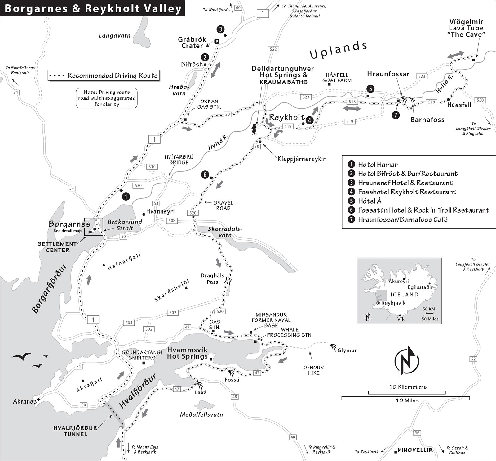
Map: Borgarnes & Reykholt Valley
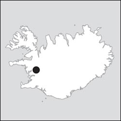
One hour north of Reykjavík sits the fine fjordside town of Borgarnes, which anchors a region offering an engaging slate of attractions. This is farming country: It’s more sedate and less crowded than some of the more famous day-trip destinations, and a good choice for those seeking less driving and a mellower pace.
The town of Borgarnes packs its peninsula with picturesque beaches, a fine little museum about the early Icelandic settlers and their sagas, and grand views of scree slopes that rise up across the bay. Just 30 minutes north, Grábrók crater is satisfying to climb—earning you sweeping views over a desolate, frozen-lava landscape.
Inland from Borgarnes is the pastoral Reykholt Valley—which stretches from the waters of Borgarfjörður past thousand-year-old lava flows to Iceland’s second-largest glacier, Langjökull. The village of Reykholt was home to Iceland’s most important Settlement Age scribe and remains a draw for historians today. The Deildartunguhver thermal springs steam and bubble, keeping the classy Krauma Geothermal Nature Baths piping hot. And “The Cave” at Víðgelmir lets you spelunk through a lava tube, with walls of petrified molten rock. The Reykholt Valley also has easy-to-visit waterfalls, charming country hotels and restaurants, and a lovable family-run goat farm. And between the Reykholt Valley and Reykjavík, the scenic Hvammsvík Hot Springs make for a serene evening soak.
Many people simply zip through this region on their way around the Ring Road, or to Snæfellsnes and the Westfjords. But travelers who explore Borgarnes and the Reykholt Valley are rewarded with vivid memories. This chapter ties everything together in one manageable day-trip drive from Reykjavík, but also lets you mix-and-match based on your itinerary.
As a Day Trip: You can visit Borgarnes and the Reykholt Valley on your own by car, following the drive outlined in this chapter—though you’ll have to be selective and take advantage of the long summer days. If you take my suggested scenic route back to Reykjavík, you could soak at the fjordside Hvammsvík Hot Springs on your way back to the city (book ahead).
As an Overnight: Accommodations in this area tend to be reasonably priced. I recommend staying in one of three areas: in Borgarnes, near Grábrók crater, or in and near Reykholt.
Sleeping here is particularly smart if you’re continuing farther north along the Ring Road and want to see the region in depth. Some people stay here on their first night in Iceland—bypassing Reykjavík and getting a head start on their trip around the Ring. (Borgarnes is about 1.5 hours by car from Keflavík Airport.)
Borgarnes also makes a good pit stop on the way north to the Snæfellsnes Peninsula and the Westfjords.
Name Note: Pay attention if you are using GPS to navigate: Iceland has two towns that go by the name of Reykholt—one here in West Iceland, and the other about 100 miles away, near the Golden Circle.
Borgarnes and Reykholt Valley Drive
This itinerary assumes you’re seeing this region’s highlights as a day trip from Reykjavík. You’ll go north to the town of Borgarnes for some sightseeing, detour up to Grábrók crater, then continue over to Reykholt, where you’ll do a circuit of the area’s sights, before heading back to Reykjavík.
PLANNING YOUR DRIVE
The following plan is minimalistic; to make adjustments, see the tips in the next section.
| 9:00 | Drive north from Reykjavík to the town of Borgarnes on highway 1 (1 hour) |
| 10:00 | Walk around Borgarnes; tour the Settlement Center |
| 11:30 | Head to Grábrók crater (30 minutes) and climb to the top and back; have a picnic lunch there or eat at the nearby Hraunsnef country hotel |
| 13:30 | Drive to Deildartunguhver hot springs (30 minutes) for a quick look (allow more time if you go for a soak at Krauma) |
| 14:15 | Drive from the hot springs to Hraunfossar and Barnafoss waterfalls (20 minutes); see the falls |
| 15:00 | Take slow scenic highways 520 and 47 back to Reykjavík (2 hours), arriving back a little after 17:00 (allow more time if you stop at Hvammsvík Hot Springs—reserve ahead) |
Borgarnes and Reykholt Valley Tips
This region offers plenty to see beyond my suggested plan above. Depending on your interests, and the weather and road conditions, you can mix in some extra stops. History buffs can focus on the good museums in Borgarnes as well as the modestly interesting church complex at Reykholt. Outdoorsy travelers can hike through an underground lava-tube cave at Víðgelmir (book ahead). Hot-spring enthusiasts will want to spend time at the Krauma thermal bath or Hvammsvík Hot Springs (or both). Families can add visits to the kid-friendly Háafell Goat Farm and the Rock ’n’ Troll restaurant. For even more suggestions, see the helpful tourism website West.is. You’ll need to allow extra time for any of these—especially the Víðgelmir lava tube. You can shave off a half-hour by returning on highway 1 instead of the scenic route.
Doing the Route in Reverse: You could also do this drive in the reverse direction, starting with the scenic route on your way north, while you’re fresh. If you’re getting an early start from Reykjavík, remember that indoor sights here don’t open until 10:00.
Weather and Road Conditions: As elsewhere in Iceland, check the weather forecast and road conditions before you head out—strong winds occasionally close highway 1 between Reykjavík and Borgarnes. Note that the scenic route from the Reykholt area back to Reykjavík (highways 520 and 47) has short stretches on rough, unpaved roads—including one over a low mountain pass. Hurried drivers should stick to highway 1. Before you go, double-check road conditions at Road.is.
To the Reykholt Valley and Back
We’ll head north from Reykjavík on highway 1 to Borgarnes, sightsee the town, then drive farther north for an optional hike up the Grábrók crater. Next, we’ll head east to the Reykholt Valley. From here, it’s an easy trek to the waterfalls of Hraunfossar and Barnafoss, or farther east to the Víðgelmir lava tube. Backtracking to Reykholt, we’ll head south on highways 520 and 47 (a slower but more scenic return) to Reykjavík, with an optional stop at Hvammsvík Hot Springs (reserve ahead). Recommended sights, restaurants, and hotels along this driving route are described later in the chapter. Budget about 10 hours (about half of that is driving). This drive covers about 200 miles in total. For a route overview, see the map on the next page.
REYKJAVÍK TO BORGARNES
It’s a bit over an hour’s drive to Borgarnes.
• Leave Reykjavík on highway 1 to the north, following signs for Borgarnes, Akureyri, and 1n.
As you leave Reykjavík, you pass under Esja, the mountain that shadows the city to the north, and you’ll see the parking lot for hikers climbing the peak. As you round the mountain, some of the city’s chicken hatcheries come into view to your left. Eventually, you’ll pass the small community of Kjalarnes (where frequent strong winds blow) and the turn off for the scenic route around the fjord (highways 520 and 47), before entering the two-lane, 3.5-mile-long Hvalfjörður tunnel that passes beneath the fjord.
Finished in 1998, this tunnel has cut travel time from Reykjavík to all points north. While the tunnel area is not actively volcanic, it lies across a geothermal vent, and the undersea rock is warm (up to 135°F; see if your car’s dashboard shows the outside temperature). Watch your speed in the tunnel: The speed limit is 70 km/hour and monitored by cameras.
• At the roundabout just after the tunnel, go right, following signs for Borgarnes and Akureyri.
In a few minutes, you’ll pass three huge metal smelters at Grundartangi, which produce ferrosilicon, aluminum, and silicon for the solar-power industry. Smelters need to be along the coast, as ships bring in the raw ore (such as bauxite for making aluminum) and carry the finished products to market.
You’ll now cross a low-lying, thinly settled plain between two mountains: Akrafjall on your left and Hafnarfjall (HAHP-nahr-FYAHTL) to your right. Farther west is Skarðsheiði, which under snow cover looks like a meringue chopped into great wavy peaks. On a clear day, you might be able to see the mountains of the Snæfellsnes Peninsula far ahead of you.
Soon you’re driving along the base of vast gravel slopes that tumble down from Hafnarfjall. (The stretch of road that curls around Hafnarfjall is subject to frequent high winds.) You’ll see many small islands in Borgarfjörður, the fjord to your left.
Eventually the town of Borgarnes will come into view, and the road will bend left and cross a causeway and bridge into town (see “Borgarnes,” later).
BORGARNES TO THE REYKHOLT VALLEY
When you’re ready to continue toward the Reykholt area, you have three route options: In good weather, hikers will want to drive up to the Grábrók volcanic crater, then loop back down toward Reykholt. (All together, Grábrók adds about 1.5 hours, including the drive and time to hike up to the crater, but not lunch.) If the weather’s too cold or windy to hike the crater, you could take the scenic route to the Reykholt area over the old bridge called Hvítárbrú, or take the quicker route through Baulan. Each of these options continues to Deildartunguhver hot springs.
Notice that no single route connects all of your choices in the Reykholt area; you’ll make one or more loops to connect them, via paved highway 518 and the mostly unpaved highway 523.
Let’s begin by heading north from Borgarnes on highway 1, following signs toward Akureyri.
Detour to Grábrók Crater (55 minutes): From Borgarnes, you’ll reach the crater in about 30 minutes; you can’t miss it (on the left side of the road). After visiting, backtrack south on highway 1 about 10 minutes; when you reach the Orkan gas station, turn left onto highway 50, then drive another 15 minutes until you see signs for Deildartunguhver and the Krauma thermal baths. (If you get to the junction with highway 518, you’ve gone a half-mile too far.)
Via Hvítárbrú Bridge, skipping Grábrók (40 minutes): This pleasant route crosses bridges that don’t allow trucks or buses. From Borgarnes, drive north along highway 1 about 10 minutes, turning right on highway 510 (signposted Hvanneyri), a gravel road. (If you’re using Google Maps, note that it mislabels this road as highway 53.) Drive slowly, and check out the horses and sheep along the way. After several minutes, you’ll cross a stream on a one-lane wooden bridge and pass a farm called Ferjukot.
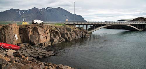
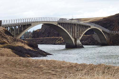
Then the old bridge called Hvítárbrú comes into view. Before the Borgarfjörður causeway was finished in 1983, traffic between Reykjavík and Borgarnes passed over this arched concrete bridge (built in 1928). The bridge has one narrow lane; before driving over, scan the far bank to make sure no one is coming toward you.
From here, follow signs for Reykholt, continuing along highway 510 and then turning left (north) onto highway 50. Along the way, you’ll pass Fossatún (with the recommended Rock ’n’ Troll restaurant and a fun troll-themed walking trail). Just after the greenhouse village of Kleppjárnsreykir, near the junction of highways 50 and 518, turn left to stay on highway 50. After a minute or two, turn left at the signs for Deildartunguhver and Krauma.
Easier Route, via Highway 1 and Highway 50 (35 minutes): The simplest route is to drive north from Borgarnes about 20 minutes along highway 1 to the junction with highway 50 at the Orkan gas station; turn right there and drive 15 minutes until you see the small turnoff to the right marked Deildartunguhver and Krauma.
REYKHOLT VALLEY TO REYKJAVÍK
To head back south to Reykjavík, you have two choices. Off-season, or in doubtful weather, play it safe and loop back south along highway 50 to return the way you came: on highway 1 and through the tunnel (about 1.5 hours).
In decent weather (generally May-Sept), and especially if you plan to visit the Hvammsvík Hot Springs, I’d take the scenic route back to Reykjavík, traveling down highways 50 and 520 via the Dragháls pass and Hvalfjörður (2 hours to Reykjavík). From Reykholt, this adds about 30 minutes of driving to your trip plus time at the hot springs (I’d allow up to two hours there). The route has some unpaved stretches and potholes (including a gravel pass that rises to several hundred feet above sea level). But the payoff is its many fine views and a chance to get off the beaten track (more so than other day-trip destinations from Reykjavík).
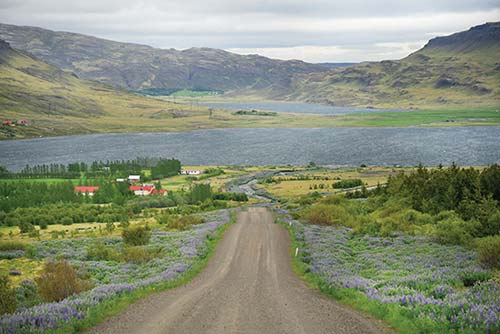
• From Reykholt, drive south on highway 50, then turn off onto gravel highway 520.
This road parallels Skorradalsvatn, a good fishing lake where you’ll see many summer cottages. Then it climbs over the low Dragháls pass to the east of the Hafnarfjall mountain system. Skirting a couple of small lakes, the road ultimately descends to Hvalfjörður, which you traversed earlier by undersea tunnel.
• Where the road tees, you’ll hit paved highway 47. Turn left, passing a tiny gas station (called Ferstikla) with a café that may be open in summer.
Take highway 47 all the way around the fjord. After about five minutes, you’ll pass the old Allied naval installation at Miðsandur (the only signpost you’ll see reads Hjálmsstaðir). The Nissen huts and camp here are Iceland’s best-preserved WWII-era buildings. The fjord here is quite deep. As the oil tanks on the far hillside suggest, this was a refueling station for ships, especially those traveling from North America to Murmansk in northern Russia. They could dock at two piers on either side of the camp.
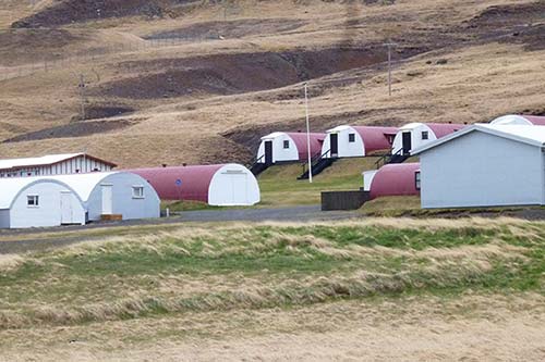
After the war, the naval station was converted into a whale-processing facility. Until recently, slaughtered whales were still brought ashore at the eastern pier and processed in the buildings against the hillside. But the future of the station is unclear; local animal-rights activists are calling for the end of whaling practices (see here for more on this controversy).
Highway 47 reaches the east end of the fjord and begins doubling back along its south shore (a small road here leads to the beginning of a challenging two-hour hike to a high, pretty waterfall called Glymur). Before long you’ll spot the fine Fossá waterfall (with a tiny, old stone sheep pen next it).
• After Fossá, look for the turnoff on the right for the idyllic...
▲▲Hvammsvík Hot Springs
The site of a British naval base during World War II, this tranquil fjordside spot has been transformed into a geothermal bath experience that feels both luxurious and rustic. Its eight shallow rock pools (of varying temperatures) are staggered along a quiet beach surrounded by breathtaking fjord scenery. You’ll soak among locals here on the idyllic Hvalfjörður (Whale Fjord), where a “cold plunge” means jumping into the fjord. The pools are small and intimate, and though it’s pricey, you’re paying for the ambience. With comfortable changing rooms, few crowds, a swim-up bar, and a piping-hot steam room, this place is made for unwinding. Reservations are a must; weekends and evenings are busiest.
Cost and Hours: 9,900 ISK if booked far in advance, more on weekends and for last-minute bookings, no kids under 10, daily 10:00-22:00, last entry at 20:30, towels and water shoes for rent, great café on-site, off highway 47, +354 510 5900, https://hvammsvik.com.
Getting There: If you’re not doing the whole Reykholt Valley loop, it’s an easy 50-minute drive to the hot springs from Reykjavík. Take highway 1 toward Borgarnes/Akureyri. Just before reaching the Hvalfjörður tunnel, turn right onto highway 47 and drive 20 minutes (about 12 miles) until you see the Hvammsvík sign on your left.
Visiting the Hot Springs: Towels are not free here, so bring your own or rent one on-site. It’s also smart to bring flip-flops or waterproof shoes (or rent some here), as the paths between pools can be rocky. A map of the pools is posted at the exit of the changing rooms as you head out to the springs. The small, circular pool to the far left is the original hot spring—and the hottest of the eight pools. Hop around from pool to pool to find your perfect temperature. (If you’re feeling brave, you can dip into the frigid fjord.)
• As you head back south along highway 47, you’ll pass the low and beautiful Laxá waterfall, and unless it’s fogged in, you’ll be able to spot the metal smelters at Grundartangi across the fjord. After about 35 minutes, you’ll wind back to highway 1 near the south entrance of the Hvalfjörður tunnel and turn toward Reykjavík, another 30 minutes away.
Borgarnes
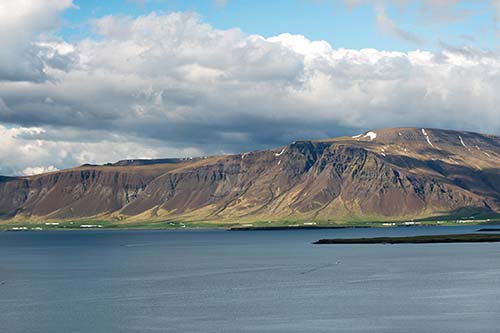
A pleasant town of approximately 2,000 people about an hour from Reykjavík, Borgarnes (BOHR-gahr-NESS) is the main hub of West Iceland. The town is set on a rocky peninsula jutting out into the estuary formed by the region’s several rivers, which merge near here. A bridge and causeway built in the early 1980s cross the mouth of the estuary. Across the water from town, Hafnarfjall mountain—with its steep scree slopes—is an impressive sight.
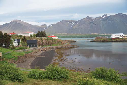
Borgarnes was an important spot in the earliest days of Icelandic settlement. According to the sagas, this area was home to the early settler Skalla-Grímur Kveldúlfsson (Grímur the Bald). After a bloody feud with Norwegian King Harald Fairhair, Skalla-Grímur fled Norway and sailed to Iceland. His father died on the journey, and—following Viking custom—Skalla-Grímur dropped his casket in the sea, then built his settlement where it washed ashore...at a place now called Borg, on the outskirts of Borgarnes. Skalla-Grímur lived out his days there, where he raised his son Egill Skallagrímsson. An even more dynamic figure than his father, Egill was ugly and passionate—equal parts battler and bard—and the protagonist of some of Iceland’s most colorful Settlement Age stories (now recounted in the town’s Settlement Center).
Arrival in Borgarnes: As you cross the causeway, you’ll pass the recommended Geira Bakery (Geirabakarí; on the left by the Bónus supermarket). Just beyond, at the town’s main junction, the N1 gas station also houses a free WC, the town’s bus station, and an overpriced café and convenience store. Next door is a Nettó supermarket, with a Lyfja pharmacy (Mon-Fri 10:00-18:00, Sat until 14:00, closed Sun, +354 437 1168). Between the supermarket and gas station, look for the Ljómalind craft store, which doubles as a small TI with maps, brochures, and friendly staff (daily 10:00-18:00, www.west.is).
Turn left off highway 1 to reach the old part of town. There’s parking at the small park on your right and a few more minutes down the road at the Settlement Center.
Sights in Borgarnes
▲Borgarnes Town Orientation
Get your bearings with this town orientation, either on foot or as you drive through. Start from the small park at the top of the old town called Skallagrímsgarður (Park of Grímur the Bald), with a few picnic tables. The park is on the site of a burial mound thought to be Skalla-Grímur’s tomb. Down the side street next to the park (to the right from the main road) is Borgarnes’ good, large, outdoor swimming pool, which has fine sea views.
Continue a little farther down the main road. If you were to turn left on Bjarnarbraut, you’d find Borgarnes’ local library and a modest museum, with rotating exhibits and sweeping views (Bjarnarbraut 4—look for a big red building, +354 433 7200, www.safnahus.is).
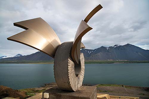
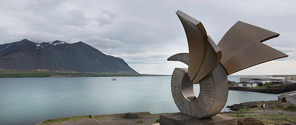
Just past Bjarnarbraut, look left to the modern hilltop monument called Brákin, which resembles a giant wheel with wings. It’s an easy walk up to the sculpture, from where nice views unfold over the town, estuary, and Hafnarfjall mountain. The monument honors Egill’s nanny and de facto mother, a Celtic woman named Þorgerður Brák. According to the sagas, when an adolescent Egill angered his father during a game, Skalla-Grímur was about to beat the boy...likely to death. Brák stood up to Skalla-Grímur, who—now completely forgetting his son and furious with his servant—chased her to the end of the peninsula here, where she leapt into the water and tried to swim to the island just offshore. Skalla-Grímur threw a giant stone at Brák, killing her. Today the channel between the monument and the island is still known as Brákarsund.
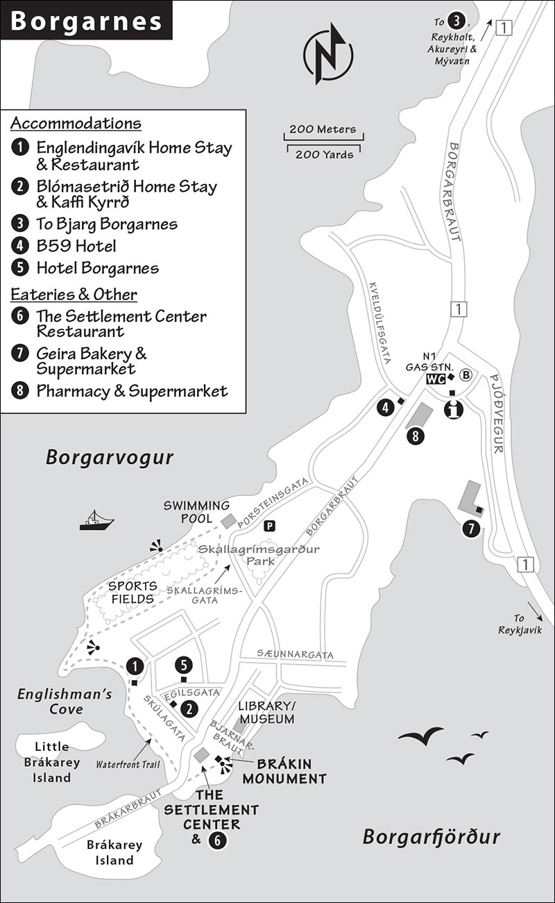
Tucked under the monument’s hill is the Settlement Center (described below). Their recommended restaurant (one of the town’s best) is in a house next door.
The road now crosses a bridge to the little island of Brákarey, home to Borgarnes’s tiny harbor. Borgarnes is one of a very few coastal towns in Iceland that did not form as a fishing center, and it remains home to a mix of services and light industry.
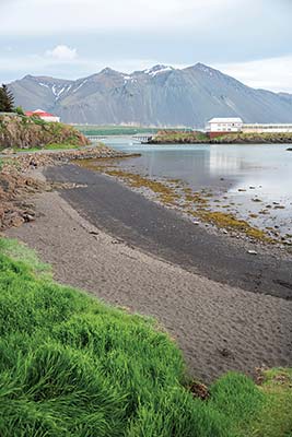
Just before the bridge, look for access to a pleasant waterfront trail. The path arcs around Englishmen’s Cove (Englendingavík) on the sleepy back side of the peninsula, where Englishmen reportedly lived during the Middle Ages. After passing a nice beach (and a recommended hotel/restaurant), the trail eventually leads to the town’s playing fields and swimming pool. From here, you’ll enjoy glorious views of the island and the mountains beyond.
▲Settlement Center (Landnámssetur)
This modest, thoughtfully presented sight is Borgarnes’ best-known attraction and one of the prime places in Iceland to learn about the Settlement Age; for history buffs, it’s worth ▲▲. The center has two exhibits: one explaining how Iceland was discovered and settled, and the other retelling the grisly Egill’s Saga, which took place in and around Borgarnes. Each takes 30 minutes to see with separate, essential audioguides.
Cost and Hours: 3,500 ISK, includes both audioguides, daily 10:00-21:00, Brákarbraut 13, Borgarnes, +354 437 1600, www.landnam.is.
Visiting the Museum: Begin with the interactive exhibit that ponders why and how Viking Age settlers first came to Iceland. As you listen to the audioguide, you’ll press buttons to light up the locations where settlers first arrived and carved farmsteads out of the wilderness, and stand on a Viking ship’s prow as it rocks back and forth on the waves. It’s thought that the ships could cross from Norway to Iceland in under 72 hours. Arriving in Iceland, the first settlers found a land with forested birch valleys and scrubby willows along the coast. The woodlands that covered over a third of Iceland’s land area were cleared to make way for fields and grazing lands for sheep. A cooling climate and overgrazing made it difficult for the trees to regenerate, resulting in the nearly treeless land we see today.
The other exhibition illustrates Egill’s Saga, with interesting wooden figures and carvings by local artist Aðalheiður Eysteinsdóttir. Egill (c. 904-995) was a poet-warrior, mixing brutishness and sensitivity, who got into all sorts of trouble in both Iceland and Norway. He feuded with the king of Norway, wrangled with a witch, and married his foster sister (and brother’s widow). After two of his sons died, Egill composed Sonatorrek, a moving lament that is among the most famous examples of Old Norse poetry. By the age of 80, Egill—now a sour old man—toyed with the idea of throwing his wealth of silver pieces into the assembled crowds at Þingvellir, simply to start a riot. Instead, like his father before him, he buried his treasure somewhere in the Borgarnes area...where today, some people still look for it. For more on Egill’s story—and the rest of the sagas—see here.
Sleeping in Borgarnes
If you can, stay in one of Borgarnes’ affordable B&Bs; the first two are right in the center. In a pinch, the town has a few pricey business-class hotels.
$$ Englendingavík Home Stay sits atop its recommended restaurant in a renovated 1880s-era building just steps from Englishmen’s Cove. They offer nine comfortable rooms, some with private bath (family rooms, rooms with shared bath have kitchen access, Skúlagata 17, +354 555 1400, www.englendingavik.is/rooms [URL inactive], info@englendingavik.is, owner Margrét Rósa). Those nostalgic for antique toys should ask to see the attached Sofia’s Toy Museum.
$$ Blómasetrið Home Stay, run by charming Svava and her family, surrounds the recommended Kaffi Kyrrð café, offering a peaceful, homey oasis in this already relaxed town. The many rooms are spread across two buildings and decorated with modern, cheery touches—and some offer water views (family rooms, some rooms with shared baths and shared kitchens, Skúlagata 13-15, +354 437 1878, www.blomasetrid.is, blomasetrid@blomasetrid.is).
$$ Bjarg Borgarnes, tucked away just a few minutes north of town, has a cozy cabin ambience. Sitting on the edge of the estuary with striking views of Hafnarfjall, it feels a world away. Owner Heidur grew up here when it was a farm and has since added modern touches while retaining the place’s rustic character (one room with private bath, other rooms have shared bath and kitchens, family room with full kitchen, excellent breakfast with homemade jams, +354 437 1925, bjarg@simnet.is; book via email, phone, or www.heyiceland.is).
Other Options: These are all $$$$ business-class hotels: B59 Hotel, across from the Nettó supermarket, is an upscale place with 81 rooms (some with views), a bar, and a basement spa (family rooms, Borgarbraut 59, +354 419 5959, www.b59hotel.is, info@b59hotel.is). Hotel Borgarnes is a few blocks from the Settlement Center (+354 437 1119, www.hotelborgarnes.is); Hotel Hamar is on a pleasant golf course just off highway 1 north of town (see the “Borgarnes and Reykholt Valley” map on here, +354 433 6600, www.hotelhamar.is, hamar@hotelhamar.is).
Eating in Borgarnes
$$ The Settlement Center has the most appealing restaurant in town (in a house next to the exhibit). You can eat here even if you don’t visit the museum itself. At lunch, they offer a good-value vegetarian buffet (daily until 15:00). It’s a substantial spread—soup, salads, pasta and potato dishes, and fresh fruit. At dinner, the restaurant has affordable main courses (restaurant open daily, same contact info as museum).
$$$ Englendingavík (Englishmen’s Cove) has an eclectic country-home feeling, with classy antique decor and a few outdoor tables that overlook the beachy cove. It’s pricey by local standards, but the food is high quality and the setting is scenic (daily, dinner reservations recommended, Skúlagata 17, +354 555 1400, www.englendingavik.is).
$ Kaffi Kyrrð (Tranquility), just up a side street from the Settlement Center, is the place to settle into the town’s slow pace. Grab a cake and coffee and relax among a quirky mix of plants, buddhas of every size, and kitsch from the owner’s travels. On a nice day, the back patio is ideal for a lingering lunch (long hours daily, Skúlagata 13).
$ Geira Bakery (Geirabakarí), the first building on the Borgarnes side of the causeway, serves all manner of pastries and budget lunches—soup with bread, sandwiches, and the like—and has tables with views of Hafnarfjall and the water. It’s a great place to gather a picnic lunch before heading north (daily until 16:30, Digranesgata 6—look for the gray building next to the Bónus supermarket, +354 437 2020).
Grábrók Crater
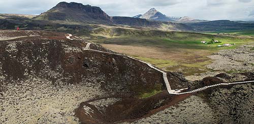
A half-hour north of Borgarnes, highway 1 curls around the pint-sized volcanic cone of Grábrók (GRAU-brohk, literally “Graypants”). In good weather, hiking up to its rim is easy, fun, and worth ▲▲.
Watch for the free parking lot on the left, just after you pass the crater (no WCs but small café just before the parking lot has WCs for customers). From there, wooden steps and boardwalks lead up to the rim. You can climb to the top in about 15 minutes, and—if it’s not too windy—stroll the gravel path that circles the crater rim, which takes about 10 minutes.
Grábrók was formed in an eruption about 3,200 years ago—around the time of the ancient Egyptians. The beautiful lava field that you drive through just before reaching Grábrók flowed out in the same eruption. A thick layer of moss and lichen has grown on top of the lava, changing color with the seasons.
From the top, enjoy stunning panoramas of the crater and the surrounding area. The classically conical mountain to the north, formed 3.4 million years ago, is called Baula (BOY-la, which means “to moo”). Closer in, to the northwest, is a sinister, heavy-browed ridge called Hraunsnefsöxl. To the west, away from the road, is a second, similar-sized crater called Grábrókarfell. A third crater, Litla-Grábrók, was mined for gravel and is hard to make out. To the south (toward Borgarnes) is the campus of Bifröst, a small college originally founded to train managers for Iceland’s network of cooperative stores (and here I was hoping to find the Bifröst of the sagas: the rainbow bridge leading to Asgard, home to the Nordic gods).
Just past Bifröst is Hreðavatn, a pretty lake with a managed forest at the far end. In the valley around you are both working farms and summer houses, some of them quite lavish.
As you descend Grábrók, look down along the slope to your left. You’ll see an odd stone structure with many compartments, which at first glance looks to be an ancient ruin. It’s actually a set of drystone pens built to hold sheep rounded up each fall, and it’s still in occasional use (it’s called Brekkurétt; rétt is the word for a sheep pen). You can walk through it if you’d like. If you continue farther north on the Ring Road, you’ll pass more elaborate modern pens.
If you haven’t packed a picnic, your only lunch option in this area is at the Hraunsnef country hotel (see next).
Sleeping and Eating near Grábrók: A half-mile before Grábrók, the $$$ Hotel Bifröst, set in a tiny university hamlet, has turned an old dorm building into 50 simple rooms with modern touches. Many rooms have lava field views; others have crater views. The swanky lobby bar also serves dinner (family rooms, +354 433 3030, www.hotelbifrost.is, info@hotelbifrost.is).
A couple of minutes past Grábrók crater, $$ Hraunsnef (Lava Nose) country hotel is a working farm with cottages, a classy valley-view restaurant, and 15 straightforward rooms in various unassuming buildings. As it’s located just before the pass to the north, this place works well for those headed around the Ring Road. The hotel’s excellent $$$ restaurant offers affordable lunches and pricey dinners (daily, +354 435 0111, www.hraunsnef.is, hraunsnef@hraunsnef.is).
Reykholt and Nearby
These sights, listed roughly in order from west to east, fill the broad, sparsely populated valley of the Hvítá (White River), which flows from the Eiríksjökull glacier and empties into the estuary near Borgarnes. Fitting everything into a single day is doable but challenging; you’re better off being selective. As you drive, count the sheep and horses sprinkled across the pastures between red-roofed farmsteads.
Book Ahead: If you’re staying overnight nearby, consider planning your day to finish with a soak at the Krauma Geothermal Nature Baths (book at least a day in advance). You’ll also need to book ahead by a day or more for the Víðgelmir lava tube.
▲Deildartunguhver Hot Springs
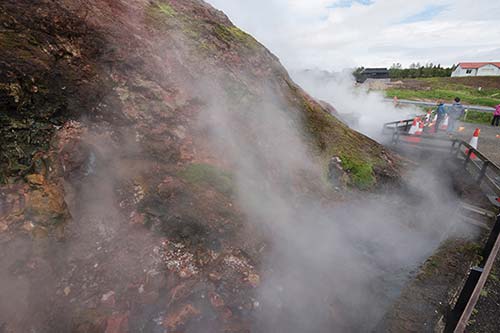
Located off highway 50 near Reykholt, Europe’s most powerful hot spring gushes out almost 50 gallons of boiling water per second. You’ll see steaming fountains of hot water spurting up next to a colorful rock face. Signs warn you not to touch the water. The beige concrete building is a pumping station that sends the 200°F water to Borgarnes and Akranes for home heating and bathing. The water cools naturally to about 170°F by the time it reaches Borgarnes (where it’s mixed with cooler water for your shower). You’ll see an honor box where you might find tomatoes and other vegetables (grown in the adjacent greenhouses) for sale. There’s also a small food truck selling simple fare.
▲Krauma Geothermal Nature Baths
If you’re looking to soak amidst an Icelandic Zen garden, go no further. This spa-like bath, sharing a parking lot (and water source) with the hot springs, is uncrowded and peaceful. Limited to 100 bathers at a time, the goal here is relaxation. Melt into the five warm pools and two steam baths, order a poolside drink, get your blood going in the cold plunge, and linger before the fire in the small relaxation room as you watch the boiling bubbles below. The upscale on-site restaurant serves dishes prepared with local vegetables (some grown in hothouses warmed by the springs) and meat from the nearby Háafell goat farm.
Cost and Hours: 5,900 ISK, towel rental-1,000 ISK, daily 11:00-21:00, book at least a day in advance in summer for baths and restaurant, +354 555 6066, www.krauma.is.
Reykholt
Reykholt, set bucolically in the center of the valley, is home to a historic church and a medieval research center; those excited about medieval Iceland and the sagas rate it ▲.
For 35 years, Reykholt was the home of Snorri Sturluson (1179-1241)—one of the most prominent figures of Iceland’s post-Settlement Age. A poet, historian, and politician, Snorri wrote some of the famous sagas, including—possibly—the locally set Egill’s Saga. Snorri also chronicled all of medieval Scandinavia: He wrote Gylfaginning, about the pantheon of Norse gods, and Heimskringla, the earliest and most definitive history of Norwegian kings. Snorri served two terms as the Alþingi’s law speaker and hobnobbed with the king of Norway. In fact, his support of continued union with Norway made him plenty of enemies—enemies who killed him in a surprise attack, right here at Reykholt. To this day, Snorri is arguably more popular among Norwegians (whose history he chronicled) than Icelanders; the statue of him in Reykholt was created by Norway’s top sculptor, Gustav Vigeland.
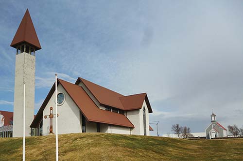
Reykholt has two handsome churches, one small and traditional from the 1880s (free), the other large and modern from the 1990s (not open to the public). Under the modern church is the one-room Snorri’s Saga exhibition (Snorrastofa). It’s a bit dry but worth a visit on a rainy day. Use the impressive included audioguide or download the free app guide (search “Snorri” in your app store); the latter covers both the exhibit and the surrounding area (1,700 ISK, includes audioguide, daily 10:00-17:00, Sept-April closed Sat-Sun, +354 433 8000, www.snorrastofa.is). The exhibit is the work of Reykholt’s well-regarded Snorrastofa research center; scholars come on retreats here to write and use the center’s fine library.
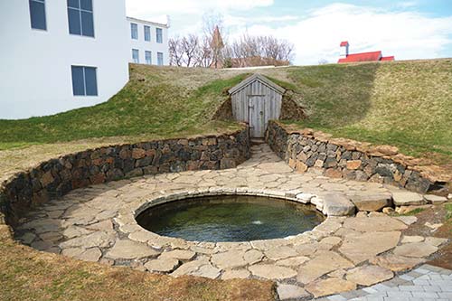
The little outdoor hot pool, Snorralaug (Snorri’s Pool), isn’t open for bathing, but it’s been here since the 10th century (it’s even mentioned in the sagas). Look for it behind the old school building, and open the wooden door in the hillside behind the pool to see the first few feet of a tunnel. This may have led to the cellar of a now-vanished building that was part of the complex in Snorri’s day. (Such tunnels were typical at the time, and there’s a similar one at Skálholt, along the Golden Circle.) As you circle the school, you’ll see the footprint of what may have been Snorri’s home.
Several tree-sheltered picnic benches in Reykholt beckon on a nice day. At the back of the Snorralaug complex is the sleek and modern Fosshotel Reykholt, with a pricey $$$ restaurant (dinner only).
Sleeping near Reykholt: About 10 miles east of Reykholt, at the valley’s crossroads, is $$ Hótel Á (River). It’s an endearingly rural option run by a local farming family. Perched on a ridge overlooking the wide river valley are 25 surprisingly modern rooms with private baths (family room, pricey dinner available for guests, Kirkjuból 2, Reykholt, +354 435 1430, www.hotela.is, hotela@hotela.is, Raggi).
$ Fossatún (Waterfall Field) is a fun little compound along highway 50 between Borgarnes and Reykholt, just where the road crosses a small river, with a nice view over its little “troll” falls. They have 12 modern rooms with private bath in the sod-roofed hotel/restaurant, 30 heated wood-clad “glamping pods” (of various sizes) that share bathrooms and a kitchen, and a cottage with a kitchen. It’s the perfect place for families: There’s a minigolf course, a fun “troll trail” behind the compound with large troll statues, and a cozy room where guests can select the music each night from an extensive record collection (15 minutes from Reykholt, bedding and towels available for pods, hot tubs, +354 433 5800, www.fossatun.is, info@fossatun.is). The place was opened by musician and writer Steinar Berg, author of the Icelandic children’s book The Last Troll, and is now run by his son Palli. The attached $$ Rock ’n’ Troll restaurant has good soups and view seating opposite the falls (daily for dinner only). A café in the reception area serves light lunches.
▲▲Hraunfossar and Barnafoss Waterfalls
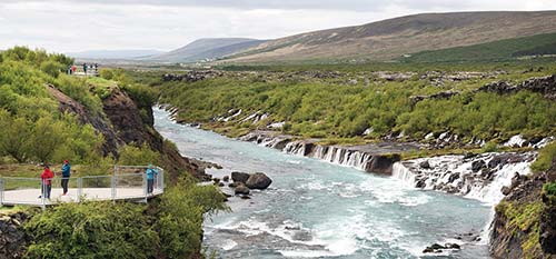
These two waterfalls are a 15-minute drive up the valley from Reykholt along highway 518. They’re free and easy to see—just a few minutes’ walk from your car (free parking).
The main river running through the valley here is called the Hvítá (White River). As you approach the falls, you’ll see that the upper part of the valley is covered by relatively new lava. Because new lava is porous, streams often sink below and flow beneath the surface of lava fields for considerable distances. At the serene Hraunfossar (Lava Waterfalls), you’ll look across the river and see rivulets of groundwater pouring out from under the striped layers of lava on the other side and falling into the stream, like many bridal veils.
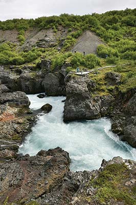
A hundred yards upstream is the rapid-running Barnafoss, a more typical waterfall on the main stream. The name means “children’s waterfall,” and you can see what looks like the remains of a natural bridge spanning the falls here. According to legend, two children who were supposed to stay home while their parents were at church went out to play instead and drowned when they fell off the bridge; the mother destroyed the bridge so no other children would meet such a tragic fate. A pedestrian bridge over the river offers a closer look at the falls.
Eating at the Falls: By the waterfall parking lot is a small, basic $ café with soup, burgers, snacks, ice cream, and coffee (and a free WC for customers).
Húsafell
About 10 minutes past Hraunfossar and Barnafoss, the little hamlet Húsafell boasts a fancy hotel, campground, vacation cottages (popular with Icelanders), and a variety of eateries (from a swanky dining room to a basic café/shop). This area is the departure point for glacier tours to Langjökull (described later) and a handful of other outdoor activities. The main attraction here is Húsafell’s surprisingly extensive thermal swimming pool, with multiple outdoor pools and a waterslide. It’s the most affordable option for a premium bath in this part of Iceland (3,800 ISK, 1,500 ISK for kids 10-16, free for kids 8 and under, daily 11:00-20:00, www.husafell.is).
▲Víðgelmir Lava Tube
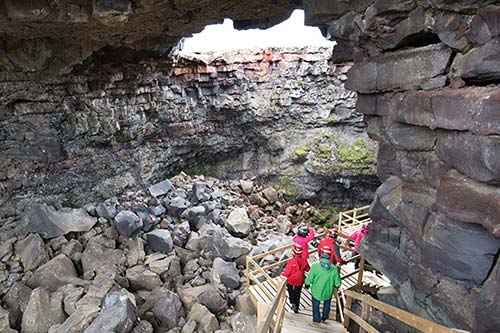
About 15 minutes past Húsafell, you’ll reach Víðgelmir (VEETHE-GHELL-meer)—marketed and well signed as simply “The Cave”—a lava tube formed about a thousand years ago by an eruption in the Langjökull volcano system. The top of a river of lava cooled and crusted over, enclosing the molten part underground. When the lava stopped flowing under the cooled surface, it left behind a hollow, mile-long, tube-like corridor, now below ground level. Today visitors can take a 1.5-hour guided walk through the lava tube and ogle its unusual formations: tubular lava stalactites shaped like strands of spaghetti, and formations that look like melted chocolate. While Víðgelmir requires a decent commitment of time and money, it’s worth considering for rock nerds. Dress warmly at any time of year; underground, the temperature hovers right around freezing.
Cost and Hours: 7,500 ISK, 4,500 for kids 7-15, book online at least a day in advance, daily tours run hourly in summer 9:00-18:00, mid-Sept-mid-May generally 5-6/day, +354 783 3600, www.thecave.is.
Visiting the Cave: Check in at the little office, where you’ll be issued a helmet and headlamp. Then you’ll walk across a petrified lava flow 300 yards to a hole formed centuries ago when part of the tube’s roof collapsed. Here you’ll descend 178 steps down a wooden staircase and follow boardwalks through about a half-mile of the mile-long cave. You’ll see multicolored layers of basalt lava, which built up over the course of the long eruption, and get a good, up-close look at some remarkable lava formations. The cave features here are different from those of a limestone cave: The “stalactites” and “stalagmites” weren’t formed over eons by dripping water, but all at once, a thousand years ago, as the liquid lava cooled and hardened. Your guide will point out where they found evidence of humans living here (perhaps a Viking Age outlaw), let you (gently) handle a few samples of the delicate lava formations, and flip off the lights so you can experience total darkness.
▲Háafell Goat Farm
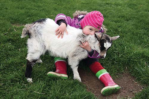
This is a one-family project by Jóhanna Þorvaldsdóttir and her clan, who idealistically set out a few years ago to breed Iceland’s nearly extinct goat stock—descended from animals brought by the first settlers. Now the family invites travelers to visit their rustic farm, meet (and, if you like, cuddle) some adorable baby goats, learn about their work, watch the goats butt heads playfully, and sample (and buy) the wide variety of products they make from their goats: cheese, ice cream, soap and lotions (from tallow), and goat hides. This is a fun, hands-on activity for kids (and goat-loving adults). I consider the cost of admission worthwhile just to keep this Icelandic tradition alive.
Cost and Hours: Guided tour including coffee—1,600 ISK, 850 ISK for kids (of the human variety); June-Aug and possibly May and Sept daily 11:00-18:00, off-season by appointment only; +354 845 2331, www.geitur.is, geitur@geitur.is.
Getting There: The farm is on gravel highway 523 on the north side of the river Hvítá. It’s about a 20-minute drive from Reykholt, or a 30-minute drive on mostly unpaved roads from the Víðgelmir lava tube.
Langjökull Glacier
At the far upper end of the valley, a four-wheel-drive track leads up to the Langjökull glacier—Iceland’s second largest. A pricey tour can get you close to all that ice. Note, though, that you can get close to glaciers more easily and cheaply elsewhere in Iceland (such as Sólheimajökull, on the South Coast).
The Into the Glacier tour takes you into a cave that has been bored into the snow and ice. You’ll meet your tour at Húsafell and board an eight-wheel-drive super truck (a retrofitted former NATO missile-launcher) for the 30-minute ride to the cave, where a guide will lead you around the tunnels. Bundle up—the temperature is generally around freezing (book ahead, 24,900 ISK, generally 3/day at 10:00, 12:30, and 15:00; fewer departures off-season, up to 4 hours total, also possible to combine with snowmobile trip or as an all-day excursion from Reykjavík, +354 578 2550, www.intotheglacier.is).