WESTFJORDS
Vestfirðir
If you wish you’d visited Iceland 15 years ago, when it was still flying under the tourist radar...go to the Westfjords. Way up here, just shy of the Arctic Circle, you’ll find towering bird cliffs, gravel roads over stunning mountain passes, quirky offbeat sights, a proud fishing heritage, and hardscrabble communities squeezed between mountains and fjords—making a go of it on little sandy spits.
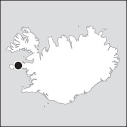
Dangling off the northwest coast of Iceland, the Westfjords feel far from civilization. The area was farmed from early times—in fact, the sagas say that this was where Raven-Flóki set up the first-ever camp on Iceland in 868. But the region was never thickly settled. Still, by the early 20th century, the Westfjords had grown into a thriving fishing center, with about double its current population. Its main town, Ísafjörður, boomed, becoming home to a strong workers’ movement. But as fish processing became more centralized, the area struggled to retain jobs and people. The entire population of this large region (8,600 square miles, a bit bigger than Connecticut) is now about 7,300.
This is an ideal destination for those who want to get a taste of rugged, less-touristed Iceland, but don’t have the time to invest a full week on the Ring Road. And it provides a welcome respite from the whistle-stop “layover” tourism farther south.
Each of this region’s many fjords and mountains has a slightly different character: wide, narrow, deep, sandbar-y, wall-like, broken. Towns occupy the few flat patches—often on a spit of land (eyri) jutting out into the fjord. As the towns grew, newer houses were built on the “main” land—but the closer you build to steep fjord slopes, the more danger there is from avalanches and landslides (though it’s the least volcanic part of Iceland).
The Westfjords are the closest place in Iceland to Greenland—both geographically and in terms of weather. (It’s usually chillier here than in Reykjavík—bundle up!) Prime season is shorter than in other parts of the country: Before early June and after early September, many businesses are closed up tight. Services are sparser here, too, so keep your gas tank full. Iceland’s tourist authorities are determined to develop the Westfjords as the next big “undiscovered” destination. As more roads are paved every year, the 530-mile Westfjords Way loop route is being promoted as a far less busy alternative to the Ring Road (sometimes called Ring Road 2; see www.vestfjardaleidin.is for the official route). Either way, visit soon—before all the short-time visitors decide to extend their trips northward.
GETTING TO THE WESTFJORDS
Depending on how much time you have and what you want to see, consider some combination of the following:
Regular flights link Reykjavík’s downtown airport to Ísafjörður, the peninsula’s largest town, in about 45 minutes. You can pick up a rental car at the Ísafjörður airport, making this an easy way to get a taste of the Westfjords in a hurry.
With more time, drive all the way up from Reykjavík. Allow at least six hours—not counting stops—to drive from downtown Reykjavík to downtown Ísafjörður. You can also head from Reykjavík to the Westfjords’ southernmost peninsulas in about six hours.
A better plan—described next—is to combine the Westfjords with Snæfellsnes, which is connected by ferry to the southern peninsulas (from Stykkishólmur to Brjánslækur). Travel time is similar to driving, but the ferry replaces tedious hours behind the wheel with a relaxed boat ride.
By Ferry from Snæfellsnes (via Flatey)
With no stops, it’s about a 2.5-hour drive from Reykjavík to Stykkishólmur town on the Snæfellsnes Peninsula (see here). From there, the good ship Baldur carries passengers and cars across the vast Breiðafjörður to the dock at Brjánslækur on the Westfjords’ south side (about a 45-minute drive from Patreksfjörður—the main town and home base for the southern peninsulas).
The ferry crossing takes about 2.5-3 hours, including a brief pause at the tiny, flat island of Flatey. It’s smart to book in advance (6,490 ISK/person, plus another 6,490 ISK for the car; typically 2/day in summer, 1/day off-season, check schedule on website; +354 433 2254, www.seatours.is). The Breiðafjörður is somewhat protected, but the ride can still be rough any time of year. Fortunately, the ferry is big, industrial-feeling, and designed to weather the waves.
Optional Flatey Stopover: The teensy, castaway islet of Flatey is a popular side-trip destination from Stykkishólmur (described on here). If you’d like to stop off on Flatey on your way to the Westfjords, ask about the option to leave your car on the ferry, get off in Flatey for a few hours, then hop on the next onward ferry to find your car waiting for you on the other side. This only works during the summer, when there are two daily ferries.
By Car from Reykjavík
It’s a pretty, though rather uneventful, sometimes desolate six-hour drive from Reykjavík to either Ísafjörður or Patreksfjörður. Both options are described below.
Driving from Reykjavík to Ísafjörður
I’ve outlined the only route to the Westfjords that’s well engineered and (almost) fully paved (about 280 miles). You’ll branch off the Ring Road just north of Grábrók and can visit one or two West Iceland sights on the way as part of a day’s drive (for specifics on those see the Borgarnes & Reykholt Valley chapter).
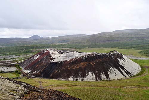
Following highway 1 north from Reykjavík, go through Borgarnes, then, after Grábrók crater—well worth a stop—watch on the left for the turnoff for highway 60.
About 30 minutes farther (about 2 hours from Reykjavík), a turnoff on the right marked Eiríksstaðir leads 5 miles down a good gravel road to the spot that was once home to Erik the Red, before he went off to Greenland. A sod-roofed, Settlement Age longhouse has been reconstructed near the site of his farm. Costumed guides lead tours and explain life in the time of the Vikings (guided tour-2,500 ISK, open May-Sept daily 10:00-16:00, closed off-season, WCs, +354 899 7111, www.eiriksstadir.is).
Just beyond that turnoff, you pull into Búðardalur—a good place for a break, with services and eateries. From Búðardalur, continue north about 30 minutes. After crossing a bridge over Gilsfjörður, continue for about 2.5 miles, then veer right onto highway 61 toward Hólmavík (over the pass called Þröskuldur—literally “Threshold”).
In about 20 minutes, you’ll descend to Steingrímsfjörður. When you hit the fjord, a three-mile detour to the right takes you to a Sheep Farming Museum—a working farm with baby lambs and a good exhibit about this agrarian Icelandic industry (June-Aug daily 10:00-18:00, closed off-season, +354 693 3474).
North along the fjord is Hólmavík (Islet Bay)—the halfway point between Reykjavík and Ísafjörður. Hólmavík has eateries (Restaurant Galdur has a good reputation), a grocery store, and the Museum of Icelandic Sorcery and Witchcraft (Galdrasýning á Ströndum), which explains the real-life history of Iceland’s witch trials, with borrowable English descriptions (daily 11:00-18:00, www.galdrasyning.is). Fill up your tank before leaving town—this is the last real gas station before Ísafjörður, 140 miles away.
Then you cross Steingrímsfjarðarheiði pass (summiting at 1,440 feet) and descend into the Westfjords. From here, you’ll drive highway 61 around five fjords (count ’em)—a scenic but slow approach to the town of Ísafjörður. Each fjord is actually a narrow offshoot of one huge inlet—Iceland’s largest fjord, called Ísafjarðardjúp. The five fjords are mostly unsettled, though you’ll periodically pass a remote farm.
Confusingly, the first fjord you reach is also called Ísafjörður (Ice Fjord). You’ll travel along the narrow Reykjanes cape; at its far end is the old Reykjanes school building. The school (closed in 1995) was built on the site of a hot-water source that has been used since the 1700s to evaporate sea water for salt making; you can stop at the nearby Saltverk shop to learn more (www.saltverk.com). The school building now houses the $$ Hótel Reykjanes, with a casual, reasonably priced restaurant and a swimming pool (also a hostel and campground, www.reykjaneswestfjords.is); if you’re in a pinch, there’s a gas pump.
A bridge spans the next fjord, Mjóifjörður (Narrow Fjord), so you don’t have to drive all the way around it. A remote guesthouse on a farm is nearby: $$ Heydalur—a fine place to overnight if completely escaping civilization is your goal (www.heydalur.is); to reach it, turn left onto road 633 after crossing the bridge and drive seven miles along the fjord. They also have a restaurant, horseback riding, and thermal hot springs filling a rocky pool.
Between the second and third fjords is a farm called Ögur, with a café and car cemetery.
Next up is Skötufjörður (Skate Fjord). Out in the mouth of this fjord is Vigur island—popular with puffin watchers during the summer months, when it’s served by a boat from Ísafjörður.
Before the next fjord is Litlibær, a rustic, turf-roofed farmstead open to visitors. Run by the National Museum of Iceland, its historic interior has been preserved as a fine museum/café (+354 695 5377, http://litlibaer.is).
Next, Hestfjörður (Horse Fjord) is actually two fjords, with the road skipping across a low pass from the main Hestfjörður into the smaller Seyðisfjörður to bypass the strikingly shaped mountain called Hestur (Horse). At Hestfjörður the road narrows to one lane, with passing places marked by M signs.
Finally, you’ll curl around Álftafjörður (Swan Fjord). At its far side is Súðavík (Slopes Bay)—an outpost of Ísafjörður, under a mountain with a distinctively shaped summit and home to the Arctic Fox Center (see here). From here, it’s another 20 minutes into a sixth fjord—Skutulsfjörður (Harpoon Fjord)—where the town of Ísafjörður lies. You made it!
Driving from Reykjavík to the Southern Peninsulas
If your goal is the southern peninsulas, you can drive from highway 1 around Breiðafjörður (about 240 miles). However, be warned that this does involve some unpaved stretches—which makes the Snæfellsnes ferry a tempting alternative.
Start by following the same route described above, until you cross the bridge over Gilsfjörður. Where highway 61 splits off to the right (to Hólmavík), stay on highway 60 (toward Patreksfjörður and Reykhólar). Figure at least 2.5 hours of driving (120 miles, mostly paved) to Patreksfjörður. This is desolate country, with little settlement.
Just a few miles after the highway splits, you’ll reach the turnoff for Reykhólar. It’s nine miles from the main road to this tiny town with a fine spa complex, called Sjávarsmiðjan, with hot pots and seaweed treatments (seaweed is processed in a nearby plant for use in cosmetics, www.sjavarsmidjan.is).
Carrying on beyond the Reykhólar turnoff, it’s a long slog past (and, in some cases, in and out of) eight separate fjords that feed into the gigantic Breiðafjörður. The next interesting point you’ll reach is Flókalundur, named for Raven-Flóki—the original Icelandic settler—and home to a nature preserve. From here, it’s best to turn south on highway 62, which lets you stay on paved roads. You’ll pass through Brjánslækur (where the ferry from Snæfellsnes arrives), then carry onward over the stunning Kleifaheiði pass to Patreksfjörður.
Westfjords Drive
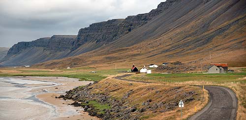
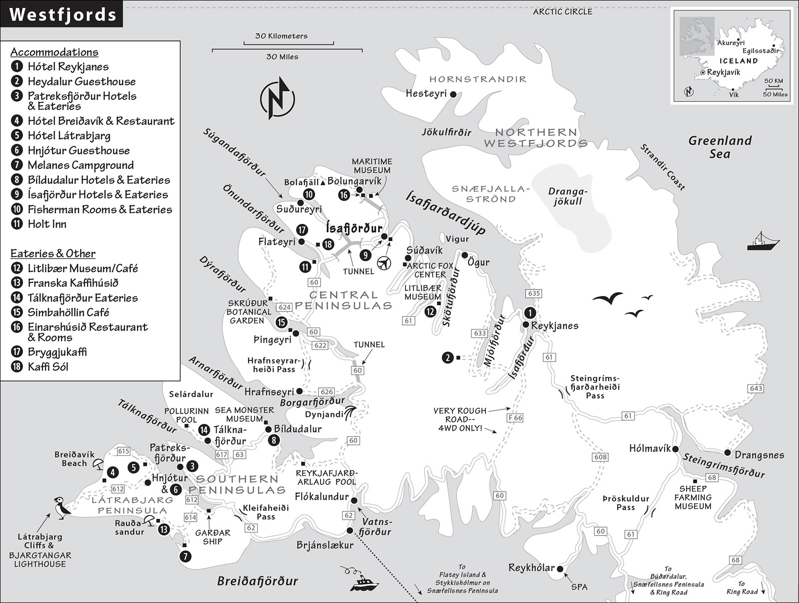
The Westfjords gives you a remote, rugged corner of Iceland with stunning scenery. This huge area is slashed with dozens of fjords, forming a fringe of peninsulas big and small. Mentally, it helps to break the Westfjords down into four main sections (from south to north):
The southern peninsulas, centered around Patreksfjörður, are famous for the rugged Látrabjarg Peninsula and its thrilling bird cliffs.
The central peninsulas—the rugged zone between Patreksfjörður and Ísafjörður—are essentially uninhabited and unpaved. This area, which encompasses the many small inlets of the sprawling Arnarfjörður, is home to spectacular scenery, including the dramatic Dynjandi waterfall.
The Ísafjörður area fans out from the Westfjords’ main town—basically along the southern coast of the huge inlet called Ísafjarðardjúp (djúp means “deep”). This area includes the nearby towns of Flateyri, Suðureyri, Bolungarvík, and Súðavík.
The northern Westfjords are almost entirely unpopulated. The terrain of hardy hikers and campers, this area can be subdivided into Snæfjallaströnd (Snowy Mountain Coast, partly accessible by road), Jökulfirðir (Glacier Fjords, accessible by boat from Ísafjörður in summer), and Hornstrandir (the Arctic-facing coast around Iceland’s “Horn”).
Most visitors focus on the southern peninsulas and/or Ísafjörður area, perhaps taking a quick excursion north to Hornstrandir.
PLANNING YOUR DRIVE
To make the long journey up here worthwhile, the Westfjords deserve at least three days (not counting travel time up and back).
The Westfjords in Three Days or More
Assuming you’re starting in the south and moving north, here’s a good three-day plan. I’ve organized this chapter according to this approach.
Day 1: Patreksfjörður and Látrabjarg (Southern Peninsulas)
Based in Patreksfjörður, use this day for a scenic loop down to the tip of the Látrabjarg Peninsula—with its grand bird cliffs—and back again (total drive time: about 3-4 hours). Bring along a picnic, and take a detour to the Rauðasandur beach, ideally at low tide (check tide tables before heading out). Relax this evening in Patreksfjörður, with a dip at the town’s exceptional fjord-view swimming pool.
Day 2: Patreksfjörður to Ísafjörður, via the Central Peninsulas
Today’s your long, super-scenic driving day (pray for good weather; figure 3-4 hours on the road, not counting stops). Head north from Patreksfjörður and follow the fjords until the pavement runs out—then keep going, over rutted roads and through remote countryside. Stop at fjordside villages, remote hot pots, and scenic viewpoints that strike your fancy. If you’re dawdling, have a fish-and-chips lunch in Bíldudalur; if you get an early start, do a picnic lunch at the spectacular Dynjandi waterfall, or a late bowl of soup at the Simbahöllin café in Þingeyri. Arriving this evening in the Ísafjörður area, settle in, and have a celebratory fish feast at the recommended Tjöruhúsið restaurant (book ahead).
Day 3: Ísafjörður Area
Divide your time today between the humble sights in Ísafjörður itself, and side-tripping to your choice of nearby villages and sights: Arctic Fox Center in Súðavík, historic fishing station at Ósvör Maritime Museum in Bolungarvík, or historic bookstore in Flateyri. Or, if you’re feeling adventurous and the weather’s good, take an excursion up to the remote Hornstrandir peninsula or (closer) to Vigur island. To be super efficient, consider flying home to Reykjavík this evening.
Extra Overnight: To see it all and flex with the weather, spend another day in the Ísafjörður area.
Itinerary Considerations and Strategies
There is a bewildering number of ways to fit the Westfjords into your itinerary. Here are some alternatives and tips to consider:
Combine with Snæfellsnes: Thanks to the handy Stykkishólmur-to-Brjánslækur ferry connection, the Westfjords are made to order to combine with the Snæfellsnes Peninsula. Spend a day or two doing Snæfellsnes, then take the ferry up to embark on my three-day plan, then head from Ísafjörður back to Reykjavík (by car or plane).
Combine with Ring Road: If you have plenty of time, splice in the Westfjords near the start of your Ring Road drive—as a very long detour between Borgarnes and Skagafjörður.
Reverse the Loop: While I’ve narrated the Westfjords loop in a clockwise direction, you could reverse it—starting in Ísafjörður, then working your way down to Patreksfjörður.
Ísafjörður Express Trip: Fly in and out of Ísafjörður’s airport (from Reykjavík’s downtown airport) for a day or two, and focus on that part of the Westfjords. You could even day-trip south along the central peninsulas as far as the Dynjandi waterfall (about 50 minutes each way).
One-Way Car Rental: For efficiency, consider a one-way car rental—for example, pick up your car in Reykjavík, drive up via Snæfellsnes and the Westfjords, and drop your car in Ísafjörður to fly back to Reykjavík.
More Westfjords Tips
Tourist Information: Spend time with the region’s excellent, informative website—Westfjords.is—as you plan your trip. Vestfjardaleidin.is is the region’s official Westfjord Way resource, with route details, tips, and sight suggestions for making the most of this driving loop.
When to Go (and When Not to Go): The remote Westfjords have a very short tourist season. Prime time is exactly three months: from June 1 until August 31. (As one local told me, “Once the puffins leave...so do the tourists!”) You have a week or two of buffer on either end, when most (but not all) businesses are still open. But before mid-May or after mid-September, expect most of what I’ve described in this chapter to be closed up tight. I’d skip this region off-season.
Two- or Four-Wheel Drive?: The Westfjords are the one destination covered in this book where you won’t regret having a four-wheel-drive vehicle. More roads are being paved here each year, but you’ll still encounter gravel roads (visit Road.is for an up-to-date map showing which routes are paved and unpaved). The unpaved roads are doable (slowly) with a two-wheel-drive car, but a four-wheel-drive and/or a bigger, higher-clearance vehicle is worth considering if you’re concerned (and it’ll give you more confidence). For an overview on driving in Iceland—including common road hazards and a map with driving times—see the “Driving” section of the Practicalities chapter.
Fuel: Gas stations are few and far between, and many are unstaffed. It may be wise to invest in an N1 prepaid gas card if you have any concerns about your credit card being accepted. Given the scarcity of fueling opportunities, top your tank off any chance you get.
WCs: Toilets are relatively rare between towns. Keep an eye out for remote countryside hotels or restaurants, some of which may charge a small fee for using the WC (unless you buy something). Remember the old adage: Go when you can...not when you have to.
The Southern Peninsulas
The lonesome southern peninsulas—anchored by the teensy town of Patreksfjörður—offer a dramatic taste of the Westfjords. While the villages are humble and many roads are unpaved, this is an ideal spot to disconnect from civilization and commune with Icelandic nature. The big draw here is the Látrabjarg bird cliffs—one of the most spectacular natural sights in a country that’s famous for them.
BRJÁNSLÆKUR TO PATREKSFJÖRÐUR
The ferry from Snæfellsnes arrives at Brjánslækur, on Vatnsfjörður, which is essentially just a ferry dock. From here, it’s about a 45-minute drive to Patreksfjörður (all paved; just turn left onto highway 62 and follow it all the way to town).
Near Brjánslækur: Before heading to Patreksfjörður, consider a quick detour to a sight a few minutes’ drive north of the ferry dock. According to the sagas, it was here—along Vatnsfjörður—that Raven-Flóki finally made it to Iceland at the conclusion of his long oversea journey from Norway, following a raven on the final stretch. Laying eyes on an iceberg-filled fjord, he dubbed this place “Ice-land.” Today Vatnsfjörður is a nature reserve. The adjacent village is named Flókalundur—for Raven-Flóki. Along the road, watch for signs to Hellulaug, a pleasant natural thermal pool overlooking the fjord (open 24 hours). The village also has a campground with bungalows (www.flokalundur.is).
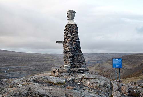
Onward to Patreksfjörður: This drive comes with a glorious introduction to Westfjords scenery. First you’ll hug the shoreline, past lovely coves and looming mountains. Then you’ll begin to gain altitude as you climb over the pass called Kleifaheiði before dropping down into Patreksfjörður. At the summit (1,325 feet), you pass a stony monument that seems to honor some great Viking Age warrior. In fact, this is simply part of a local tradition of road crews building a “stone man” upon completing a difficult project—and this road, when completed in 1947, was quite an accomplishment.
Patreksfjörður
Patreksfjörður (pop. 675) doesn’t have a lot of charm—but fortunately, it doesn’t need it. While workaday, it’s tidy and scenically set, with just enough tourist services and an exceptionally nice thermal swimming pool, to boot. Like all Westfjords towns, Patreksfjörður is squeezed between its steep mountain and the waters of its fjord, with more buildings filling a spit that sticks out into the water. The town’s name honors a Scottish bishop who provided spiritual guidance to one of this area’s original settlers—a reminder of the often-forgotten Celtic influence in the settlement of Iceland.
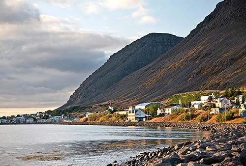
Orientation: Most hotels and services line up either along the main road into town (Strandgata), or on a higher, parallel road just above (Aðalstræti). The “town center,” on the spit, is quieter—home only to the TI and grocery store, and lots of nondescript houses and warehouses.
Tourist Information: The TI, operated by Westfjords Adventures, a private tour company, hands out free maps and brochures, and offers helpful advice for independent travelers in addition to selling their own tours (Mon-Fri 8:30-16:30, Sat-Sun 10:00-12:00; off-season shorter hours and closed Sat-Sun; Þórsgata 8a, +354 456 5006). Their excursions include trips to the Látrabjarg bird cliffs, Rauðasandur beach, and Dynjandi waterfall, plus boat trips (fishing, kayaking, whale watching) and super-jeep tours (for options, see www.wa.is).
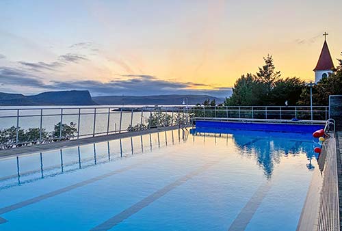
Sights: The town’s fine, modern swimming pool (Íþróttamiðstöðin Brattahlíð) is one of the nicest small-town pools you’ll find—worth ▲▲. With a lap pool, a shallow simmer pool, two hot pools, and a sauna, it fills a glassed-in terrace overlooking the fjord, with grand views from hot water. If you’ve yet to sample an Icelandic swimming pool, give this one a try (1,200 ISK, mid-June-Aug Mon-Thu 8:00-21:30, Fri until 20:30, Sat-Sun 10:00-18:00, just before the church on the upper road through town, Aðalstræti 55, +354 450 2350).
Sleeping in Patreksfjörður: $$$ Fosshotel Westfjords, at the entrance to town, is the biggest option, with 40 rooms (breakfast extra, Aðalstræti 100, +354 456 2004, www.islandshotel.is, vestfirdir@fosshotel.is). $$$ Hotel West, filling a modern building between the lower and upper roads, has 18 rooms (all with private bathrooms); the upstairs fjord-view rooms cost the same (family room, Aðalstræti 62, +354 892 3414, www.hotelwest.is, stay@hotelwest.is). $$ Stekkaból Guesthouse is tidy and comfortable, with a friendly staff, a welcoming breakfast room overlooking the water, and a patio and firepit in the backyard. Its 12 rooms—many with grand views—span two buildings near the top of town; all but one have shared bathrooms (Stekkar 19, +354 864 9675, www.stekkabol.net, stekkabol@snarpa.is). $$ Pálshús Guesthouse, right along the water, is one of the oldest houses in Patreksfjörður, but you’d never know it. Formerly an auto body shop, the place has been renovated into a charming, modern cottage with five cheery rooms (all with shared bathroom) and a stylish shared kitchen (no breakfast, Aðalstræti 3, +354 858 1883; book on Booking.com).
Eating in Patreksfjörður: Options in this town are severely limited, but there is one solid choice: $$ Stúkuhúsið fills a cozy old house along the upper road with cramped tables, a well-stocked dessert cooler, and simple but high-quality local dishes, including several fish-of-the-day options. In good weather, they have an inviting deck with grand views over the fjord (daily, kitchen closes at 21:00, closed Oct-April, Aðalstræti 50, +354 456 1404).
The $$$ restaurant inside the recommended Fosshotel Westfjords serves the usual: cod, lamb, and fish-and-chips. The space is far from charming, and the food is on the pricey side, but it’s convenient and open when others are closed or full (daily for dinner). $ Vestur, at the N1 gas pumps at the start of town, has a simple menu of burgers and pizza. While nothing fancy, it’s nicer than a gas-station restaurant really needs to be (daily, Aðalstræti 110, +354 456 1515).
Groceries: Fjölval, near the TI/Westfjords Adventures, is the town’s big supermarket (daily, Þórsgata 10). Albína, near the start of town (on the upper road just past the Fosshotel), is smaller but has a bakery (daily, Aðalstræti 89).
Látrabjarg Peninsula
South of Patreksfjörður is a giant peninsula that’s a pincushion of grand scenery and interesting sights. While “Látrabjarg” (LAH-tra-byerg) refers only to the famous seabird cliffs at the far-western tip, for convenience I’m using it to refer to the entire peninsula. This chunk of land—rated ▲▲—offers a full day of stunning scenery and offbeat attractions, and is made to order for a side-trip from Patreksfjörður.
Bird Note: The Látrabjarg cliffs, at the end of this drive, are best when seabird life is in full fettle—that means roughly mid-June through mid-August. At other times, the drive is still scenic and worthwhile, but you’ll see fewer birds. If you’re near the edges of this prime season, ask around to find out which birds are currently roosting. The prime time for up-close views of birds (especially puffins) is in the evening, starting around 18:00, when the light is best and birds begin returning to their cliffside nests. This timing is doable if you’re staying overnight nearby.
Planning Tips: Most of the peninsula’s roads are unpaved, and some are quite rough (particularly near the bird cliffs). While it can be done by a confident driver in a two-wheel-drive car, it’s more comfortable with four-wheel drive; regardless, err on the side of caution and go slow. And gas up before you go—there’s no fuel after you leave Patreksfjörður.
Rauðasandur is better at low tide, when you can see a much broader and grander expanse of the beach. When planning your day, check the tide tables (ask your hotelier or the TI) to decide when to visit—either en route to the cliffs in the morning, or on your way back in the afternoon.
LÁTRABJARG PENINSULA LOOP DRIVE
Driving from Patreksfjörður to the Látrabjarg bird cliffs is about 40 miles one-way and takes a bit over an hour. If detouring down to Rauðasandur beach, allow an additional 45 minutes for that round-trip drive.
• From Patreksfjörður, head out of town southeast along the fjord on highway 62 (toward Brjánslækur). When you reach the fork at the base of the Kleifaheiði pass, bear right on road 612 toward Látrabjarg. After just two miles, pull over at the rusted, beached ship.
▲Garðar Shipwreck
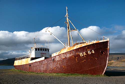
In 1981, this Norwegian-built fishing ship was purposefully beached here after nearly 70 years in service. Today it still remains high and dry, and has become a favorite photo stop for visitors. The Westfjords—and particularly Látrabjarg—are notorious for their shipwrecks; we’ll hear more about others as our day goes on.
• Carry on along road 612. After about 2.5 miles, on the left you’ll see the turnoff for Rauðasandur beach. If the weather’s good, but might not last, you may want to get to the Látrabjarg bird cliffs first. But if the tide’s out at Rauðasandur, now’s a good time to detour.
▲Rauðasandur
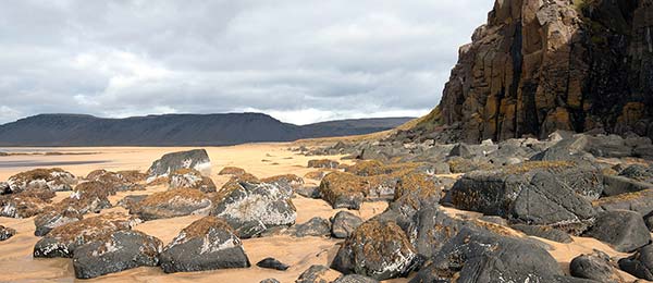
This impossibly broad sandy beach—whose name means “Red Sands”—stretches virtually as far as the eye can see between dramatic rocks. At low tide, it’s fun to stroll here; this is a good place to spot seals.
Along the unpaved road to the beach (about six miles one-way), you’ll grind up through desolate rocky terrain, then crest a pass into a glorious striped canyon flowing with waterfalls and streams. Soon the beach comes into view, filling the entire horizon. Reaching the bottom of the pass, you arrive at a fork in the road.
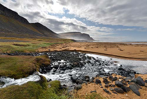
For the best beach access, turn left about two miles toward the recommended Melanes campground (with WCs). Tents and munching sheep share a grassy field that stretches to the golden sands. If you have time and the tide’s out, go for a little hike: Turn left as you face the beach, cross the creek (there’s a little footbridge and stepping stone), and head south—either along the beach itself or along the rocky area above. You’ll work your way toward some dramatic basalt cliffs and sea stacks that rise up from the beach. (You’ll need to cross another stream at a makeshift log bridge to get all the way there.) Get as close as the tide will allow (remember that the tide can come in fast, and sneaker waves are always a threat).
Back at the fork in the road, heading the other direction (toward Saurbæjarkirkja) takes you a mile or so along the beach to a little black village church; just before it is the popular $ Franska Kaffihúsið (French Café), with coffee, waffles, and soup (generally open midday for a short season—likely mid-June-mid-Aug, +354 770 2161). The best beach access from this area is at a small cove halfway between the café and the turnoff.
• Retrace your route on road 614 back to road 612, and carry on west. Very soon after the Rauðasandur turnoff, the road turns to gravel—and stays that way the rest of the way.
Follow the coastline for about nine miles, cruising past a big, beautiful beach. Look down to see a long-abandoned airstrip, spot mussel farms out in the water, and enjoy views of Patreksfjörður town across the fjord. Weaving beneath dramatic vertical cliffs, you’ll curl around headlands, driving right up against the rocky mountainside. Finally, you’ll curve inland and pass right through the middle of the teensy settlement called...
Hnjótur
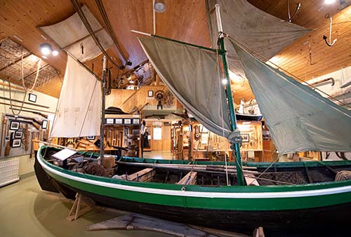
This miniscule community is home to an endearing folk museum—officially called Minjasafn Egils Ólafssonar að Hnjóti. (Look for the building with the two old fishing boats out front.) It’s named for Egill Ólafsson, a local man who collected an extensive array of artifacts from the southern Westfjords: tools, clothing, books, and an entire fishing boat. The newer section explains a rescue mission that took place when a British trawler ran aground at the Látrabjarg bird cliffs in December 1947 (you can watch a 45-minute film about the event). They also run a film about old fishing techniques (1,400 ISK, daily 10:00-18:00, shorter hours in shoulder season, WCs and small café, closed Oct-April).
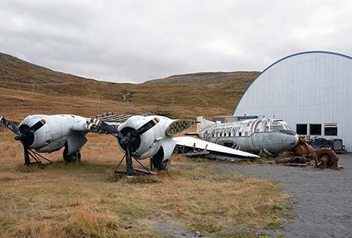
Next door to the folk museum, you’ll likely see the remains of a US Navy DC-3 airplane in front of a hangar. Built in 1944, the plane saw service in Iceland in the 1970s and even aided in the evacuation of the volcano-endangered Westman Islands in 1973. It was retired in 1977—after some 20,000 flight hours, from the Arctic Circle to the Antarctic Circle. Egill Ólafsson brought it here as a memorial to all US Navy and Marine Corps troops who served in Iceland (the former US base at Keflavík is now the main international airport). Inside the hangar is another airplane—a Russian Antonov AN-2, built in 1967, which was damaged and landed in Iceland in 1993; if you’d like to see it, get the key from Kristinn, who runs the recommended Hnjótur Guesthouse (the brown house at the start of the village). Kristinn, Egill’s son, appreciates visitors who take an interest in his dad’s work.
• Continuing through Hnjótur, in just about a mile you’ll hit another crossroads. Keep following road 612 to the left, toward Breiðavík and Látrabjarg. (The only reason to turn right—toward Kollsvík—is to reach the recommended Hotel Látrabjarg, a few miles down this road.)
From here, the road heads up over the rocky spine of the peninsula—you’ll feel like you’re on top of the world. Soon you’ll start to see beaches on your right. You’ll drop down to sea level, and—after about four miles—see signs on the right to...
Breiðavík Beach
This remote, sandy beach, while not as dramatic as Rauðasandur, is framed by big cliffs. Anchoring this area is the recommended Hótel Breiðavík; you can stop off for a coffee or a meal in their big dining room.
• It’s seven more miles to the end of the road. You’ll climb up over yet another headland, and finally drop down through a tiny village that really, really, really wants to you drive 30 kilometers per hour. From here, smelling sulfur, follow the low-lying rutted road through beach grasses. Just before the road climbs up to one more headland, keep an eye out—on your left—for the little, free WC (signed Brunna for a nearby spring). These are the closest WCs to the cliffs we’ll be visiting next.
Now head up one more steep road and pull into the parking lot for...
▲▲▲Látrabjarg Bird Cliffs
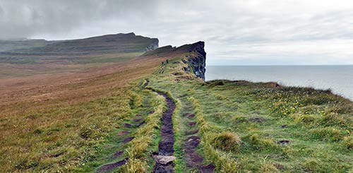
The Látrabjarg bird cliffs are world famous and stunning. Even without the birds, it would be an epic sight: gigantic cliffs looming up from the churning Atlantic, cast away at the end of the world. But in summer (roughly mid-June through mid-Aug), these cliffs teem with bird life—some 10 different species, an estimated one million birds in total. Even for those who can’t tell a fulmar from a kittiwake, it’s one of those destinations that rewards the challenging journey. And as a bonus, it’s also the westernmost point in Europe.
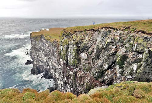
Látrabjarg is actually a chain of cliffs stretching more than seven miles long, reaching heights of more than 1,400 feet—taller than the Empire State building (or, for Icelanders, six Hallgrímskirkjas stacked on end).
From where you park—near the boxy little Bjargtangar lighthouse—it doesn’t seem too exciting. But head up the well-marked path and you’ll soon enjoy sweeping views. Hike along the cliff-top trail as far as time, energy, and weather allow (being here after 18:00 is ideal—the wind dies down, the light is better, and birds begin returning to their cliffside nests). The big, jagged cove just up from the parking lot—with views back to the lighthouse—is already quite thrilling. But the farther you go, the more cliffs you’ll see. Consider going about a mile to the tall, pointy pinnacle of land that sticks way up, giving you grand views back on the cliffs you’ve just crossed over.
The best views are from up close to the edge of the cliff—a vertigo-inducing experience even for the very surefooted. Be very careful, as there are no barriers to keep you safe. The ground—with its many ruts and bulbous mounds—seems designed to trip you, and high winds can make it very dangerous to get too close to the edge. If it’s not too soggy, you can lie on your stomach and slowly inch your way along the sod until your head is poking over the cliff face.
Once you do, you’ll understand why Látrabjarg is so unique and so important. If you designed a perfect habitat for seabirds, this would be it: A sheer rock cliff with plenty of ledges and alcoves for birds to take shelter and build nests, safe from predators. The walls of the cliff are streaked white, and the smell can be overpowering. Plug your nose and perk up your ears to the call of the different birds. Try to identify as many as you can: puffins, of course, but also guillemots, razorbilled auks, fulmars, and kittiwakes. Delicate little feathers are scattered across the grass, like flower petals after a wedding.
Peering down into the churning surf at the base of the cliffs, imagine the scene in December 1947, when the British fishing trawler Dhoon crashed against these rocks. Local villagers—a volunteer rescue squad—flew into action and came to the cliffs with ropes and pulleys, staging a dramatic rescue and ultimately saving 12 of the crew members. Unbelievably, history repeated itself just a year later, when those original rescuers were re-enacting the event for a documentary. As they were filming the scene, a different British trawler (the Sargon) also ran aground on the rocks nearby—so the “actors” had to rescue those crew members as well.
• Our trip to the end of the world is complete. To get home, simply go back the way you came—it’s about an hour to Patreksfjörður if you take it fast.
SLEEPING ON LÁTRABJARG PENINSULA
The peninsula has a handful of accommodations options, all of them fairly basic and extremely expensive for what you get. Birders who want to be close to Látrabjarg may enjoy these choices, but I’d rather bunk in Patreksfjörður. All are closed off-season.
$$$$ Hótel Breiðavík is a short walk from Breiðavík Beach and a short drive from Látrabjarg. It has 42 rooms: half of them, in the big main building, are basic but updated, with shared bathrooms; the rest are in a long, low-lying, motel-like annex, all with views to the beach (+354 867 1575, www.breidavik.is, breidavik@patro.is). Their $$ restaurant serves lunch and dinner to guests and nonguests alike in a huge dining room (open May-Aug daily all day, Sept daily for dinner only).
$$$$ Hótel Látrabjarg is a humble little complex hunkered down on a ridge overlooking the fjord, about a 10-minute drive beyond the village of Hnjótur. The 12 rooms (all with private bath) are functional but cozy; you can pay more for grand views (open mid-May-mid-Sept, +354 419 2810, www.hotellatrabjarg.com, info@hotellatrabjarg.com).
$$$$ Hnjótur Guesthouse, the brown house at the start of the village, has 10 simple rooms (some with shared bath), backpacker beds, and one log cabin-like cottage. The lodgings are basic and pricey, but well run by Kristinn (open May-late Sept, +354 893 8024 or +354 456 1591, www.hnjoturtravel.is, info@hnjoturtravel.is). Kristinn also sells Icelandic wool sweaters handknit by his wife.
$ Melanes Campground, stunningly located at the base of a cliff overlooking Rauðasandur beach, has a few camping cabins, plus showers, WCs, and a shared kitchen—a very tempting place to rough it (+354 783 6600, www.melanes.com, melanes451@gmail.com).
The Central Peninsulas
Patreksfjörður and Ísafjörður are little pockets of civilization on the otherwise untamed Westfjords. The road between them is stark and desolate—and stunningly gorgeous. Settle in for a long day of driving, and you’ll be rewarded with scenery that’s breathtaking (in every sense), ranging from mellow fjordsides to high-altitude passes.
Beyond the crescendoing scenery, there’s not much to see other than a few humdrum villages—and one of Iceland’s most dramatic waterfalls (and that’s saying something): Dynjandi. Those cascades alone would make it worth the long trip...even if this road weren’t the only way to connect the northern and southern Westfjords.
PATREKSFJÖRÐUR TO ÍSAFJÖRÐUR
The drive from Patreksfjörður north toward Ísafjörður is long (90 miles). Allow 2.5 hours, not counting stops. Roads are paved only as far as Bíldudalur, followed by about 40 miles with no pavement whatsoever until you reach the Dynjandi waterfall and the tunnel just beyond. Your route is then paved all the way to the more developed Ísafjörður area. Along the way are a few stops worth knowing about, listed in order as you move north, and linked with driving tips.
Scenic Alternative: If you’re not in a rush and want to take the slower, more scenic route, consider keeping left after the Dynjandi waterfall and driving along Borgarfjörður. You’ll drive through a quaint village (Hrafnseyri) and over a mountain pass (Hrafnseyrarheiði)—both described later—before winding down to Þingeyri. This way is slow, unpaved, and beautiful.
• From Patreksfjörður, head north on road 63 (toward Bíldudalur) across the headland to the next fjord. With extra time, you could detour to the left 2.5 miles here (on highway 617) to reach the village of Tálknafjörður.
Tálknafjörður Detour
This 300-person village is nicely wooded (a rarity in Iceland), and features a long, beachy spit that extends almost entirely across the fjord. The town centerpiece is its modern hilltop church with a glass steeple; it also has N1 gas pumps and a nice swimming pool. The house next to the beached fishing boat, on the left side of the road in the middle of town, has a little 24-hour self-service fresh fish shop that’s fun to peruse (honor system): Find the little greenhouse with a fridge stocked with fresh catch on ice and pay at the table with the card reader.
Eating in Tálknafjörður: $$ Café Dunhagi, at the far end of town (next to the swimming pool), is the best eatery here—either for coffee and cakes, or for a home-cooked meal (daily from 17:00). $$ Hópid is another good option if you’re here at lunchtime; they serve a simple menu in a woody mess-hall interior from 12:00-13:00 on weekdays (also dinner daily, Hrafnadalsvegur 3).
Thermal Bath: For a very rustic Icelandic bathing experience, continue about two miles past the town on the (mostly unpaved) fjordside road. Watch on the right for a little white sign directing you to pollurinn (“the pool”). Here, perched on the hillside overlooking the fjord, you’ll find a simple little bathing compound, with changing cabins, showers, and four small pools fed with geothermal water. No towels, no chemicals, no kidding (open 24/7, donation box).
• Carry on north on highway 63 over the headland toward Bíldudalur. Cresting the pass, watch on the left for stunning views over several layers of fjords, with Bíldudalur in the foreground. This is the sprawling, many-armed Arnarfjörður. Notice how the valley has been carved into a perfect U-shape by glaciers.
Descending to fjord level, you’ll reach a junction. You can turn right on highway 63 for Ísafjörður—but first, consider bearing straight (on road 619) for a quick visit to...
Bíldudalur
This village of about 200 people is the last real population center you’ll see for several fjords...so enjoy it. It’s a hardworking town that does a fair bit of fishing (mainly prawns and salmon) and processes mineral-rich algae harvested in the fjord—you’ll see these healthy products for sale all over town. But these industries aren’t quite enough to sustain a thriving community, and Bíldudalur feels a bit ramshackle—especially down along its busy port. Still, it has gas pumps, a golf course, a fine little guesthouse, and an offbeat museum; it’s also a good place for a meal before a long drive (don’t miss this, unless you’re packing a picnic).
The Icelandic Sea Monster Museum (Skrímslasetrið Bíldudal) fills a former factory with hyperbolic lore of the many weird creatures that have been spotted in Arnarfjörður. At once corny and bursting with local pride, it’s a fun way to pass a half-hour; while there are a few big models of scary Icelandic creatures (including a seaweed-draped hedgehog called the “shore laddie”), the core of the exhibit are eyewitness accounts by local old-timers, with some interactive elements (1,450 ISK, mid-May-mid-Sept daily 10:00-18:00, closed off-season, café, next to the town church—look for the big parking lot along the main drag through town, +354 456 6666, www.skrimsli.is).
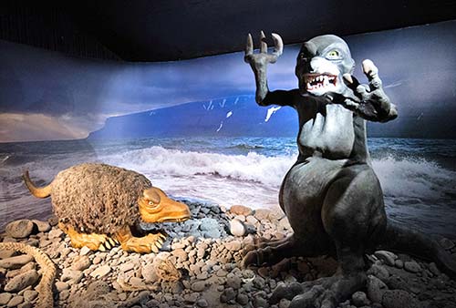
Sleeping in Bíldudalur: $$$ Harbour Inn Guest House is surprisingly stylish, modern, and comfortable for a tiny, remote town, and some of the 14 rooms have views over the fjord. They also run fishing tours on the fjord (some rooms with private bath, family apartment, +354 456 5005, https://harbourinn.is, info@harbourinn.is).
Eating in Bíldudalur: If heading north, you won’t see another real restaurant again for a while. Consider getting a bite at $$ Vegamót Bíldudal. It has a tiny grocery store up front, and a cozy two-floor restaurant in back serving up burgers, sandwiches, and—the big draw—fish-and-chips. This is also where retired fishermen hang out in the morning, trading stories over coffee (daily in summer, +354 456 2232).
• From Bíldudalur, continue along the fjord on highway 63. From here, you’ll be driving along the shore of...
▲▲Arnarfjörður
This next stretch is almost entirely unpopulated, so stock up on gas and food before moving on from Bíldudalur. (The next WCs are at Dynjandi waterfall.) All along the way, you’ll be immersed in spectacular Westfjords scenery. Settle in and remember to ease your grip on the steering wheel enough to enjoy it—especially your last three miles of paved roads, which end near the town airstrip. (Yes, even this tiny little village has regular flights to Reykjavík—an essential lifeline for this remote community.)
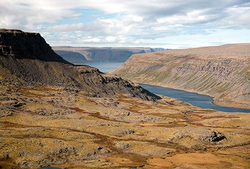
This gigantic fjord is shaped like a squid—and you’ll be curving around its many tentacles for the next couple of hours. The shape is appropriate, as Arnarfjörður is famous among Icelanders for its sea-monster lore. But for modern-day drivers, the scary part may be the next 20 or so miles of rough roads. While passable under normal circumstances, they can be quite rutted and potholed.
Soon after the airstrip, you’ll curl back to the apex of Fossfjörður—where a little farm perches under a churning waterfall (foss-fjörður means “waterfall fjord”). On your way out of this fjord, watch on the left for a little farmhouse with a distinctive pyramid-shaped roof—a fun fjordside photo op.
You’ll cut around a headland, then back into the next fjord, Reykjafjörður—meaning “smoky fjord.” Here you’ll find a natural thermal spring feeding a big outdoor hot pool, called Reykjafjarðarlaug. This is a free place to swim and warm up (open 24 hours, changing cabins and WC). Don’t miss the smaller, natural stone hot pools (extremely hot, but safe to use), hiding just up the hill by the parking lot.
You’ll wind around another headland, then dive into Trostansfjörður. At the bridge at the fjord’s apex, it’s worth pulling over into the little picnic area for beautiful views of a waterfall that surges toward the fjord.
From here, you’ll begin to ascend up, up, up to the plateau called Dynjandisheiði (over 1,600 feet) with stunning views back over the entire Arnarfjörður, all the way to where it opens into the North Atlantic. You’ll find yourself up in the highlands, far above the fjords. Way up here, the Westfjords look like one big, flat plateau with great divots chipped away from its edges.
In the middle of this desolation, the road is paved again, and you’ll reach a crossroads. Turn left (toward Ísafjörður, on highway 60) to carry on northward. Enjoy the mountaintop lakes, rivers, waterfalls, and distant snow fields as you carry on along the top of the world.
Finally you’ll begin your descent as you pass a Dynjandi Nature Conservation Area sign. Twist your way down, following streams and waterfalls to the fjord. Soon you’ll begin to see the gigantic Dynjandi waterfall on your left.
• Just before you reach the water, turn off on the left and park in the lot for...
▲▲Dynjandi Waterfall
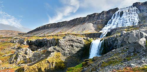
Look up—way up, to the top of the cliff, where massive cascades pour over the edge of rock. Dynja means roughly “thunder,” so this is essentially “Thundering Waterfall.” It’s the ultimate expression of Iceland’s countless bridal-veil cascades.
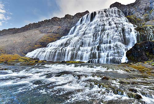
But Dynjandi (DIN-yan-dee) isn’t just one waterfall—it’s several. You’ll park near the base of the lowest one (big, free lot; free WCs), then hike your way up past a series of smaller falls. Each one is identified by name. A rocky, uneven, steep path leads all the way up to the biggest waterfall—hike up as far as you can. Standing at the plateau in front of the massive main falls, you feel the power—and the spray. Beneath you, water hurls itself through a chute of rock as it hopscotches down toward the fjord. From the top, you also enjoy grand views over the next fjord.
• Back on the main road, follow the fjord around the headland, then back into Borgarfjörður. At the apex of this fjord, the 3.5-mile-long Dýrafjarðarg tunnel burrows through the middle of the mountain to the next fjord. Take the tunnel if you’re in a hurry; you’ll bypass Hrafnseyri and Hrafnseyrarheiði (described next), and pop out on Dýrafjörður near Þingeyri.
If you prefer a longer scenic alternative, keep left before the tunnel onto the unpaved highway 626 along the north shore of Borgarfjörður. It’s about 13 miles to Hrafnseyri, at the base of the pass to the next fjord. Keep an eye across the fjord on your left, for distant views of Dynjandi waterfall. Just before the road cuts up away from the fjord, watch on the right for the turnoff to...
Hrafnseyri
This isolated corner of the Westfjords (called “Raven Spit”) was the birthplace of Icelandic founding father Jón Sigurðsson, who lobbied the Danish government on behalf of independence during the 19th century. Today his birthplace is marked by a red-and-white church, a trio of turf-roofed houses, and a modern museum honoring this Icelandic hero—offering thoughtful exhibits and a break from your long drive (free, June-Aug daily 11:00-17:00, likely closed off-season, +354 456 8260, www.hrafnseyri.is).
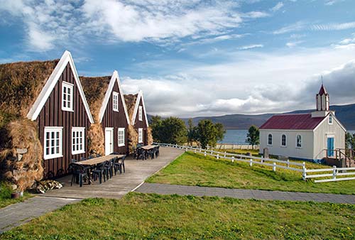
• Just past Hrafnseyri, the road turns up away from the water—you’re finally leaving Arnarfjörður behind as you twist up over the pass called...
Hrafnseyrarheiði
This pass (Raven Spit Heath) corkscrews up to more than 1,800 feet. The scenery is spectacular. Though unpaved, the road is well-packed gravel, allowing fairly good progress; the lack of guardrails at certain twisty sections can inspire a death grip on the steering wheel.
• For those emerging from the Dýrafjarðarg tunnel, you could head straight on highway 622 to reach Þingeyri (10 minutes). Or, turn right to stay on highway 60 for the remaining 35 minutes to Ísafjörður.
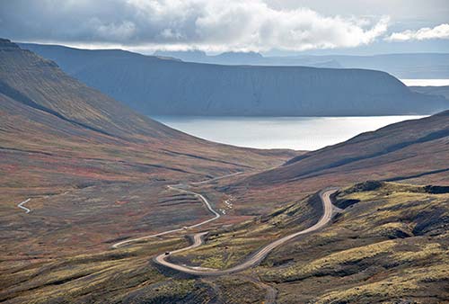
If you’re coming from Hrafnseyrarheiði, you’ll wind down to sea level, go over one more small rise, then return to civilization (and paved roads!) to reach...
Þingeyri
This small town (THING-yeh-ree, pop. 249) looks out over the Dýrafjörður from its commanding midfjord position. Its name (meaning “Assembly Spit”) suggests this was one of the earliest population centers in the Westfjords and the location of the area’s þing (a smaller version of the Iceland-wide gathering at Þingvellir). Today it’s yet another humble small town, worth a quick stop to gas up and grab a bite.
Eating in Þingeyri: $ Simbahöllin café, in an old general store from 1915, is one of the most appealing eateries in the Central Westfjords, and a great place to recover from a long drive. In addition to great coffee, they have good soup and a waffle iron cranking out fresh, crispy waffles. The café is rustic, charming, and modern all at once; you’ll see it on the right in the town center, on the main drag (daily until 17:00, closed early Sept-May, Fjarðargötu 5, +354 899 6659, www.simbahollin.is).
• We’re almost finished with the drive. From Þingeyri, head toward Ísafjörður on (paved) highway 60. You’ll wrap around the fjord, cut across its tip on a bridge, then head back up the other side.
Before you continue on the final stretch to Ísafjörður, consider one last detour: Just before the road leaves the fjord, watch for the turnoff on the left to Núpur. If you follow this road (highway 624) for four miles, on the right you’ll reach...
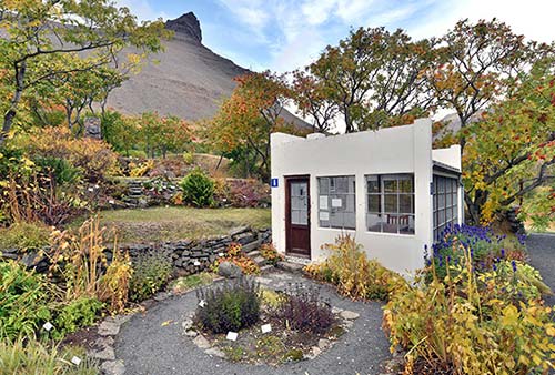
Skrúður Botanical Garden
This little green patch, tucked up against steep cliffs, is a “school garden,” originally created in 1909 by a local parish priest to teach youngsters how to grow different types of plants. From the parking lot, drop a donation in the box and head through the gate into an inviting oasis of carefully labeled plants, gurgling fountains, and chirping birds. The small white greenhouse in the middle of the garden has more information about the history of the place.
• Back on highway 60, the road crosses up over the headland and enters the unusual tunnel to Ísafjörður (see the sidebar; the tunnel also connects to the town of Suðureyri). Just before the tunnel is the turnoff to Flateyri (for the nearby recommended Kaffi Sól café and the town, see here).
Ísafjörður
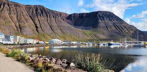
By Westfjords standards, Ísafjörður (EE-sah-FYUR-thur, meaning “Ice Fjord”) is a thriving metropolis. While more functional than charming, Ísafjörður has a spectacular setting—filling a broad spit in the middle of a fjord—and pockets of historic charm, in the form of colorful old shiplap houses. And it’s the hub for transportation and services in this region...so you couldn’t avoid it even if you tried. Fortunately, it’s a pleasant place to spend time. Time-travel to the rustic early 20th century of weather-beaten fishermen at the Westfjords Historical Museum, have lunch or dinner in an old tar house, gaze up at the dramatic cliffs in every direction, and keep an eye out for whales and puffins.
Orientation to Ísafjörður
With about 2,600 inhabitants, Ísafjörður is easily the biggest town in the Westfjords. The main part of town fills the huge Eyri spit in the middle of Skutulsfjörður; more homes clamber up the base of the nearby mountain, and a few more neighborhoods and services (including the big Bónus supermarket) are strung along the coastline to the west, toward the tunnel to points south. The airport is across the fjord from the town center.
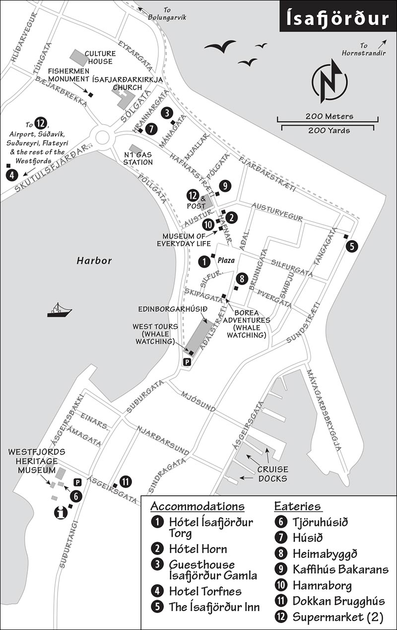
The main street into town has all of the major services (such as the N1 gas station and Nettó supermarket)—but the next street one block inland hogs all the charm. The main walking street through town (Aðalstræti/Hafnarstræti) runs parallel to the main traffic drag; that’s where you’ll find most of my recommended eateries and accommodations.
Ísafjörður anchors the Ísafjarðarbær metropolitan area, which includes four smaller nearby towns: Bolungarvík, Súðavík, Suðureyri, and Flateyri (each about 20 minutes from Ísafjörður; for more, see the end of this chapter). The total population of this area is about 4,000—in other words, one out of every two Westfjorders.
Tourist Information: The helpful TI is near the Westfjords Heritage Museum at the south end of town (mid-June-mid-Sept Mon-Fri 8:00-17:00, Sat-Sun until 14:00; off-season shorter hours and closed Sat-Sun; Neðstakaupstað, +354 450 8060).
ARRIVAL IN ÍSAFJÖRÐUR
Arriving in town by car, you’ll follow the fjord’s shore, then reach the big roundabout at the start of the town’s spit (with the N1 gas station and modern church). Turn right here and follow the waterfront road into town; you can park near West Tours (in the long, historic gray building on your left) or continue through the warehouse zone to park at the historic stand of buildings with the TI and the Westfjords Heritage Museum.
If arriving by plane, you’ll find car-rental desks at the airport; it’s a seven-minute drive around the fjord into town. A Flybus meets arriving flights to bring passengers to the Hótel Ísafjörður in the town center (1,000 ISK); buses return to the airport from the hotel about 50 minutes before flights depart.
Cruises dock in a warehouse zone along the east side of the town’s peninsula.
Tours from Ísafjörður
Whale Watching, Sightseeing Cruises, and More
This town is the jumping-off point for various activities around the Westfjords. Popular choices include whale-watching trips (either on traditional boats or in a high-speed rigid inflatable boat); sightseeing cruises; and super-jeep drives up into the rocky highlands. For any, it’s smart to book ahead. Cruise passengers and people flying in for the day from Reykjavík find these tours a handy way to pack a lot in. The dominant companies are West Tours (big, gray historic building signed Edinborgarhúsið on the main road, Aðalstræti 7, +354 456 5111, www.westtours.is) and the more active Borea Adventures (a block away at Aðalstræti 17, +354 456 3322, www.boreaadventures.com).
Tours to Hornstrandir
Both companies listed above run ferry service and guided tours to Hornstrandir, the exceedingly remote nature-reserve peninsula at the northern fringe of the Westfjords. Hornstrandir has no towns or services—there’s one guesthouse and lots of rugged camping—but in summer, it bursts with bird life. (Outside of May-Aug, it’s off-limits without special permission.) Either take a guided all-day hiking tour (including the boat ride there and back; options range from about 40,000-60,000 ISK) or opt for the ferry-only option, typically used by campers. The nearest point (and most popular entry point), Hesteyri, is about an hour’s ride from Ísafjörður. It’s often possible to head over and back on the same day, but you may need to mix-and-match rides—check both companies’ websites for full schedules. Hornstrandir Tours also operates boat and hiking tours out of Bolungarvík—including to Hesteyri (https://hornstrandirtours.is).
Tours to Vigur
As a simpler alternative—but along similar lines—consider a boat trip to the tiny island of Vigur. It’s closer, and in summer you’ll see puffins (West Tours does a 3-hour round-trip for around 14,500 ISK; see listing earlier).
Sights in Ísafjörður
▲Westfjords Heritage Museum (Byggðasafn Vestfjarða)
This humble yet exceptional museum—housed in a historic 1784 trading-post warehouse—strives to educate visitors about the unique Westfjords way of life, particularly as the region’s fishing industry flourished in the early 20th century. The main-floor exhibit views history through the eyes of Karítas Skarphéðinsdóttir, who was born in this region in 1890, married a much older man at age 16, and later became active in the local workers’ movement of the 1930s. Upstairs are eclectic exhibits about Westfjords life in the mid- to late-20th century: You’ll see tools for barrel making and shipbuilding, and a mesmerizing dramatized film about what it was like to fish on an open boat out in the fjord a hundred years ago. Together the exhibits do a fine job of presenting history—and the region’s urbanization—through the fascinating stories of local individuals. Up in the attic are displays of model ships and a collection of accordions (some formerly owned by famous Icelandic musicians).

Cost and Hours: 1,500 ISK, mid-May-Aug daily 10:00-17:00, early Sept until 15:00, closed late-Sept-mid-May, Neðstikaupstaður, +354 456 3291, www.nedsti.is.
Nearby: The museum is part of a little ensemble of historic buildings (called Neðstikaupstaður) that made up the first trading port in Iceland. Only the museum and the recommended Tjöruhúsið restaurant, next door, are open to the public. The other two buildings are now the homes of the local museum director and the Danish consular.
▲Ísafjörður Town Stroll
There’s not much to see in this humble town, but this 20-minute stroll will help you get your bearings.
Begin at the big gray building on Aðalstræti—the town’s historic main drag—that houses West Tours. This former warehouse is called Edinborgarhúsið—the “Edinburgh House,” recalling when this was a warehouse used in long-distance trade with that Scottish city. (Halfway down this building, duck in the door on your left for WCs.)
Carry on down Aðalstræti, appreciating the town’s historic and still inhabited colorful old houses (notice, on the right side, the turquoise one marked 1816, and later the yellow chalet-style Ásbyrgi house from 1910).
On the next block is the office for Borea Adventures and the recommended Heimabyggð café. At the end of the block is Ísafjörður’s main plaza, Silfurtorg—with benches, the big Hótel Ísafjörður on the left, and an Eymundsson bookstore straight ahead (in the rounded building, marked Bókhlaðan).
Bear left at the bookstore and head halfway down the street (now called Hafnarstræti). On the left is the endearing little Museum of Everyday Life (Hversdagssafn). While the specific exhibits can change, they always shine a light on the lived experiences of local people. You can use the headsets at a wall of shoes to hear stories from their respective owners, flip through old photos with tales from the people who took them, and watch a series of films that elevate the everyday to a place of honor (1,000 ISK, June-mid-Sept Mon-Fri 10:00-16:00, Sat-Sun until 14:00, closed off-season, Hafnarstræti 5, +354 770 5503, www.everydaylife.is).
Next door is the Hamraborg convenience store, the local favorite for a sandwich, pizza, or soft-serve cone. Just beyond that, also on the left, is the post office and big discount Nettó supermarket (unmarked, but inside the same building as the post office). On your right is a recommended bakery, Kaffihús Bakarans.
Keep going a few short blocks past these modern buildings, watching on the right for side streets (such as Mánagata) with more colorful historic houses; you’ll also pass the recommended Húsið restaurant.
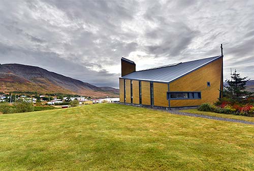
You’ll wind up at Ísafjörður’s can’t-miss-it modern yellow church (Ísafjarðarkirkja). Built in 1995 to replace an old wooden church that burned down, it’s still surrounded by the original churchyard. The church remains somewhat controversial both for its modern aesthetic and because its construction required the relocation of several old graves. It’s sometimes open on weekdays; if so, step inside its serene, austere Lutheran interior, with a flock of red birds taking flight over the main altar.
Continue past the church to the monument to fishermen at the corner of the nearby lawn. The stately building behind the monument is the Culture House—today home to the town library and cultural center. It was built in 1925 as a hospital by state architect Guðjón Samúelsson, who designed buildings all over Iceland (including Reykjavík’s landmark church, Hallgrímskirkja). Today it’s open to those who want to escape the rain and cold, use WCs and free Wi-Fi, check out some historic photos of Ísafjörður and rotating art exhibits, and—at the top of the staircase—see old hospital equipment and an exhibit on the building’s original use (free, Mon-Fri 12:00-18:00, Sat 13:00-16:00, closed Sun, www.safnis.is).
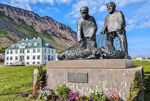
Our Ísafjörður walk is finished. Consider walking back along one of the paved waterfront paths that corral the town—along Pollgata or Fjarðarstræti—for glorious views over each end of the fjord. Or you could duck uphill across the street from the Culture House for a stroll through the town’s little, well-kept park.
Sleeping in Ísafjörður
Accommodations in this town are, generally speaking, unimpressive. I’ve listed a few options here, though I prefer sleeping in the nearby countryside—see “Sleeping in the Countryside, near Flateyri” at the end of this chapter.
$$$$ Hótel Ísafjörður Torg is a big, sterile, business-class hotel right in the heart of town, facing the main plaza. Many of its 36 rooms have fjord views (Silfurtorg 2, +354 456 4111). This hotel manages four other properties in town (including a hostel; all use the same website and email—www.isafjordurhotels.is, lobby@isafjordurhotels.is): $$$ Hótel Horn, a couple of blocks away, has 24 rooms for about the same price, with check-in/reception and breakfast at the main hotel (Austurvegur 2). $$ Guesthouse Ísafjörður Gamla, also nearby, has nine simpler rooms with shared bathrooms; check in and breakfast are at the big hotel (Mánagata 5, +354 456 4146). $$ Hotel Torfnes is a student dorm during the school year, but it’s open to tourists in the summer. Its double and triple rooms, with almost no amenities, are institutional but functional—and it’s cheaper than most other places in town (Silfurtorgi 2).
$$ The Ísafjörður Inn is a friendly, modern place with a tidy kitchen/lounge area, small rooms (most with shared bath), and remodeled bathrooms (Sundstræti 43, +354 776 3131, www.isafjordurinn.is, info@isafjordurinn.is).
Eating in Ísafjörður
$$$$ Tjöruhúsið (Tar House) is a memorable, if touristy, dining experience at the historic tip of Ísafjördur. Inside a creaky old tar factory (from 1781) next to the Westfjords Heritage Museum, diners belly up to long, shared, rustic tables and dig into a smorgasbord of delicious fish dishes. Don’t come here for an intimate, romantic meal—it’s lively and convivial, and you’re expected to get to know your tablemates. You’ll begin with a bowl of fish soup, then work your way through a buffet of flavorful, freshly caught fish dishes, all served in sizzling skillets. The food is simply delicious, with a combination of traditional Icelandic flavors and palate-pleasing international ones. Although pricey and designed entirely for visitors, it’s intimate, family-run, and worth the long wait in the buffet line. Reservations are required (4,500-ISK lunch buffet served Tue-Sun 12:00-14:00, no lunch Mon; 8,500-ISK dinner seatings daily at 18:00 and 20:30; closed Nov-Easter; Neðstakaupstað, +354 456 4419, www.tjoruhusid.is, tjorhusid@gmail.com).
$$ Húsið, near the start of Hafnarstræti behind the N1 gas station, fills an old house with a welcoming atmosphere and reasonably priced burgers, pizzas, and fish of the day (daily 11:00-late, Hafnarstræti, +354 456 5555).
Bakeries: Two bakeries—with entirely different personalities—offer good coffee, sandwiches, and sweets. $ Heimabyggð (meaning “a feeling of home”) is creaky and cute, with a short menu of open-faced sandwiches and comforting soup, and a classic woody atmosphere (daily, Aðalstræti 22b, +354 697 4833). $$ Kaffihús Bakarans looks vaguely French and sells pastries, breads, and sandwiches—and the usual coffee-machine concoctions that are so common in Iceland (daily, Hafnarstræti 14, +354 456 4771).
Fast Food: $ Hamraborg is a locally beloved convenience-store/fast-food joint, with typical sandwiches, skippable pizzas, and a mean soft-serve toppings bar. With diner-like seating and a little slot-machine corner in the back, this feels like a perfect slice of small-town Icelandic life...like a 1950s soda fountain is to Americana (long hours daily, Hafnarstræti 7, +354 456 3166).
Brewpub Tasting Room: Dokkan Brugghús is not to be missed by beer lovers. This tasting room, hiding in a warehouse zone near the cruise terminal, has 12 beers on tap that are made on the premises and a menu of tasty sandwiches, fish-and-chips, wings, and other snacks (tasting flights available, June-Aug daily until late, off-season from 16:00 and may be closed Sun-Mon, Sindragata 14, +354 788 1980).
Supermarkets: Nettó supermarket is right on the main drag in the center of town (daily, Hafnarstræti 9), while a huge Bónus is a five-minute drive out of town (daily, near the turnoff for the tunnel to Flateyri/Suðureyri).
Towns near Ísafjörður
You’ll quickly exhaust the town of Ísafjörður’s sightseeing, but it’s an easy and scenic 20-minute drive to any one of four neighboring settlements: Bolungarvík, Súðavík, Suðureyri, and Flateyri. Collectively, this area is known as Ísafjarðarbær.
All of these towns grew in the years around 1900, as they exploited the rich fishing grounds not far offshore. You’ll sense this nautical vibe wherever you go in this region, and if you keep an eye out on the roads between fjords, you’ll spot what look like big, open-air barns on the slopes near the sea. These are used to store fishing equipment and to air-dry fish to create the Icelanders’ beloved harðfiskur—a sort of fish jerky that is pounded flat and dried, then eaten with butter.
Where to visit? Animal lovers flock to Súðavík’s Arctic Fox Center. Bolungarvík is the best place to learn about traditional fishing lifestyles—and to walk through a sod-roofed fishermen’s settlement. Flateyri has a historic bookstore and perhaps the most scenic drive (through a unique tunnel and along the picturesque Önundarfjörður). Suðureyri’s main attraction is its fine fish restaurant.
Getting There: Each town is in a different direction, but all are well signed from Ísafjörður. To reach Súðavík or Bolungarvík, you’ll simply head around the headlands to the next fjord (the Bolungarvík road includes a standard tunnel); to reach Flateyri or Suðureyri, you’ll use a somewhat unconventional tunnel—read the sidebar earlier to be ready for it.
Súðavík
This small town, with just 264 people, has few services but a few crowd-pleasing sights. Facing out to the wide Ísafjarðardjúp, Súðavík feels more exposed than the other towns. It’s known, tragically, for a devastating 1995 avalanche that wiped out many buildings and killed 14 people (including eight children). The destroyed houses were rebuilt—but relocated to a less avalanche-prone site. Look for a memorial to those killed in the avalanche, just below the Raggagarður playground.
Sights in Súðavík: The ▲▲ Arctic Fox Center seeks to educate visitors about this remarkable creature—Iceland’s only native land mammal—which ekes out a challenging existence in some of the harshest conditions on earth. The exhibits, filling an old house, feature several stuffed foxes, adorable photos, thoughtful videos, and lots of information about how magnificently adapted the arctic fox is to its conditions (it has some of the thickest and best-insulated fur in the animal kingdom). The foxes thrive across the fjord on the remote Hornstrandir peninsula, where they’ve been protected since 1994. You’ll learn about the tense relationship between Icelandic sheep farmers and the foxes, who’ve been hunted going all the way back to the Settlement Age. While Icelanders think of the foxes as savagely attacking innocent sheep, the center’s staff point out that they’re simply following their instincts and typically pick off only sick or weak lambs that wouldn’t survive anyway.
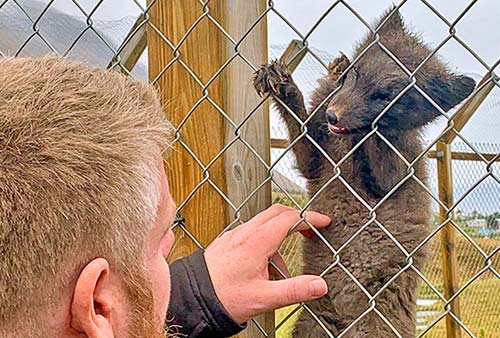
The highlight for most visitors is out back, where a pen sometimes holds live arctic foxes rescued from the wild—often young, orphaned pups that would not have otherwise survived. While well worth a visit, the center can be deluged from time to time by big bus tours—consider calling ahead to plan your visit accordingly (1,500 ISK, free for kids under 15, daily 9:00-18:00, May and Sept 10:00-15:30, closed Oct-April, +354 456 4922, www.arcticfoxcentre.com). It’s at the far end of town—watch for signs on the right.
Sætt & Salt is an artisan chocolate shop tucked into a warehouse down the road from the Arctic Fox Center. Owner Elsa started the company to “offer the taste of the Icelandic land in the form of chocolates.” Her delicious, if pricey, truffles and chocolate bars are speckled with local berries and herbs. They also serve coffee and hot chocolate (daily, Langeyrarvegur 3b, +354 893 0472).
Raggagarður—a big, fun playground (with WCs)—is a big draw for families. Watch for it up above the main road, on the right, in the center of town (look for the big swan-shaped arches).
Bolungarvík
This larger town (pop. 931) feels like the end of the world. It faces toward the open Atlantic and often bears the full brunt of oncoming storms. While the town itself is a sprawl of characterless modern housing, the setting is striking, with giant mountains thrusting up from a black sand beach. The main reason to come here is for its interesting maritime museum—the best place in the region to get a feeling for traditional fishing lifestyles. Bolungarvík also has a nice town swimming pool (you’ll see its waterslide on the left on your way into town).
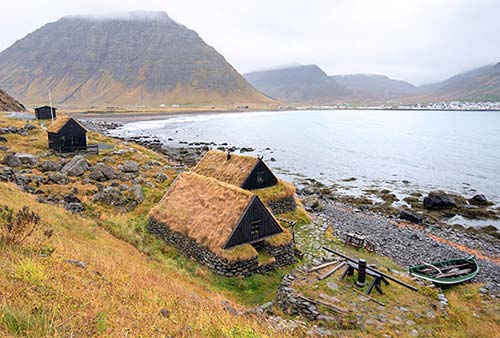
Sights in Bolungarvík: The Ósvör Maritime Museum—worth ▲—brings to life a time, not that long ago, when hardworking fishermen lived and worked here in practically Settlement Age conditions. The “museum” is an open-air collection of three sod-roofed buildings across the bay from the town center. As you exit the tunnel coming from Ísafjörður, you’ll pass over a small bridge, then turn right at the sign for Ósvör. Watch for the buildings on the seaward side of the road, tucked along a rocky beach. On arrival, you’ll usually be greeted by a docent, clad in traditional sheepskin fishermen’s gear, who can explain what you’re seeing. When Ósvör was set up in the 1800s as a verbúð (seasonal fishing station), the Westfjords had no towns; farm laborers were sent here for part of the year. The buildings include a fish-drying shed (hjalli), a fisherman’s hut, and a salting house. You’ll also see an open fishing boat down on the beach, and lots of equipment. If this place grabs your imagination, read Jón Kalman Stefánsson’s Heaven and Hell, which is set here (1,500-ISK, daily 10:00-16:00, closed Sept-May, www.bolungarvik.is/osvor).
Eating in Bolungarvík: $$ Einarshúsið is a handy choice for a meal in town, with a cozy, old-timey interior. They serve pizza all day and additional items, such as fish stew and lamb at dinnertime (also rents rooms, daily, Hafnargata, +354 456 7901, www.einarshusid.is).
Nearby Hikes: If the weather’s great and you’d enjoy a seaside stroll, you can walk along the old coastal road—now closed to traffic—that runs between Ísafjörður and Bolungarvík. From either end of the tunnel, turn off and drive around the headland until you can’t drive anymore, then park and walk as far as you like (on the Bolungarvík side, it’s just past the Ósvör Maritime Museum). But be warned: They dug the tunnel because of the many dangerous rockslides on this road, so keep your eyes open and ears alert as you walk.
Another popular choice (again, in good weather) is to head beyond Bolungarvík and up the unpaved road to Bolafjall mountain, with sweeping views over the region.
Suðureyri
Suðureyri (South Spit, pop. 264) is a sleepy, pleasant-enough halibut-fishing town near the mouth of the long, narrow Súgandafjörður. While a fun drive for completists, it’s perhaps the least appealing of the four towns near Ísafjörður.
The town’s main attraction is $$ Fisherman, a trendy hotel/restaurant complex that celebrates the local maritime tradition with big black-and-white photos of grizzled old fishermen. They have 21 rooms—some with shared bathrooms (Aðalgata 14, +354 450 9000, www.fisherman.is). They also have a small $ café with light fish meals (daily lunch and dinner), and—across the street—a more serious (and pricier) restaurant with quality dishes made with fresh-caught fish (daily for dinner). If you want to have a bite here, call ahead, as they get busloads of visitors from Ísafjörður and can be unexpectedly slammed.
Flateyri
This town (its name literally means “Flat Spit,” pop. 201) is the main settlement on scenic Önundarfjörður. While it’s a hardworking fishing village like the others, Flateyri has a bit more of an artistic bent.
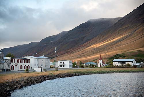
The town’s main claim to fame is the endearing Old Bookstore, family-run since 1914 and currently managed by Eyþór Jóvinsson (watch for it on the way into town—marked Bræðurnir Eyjólfsson). Eyþór sells both old and new books, and you can make a small donation to tour the family’s old apartment (daily May-mid-Sept 9:00-17:00, shorter hours off-season, Jan-March typically open only Sat afternoons but you can call to see if Eyþór can let you in, +354 840 0600, www.flateyribookstore.com).
The other interesting thing to see in Flateyri is the berm protecting the town from another avalanche (like Súðavík, the town was devastated by one in 1995—killing 20 people). From town, look up to the hillside and you’ll notice this protective barrier.
Sleeping in the Countryside, near Flateyri: Considering the relatively low quality and value of accommodations in Ísafjörður, consider bunking in the countryside. The $ Holt Inn, buried deep in bucolic fjordland scenery but just 20 minutes from Ísafjörður, fills an old boarding house with 11 rooms—all with private bathrooms. While the building feels a bit sparse, the backyard hot tub and serene setting are enticing (free bikes for guests, +354 456 7611, www.holtinn.is, holtinn@holtinn.is, Helga; for location, see the map on here).
Eating in and near Flateyri: $ Bryggjukaffi, down by the harbor, is a good place for homemade soup (daily until 18:00, closed off-season, Hafnarstræti 4, +354 846 6262).
$$ Kaffi Sól is a charmingly local spot on a farm with stunning views. It’s located just after you turn off highway 60 onto the Flateyri road; they have coffee and sweets, plus home-cooked traditional meals (daily until 17:00, closed off-season, +354 866 7706).