KARDAMYLI & THE MANI PENINSULA
Καρδαµύλη • Μάνη
The Mani Peninsula is the southernmost tip of mainland Greece (and of the entire European continent, east of Spain)—and it really does feel like the end of the road. Sealed off from the rest of Greece by a thick ring of mountains, the peninsula has seen its population ebb and flow throughout history with tides of refugees fleeing whatever crises were gripping the rest of Greece. The only part of Greece that never completely fell to the Ottoman invaders, the Mani became the cradle of the 1821 revolution that finally brought independence to the Greeks.
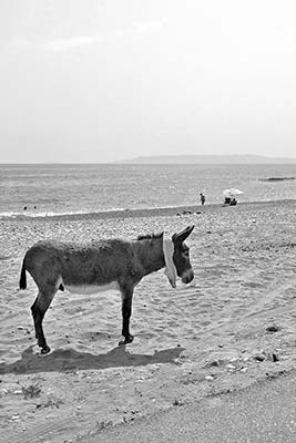
In the Mani, travelers discover a timeless region of rustic villages and untrampled beaches. A day’s drive around this desolate, rural peninsula offers dramatic mountain scenery and bloody history all tied up in a hardscrabble and evocative package—making hedonism on the Mani coast feel all the more hedonistic. At the end of the day, you can retire to charming Kardamyli.
PLANNING YOUR TIME
Two nights and a full day is a minimum for this area. Sleep in Kardamyli. With one day, first take my self-guided walk of Kardamyli to get your bearings, then head up to Old Kardamyli. In the afternoon, go for a hike or hit the beach. With a second day and a car, drive the Mani Peninsula. To really be on vacation, add more nights. Those with three days here can do the driving tour at a more leisurely pace, saving the Pyrgos Dirou Caves and the detour to Kastania for a separate side-trip from Kardamyli. Or instead of returning to Kardamyli, you can head from the Mani loop directly to Monemvasia.
Kardamyli
The village of Kardamyli (kar-dah-MEE-lee) is the gateway to the Mani Peninsula and its best home base. It’s an atypical resort that delicately mixes chic hotels and conscientious travelers with real-world Greece. Relax and tune in to the pace of country life. On Kardamyli’s humble main drag, locals-only mom-and-pop shops mingle with trendy tourist boutiques.
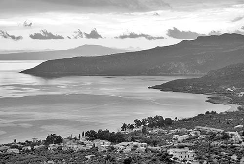
Little Kardamyli is one of the oldest city names in Greek history. In the Iliad, Homer described “well-peopled” Kardamyli as one of seven cities presented to the Greek hero Achilles to persuade him to return to the siege of Troy. Achilles’ son Pyrrhus sailed to Kardamyli, then walked to Sparta to claim the hand of Ermioni. And the legendary Gemini twins—Castor and Pollux—are said to be buried here.
Kardamyli is wedged between the sparkling pebble beaches of the Messenian Gulf and towering Mount Profitas Ilias (7,895 feet)—the Peloponnese’s highest peak, which is snowcapped from November to early May. Between the sea and the distant mountaintop, dramatic hills and cliffs are topped with scenic villages, churches, and ruined towers. As throughout the rest of the Mani, in the sixth century AD Kardamyli’s residents fled from pirates into these hills—returning to sea level only in the 18th century, after the construction of Old Kardamyli’s defensive tower house made it safe.
Visitors can enjoy hiking into the hills, learning about the region’s rough-and-tumble history at Old Kardamyli, swimming at the town’s Ritsa Beach, and driving deeper into the Mani Peninsula, but the real charm of Kardamyli is its low-key ambience—the place works like a stun gun on your momentum. I could stay here for days, just eating well and hanging out. It’s the kind of place where travelers plan their day around the sunset.
Orientation to Kardamyli
Tiny Kardamyli—with just 230 year-round residents—swells with far more visitors in the summer months. The town is compact, gathered around a convenient central spine (the main road running south from Kalamata). Kardamyli is small enough to feel like a cozy village, but big enough to serve the needs of its many visitors—with small grocery stores, ATMs, and more.
Tourist Information: Because Kardamyli has no TI, hoteliers pick up the slack, sometimes offering free hiking maps and usually eager to direct visitors to the best restaurants and activities. The helpful official town website has lots of good information, including accommodations (www.kardamili-greece.com).
Arrival in Kardamyli: For specifics on driving into town, see “Route Tips for Drivers,” later.
Kardamyli Walk
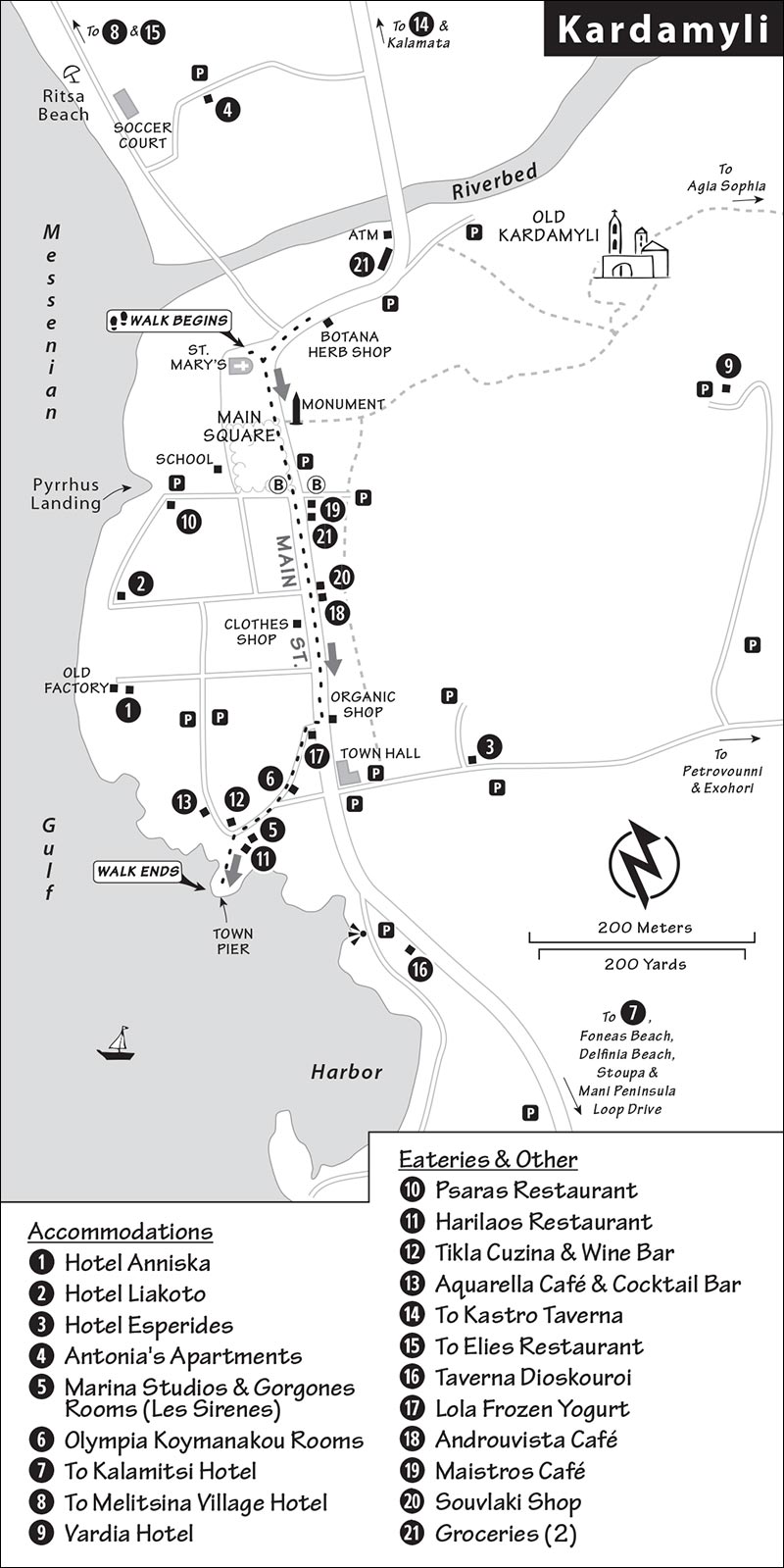
You could walk from one end of Kardamyli to the other in 10 minutes, but you’d miss the point. Slow down—and keep an eye out for intriguing pockets of traditional Greek village culture. This leisurely self-guided stroll lasts about an hour.
• Start at the beginning of town, by the...
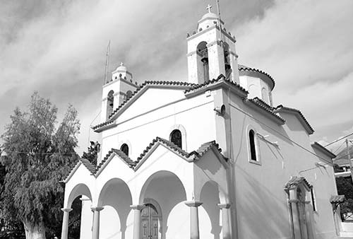
Village Church
The modern Church of St. Mary, with its thriving congregation, is the heart of this town. Notice the loudspeakers outside, which allow overflow crowds to take part in the service on very important days, such as Easter. Kardamyli takes its Easter celebration very seriously: On Good Friday, a processional passes through the town and the priest blesses each house. At midnight on Holy Saturday, everyone turns off their lights and comes to this main square. The priest emerges from the church with a candle, passing its flame through the candle-carrying crowd, who then take the light home with them...gradually illuminating the entire town. And then the fireworks begin.
Before we head into the middle of town, walk a few yards up the main street, away from the church and the main square, and look on the right for a wooden wall painted olive green (before the two grocery stores). This is the Botana Herb Shop, a celebration of what grows in the hills above Kardamyli. Welcoming owner Yiannis Dimitreas, a walking encyclopedia on local foraging, offers free tastes of his organic produce—marinated olives, fresh olive oil, and local honey—and also sells homemade herbal teas, soaps, and skin creams (generally open daily).
• Extending toward town from the church is the leafy...
Main Square
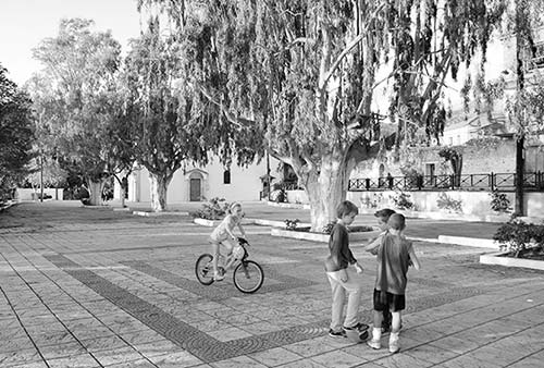
Most of the year, this spot is a popular playground for Kardamylian kids, who play under the eucalyptus trees (on the site of the ancient gymnasium). But on New Year’s Day, a local club fills the square with truckloads of snow from the mountains, turning it into a playground for giddy grown-ups as well.
Walk to the far end of the square. In the little park is the town water spigot and an oddball collection of monuments. Find the busts of two almost comically medal-laden generals who fought in the Greek Revolution and Macedonian Wars. The modern sculpture between them, called Unity, evokes the many fortified towers that dot the Mani Peninsula. Despite the vendettas that frequently cropped up among the peninsula’s inhabitants, known as Maniots, those who live here today generally feel united with one another.
Across the street, on the pedestal, is a monument to the heroes who have fought for Greek unity and independence since antiquity. Next to the palm branch is the Greek motto “Freedom or Death.” While two wars are highlighted in the wreath below (the 1821 Greek War of Independence and the 1912-1913 First Balkan War), the monument is a reminder that the ideals behind those conflicts date back to the ancients.
The cobbled path just behind this monument takes hikers to the restored ruins and museum of Old Kardamyli (a 10-minute trek, described later under “Sights in Kardamyli”).
Back across the street at the end of the square, look down to the waterfront. The primary school (with a small playground) sits just behind the square. The school has a number of Albanian kids, because as a couple of generations of Kardamyli’s young people moved to Athens in search of work, Albanian workers migrated here to do stonework and other manual-labor jobs. And more recently, Greeks who are struggling economically have been unable to afford a family.
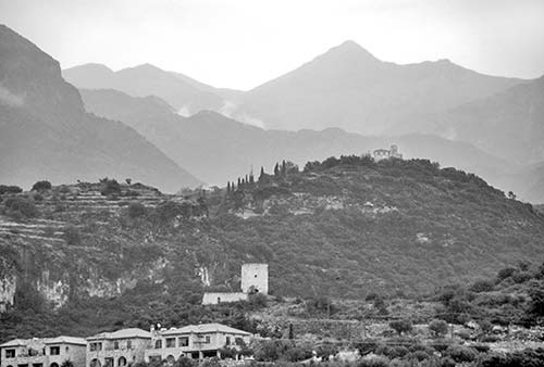
Now look in the opposite direction, up at the hillsides. From here you can see two of the most popular nearby hiking destinations: On the left is a little hilltop church, and to the right is the village of Petrovouni. An enjoyable three-hour loop covers both (described later, under “Hiking”).
• Across from the end of the park begins the commercial zone of...
Kardamyli’s Main Street
The next few blocks reveal a fascinating blend of traditional Greek village lifestyles side-by-side with pleasantly low-key tourism. In most Greek towns with such a fine seaside setting, the beaches are lined with concrete high-rise hotels, and the main streets are a cavalcade of tacky T-shirt shops. But the people of Kardamyli are determined to keep their town real—a hard-fought local law prohibits new construction over a certain height (ruling out big resorts), and the town has made long-term sustainability a priority over short-term profit. (It also helps that the beach has pebbles instead of sand, which keeps away the party crowds.) Its residents have created a smart little self-sustaining circle: The town keeps its soul even as it profits from visitors...allowing it to attract the caliber of travelers who appreciate Kardamyli for what it is.
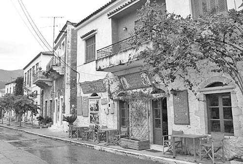
Take a walk down the main street for examples of both faces of Kardamyli. Notice that nearly all of the buildings are traditionally built, using stone from this area. Even newer buildings (such as the café right at the start of the street) match the old style. As you stroll you’ll see:
Noeas (on the left, with the green awning): A tempting bakery/pastry shop.
Maistros Café (on the left, with breakfast and backgammon): This is Kardamyli’s closest thing to a place where the “old boys” hang out.
The pharmacy (left, after the handy little supermarket): Pop inside to see how tastefully it’s been renovated.
Psaltiras Wine Bar and Olive Oil Shop (left): Nicos Psaltiras speaks English and loves to share his quality local products.
2407 Kardamili Mountain Shop (left): Named for the height in meters of the tallest mountain in the Peloponnese, this is the go-to place for outdoor equipment, bike rentals, and advice on walks and treks. See the chalkboard outside, or 2407m.com, for their weekly schedule of excursions and tours.
Souvlaki Shop (left): Here you’ll find local-style “fast food” dished up by shepherds serving their own freshly butchered meat.
Androuvista Café (left): This delightful little café bakes its much-loved walnut cake daily.
Blauel Olive Shop (right): This shop is a pioneer in organic olive-oil production. Stop in and try some tasty samples.
The butcher (left): Peek inside to see a classic butcher block and a row of hooks with tools and smocks. Local shepherds produce lots of goats.
Bio Organic Shop (left): Pop in for homegrown goodies—and possibly some samples of olive oils and honeys.
Lola Frozen Yogurt (right, just off the main street): Try this fun stop for homemade ice cream, tempting cakes, and a peaceful courtyard out back.
Farther down Main Street are the Town Hall and a hardware store (supplying out-of-towners working on their fixer-upper retirement/vacation properties). But we’ll hang a right down the cobbled lane, past a real estate office (one of a few in town for visitors dreaming of a vacation home here).
• You’re walking toward the water, and getting a little taste of...
Kardamyli’s Back Streets
As you step off the main drag, notice how civilization seems to melt away as the town’s back streets quickly turn into cobbles, gravel, or red dirt.
Meandering past small shops down the road to the sea, you’ll see some signs advertising rooms (Δωματια, dhomatia) for visitors—a great value for cheap sleeps. If you look like you need a roof over your head tonight, someone might offer you a room as you pass.
• Continue down to the water, walk out on to the concrete pier, and look around at...
Kardamyli’s Waterfront
Not so long ago, no roads connected Kardamyli to the rest of civilization. This pier was the main way into and out of the area, providing a link to the big city of Kalamata and bustling with trade and passengers. The old smokestack (behind your right shoulder as you face the water) marks the site of a once-thriving olive-oil factory. The oil was shipped from this pier. The factory has been deserted since the 1950s when—in true Maniot fashion—a rival company from Kalamata bought it in order to close it and become the region’s sole olive-oil producer. Much of the original equipment is rusty but intact, though not open to visitors. There’s talk of turning it into a museum.
Between the 1950s and the 1970s, an ever-improving network of roads made this port obsolete. Today only one professional fisherman works out of Kardamyli. He brings his catch right here to the pier to sell to locals, tourists, and restaurateurs. To the left, a set of concrete steps leads around a watery curve to a rocky alcove where there may be a handful of swimmers. The small harbor across the bay has only a few boats. Even without its traditional industries, Kardamyli still thrives, and most of its traditional lifestyles remain intact...thanks in part to respectful visitors like you.
Above the harbor the Mirginos Tower completes the ring of fortifications that starts at the other end of town at Old Kardamyli. The little island offshore (Miropi) holds the barely visible ruins of an old church.
• Our walk is finished—time to take a deep breath of sea air, relax, and soak in the slow pace of Kardamyli life. There are a couple of relaxing bars with fine sea views within a few steps.
Sights in Kardamyli
Old Kardamyli
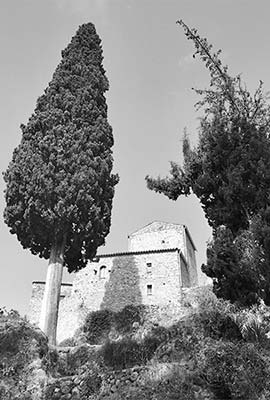
The fortified compound of Old Kardamyli perches just above today’s modern town. On the ancient Mani Peninsula, “old” is relative—this settlement, marked by a fortified tower, was established by the first families to return to flat ground at the end of the 17th century (they had been forced into the hills in the Middle Ages by pirates). After sitting in ruins for centuries, the complex has been partially restored and converted into a little museum about the Mani Peninsula and its traditional architecture. It’s worth the short hike through an olive grove to poke around the tiny, fortified cluster and visit the museum.
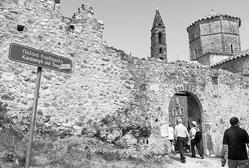
The trail to Old Kardamyli begins just behind the monument to the heroes along the main street. From here it’s an up-and-down 10-minute walk—just follow the cobbled path, lined with lampposts, which leads through an up-close slice of traditional village life and an olive grove. As you approach the site, make a right after the little bridge. Behind the ruined building on the right (under a eucalyptus tree near the final lamppost) is an old cistern once used to draw and carry water back home. Continue on straight and curl around the right side of Old Kardamyli to hike up into the complex. Standing inside the fortified complex, imagine the stark reality of life within these walls, where a church, olive press, iron smith, garden, and cistern were the necessities for the frightened community to survive.
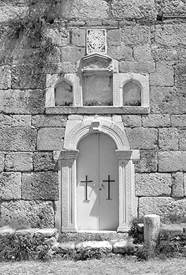
Passing through the archway, on the right you’ll see the Church of St. Spyridon (circa 1750). Though it’s not open to visitors, the exterior is interesting for its bell tower and its typical-in-Greece use of fragments of older buildings in its construction (such as the 3,500-year-old Mycenaean-age sill, wall chunks plundered by the Venetians, and Byzantine marble frames that surround the door and windows). Over the window and door, notice the crowned double-headed eagle, a symbol of the Byzantine Empire and the Orthodox Christian Church.
Now head toward the tower complex itself. The Mourtzinos Tower was built by the powerful Troupakis family at the beginning of the 18th century. It’s named after the leader of the Troupakis clan, who was known for his scowling face (mourtzinos) during the War of Independence.
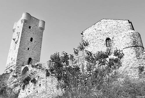
Attached to the tower, the former Troupakis residence now houses a multilevel museum (€3, Wed-Mon 9:00-16:00, until 20:00 in summer, closed Tue and Nov-March). Poke into all the little doors to see exhibits about the Maniots’ terraces, cisterns, beekeeping, agricultural production, salt pans, and quarries. On the top floor you can learn about the different subregions of the Mani.
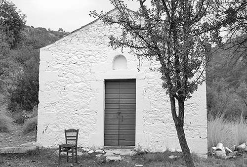
The cute little church just uphill from the complex, Agios Nikolaos, marks the beginning of a cobbled path that leads up, up, up to the distant church on the hilltop (called Agia Sophia). High above on the bluff was the site of the acropolis of Homeric-era Kardamyli (from 1250 BC). You can do the whole strenuous loop up to the church, then walk around to the adjacent village of Petrovouni (see “Hiking,” below). Or, for just a taste, hike about five minutes up the cobbled trail to find two graves burrowed into a rock (on the right, behind the green gate). These are supposedly the graves of Castor and Pollux, the “Gemini twins” of mythology. These brothers of Helen of Troy had different fathers. When Castor died, Pollux—who was immortal because he was fathered by Zeus—asked his dad to bond the brothers together in immortality. Zeus agreed and turned them into the Gemini constellation. These brothers, so famous for their affection for each other, remain in close proximity even in death: Notice the connecting passage at the back of the graves.
Beaches
Many visitors come to Kardamyli to enjoy the beach. Most simply head for nearby Ritsa Beach, a pleasant pebbly stretch that begins just beyond the village church. You can swim anywhere along its length, but most beach bums prefer the far end, where the water gets deeper quicker (no showers).
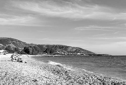
Ritsa Beach is bookended by twin restaurants with outdoor seating. Recommended Elies, at the far end, is everyone’s favorite.
If you have a car and want to get out of town, you could day-trip to two more good sand/fine-gravel beaches that lie to the south, near the hamlet of Neo Proastio on the way to Stoupa: Foneas Beach (a cove flanked by picturesque big rocks) and Delfinia Beach. It’s a short walk down from the road to access either. The resort town of Stoupa also has some good sandy beaches and a promenade perfect for strolling.
As elsewhere in Greece, water shoes are recommended to avoid stepping on spiny sea urchins. Locals claim that the water’s warm enough for swimming year-round, except in March, when it’s chilled by snowmelt runoff from the mountains.
Hiking
Hiking vies with beach fun as Kardamyli’s biggest attraction. Especially in spring and fall, visitors head away from the sea to explore the network of color-coded trails that scramble up the surrounding hills. Many of these follow the ancient kalderimi (cobbled paths) that once were the only way of traveling between villages. Ask your hotel for a map that explains the routes and codes; for serious hikes, buy a more detailed hiking map. As the hikes tend to be strenuous—uphill and over uneven terrain—wear good shoes and bring along water and snacks (some walks pass through villages where you can buy food and drinks, but don’t count on it).
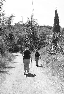
The most popular destinations sit on the hillsides just behind Kardamyli: the hilltop church of Agia Sophia and the village of Petrovouni. You can hike to either one or (with more time and stamina) do a loop trip that includes both. Consider this plan: Start by visiting Old Kardamyli, then continue past the small Agios Nikolaos church and the ancient graves of Castor and Pollux (described earlier). After about 30 minutes take the uphill stone pathway on your sharp right—the higher church of Agia Sophia is at the top of the ramp. Then, if your energy holds, follow the dirt path (to the left of the church as you face the sea) around to Petrovouni—this shortcut avoids a boring two-mile trek along the paved upper road. From there you can head back down into Kardamyli. The paths are very steep (there’s about a 650-foot elevation gain from Kardamyli to Petrovouni), and the round-trip takes about 1.5 hours at a good pace with few breaks (follow the yellow-and-black trail markings). Other trips lead farther into the hills, to the remote village of Exohori. To avoid brutal heat in the summer, time your hike to finish by 10:00.
Sleeping in Kardamyli
Most of Kardamyli’s accommodations cater to British, European, and Australian tourists who stay for a week or more. Rather than traditional hotels, you’ll find mostly “apartments” with kitchenettes, along with simpler and cheaper rooms (dhomatia). While some places offer breakfast, most charge extra, assuming that you’ll make your own in your kitchenette or get a pastry and a coffee at a bakery or café. If you want breakfast, be sure to tell your host the day before (they’ll likely buy fresh bread for you in the morning).
IN THE TOWN
$$$ Hotel Anniska and Hotel Liakoto (Sunny Place) rent nicely appointed, resort-feeling apartments with kitchenettes. The Anniska has 22 apartments that share an inviting lounge and a delightful seaview terrace (breakfast extra, +30 2721 073 601). The Liakoto’s 25 apartments cluster around a swimming-pool courtyard oasis, all with sea views that turn golden at sunset (breakfast extra and worth it, +30 2721 073 600). Both hotels are run by friendly British-Australian-Greek couple Ilia and Gerry (www.anniska-liakoto.com, info@anniska-liakoto.gr).
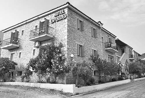
$$ Hotel Esperides has 19 rooms and apartments with kitchenettes, all surrounding a pleasant garden veranda just a few steps up from the main road. You’ll enjoy a friendly welcome and lots of travel advice (breakfast extra, closed Nov-March, arrange arrival time in advance because reception isn’t open 24 hours, +30 2721 073 173, www.hotelesperides.gr, esperideshoteln@gmail.com).
$$ Antonia’s Apartments sit among the olive trees, just up from Ritsa Beach and a short walk from the town center (turn right after the first beach restaurant). Its two newer apartments in the tower house are stylishly furnished with thoughtful touches that put them several notches above the norm. The two older units, while more old-fashioned, are a bit bigger, with two separate bedrooms. All four apartments have seaview verandas (lending library, +30 2721 073 453, antoniasapartments@yahoo.gr, lovingly tended by knowledgeable Elias).
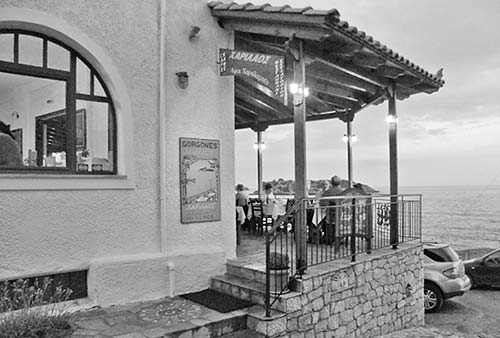
$ Marina Studios & Gorgones Rooms (Les Sirenes) are owned by the same family and occupy 10 rooms in the building above a busy restaurant. The rooms are simple, but all have kitchenettes and most have views or balconies overlooking Kardamyli’s little harbor (good windows block out most of the dining noise, reserve via Booking.com, Gorgones: +30 693 233 4855, http://www.gorgonesrooms.gr/ [URL inactive]; Marina: +30 698 572 7177).
$ Dhomatia: You’ll see signs advertising rooms (Δωματια) all over town. Though air-conditioning is a safe bet, rooms are generally quite simple, with kitchenettes but no breakfast. English can be limited, credit cards aren’t accepted, and value can vary. If you’re in a pinch, check out a few, pick the best, and don’t be afraid to haggle. Try warm and welcoming Olympia Koymanakou, who rents five rooms on the cobbled lane just up the road from the harbor and speaks just enough English (shared kitchen, Paraleia street, +30 2721 073 623, mobile +30 693 479 2259).
JUST OUTSIDE KARDAMYLI
These enjoyable retreats sit a bit farther from Kardamyli’s main street. While walkable, they’re more practical if you have a car (especially the Kalamitsi).
$$$ Kalamitsi Hotel is an enclave hovering above its own bay, beach, and olive grove a two-minute drive down the road from Kardamyli (toward Areopoli, just around a big curve in the road). There are 17 rooms in the main building, plus 15 bungalows that bunny-hop across its plateau; the rooms aren’t fancy, but it’s a charming place (suites, breakfast extra, dinner available, +30 2721 073 131, www.kalamitsi-hotel.gr, info@kalamitsi-hotel.gr).
$$$ Melitsina Village Hotel, at the top of Ritsa beach, feels more resorty. This collection of stone buildings housing 23 sophisticated studios and apartments, most with kitchenettes and terraces, gives you that “get away from it all” vibe (+30 2721 073 334, www.melitsina.com, info@melitsina.com).
$$ Vardia Hotel is a stony retreat huddled on a hilltop just above town. All of its 18 studios and apartments have balconies overlooking town and the sea beyond, and a steep, rocky path leads from the hotel’s view veranda directly to Old Kardamyli (breakfast extra, +30 2721 073 777, mobile +30 694 611 9741, www.vardia-hotel.gr, info@vardia-hotel.gr).
Eating in Kardamyli
Kardamyli prides itself on pleasing return visitors, who come here on holiday year after year. When you ask locals where to dine, they shrug and say, “Anywhere is good”...and you sense it’s not just empty town boasting. As you dine, notice the dignified European visitors conversing quietly around you...and try to imitate them.
IN TOWN, NEAR THE SEA
These places all have sea views. The first one is near the top of the short main street; the next three are side-by-side overlooking the harbor. All have fine interiors if the weather is disagreeable. The first three are serious restaurants, while the last one is more of a bar that serves food.
$$ Psaras Restaurant (Ψαράς) overlooks Pyrrhus landing, an appropriate location given the fish-forward menu. Rustic wood tables under a covered patio and the sound of lapping waves make this a great spot for a memorable meal (daily 11:30-23:00, +30 2721 073 365).
$$$ Harilaos Restaurant is bright and elegant, boasts fine views over the harbor, and serves fresh fish and classic Greek dishes (daily 12:00-23:00, closed Nov-March, +30 2721 073 373).
$$$$ Tikla Cuzina & Wine Bar, with a stylish covered terrace and a stony-mod interior, aims to innovate on the Greek standards—think roast lamb served with eggplant mousse (daily 13:00-24:00, from 17:00 in shoulder season, closed Nov-March, +30 2721 074 444).
$$ Aquarella Café and Cocktail Bar is youthful and hip, taking full advantage of its romantic seaside setting with sofas under trees and backgammon boards. Relax with drinks and snacks—there are even cigars on the menu. They also serve breakfast (open daily 8:00-24:00, +30 2721 075 010).
JUST OUTSIDE KARDAMYLI
$$ Kastro Taverna is a gourmet’s delight and a splurge for your taste buds (but no pricier than most other restaurants in town). Sitting amid an olive grove just outside town toward Kalamata, it’s a 15-minute walk or quick drive from the town center. The trek is worth it—the chef uses local products for his daily specials, including meat and produce from his farm in the hills above town. A highlight is the keftedes (meatballs) in a savory tomato sauce, but it’s hard to go wrong with anything on the menu. Choose between the cozy fireplace interior and the broad veranda with distant sea views (Tue-Sun 19:00-23:00, closed Mon and mid-Oct-mid-March, +30 2721 073 951).
$$$ Elies (Ελιές), with what most locals consider the best lunch around, is a 15-minute walk up from the town center, on Ritsa Beach. Relax with beachgoers at pastel tables in the shade of olive trees and enjoy their excellent Greek cuisine. They serve simple, traditional Greek dishes for lunch from April through October and offer a fancier dinner menu in summer (daily 13:00-18:00, mid-June-mid-Sept until 23:00, +30 2721 073 140). Kids enjoy their playground.
$$$ Taverna Dioskouroi sits in a lovely setting on the headland overlooking Kardamyli’s adorable little harbor, on the southern end of the village (daily specials, daily 13:00-22:00, on the right 200 yards south of the village, +30 2721 073 236).
OTHER OPTIONS
Breakfast: Consider these options if you’re not eating breakfast at your hotel. Several places mentioned on my self-guided walk offer breakfast fare: Lola Frozen Yogurt (dainty setting, garden tables out back) has light bites and good coffee, $$ Androuvista Café serves walnut cake, a beloved local specialty, and $$ Maistros Café, on the main square, is an old-school cafeteria with local clientele and full array of breakfast options. Bohemian-chic Aquarella is also open mornings.
Picnics: There are two grocery stores at the entrance to town, and one on the main street just past the square (all open long hours daily). For a fast bite, the souvlaki shop on the main street is good (described earlier, on my self-guided walk).
Kardamyli Connections
Kardamyli’s biggest disadvantage is its tricky-to-reach position on the far-flung Mani Peninsula. The nearest major city (with good bus connections to the rest of Greece) is Kalamata, about 24 twisty miles to the north. The bus schedule between Kalamata and Kardamyli changes frequently (generally 3-4/day Mon-Fri—first bus around 7:00, last at around 20:00; 2-3/day Sat-Sun, 1 hour; in Kardamyli, catch bus at main square). It’s best to inquire about buses with your hotel, though you can also try the Kalamata bus station (+30 2721 028 581, www.ktelmessinias.gr).
You can also get to Kalamata by taxi for around €65—a handy option for catching early buses out of Kalamata off-season, when buses from Kardamyli to Kalamata might not run early enough. Ask your hotelier for help booking a taxi.
ROUTE TIPS FOR DRIVERS
The Mani Peninsula’s mountains make driving slow going, but if you don’t mind spending a few euros on tolls, A-7 allows you to bypass the town of Kalamata, shaving 30 minutes off your travel time. Cheapskates driving through Kalamata should follow signs reading Port, Seafront, or Areopoli. Once past the port, keep driving in the same direction, with the water on your right. The road to Kardamyli is badly signed—you might see directions in Greek for Καρδαµύλη (Kardamyli) or Μάνη (Mani)—but as long as you keep the water on your right, you’ll end up on the highway.
Either way, heading south from Kalamata, you’ll twist over a suddenly remote-feeling terrain of dramatic mountains and emerge overlooking a grand bay with views over Kardamyli.
After going through Kardamyli, the road continues south, passing near—or directly through—a string of scenic villages before climbing back up over mountains and around a dramatic bay to the regional capital of Areopoli.
From Areopoli you can head east to Gythio and then on to Monemvasia (about 2 hours total), or head south for a loop of the Mani on lesser roads (described next).
Mani Peninsula Drive
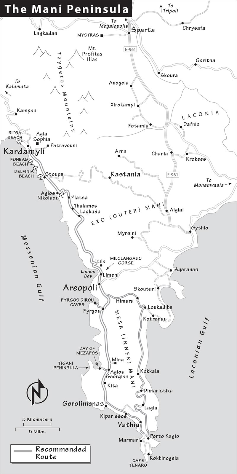
KARDAMYLI LOOP
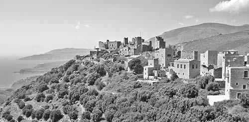
The Mani Peninsula is where the rustic charm of Greece is most apparent. For many travelers, this peninsula is the rural slice of Greek coast-and-mountains that they came to this country to see. The region’s dramatic history has left behind a landscape that’s at once eerily stark and remarkably scenic. While mountains edged with abandoned terraces hint that farming was once more extensive, olives have been the only Mani export for the last two centuries. Empty, ghostly hill towns cling barnacle-like onto distant ridges, still fortified against centuries-old threats. Cisterns that once caught rainwater to sustain hardy communities are now mucky green puddles that would turn a goat’s stomach. The farther south you go, the bleaker conditions become. And yet many Mani towns feature sumptuous old fresco-slathered churches...pockets of brightness that survive in this otherwise parched land.
This region is difficult to fully experience without a car. To really delve into this backcountry corner of Greece, follow this loop drive from Kardamyli.
PLANNING YOUR DRIVE
To hit all the places described here in one day, you’ll need to get an early start and not linger too long in any one place. It takes about eight hours to drive the entire loop, pausing just long enough to stretch your legs and snap a few photos at each sight. You can also incorporate part or all of this drive on the way from Kardamyli to Monemvasia—figure on six to seven hours (less if you only hit the highlights as far as Pyrgos before heading east).
The major towns worth stopping at are Agios Nikolaos, Areopoli, and Gerolimenas. Any of these are a good place to grab lunch (whether picnic or sit-down)—most of the other settlements in this area are so small you might not be able to find anywhere to eat. For me, though, it’s the tiny, remote spots that are most atmospheric; my favorites are Kastania, Cape Tenaro, and Vathia. Also worthwhile are the Pyrgos Dirou Caves, which you can visit at the beginning or end of the drive, as you’ll pass by them on your return to Kardamyli (bear in mind what time they close). If you prefer a later start or a more relaxed day, you could skip Kastania or the cape (saving you about an hour each).
Along the way, you’ll experience stunning coastal vistas equal to California’s Big Sur or the French Riviera. But keep a firm grip on the wheel—the route is a string of hairpin curves, missing guardrails, and blind corners in ancient stone villages.
Sightseeing Tip: The light inside old churches can be very dim—if you have a flashlight, bring it along to illuminate the frescoes.
From Kardamyli to Kastania
Head south from Kardamyli on the main road. After a few miles you’ll pass the attractive little resort town of Stoupa. While Kardamyli turns its back to the sea, Stoupa embraces it—with a fine sandy beach arcing right through its center. (Stoupa also works as a separate jaunt from Kardamyli.)
Just after Stoupa is the turnoff for our first stop, Kastania (Καστανεα). Note that Kastania is a time-consuming detour from the main road (allow 1.5 hours for the round-trip, including 30 minutes to walk around). If short on time, you might want to skip it or consider making it a separate side-trip from Kardamyli or a detour en route to Monemvasia.
• To reach Kastania, look for the turnoff from the main road. You’ll see a large blue road sign pointing left to a long list of destinations; the sign is near a prominent rocky hill and just before a tiny church on your right. Follow any signs to Neochori, which is en route to Kastania. Leaving the main road, head uphill, passing through what feels like the peninsula’s version of modern “urban sprawl.” Keep going, following the well-traveled blacktop through two other villages along the way.
Kastania
Wedged in a gorge, the village of Kastania offers you a rare opportunity to explore a traditional, still-inhabited Mani village that’s somewhat off the tourist track. It may feel sleepy today, but Kastania was once a local powerhouse. During the 19th-century Greek War of Independence, it boasted no fewer than 400 “guns” (as Maniots called their menfolk), gathered under a warlord whose imposing family tower still stands over the town square. The town also had many churches, some of which still feature remarkably well-preserved old frescoes. (Unfortunately, the churches are often closed. If you come across one that doesn’t look open, try the door. If it’s locked and you see people nearby, ask if they know how to get inside—sometimes there’s a key hidden somewhere close by.)
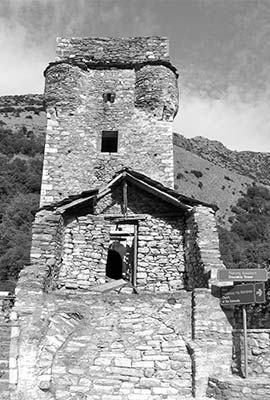
Kastania is nestled in a strategically hidden location: You don’t even see the town until you’re right on top of it. As you enter the town, you’ll pass the first of many Byzantine churches on the left—this one dedicated to St. John (Agios Ioannis). Beyond the church, look for a round traffic mirror and park your car wherever you safely can nearby. To the right from the traffic mirror is what seems to be an alley. It’s actually the link to the main square. Walk up into the square, which is watched over by the Church of the Assumption and the town’s tower house (which you can climb if it’s open). Poke into one of the very traditional cafés for a coffee. The one at the top of the square is a real time warp, where old-timers gather around simple tables, smoking and chatting.
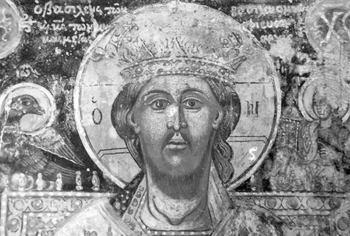
Consider hiking uphill from the square to take in the back streets and some deep breaths of mountain air. Wander generally uphill, and along a rustic lane near the old cistern at the upper end of town you’ll come across the Church of St. Peter (Agios Petros), the oldest of the town’s Byzantine churches. It appears to be cobbled together using bits and pieces of antiquity. If it’s open, go inside—it’s richly adorned with frescoes that have told Bible stories to this community since the 14th century. A destructive mold has hastened the aging of its precious art, but the spiritual wonder of the place remains intact. The olive-oil lamp often still burns, tended by a caretaker family. Even if the church is closed, stop to enjoy the views over town from this perch.
• Return to your car, backtrack to the main road, and turn left (south). Continue driving...
From Stoupa to Areopoli
As you drive you may notice rooftop solar panels attached to cylindrical tanks—an efficient way to heat water in this sunny climate. All along the route, set on roadside pedestals, are those little miniature churches you’ve seen throughout Greece. Most of these are “votive churches,” erected as a thank-you gesture to God by someone who was spared in an accident. Little churches with a photograph of a person, however, are memorials to someone who lost their life on the highway.
Heading south, you’ll pass another fine beach town, Agios Nikolaos (St. Nicholas). About a kilometer (half-mile) off the road, this is a little fishing port with wild rocks, a tiny bell tower, a scrawny lighthouse, a tough fleet of little fishing boats, inviting stay-a-while cafés, and harborfront restaurants selling fresh fish to stray travelers. The waterfront eatery Vesuvius has a ladder down to the sea from its terrace, so you can combine swimming, basking, and eating.
After Agios Nikolaos the road begins to curve up the mountain, passing through Platsa (with two interesting churches). If the church of St. John/Agios Ioannis is open, poke inside to see a ceiling fresco with Jesus surrounded by zodiac symbols—a reminder of the way early Christians incorporated pre-Christian mythology. On the far (south) end of town, the church of St. Nicholas/Agios Nikolaos sits abandoned behind an athletic field and is recognized as one of the region’s oldest Byzantine churches, dating from the 10th century.
Higher up, the village of Thalames—its square shaded by a giant plane tree—is known for its olive-oil production (several shops on the square sell it). Then, in Lagkada, watch (on the left) for the remarkably well-preserved Byzantine Church of the Metamorphosis, lavishly decorated with terra-cotta designs.
As you ascend ever higher, notice how the landscape fades from green to brown. From here on out, the Mani becomes characteristically arid. You’ll begin to see terraces etched into the mountainsides, a reminder of how hard Maniots had to work to earn a living from this inhospitable land. They’d scrape together whatever arable soil they could into these little patches to grow olive trees and wheat. Some of the larger stone walls surrounding the terraces demarcate property boundaries.
Soon you cross the “state line” that separates the Exo (Outer) Mani from the Mesa (Inner) Mani—its southern tip and most striking area.
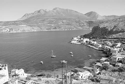
As you reach the lip of the dramatic Milolangado Gorge, the town of Itilo (EE-tee-loh) comes into view. Like Kardamyli, this town was mentioned in Homer’s Iliad. The fortifications on the southern side of the gorge belong to Kelefa Castle, built by the Ottomans in 1670 in a short-lived attempt to control the rebellious Maniots. Enjoy the views before heading down to Limeni Bay, where you’ll pass the settlements of Neo (New) Itilo and Limeni, birthplace of the war hero Petros Mavromichalis, whom we’ll meet shortly (see the sidebar for more about Petros). Fish lovers detour into Limeni for lunch at Takis Taverna—where local fishermen bring their best catch—overlooking the harbor, while adventure seekers enjoy hiking the 3.5 miles up from the bayside road into the gorge itself.
• Continuing up the other side of the gorge, and then cresting the top, you’ll shortly arrive in...
Areopoli
Areopoli (ah-reh-OH-poh-lee)—named after Ares, the ancient god of war—is the de facto capital of the Inner Mani. Less charming but more lived-in than other Mani towns, Areopoli is the region’s commercial center.
As you arrive from Itilo, turn right at the stop sign, veer left following the sign to Diros Caves, then turn right just past the supermarket and stone wall into a modern main square, Plateia Athanaton (where you should be able to find a place to park). Dominating the square is a statue of Petros Mavromichalis (1765-1848). This local-boy-done-good was selected to rule the region by the Ottoman overlords, who assumed they could corrupt him with money and power. But they underestimated his strong sense of Mani honor. On March 17, 1821, Mavromichalis gathered a ragtag Maniot army here in Areopoli and marched north to Kalamata, launching the War of Independence. Mavromichalis looks every inch a warrior, clutching a mighty curved sword, with a pistol tucked into his waistband.
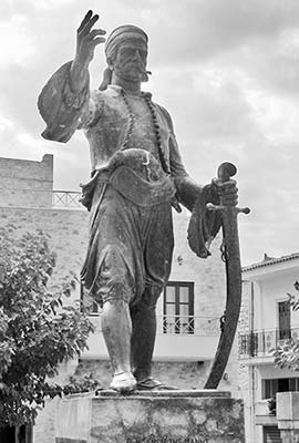
The square hosts a lively market on Saturday mornings. At other times, everything else of interest is to be found about 500 yards west of here, around the old main square, Plateia 17 Martiou. If Mavromichalis jumped off his pedestal, marched toward the candy-colored cafés, and headed left, he’d reach the old center of town in five minutes: a stony fortified village settlement circling a stone church. Reaching the old town, circle the square counterclockwise (keeping the church on your left) and find the life-size memorial plaque on the wall to your right. This is the spot where Petros mustered his men for the march to Kalamata. Just past the plaque, near the well, is a rustic bakery (Της Κυρά Μηλιάς) run by Milia, who makes bread and savory pies in a wood-fired oven. For an edible souvenir, survey the bags of cookies on the rack by the door. Continue rounding the church until you’re facing the bell tower. Now step back and take it in: This is the 18th-century Church of Taxiarhes (Archangels), sporting an impressive four-story bell tower and dominating the square. The carvings above the main door show the archangels Gabriel and Michael, flanked by the saints Georgios and Dimitrios on horseback.
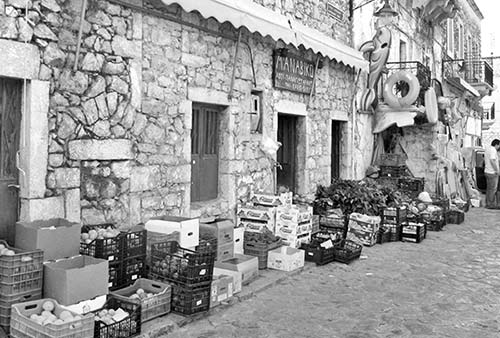
If you want more of a wander, keep the bell tower at your back and take the path straight in front, skirting around the ruins of the war tower of Petros Mavromichalis. Follow this alley as it winds its way next to a church (on the left, just after the tower). At the end of the alley, jog left, then right. On this square are the Church of St. John and the Pikoulakis Tower—home to the two-room Mani Byzantine Museum, which has a few artifacts from the Christian history of this area (closed Tue).
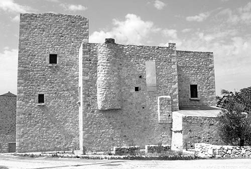
• Your next stop is the Pyrgos Dirou Caves, about six miles south of Areopoli. Follow the well-marked signs for Diros Caves; the turnoff is marked with a blue sign in the center of Pyrgos town. If you go past Pyrgos and reach the turnoff sign for Γκλεζι, you’ve gone too far—backtrack into Pyrgos. The cave entry is along a small bay, reached by a steep road that twists down to the water.
(If you’re skipping the caves, or saving them for the end of your drive, follow signs toward Kotronas/Κότρωνας just south of Areopoli—take the left turn at the fork—and pick up this tour at “Eastern Mani,” later.)
▲Pyrgos Dirou Caves (a.k.a. Diros Caves and Vlychada Cave)
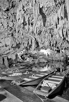
These remarkable cave formations—discovered by locals in the 1870s and opened to the public in 1963—rank among Europe’s best. The formations range from stout stalactites and stalagmites to delicate hair-like structures—many of them surprisingly colorful, thanks to reddish iron deposits.
The Mani feels as wild as its history. The region was supposedly first developed around 200 BC by breakaway Spartans (from the famously warlike city to the north). Spartan stubbornness persisted in the Mani character for centuries—and made Maniots slow to adopt Christianity. In the 10th century, St. Nikon finally converted the Maniots, and a flurry of Byzantine church-building followed.
Most coastal Mani towns (including Kardamyli) were slowly deserted in the Middle Ages as marauding pirate ships forced people to flee into the hills. There they hid out in villages tucked in the folds of the mountains, far from the coast. (Later, in the 18th century, the construction of protective tower houses allowed Maniots to tentatively begin to return to their coastal settlements.)
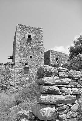
Fertile land here was at an absolute premium and hotly contested. In the 17th and 18th centuries, this hostile corner of Greece was known to travelers as the “land of evil counsel” (Kalavoulia) because of its reputation for robbery and piracy—a more reliable way to survive than trying to eke out an honest living by farming. Maniots banded together in clans, whose leaders built the characteristic tower settlements (kapitanias) that are a feature of the region. Each kapitania controlled its own little city-statelet of land. Some larger towns were occupied by several rival kapitanias. Honor was prized even more than arable land, and each clan leader had a chip on his shoulder the size of a big slab of feta cheese. Vendettas and violent bickering between clans—about control of territory or sometimes simply respect—became epidemic. If Greece had a Tombstone and an OK Corral, this is where they’d be.
When they weren’t fighting each other, the Maniots banded together to fight off foreign invaders. Locals brag that the feisty Mani—still clinging to the stubborn militarism of the ancient Spartans—remained the only corner of Greece not fully under the thumb of the Ottoman Turks. During nearly four centuries of Turkish rule, the sultan struck a compromise to appoint more or less Ottoman-friendly Maniots as regional governors. After a failed Greek uprising against the Turks in the late 18th century, Greeks from all over the country flooded into the Mani to escape harsh Ottoman reprisals. As the population boomed, competition for the sparse natural resources grew even fiercer.
Perhaps not surprisingly, the hot tempers of the Maniots made the peninsula the crucible for Greek independence. On March 17, 1821, Maniot Petros Mavromichalis, the Ottoman-appointed governor (bey), led a spirited rebellion against his Turkish superiors. Mavromichalis succeeded in taking Kalamata six days later, and the War of Independence was underway. What began in the remote hills of the Mani quickly engulfed the rest of Greece, and by 1829 the Ottomans were history and Greece was independent.
Looking around today at the barren landscape of the Mani Peninsula, which now barely supports 5,000 people, it’s hard to believe that 200 years ago it sustained a population of almost 60,000. Over time that number was depleted by blood feuds, which raged into the early 20th century. The end of Ottoman rule in the early 19th century and the devastating Greek Civil War of the mid-20th century sparked population shifts out of the region, as Maniots sought easier lifestyles elsewhere in Greece, or set out for the promise of faraway lands, primarily America, the UK, and Australia. But these days, as the Mani emerges as a tourist destination, many Maniot emigrants are returning home—bringing back with them an array of accents from around the world.
Cost and Hours: €15; daily 9:00-17:00, Nov-April until 16:30; +30 2733 052 222.
Crowd-Beating Tips: Because this is a very popular attraction, you might be in for a wait during busy summer months (lines are worst from 12:00 to 14:00 and any time in August). Figure about an hour total to tour the caves (not counting time in line). Booking a ticket online can secure a place and help avoid a long wait: www.diros-caves.gr [URL inactive].
Visiting the Caves: Once you’ve bought your ticket and your group is called, you’ll walk five minutes down to the cave entrance for your appointed entry time (if the gate’s open, you can also drive right down to the cave entrance after getting your ticket). The temperature in the caves is usually between 60 and 65 degrees Fahrenheit—you may want a sweater. (Be sure to pick up the English brochure, which says about as much as your Greek guide.)
After you’ve boarded a little boat, your guide poles you along underground canals, softly calling out (usually in Greek only) the creative names for each of the spectacular formations: “Hercules’ columns,” “palm forest,” “golden rain,” “crystal lily,” and so on. Stalactites drip down directly overhead, and damp cave walls, beautifully lit, are inches away—you’ll need to duck or bend from time to time as the boat glides through some of the narrower passageways. In some places the water beneath you is 100 feet deep...you’re actually floating near the ceiling of a vast, flooded cavern. (Life preservers are provided.) Pinch yourself: This isn’t a movie or a Disney ride, but the real deal. After your three-quarter-mile boat trip, you return to dry land and walk another quarter-mile for up-close views of more limestone formations.
Eastern Mani
To experience the Mani’s most rugged and remote-feeling area, cross over the spine of the peninsula to the eastern coast. The few tourists you encounter melt away the farther south you drive, until it’s just you, sheer limestone cliffs, fortified ghost towns, olive trees, and tumbling surf. Here the terrain seems even more desolate than what you’ve seen so far.
Yet as you explore the countryside you’ll notice huge building projects, hotel developments springing up like mushrooms—including the luxury Tzokeika Traditional Settlement just north of Platsa at the beginning of this drive—and decadent private mansions. (Athenian big shots like to have a Mani escape.) The impressive stonework is generally done by Albanian workers. Mixed in are tiny 13th-century Byzantine churches clinging to the stark land like barnacles and lots of mobile “honey farms.” Bee farmers chase the sage and thyme, setting up their hives where the pollen is best. The honey of the Mani is the most expensive and prized in Greece. With so much to see, drive carefully so you don’t wind up the reason for another roadside shrine.
After taking the turn for Kotronas/Κότρωνας just south of Areopoli, head overland through stark scenery. Cresting the hills at Himara/Χιµαρα, you’ll begin to glimpse the Mani’s east coast. At Loukadika/Λουκαδικα, bear right (south) along the main road toward Kokkala/Κοκκαλα, and you’ll soon find yourself traversing the top of a cliff above some of the best scenery on the Mani. Heading south you’ll see more and more fortified towers climbing up the rocky hillsides. Imagine that each of these towers represents the many ruthless vendettas that were fought here.
Approaching Dimaristika/Διµαριστικα, notice the three tower settlements that dot the hill at three different levels. It’s easy to imagine why the Ottomans never took this land—the villages could see them coming by ship from miles away and bombard them with cannonballs. And if the Ottomans managed to make landfall, they’d have to climb up, up, up to overtake the forts. It just wasn’t worth the trouble.
The village of Lagia/Λαγια was supposedly the site of the last Mani vendetta, a scuffle in the 1930s. The town seems almost abandoned today, but most of these houses are owned by Maniots who now live in Athens and come back for the holidays. On the square (along the main road through town) is a monument honoring Panagiotis Vlahakos, a villager who died in a 1996 conflict over a small Aegean island (called Imia in Greek, or Kardak in Turkish) claimed by both Greece and Turkey. The Ottomans left this country close to two centuries ago, but Greek-Turkish relations are still raw.
• Leaving Lagia, continue straight ahead. After about five minutes, you’ll reach a fork. If you’re ready to head back around to the western Mani coast, take the right turn (direction: Lagia—and skip down to the “Vathia” section of this tour). But to reach the most distant corner of mainland Greece, Cape Tenaro, bear left toward the long list of Greek names (including Kokkinogeia/Κοκκινόγεια). Switchback your way tightly down toward the sea, always following signs for Kokkinogeia/Κοκκινόγεια; if highway signs are missing, look for smaller hiking-route signs that mark the Tenaro Archaeological Site (not Porto Kagio). After cresting the small isthmus over to the west side of the cape, with both bays in front of you, you’ll come to a poorly-marked fork just after a stone shed; bear right, then take a sharp left. You’ll shortly pass near Marmari/Μαρµαρι (but not through it; it’ll be below and to the right as you follow hikers’ signs to take an uphill left fork). Then keep following signs to Tenaro/Ταίναρο and Sanctuary and Death Oracle, staying left. You’ll come to the literal end of the road.
Imagine the work it takes to eke out a subsistence living in this god-forsaken corner of Greece, spending your days digging up stones to build the fortified tower houses you see capping the hills.
Cape Tenaro (a.k.a. Cape Matapan): Greece’s “Land’s End”
Drive out to the tip of the rocky promontory known as the “Sanctuary of the Dead.” As the farthest point of the known world, this was where the ancient Greeks believed that the souls of the deceased came to enter the underworld. An underwater cave here was thought to belong to Hades, god of the underworld. It was also the site of a temple and oracle devoted to Poseidon, the god of the sea (marked today by a ruined Christian church). Visitors can still explore the scant unexcavated ruins of an ancient town that was called Tenaron (mentioned in the Iliad). An inviting restaurant also offers travelers a good opportunity for a break.
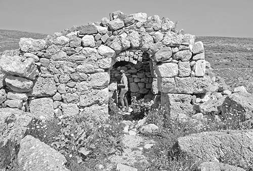
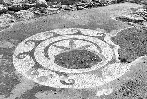
Just below the parking lot are the ruins of an early Christian church, likely constructed using giant blocks scavenged from the temple upon which it sits. To visit the poorly marked ruins of Tenaron, walk down from the parking lot toward the water, then bear right around the far side of the bay. You’ll soon be able to pick out the footprints of ancient Greek and Roman structures. Hiding behind one of these low walls, about a five-minute walk around the tiny bay, is a surprisingly intact floor mosaic from a Roman villa, just sitting out in the open. If you’ve got time to kill and are up for a longer hike, trudge another 30 minutes out to a lighthouse at the end of the world. A busy shipping channel lies just offshore; you can count the vessels heading east to Athens or to ports to the west.
• Retrace your tracks back to civilization. Reaching the first fork (unmarked, with the stone shed), turn left and head up the west coast of the Mani (toward Vathia/Βαθειά—not the direction you came down from). Soon you’ll be treated to views of the classic Mani ghost town. The pullout on the left, 100 yards before the town, offers the best view. Then continue and park after you see the sign for the Aspalathos restaurant. From there you can walk into the stony village. Circle it clockwise (a former donkey mill is inside the first house on the left). Consider how a settlement like this with no roads and only footpaths can’t survive in the modern age.
Vathia
The most dramatic of all the Mani tower villages, Vathia is Vendetta-ville—it seems everyone here barricaded themselves in forts. The more towers a town had, the more dangerous it was—and it’s hard to imagine cramming more towers into a single town than they did in Vathia. Built on a rocky spur and once famed for its olive oil, Vathia was an extreme example of what can happen when neighbors don’t get along. The 80-some houses were split north/south into two rival camps, which existed in a state of near-permanent hostility. Now Vathia is mostly uninhabited. Once-intimidating towers are now haunting ruins, held together with boards and steel cables.
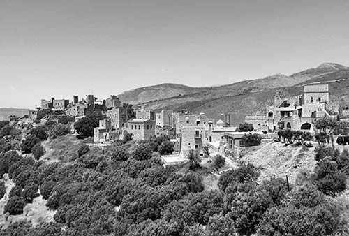
• Driving north, you’ll pass through the larger town of Kiparissos—originally Kenipolis (New City), which was settled by those who left ancient Tenaron—then turn off when you see Γερολιμένας (signs in Greek only) to reach the town center and port of...
Gerolimenas
Gerolimenas (Γερολιμένας; yeh-roh-LEE-meh-nahs, roughly “sacred port”), nestled at the back of a deep sheltered bay, is a cute fishing town kept alive by tourism. The waterfront is lined with cafés and restaurants, and the water is good for a swim—making it an all-around enjoyable place to take a break and watch the surf.
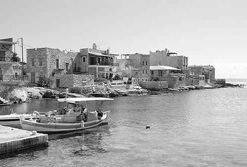
• Continue back out to the main road and turn left, toward Kita. This town was the setting for the Mani’s final major feud in 1870, which raged for weeks until the Greek army arrived, artillery in tow, to enforce a truce.
For one last little detour, hang a left turn at the village of Agios Georgios (toward Μέζαπος/Mezapos/Beach), and go a bit more than a mile down to the...
Bay of Mezapos
At the cove at Mezapos (MEH-zah-pohs), carved out of limestone by the surf, boats bob picturesquely in the protective harbor, watched over by an extremely sleepy hamlet. Mezapos was once a notorious haven for pirates. It’s easy to see why if you look across the bay to see the long, naturally fortified peninsula aptly named Tigani (frying pan). This was once thought to be the site of the Frankish castle of Maina (roughly, “clenched fist”), which some believe to be the namesake of the Mani.
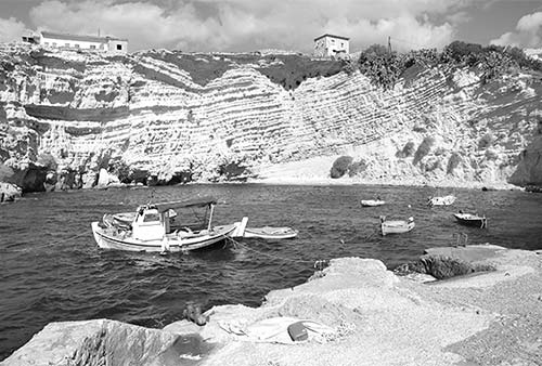
• Continuing north you’ll first pass the village of Pyrgos—with the turnoff for the caves—then arrive back at Areopoli. From here retrace your route around Itilo Bay back to Kardamyli; or, if you’re continuing onward, head east just beyond Areopoli to reach Monemvasia.