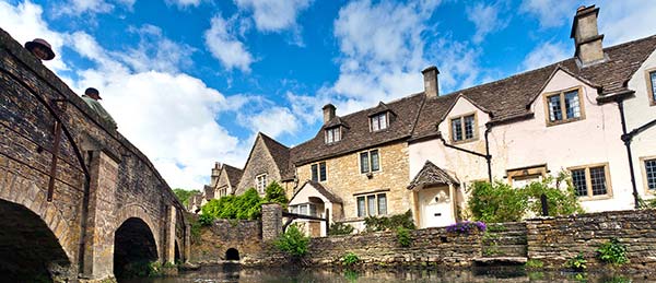
THE COTSWOLDS
Chipping Campden • Stow-on-the-Wold • Moreton-in-Marsh
Orientation to Chipping Campden
Orientation to Stow-on-the-Wold
Orientation to Moreton-in-Marsh
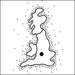
The Cotswold Hills, a 25-by-90-mile chunk of Gloucestershire, are dotted with enchanting villages. As with many fairy-tale regions of Europe, the present-day beauty of the Cotswolds is the result of an economic disaster. Wool was a huge industry in medieval England, and Cotswold sheep grew the best wool. (The famed Cotswold Lion breed goes back to ancient times when Romans bred one of their sheep with the indigenous breed to make a hybrid version that was big, bad for meat, and great for wool.) A 12th-century saying bragged, “In Europe the best wool is English. In England the best wool is Cotswold.” The region prospered. Wool money built fine towns and houses. Local “wool” churches are called “cathedrals” for their scale and wealth. Stained-glass slogans say things like “I thank my God and ever shall, it is the sheep hath paid for all.”
But with the rise of cotton and the Industrial Revolution, the woolen industry collapsed. The wealthy Cotswold towns fell into a depressed time warp; the homes of impoverished nobility became gracefully dilapidated. Today, visitors enjoy a harmonious blend of man and nature—the most pristine of English countrysides decorated with time-passed villages, rich wool churches, tell-me-a-story stone fences, and “kissing gates” you wouldn’t want to experience alone. Appreciated by throngs of 21st-century Romantics, the Cotswolds are enjoying new prosperity as rural-rooted citizens have been joined by wealthy retirees, London executives who don’t mind a lengthy commute, and celebrities.
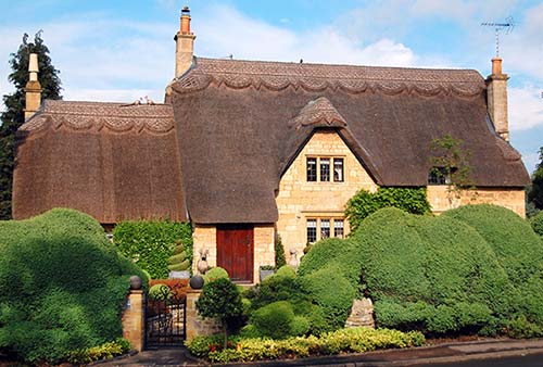
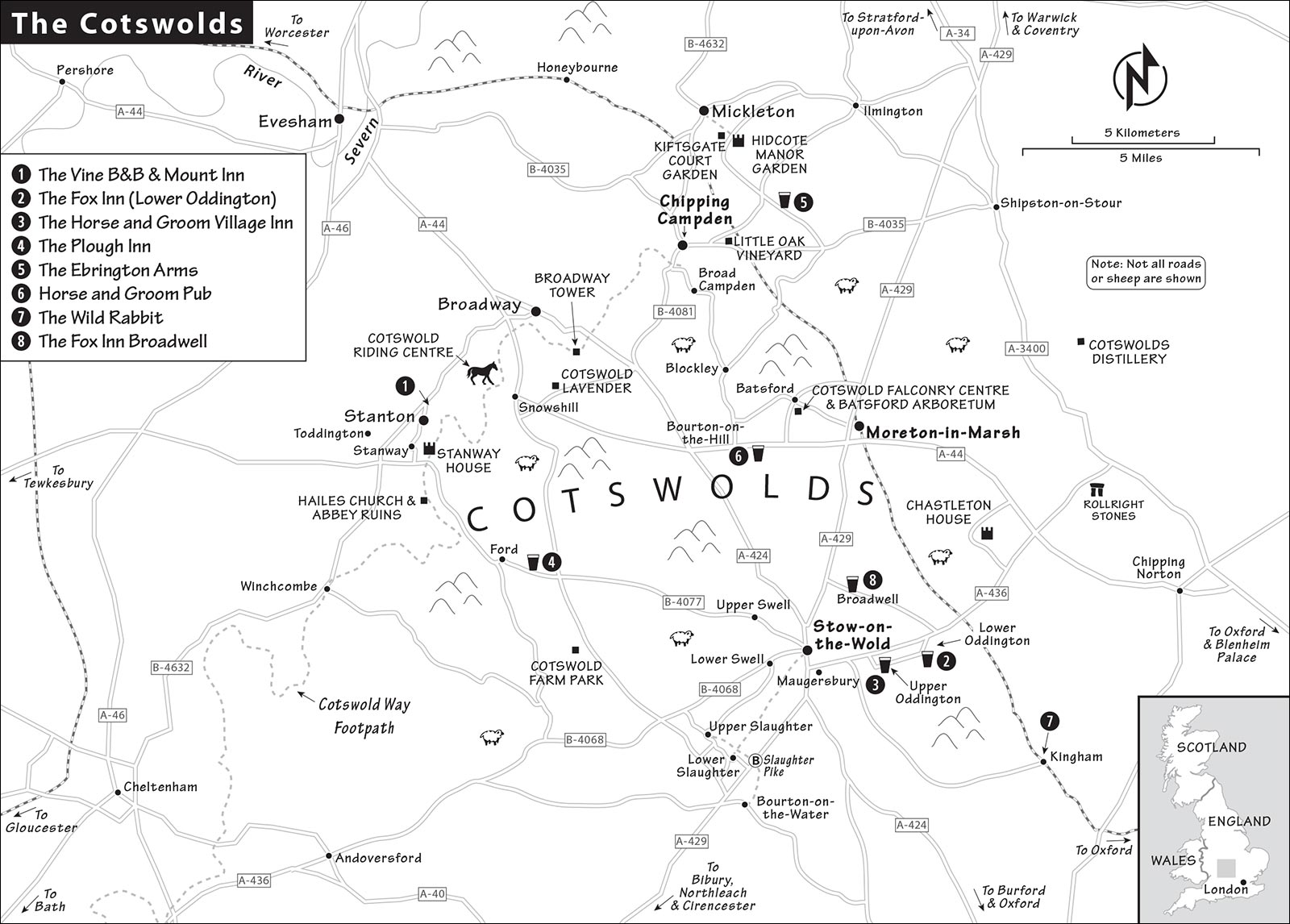
The north Cotswolds are best. Two of the region’s coziest towns, Chipping Campden and Stow-on-the-Wold, are eight and four miles, respectively, from Moreton-in-Marsh, which has the best public transportation connections. Any of these three towns makes a fine home base for your exploration of the thatch-happiest of Cotswold villages and walks.
PLANNING YOUR TIME
The Cotswolds are an absolute delight by car and, with a well-organized plan—and patience—are enjoyable even without one. Do your homework in advance; read this chapter carefully. Then decide if you want to rent a car, rely on public transportation (budgeting for an inevitable taxi ride), or reserve a day with a tour company or private driver. Whatever you choose, on a three-week countrywide trip, I’d spend at least two nights and a day in the Cotswolds—its charm has a softening effect on many uptight itineraries. You could enjoy days of walking from a home base here.
Home Bases: Quaint without being overrun, Chipping Campden and Stow-on-the-Wold both have good accommodations. Stow has a bit more character for an overnight stay and offers the widest range of choices. The plainer town of Moreton-in-Marsh is the only one of the three with a train station, and only worth visiting as a transit hub or for a stop at the town’s excellent TI—the best in the Cotswolds. While Moreton has the most convenient connections, nondrivers could home-base in Chipping Campden or Stow—especially if you don’t mind sorting through bus schedules or springing for the occasional taxi to connect towns. (This becomes even more challenging on Sundays, when there is essentially no bus service.) These three towns are a 10- to 15-minute drive apart from each other.
Tourist Traps (Broadway, Bourton-on-the-Water, and Bibury): Mass tourism is channeled to a handful of towns that cater to big buses and their groups. Known as “The Bs,” this trio of village cuteness has invested in convenient coach lots (the terra firma equivalent of cruise ship docks), and they’re capitalizing on their over-the-top quaintness and fame. Expect traffic congestion and lots of crowds during the day as most visitors are day-tripping from London or Stratford. If flexible, enjoy these towns at the end of the day when they’re relaxed and quiet.
Nearby Sights: If you want to take in some Shakespeare, note that Stow, Chipping Campden, and Moreton are only a 30-minute drive from Stratford, which offers a great evening of world-class entertainment (see next chapter). And England’s top countryside palace, Blenheim, is located at the eastern edge of the Cotswolds, between Moreton and Oxford (see previous chapter). For drivers, Blenheim fits well on the way into or out of the region.
One-Day Driver’s Cotswold Blitz: Use a good map and reshuffle this plan to fit your home base:
| 9:00 | Browse through Chipping Campden, following my self-guided walk. |
| 10:30 | Joyride through Snowshill, Stanway, and Stanton, sightseeing at your choice of several worthwhile stops in the area. |
| 13:00 | Have lunch in Stow-on-the-Wold, then follow my self-guided walk there. |
| 16:00 | Drive to the Slaughters and Bourton-on-the-Water or Northleach; or, if you’re up for a hike instead of a drive, walk from Stow to the Slaughters to Bourton, then catch the bus back to Stow. |
| 19:00 | Have dinner at a countryside gastropub (make a reservation), then head home; or drive 30 minutes to Stratford-upon-Avon for a Shakespeare play. |
With More Time: If you have a second day to explore the area by car, consider this plan for day 2:
| 10:00 | Visit Hidcote Manor, then meander through Broad Campden, Blockley, and Bourton-on-the-Hill on the way to Stow-on-the-Wold. |
| 12:00 | Have lunch in Stow-on-the-Wold, then follow my self-guided walk. |
| 14:00 | Drive one of two loops, exploring anything you missed on day 1: Either head south through Upper and Lower Slaughter, Bourton-on-the-Water (visit the Cotswold Motoring Museum), Northleach, Chedworth Roman Villa, and Bibury; or explore sights in and around Moreton-in-Marsh (Chastelton House, Rollright Stones, Cotswolds Distillery, and Batsford Arboretum). |
| 19:00 | Enjoy another atmospheric gastropub dinner (make reservations) before returning to your home base. |
Two-Day Plan by Public Transportation: This plan is best for any day except Sunday—when virtually no buses run—and assumes you’re home-basing in Moreton-in-Marsh.
Day 1: In the morning, take bus #1 to Chipping Campden (likely departing around 9:25) to explore that town. Hike up Dover’s Hill and back (about one-hour round-trip), or take bus #1 to Mickleton and walk (uphill, 45 minutes) to Hidcote Manor Garden for a visit there. Eat lunch in Chipping Campden, then squeeze in either bus #2 to Broad Campden or bus #1 to Broadway before returning directly from Broadway (bus #1 only) or Chipping Campden (bus #1 or #2) to Moreton.
Day 2: Take the morning bus (#801, departing at 8:05 or 9:25) to Stow. After poking around the town, hike from Stow through the Slaughters to Bourton-on-the-Water (about 3 hours at a relaxed pace), then return by bus or taxi to Moreton for dinner.
TOURIST INFORMATION
Local TIs stock a wide array of helpful resources and can tell you about any local events during your stay. Each village also has its own assortment of brochures, often for a small fee. While being asked to pay for these items seems chintzy, realize that Cotswold TIs have lost much of their government funding and are struggling to make ends meet (some are run by volunteers). Most also sell Ordnance Survey maps prepared by the British government that are ideal for hiking. The “OS Maps” app has free basic maps of the region, and any purchase of a paper OS map comes with a code for a free digital version through the app.
It’s also worth consulting Cotswold Lion, the online biannual magazine (www.cotswoldsaonb.org.uk/about-us).
GETTING AROUND THE COTSWOLDS
By Car
Joyriding here truly is a joy. Winding country roads seem designed to spring bucolic village-and-countryside scenes on the driver at every turn. Distances are wonderfully short, and easily navigable with GPS. As a backup, you could invest in the Ordnance Survey map of the Cotswolds, sold locally at TIs and newsstands (the £10 Explorer OL #45 map is excellent but geared toward hiking and is too detailed for drivers; the OS Tour £6 map covers a wider area in less detail). Here are driving distances from Moreton: Stow-on-the-Wold (4 miles), Chipping Campden (8 miles), Broadway (10 miles), Stratford-upon-Avon (17 miles), Warwick (23 miles), Blenheim Palace (20 miles).
Car hiking is great. In this chapter, I cover the postcard-perfect (but discovered) villages. With a car and a good map (either GPS or the local Ordnance Survey), you can easily ramble about and find your own gems. The problem with having a car is that you are less likely to walk. Consider taking a taxi or bus somewhere, so that you can walk back to your car and enjoy the scenery (see suggestions next).
By Bus
The Cotswolds are so well preserved, in part, because public transportation to and within this area has long been miserable. Fortunately, trains link the region to larger towns, and a few key buses connect the more interesting villages. Centrally located Moreton-in-Marsh is the region’s transit hub—with the only train station and several bus lines.
To explore the towns, use the bus routes that hop through the Cotswolds about every 1.5 hours, lacing together main stops and ending at train stations. In each case, the entire trip takes about an hour. Put together a one-way or return trip by public transportation, making for a fine Cotswold day. Individual fares are around £2-5. If you plan on taking more than two rides in a day, consider a day pass (check prices online at www.pulhamscoaches.com or www.stagecoachbus.com).
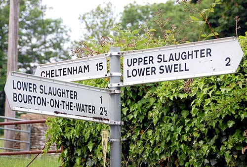
Local TIs hand out easy-to-read bus schedules for the key lines described here (or check www.traveline.info, or call the Traveline info line, +44 871 200 2233). Note that some schedules omit stop names for simplicity. When in doubt, ask at the TI if the bus stops at your destination, or check with the driver before boarding.
If you’re traveling one-way between two train stations, remember that the Cotswold villages have no official baggage-check services. You’ll need to improvise; ask sweetly at the nearest TI or business.
Note that no single bus connects the three major towns described in this chapter (Chipping Campden, Stow, and Moreton); to get between Chipping Campden and Stow, you’ll have to change buses in Moreton. Since buses can be unreliable and connections aren’t timed, it may be better to call a driver or taxi to go between Chipping Campden and Stow.
Buses #1 and #2 run from Moreton-in-Marsh to Blockley and Broad Campden (#1 also stops in Broadway, 3/day) on their way to Chipping Campden, and pass through Mickleton before ending at Stratford-upon-Avon (operated by Stagecoach Midlands, www.stagecoachbus.com). Bus #51 runs between Moreton-in-Marsh and Stratford-upon-Avon (Mon-Sat 5/day, none on Sun, run by Pulham & Sons Coaches, www.pulhamscoaches.com).
The #8XX bus lines are operated by Pulham & Sons Coaches (+44 1451 820 369, www.pulhamscoaches.com): Bus #801 runs nearly hourly in both directions from Moreton-in-Marsh to Stow-on-the-Wold to Bourton-on-the-Water (connecting towns in about 15 minutes); most continue to Northleach and Cheltenham (limited service on Sun in summer). To get to Bibury and Cirencester, take bus #801 to Bourton-on-the-Water, then transfer to bus #855 toward Cirencester. Bus #802 connects the Kingham train station (rail connections to Oxford) with Bourton-on-the-Water (50 minutes) and Stow-on-the-Wold (15 minutes).
Warning: Schedules change frequently, so always confirm details and check the last return bus before setting out. Leave yourself plenty of time if using buses to make another connection (such as a train to London). Keep in mind that bus service is essentially nonexistent on Sundays.
By Bike
Despite narrow roads, high hedgerows (blocking some views), and even higher hills, bikers enjoy the Cotswolds free from the constraints of bus schedules. For each area, TIs have fine route planners that indicate which peaceful, paved lanes are particularly scenic for biking. In summer, it’s smart to book your rental bike a couple of days ahead.
TY Cycles in Chipping Norton rents hybrid and e-bikes and can deliver them to your hotel for a fee if it’s within 15 miles of their shop (includes Stow, Chipping Campden, and Moreton-in-Marsh; closed Sun, +44 1608 238 150, www.tycycles.co.uk, enquiries@tycycles.co.uk, Tom and Rob Yeatman).
History can be read into the names of the area. Cotswold could come from the Saxon phrase meaning “hills of sheep’s cotes” (shelters for sheep). Or it could mean shelter (“cot” like cottage) on the open upland (“wold”).
In the Cotswolds, a town’s main street (called High Street) needed to be wide to accommodate the sheep and cattle being marched to market. Some of the most picturesque cottages were once humble row houses of weavers’ cottages, usually located along a stream for their waterwheels (good examples in Bibury and Lower Slaughter). The towns run on slow clocks and yellowed calendars.
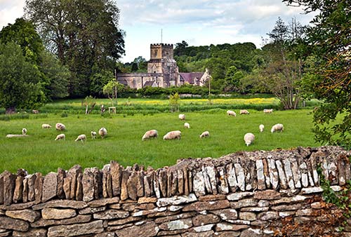
Fields of yellow (rapeseed) and pale blue (linseed) separate pastures dotted with black and white sheep. In just about any B&B, when you open your window in the morning, you’ll hear sheep baa-ing. The decorative “toadstool” stones dotting front yards throughout the region are medieval staddle stones, which buildings were set upon to keep the rodents out.
Cotswold walls and roofs are made of the local limestone. The limestone roof tiles hang by pegs. To make the weight more bearable, smaller and lighter tiles are higher up. An extremely strict building code keeps towns looking what many locals call “overly quaint.”
While you’ll still see lots of sheep, the commercial wool industry is essentially dead. It costs more to shear a sheep than the 50 pence the wool will fetch. In the old days, sheep lived long lives, producing lots of wool. When they were finally slaughtered, the meat was tough and eaten as “mutton.” Today, you don’t find mutton much because the sheep are raised primarily for their meat, and slaughtered younger. When it comes to Cotswold sheep these days, it’s lamb (not mutton) for dinner (not sweaters).
Towns are small, and everyone seems to know everyone. The area is provincial yet ever-so-polite, and people commonly rescue themselves from a gossipy tangent by saying, “It’s all very...mmm...yaaa.”
In contrast to the village ambience are the giant manors and mansions that have private gated driveways you’ll drive past. Many of these now belong to A-list celebrities, who have country homes here. If you live in the Cotswolds, you can call Madonna, Elizabeth Hurley, and Kate Moss your neighbors.
This is walking country. The English love their walks and vigorously defend their age-old right to free passage. Once a year the Ramblers, Britain’s largest walking club, organizes a “Mass Trespass,” when each of the country’s 50,000 miles of public footpaths is walked. By assuring that each path is used at least once a year, they stop landlords from putting up fences. Any paths found blocked are unceremoniously unblocked.
Questions to ask locals: Do you think foxhunting should have been banned? Who are the Morris men? What’s a kissing gate?
If you make it to Bourton-on-the-Water, you can rent bicycles through Hartwells on High Street (see here). In Broadway, e-bikes are rentable at Broadway Tower (see here).
By Foot
If you have a few hours to spare, consider venturing across the pretty hills and meadows of the Cotswolds. Each of the home-base villages I recommend has several options. Stow-on-the-Wold, immersed in pleasant but not-too-hilly terrain, is within easy walking distance of several interesting spots and is probably the best starting point. Chipping Campden sits along a ridge, which means that hikes from there are extremely scenic, but also more strenuous. Moreton—true to its name—sits on a marsh, offering flatter and less picturesque hikes.
Information: Walking guidebooks and leaflets abound, giving you a world of choices for each of my recommended stops. If you’re doing any hiking whatsoever, get the excellent Ordnance Survey Explorer OL #45 map, which shows every road, trail, and ridgeline (sold at local TIs). Nearly every hotel and B&B offers hiking advice and has a box or shelf of local walking guides and maps, including Ordnance Survey #45. Don’t hesitate to ask for a loaner. Two good websites offer excellent resources for walkers: Cotswold National Landscape, with an interactive map, downloadable walk routes and info sheets, and a list of available guided walks that range in distance and often involve a stop at a pub or tearoom (www.cotswoldsaonb.org.uk); and NationalRail.co.uk (scroll down and select “Cotswold Way,” then “Circular and Linear Walks”).
Organized Walking Packages: For long-distance walkers connecting towns, Cotswold Walking Holidays is an appealing option. They can help you design a walking vacation, provide route instructions and maps, transfer your bags, and even arrange lodging. They also offer six-night walking tours that come with a local guide. Walking through the towns allows you to slow down and enjoy the Cotswolds at their very best—experiencing open fields during the day and arriving in towns just as the day-trippers depart (cycling options available, www.cotswoldwalks.com).
Routes: There are many options for hikers, ranging from the “Cotswold Way” path that leads 100 miles from Chipping Campden all the way to Bath, to easy loop trips to the next village. Serious hikers enjoy doing a several-day loop, walking for several hours each day and sleeping in a different village each night. Also see my recommended day-hikes, later.
One popular route is the “Cotswold Ring”: Day 1—Moreton-in-Marsh to Stow-on-the-Wold to the Slaughters to Bourton-on-the-Water (12 miles); Day 2—Bourton-on-the-Water to Winchcombe (13 miles); Day 3—Winchcombe to Stanway to Stanton (7 miles), or all the way to Broadway (10.5 miles total); Day 4—On to Chipping Campden (just 5.5 miles); Day 5—Chipping Campden to Broad Campden, Blockley, Bourton-on-the-Hill, or Batsford, and back to Moreton (7 miles).
Navigation Tips: On any walk between towns, stick to the walking/hiking trails, and avoid the busier (if more direct) main roads. It’s much safer—and more scenic—to take the longer footpaths and trails (which veer away from roads, cutting through fields and adding time and distance). Villages are generally no more than three miles apart, and most have pubs that would love to feed and water you. Wear sturdy shoes, pack an extra layer, and get details locally before heading out.
Town Walks: While none of the Cotswold towns offers regularly scheduled walks, many have voluntary warden groups who love to meet visitors and give walks for a small donation (see specific contact information listed in Chipping Campden’s “Helpful Hints,” later).
Recommended Hikes
Here are a few hikes to consider, in order of difficulty (easiest first). I’ve selected these for their convenience to the home-base towns and because the start and/or end points are on bus lines, allowing you to hitch a ride back to where you started (or on to the next town) rather than backtracking by foot.
Stow, the Slaughters, and Bourton-on-the-Water: Walk from Stow to Upper and Lower Slaughter, then on to Bourton-on-the-Water (which has bus service back to Stow on #801 or #802). One big advantage of this walk is that it’s mostly downhill (4.5 miles, about 2-3 hours one-way). For details, see here.
Chipping Campden, Broad Campden, Blockley, and Bourton-on-the-Hill: From Chipping Campden, it’s an easy one-mile walk into charming Broad Campden, and from there, a more strenuous two-mile hike to Blockley and two more miles to Bourton-on-the-Hill (Blockley is connected by buses #1 and #2 to Chipping Campden and Moreton). For more details, see here.
Winchcombe, Stanway, Stanton, and Broadway: You can reach the charming villages of Stanway and Stanton by foot, but it’s tough going—lots of up and down. The start and end points (Winchcombe and Broadway) have limited bus connections, and in a pinch some buses do serve Stanton (but carefully check schedules before you set out).
Broadway to Chipping Campden: The hardiest hike of those I list here, this takes you along the Cotswold Ridge. Attempt it only if you’re a serious hiker (5.5 miles).
Bibury and the Coln Valley are pretty, but limited bus access makes hiking there less appealing.
By Taxi or Private Driver
Two or three town-to-town taxi trips can make more sense than renting a car. While taking a cab cross-country seems extravagant, the distances are short (Stow to Moreton is 4 miles, Stow to Chipping Campden is 10), and one-way walks are lovely. If you call a cab, confirm that the meter will start only when you are actually picked up. Consider hiring a private driver at the hourly “touring rate” (generally around £35), rather than the meter rate. For a few more bucks than taking a taxi, you can have a joyride peppered with commentary. Whether you book a taxi or a private driver, expect to pay about £25 between Chipping Campden and Stow and about £20 between Chipping Campden and Moreton.
Note that the drivers listed here are not typical city taxi services (with many drivers on call), but are mostly individuals—it’s best to call ahead if in high season, since they can be booked in advance on weekends. Local TIs can also provide taxi information.
To scare up a taxi in Moreton, try Ian Swallow Taxis (+44 7789 897 966) or Cotswold Taxis (+44 7710 117 471; see also the taxi phone numbers posted outside the Moreton train station office). In Chipping Campden, call James at Cotswold Chauffeur Services (+44 7980 857 833), or Les Proctor, who offers village tours and station pick-ups (+44 7580 993 492, Les also co-runs Cornerways B&B—see here). Tim Harrison at Tour the Cotswolds specializes in tours of the Cotswolds and its gardens, but he also gives tours outside the area (+44 7779 030 820, www.tourthecotswolds.co.uk). Lifelong resident Nick Long is flexible, fun, and knowledgeable (+44 7580 595 202, theoriginalctc@hotmail.co.uk). Peter Shelley at Cotswolds by Car offers custom tours in a comfy Range Rover (+44 7968 330 485, www.cotswoldsbycar.com).
By Minibus Tour
Go Cotswolds offers a fast blitz of the most famous stops. It’s an efficient way to see some of the Cotswolds’ most picturesque places (with six stops in a 16-seat bus). Energetic Tom or Colin can pick you up from Stratford-upon-Avon or Moreton-in-Marsh for a jam-packed day including about an hour each in Chipping Campden, Stow-on-the-Wold, and Bourton-on-the-Water (£58/person, +44 7786 920 166, www.gocotswolds.co.uk, info@gocotswolds.co.uk). Handy option: Check out of your hotel, stow bag on bus, and catch the evening train in Moreton for your next stop.
Cotswolds Guided Tours, run by Lucy and Richard, offers fun and informative private tours that hit several locations in 6-8 hours (starting at £395 for up to 7 people, dates vary—confirm online, +44 7756 513 150, www.cotswoldsguidedtours.co.uk, hello@cotswoldsguidedtours.co.uk).
Chipping Campden
Just touristy enough to be convenient, the north Cotswold town of Chipping Campden (CAM-den) is a ▲▲ sight. This market town, once the home of the richest Cotswold wool merchants, has some incredibly beautiful thatched roofs. Both the great British historian G. M. Trevelyan and I call Chipping Campden’s High Street the finest in England.
Orientation to Chipping Campden
TOURIST INFORMATION
Chipping Campden’s TI is tucked away in the old police station on High Street. Buy the cheap town guide with map, or the local Footpath Guide (Mon-Tue and Thu-Fri 9:30-14:00, Wed and Sat until 16:00, Sun 10:30-16:00; +44 1386 841 206, www.chippingcampdenonline.org, info@campdenonline.org).
HELPFUL HINTS
Book Ahead: For peak season visits, book your accommodation as early as possible. Many of the area’s best gastropubs get booked up in the evenings; reserve ahead if you have your heart set on a place (see the “Great Country Gastropubs” sidebar later in the chapter).
Market Day: A small country market fills the lower room of the Town Hall with arts, crafts, and homemade baked goods nearly year-round on Friday mornings (Fri 9:00-11:00, no market in Jan). Check for a heartier, more modern market on Fridays in the Market Hall (Fri 11:00-16:00).
Festivals: The Cotswold Olimpicks are a series of tongue-in-cheek countryside games (such as competitive shin-kicking) held atop Dover’s Hill, just above town (generally in late spring; check www.olimpickgames.co.uk). Chipping Campden also has a music festival in May.
Taxi: Try Cotswold Private Hire, Les Proctor, or Tour the Cotswolds (see here).
Parking: Find a spot anywhere along High Street and park for free with no time limit. There’s also a pay lot on High Street, next to the Town Hall (2-hour maximum). If those are full, there is free parking on the street called Back Ends. On weekends, you can also pay to park at the school at the north end of town (see map).
Tours: The local members of the Cotswold Voluntary Wardens are happy to show you around town for a small donation to the Cotswold Conservation Fund (suggested donation-£4/person, 1.5-hour walks run May-Sept Tue at 14:00 and Thu at 10:00, meet at Market Hall; +44 7761 565 661, Vin Kelly).
Walks and Hikes from Chipping Campden: Since this is a particularly hilly area, long-distance hikes are challenging. The easiest and most rewarding stroll is to the thatch-happy hobbit village of Broad Campden (about a mile, mostly level). From there, you can walk or take the bus (#2) back to Chipping Campden.
Or, if you have more energy, continue from Broad Campden up over the ridge and into picturesque Blockley—and, if your stamina holds out, all the way to Bourton-on-the-Hill (Blockley is connected by buses #1 and #2 to Chipping Campden and Moreton).
Alternatively, you can hike up to Dover’s Hill, just north of the village. Ask locally about this easy, circular one-hour walk that takes you on the first mile of the 100-mile-long Cotswold Way (which goes from here to Bath).
For more about hiking, see “Getting Around the Cotswolds—By Foot,” earlier.
Chipping Campden Walk
This self-guided stroll through “Campden” (as locals call their town) takes you from the Market Hall west to the old silk mill, and then back east the length of High Street to the church. It takes about an hour.
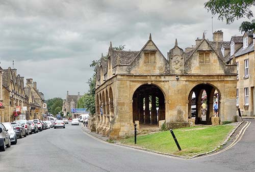
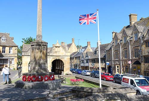
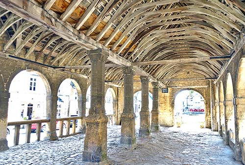
Market Hall: Begin at Campden’s most famous monument—the Market Hall. It stands in front of the TI, marking the town center. The Market Hall was built in 1627 by the 17th-century Lord of the Manor, Sir Baptist Hicks. (Look for the Hicks family coat of arms on the east end of the building’s facade.) Back then, it was an elegant shopping hall for the townsfolk who’d come here to buy their produce. In the 1940s, it was almost sold to an American, but the townspeople heroically raised money to buy it first, then gave it to the National Trust for its preservation.
The timbers inside are true to the original. Study the classic Cotswold stone roof, still held together with wooden pegs nailed in from underneath. (Tiles were cut and sold with peg holes, and stacked like waterproof scales.) Buildings all over the region still use these stone shingles. Today, the hall, which is rarely used, stands as a testimony to the importance of trade to medieval Campden.
Adjacent to the Market Hall is the sober WWI monument—a reminder of the huge price paid by nearly every little town. Walk around it, noticing how 1918 brought the greatest losses.
Between the Market Hall and the WWI monument you’ll find a limestone disc embedded in the ground marking the ceremonial start of the Cotswold Way (you’ll find its partner in front of the abbey in Bath—100 miles away—marking the southern end).
The TI is across the street, in the old police courthouse. If it’s open, you’re welcome to climb the stairs and peek into the Magistrate’s Court (free, same hours as TI, ask at TI to go up). Under the open-beamed courtroom is a humble little exhibit on the town’s history.
• Walk west, passing the Town Hall (with the cute little bell tower) and the parking lot that was originally the sheep market, toward the Red Lion Inn. At the small park with three trees, look to the right, across High Street for the house with a sundial and sign over the door reading...
“Green Dragons”: The house’s decorative, black cast-iron fixtures (originally in the stables) once held hay and functioned much like salad bowls for horses. Fine-cut stones define the door, but “rubble stones” make up the rest of the wall. The pink stones are the same limestone but have been heated, and likely were scavenged from a house that burned down.
• At the Red Lion, leave High Street and walk a block down Sheep Street. At the little creek just past the public WC, a 30-yard-long lane on the right leads to an old Industrial-Age silk mill (and the Hart silversmith shop).
Silk Mill: The tiny River Cam powered a mill here since about 1790. Today it houses the handicraft workers guild and some interesting history. In 1902, Charles Robert Ashbee (1863-1942) revitalized this sleepy hamlet of 2,500 by bringing a troupe of London artisans and their families (160 people in all) to town. Ashbee was a leader in the romantic Arts and Crafts movement—craftspeople repulsed by the Industrial Revolution who idealized the handmade crafts and preindustrial ways. Ashbee’s idealistic craftsmen’s guild lasted only until 1908, when it ran into financial difficulties and the individual artisans were left to run their own businesses.
Today, the only shop surviving from the originals is that of silversmith David Hart. His grandfather came to town with Ashbee, and the workshop (upstairs in the mill building) is an amazing time warp—little has changed since 1902. Hart is a gracious elderly man as well as a fine silversmith, and he, his son William, and nephew Julian welcome browsers six days a week (ask to sign their guest book and join a century’s worth of visitors, including Frank Lloyd Wright). They’re proud that everything they make is a “one-off” (Mon-Fri 9:00-16:00, Sat until 12:00, closed Sun, +44 1386 841 100).
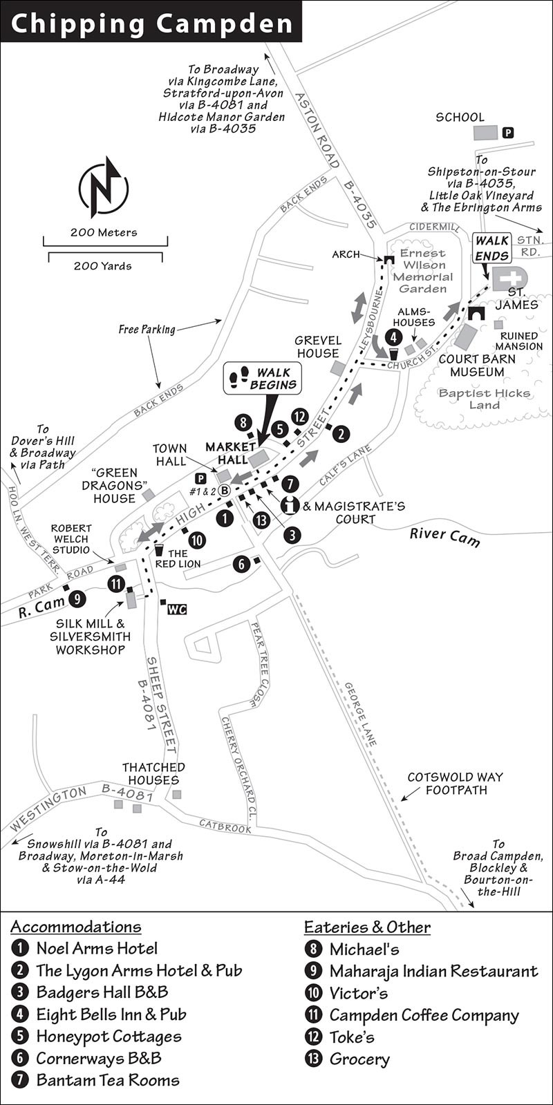
• While you could continue 200 yards farther to see some fine thatched houses, this walk instead returns to High Street. On the corner (to your left as you return to High Street) is the studio shop of Robert Welch, a local industrial designer who worked in the spirit of the Arts and Crafts movement. His son and daughter carry on his legacy in the fine shop with sleek tableware, glassware, and bath fittings (with a little museum case in the back). Now turn right and walk through town.
High Street: Chipping Campden’s High Street has changed little architecturally since 1840. (The town’s street plan and property lines survive from the 12th century.) As you now walk the length of England’s finest historic High Street, study the skyline, see the dates on the buildings, and count the sundials. Notice the harmony of the long rows of buildings. While the street comprises different styles through the centuries, everything you see was made of the same Cotswold stone—the only stone allowed today.
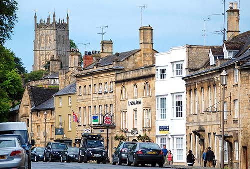
To remain level, High Street arcs with the contour of the hillside. Because it’s so wide, you know this was a market town. In past centuries, livestock and packhorses laden with piles of freshly shorn fleece would fill the streets. Campden was a sales and distribution center for the wool industry, and merchants from as far away as Italy would come here for the prized raw wool.
High Street has no house numbers: Locals know the houses by their names. In the distance, you’ll see the town church (where this walk ends). Notice that the power lines are buried underground, making the scene delightfully uncluttered.
As you stroll High Street, you’ll find the finest houses on the uphill side. Decorative features (like the Ionic capitals near the TI) are added for nonstructural touches of class. Most High Street buildings are half-timbered, but with cosmetic stone facades. You may see some exposed half-timbered walls. Study the crudely beautiful framing, made of hand-hewn oak (you can see the adze marks) and held together by wooden pegs.
Peeking down alleys, you’ll notice how the lots are narrow but very deep (33 x 330 feet). Called “burgage plots,” this platting goes back to 1170. In medieval times, rooms were lined up long and skinny like train cars: Each building had a small storefront, followed by a workshop, living quarters, staff quarters, stables, and a garden at the very back. Now the private alleys that still define many of these old lots lead to comfy gardens. While some of today’s buildings are wider, virtually all the widths are exact multiples of that basic first unit (for example, a modern building may be three times wider than its medieval counterpart).
• Hike the length of High Street toward the church. After a couple hundred yards, just before Church Street, there’s a fine mansion on the left with a sundial and coats of arms adorning stained-glass windows.
Grevel House: In 1367, William Grevel built what’s considered Campden’s first stone house. Sheep tycoons had big homes. Imagine back then, when this fine building was surrounded by humble wattle-and-daub huts. It had newfangled chimneys, rather than a crude hole in the roof. (No more rain inside!) Originally a “hall house” with just one big, tall room, it got its upper floor in the 16th century. The finely carved central bay window is a good early example of the Perpendicular Gothic style. The gargoyles scared away bad spirits—and served as rain spouts. The boot scrapers outside the door were fixtures in that muddy age—especially in market towns, where the streets were filled with animal dung.
• Continue up High Street for about 100 yards. Go past Church Street (which we’ll walk up later). On the right, at a big tree behind a low stone wall, you’ll find a small Gothic arch leading into a garden.
Ernest Wilson Memorial Garden: Once the church’s vegetable patch, this small and secluded garden is a botanist’s delight today. Pop inside if it’s open. The garden is filled with well-labeled plants that the Victorian botanist Ernest Wilson brought back to England from his extensive travels in Asia. There’s a complete history of the garden on the board to the left of the entry.
• Backtrack to Church Street. Turn left, walk past the recommended Eight Bells pub, and hook left with the street. Along your right-hand side stretches...
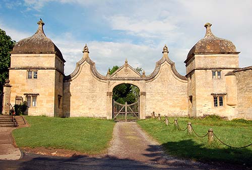
Baptist Hicks Land: Sprawling adjacent to the town church, the area known as Baptist Hicks Land held Hicks’ huge estate and manor house. This influential Lord of the Manor was from “a family of substance,” who were merchants of silk and fine clothing as well as moneylenders. Beyond the ornate gate (which you’ll see ahead, near the church), only a few outbuildings and the charred corner of his mansion survive. The mansion was burned by royalists in 1645 during the Civil War—notice how Cotswold stone turns red when burned. Hicks housed the poor, making a show of his generosity, adding a long row of almshouses (with his family coat of arms) for neighbors to see as they walked to church. These almshouses (lining Church Street on the left) house pensioners today, as they have since the 17th century. Across the street is a ditch built as a “cart wash”—it was filled with water to soak old cart wheels so they’d swell up and stop rattling.
On the right, filling the old Court Barn, is a small, fussy museum about crafts and designs from the Arts and Crafts movement, with works by Ashbee and his craftsmen (£7, Tue-Sun 10:00-17:00, Oct-March until 16:00, closed Mon, +44 1386 841 951, www.courtbarn.org.uk).
• Next to the Hicks gate, a scenic lane leads to the front door of the church. It’s lined with 11 linden trees: Planted in about 1760, there used to be one for each of the apostles. But recently one of the trees died.
St. James Church: This is one of the finest churches in the Cotswolds. Both the town and the church were built by wool wealth. Go inside. The church is Perpendicular Gothic, with lots of light and strong verticality. Notice the fine vestments and altar hangings (intricate c. 1460 embroidery) behind protective blue curtains (near the back of the church). Tombstones pave the floor in the chancel (often under protective red carpeting)—memorializing great wool merchants through the ages.
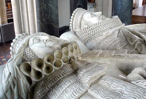
At the altar is a brass relief of William Grevel, the first owner of the Grevel House (described earlier), and his wife. But it is Sir Baptist Hicks who dominates the church. His huge canopied tomb is the ornate final resting place for Hicks and his wife, Elizabeth. Study their faces, framed by fancy lace ruffs (trendy in the 1620s). Adjacent—as if in a closet—is a statue of their daughter, Lady Juliana, and her husband, Lutheran Yokels. Juliana commissioned the statue in 1642, when her husband died, but had it closed up until she died in 1680. Then, the doors were opened, revealing these two people holding hands and living happily ever after—at least in marble. The hinges were likely used only once.
Just outside as you leave the church, look immediately around the corner to the right of the door. A small tombstone reads “Thank you Lord for Simon, a dearly loved cat who greeted everyone who entered this church. RIP 1986.”
Sleeping in Chipping Campden
In Chipping Campden—as in any Cotswolds town—B&Bs offer a better value than hotels. Most of my listings are centrally located on or near the main street. Book well in advance, as rooms are snapped up early in the spring and summer by happy hikers heading for the nearby Cotswold Way. Rooms are also generally tight on Saturdays (when many charge a bit more and are reluctant to rent to one-nighters) and in September, another peak month. Parking is never a problem. Always ask for a discount if staying longer than one or two nights.
$$$ Noel Arms Hotel, the characteristic old hotel on the main square, has welcomed guests for 600 years. Its lobby was remodeled in a medieval-meets-modern style, and its 27 rooms are well furnished with antiques (some ground-floor doubles, attached restaurant/bar and café, free parking, High Street, +44 1386 840 317, www.noelarmshotel.com, reception@noelarmshotel.com).
$$$ The Lygon Arms Hotel (pronounced “lig-un”), attached to the popular pub of the same name, has small public areas and 10 cheery, open-beamed rooms (family rooms, free parking, High Street, go through archway and look for hotel reception on the left, +44 1386 840 318, www.lygonarms.co.uk, sandra@lygonarms.co.uk, Sandra Davenport).
$$$ Badgers Hall rents four somewhat overpriced rooms with antique furnishings beneath wooden beams (2-night minimum, no kids under 18, High Street, +44 1386 840 839, www.badgershall.com, karen@badgershall.com, Karen).
$$$ Eight Bells Inn rents six old-school rooms with modern en suite baths above a recommended pub (Church Street, +44 1386 840 371, www.eightbellsinn.co.uk, info@eightbellsinn.co.uk).
$$$ Honeypot Cottages, run by helpful Cotswolds residents Andy and Sarah, supply home-away-from-home modern amenities in a handful of cottages sprinkled across Chipping Campden (including one next to the silk mill and another on High Street) and other Cotswold towns (Sheep Street, +44 1386 849 079, www.honeypotcottages.co.uk, info@honeypotcottages.co.uk).
$$ Cornerways B&B is a fresh, bright, and comfy home a block off High Street. It’s run by the delightful Carole Proctor, who can “look out the window and see the church where we were married.” The two huge, light, airy loft rooms are great for families with children over 10 (2-night minimum, cash only, off-street parking, George Lane—walk through the arch beside Noel Arms Hotel, +44 1386 841 307, www.cornerways.info, carole@cornerways.info). For a fee, Les can pick you up from the train station, or take you on village tours.
$$ Bantam Tea Rooms rents eight cottage-cute rooms befitting of their charming Cotswolds surroundings (free parking, High Street, +44 1386 840 386, www.bantamtea-rooms.co.uk, info@bantamtea-rooms.co.uk).
Eating in Chipping Campden
This town—filled with wealthy residents and tourists—comes with several good choices. I’ve listed some local favorites below. If you have a car, consider driving to one of the excellent countryside pubs mentioned in the sidebar on here.
$$$ Eight Bells pub is a charming 14th-century inn. It’s the best deal going for top-end pub dining in town, with English dishes both classic and modern. They serve a daily special, summer salads, and always have a good vegetarian dish. The restaurant, classy pub, and terrace out back all have the same menu (daily, reservations smart, Church Street, +44 1386 840 371, www.eightbellsinn.co.uk).
$$$ Michael’s, a fun Mediterranean restaurant on High Street, serves hearty portions and breaks plates at closing every Saturday night. Michael, from Cyprus, runs his place with a contagious love of life. He serves a variety of mezes—small dishes—and larger mains with Greek flavors. “The Meze” special gives you the works with a hearty selection of small plates (daily until 19:30, +44 1386 840 826).
$$ Maharaja Indian Restaurant, filling the back end of the down-and-dirty Volunteer Inn pub, serves decent Indian dinner standards (daily for early dinner only, grassy courtyard out back, Lower High Street, +44 1386 849 281).
LIGHT MEALS
For a quick takeaway bite, consider these options. Munch your lunch on the benches on the little green near the Market Hall. Most of these spots close by late afternoon.
$ Victor’s is a practical little eatery offering full English breakfasts, salads, tasty sandwiches, and wraps made to order (Tue-Fri until 14:00, Sat until 12:00, closed Sun-Mon, Lower High Street, +44 1386 840 401).
$ Campden Coffee Company is a cozy little café and shop serving salads, sandwiches, and homemade sweets (closed Mon, on the ground floor of the silk mill, +44 1386 849 251).
$ Toke’s has a tempting selection of deli salads, cheeses, meats, and wine for a make-your-own hamper lunch (closed Sun, just past the Market Hall, +44 1386 849 345).
Afternoon Tea: The Bantam Tea Rooms, a scone’s throw from the Market Hall, is a sweet and pastel place popular for their cakes, bakery goods, lunches, and afternoon tea (daily). They also rent several rooms for overnighters (see “Sleeping in Chipping Campden,” earlier).
Picnic and Groceries: The Co-op grocery is handy for a picnic, with a good selection of sandwiches and takeaway items (daily, next to TI on High Street).
Near Chipping Campden
Because the countryside around Chipping Campden is particularly hilly, it’s also especially scenic. This is a very rewarding area to poke around and discover little thatched villages.
WEST OF CHIPPING CAMPDEN
Due west of Chipping Campden lies the famous and touristy town of Broadway. Just south of that, you’ll find my nominations for the cutest Cotswold villages. Like marshmallows in hot chocolate, Stanway, Stanton, and Snowshill nestle side by side, awaiting your arrival. (Note the Stanway House’s limited hours when planning your visit.)
Broadway
This postcard-pretty town, a couple of miles west of Chipping Campden, is filled with inviting shops and fancy teahouses. With a “broad way” indeed running through its middle, it’s one of the bigger towns in the area. This means you’ll likely pass through at some point if you’re driving—but, since all the big bus tours seem to stop here, I usually give Broadway a miss. However, with a new road that allows traffic to skirt the town, Broadway has gotten cuter than ever. If driving, check out the top end of High Street (which is a dead end, residential, and a classic/modern Cotswolds neighborhood). Broadway has limited bus connections with Chipping Campden.
Broadway Tower
Ornamenting a hill above Broadway, this tower looks like a turreted castle fortification stranded in the countryside without a castle in sight. This 55-foot-tall observation tower is a “folly”—a uniquely English term for a quirky, outlandish novelty erected as a giant lawn ornament by an aristocrat with more money than taste. Climbing to the top affords you views over the pastures, but the view from the tower’s parklike perch is almost as impressive. A short hike beyond the tower just before sunset can be unforgettable.
Cost and Hours: £14 ticket covers entry to tower grounds and tower climb, includes audioguide; £4 for grounds only; tower open daily 10:00-17:00; +44 1386 852 390, www.broadwaytower.co.uk).
Getting There: Just outside of Broadway town, on the road to Chipping Campden, signs direct you to the tower and its welcome center (pay parking—by cash at machine or by card inside tower ticket office).
E-bike Rental and More: Follow Tower Barn signs from the tower ticket office to a slick café and shop with fine Cotswolds goods and e-bike rentals. From here, it’s an easy pedal over country lanes to the nearby lavender fields. The helpful staff can recommend various routes to take (smart to book online, daily, +44 1386 852 390, www.broadwaytower.co.uk). There’s also a Cold War-era bunker open on weekends (£12, closed Nov-March).
Stanway
More of a humble crossroads community than a true village, sleepy Stanway is worth a visit mostly for its manor house, which offers an intriguing insight into the English aristocracy today.
▲▲Stanway House
The Earl of Wemyss (pronounced “Weemz”), whose family tree charts relatives back to 1202, opens his melancholy home and grounds to visitors two days a week in the summer. Walking through his house offers a unique glimpse into the lifestyles of England’s eccentric and fading nobility.
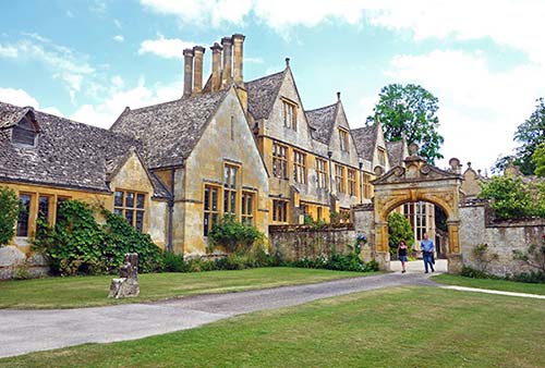
Cost and Hours: £11, cash only, admission includes a wonderful and intimate audioguide narrated by the lordship himself; June-Aug Tue and Thu only 14:00-17:00, closed Sept-May, +44 1386 584 469, www.stanwayfountain.co.uk.
Getting There: By car, leave the B-4077 at a statue of (the Christian) George slaying the dragon (of pagan superstition); you’ll round the corner and see the manor’s fine 17th-century Jacobean gatehouse. Park in the lot across the street. There’s no public transportation to Stanway.
Visiting the Manor: The 14th-century Tithe Barn (near where you enter the grounds) predates the manor. It was originally where monks—in the days before money—would accept one-tenth of whatever the peasants produced. Peek inside: This is a great hall for village hoedowns. While the Tithe Barn is no longer used to greet motley peasants and collect their feudal “rents,” the lord still gets rent from his vast landholdings, and hosts village fêtes in his barn.
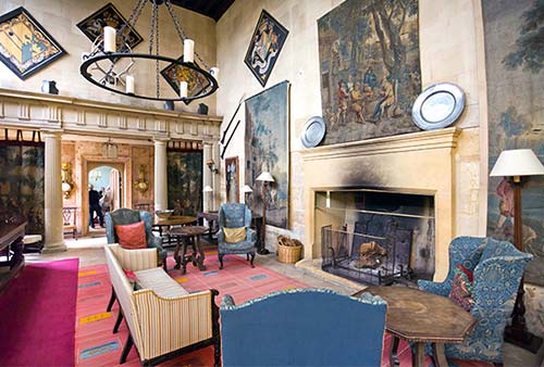
You’re free to wander around the manor house pretty much as you like, but keep in mind that a family does live here. His lordship is often roaming about as well. The place feels like a time warp. Ask a staff member to demonstrate the spinning rent-collection table. In the great hall, marvel at the one-piece oak shuffleboard table and the 1780 Chippendale exercise chair (a half-hour of bouncing on this was considered good for the liver).
The manor dogs have their own cutely painted “family tree,” but the Earl admits that his last dog, C. J., was “all character and no breeding.” Poke into the office. You can psychoanalyze the lord by the books that fill his library, the piles stacked in front of his bed (with the mink bedspread), and whatever’s next to his toilet.
The place has a story to tell. And so do the docents stationed in each room—modern-day peasants who, even without family trees, probably have relatives going back just as far in this village. Talk to these people. Probe. Learn what you can about this side of England.
Wandering through the expansive backyard you’ll see the earl’s pet project: restoring “the tallest fountain in Britain”—300 feet tall, gravity-powered, and running for 30 minutes twice a day (at 14:45 and 16:00).
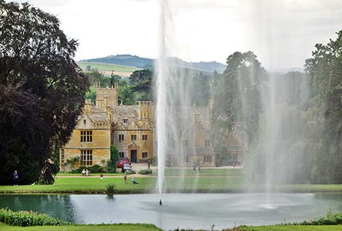
Signs lead to a working watermill, which produces flour from wheat grown on the estate (about 100 yards from the house).
Hailes Church and Abbey
A three-mile drive or pleasant 2.5-mile walk from Stanway House along the Cotswold Way leads you to a fine Norman church and tranquil abbey ruins. There’s also an adjacent museum displaying the abbey’s surviving artifacts. While little remains of the abbey, just being here can be a moving experience.
Cost and Hours: Church-free, abbey and museum-£8; open Wed-Sun 10:00-17:00, closed Mon-Tue; Nov-March Sat-Sun 10:00-16:00, closed Mon-Fri; free parking, +44 1242 602 398, www.english-heritage.org.uk.
Visiting the Abbey: Richard, Earl of Cornwall (and younger brother of King Henry III) founded the abbey after surviving a shipwreck. His son Edmund turned it into a pilgrimage site after buying a vial of holy blood and bringing the relic to Hailes around 1270. Because of Henry VIII’s dissolution of monasteries in the 16th century, not much remains of the abbey today.
The church—which predates the abbey by about a century—houses some of its original tiles and medieval stained glass. It’s worth a look for its 800-year-old baptismal font and faded but evocative murals (including St. Christopher, patron saint of travelers, and a hunting scene attributed to a local knight). Check out the wooden screen added long after the original construction—notice how the arch had to be cut away for the screen to fit.
From Stanway to Stanton
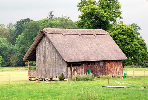
These towns are separated by a row of oak trees and grazing land, with parallel waves echoing the furrows plowed by medieval farmers. Centuries ago, farmers were allotted long strips of land called “furlongs.” The idea was to dole out good and bad land equitably. (One square furlong equals 10 acres.) Over centuries of plowing these, furrows were formed. Let someone else drive, so you can hang out the window under a canopy of oaks, passing stone walls and sheep. Leaving Stanway on the road to Stanton, the first building you’ll see (on the left, just outside Stanway) is a thatched cricket pavilion overlooking the village cricket green. Originally built for Peter Pan author J. M. Barrie, it dates from 1930 and is raised (as medieval buildings were) on rodent-resistant staddle stones. Stanton is just ahead; follow the signs.
▲Stanton
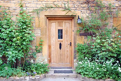
Pristine Cotswold charm cheers you as you head up the main street of the village of Stanton, served by a scant few buses. Go on a photo safari for flower-bedecked doorways and windows.
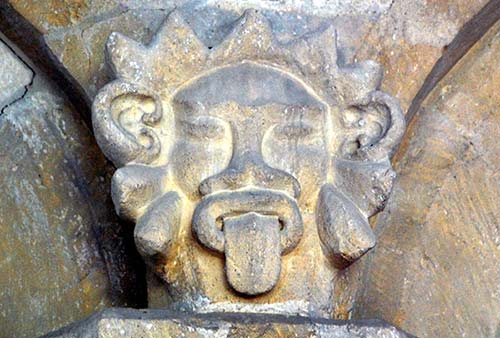
Stanton’s Church of St. Michael (with the pointy spire) betrays a pagan past. It’s safe to assume any church dedicated to St. Michael (the archangel who fought the devil) sits upon a sacred pagan site. Stanton is actually at the intersection of two ley lines (a line connecting prehistoric or ancient sights). You’ll see St. Michael’s well-worn figure (and, above that, a sundial) over the door as you enter. Inside, above the capitals in the nave, find the pagan symbols for the sun and the moon (see photo). While the church probably dates back to the ninth century, today’s building is mostly from the 15th century, with 13th-century transepts. On the north transept (far side from entry), medieval frescoes show faintly through the 17th-century whitewash. (Once upon a time, these frescoes were considered too “papist.”) Imagine the church interior colorfully decorated throughout. Original medieval glass is behind the altar. The list of rectors (at the very back of the church, under the organ loft) goes back to 1269. Finger the grooves in the back pews, worn away by sheepdog leashes. (A man’s sheepdog accompanied him everywhere.)
Horse Riding: Jill Carenza’s Cotswolds Riding Centre, set just outside Stanton village, is in the most scenic corner of the region. The facility’s horses can take anyone from rank beginners to more experienced riders on a scenic “hack” through the village and into the high country (per-hour prices: £45/person on a group hack, £55/person semiprivate hack, £65 private one-person hack; lessons, longer/expert rides, and pub tours available; +44 1386 584 250, www.cotswoldsriding.co.uk, info@cotswoldsriding.co.uk). From Stanton, head toward Broadway and watch for the riding center on your right after about a third of a mile.
Sleeping in Stanton: $$ The Vine B&B has four rooms in a lovingly worn family home near the center of town, next to the cricket pitch (ask if any matches are on if you’re there on a Saturday in summer). While it suffers from absentee management, the Vine is convenient if you want to ride all day (most rooms share a WC but have a private shower, one room en suite, family room available, some stairs; for contact info, see listing for riding center, earlier).
Eating in Stanton: High on a hill at the far end of Stanton’s main drag, nearest to Broadway, the aptly named $$$ Mount Inn serves upscale meals on its big, inviting terrace with grand views of Stanton rooftops and the Cotswold hills (Tue-Sat for lunch and dinner, Sun for lunch only, closed Mon, Old Snowshill Road, +44 1386 584 316).
Snowshill
Another nearly edible little bundle of cuteness, the village of Snowshill (SNAH-zul) has a photogenic triangular square with a characteristic pub at its base.
Snowshill Manor
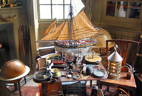
Dark and mysterious, this old manor house is stuffed with the lifetime collection of Charles Paget Wade (its management made me promise not to promote it as an eccentric collector’s pile of curiosities). It’s one big, musty celebration of craftsmanship, from finely carved spinning wheels to frightening samurai armor to tiny elaborate figurines carved by prisoners from the bones of meat served at dinner. Nothing is labeled; instead, the displays are intended to tell their own stories. Taking seriously his family motto, “Let Nothing Perish,” Wade dedicated his life and fortune to preserving things finely crafted.
Cost and Hours: £13, timed-entry tickets may be available online; manor house open daily 11:30-16:30, Nov Sat-Sun 11:00-14:30, closed Mon-Fri; closed Dec-mid-March; gardens and ticket window open at 11:00, last entry one hour before closing; restaurant, +44 1386 852 410, www.nationaltrust.org.uk/snowshillmanor.
Getting There: There’s no direct access from the village square; instead, the entrance and parking lot are about a half-mile up the road toward Broadway. Park there and follow the long walkway through the garden to get to the house. A golf-cart-type shuttle to the house is available for those who need assistance.
Cotswold Lavender
In 2000, farmer Charlie Byrd realized that tourists love lavender. He planted his farm with 250,000 plants, and now visitors come to wander among his 53 acres, which burst with gorgeous lavender blossoms from mid-June through late August. His fragrant fantasy peaks late each July. Lavender—so famous in France’s Provence—is not indigenous to this region, but it fits the climate and soil just fine. A free flier explains the variations of blooming flowers. Farmer Byrd produces lavender oil (an herbal product valued since ancient times for its healing, calming, and fragrant qualities) and sells it at the farm, along with many other lavender-themed items.
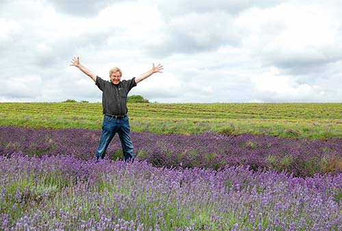
Cost and Hours: £7.50 to walk through the fields and the distillery; generally open June-Aug daily 10:00-17:00, closed Sept-May, schedule changes annually depending on when the lavender blooms—call ahead or check their website; +44 1386 854 821, www.cotswoldlavender.co.uk.
Getting There: It’s a half-mile out of Snowshill on the road toward Chipping Campden (easy parking). Entering Snowshill from the road to the manor (described earlier), take the left fork, then turn left again at the end of the village.
EAST OF CHIPPING CAMPDEN
Hidcote Manor Garden is just northeast of Chipping Campden, while Broad Campden, Blockley, and Bourton-on-the-Hill lie roughly between Chipping Campden and Stow (or Moreton)—handy if you’re connecting those towns.
▲Hidcote Manor Garden
This is less “on the way” between towns than the other sights in this section—but the grounds around this manor house are well worth a detour if you like gardens. Hidcote is where garden designers pioneered the notion of creating a series of outdoor “rooms,” each with a unique theme (such as maple room, red room, and so on) and separated by a yew-tree hedge. The garden’s design, inspired by the Arts and Crafts movement, is most formal near the house and becomes more pastoral as it approaches the countryside. Follow your nose through a clever series of small gardens that lead delightfully from one to the next. Among the best in England, Hidcote Gardens are at their fragrant peak from May through August. And, thanks to an ongoing renewal project, soon they’ll be restored to their original 1930s splendor. But don’t expect much indoors—the manor house has only a few rooms open to the public.
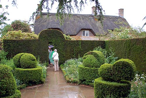
Cost and Hours: £15, book timed-entry ticket online in advance to avoid lines; open daily 10:00-17:00, Oct until 16:00; mid-Nov-mid-Dec Sat-Sun 11:00-16:00, closed Mon-Fri; closed mid-Dec-Feb; last entry one hour before closing, café, +44 1386 438 333, www.nationaltrust.org.uk/hidcote.
Getting There: If you’re driving, it’s four miles northeast of Chipping Campden—roughly toward Ilmington. The gardens are accessible by bus, then a 45-minute country walk uphill. Buses #1 and #2 take you to Mickleton (one stop past Chipping Campden), where a footpath begins next to the churchyard. Continuing more or less straight, the path leads through sheep pastures and ends at Hidcote’s driveway.
Nearby: Gardening enthusiasts will also want to stop at Kiftsgate Court Garden, just across the road from Hidcote. While not as impressive, these private gardens are a fun contrast since they were designed at the same time and influenced by Hidcote (£11; May-Aug Sun-Thu 12:00-18:00, closed Fri-Sat; shorter hours and closed Thu-Sat in April and Sept; closed Oct-March; +44 1386 438 777, www.kiftsgate.co.uk).
▲Broad Campden, Blockley, and Bourton-on-the-Hill
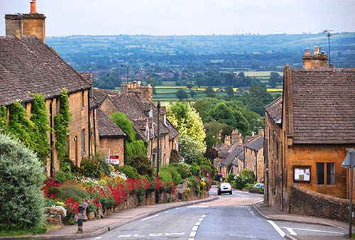
This trio of pleasant villages lines up along an off-the-beaten-path road between Chipping Campden and Moreton or Stow. Broad Campden, just on the outskirts of Chipping Campden, has some of the cutest thatched-roof houses I’ve seen. Blockley, nestled higher in the picturesque hills, is a popular setting for films. The same road continues to Bourton-on-the-Hill (pictured), with fine views looking down into a valley and an excellent gastropub (Horse and Groom, described on here). Blockley is connected to Chipping Campden by bus #1 and #2, or you can walk (easy to Broad Campden, more challenging to the other two—see here).
Little Oak Vineyard
In 2005, Steve Wilson planted a grapevine on a field in front of his house. Since then, he has expanded his vineyard to nearly three thousand grapevines across one hectare (about 2.5 acres). Wilson is a pioneer of the winemaking industry in the Cotswolds and today produces white wines (Siegerrebe grape) and a double-fermented sparkling wine (Seyval Blanc grape). His colleague Gemma offers walks through the vineyard and tastings of three wines and a brandy, plus an optional lunch.
Cost and Hours: £18 tour and tasting, £20 extra for lunch; Tue-Sun at 11:00, plus some Sat and Sun at 14:00, no tours Mon, tour and tasting last 1.5 hours; book ahead online, +44 7812 339 556, www.littleoakvineyard.com, admin@littleoakvineyard.com.
Getting There: The vineyard is a 20-minute stroll (or short taxi ride) east of Chipping Campden on Paxford Road. As you leave town heading north on High Street, turn right on Cidermill Lane. Turn left onto Station Road and keep straight until the winery appears on your left.
Stow-on-the-Wold
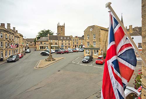
Located 10 miles south of Chipping Campden, Stow-on-the-Wold—with a name that means “meeting place on the uplands”—is the highest town in the Cotswolds. It was strategically built on this spot in an attempt to control trade along the old Roman road—Fosse Way. Despite its crowds, the town retains its charm, and it merits ▲▲. Most of the tourists are day-trippers, so nights—even in the peak of summer—are peaceful. Stow has no real sights other than the town itself, some good pubs, antiques stores, and cute shops draped seductively around a big town square. Visit the church, with its evocative old door guarded by ancient yew trees and the tombs of wool tycoons.
Orientation to Stow-on-the-Wold
TOURIST INFORMATION
A small visitor information center—little more than a rack of brochures staffed by volunteers—is run out of the library in St. Edwards Hall on the main square (Mon and Wed 10:00-17:00, Tue and Fri until 19:00, Thu and Sat until 14:00, closed Sun; Oct-April Sat 10:00-14:00 only, +44 1451 870 998). The TI in Moreton-in-Marsh is more serious (see here).
HELPFUL HINTS
Services: Pay WCs are located at the north and south ends of town.
Taxi: See “Getting Around the Cotswolds—By Taxi or Private Driver,” earlier in the chapter.
Parking: Park anywhere on Market Square free for two hours, and overnight between 18:00 and 9:00 (combining overnight plus daily 2-hour allowances means you can park for free 16:00-11:00—they note your license, so you can’t just move to another spot after your time is up; £50 tickets for offenders). There is free, unlimited parking on some streets farther from the center (such as Park Street and Well Lane). A convenient pay lot is at the bottom of town (toward the Oddingtons), and there’s free long-stay parking adjacent to the lot at Tesco Supermarket—an easy five-minute walk north of town (follow the signs).
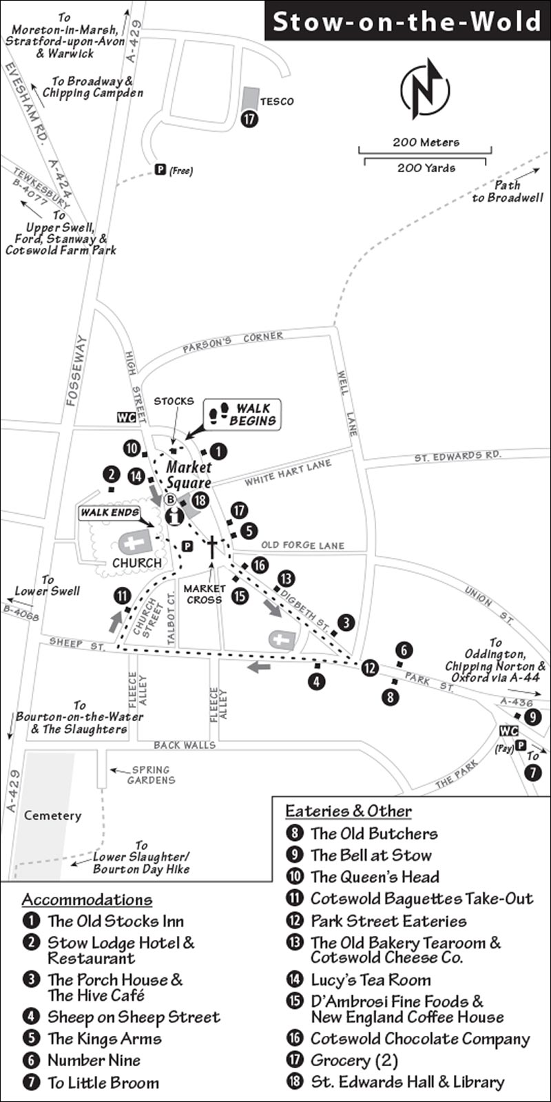
Sunday Morning Town Walk: Volunteers give charming guided town walks once a week to raise a little money for community projects. It’s fun to mix with English visitors as a local tells the town’s story (£5, April-Sept Sun at 10:30, just show up at the stocks on Market Square).
Stow-on-the-Wold Walk
This six-stop self-guided walk covers about 500 yards and takes about 45 minutes. We’ll start in the small park on the main square.
The Stocks on Market Square
Imagine this village during the 17th century when people were publicly ridiculed in stocks like this as a punishment. Stow was born in pre-Roman times; it’s where three trade routes crossed at a high point in the region (altitude: 800 feet). This square was the site of an Iron Age fort, and then a Roman garrison town. Starting in 1107, Stow was the site of an international fair, and people came from as far away as Italy to shop for wool fleeces on this vast, grassy expanse. Picture it in the Middle Ages (minus all the parked cars, and before the buildings in the center were added): a public commons and grazing ground, paths worn through the grass, and no well. Until the late 1800s, Stow had no running water; women fetched water from the “Roman Well” a quarter-mile down the hill.
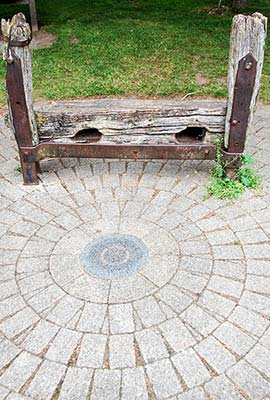
With as many as 20,000 sheep sold in a single day, this square was a thriving scene. And Stow was filled with inns and pubs to keep everyone housed, fed, and watered.
Most of the buildings you see date from the 17th and 18th centuries. A thin skin of topsoil covers the Cotswold limestone, from which these buildings were made. The local limestone is easy to cut, hardens after contact with the air, and darkens with age. Many buildings were made of stone quarried right on site—with the mini quarries becoming their cellars.
That’s why the Stow Lodge (next to the church) lies a little lower than the church. It sits on the spot where locals quarried stones for the church. That building, originally the rectory, is now a hotel. The church (where we’ll end this little walk) is made of Cotswold stone, and marks the summit of the hill upon which the town was built.
Enjoy the stonework and the crazy rooflines. Observe the cheap signage on solid stone facades and think about how shops have been coming and going for centuries in buildings that never change.
The Stag Inn, ahead on the left, was a typical coaching inn from a time before trains and cars, when land transport was literally horsepower. As horses could manage about 25 miles without a rest, coaches stopped at coaching inns to swap teams of horses. Taking advantage of such a relay of horses, travelers could go from London to Liverpool in 10 days.
As you walk, notice how locals stop to chat with each other to catch up on local news: This is a tight-knit little community.
• Walk around the right of the building in the middle of the square and enter the library.
St. Edwards Hall
The stately building in the square with the wooden steeple is St. Edwards Hall. Back in the 1870s, a bank couldn’t locate the owner of an account containing a small fortune, so it donated the funds to the town to build this civic center. It serves as a City Hall, library, TI, and meeting place. When it’s open, you can wander around upstairs to see the largest collection of Civil War portrait paintings in England—well described and an education in local 17th-century history. The library offers a candid peek at town life: community bulletin board, volunteers, history in a glass case, and historic town photos.
• Beyond the library, at the far end of the square find the free-standing stone cross.
The Market Cross
For 500 years, the Market Cross stood in the market reminding all Christian merchants to “trade fairly under the sight of God.” Notice the stubs of the iron fence in the stone base—a reminder of how countless wrought-iron fences were cut down and given to the government to be melted down during World War II. (Recently, it’s been disclosed that all that iron ended up in junk heaps—frantic patriotism just wasted.) One of the plaques on the cross honors the Lord of the Manor, who donated money back to his tenants, allowing the town to finally finance running water in 1878. Panels at the top of the cross depict St. Edward, the Crucifixion, the wool trade, and a memorial to the Battle of Stow.
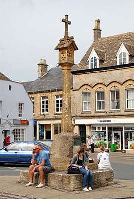
This is the site of the 1646 Battle of Stow. During the English Civil Wars, which pitted Parliamentarians against Royalists, Stow-on-the-Wold remained staunchly loyal to the king. The final battle of England’s first Civil War was fought on this square as about 3,000 troops loyal to the king made their last stand. About 200 Royalist troops were killed (and survivors were locked up in the church). Ultimately, this cleared the way for the beheading of King Charles I and the rise of Oliver Cromwell.
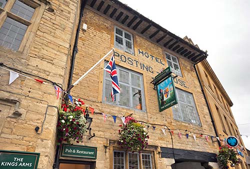
Scan the square for The Kings Arms, with its great gables and spindly chimney. This square was where travelers parked their horses before spending the night at the inn. In the 1600s, this inn was considered the premium “posting house” between London and Birmingham. Because of its allegiance to the king, the town has an abundance of pubs with royal names (King’s This and Queen’s That). Today, The Kings Arms cooks up pub grub and rents rooms upstairs (see listing under “Sleeping in Stow,” later).
• Continue with The Kings Arms on your left, and walk down Digbeth Street.
Digbeth Street
This street is lined with workaday shops, cute gift shops, many good little eateries, and beautiful Cotswold stone. From top to bottom you’ll find: D’Ambrosi Fine Foods (chef-prepared takeaway food, owners Jesse and Andrew), Cotswold Chocolate Company (pop in to watch Tony working in the back kitchen and his wife, Heidi, decorating his concoctions), the New England Coffee House (which feels like a village Starbucks with cozy lounge rooms upstairs), a “saddlery” for the many local horse enthusiasts, Lambournes (a traditional butcher), Cotswold Cheese Company (with old milk churns flanking the door), and the Old Bakery Tearoom (good for a cream tea or lunch; see “Eating in and near Stow,” later).
Digbeth ends at a little triangular park in front of the former Methodist Church and across from the Porch House Hotel, with timbers that date from 947 (it claims—along with about 20 others—to be the oldest in England).
Just beyond the small grassy triangle was the place where locals gathered for bloody cockfights and bearbaiting (watching packs of hungry dogs tear at bears).
Today this is where—twice a year, in May and October—the Stow Horse Fair attracts thousands of nomadic Roma (still called Gypsies by some less politically correct locals) and Travellers from far and wide. Thousands of people, who are determined not to be “miserable clock punchers,” congregate down the street on the Maugersbury Road. Locals paint a colorful picture of the Roma, Travellers, and horses inundating the town. The young women dress up to distract the men because the horse fair—with its “grabbing” ritual—also functions as a marriage market. (It’s a challenging time for the town, and many shops and pubs actually close up for the fair.)
• Hook right and hike up the wide street.
Sheep Street
As you head up Sheep Street, you’ll pass a boutique-filled former brewery yard (on the left). Notice the old brewery’s fancy street-front office, with its striking Welsh flint facade. This was the bad side of town (with the “smelly trades”). Across the street from the brewery was the slaughterhouse. And Sheep Street was originally not a street, but a staging place for medieval sheep markets. The sheep would be gathered here, then paraded into the market on the main square.
You’ll notice narrow lanes on either side of the street. There are two explanations: one I like to believe (paths just wide enough for a single file of sheep to walk down, making it easier for merchants to count them) and another that’s more likely true (practical walks between the long, narrow, medieval strips of land allotments). You’ll see several of these so-called “fleece alleys” as you walk up the street.
• Walk a couple blocks until you’re one block from the traffic light and the highway, then make a right onto cute little Church Street, which leads to the church.
St. Edwards Church
Before entering the church, circle it. On the back side, a wooden door is flanked by two ancient yew trees. While many see the door and think of the Christian scripture, “Behold, I stand at the door and knock,” J. R. R. Tolkien fans see something quite different. Tolkien hiked the Cotswolds and had a passion for sketching evocative trees such as this. Lord of the Rings enthusiasts are convinced this must be the inspiration for the Doors of Durin, leading into Moria.
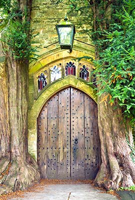
Notice the two “bale tombs” (10 steps to the right of the door). Wool-merchant gravestones were topped with a carved image of a tightly bound bale of wool.
Enter the church (usually open 9:00-17:00, except during services). While a wooden Saxon church stood here in the 10th century, today’s structure is mostly from the 15th century. Its history is played up in leaflets and plaques just inside the door. The floor is paved with the tombs of big shots who made their money from wool and are still boastful in death. (Find the tombs crowned with the bales of wool.) Most of the windows are traditional Victorian (19th century) designs, but the two sets high up in the clerestory are from the dreamier Pre-Raphaelite school.
On the right wall, as you approach the altar, a monument remembers the many boys from this small town who were lost in World War I (50 out of a population of 2,000). There were far fewer in World War II. The biscuit-shaped plaque remembers an admiral from Stow who lost four sons defending the realm. It’s sliced from an ancient fluted column (which locals believe is from Ephesus, Turkey).
During the English Civil Wars in the mid-1600s, the church was ransacked, and hundreds of soldiers were imprisoned here. The tombstone on the floor in front of the altar remembers the Royalist Captain Francis Keyt. His long hair, lace, and sash indicate he was a “cavalier,” and true-blue to the king (Cromwellians were called “round heads”—named for their short hair). Study the crude provincial art—childlike skulls and (in the upper corners) symbols of his service to the king (armor, weapons).
Finally, don’t miss the kneelers tucked in the pews. These are made by a committed band of women known as “the Kneeler Group.” And with Reverend Martin Short for the pastor, the services could be pretty lively.
Hiking from Stow
Stow/Lower Slaughter/Bourton Day Hike
Stow is made to order for day hikes. The most popular is the downhill stroll to Lower Slaughter (3 miles), then on to Bourton-on-the-Water (about 1.5 miles more). It’s a two-hour walk if you keep up a brisk pace and don’t stop, but dawdlers should allow three to four hours. At the end, from Bourton-on-the-Water, a bus can bring you back to Stow. While those with keen eyes can follow this walk by spotting trail signs, it’s always smart to download or bring a map (ask to borrow one at your B&B). Note that these three towns are described in more detail starting on here.
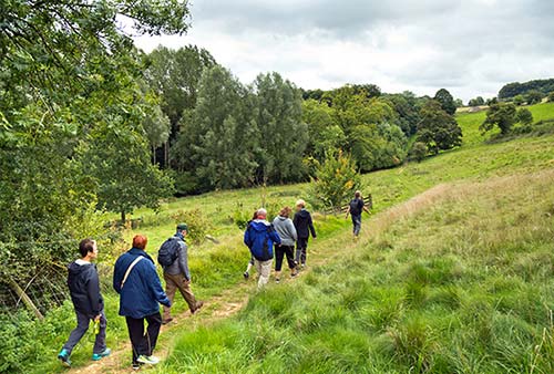
To reach the trail from Stow, walk to the top of Sheep Street. At the busy A-429 highway, turn left. Head south of town on a footpath alongside the busy highway, past the gas station for a couple hundred yards. Leave the highway on a well-marked trail (on the right) at Quarwood Cottage. You’ll see a gravel lane with a green sign noting Public Footpath/Gloucestershire Way/Monarch’s Way).
Follow this trail for a delightful hour across farms, through romantic gates, across a fancy driveway, and past Gainsborough-painting vistas. You’ll enjoy an intimate backyard look at local farm life. Although it seems like you could lose the trail, tiny easy-to-miss signs (yellow Public Footpath arrows—sometimes also marked Gloucestershire Way or The Monarch’s Way—usually embedded in fence posts) keep you on target—watch for these very carefully to avoid getting lost. Finally, passing a cricket pitch, you reach Lower Slaughter, with its fine church and a mill creek leading up to its mill.
From Lower Slaughter, you can continue 30 minutes on Monarch’s Way (follow green signs) into touristy Bourton-on-the-Water. Enjoy some time in Bourton itself and—when ready—catch the bus from in front of the Edinburgh Woolen Mill back to Stow (bus #801 departs nearly hourly, limited service on Sun in summer, 15-minute ride; bus #802 also connects to Stow).
Sleeping in Stow
$$$ The Old Stocks Inn rents 16 stylish rooms next to the stocks on Market Square. Rooms are crisp and updated, but the place still retains its 17th-century Cotswold charm. In the evening, the breakfast room becomes a bar and restaurant that serves seasonal British cuisine (family room, large garden, The Market Square, +44 1451 830 666, www.oldstocksinn.com, info@oldstocksinn.com).
$$$ Stow Lodge Hotel fills the historic church rectory with lots of old English character. Facing the town square, with its own sprawling and peaceful garden, this lavish old place offers 21 large, thoughtfully appointed rooms with soft beds, stately public spaces, and a cushy-chair lounge (closed Jan, free parking, The Square, +44 1451 830 485, www.stowlodge.co.uk, info@stowlodge.co.uk, helpful Hartley family).
$$$ The Porch House rents 13 updated rooms with stone-wall and wood-beam accents (Digbeth Street, +44 1451 870 048, www.porch-house.co.uk, info@porch-house.co.uk).
$$ Sheep on Sheep Street mixes modern comfort and quaint Cotswold style, with 22 well-appointed rooms and a friendly staff (free parking, Sheep Street, +44 1451 830 344, www.thesheepstow.com [URL inactive], book@thesheep.co.uk).
$$ The Kings Arms, with seven rooms above a pub, manages to keep its historic Cotswold character while still feeling fresh and modern in all the right ways (steep stairs, three additional and slightly shabby “cottages” out back, free parking, Market Square, +44 1451 830 364, www.kingsarmsstow.co.uk, info@kingsarmsstow.co.uk, Chris).
$$ Number Nine rents three bright, refurbished, and tastefully decorated rooms (two large rooms, plus a smaller loft room). This 200-year-old home comes with a home-cooked breakfast, watch-your-head beamed ceilings, and a lounge with a fireplace (two-night minimum in peak season, 9 Park Street, +44 1451 870 333, www.number-nine.info, enquiries@number-nine.info, Merlyn and John).
NEAR STOW
$$ Little Broom hides out in the neighboring hamlet of Maugersbury, which enjoys the peace Stow once had. It rents one room with a sunroom and small patio, and a fully equipped studio apartment; both share a lush garden (cash only, no breakfast, fridges, +44 1451 830 510, www.cotswolds.info/webpage/little-broom.htm, brendarussell1@hotmail.co.uk). It’s a hilly half-mile walk from Stow: Head east on Park Street and stay right toward Maugersbury. Turn right into Chapel Street and take the first right uphill to the B&B.
Eating in and near Stow
While Stow has several good dining options, consider venturing out of town for a meal. You can walk to the pub in nearby Broadwell, or—better yet—drive to one of several enticing gastropubs in the surrounding villages (see sidebar, later in this chapter).
IN STOW
These places are all within a five-minute walk of each other, either on the main square or downhill on Queen and Park streets. For good sit-down fish-and-chips, go to either pub on the main square: The Queen’s Head or The Kings Arms. For dessert, consider munching a locally made treat under the trees on the square’s benches and watching the sky darken, the lamps come on, and visitors having their photo fun in the stocks.
Restaurants and Pubs
$$$ The Old Butchers, named for its location rather than its menu, specializes in fish. Serving oysters, scallops, and fish along with steak and burgers, they offer both indoor and outdoor tables and a good wine list (closed Sun-Mon, 7 Park Street, +44 1451 831 700).
$$ Stow Lodge is the choice of the town’s proper ladies. There are two parts: The formal but friendly bar serves fine pub grub (daily, bar open late, veggie options, good wines, just off main square, +44 1451 830 485, Chris). On a sunny day, the pub serves lunch in the well-manicured garden, where you’ll feel quite aristocratic.
$$$ The Bell at Stow, at the end of Park Street (on the edge of town), has a youthful pub energy for a drink or for a full meal. They serve up classic English dishes with seasonal, locally sourced ingredients (daily, reservations recommended, +44 1451 870 916, www.thebellatstow.com).
$$ The Queen’s Head faces Market Square, near Stow Lodge. With a classic pub vibe, it’s a great place to bring your dog and watch the eccentrics while you eat pub grub and drink the local Cotswold brew, Donnington Ale. They have a meat pie of the day and good fish-and-chips (beer garden out back, Tue-Sat for lunch and dinner, Sun for lunch only, closed Mon, +44 1451 830 563).
Cheaper Options
The grassy triangle where Digbeth hits Sheep Street has takeout fish-and-chips, Chinese, and Indian food. You can picnic at the triangle, or on the benches by the stocks on Market Street.
$ Cotswold Baguettes Take-Out has a line out the door for tasty takeout jacket potatoes, pasties, made-to-order sandwiches, and soup (Mon-Sat until 15:00, closed Sun, Church Street, +44 1451 831 362).
Of several options on Park Street, $ Greedy’s Fish and Chips is the go-to place for takeout. There’s no seating, but they have benches out front (Wed-Sat for dinner, plus Fri-Sat for lunch, closed Sun-Tue, +44 1451 870 821). $ Jade Garden Chinese Take-Away is appreciated by locals who don’t want to cook dinner (Wed-Mon for dinner only, closed Tue, 15 Park Street, +44 1451 870 288). $$ The Prince of India, with a pleasant dining room, offers good Indian dinners to take out or eat in (daily for dinner only, 5 Park Street, +44 1451 830 099).
$ The Old Bakery Tearoom is a local favorite hidden away in a tiny mall at the bottom of Digbeth Street. Come here for traditional cakes, soup, salad, sandwiches, or their £8.95 cream tea (Mon-Wed and Fri until 16:00, Sat until 17:00, closed Thu and Sun, Digbeth Street, Alan and Jackie).
$ The Hive is a quality modern café, where Jane and Sally offer breakfast, lunch, and tea with a warm welcome (Thu-Mon until 15:00, closed Tue-Wed, Digbeth Street, +44 1451 831 087).
$ Lucy’s Tea Room is a nice option if you fancy a light lunch or cream tea on Market Square (Mon-Sat until 16:00, closed Sun, next to Stow Lodge).
Groceries: The Co-op, a small grocery store, faces the main square next to the Kings Arms (daily 7:00-22:00) and a big Tesco supermarket is 400 yards north of town.
PUB DINNER HIKE FROM STOW
From Stow, consider taking a half-hour countryside walk to the village of Broadwell, where you’ll find a traditional old pub facing the village green that serves good basic grub in a convivial atmosphere.
$$ The Fox Inn Broadwell serves pub dinners (including fish and meat pies) and draws traditional ales—including the local Donnington ales. It’s a classic, family-friendly pub (closed Mon-Tue, outdoor tables in garden out back, reservations smart, +44 1451 870 909, www.thefoxbroadwell.com).
Getting There: It’s 30 minutes downhill from Stow. While the walk is not particularly scenic (it’s one-third paved lane, and the rest on an arrow-straight bridle path), it is peaceful, and the walk will stoke your appetite. The trail is poorly marked, but it’s hard to get lost: Leave Stow at Parson’s Corner, continue downhill, pass the town well, follow the bridle path straight until you hit the next road, then turn right at the road and walk downhill into the village of Broadwell.
Near Stow-on-the-Wold
These sights are all south of Stow: Some are within walking distance (the Slaughters and Bourton-on-the-Water), and one is 20 miles away (Cirencester). The Slaughters and Bourton are tied together by the countryside walk described on here.
▲Lower and Upper Slaughter
“Slaughter” has nothing to do with lamb chops. It likely derives from an Old English word, perhaps meaning sloe tree (the one used to make sloe gin).
Lower Slaughter is a classic village, with ducks, a charming little church, a picturesque water mill, and usually an artist busy at her easel somewhere. Just behind the mill, two kissing gates lead to the path that goes to nearby Upper Slaughter, a 15-minute walk or two-minute drive away (leaving the mill, take two lefts, then follow sign for Wardens Way). And if you follow the mill creek downstream, a bridle path leads to Bourton-on-the-Water (described next).
These places are known for their high-quality meals and fine settings and are justifiably popular. Arrive early or call ahead to make a reservation. (If you show up at 20:00, it’s unlikely they’ll be able to seat you for dinner if you haven’t called first.) These pubs allow “well-behaved children,” have overnight accommodations, and are practical only for those with a car. If you have wheels, make a point to dine at one of these—no matter where you’re sleeping. For locations, see the “Cotswolds” map at the beginning of this chapter.
The first two (in Oddington, about three miles from Stow) are trendier and fresher, yet still in a traditional pub setting. The Plough (in Ford, a few miles farther away) is your jolly olde dark pub.
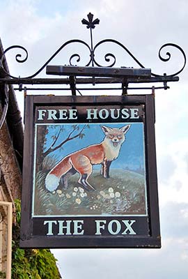
$$$$ The Fox Inn, a different Fox Inn than the one in Broadwell (see “Pub Dinner Hike from Stow”), has a long history but a fresh approach. It’s a popular choice among local foodies for its updated pub classics and more creative, modern English dishes. They’ve perfected their upmarket rustic-chic vibe, with a genteelly Old World interior that’s fresh and candlelit and a delightful back terrace and garden (extensive wine list, daily, in Lower Oddington, +44 1451 767 000, http://thefoxatoddington.com).
$$$$ The Horse and Groom Village Inn in Upper Oddington is a smart place in a 16th-century inn, serving modern English and Continental food with plenty of vegetarian options, a good wine list (12 wines by the glass), and serious attention to beer. It boasts a wonderful fireplace and lots of meat on the menu (daily, Tue-Wed for dinner only, +44 1451 830 584, www.horseandgroomoddington.com).
$$$ The Plough Inn, in the hamlet of Ford, fills a fascinating 16th-century building—once a coaching inn, later a courthouse, and now a tribute to all things horse racing (it sits across from the Jackdaws Castle racehorse training facility). Eat from the same traditional English menu in the restaurant, bar, or garden. They are serious about their beer (owned by the local brewery), seasonal ingredients, and their heaping portions of stick-to-your-ribs pub-grub classics—a bit more traditional and less refined than others listed here (closed Mon except June-Aug open daily, 6 miles from Stow on the road to Tewkesbury, reservations smart, +44 1386 584 215, www.theploughinnford.co.uk).
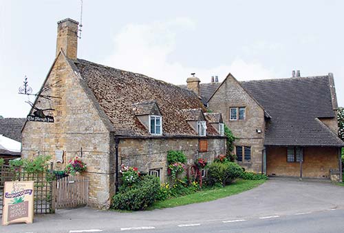
$$$$ The Ebrington Arms is a quintessential neighborhood pub with 21st-century amenities: modern British cuisine, an extensive wine list, and friendly (if occasionally slow) service. Rub elbows with locals in the crowded bar—energetic any day of the week. The restaurant and rotating menu are classy without being pretentious (closed Mon-Tue, 3 miles from Chipping Campden, reservations smart, +44 1386 593 223, www.theebringtonarms.co.uk, enquiries@theebringtonarms.co.uk). Their four rooms for rent offer classic cottage charm.
The hill-capping Bourton—about a five-minute drive (or two-mile uphill walk) above Moreton—offers sweeping views over the Cotswold countryside. Perched at the top of this steep, picturesque burg is an enticing destination pub.
$$$$ Horse and Groom Pub melds a warm welcome with a tempting menu of delicious modern English fare. They hit a good balance of old and new, combining delicious food with a convivial spit-and-sawdust spirit. Choose between the lively, light, spacious interior or—in good weather—the terraced picnic-table garden out back (closed Mon-Tue, +44 1386 700 413, www.horseandgroom.info). Don’t confuse this with The Horse and Groom Village Inn in Upper Oddington, near Stow (described earlier).
$$$ Eight Bells in Chipping Campden (described on here) and the $$$ Mount Inn in Stanton (described on here) are both upscale options. $$$$ The Wild Rabbit in Kingham, 5 miles from Chipping Norton, is quiet, gourmet, and the most expensive of all. It’s urbane-pub-meets-California, serving a traditional British menu of seasonal dishes with a modern twist. The £75 tasting menu is a hit with foodies (restaurant closed Mon-Tue, but limited menu available on the terrace, on Church St. in Kingham, +44 1608 658 389, www.thewildrabbit.co.uk).
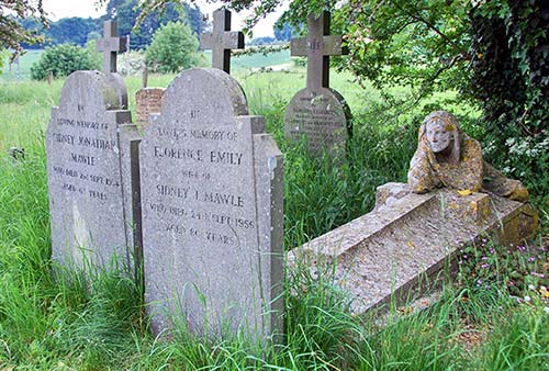
In Upper Slaughter, find the gate across from the square and walk through the yew trees (sacred in pagan days) down a lane through the raised graveyard (a buildup of centuries of graves) to the peaceful church. In the far back of the fine cemetery, hidden behind trees, the statue of a wistful woman looks over the tomb of an 18th-century rector (sculpted by his son). Notice the town is missing a war memorial—that’s because every soldier who left Upper Slaughter for World War I and World War II survived the wars. As a so-called “Doubly Thankful Village” (one of only 13 in England and Wales), the town instead honors those who served in war with a simple wood plaque in the Town Hall.
Getting There: These towns are hard to reach by bus, but you can take bus #801 (from Moreton or Stow) and request the “Slaughter Pike” stop (along the main road, near the villages). From here, it’s a 10-minute walk to Lower Slaughter (or 30 minutes to Upper Slaughter). If driving, the small roads from Upper Slaughter to Ford and Kineton (and the Cotswold Farm Park, described later) are some of England’s most scenic. Roll your window down and joyride slowly.
▲Bourton-on-the-Water
I can’t figure out whether they call this “the Venice of the Cotswolds” because of its quaint canals or its miserable crowds. Either way, this town—four miles south of Stow and a mile from Lower Slaughter—is very pretty. But it can be mobbed with tour groups during the day: Sidewalks become jammed with disoriented tourists wearing nametags.
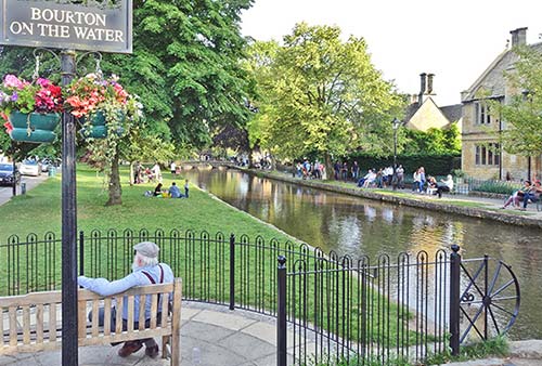
If you can avoid the crowds, it’s worth a drive-through and maybe a short stop. It’s pleasantly empty in the early evening and after dark.
Bourton is filled with tacky tourist traps, but the attractions listed later are worth considering. In addition to these, consider Bourton’s leisure center (big pool and sauna, a five-minute walk from town center off Station Road; Mon-Fri 6:30-22:00, Sat-Sun 8:00-20:00; shared with the school—which gets priority for use, +44 1451 824 024).
Getting There: It’s conveniently connected to Stow and Moreton by bus #801.
Parking: Finding a spot here can be tough. Even during the busy business day, rather than park in the pay parking lot a five-minute walk from the center, you can drive right into town and wait for a spot on High Street just past the village green. (Where the road swings left, turn a hard right—watch for signs for museums and TI—to go along the babbling brook and down High Street; there’s a long row of free 1.5-hour spots starting just past the brook in front of the Edinburgh Woolen Mills Shop, on the right.) After 18:00 you can park free just along the brook.
Tourist Information: The TI is tucked across the stream a short block off the main drag, on Victoria Street, behind The Victoria Hall. They sell a cheap and handy “Cotswolds Towns and Villages” guide (Mon-Sat 10:00-17:00, Sun 10:00-14:00 except closed Sun Oct-April, +44 1451 820 211).
Bike Rental: Hartwells on High Street rents bikes by half-day or day and includes a helmet, map, and lock (deposit required, smart to reserve in advance, daily, +44 1451 820 405, www.hartwellscotswoldcyclehire.uk, hartwells@suplanet.com).
▲Cotswold Motoring Museum
Lovingly presented, this good, jumbled museum shows off a lifetime’s accumulation of vintage cars, old lacquered signs, threadbare toys, prewar memorabilia, and sundry British pop culture knick-knacks. If you appreciate old cars, this is nirvana. Wander the car-and-driver displays, which range from the automobile’s early days to slick 1970s models, including period music to set the mood. Talk to an elderly Brit who’s touring the place for some personal memories.
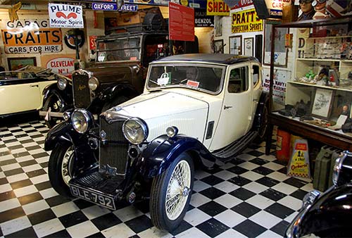
Cost and Hours: £7.50, daily 10:00-18:00, closed mid-Dec-mid-Feb, in the mill facing the town center, +44 1451 821 255, www.cotswoldmotoringmuseum.co.uk.
Model Village
This light but fun display re-creates the town on a 1:9 scale in a tiny outdoor park, and has an attached room full of tiny models showing off various bits of British domestic life (£4.50, daily 10:00-18:00, until 16:00 in winter, at the edge of town, behind The Old New Inn, a few minutes’ walk from the center, www.themodelvillage.com).
Walk to the Slaughters
From Bourton-on-the-Water, it’s about a 30-minute walk (or a two-minute drive) to Upper and Lower Slaughter (described previously); taken together, they make for an easy two-hour round-trip walk from Bourton. (You could also walk from Stow through the Slaughters to Bourton—hike described on here.)
▲Cotswold Farm Park
Here’s a delight for young and old alike. This park is the private venture of the Henson family, who are passionate about preserving rare and endangered breeds of native British animals. While it feels like a kids’ zone (with all the family-friendly facilities you can imagine), it’s a fascinating chance for anyone to get up close and (very) personal with piles of mostly cute animals, including the sheep that made this region famous—the big and woolly Cotswold Lion. The “listening posts” deliver audio information on each rare breed.
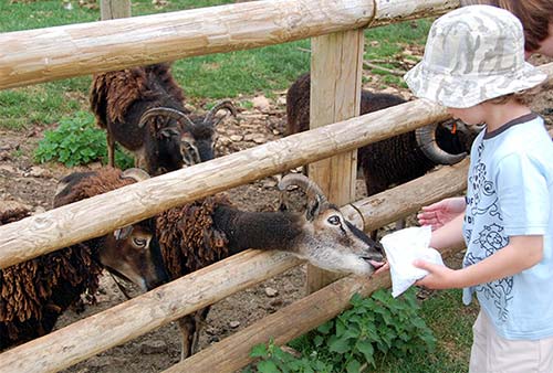
Check the events board for seasonal demonstrations of farm life—such as milking, bottle-feeding (generally March-Sept), shearing, sheep shows (meet the seven local breeds), and more. Buy a bag of seed upon arrival, or have your map eaten by munchy goats as I did. Tykes love the maze and zip line, and especially the “discovery barn” where they can (carefully) handle wee chicks and bunnies.
Cost and Hours: £15, kids-£14, daily 9:30-17:00, Nov-Dec until 16:00, closed Jan-mid-Feb, restaurant and café, +44 1451 850 307, www.cotswoldfarmpark.co.uk.
Getting There: It’s well signposted about halfway between Stow and Stanway (15 minutes from either). A visit here makes sense if you’re traveling from Stow to Chipping Campden.
Northleach
While other towns may be cuter with more tourist-oriented sights, Northleach (nine miles south of Stow-on-the-Wold) is the best of the “untouched and untouristed” Cotswold villages. Officials made sure the main road didn’t pass through town back in the 1980s, and today there’s no TI and no place to park a big bus. It’s invisible to mass tourism...and I like it.
The town’s impressive main square (Market Place) and church attest to its position as a major wool center in the Middle Ages. Along with the Cotswolds Discovery Centre (on the big road at the edge of town), the town mostly consists of a main street leading to a fine old square facing a glorious church.

Drivers can park in the square called The Green or the adjoining Market Place. Bus #801 (with good Stow and Moreton connections) stops on the square, where there’s an outdated map posted by the WC. For better information, find the nicely done Northleach map/guide (free at the church or post office). Information is also online (www.northleach.gov.uk). Your best bet for a friendly and knowledgeable local might be the volunteer greeters at the church.
Eating: Two good options are on or near Market Place. Facing the square is the $$ Sherborne Arms pub (closed Mon-Tue, Sun open for lunch only). It’s a classic, family- and pet-friendly locale, with a big fireplace, pool table, traditional ales and pub grub, outdoor seating, and a sloppy vibe.
$$$$ The Wheatsheaf Inn is the foodie’s favorite for fine dining. With a pleasantly traditional dining room and a gorgeous sprawling garden, they offer modern English cuisine (long hours daily, reservations smart, on the main street into town one block before Market Place, +44 1451 860 244, www.cotswoldswheatsheaf.com).
Market Place
Standing on the main square, you sense this was a fine medieval town. In fact, Northleach is a good example of a medieval “New Town.” Hundreds of planned market towns like this were “planted” around England after the Norman conquest in 1066. Part of the Norman vision of creating a strong and centralized England was a land of logical towns, each with a triangular market place (likely symbolic of the Trinity) and a long High Street lined with standard and skinny “burgage plots”—parcels of land (from front-to-back: storefront, warehouse, living quarters, servants’ quarters, stables, garden) all 33-feet-wide and reaching back to a service lane 330 feet behind the High Street. The Northleach economy got a boost in 1227 when it was granted a market charter by the king. Back then, traders came from far and wide...you could hear Italian-speaking wool importers in the streets. Nine centuries later, you can still see these skinny units (now either 33- or 66-feet wide) surviving.
While the market hall and the stocks may be gone, the square still has all the essentials of a town: bus stop, post office, pub, and so on, overseen by its church tower.
Church of Saints Peter and Paul
This fine Perpendicular Gothic church has been called the “cathedral of the Cotswolds.” It’s one of the Cotswolds’ two finest “wool” churches (along with Chipping Campden’s), paid for by 15th-century wool tycoons. And, with its enthusiastic corps of volunteer greeter/guides, it’s the most welcoming place in town.
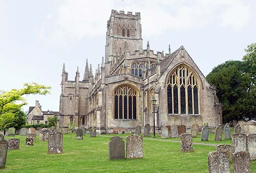
Pick up a flier and the fine town map/guide. Find the baptismal font (in the back as you enter), with carved devils being crushed at its base (which dates from the 14th century and was part of the previous church). Ponder the brass plaques on the floor that memorialize big shots, showing sheep and sacks of wool at their long-dead feet, and inscriptions mixing Latin and Old English. Imagine the stained glass filling the windows before being destroyed—likely in the 17th-century civil war. And don’t miss the wonderful little exhibit about planned towns throughout medieval England in the north transept (daily 9:00-17:00 or until dusk, +44 1451 861 132).
Cotswolds Discovery Centre at the Old Prison
This 18th-century building hosts displays about Cotswolds geology and history, preindustrial farming including two shepherds’ huts, and cell blocks and a courtroom from the building’s previous uses (free, daily 9:00-16:00, on A-429—Fosse Way—at the edge of Northleach, +44 1451 862 000). Also on site is the modern and glassy Old Prison Kitchen and Café, serving up brunch, homemade cakes, and afternoon tea (indoor and outdoor seating).
Coln Valley
Drivers will enjoy exploring the scenic Coln Valley, linking Northleach to Bibury as you pass through the enigmatic villages of Coln St. Dennis, Coln Rogers, Coln Powell, and Winson.
Chedworth Roman Villa
Secluded in thick woods in the Coln Valley are the remains of one of the finest aristocratic villas of fourth-century Roman Britain. Though well off the beaten path now, in its heyday of the late fourth century this wealthy farmstead was not far from a major Roman thoroughfare. You’ll find a small museum and visitors center, and extensive, well-preserved floor mosaics. Rounding out the site are the remains of a small bath complex and a mossy spring once surrounded by an ostentatious water shrine. For history buffs with their own transportation, this is worth seeking out.
Cost and Hours: £12, daily 10:00-17:00, until 16:00 off-season, includes audioguide, small on-site café closes one hour before the villa, +44 1242 890 256, www.nationaltrust.org.uk/chedworth.
Getting There: A half-mile beyond Northleach on A-429, turn right and follow brown Roman Villa signs another four miles to the villa. Don’t follow Chedworth signs; these lead to Chedworth village.
▲Bibury
Six miles northeast of Cirencester, this village—long a favorite with British fond of strolling and fishing—is now so touristy I’d only visit after hours. Bibury (BYE-bree) caters to tour buses, and lately has become a stop on the Instagram circuit and can be overwhelmed by selfie-stick tourists. After about 17:00, the light is warm and the masses are gone. The town offers some relaxing sights, including a row of very old weavers’ cottages, a trout farm, a stream teeming with fat fish and proud ducks, and a church surrounded by rosebushes. A protected wetlands area on the far side of the stream hosts newts and water voles.
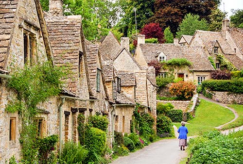
From the small parking lot, check out the posted map and information. Then cross the wooden pedestrian bridge and walk the loop: up the main street (enjoying achingly beautiful homes with gardens and signs in Chinese that say keep out), then turn right along the old weavers’ Arlington Row and back along the made-for-tour-groups paved path on the far side of the marsh, peeking into the rushes for wildlife.
For a closer look at the fish, cross the little bridge to the 15-acre Trout Farm, where you can feed them—or catch your own (£7.50 to walk the grounds, fish food-£0.60; daily 8:00-18:00, shorter hours off-season; catch-your-own March-Aug daily, Sept-Oct weekends only 10:00-17:00, £10.50/kilogram, no fishing in winter, call or email to confirm fishing schedule, +44 1285 740 215, www.biburytroutfarm.co.uk).
Getting There: Take bus #801 from Moreton-in-Marsh or Stow, then change to #855 in Northleach or Bourton-on-the-Water (3/day, 1 hour total).
▲Cirencester
Almost 2,000 years ago, Cirencester (SIGH-ren-ses-ter) was the ancient Roman city of Corinium. Today it’s the largest town of the Cotswold district. It’s less cute and feels more bustling than surrounding towns, but has a pleasant and pedestrianized historic center. It’s 20 miles from Stow down A-429, which was called Fosse Way in Roman times. The TI, in the shop at the Corinium Museum, answers questions and sells a town map and a town walking-tour brochure (same hours as museum, +44 1285 654 180).
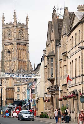
Getting There: By bus, take #801 from Moreton-in-Marsh or Stow, then change to #855 in Northleach or Bourton-on-the-Water for Cirencester (3/day, 1.5 hours total). Drivers follow Town Centre signs and find parking right on the market square; if it’s full, retreat to the Waterloo pay lot (a 5-minute walk away).
Visiting Cirencester: Stop by the impressive Corinium Museum to find out why they say, “If you scratch Gloucestershire, you’ll find Rome.” The museum chronologically displays well-explained artifacts from the town’s rich history, with a focus on Roman times—when Corinium was the second-biggest city in the British Isles (after Londinium). You’ll see column capitals and fine mosaics before moving on to the Anglo-Saxon and Middle Ages exhibits (£7.40, Mon-Sat 10:00-17:00, Sun from 14:00, shorter hours off-season, Park Street, +44 1285 655 611, www.coriniummuseum.org).
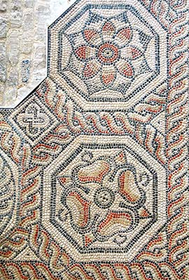
Cirencester’s church, built in about 1490, is the largest of the Cotswold “wool” churches. The cutesy New Brewery Arts crafts center entertains visitors with traditional weaving and potting, workshops, an interesting gallery, and a good coffee shop (www.newbreweryarts.org.uk). Monday and Friday are general-market days, Friday features an antique market, and a crafts market is held every Saturday.
Moreton-in-Marsh
This workaday town—worth ▲—is like Stow or Chipping Campden without the touristy sugar. Rather than gift and antique shops, you’ll find streets lined with real shops: ironmongers selling cottage nameplates and carpet shops strewn with the remarkable patterns that decorate B&B floors. A traditional market of 100-plus stalls fills High Street each Tuesday, as it has for the last 400 years (9:00-15:00, handicrafts, farm produce, clothing, books, and people-watching; best if you go early). The Cotswolds has an economy aside from tourism, and you’ll feel it here.
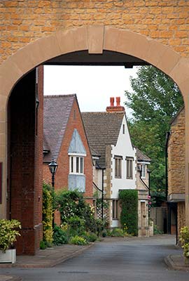
Orientation to Moreton-in-Marsh
Moreton has a tiny, sleepy train station two blocks from High Street, lots of bus connections, and the best TI in the region. Peruse the racks of fliers, confirm rail and bus schedules, and consider the cheap Town Trail self-guided walking tour leaflet. Ask about rail and bus ticket discounts for Blenheim Palace, easily visited between here and Oxford (TI open Mon-Fri 8:45-17:00, closed Sat-Sun, good public WC, +44 1608 650 881).
HELPFUL HINTS
Laundry: The handy launderette is a block in front of the train station on New Road (daily 7:00-19:00, last self-service wash at 18:00, drop-off service options available—call ahead to arrange, may also store bags for a small fee, +44 1608 650 888).
Bike Rental and Taxis: See “Getting Around the Cotswolds,” earlier.
Parking: It’s easy—anywhere on High Street is fine any time, as long as you want, for free (though there is a 2-hour parking limit for the small lot in the middle of the street). On Tuesdays, when the market makes parking tricky, try the Co-op supermarket, where you can park for two hours.
Hikes and Walks from Moreton-in-Marsh: As its name implies, Moreton-in-Marsh sits on a flat, boggy landscape, making it a bit less appealing for hikes; I’d bus to Chipping Campden or to Stow, both described earlier, for a better hike (this is easy, since Moreton is a transit hub). If you do have time to kill in Moreton, consider taking a fun and flat but often muddy 1.5-mile walk through kissing gates and sheep-strewn fields to the arboretum and falconry center in Batsford (described later). From the TI, cross the street and head west down Corder’s Lane till it dead-ends at the clearly signed public footpath marked The Monarch’s Way.
Sleeping in Moreton-in-Marsh
$$$$ Manor House Hotel is Moreton’s big old hotel, dating from 1545 but sporting such modern amenities as toilets and electricity. Its 35 classy-for-the-Cotswolds rooms and its garden invite relaxation (elevator, attached restaurants, free parking, on far end of High Street away from train station, +44 1608 650 501, www.cotswold-inns-hotels.co.uk, manorhouse.reception@cotswold-inns-hotels.co.uk).
$$ The Swan Inn is wonderfully perched on the main drag, with nine en suite rooms. You enter through a bar/restaurant that can be noisy on weekends, but the renovated rooms themselves are classy and the bathrooms modern (free parking, restaurant gives guests 10 percent discount, High Street, +44 1608 650 711, www.swanmoreton.co.uk, info@swanmoreton.co.uk, Sara and Terry Todd). Terry may be able to pick up guests from the train station.
$$$ The Bell Inn rents five en suite rooms—some with stone walls and wood beams—in a 300-year-old building a short walk from the train station. Their pub has live music and outdoor seating (High Street, +44 1608 651 887, www.thebellinnmoreton.co.uk, stayatbellinn@icloud.com).
$ Acacia B&B, on the short road connecting the train station to the town center, is a convenient budget option. Dorothy and Michael have four small, bright, and tidy rooms, most overlooking a lovely garden (+44 1608 650 130, 2 New Road, www.acaciainthecotswolds.co.uk, acacia.guesthouse@tiscali.co.uk).
Eating in Moreton-in-Marsh
A stroll up and down High Street lets you survey your options. Nobody travels to Moreton for its restaurants, but you won’t go hungry.
$$ White Hart Royal Hotel and Eatery is a solid bet for pub grub with a characteristic bar, finer restaurant seating, and a terrace out back—all with the same menu. They also offer a £22 afternoon tea from 14:00-18:00 (daily, reservations required for afternoon tea, +44 1608 650 731, www.whitehartroyal.co.uk).
$$ Raj Mahal, on High Street, just past the White Hart, serves good-value Indian food in a rustic and cozy dining room (daily for dinner only).
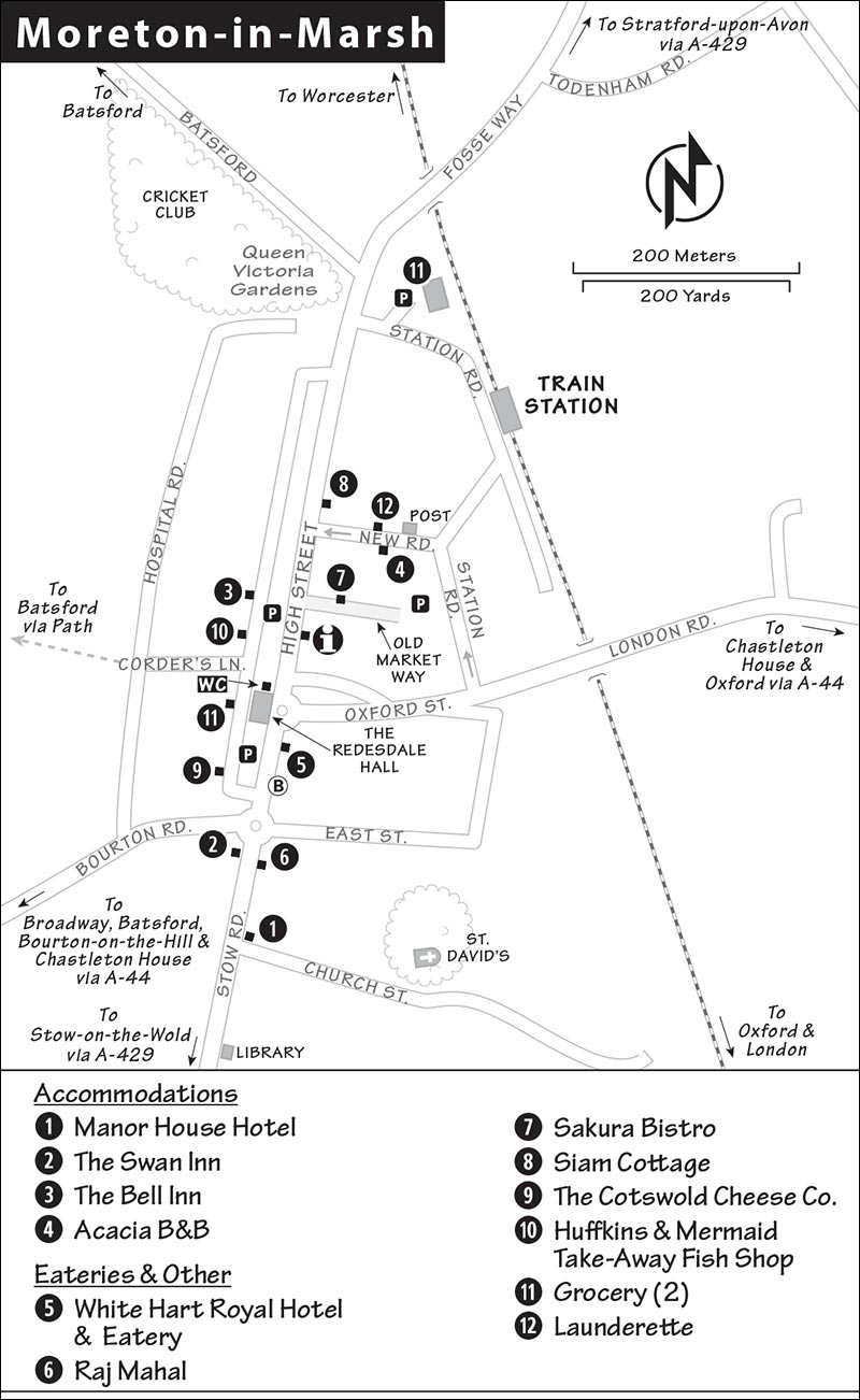
$$ Sakura Bistro has a delightful outdoor patio, cozy indoor seating, a cheap and cheery menu of English-Asian fusion, and a tempting display of homemade cakes (daily for lunch, plus Fri-Sat for dinner, just off High Street at 3 Old Market Way, +44 1608 651 881).
$$ Siam Cottage serves up tasty Thai dishes and tapas-style lunch specials. Sit inside or out back in their shaded garden (closed Mon, High Street, +44 1608 651 117).
$ The Cotswold Cheese Company’s friendly staff sells local products that make for an easy, upscale picnic. Try their Stow blue cheese, made exclusively for their shop (daily, 5 High Street, +44 1608 652 862).
$ Huffkins serves salads, sandwiches, and toasties for lunch, plus pastries and a good cream tea, in a cheerful spot on High Street across from the TI (daily, +44 1608 650 000).
$ Mermaid Take-Away Fish Shop is popular for its takeout fish and tasty selection of traditional savory pies (closed Sun, +44 1608 651 391).
Picnic: There’s a small Tesco Express on High Street (Mon-Fri 6:00-23:00, Sat-Sun from 7:00). The big Co-Op supermarket is at the far end of High Street (Mon-Sat 8:00-20:00, Sun 10:00-16:00). You can picnic across the street in pleasant Victoria Park (with a playground).
Nearby: The excellent $$$$ Horse and Groom gastropub in Bourton-on-the-Hill is two miles away on A-44 toward Chipping Campden (see here).
Moreton-in-Marsh Connections
Moreton, the only Cotswold town with a train station, is also the best base for exploring the region by bus (see “Getting Around the Cotswolds” on here).
From Moreton by Train to: London’s Paddington Station (every 1-2 hours, 1.5 hours), Bath (hourly, 2.5 hours, 1-2 transfers), Oxford (hourly, 35 minutes), Ironbridge Gorge (hourly, 3 hours, 2 transfers; arrive Telford, then catch a bus or cab 5 miles to Ironbridge Gorge—see here), Stratford-upon-Avon (hourly, 3 hours, 2 transfers, slow and expensive, better by bus). Train info: +44 345 748 4950, NationalRail.co.uk.
From Moreton by Bus to: Stratford-upon-Avon (#1 and #2 go via Chipping Campden: Mon-Sat 5/day, none on Sun, 1.5 hours, run by Stagecoach Midlands, www.stagecoachbus.com; bus #51 runs Mon-Sat 5/day, none on Sun, run by Pulham & Sons, www.pulhamscoaches.com).
Near Moreton-in-Marsh
▲Chastleton House
This stately home, located about five miles southeast of Moreton-in-Marsh, was lived in by the same family from 1607 until 1991. It offers a rare peek into a Jacobean gentry house. (Jacobean, which comes from the Latin for “James,” indicates the style from the time of King James I—the early 1600s.) Built, like most Cotswold palaces, with wool money, it gradually declined with the fortunes of its aristocratic family, who lost much of their wealth in the war—not World War II, but the English Civil Wars in the 1640s. They stuck it out for centuries until, according to the last lady of the house, the place was “held together by cobwebs.” It came to the National Trust on the condition that they would maintain its musty Jacobean ambience. It’s so authentic that the BBC used it to film scenes from its adaptation of Wolf Hall (a best-seller about Henry VIII’s chief minister, Thomas Cromwell, who masterminded Henry’s divorce, marriage to Anne Boleyn, and break with Rome). Wander on creaky floorboards, many of them original, chat with the knowledgeable volunteer guides, and understand this frozen-in-time relic revealing the lives of nobles who were land rich but cash poor. The docents are proud to play on one of the best croquet teams in the region (the rules of croquet were formalized in this house in 1868—if the weather’s good, you’ll see courses set up on the lawn; ask about playing if you fancy a round). Page through the early 20th-century family photo albums in the room just off the entry.
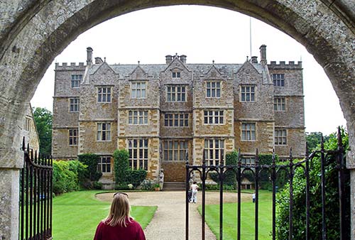
Cost and Hours: £12; Wed-Sun 13:00-17:00, closed Nov-mid-March and Mon-Tue year-round; last entry one hour before closing, +44 1608 674 355, www.nationaltrust.org.uk/chastleton. They let people in every 10 minutes; when it’s busy you may have a short wait.
Getting There: Chastleton House is well signposted (be sure you follow signs to the house, not the town), about a 10-minute drive southeast of Moreton-in-Marsh off A-44. It’s a five-minute hike to the house from the free parking lot.
Rollright Stones
Three megalithic monuments, together known as the Rollright Stones, make a short and worthwhile detour from Moreton-in-Marsh. At the entrance to the site is the King’s Men stone circle, from about 2500 BC. This ring of weathered limestones—the easternmost of its kind in England—was likely used as a ceremonial site.
As the legend goes, a mighty king and his army were approaching the Cotswolds when they encountered a witch who challenged the king: If he could see Long Compton (a town below the stones) in seven strides, he would become the king of England. On his seventh step, the ground rose up, obscuring his view and turning him and his army into the stones you see here today. The circle originally was comprised of well over 100 stones, but over the years some were repurposed into local building materials (now there are about 70).
A trail leads away from The King’s Men to the Whispering Knight’s tomb (c. 3800-3500 BC), a burial chamber with four upright stones and a fallen capstone, and crosses the street to the singular King Stone (c. 1500 BC).
Cost and Hours: £1, open daily.
Getting There: The sight is 7 miles from Moreton-in-Marsh on Rollright Road. Drive east out of town following the London Road/A-44 for about 5 miles. Just after the sign for Chastelton House, look for a white sign to Rollright and turn left. About 2 miles down the road you’ll find free street parking and a gate to the entrance on the right.
Cotswolds Distillery
About 15 miles east of Moreton-in-Marsh, the largest distillery in England welcomes visitors for tours of their facility, followed by a generous tasting. In 2011, the owners bought a farm and started making single-malt whisky using locally grown barley. Soon after, they launched their gin—a classic London dry style infused with lavender from nearby Snowshill. Today, their signature whisky and gin can be found all over the Cotswolds region—and beyond.
Cost and Hours: £25 tours offered daily at 10:30, 13:30, and 15:00, 90 minutes, £32 for tour and lunch; includes tastes of their whisky, gin, and a third tasting of your choice, take-home tasting available, reserve in advance; Whichford Road, Stourton, +44 1608 238 533 www.cotswoldsdistillery.com).
Getting There: Drive east from Moreton-in-Marsh, turn left on Oxford Road, and follow London Road/A-44. Turn left on Great Wolford Road toward Great Wolford, then after 2 miles, turn right toward Little Wolford/Barton/Shepston. Keep left at the bend in the road (toward Little Wolford/Shipton), passing through Little Wolford (with sheep grazing in the fields). Turn left onto A-4310, then take an immediate right onto Wood Lane, following the brown sign for Cotswolds Distillery. You’ll see signs to Stourton about 2 miles after that. From there, it’s well signed to the distillery.
Batsford
This village has two side-by-side attractions that could appeal if you have a special interest or time to kill.
Getting There: Batsford is an easy 45-minute, 1.5-mile country walk west of Moreton-in-Marsh. By request, buses #1 and #2 will stop on A-44, which is walking distance to Batsford Arboretum. You could also book a taxi in advance (see here).
Cotswold Falconry Centre
Along with the Cotswolds’ hunting heritage comes falconry—and this place, with dozens of specimens of eagles, falcons, owls, and other birds, gives a sample of what these deadly birds of prey can do. You can peruse the cages to see all the different birds, but the demonstration, with vultures or falcons swooping inches over your head, is what makes it fun.
Cost and Hours: £12, book ahead online; daily mid-Feb-Nov 10:30-17:30, last entry at 15:00, closed off-season; flying displays at 11:30, 13:30, and 15:00, plus in summer at 16:30; Batsford Park, +44 1386 701 043, www.cotswold-falconry.co.uk.
Batsford Arboretum and Garden Centre
This sleepy grove, with 2,800 trees from around the world, pales in comparison to some of the Cotswolds’ genteel manor gardens. But it’s next door to the Falconry Centre, and handy to visit if you’d enjoy strolling through a diverse wood. The arboretum’s café serves lunch and tea on a terrace with sweeping views of the Gloucestershire countryside.
Cost and Hours: £10, daily 9:30-17:00, Sun from 10:00, last entry one hour before closing, Dec-Feb same hours but last entry at 15:00, +44 1386 701 441, www.batsarb.co.uk.