BRITTANY
Dinan • St-Malo • Fougères
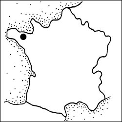
The bulky peninsula of Brittany (“Bretagne” in French; “Breizh” in Breton) is windswept and rugged, with a well-discovered coast, a forgotten interior, strong Celtic ties, and a craving for crêpes. This region of independent-minded locals is linguistically, physically, and culturally different from Normandy—and, for that matter, the rest of France. Tradition is everything here, where farmers and fishermen still play a big part in the region’s economy.
The Couesnon River skirts the western edge of Mont St-Michel and has long marked the border between Normandy and Brittany. The constant moving of the riverbed made Mont St-Michel at times Norman and at other times Breton. To end the bickering, the border was moved a few miles to the west—making Mont St-Michel Norman for good.
In 1491, the French king Charles VIII forced Brittany’s 14-year-old Duchess Anne to marry him (at Château de Langeais in the Loire Valley). Their union made feisty, independent Brittany a small, unhappy cog in a big country (the kingdom of France). Brittany lost its freedom but, with Anne as queen, gained certain rights, such as free roads. Even today, more than 500 years later, Brittany’s freeways have no tolls, which is unique in France.
Locals take great pride in their distinct Breton culture. In Brittany, music stores sell more Celtic albums than anything else. It’s hard to imagine that this music was forbidden as recently as the 1980s. During that repressive time, many of today’s Breton pop stars were underground artists. And not long ago, a child would lose French citizenship if christened with a Celtic name.
But les Bretons are now free to wave their black-and-white-striped flag, sing their songs, and parler their language (there’s a Breton TV station and radio station). Look for Breizh (abbreviated BZH) bumper stickers and flags touting the region’s Breton name. Like their Irish counterparts, Bretons are chatty, their music is alive with stories of struggles against an oppressor, and their identities are intrinsically tied to the sea.
PLANNING YOUR TIME
With one full day, spend the morning in Dinan and the afternoon either along the Rance River (walking or biking are best) or driving along Brittany’s wild coast, where you can tour Fort la Latte and enjoy the massive views near Cap Fréhel. Try to find at least a half-day for St-Malo—ideally when connecting Mont St-Michel with Brittany. The coastal route between Mont St-Michel and St-Malo—via the town of Cancale (famous for oysters and a good place for lunch), with a stop at Pointe du Grouin (fabulous ocean views)—gives travelers with limited time a good glimpse at this photogenic province.
GETTING AROUND BRITTANY
By Car: This is the ideal way to scour the ragged coast and watery towns. Expressways here are free, with a 110 km/hr speed limit. Traffic is generally negligible, except in summer, on sunny weekends along the coast, and around St-Malo and the big city of Rennes.
By Train and Bus: Trains provide barely enough service to Dinan and St-Malo (on Sun, service to Dinan all but disappears). Key transfer points by train include Rennes and the small town of Dol-de-Bretagne. Some trips are more convenient by bus (including Rennes to Dinan and Dinan to St-Malo).
By Minivan Tour: Designed for day-trippers from Paris, Westcapades runs daylong minivan tours covering Dinan, St-Malo, Mont St-Michel, or the coast around Fort la Latte. Tours leave from St-Malo or Rennes (pickups also possible from Dinan; €100/day includes abbey entry, +33 2 23 23 01 96, www.westcapades.com, contact@westcapades.com).
BRITTANY’S CUISINE SCENE
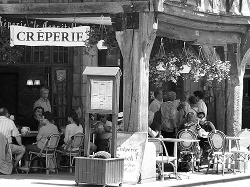
Though the endless coastline suggests otherwise, there is more than seafood in this rugged Celtic land. Crêpes are to Bretons what pasta is to Italians: a basic, reasonably priced, daily necessity. Galettes are savory buckwheat crêpes, commonly filled with ham, cheese, eggs, mushrooms, spinach, seafood, or a combination. Purists insist that a galette should not have more than three or four fillings—overfilling it masks the flavor (which is the point in certain places).
Oysters (huîtres), the second food of Brittany, are available all year. Mussels, clams, and scallops are often served as main courses, and you can also find galettes with scallops and moules marinières (mussels steamed in white wine, parsley, and shallots). Farmers compete with fishermen for the hearts of locals by growing fresh vegetables, such as peas, beans, and cauliflower.
For dessert, look for far breton, a traditional flan-like cake often baked with prunes. Dessert crêpes, made with white flour, come with a variety of toppings. Or try kouign amann, a puffy, caramelized Breton cake (in Breton, kouign means “cake” and amann means “butter”). At bakeries, seek out gâteau breton, a traditional Breton shortbread cake made with butter, of course.
Cider is the locally produced drink. Order une bolée de cidre brut, demi-sec, or doux (a traditional bowl of hard apple cider, from dry to sweet) with your crêpes. Breton beer is varied and delicious; try anything local.
Dinan
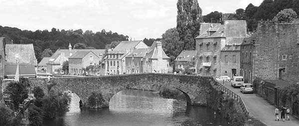
If you have time for only one stop in Brittany, do Dinan. Hefty ramparts corral its half-timbered and cobbled quaintness into Brittany’s best medieval town center. While simply charming today, Dinan was once a formidable city—a residence of the duke of Brittany, a strategic port, and a trading center with powerful guilds and good connections with England and Holland. But in the 13th century, ships outgrew its river port, and the harbor action migrated to nearby St-Malo. That economic downturn later became an advantage as unimportant Dinan escaped the bombs of World War II (unlike St-Malo), and today you’ll find an impeccably preserved town center made for lingering. Its stout, mile-long ramparts are like an elevated parkway. Given a chance to replace those venerable walls with a wide, modern boulevard, the people of Dinan chose instead to keep their slice of history—and the traffic congestion that comes with it.
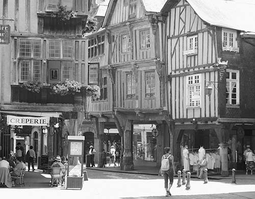
Inside those walls, Dinan has a touristy icing—plenty of crêperies, shops selling Brittany kitsch, and colorful flags—yet it remains a workaday Breton town filled with about 10,000 people who appreciate their beautiful, peaceful surroundings. It’s also conveniently located, about a 45-minute drive from Mont St-Michel. For a memorable day, spend your morning exploring Dinan and your afternoon walking, biking, or boating the Rance River.
Orientation to Dinan
Dinan’s old city, wrapped in medieval ramparts, gathers on a hill well above the Rance River. The vast Place du Guesclin (gek-lan) welcomes you with acres of parking and the TI at the far end. A few blocks from there, Place des Merciers marks the center for shoppers. From the old cobbled core, a steep lane leads down to a small river port where Dinan was founded, now a springboard for vacation paddles and pedals.
TOURIST INFORMATION
At the TI, pick up a map and bus schedules and ask about bike rental and boat trips on the Rance River (July-Aug Mon-Sat 9:30-19:00, Sun 10:00-12:30 & 14:30-18:00; Sept-June Mon-Sat 9:30-12:30 & 14:00-18:00, closed Sun; just off Place du Guesclin near Château de Dinan at 9 Rue du Château, +33 8 25 95 01 22, www.dinan-capfrehel.com).
ARRIVAL IN DINAN
By Train: To get to the town center from Dinan’s Old World train station, hop a taxi (see “Helpful Hints,” later) or walk 20 steady minutes (see the town map). If walking, veer left out of the train station and walk up Rue Carnot. At the roundabout, turn right on Rue Thiers (following Centre Historique/Office de Tourisme signs), then go left across big Place Duclos-Pinot, passing just left of Café de la Mairie. To reach the TI and Place du Guesclin, go to the right of the café (on Rue du Marchix).
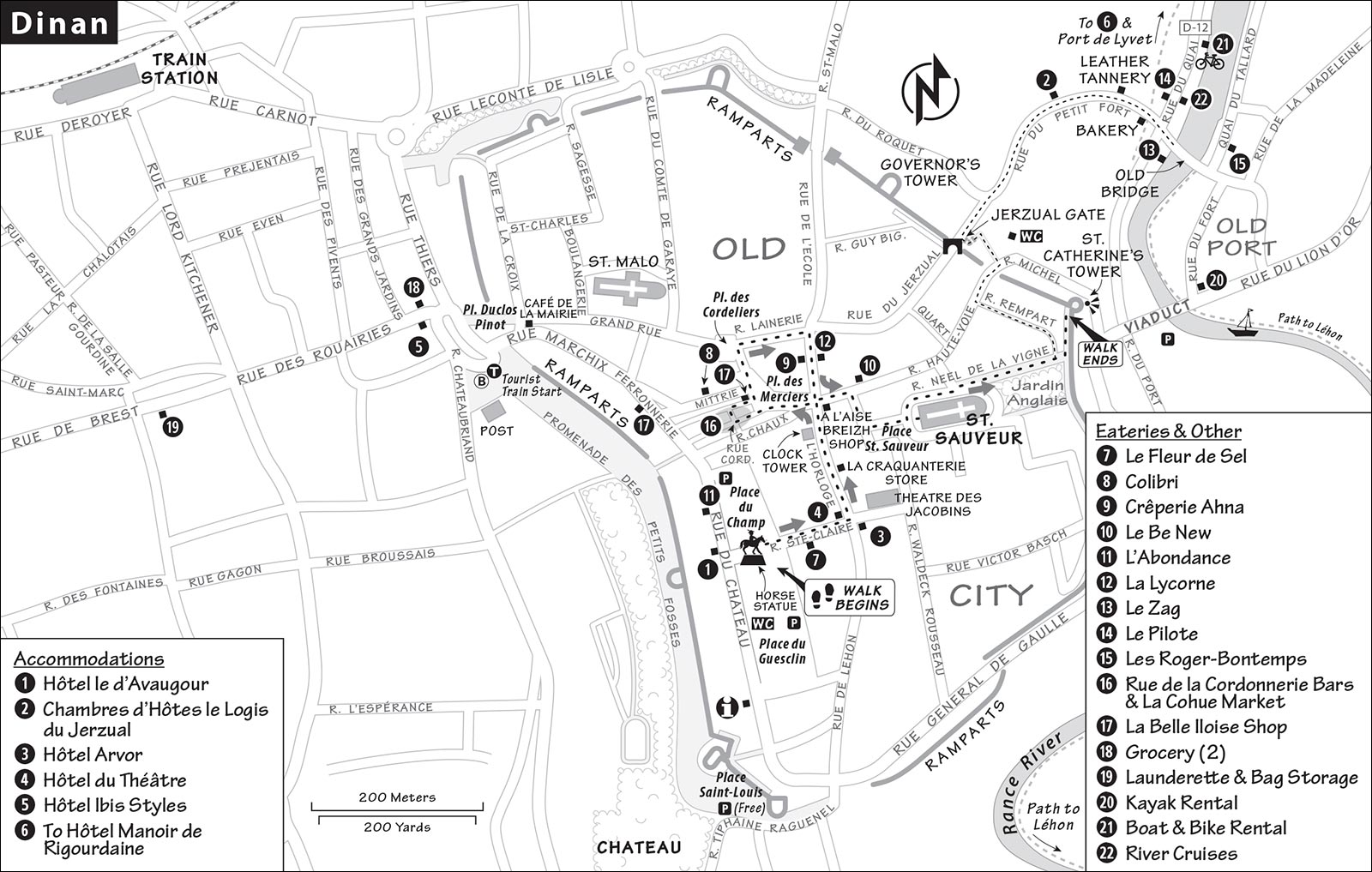
By Bus: Dinan’s intercity bus stops are at the train station and in front of the post office on Place Duclos-Pinot, minutes from Place du Guesclin. To reach the historic core, cross the square, passing to the left of Café de la Mairie (for more on buses, see “Dinan Connections,” later).
By Car: Follow Centre Historique/Office de Tourisme signs and park on or near Place du Guesclin (free overnight from 19:00-9:00 except on Thu market days). Check with your hotelier before leaving your car overnight on Place du Guesclin; it will be towed before 6:00 on market or festival days. If you enter Dinan near the train station, drive the route described earlier (see “By Train”), and keep to the right of Café de la Mairie to reach Place du Guesclin. You can park for free all day behind the Château de Dinan, but space is limited—arrive early or late (coming from Place du Guesclin, take the first right under the medieval arch after passing the château and keep right).
HELPFUL HINTS
Market Days: Every Thursday, a big open-air market is held on Place du Guesclin (8:00-13:00).
Laundry and Bag Storage: A dry-cleaner/self-serve launderette is a few blocks from Place Duclos-Pinot at 19 Rue de Brest (Mon-Sat 8:30-12:00 & 13:45-18:30, no midday closure Thu or Sat, closed Sun, +33 2 22 13 19 72). While they will also store your bags, the location is not very central; try Nanny bag.com or another luggage storage app to find a more central place.
Supermarkets: Groceries are upstairs in the Monoprix (Mon-Sat 9:00-19:30, closed Sun, 7 Rue du Marchix). Or try Carrefour City on Place Duclos-Pinot (Mon-Sat 7:00-21:00, Sun 8:00-13:00).
Bike Rental: Handily located at the harbor, find Kaouann past the river cruise kiosks (daily April-Oct, 10:00-18:00, shorter hours off-season, 20 Rue du Quai +33 2 56 11 00 42, www.kaouann.fr).
Boat Rental: See Dina’Vig for small, easy-to-drive boats for exploring the Rance River. In an hour, you can get to Léhon’s lock and back; with two hours, you can reach Port de Lyvet (from €38/hour, run by the bike company above with same hours, +33 6 21 14 16 70, www.dinavig.com).
Kayak Rental: Paddle the Rance with a boat from Club Canoë Kayak, which rents both kayaks and canoes; you can go upstream almost to Léhon, and downstream to Taden (€10/1 hour, €30/day, July-Aug daily 10:00-18:00, April-June by reservation only and cash only, 13 Rue du Four, Lanvallay; +33 2 96 39 01 50, www.dinanrancekayak.fr).
Taxi: Call +33 6 08 00 80 90. Figure about €75 to St-Malo, €125 to Rennes, and €150 to Mont St-Michel.
Tourist Train: The petit train runs a 45-minute circuit connecting the port and upper old town and allows you to avoid the steep walk (€10, Easter-Sept Mon-Sat 10:00-17:30, Sun from 14:00, leaves on the hour from Place Duclos-Pinot and returns from the port on the half-hour, stopovers at the port allowed).
Picnic Park: The small but flowery Jardin Anglais hides behind the Church of St. Sauveur.
Dinan Walk
Frankly, I wouldn’t go through a turnstile in Dinan. The attraction is the town itself. Enjoy the old town center, ramble around the ramparts, and explore the old riverfront harbor. Here are some ideas, laced together as a relaxed one-hour walk (not including exploring the port). As you wander, notice the pride locals take in their Breton culture. To trace our route, see the “Dinan” map.
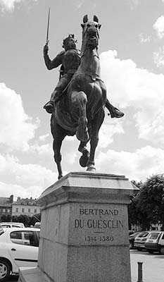
• Start in the center of Place du Guesclin and find the statue of the horseback rider.
Place du Guesclin: This sprawling town square/parking lot is named after Bertrand du Guesclin, a native 14th-century knight and hero (described as small in stature but bighearted) who became a great French military leader, famous for his daring victories over England during the Hundred Years’ War (like Joan of Arc, he was a key player in defeating the English). On this very square, he beat Sir Thomas of Canterbury in a nail-biter of a joust that locals talk about to this day. (Bertrand’s heart is buried in the church where this walk finishes.) For 700 years, merchants have filled this square to sell their produce and crafts (in modern times, it’s Thu 8:00-13:00).
• With the statue of Guesclin behind you, follow Rue Ste. Claire to the right, into the old town and to the...
Théâtre des Jacobins: Fronting a pleasant little square, this theater was once one of the many convents that dominated the town in the 13th century. In fact, in medieval times, a third of Dinan consisted of convents (which, in Europe, are not exclusively for nuns). They’re still common in Brittany, which remains the most Catholic part of France. The theater today offers a full schedule of events. To the left as you face the theater, the fine building with the colorful half-timbered porch on stone columns is the Keratry Mansion, which dates from 1559. It was brought here from a nearby town and reassembled—one of many examples of how Dinan takes pride in its old center. (Posts around town give short descriptions of historic sights like this one.)
• Walk past the mansion down Rue de l’Horloge (“Clock Street”) toward the clock tower. Under the next porch on your left, you’ll see...
Anybody’s Tombstone: The tombstone without a head is a town mascot. It’s a prefab tombstone, mass-produced during the Hundred Years’ War, when there was more death than money in France. A portrait bust would be attached to this generic body and they’d chip the deceased’s coat of arms onto the blank banner for a proper, yet economical, burial.
• On your right, 20 yards farther down, is...
La Craquanterie: This shop specializing in Breton cookies and treats offers tastes of the local mead, chouchen, or buckwheat whisky (yum). Look for caramels au beurre salé (salted butter caramels), kouign amann (extremely rich butter cake), gâteau breton (traditional cake), craquants (crisp cookies with salted butter), and the Breton answer to Nutella—a caramel spread. There’s a good chance your hotel will serve these local treats at breakfast.
• Continue a few steps to the...
Clock Tower: More than 500 years ago, Dinan built this 150-foot tall tower so people would know when to start and stop working. Back when most towns only had church bell towers, this proud civic tower was a symbol of the power of the town’s merchants. The tower’s 156 steps (the last 12 are on a ladder) lead past the clock’s original mechanism—from 1498, one of the oldest in Europe—to a 360-degree sweeping city view. Warning: Plug your ears at the quarter-hour (€4, daily 10:30-18:30, Mon-Tue closed 13:00-14:00, closed Oct-March).
• At the next corner, find the store...
A l’Aise Breizh: This store, with its distinctive name (meaning “take it easy in Brittany”), has been riding the wave of Brittany’s cultural renewal since 1996. You may have seen their slogan on bumper stickers throughout the region. Inside, you’ll find fun clothing and whimsical souvenirs designed in Brittany.
• You’re in the middle of Dinan’s...
Old Town Center: The arcaded, half-timbered buildings around you are Dinan’s oldest. They date from the time when property taxes were based on the square footage of the ground floor. To provide shelter from both the rain and taxes, buildings started with small ground floors, then expanded outward as they got taller. Notice the stone bases supporting the wood columns. Because trees didn’t come in standard lengths, builders adjusted the size of the pedestals. Medieval shopkeepers sold goods in front of their homes under the shelter of these traditional porches.
• Ducking for cover at Le Pole Nord (a local favorite for ice cream), turn left under the covered arcade, enjoying the architecture along the way. At the end, angle left and find the stone bench on...
Place des Merciers: From this spot spin 360 degrees counter-clockwise. Looking back at Le Pole Nord, admire the woody structures. This arcade originally continued left 100 yards past the four modern black lampposts to the next arcade. In the 19th century Dinan had about a thousand buildings with fine wooden porches, but a 1907 fire destroyed much of the center, and only 16 survive today. Fire remains a worry in this half-timbered town—a 2019 fire tragically destroyed Dinan’s most famous half-timbered building (the restaurant Chez la Mère Pourcel), leaving the open space behind the metal barrier. As with Notre-Dame in Paris, locals are working to restore the much-loved 15th-century building and fill the big hole on their lovely main square.
Just to the right is La Belle Iloise, a shop filled with canned fish from Brittany (described later). Behind you is a shop with regional products and a window full of traditional Breton ceramic cups with “ears” as handles and folk paintings inside. The mugs are based on the traditional Breton bowls that every local was raised with—hand-painted with designs of costumed Bretons and each kid’s first name.
• Walk a few paces along narrow Rue du Petit Pain toward the market La Cohue to find a small square and...
Rue de la Cordonnerie: Many Breton streets are named for the key commerce that took place there in medieval times. Rue de la Cordonnerie, literally “Cobblers’ Lane,” is now nicknamed “Street of Thirst” for its many pubs. It’s a good example of a medieval lane, with overhanging buildings whose roofs nearly touch. After a disastrous 18th-century fire, a law required that the traditional thatch be replaced by safer slate. Enjoy the details of the buildings on this characteristic lane.
• The gate (close to a public WC) leads to a modern market.
La Cohue: There’s been a market here since the 13th century, but the ambience of La Cohue today is very 21st century. It has a produce stand, wine store, cheese shop, bakery, and more (Tue-Sun 8:00-14:00, Fri-Sat until 19:00, closed Mon).
• Explore the market. Then double back to Place des Merciers, where you reach the shop selling tinned fish.
La Belle Iloise: For three generations, a fishing family has respected the traditions of canning their fresh catch. Their factory, which is based in southern Brittany and has outlets all over France, produces tasty sardine, mackerel, and tuna spreads. Check out the blackboard for what’s available for tasting today.
• Make your way left past the black lampposts to the end of the square. (The building with the arched stone facade at the end—Les Cordeliers, once a Franciscan monastery—is now a middle school.) Turn right and walk a block down Rue de la Lainerie (“Street of Wool Shops”) to the top of a hill. Stop at the top of...
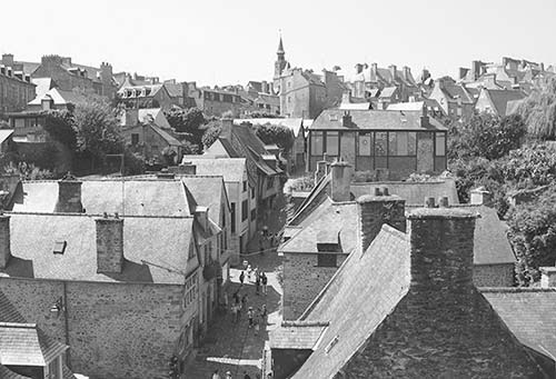
Rue du Jerzual: Peer down this street that connects the town and its river port. Notice the waist-high stone and wooden shelves that front many of the buildings. Here, medieval merchants could display their products and tempt passersby. These days, the street is lined with welcoming art galleries and inviting craft shops. (From here it’s a steep 10-minute walk down to the port—described later, under “Sights in Dinan.”)
• Head right on Rue de la Poissonnerie (back toward the clock tower), turn left at Rue de l’Apport, then turn immediately right on Rue de la Larderie to find the...
Church of St. Sauveur: When it was built a thousand years ago, this church sat lonely here, as all other activity was focused around the port well below. Step in to see its striking, modern stained-glass windows and beautifully lit nave. Pick up the simple English explanation. The old wood balcony above the entry heaves under the weight of its organ. A capital in the center of the back wall is decorated with camels. According to legend, a local crusader promised to build this church if he survived his crusade. Apparently he did.
The gangly church is asymmetrical—built in many stages over the centuries. Notice an older section of wall on the right of the nave: The simple, round Romanesque arches bear traces of the original red bull’s-blood paint, surviving from the 12th century. The fourth chapel on the left has its original 15th-century stained glass (with four Breton saints lined up below the four evangelists). The rest of the church’s windows are post-World War II (c. 1950). And in the urn atop the upright tomb in the left transept no longer beats the heart of the Dinan hero, Bertrand du Guesclin.
• Exit the church and walk around it to the English Gardens. To the left is the round...
St. Catherine’s Tower: This part of Dinan’s medieval defense system allows strategic views of the river valley and over the old port. Below you can see the medieval bridge and the path that leads along the river, to the right, to Léhon (see under “Sights in Dinan”). To the left, the Rance River flows toward the sea. Although the old port town was repeatedly destroyed, these ramparts were never taken by force. If an attacker got by the contrescarpe (second outer wall, now covered in vegetation) and through the (dry) moat, he’d be pummeled by ghastly stuff dropped through the holes lining the ramparts. Today, the ramparts protect the town’s residential charm and are lined by private gardens.
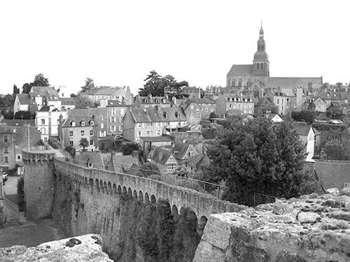
• Your tour is over. From here, it’s a steep but rewarding descent to the port for more views, terrific eating options, and a full menu of activites for your afternoon. To reach the Jerzual Gate and a view of more ramparts, backtrack a few steps from the tower, turn right on the first path (which becomes Rue du Rempart), turn right on Rue Michel, and then left on Venelle Michel. Pause to appreciate the fine view of the ramparts here, then continue down Rue du Petit Fort to the port.
Sights in Dinan
Dinan’s Old Port
This port was the birthplace of Dinan a thousand years ago. For centuries, this is where people lived and worked, and today it’s a great place for a riverside drink or meal. The once-thriving port is connected to the sea—15 miles away—by the Rance River (and a bike path that parallels it). The town grew prosperous by taxing river traffic. The tiny medieval bridge dates to the 15th century. Because the port area was so exposed, the townsfolk retreated to the bluff behind its current fortifications. The viaduct high above was built in 1850 to alleviate congestion and to send traffic around the town. Before then, the main road crossed the little medieval bridge, heading up Rue du Jerzual to Dinan.
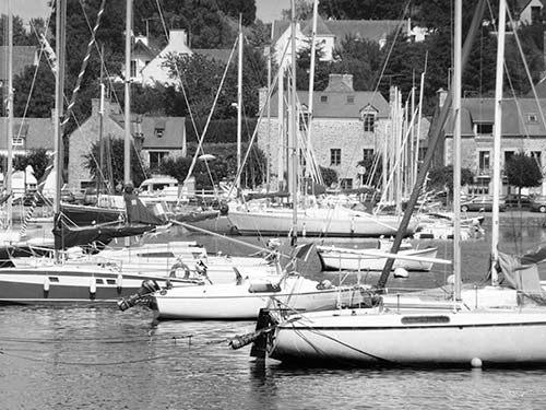
Getting There: Walkers following my self-guided walk (described earlier) can reach Dinan’s modest little port by continuing steeply down Rue du Petit Fort. Just before reaching the port, notice the unusual wood-topped building on the left-hand side. This was the town’s leather tannery—those wooden shutters could open to dry the freshly tanned hides while the nearby river flushed away the waste (happily, swimming was not in vogue then). The last business on the right before the port is a killer bakery, Gat’et Vous, with delicious local specialties, including far breton and kouign amann (you’ll also find good picnic fixings and drinks to go; closed Wed off-season). You deserve a baked break.
Drivers can park at the pay lot under the viaduct for easy port access.
▲Rance River Valley
The best thing about Dinan’s port is the access it provides to lush riverside paths that amble along the gentle Rance River Valley. You can walk, bike, drive, or boat in either interesting direction (perfect for families).
On Foot: For a breath of fresh Brittany air and an easy walk, visit the flower-festooned village of Léhon. The most scenic trail along the river starts across Dinan’s medieval bridge (turn right and walk 35 minutes to Léhon).
Arriving in pristine little Léhon—a town of character, as the sign reminds you—visitors are greeted by a beautiful ninth-century abbey that rules the roost (find the cloister). Explore the village’s flowery cobbled lanes and the church with its cloister garden, but skip the town-topping castle ruin. Next to the church, enjoy a tapas-like meal at the adorable $ Côté Cour café in a linger-longer courtyard setting. A modest selection of lunch offerings (several shared plates and a few plats) is served 12:00-14:30 and dinner from 18:00 on; tempting cakes and local beers are served all day (open 10:30-19:30, Fri-Sat until 21:00, closed Tue, +33 7 82 58 78 37).
The trail continues well past Léhon, but you’ll need a bike to make a dent in it. The villages of Evran and Treverien are both reachable by bike (allow 45 minutes from Dinan to Evran, and an additional 25 minutes to Treverien).
By Bike: The Rance River Valley could not be more bike-friendly, as there’s nary a foot of elevation gain (for bike rentals at the harbor, see “Helpful Hints,” earlier). Here’s what I’d do with three hours and a bike: Pedal to Léhon (following the “On Foot” route, earlier), then double back to Dinan and follow the bike path along the river downstream to the Port de Lyvet.
To reach the Port de Lyvet, ride through Dinan’s port, staying on the old-city side of the river. You’ll join a parade of ocean-bound boats as the river widens, becoming more like an inlet of the sea. It’s a breezy, level 30-minute ride past rock faces, cornfields, and slate-roofed farms to the tiny Port de Lyvet (cross bridge to reach village). $ Le Lyvet Gourmand café/restaurant is well positioned in the village on the right after the bridge and serves standard café fare (closed Tue-Wed, +33 2 96 41 45 48).
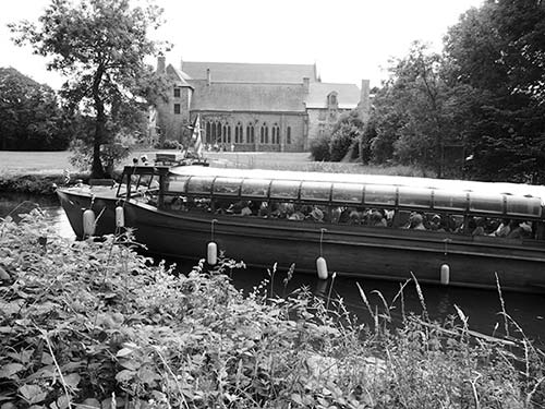
By Boat: Boats depart from Dinan’s port, at the bottom of Rue du Petit Fort, 50 feet to the left of the medieval bridge on the Dinan side (schedules depend on tides, get details at TI). The snail-paced, one-hour cruise on the Jaman V runs upriver to Léhon (the trip is better on foot or bike), taking you through a lock and past pretty scenery (€14, April-Oct Tue-Sat, 2/day usually in afternoon, none on Sun-Mon, see schedule online—select Horaires, +33 2 96 39 28 41, www.vedettejamaniv.com). A slow and scenic cruise with Compagnie Corsaire goes to St-Malo (€30 one-way, €35 round-trip, 2.5 hours each way, better to return by bus to save time, April-Sept, schedule varies with tide, almost daily July-Aug, +33 8 25 13 81 00, www.compagniecorsaire.com or ask at TI). Enjoy St-Malo (described later in this chapter), then take the bus back or vice-versa.
By Car: Meandering the Rance River Valley by car requires a good map (orange Michelin #309 worked for me). Drivers connecting Dinan and St-Malo can include this short Rance joyride detour: From Dinan, go down to the port, then follow D-12 with the river to your right toward Taden, then toward Plouër-sur-Rance (Dinan’s port-front road is occasionally blocked, in which case you’ll join this route beyond the port). Stay straight through La Hisse, then drop down and turn right, following signs to La Vicomté-sur-Rance. Cross the Rance on the bridge and find the cute Port de Lyvet, then continue to La Vicomté and find D-29 north toward St-Malo and on to St-Suliac, a pretty little hill town that spills down to the water—with flowery lanes, a musty church, a handful of restaurants, a small grocery store, and a boulangerie. You’ll be directed to remote parking lots. Leave your car, then stroll the ancient alleys, find a bench on the grassy waterfront, and contemplate lunch. $ Au Galichon in the upper town serves good crêpes with salad in a traditionally Breton setting (closed Mon-Tue, 5 Rue de la Grande Cohue, +33 2 99 58 49 49). $$ Bistrot de la Grève is the place to savor a fine lunch from a short, seafood-focused menu on a terrace with tables ovelooking the bay (closed Sun-Mon, 1 Quai de la Rance, +33 2 99 58 95 84). From St-Suliac, continue to St-Malo or return to Dinan.
Sleeping in Dinan
Weekends and summers are tight; book ahead if you can. Dinan likes its nightlife, so be wary of rooms over loud bars, particularly on lively weekends. Among the hotels I list, only the Ibis has air-conditioning.
IN THE OLD CENTER
$$ Hôtel le d’Avaugour*** is central, with an efficient staff, stay-awhile lounge areas, a full bar, and a backyard garden oasis. It faces busy Place du Guesclin, near the town’s medieval wall. The wood-furnished rooms have queen- or king-size beds and some modern hotel amenities, such as an elevator (rooms over the garden are best). Owner Nicolas strongly encourages two-night stays (1 Place du Champ, +33 2 96 39 07 49, www.avaugourhotel.com, contact@avaugourhotel.com).
$ Chambres d’Hôtes le Logis du Jerzual is just about as cozy as it gets, with five warmly decorated rooms and thoughtful touches throughout. Gentle Sylvie Ronserray and her son Guillaume welcome guests to their terraced garden in this haven of calm close to the action: It’s just up from the port but a long, steep walk below the main town (includes breakfast, deals for stays of three nights or longer, no elevator, 25 Rue du Petit Fort, +33 6 68 47 70 35, www.logis-du-jerzual.com, sylvie.logis@bbox.fr). Get parking advice when you book.
$ Hôtel Arvor*** is a good value with a fine stone facade, ideally located in the old city a block off Place du Guesclin. It’s well run by a mother-and-son team, with 24 tasteful rooms, an elevator, a cozy lounge, and nine “apartments,” all with small kitchens and room to stretch (pay parking, 5 Rue Pavie, +33 2 96 39 21 22, www.hotelarvordinan.com, contact@hotelarvordinan.com).
¢ Hôtel du Théâtre is ideal for budget travelers, with four central, surprisingly sharp, clean rooms above a luminous café/bar, across from Hôtel Arvor (no elevator, narrow stairway, 2 Rue Ste. Claire, +33 2 96 39 06 91, theatredinan@free.fr, owner Mickael speaks some English).
CLOSER TO THE TRAIN STATION
$$ Hôtel Ibis Styles,*** with its predictable comfort, stands tall between Place du Guesclin and the train station. It works especially well for bus and train travelers, as it’s central, reasonably priced, and next to the bus stop. They may have rooms when others don’t (air-con, elevator, 1 Place Duclos-Pinot, +33 2 96 39 46 15, ibis.accorhotels.com, h5977@accor.com).
NEAR DINAN
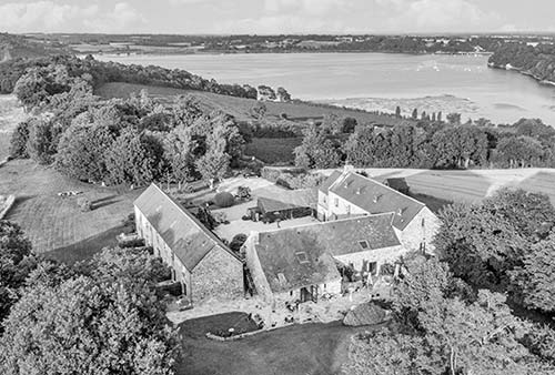
$$ Hôtel Manoir de Rigourdaine*** is the place to stay if you have a car and two nights to savor Brittany (you’ll want to stay longer). Overlooking a splendid scene of green meadows and turquoise water, the stone farmhouse has comfortable, modern rooms, a cozy bar-lounge, a courtyard terrace, a great breakfast featuring homemade cakes, verdant grounds with short and scenic hikes nearby, and good rates. Owners Ghyslain, Rita, and Helen take fine care of their guests and offer a few tasty dinner plates (15-minute drive north of Dinan, +33 2 96 86 89 96, https://rigourdaine.com, hotelrigourdaine@gmail.com). From the N-176, take the Plouër-sur-Rance exit, follow signs to Langrolay, then you’ll soon see signs for the hotel.
Eating in Dinan
Dinan has good restaurants for every budget. Since galettes (savory crêpes) are the specialty, crêperies are a nice, inexpensive choice—and available on every corner. Be daring and try a gourmet crêpe (my favorite is with scallops and cream). For a fine dinner, book Colibri, Le Fleur de Sel, or Crêperie Ahna a day or two ahead. When the weather agrees, go local by heading for the small port and drinking or dining riverside.
$$$ Le Fleur de Sel is where locals come for Dinan’s best seafood, served in a dressy dining room. Book this place ahead (closed Tue-Wed, just off Place du Guesclin at 7 Rue Ste. Claire, indoor dining only, +33 2 96 85 15 14).
$$ Colibri is the talk of Dinan and rightfully so, mixing international touches with regional cuisine. Service is on a front terrace, in a warmly designed main dining room, and in the atrium-like rear room (closed Sun-Mon, 14 Rue de la Mittrie, +33 2 96 83 97 89, https://colibri-dinan.com).
$ Crêperie Ahna rocks Dinan. Locals jam the place: The price is right, the dishes are tasty, and owner Greg sets the tone for a fun experience. The Ahna crêpe with duck breast is delicious, and his vanilla rum is excellent. The cuisine goes well beyond crêpes; the do-it-yourself pierrades—you cook your meat or fish on a hot stone at your table—are a treat (mostly inside seating, closed Sun-Mon, reservations recommended, 7 Rue de la Poissonnerie, +33 2 96 39 09 13).
$ Le Be New is an intimate place that takes its crêpes seriously, using local organic ingredients to create delicious results (closed Thu, 17 Rue de l’Apport, +33 2 96 87 56 75).
$$ L’Abondance features flavorful and seasonal plats, served indoors and in the courtyard to a happy, relaxed crowd (closed Sun, 9 Place du Champ Clos, +33 2 56 11 02 96).
$$ La Lycorne is Dinan’s place to go for a healthy serving of mussels prepared 18 different ways, as well as great desserts. The cook-at-your-table pierrades are a good deal. The ambience is medieval; the setting is on a traffic-free street (closed Mon-Tue except July-Aug, 6 Rue de la Poissonnerie, +33 2 96 39 08 13).
At the Old Port: Have a before-dinner drink—or better, a meal at one of several places right on the river. Skip the always-crammed and medicore Les Terraces and try one of these good places:
$ Le Zag, with a privileged riverfront setting, is famous in Dinan for its pizza and salads. It has a bohemian, laid-back feel with easygoing waitstaff and a fun bar scene (next door). It’s good in any weather (closed Mon, 7 Rue du Port, +33 2 96 80 55 84).
Choose $$ Le Pilote for an intimate dinner with a few tables positioned right on the river and a cozy dining room. The cuisine features regional dishes cooked with tasty twists (good wines by the glass, closed Sun for dinner and all day Mon, 13 Rue du Quai, + 33 9 82 54 32 52).
Across the river, craft beer fans will feel right at home at $$ Les Roger-Bontemps, the place to go for shared plates, burgers, and home brews in a lively setting. Sit in the delightful garden or pleasing interior room with river views (live music on weekends in-season, serves nonstop 12:00-23:00, closed Wed except July-Aug, 8 Quai du Tallard, +33 6 37 17 73 52).
Nightlife: So many lively pub-like bars line the narrow, pedestrian-friendly Rue de la Cordonnerie that the street is nicknamed “Rue de la Soif” (“Street of Thirst”). When the weather is good, you can sit outside at a picnic table and strike up a conversation with a friendly, tattooed Breton. See also Les Roger-Bontemps, above.
Dinan Connections
Trains from Dinan generally require a change in Dol-de-Bretagne; for some long-distance connections it may be better to take the bus to Rennes, then catch a train from there. For regional destinations the bus is generally better (bus service provided by Breizhgo for St-Malo and Dinard, by Illenoo for Rennes; timetables for both at www.breizhgo.bzh).
From Dinan by Train to: Dol-de-Bretagne (7/day, 25 minutes), Paris’ Gare Montparnasse (10/day, 3.5 hours, change in Dol-de-Bretagne, or in Dol and Rennes), Rennes (6/day, 75 minutes), Pontorson/Mont St-Michel (2/day, 2.5 hours, change in Dol, then bus or taxi from Pontorson, see “Mont St-Michel Connections” on here), St-Malo (6/day, 1 hour, transfer in Dol, bus is more convenient—see next), Amboise (6/day, 7 hours, several changes).
By Bus to: Rennes (with good train connections to many destinations, line #7, about hourly, fewer on Sun, 1 hour), Dinard (line #7, about hourly, fewer on Sun, 50 minutes), Mont St-Michel (3/day, 3.5 hours, transfer in Rennes via line #7), St-Malo (line #10, 6/day Mon-Fri, 4/day Sat, none on Sun except in summer, 50 minutes; faster, cheaper, and better than train, as bus stops are more central). All buses depart from Place Duclos-Pinot (near the main post office), and most make a stop at the train station, too.
St-Malo
Come here to experience a true Breton beach resort. The old city (called Intra Muros) is your target, with pretty beaches, powerful ramparts, and island fortifications littering the bay. Traffic-free streets and squares fill the busy town, hemmed in by tall stone buildings and towering ramparts. (St-Malo is best up on top of the walls, which are the sight here.) The town is packed in July and August, when the 8,000 people who call the old city home become a minority within their own walls.
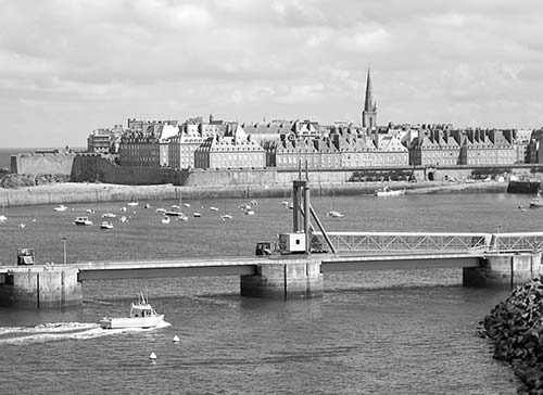
Established as a Gallic city in the first century BC, St-Malo became an important fortress town under Roman rule in the fourth century thanks to its seafront location protecting access to the Rance River. The town emerged after the fall of the Roman Empire as a monastic center, then faded in importance. But St-Malo rose again from the ashes of irrelevance in the 17th and 18th centuries, becoming an important base for merchant ships and government-sanctioned pirates defending France against threats from England and Holland. In the 20th century, St-Malo was heavily fortified by the occupying Germans during World War II. St. Malo was virtually leveled by American bombs in August 1944.
More recently, the city became a literary destination thanks to the best-selling novel All the Light We Cannot See by Anthony Doerr, winner of the 2015 Pulitzer Prize for fiction. This story, about a young German who joins the Nazi military and a blind French girl who flees Paris for St-Malo with her father, brings wartime St-Malo to life and describes the impact of the conflict on regular people on both sides.
Today’s city feels simultaneously old and new. St-Malo has no important interiors: The cathedral, rebuilt after 1944, has little touristic interest, and the castle houses the city government. The city itself is the attraction—a stony wonder with some of Europe’s finest ramparts in an unforgettable setting, mixing family-friendly beaches and craggy coastline. Simply walking the walls makes a visit here unforgettable.
St-Malo is a 45-minute drive—or a manageable bus or train ride—from Dinan. (There’s no baggage storage in town.) If you have a whole day here, stroll St-Malo’s ramparts, cruise to Dinard, and walk to Alet.
Orientation to St-Malo
St-Malo’s seafront walled city (your focus) is ringed by water. Nice beaches border the walls to the north and west, providing access to historic forts and good strolling at low tide. Most access points to St-Malo lie to the east (including roads from Mont St-Michel, Dinan, and the train and bus stations).
TOURIST INFORMATION
St-Malo’s glassy TI is just outside the walls across from the main city gate (Porte St. Vincent) on Esplanade St. Vincent (daily 9:30-19:00; closed at lunchtime April-June and Sept; shorter hours and closed Sun off-season; +33 8 25 13 52 00, www.saint-malo-tourisme.com). The TI’s “scenic walks map” is a worthwhile, tiny investment (with good English information). You can get bus, train, and ferry schedules here, too.
ARRIVAL IN ST-MALO
By Train: From the modern TGV station, it’s a five-minute bus ride on the #1, #2, or #8 line to the TI (€2 cash-only to driver, less from ticket machines). If you’d rather walk, go for 15 minutes straight out of the station, then track the spire in the distance for another five minutes.
By Bus: Regional buses and FlixBus stop at the bus station, next to the train station. The bus from Mont St-Michel stops there and at the TI.
By Car: Arrive before 10:00 to avoid traffic and to find a decent parking space. Follow Intra-Muros/Office de Tourisme signs to the old center, and park as close as possible to Porte St. Vincent (near the merry-go-round). A big underground parking lot is opposite Porte St. Vincent (descend near the TI), and smaller surface lots and street parking are scattered around or near the ramparts. In peak season, you can park in the spacious pay parking lot just outside of town (Parking Paul Féval-about €4/day), and take the free Express Féval shuttle to Porte St. Vincent (runs daily, 4/hour until 22:00; hourly on Sun).
HELPFUL HINTS
Services: Pay WCs are located at some gates (portes) leading to the old city, and free WCs are behind the TI.
Laundry: Inside the walls, there’s a launderette on the corner of Rue de la Herse and Rue de la Halle aux Blés (daily 7:00-21:00).
Car Rental: Find Avis (+33 2 99 40 18 54) and Europcar (+33 2 99 56 75 17) at the train station.
Bike Rental: Although shops are willing to rent you a bike, St-Malo is not bike-friendly. Instead, pedal around Dinan, then explore St-Malo on foot (2-hour ride from Dinan north past Port de Lyvet (see here and get directions at TI).
Foot Ferry to Dinard: Two companies run frequent little ferries for the scenic and worthwhile 12-minute ride to Dinard (see “Sights Near St-Malo,” later).
Petit Train: The town’s tourist train stops by the TI and does a scenic 30-minute loop around the city (€7 from 10:00-12:00 & 14:00-18:00).
Minivan Tour: St-Malo is a departure point for Westcapades, which has tours to Dinan, Mont St-Michel, and the D-Day beaches (see here).
Sights in St-Malo
▲St-Malo’s Ramparts Walk
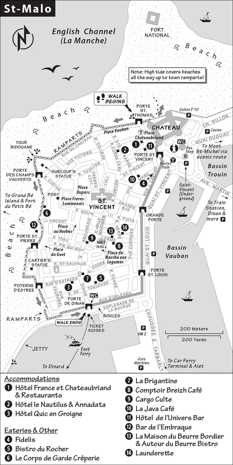
To reach the ramparts, find Porte St. Thomas (behind the Hôtel France et Chateaubriand). Then tour the walls counterclockwise. You’ll take a rewarding half-mile-long romp around medieval fortifications with segments dating from the 1100s. (Note that the ramparts described here are the scenic ones. The sections not described are not worth your time or energy.) Read the information panels as you go. Along the way, stairs provide access to the beach and the town. Walk down to the soft, sandy beaches when tides allow (along with Mont St-Michel, St-Malo has Europe’s greatest tidal changes). The walls are at their best and most peaceful early in the day.
Here are your rampart highlights:
View from near Porte St. Thomas: Before you climb the walls, walk out to the beach to get a good feel for the ramparts and a whiff of the salt air. (Take off your shoes and get your feet wet.) Once up on the Porte St. Thomas, walk to the first tower lookout and imagine the strategic importance of this city. The fortified islands were built during the wars of Louis XIV (late 1600s) by his military architect, Vauban, to defend the country against British and Dutch naval attacks. You can tour the closer forts (€5 each) when tides allow. Both offer visits with a French-only tour (skippable, though the views back to St-Malo from near the forts alone can merit the effort).
Fort National is nearest. Farther to the left is Fort du Petit Bé. Built in the 1600s, it sits behind Ile du Grand Bé, where the famous poet Chateaubriand is buried. A garrison of 177 French soldiers manned this fort until 1885. During World War II, Germans used these forts as part of their Atlantic Wall defense. They occupied the forts and the city of St-Malo through much of the war with almost no damage. But as the Allies pushed into France after D-Day, Hitler ordered St-Malo’s Nazi commander to fight to the end. This led to the near-total destruction of the city in one horrible week in August 1944.
Continue along and climb the steps up to the next tower—the defensive-minded Tour Bidouane, with the best view along the ramparts. Locate Fort la Latte on the orientation table, about 11 miles in the distance (described on here). Fort la Latte was part of Vauban’s elaborate defense network (with Forts National and Bé). The tree trunks below, planted like little forests on the sand, form part of St-Malo’s breakwater and must be replaced every 20 years. These help break the powerful waves that pound the seawalls when storms scream in off the English Channel. High tides cover those trunks.
View from Porte des Champs Vauverts: Cross the short wooden bridge on the left to the statue pointing toward Québec. The great Breton navigator Jacques Cartier, who visited the future site of Québec City during early Canadian explorations, lived in St-Malo and sailed from here in the 1500s. Today, St-Malo’s sister city is Québec City. Cartier’s statue is farther along the wall; the statue here is of the pirate Robert Surcouf, who made a fortune in the late 1700s by operating slave ships as well as raiding dozens of (mostly British) ships, seizing their cargo for the French.
Mean Bulldogs: Next, pass St-Malo’s best-positioned crêperie, Le Corps de Garde (consider coming back for lunch or dinner), then find the Chiens du Guet restaurant sign (with two dogs). At one time, 24 bulldogs were kept in the small, enclosed area behind the restaurant, then let loose late at night to patrol the defenses and no-man’s-land along these ramparts. Steps here lead down to a pretty beach and the Bar de l’Embraque—an outdoor-only bar/café ideal at sunset (see “Eating in St-Malo,” later).
Porte St. Pierre: Next is a big, square park on the ramparts still defended by cannons. The statue, commemorating Jacques Cartier (with his hand firmly on the tiller), was inaugurated in 1984 by Canadian prime minister Pierre Trudeau on the 450th anniversary of Cartier’s first voyage to Canada.
As you continue along the ramparts, notice that much of the fine stonework of both the city and the ramparts feels rebuilt. Eighty percent of St-Malo was destroyed by American bombers during World War II as part of the campaign to liberate France. So, even though they may look old, most of the town’s buildings date from after 1945 (the walls you’re walking on were rebuilt between 1948 and 1960). The quality of St-Malo’s rebuild is a testament to the feisty pride and spirit of its people.
Rounding the corner, look for a long, concrete jetty pointing across the bay to the belle époque resort town of Dinard. Consider a walk out to the end of the jetty, where the views back to St-Malo justify the detour. Across the bay, you’ll also spot the green, circular park at the tip of Alet. Big ferries sail to England from the harbor in front of you.
Porte de Dinan: With the most interesting section of the ramparts behind you, this is a good place to descend and check out the harbor action (jetty walk) and the pétanque (a.k.a. boules) courts (you may see locals playing boule bretonne—more like lawn bowling and with bigger balls). The dock has ticket kiosks for the foot ferries to Dinard and beyond, described later.
Strolling the Old Town
After walking the ramparts, see the town center by strolling from Porte de Dinan to Porte St. Vincent, eating, browsing, and shopping as you go. The liveliest shopping streets are Rue de Dinan, the delightful Place du Marché aux Légumes (with its medieval timber market hall), Rue de la Vieille Boucherie, and Rue Porcon de la Barbinais.
Drop by La Maison du Beurre Bordier to appreciate the art of handmade butter and cheese. With the help of a small exhibit, the welcoming staff explains how their artisanal butter and cheese are crafted. The bistro next door allows you to sample dishes that show off their work (shop open Tue-Sat 9:00-12:30 & 15:30-19:30, longer hours July-Aug, Sun 9:00-13:00, closed Mon, see “Eating in St-Malo,” later).
NEAR ST-MALO
Foot Ferry to Dinard and Beyond
This upscale-traditional resort offers a peaceful break from St-Malo and comes with a kid-friendly beach and a classic promenade. In the late 1800s, this was France’s number-one beach resort (before the Mediterranean became popular). This explains the many elaborate seaside villas you’ll see. Take an hour or two to explore Dinard, then ferry back to St-Malo.
Ferries: Both Bateaux Rouges and Corsaire make the short hop between St-Malo and Dinard every 20 minutes (12-minute crossing, €8.50 round-trip, worthwhile for the views alone, runs roughly 9:30-18:00, later in summer, none Nov-March). Boats depart from near Porte de Dinan on the south side of St-Malo’s old city—buy tickets from either kiosk. Bateaux Rouges ferries are easier as they only serve one dock in Dinard (Corsaire alternates between two docks, about 200 yards apart).
Landing at Dinard’s Cale de la Vallée dock puts you in the ideal position to explore Dinard’s seafront. (If you land at the Embarcadère dock, walk five minutes with the sea to your right to join our stroll.) From Cale de la Vallée dock, walk uphill past the hotel and under the high bridge, then down to reach the very scenic loop trail, Promenade du Moulinet (where rich Brits strolled during the belle époque, as they did on Promenade des Anglais in Nice). Dinard’s center lies ahead along the bay behind the big casino. The beach you see, Plage de l’Ecluse, makes for a nice beach break. Dinard’s market day is Saturday on Place Crolard, behind the casino (until 13:00).
We’ll skip all that and turn right, walking clockwise along the Promenade du Moulinet for 20 minutes back to the ferry. If you want, you can continue on the promenade past the Embarcadère dock another 15 minutes to reach the family-friendly beach Plage du Prieuré (skip it at low tide). Along the trail, you’ll see photogenic trees framing views of St-Malo—and have point-blank views to the old German fortifications across the water in Alet (described next). If you’re thirsty and have time on your hands, enjoy a cold or hot beverage at the Old World Hôtel Printania a block up from the La Valleé ferry (5 Avenue George V, + 33 2 99 46 13 07).
Alet
The park and village of Alet is just a few minutes’ drive past St-Malo’s port (a pleasant 20-minute walk south from the ramparts), but it feels a world apart. A splendid 30-minute walking path leads around Alet’s forested point with stunning views of crashing waves, the city of Dinard, the open sea, and St-Malo. The entire park is picnic-perfect. Wartime bunkers cap the small hill, and a few rusted defenses are scattered throughout the park. Inside one of the bunkers is the small Mémorial 39/45 museum, which explains the strategic value of St-Malo, its WWII battles, and German defenses (€6, April-Oct, must join an infrequent one-hour guided tour in French only—printed English text provided, 45-minute film in French available—no subtitles, +33 2 99 82 41 74, www.ville-saint-malo.fr). Several pleasing cafés face the bay near the Tour Solidor (a 14th-century fortification at the mouth of the Rance River).
Getting There: By car from St-Malo’s TI or train station, follow Toutes Directions signs south until you spot signposts for Alet Camping and Alet/Mémorial. These lead to and through the park, where you can drive right to the top of the hill and park for free. Those preferring a somewhat longer stroll should follow signs to Alet, then Tour Solidor (parking on or near Place St. Pierre). To reach the start of the walking path from Place St. Pierre, walk to the sea overlook, turn right, and follow the lane (if you end up on the beach, climb the stairs at the end of the small bay before making a hard left).
On foot from St-Malo, buy the TI map and walk from Porte St. Louis along Quai St. Louis. Cross the drawbridge and continue along the dike (Digue des Sablons), hugging the bay through the Port de Plaisance. Follow Mémorial signs up and into the park.
Sleeping in St-Malo
Overnighting here gives you more time to enjoy the sunset and sea views from the town walls. To reach these hotels, it’s best to park outside the walls and walk in through Porte St. Vincent. None of these hotels has air-conditioning.
$$$ Hôtel France et Chateaubriand*** is a venerable Old World establishment near Porte St. Vincent, with 80 slightly tired but OK rooms at inflated rates (secure pay parking—book ahead, elevator, 12 Place Chateaubriand, +33 2 99 56 66 52, www.hotel-chateaubriand-st-malo.com, contact@hotel-saintmalo.fr).
$ Hôtel le Nautilus** is a solid value with big beds and sharp rooms, run by welcoming Aurélie and Edouard. It’s conveniently located inside the walls near Porte St. Vincent (elevator, pay parking, bikes on loan, 9 Rue de la Corne de Cerf, +33 2 99 40 42 27, www.hotel-lenautilus-saint-malo.com, info@lenautilus.com).
$ Hôtel Quic en Groigne,*** well run by charming Marie-Dominique, is a popular place with 15 tasteful rooms at great prices, a quiet courtyard, and a delightful atrium breakfast room. Ask for the Charme rooms with bigger beds (no elevator but just two floors, 8 Rue d’Estrées, +33 2 99 20 22 20, www.quic-en-groigne.com, contact@quic-en-groigne.com).
Eating in St-Malo
St-Malo is all about seafood and crêpes. There’s no shortage of restaurants, many serving the local specialty of mussels (moules) and oysters (huîtres). Look also for bakeries selling ker-y-pom, traditional apple-filled shortbread biscuits that are the best-tasting specialty in town, especially when warmed.
$$$ Fidelis is where locals go to savor a fine meal with international choices from gourmet tacos to lobster, plus reasonably priced three-course menus (nice terrace seating or pleasant dining room, closed Tue-Wed, no dinner Sun off-season, 10 Rue Jacques Cartier, + 33 2 99 40 97 27).
$$ Bistrot du Rocher serves fine regional and traditional French cuisine in a cozy dining room (closed Wed, dinners served Thu-Sat, 19 Rue de Toulouse, +33 2 99 40 82 05).
$$$ Le Chateaubriand offers two choices: the skippable ground-floor brasserie and Le 5, their “gourmet” restaurant five floors up, where you get sea views and a fair-value menu featuring local cuisine (closed Mon-Tue, Place Chateaubriand, +33 2 99 56 66 52).
$ Le Corps de Garde Crêperie is on the city walls and has St-Malo’s cheapest view tables. It’s a cozy place for an inexpensive meal with views on the glassed-in terrace and warm dining inside. They serve good crêpes at fair prices from 11:30 to 22:00 (daily, 3 Montée Notre Dame, +33 2 99 40 91 46).
$$$ Autour du Beurre Bistro, the restaurant for La Maison du Beurre (described on here), is an institution in St-Malo. Every dish comes deliciously cooked in butter, including great seafood and desserts that are, well, rich (Tue-Sat for lunch and Thu-Sat for dinner, every evening July-Aug; 9 Rue de l’Orme, +33 2 23 18 25 81).
$$ Annadata is St-Malo’s vegetarian destination, serving beautifully presented “gourmet” veggie and vegan options in a delightful setting (closed Tue-Wed, dinner served from 19:30, 20 Rue de la Corne de Cerf, +33 9 50 93 32 06).
$ La Brigantine serves delicious crêpes with inside and outside dining (closed Tue-Wed except July-Aug, 13 Rue de Dinan, +33 2 99 56 82 82).
$$ Comptoir Breizh Café has a smart, wood-accented interior, with the best gourmet crêpes in St-Malo. It’s the only crêperie I dress up for (July-Aug open daily, closed Mon-Tue rest of year, reservations highly recommended, 6 Rue de l’Orme, +33 2 99 56 96 08, www.breizhcafe.com).
$ Cargo Culte is a lunch-only place run by happy-go-lucky Yann, serving creative and tasty salads, quiches, and croque monsieur in a fun indoor setting or on a small terrace. The menu offers a few choices at very good prices. It’s popular with locals, so arrive at noon or reserve a bit ahead (Tue-Sat 12:00-16:00, open Sun July-Aug, closed Mon year-round, 1 Rue Broussais, +33 2 99 88 08 68).
Nightlife: The oldest café in St-Malo (open since 1820) also has the longest name (too long to repeat here) and 2,874 dolls along its walls. Locals call it La Java and gather here for beer, wine, and les bons temps. Even if you aren’t staying overnight in St-Malo, it’s worth taking a peek at the quirky decor any time of day (near Porte St. Vincent at 3 Rue Ste. Barbe, +33 2 99 56 41 90). The bar at Hôtel de l’Univers reeks of swashbuckling, local character, and everything nautical (daily, Place Chateaubriand, +33 2 99 40 89 52).
Beach Life: For St-Malo’s best view beach bar and good prices, find a seat at Bar de l’Embraque and soak up the view (ideal at sunset, open 10:00-late in good weather; closed Mon-Tue, on the Plage de Bon Secours, 4 Rue de la Harpe, +33 2 23 15 99 13).
St-Malo Connections
From St-Malo by Train to: Dinan (6/day, 1 hour, transfer in Dol-de-Bretagne, bus is better—see below), Pontorson (with bus connections to Mont St-Michel; 2/day, 1-2 hours, transfer in Dol), Rennes (hourly, 1 hour).
By Bus to: Dinan (line #10, 6/day Mon-Fri, 4/day Sat, none on Sun except in summer, 50 minutes; faster and better than train, as bus stop in Dinan is more central).
By Train/Bus to Mont St-Michel: (2/day, 1-2.5 hours, train to Pontorson, bus to Mont St-Michel).
By Direct Bus to Mont St-Michel: (1/day at 9:15 from stop next to the TI, 9:25 from bus station, 1 hour, return trip departs from Mont St-Michel at 15:45, runs on Sun July-Aug only, less frequent service off-season, https://keolis-armor.com).
Scenic Drives near St-Malo
▲▲Scenic Drive on the Western Emerald Coast
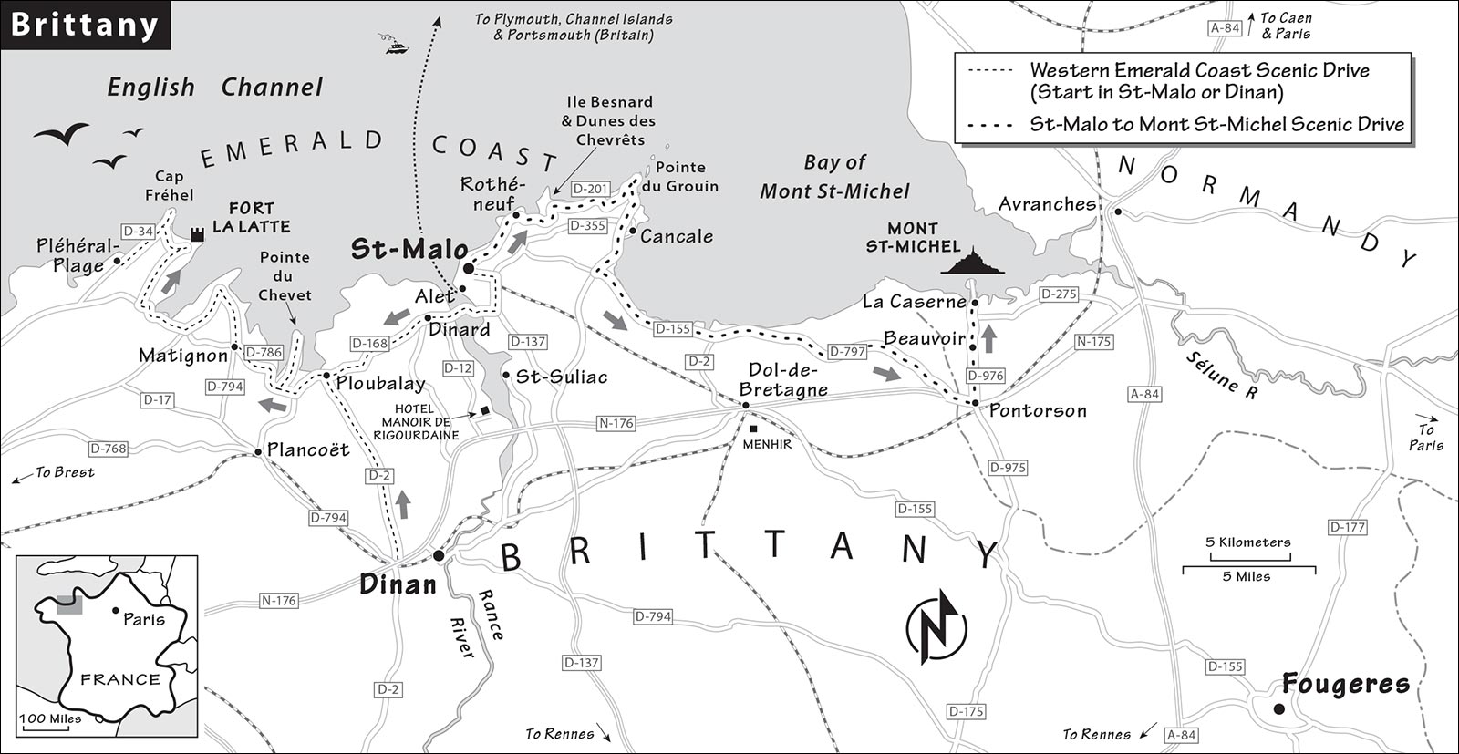
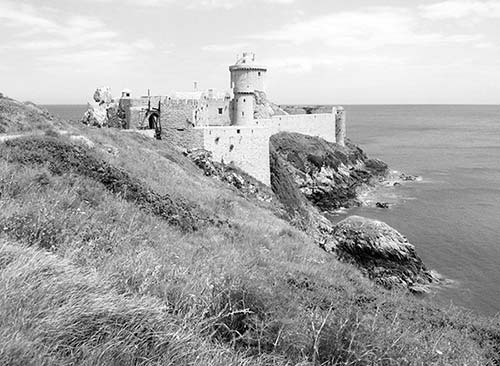
For drivers, the western Emerald Coast (Côte d’Emeraude) between St-Malo and Cap Fréhel offers the best look at Brittany’s raw beauty. You’ll drive past sleepy villages, sweeping views of sandy beaches with wind-sculpted rocks, and immense cliffs overlooking crashing waves (see route on the “Brittany” map, earlier). The highlight is Fort la Latte, a medieval castle built on a rocky spur over the ocean.
Allow a half-day for the entire trip. Your drive covers the area between St-Malo and the town of Pléhérel-Plage (about 55 kilometers). If you don’t have much time and just want to see the fort, it’s about an hour’s scenic drive from St-Malo or Dinan. During summer or on a weekend, do this drive early to avoid crowds. If it’s Saturday and off-season, consider starting at the market in Dinard (described earlier). Here’s a brief explanation of the route.
Driving from St-Malo to Pléhérel-Plage: Take D-168 west, which becomes D-786 near Ploubalay. The road is busy until Ploubalay but opens up nicely west of there. Continue toward Matignon, detouring to St-Jacut-de-la-Mer and Pointe du Chevet (described next) before continuing on to Fort la Latte, Cap Fréhel, and finally, Pléhérel-Plage.
Driving from Dinan to Pléhérel-Plage: Drive north on D-2 to Ploubalay, then follow the route described from St-Malo (see previous page).
Pointe du Chevet
After Ploubalay, the first worthwhile detour is up the narrow peninsula to Pointe du Chevet. From D-786, follow D-26, passing just outside the sweet little town of St-Jacut-de-la-Mer. Follow imperfect signage a few miles to Pointe du Chevet (just keep heading north). You’ll come to a parking area near the end of the peninsula—turn left and continue down a tiny lane, parking where the road ends. Beautiful views (and few people) surround you. If the tide is out, you can hike to an island or just study the impressive rows of wooden piers sunk into the bay. These are used to grow mussels, which cling to the wooden poles; farmers eventually harvest them using a machine that pushes a ring around the poles.
From here, return to D-786 heading toward Matignon and follow signs to Fort la Latte and Cap Fréhel. Start with Fort la Latte.
▲▲Fort la Latte
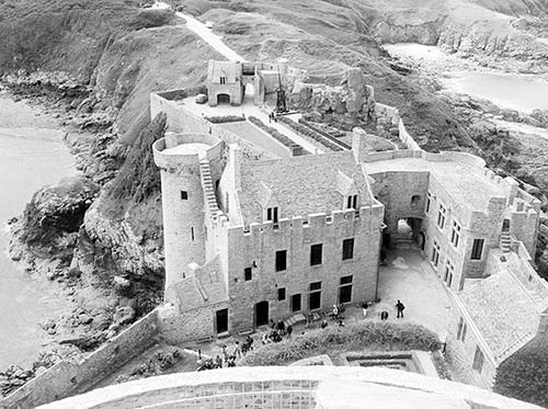
This mighty fortress is a 25-minute drive west of Pointe du Chevet. From the parking lot, it’s a 10-minute walk to views of a medieval castle capping a massive rock above the ocean. The English flier gives general background about the castle’s history. The castle is well presented, with unusually good information panels (in English) at all key stops—but for me, its really about the castle’s spectacular setting.
Cost and Hours: €7.50, daily 10:30-18:00, July-Aug until 19:00, shorter hours off-season, closed Jan, +33 2 96 41 57 11, www.castlelalatte.com.
Visiting the Fort: The first fort on this site was made from wood and built as a lookout for invading Normans. What you see today dates from the 14th and 15th centuries, when wars between England and France caught Brittany in the middle for well over a hundred years. While the castle was never successfully attacked from the sea, in 1597 its garrison of 25 men was overwhelmed by a force of 2,000 soldiers coming overland. Later, Louis XIV’s military architect Vauban oversaw work shoring up the castle’s outer defenses. It was used well into the 18th century.
Touring the site, take time to read the small information panels and appreciate the carefully tended plantings. You’ll cross two impressive drawbridges (the second separates the castle from the mainland), peer into a dungeon (l’oubliette in French—“the forgotten”) that still holds a prisoner, then wander ramparts towering high above the ocean. A small cistern (on the left with the well) was essential to the soldiers’ survival during sieges. The guardroom by the cistern houses a small gift shop and sells a good booklet about the castle in English. The largest structure inside the fort is the governor’s lodge, the building you pass just after l’oubliette (closed to the public because the owners—from the same family that restored the place in the 1930s—live here).
Following the signed route around the castle, you’ll come to the four-story archer’s tower with crossbows in place (look down one floor inside). Nearby, the low-slung four à rougir les boulets served as a kiln to heat cannonballs. The defenders aimed hot shots at ships to set them afire. One hundred cannonballs could be heated at a time. That’s cool. The channel the balls were delivered on reminds me of a bowling alley ball return. From the castle’s end, a cannon that fired those balls sits on a wheeled base, allowing it to swivel as it points out to the infinite sea.
The well-fortified castle keep holds several rooms that give some sense of how men lived here (and notice the arrow loopholes and machicolations for dropping objects on attackers). The highlight of a visit to Fort la Latte is the climb to the top of this tower, with a magnificent 360-degree view. You can reach the very top lookout only by steep, ladder-like steps, but the views from the more accessible level just below are plenty rewarding. As you gaze out from this invincible castle, clinging for its life to a rock, think of Fort la Latte as a symbol of Brittany’s determination to remain independent from France.
Your last stop will be in the small chapel. Added in the 18th century to replace the original chapel, it is dedicated to St. Michael, protector of warriors.
If you want to stretch your legs, a trail behind the ticket kiosk runs to Cap Fréhel (75 minutes one-way). That same trailhead leads back to the car park (15 minutes) with good views back to the fort. There’s also a short trail from the ticket kiosk down to a rocky beach, giving you a sea-level perspective of the fortress.
Cap Fréhel and Pléhérel-Plage
Too-popular Cap Fréhel is a five-minute drive west of Fort la Latte at the tip of a long peninsula. It features walking paths over soaring cliffs with views in all directions. You’ll pay to park near Cap Fréhel’s stone lighthouse, which gets overwhelmed during its short hours on weekends and summer afternoons. Views from the trails are sufficiently expansive, making the climb to the lighthouse unnecessary (€3, April-Oct Fri-Sun 14:00-17:30, July-Aug daily).
While Cap Fréhel offers immediate access to good trails, consider skipping the site (and crowds) and continuing west on D-34, stopping at one of the pullouts with access to bluff trails (including a trail that parallels the road). Parking at Plage de la Fosse is an ideal stop with trails down to a gorgeous beach below.
Finish your beach excursion by continuing west 10 minutes to the small town of Pléhérel-Plage, where beachfront parking is available at Plage de l’Anse du Croc (turn right at the fork toward Sable d’Or and immediately right down to the beach). You can walk forever on this beautiful beach if the tide is out far enough.
From Pléhérel-Plage, return east to Dinan or St-Malo by following signs to the town of Fréhel, then Matignon, then eventually Dinan and St-Malo.
▲▲Scenic Drive Between St-Malo and Mont St-Michel
If you have less time, consider this lovely drive—worth ▲▲▲ if it’s clear (see route on the “Brittany” map on here). This quick taste-of-Brittany driving tour samples a bit of the rugged peninsula’s coast, with lots of views but no dramatic forts. Allow two hours for the drive between St-Malo and Mont St-Michel, including stops (a more direct route takes 45 minutes). On a weekend or in summer, the drive will take longer—start early. These directions are from St-Malo to Mont St-Michel, but the drive works just as well in the other direction.
St-Malo to Cancale: From St-Malo, take the scenic road hugging the coast east on D-201 to Pointe du Grouin. To find the road, leave St-Malo following Paramé/Cancale signs. D-201 skirts in and out of camera-worthy views as you follow signs for Rothéneuf. As you drive, you’ll be surrounded by fields of cauliflowers, potatoes, and onions, reminding you that tourism and agriculture form the economic base of Brittany.
Fans of quirky sights can make a quick stop at Les Rochers Sculptés in Rothéneuf. At the end of the 19th century, a Catholic abbot decided to devote his life to sculpture after he became deaf and mute. With a hammer and chisel, he worked for 15 years creating his story out of the rock of a sea cliff (€2.50, daily 10:00-12:00 & 14:00-18:00, 9:00-19:00 July-Aug, a brief intro available in English). You can have lunch right here at $$$ Le Bénétin, a mod restaurant serving fresh food with panoramic views (April-Oct daily, +33 2 99 56 97 64).
Back on the road to Cancale, signs lead to short worthwhile detours to the coast. These are my favorites:
Ile Besnard and Dunes des Chevrêts: A five-minute detour off D-201 leads to this pretty, sandy beach arcing alongside a crescent bay. There are sea-piercing rocks to scramble on and a nature trail above the beach. Follow signs to Ile Besnard and Dunes des Chevrêts to the very end (past the campground), and park at the far end of the lot.
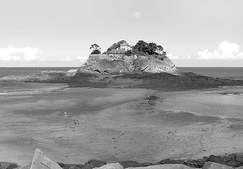
Pointe du Grouin: This striking rock outcrop yields views from easy trails in all directions. One of the best is an easy 20-minute loop to the end of the peninsula: Start to the right of the parking lot on the path hugging the coast, and return passing a bunker, the sémaphore du Grouin (signal station), and an outdoor café with views. Breathe in the sea air. Can you spot Mont St-Michel in the distance? The big rock below is Ile des Landes, an island earmarked for a fort during the French Revolution. The fort was never built, and the island remains home to thousands of birds. What fool would build on an island in this bay?
Cancale: Leave Pointe du Grouin, following signs to Cancale, Brittany’s appealing oyster capital. Follow le port signs to park, and head to the harbor. Slurp a variety of oysters at the outdoor stands: Belon are flat and round—they’re finer and pricier than the more common creuse. Pied de cheval are older and even more expensive because they are wild, unlike most oysters growing in the seabeds in front of you. Size is rated from #5 (smallest) to #0 (biggest). The port is lined with more than 30 restaurants showing off the label Site remarquable du goût (extraordinary place to taste).
Cancale to Mont St-Michel: Cancale is a 45-minute drive from Mont St-Michel. Head out of Cancale toward Mont St-Michel on D-76 to D-155, then D-797, and drive along the Route de la Baie, which skirts the bay and passes big-time oyster farming, windmill towers (most lacking their sails), flocks of sheep, and, at low tide, grounded boats waiting for the sea to return. On a clear day, look for Mont St-Michel in the distance. On a foggy day, look harder.
Fougères
The traditional Breton city of Fougères, worth ▲, is a handy stop for drivers traveling between the Loire châteaux and Mont St-Michel. Fougères has one of Europe’s largest medieval castles, a lovely old city center, and a panoramic park viewpoint. Drivers follow Centre-Ville signs, then Château, and park at the lot just past the château.
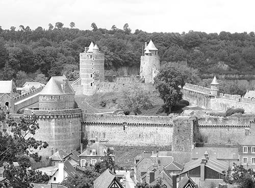
For a memorable loop through new and old Fougères, start at the parking lot near the château. Walk into Fougères with the water-filled moat on your left, then follow the Château sign. Stop for a peek in the handsome Church of St. Sulpice (English handout inside)—the woodwork is exceptional, especially the choir stalls and altar. Then walk through Porte Sainte Anne, the only remaining gate to the walled city. The château is on your left, but there’s no reason to visit it unless you need more exercise or want to pick up a town map at the ticket office (€9, includes audioguide, June-Sept daily 10:00-19:00, shorter hours and closed Mon off-season, closed Jan, +33 2 99 99 79 59, https://chateau-fougeres.com).
Next, walk up Rue de la Pinterie (fine views) to the top of the street, then turn right on Rue Nationale at the TI. You are now in the Haute Ville (modern Fougères). Keep walking toward St. Léonard Church, passing the old belfry on a square on your right. At the church, enter the Jardin Public and enjoy its floral panorama. From here all paths lead down to the old town. At the bottom of the garden, find various types of fougères (ferns). To finish the loop, exit the Jardin Public following signs to the château and cross the little Nançon River. You’ll land in the Basse Ville, the old medieval town with lovely half-timbered houses on Place du Marchix. The château is ahead, and you’ll find a gaggle of cafés and crêperies nearby with good choices and prices.