SCENIC RAIL JOURNEYS
Golden Pass • Gotthard Panorama Express • Bernina Express • Glacier Express • Chur
ORIENTATION TO THE GOLDEN PASS
Map: Gotthard Panorama Express
ORIENTATION TO THE GOTTHARD PANORAMA EXPRESS
ORIENTATION TO THE BERNINA EXPRESS
ORIENTATION TO THE GLACIER EXPRESS
Map: Glacier Express Elevations
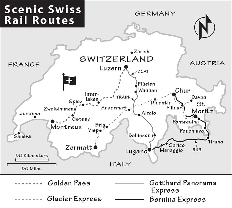
Switzerland has one of the world’s best rail networks, and many of its tracks run through dramatic and beautiful scenery. While just about any train ride in Switzerland is photogenic, four are aggressively marketed as the most spectacular: the Golden Pass, Gotthard Panorama Express, Bernina Express, and Glacier Express. If you’re looking for a scenic day enjoying the Alps from the window of your train, and would like to do it in a “panoramic” car (with huge windows that sweep halfway across the ceiling), these journeys can be great experiences. Though they aren’t quite as “fantastic with countless highlights” as they’re advertised to be (the high lifts in the mountains themselves are much higher and more breathtaking), the trains are a fun way to do some sightseeing while getting from point A to point B.
This chapter provides you with all the logistical, nuts-and-bolts information you’ll need to splice each journey into your itinerary. Keep this in mind as you plan: You don’t need to take a special train to enjoy the routes described in this chapter. Regular, nonpanoramic trains also run along all these scenic routes. They go more frequently and cost less. The branded journeys are a premium service available on a handful of regular departures each day, which add meals and souvenirs, and seat guests in special rail cars with expansive windows.
I’ve described highlights along each route, written in the direction that most travelers are likely to go. If you travel in the opposite direction, the same information still applies—just hold the book upside down. Of course, these descriptions also apply to those who have bought a regular ticket along the route rather than the premium package.
This chapter also includes information about Chur, a town that’s not really worth a visit, except that it lies on both the Bernina Express and Glacier Express routes and can be handy for a pit stop or an overnight (especially if you’re connecting to or from Zürich or Appenzell). Pontresina (covered in the Upper Engadine chapter), is an additional—and more appealing—place where these routes overlap.
TICKETS
Verify Schedules: Though I’ve listed some specific departure and arrival times, schedules are always subject to change. It’s essential to confirm times before you travel. You’ll find timetables and prices on the Swiss rail system’s website (www.rail.ch) and on their excellent SBB Mobile app. Any train station in Switzerland can provide free schedules. Each scenic rail line also operates its own website, with even more details.
Buying Tickets: You can purchase tickets and reservations for all these scenic rail lines at any train station in Switzerland. At larger stations, staffers are familiar with the scenic routes and can help you sort through your options. However, in peak season, premium seats on the famous routes can sell out far in advance—it’s better to book online well ahead, either on the Swiss Rail website, on each scenic rail website, or through the SBB Mobile app. You can also book via the North American-friendly RailEurope.com (online or through your travel agent)—but you’ll pay a substantial markup.
Seat Reservations: Some scenic trains require seat reservations (including for rail-pass holders—see below). Be warned that these can sell out several days, or even weeks, ahead in high season. Reservations are required for all classes of the Glacier Express and Gotthard Panorama Express, the panoramic cars in all classes on the Bernina Express, and the bus segment of the Bernina Express. They are strongly recommended for the Golden Pass Express train between Interlaken and Montreux during peak season (and mandatory for Prestige class). These options are explained in each section, later.
If you’re set on taking a panoramic train and your itinerary is already fixed, it makes sense to book your scenic-train seats as soon as you can. However, individual travelers may be able to book just a few days in advance to maximize their chances of traveling in clear weather. If your itinerary is flexible, keep an eye on the weather, pick a good travel day, and then reserve your seats. You’re taking a bigger risk from mid-July to mid-August, when trains (especially the über-promoted Glacier Express) fill up faster.
Rail Passes: Swiss Travel Passes and the Eurail Global Pass cover travel on all four scenic trains. Seat reservations, though, always cost extra. You can skip reservations if traveling scenic routes on standard regional trains, rather than on the designated tourist departures.
When buying your ticket or making reservations, be sure the ticket agent understands what type of rail pass you have and exactly what trip you’re taking. (Pass coverage varies on boats, buses, and mountain lifts, and is subject to change.) Confirm that you’ve purchased all the reservations and other tickets you need to complete your trip.
TRAIN TYPES
Various types of trains, with various types of cars, run these routes. Here are the key distinctions to look for:
Classes: Most trains have both first- and second-class cars. On both tourist and standard trains, first class has somewhat wider seats, a little more legroom, and fewer passengers; second-class cars offer the same scenery, go just as fast, and usually still have plenty of room. Some train cars on scenic routes have an additional premium class (see “Panoramic vs. Standard Cars,” later).
If you have a second-class rail pass, you can always pay extra to sit in first on any given train (though reservations may be necessary). In bigger train stations, a digital panel on the tracks indicates departure time, destination, and at which part of the platform you’ll find the first- and second-class cars.
Standard vs. Tourist Trains: Used by local commuters, standard trains may stop at more stations along the route than the designed-for-tourists panoramic trains. Many travelers enjoy the flexibility of following the scenic route on standard trains, enabling them to hop off and explore a village, then hop on the next standard train that comes through (reservations are not necessary on standard domestic trains).
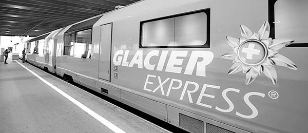
Panoramic vs. Standard Cars: All the tourist trains on the routes in this chapter offer special panoramic cars, usually in both first and second class, so there’s no need to splurge for first class. Panoramic cars have huge windows that curve back into the roof of the train car, allowing you to view high mountains from a wider angle than in a normal train car.
The windows in the panoramic cars generally can’t open, and there are no window shades, so the interior can heat up on sunny days even with air-conditioning. Bring sunglasses and a hat.
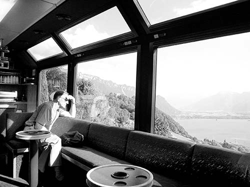
Since nonpanoramic cars have a smaller field of vision than the panoramic cars, these require a little more bobbing and weaving to enjoy the views. Aside from being cheaper, the chief advantage of standard cars is that the windows generally can be opened, for cool air and better photos.
Some trains have even fancier carriages. For instance, the Glacier Express has a super-pricey “Excellence” class, which is very roomy (only one row of seats on each side of the car) and adds lots of food en route. And the Golden Pass Express has a more affordable “Prestige” class, with cushier seats that can swivel to face oncoming scenery.
Caveat for Shutterbugs: Panoramic windows have lots of glare, and the famous bridges and viaducts used to advertise these trips are not actually visible. For clearer shots, look for openable windows in standard train cars or in passages between cars; the Gotthard Panorama Express has a “photo coach” in the middle of the train. Or, consider just sitting back, relaxing, and enjoying the scenery.
Golden Pass
The exceptionally picturesque Golden Pass train route cuts a swath diagonally across the pristine center of the country, connecting Luzern, the Berner Oberland, and Lake Geneva—and German Switzerland with French. Of all the scenic routes in this chapter, it’s the one you’re most likely to travel along, as it’s central and laces together many of Switzerland’s top sights.
ROUTE OVERVIEW
The classic Golden Pass route connects Luzern with Lake Geneva, by way of the Berner Oberland, in about five hours. The first section, from Luzern to Interlaken, is covered by the Luzern-Interlaken Express (departs hourly, 2 hours). The second, more scenic section, from Interlaken to Montreux, is covered by the new panoramic Golden Pass Express (4/day direct, just over 3 hours)—with no further train changes required. This is a bigger feat than it sounds, because the rail gauge changes midway through. (More on this later, under “Self-Guided Tour.”)
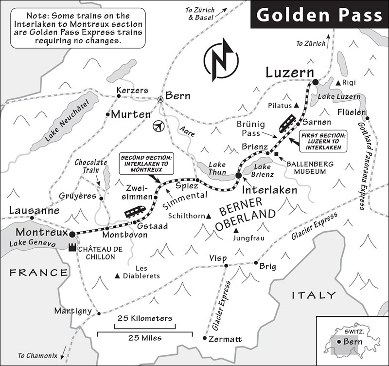
You can also take standard trains between Interlaken and Montreux, but they have nonpanoramic windows, take a bit longer, require two additional changes, and save you only about 20 CHF.
PLANNING YOUR TIME
To go all the way from Luzern to Lake Geneva, here’s a sample day plan: Take the 8:06 Luzern-Interlaken Express train to Interlaken Ost (arriving at 9:55), wander Interlaken and have a quick lunch, then catch the 14:08 Golden Pass Express train that arrives in Montreux at 17:20.
From Montreux, Lausanne (a more substantial and appealing town with many places to stay) is only another 20-30 minutes by train. And to make an even fuller day of the Golden Pass, you could begin in Zürich and ride the train 40 minutes to Luzern.
For onward train connections from major Golden Pass stops, see the Connections sections for Luzern (here), Interlaken Ost (here), and Montreux (here).
ORIENTATION TO THE GOLDEN PASS
Cost: The full, classic Golden Pass trip from Luzern to Montreux costs 86 CHF second class; the Golden Pass Express segment from Interlaken to Montreux is 53 CHF for second class (93 CHF for first class). Reservations (20 CHF extra) are optional but strongly recommended. The entire journey—not counting reservations—is covered by Swiss Travel or Eurail Global passes.
Schedule: Regular Luzern-Interlaken Express trains with semipanoramic windows run hourly (trip takes about 2 hours). On the Interlaken-Montreux leg, panoramic Golden Pass Express trains run four times daily (trip takes a bit longer than 3 hours). If you take standard trains on this leg, two changes are required: in Spiez and again in Zweisimmen. There may be a brief lag between trains, so the total journey can take longer.
Information: For the Luzern-Interlaken leg, visit www.zentralbahn.ch/en/interlaken-express or call +41 58 668 8000. For the Golden Pass Express, visit www.gpx.swiss or call +41 21 989 8190. Switzerland-wide rail information is at www.rail.ch or on the SBB Mobile app.
Seats: On the Golden Pass Express between Interlaken and Montreux, all the carriages are panoramic. There are three classes: second class, first class, and “Prestige” class. It’s always smart to reserve a seat (20 CHF in either second or first class). The fancy “Prestige” seats are cushy, heated, and can swivel to face the direction of travel (35 CHF extra with a first-class ticket or rail pass).
If you’re taking standard trains between Interlaken and Montreux, the seats are...well, standard, in nonpanoramic carriages. However, on the Zweisimmen-Montreux leg, twice daily you can pay extra to ride in an elegant belle époque coach with a wood-paneled interior (not available on Express trains; see www.mob.ch).
Eating: The Luzern-Interlaken stretch is the only section with a restaurant car, but it may be closed on trains running early or late in the day. On Golden Pass Express trains (Interlaken to Montreux), pricey drinks and snacks are available (best to pre-order). Otherwise, Interlaken is a good spot for lunch or for picnic shopping.
 SELF-GUIDED TOUR
The most heavily promoted stretch is the Golden Pass Express, between Interlaken and Montreux—and it’s certainly the most visually exciting part of the trip. But the classic Golden Pass trip starts in Luzern.
Part 1: Luzern to Interlaken
As you leave Luzern (sit on the right side), you’ll go along the lake to Alpnachstad, the starting point for the cogwheel train that climbs to the top of Mount Pilatus (the massive bulk on the right).
Then the train follows the Sarner Aa River through farmland, passing through the town of Sarnen and running along Lake Sarnen. Beyond the end of the lake is the town of Giswil, where the train begins its gradual ascent to the Brünig Pass.
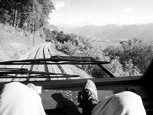
Eventually the train runs above the beautiful turquoise waters of the Lungernsee reservoir. After passing the resort of Lungern, the train climbs gradually through the forest to the summit station of Brünig-Hasliberg (keep an eye out for fake animal cutouts—lynx, ibex, deer—placed whimsically in the woods at eye level).
After cresting the pass, the train descends to the Aare River valley, with its sheer cliffs and waterfalls. The arrow-straight river channel, straightened by the ever-efficient Swiss, slices through the broad valley and on to Meiringen. (Sir Arthur Conan Doyle chose Meiringen and nearby Reichenbach Falls as the setting for the death of Sherlock Holmes.)
The train then follows the river to beautiful Lake Brienz (Brienzersee; a bus runs from the town of Brienz to the remarkable open-air museum at Ballenberg).
Beyond Brienz, the train follows the lakeshore to Interlaken (“between the lakes”), where the town sits between the big lakes of Thun and Brienz.
Here you’ll change trains. If you’re taking the Golden Pass Express train onward to Montreux, you’ll need to change at the Interlaken Ost station (that train’s departure point). If you’re taking standard trains, you can change at either Interlaken Ost or Interlaken West for the next leg, to Spiez. If you have a layover, Interlaken is a handy place to grab lunch or shop for a picnic.
Part 2: Interlaken to Montreux
Lake Thun to Zweisimmen: As the train pulls out of Interlaken, you cruise along the south bank of Lake Thun (Thunersee). Enjoy watching the sailboats and lazy lake cruises under soaring alpine peaks. Soon you’ll pull into the town of Spiez, overlooking the lake. (If you’re taking standard trains, you’ll change here.)
From Spiez, you’ll head southwest toward Zweisimmen—squeezing between two mountainsides and into the rolling, cow-speckled valley called Simmental.
Rail Gauge Change in Zweisimmen: A small commotion surrounds the Golden Pass Express train at the Zweisimmen station, where the gauge (width) of the track changes. You may hardly notice what is happening, but it represents a major achievement of rail-carriage engineering. Historically, changing gauges required changing to a different train. (And, over time, other countries have come up with creative solutions. At the Spanish-French border, for decades, the entire carriage would be hoisted up by a winch and moved to a new set of wheels.) To make this express line possible, with limited hassle to passengers, engineers created a “variable gauge bogie” (a bogie is the set of wheels at the bottom of the carriage) that adjusts seamlessly to the new gauge. The process requires adjusting not only the gauge but the height of the train above the tracks (to match the new platform height). It also requires a locomotive switch to one with a different electrical voltage.
There are early discussions about extending the Golden Pass Express to Luzern, eliminating the need to switch trains at all. However, that would require yet another rail gauge change...so don’t hold your breath.
If you’re taking a standard train, you’ll make yet another change here in Zweisimmen to reach Montreux.
Simmental: Leaving Zweisimmen, you’ll continue through the Simmental, famous among American farmers for its top-end cows. Big farmhouses lie scattered in the lush meadows—an indication that the farmland is good here. The large wooden buildings are typical of Bernese farm architecture: housing the barn, sheltering the crops, and storing agricultural machines, all under one huge roof. Farming is heavily subsidized in Switzerland, and farmers form the strongest economic lobby. Trying to increase their income, many farmers have added exotic crops (like melons) or animals. Ostriches, yaks, bison, and highland cattle have become a common sight in the Swiss Alps.
Gstaad: Between Saanenmoser and Schonried, the train reaches its highest point (about 4,000 feet) and stops at the famous resort town of Gstaad. Although known as a favorite hangout for well-known rustic mountain folk such as Julie Andrews, Monaco’s Princess Caroline, and Roman Polanski, the town doesn’t offer much in the way of sights. In winter, its modest ski slopes are less crowded than the town’s flashy nightspots. Sipping their cocktails, the après-skiers eye each other and discuss the latest trends in ski fashion. In summer, Gstaad hosts the Swiss Open tennis, polo, and golf tournaments, as well as high-quality music festivals.
French Switzerland: Just south of Gstaad, say auf Wiedersehen to the German-speaking part of Switzerland and bonjour to French Switzerland. The mountains are jagged. In fact, many are called dents, French for “teeth.” With the change in language comes a change in culture and architecture. French-style gray stone houses start to replace half-timbered, woody, German-style chalets. The mountain airstrips—generally made for the Swiss Air Force during World War II—are used today for sightseeing flights around the Alps. The cute village of Rougemont, with its fine church and traditional houses, is famous among the Swiss as the place where the wealthy send their girls to boarding school.
Happy cows spend their summers on the Alps, wandering freely and munching the fragrant herbs of these lush alpine meadows. The resulting milk is the secret ingredient for tasty Gruyère cheese. On steep hillsides here, the grass is still cut by hand. It dries in the summer sun, then is collected and stored in the barns to serve as cow salads through the winter.
Château-d’Œx: This charming alpine village may tempt you to interrupt your journey. It’s known for its Hot-Air Ballooning Week (last week of Jan). Bertrand Piccard and Brian Jones took off from here on March 1, 1999, and sailed their balloon all the way around the world. Below the train station, Le Chalet restaurant gives insight on Gruyère cheese production.
South of Château-d’Œx, the valley narrows to a deep gorge. The hillsides above were devastated by the 1999 Lothar winter storm. Entire forests were leveled, aggravating an already precarious avalanche situation. Trees on steep slopes stop snow from sliding down and burying the villages, but once the trees are gone, artificial avalanche barriers need to be erected. Landslides and floods have been relatively common in recent years—an unfortunate consequence of deforestation and the construction of vacation homes in areas that traditionally served as pastures and forestlands.
The small lake, Lac du Vernay, is dammed and used for hydroelectric power. Switzerland makes good use of its Alps, with their fast-flowing streams. Although it has some nuclear power plants, 60 percent of Switzerland’s energy is hydroelectric. The country exports its electricity to France and Italy.
Montbovon: This small town is the place to change trains if you’re going to Bulle or Gruyères (see here). After the first tunnel, an inscription on the barn to the right welcomes you to the Gruyère region: La Gruyère vous salue. From here, the train winds its way uphill with more curves and tunnels than before.
Bienvenue to the “Swiss Riviera”: The Jaman Tunnel engulfs you in nearly two miles of darkness. When you emerge, you’re in another world—you’ve left the feudal Middle Ages and entered the 19th-century belle époque. At the village of Les Avants, one of Switzerland’s oldest winter resorts, the first glimpses of Lake Geneva sprawl deep underneath you. Beginning a steep descent, the train passes through a series of sharp bends in tunnels before delivering you from the mountains to lake level.
The architecture has even more of a French flair now that you’ve entered the “Swiss Riviera.” Palm trees, grapevines, and many sanatoriums indicate that this is a warmer climate. You’re surrounded by the vineyards of the Lavaux region, famous for its white wine. The view broadens to include the French Alps of Savoy across the lake, the lakeshore of the Swiss Riviera to the west, and the broad Rhône Valley to the east. As you approach Montreux—with its grand hotels—the train meanders its way intimately through private gardens.
Montreux: Stepping off your train here, notice that this is one of the only train stations in Europe with three different rail gauges: regular, narrow, and very skinny (for the Rochers de Naye train, taking sightseers to a nearby peak with views less exciting than those you’ve just enjoyed).
From here, it’s an easy train trip to Lausanne, or a quick bus ride or about a two-mile lakefront hike to Château de Chillon (covered in the Lake Geneva & French Switzerland chapter).
Gotthard Panorama Express
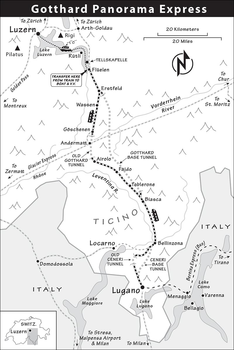
The Gotthard Panorama Express is half by boat and half by train, from Luzern to Lugano in the Italian-speaking region of Ticino. The boat ride passes the place where the first Swiss cantons pledged “all for one and one for all,” the birthplace of the Confoederatio Helvetica in 1291. Then, at Flüelen, you switch to a train that climbs up to the town of Göschenen (3,600 feet), then plunges through the old Gotthard Tunnel into Italian Switzerland.
Don’t go out of your way to do this trip. The boat ride is more pastoral than thrilling, and the train ride is more interesting as a lesson in Swiss engineering than impressive for its views. But if you’re connecting Luzern and Italian Switzerland in high season and have the time, this 5.5-hour boat-train combination is undeniably scenic. If you’ve already taken a boat trip on Lake Luzern, you won’t see much more by taking the Gotthard Panorama Express boat. Conversely, if you’re planning on doing the whole Gotthard Panorama trip, don’t bother doing a boat trip while in Luzern.
Alternatives: If you’re in a hurry to get between Luzern and Lugano, you can do it by train in less than two hours via the 35-mile-long Gotthard Base Tunnel, which lets trains burrow through the Alps at full speed. Or, to make the trip to Lugano a little more scenic (without doing the full-blown Gotthard Panorama Express), you can take a slower regional “Treno Gottardo” from Luzern through the old Gotthard Tunnel (this also skips the boat and takes just over three hours, with a change of trains in Bellinzona). To find the more scenic routes through the old tunnel, search for trains that go through Airolo.
ROUTE OVERVIEW
The Gotthard Panorama Express begins with a very pretty three-hour boat trip along the length of Lake Luzern from the city of Luzern to Flüelen. As the traditional steamer blows its old-time horn, you glide by idyllic lakeside resort towns and under mighty peaks. In Flüelen, you leave the boat and board the train, which crosses the Alps and cuts down into the Italian-speaking canton of Ticino (2.5 hours).
For onward train connections, see the Connections sections under Luzern (here) and Lugano (here).
ORIENTATION TO THE GOTTHARD PANORAMA EXPRESS
Cost: The Gotthard Panorama Express trip costs 153 CHF for first class all the way, or 93 CHF for second class on the boat and first class on the train (second class is not available). You’ll also pay an obligatory train seat reservation fee of 16 CHF. The boat doesn’t have reserved seats, though you can reserve a table.
First-class rail passes cover the train part of the journey but not the seat reservation fee. With a second-class pass, you’ll have to pay the reservation fee plus a 20 CHF upgrade to sit in the first-class train cars. The Swiss Travel Pass covers the lake segment; the Eurail Global Pass gives you half off, so you’ll pay 24 CHF for the second-class boat trip.
Schedule: The official Gotthard Panorama Express package is available once daily except Mon in each direction between mid-April and mid-October. Going from north to south, you’ll leave Luzern on the 11:12 boat (board at pier 1, across from the train station); after the boat docks in Flüelen at 13:55, you have about 15 minutes before the 14:09 train leaves for Lugano, arriving at 16:41. Going from south to north, you leave Lugano at 9:18 to make a Flüelen-Luzern boat departing at 12:00 and arriving at 14:47. Off-season, regular trains still run between Luzern and Lugano via Flüelen, but there are no boat sailings.
Information: The boat and train companies both have brochures and websites about the Gotthard Panorama Express (general information: www.gotthard-panorama-express.ch; boat: +41 41 367 6767, www.lakelucerne.ch). Switzerland-wide rail information is at www.rail.ch or on the SBB Mobile app. The Gotthard Panorama Express also has live, multilingual tour guides who narrate the journey.
Luggage Delivery Service: Travelers from Luzern to Lugano can have luggage delivered to the platform in Lugano (free, no access to bags while traveling). Ask when you check in at the Luzern boat pier.
SELF-GUIDED TOUR
Here’s what you’ll see if you’re doing the entire Gotthard Panorama Express route. If you’re taking only the train, skip to that section.
Boat Trip
Departing Luzern: The boat crisscrosses the Vierwaldstättersee (the “Lake of the Four Forest Settlements”—let’s call it Lake Luzern). The trip is popular with the older generation of European tourists, who eat and drink their way through the lazy route. On a sunny day, you can sit on the deck and enjoy the mountain views. Survey the boat before you settle on a seat—consider sun, shade, and wind.
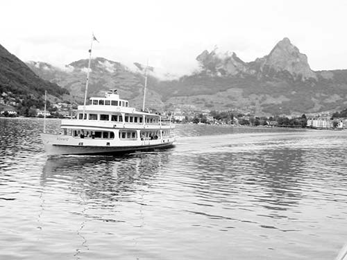
After two hours, you sail into the canton of Uri, and the landscape gets rougher, the slopes steeper, and the villages fewer and more rustic.
Rütli: Swiss patriots get excited as the boat approaches Rütli. The meadow above is the birthplace of the Swiss Confederation. In 1291, representatives of the three founding cantons met here and swore allegiance to each other, against their oppressive neighbors. More than 700 years later, Switzerland is still a confederation—but now its cantons number 26.
You may see hikers disembark at Rütli and head for the mystical meadow marked by a big Swiss flag. Then they follow the Weg der Schweiz (“Path of Switzerland”), a trail leading around the lake. Along the way, they contemplate stone signs representing each of the 26 cantons in the order they joined the union. The canton markers are spaced according to each canton’s population (the 20-mile-long trail was designed to have exactly 5 millimeters for each Swiss citizen).
Tellskapelle: The boat stops at this 16th-century frescoed chapel, marking the spot where, according to legend, Swiss hero William Tell jumped ship on the way to prison and swam to freedom.
Flüelen: This is the boat’s last stop, where the panoramic train awaits.
Train Trip
Above Flüelen: Soon after departure, the train climbs from 1,540 feet up toward its maximum of 3,600 feet. You enter a classic alpine world of snowcapped mountains towering above wild valleys, with narrow gorges carved over eons by angry white water. Wooden chalets, pine forests, and lush meadows dotted with munching cows complete this picture-perfect image of Switzerland.
The train tracks are protected from avalanches, landslides, and waterfalls by concrete galleries. Gazing out the window, you’ll see some of the greatest accomplishments of Swiss road-and-railroad engineering.
Wassen: Keep an eye out for the striking chapel. At first, the chapel is on your right. Then the train loops around the tiny town, and the chapel is on your left. Your train disappears into a tunnel, and when you emerge, the same chapel is still there. The train actually spirals up the slopes. Bring a compass and you can watch it spin 360 degrees.
Gotthard Pass: After Göschenen, your train approaches the famous Gotthard Pass, which—since the 13th century—has been the major trade route over this part of the Alps, connecting northern and southern Europe. Today, trade—and your train—rumbles under rather than over the pass. You’ll be taking the original Gotthard Tunnel. Completed in 1882, this 9.5-mile-long engineering marvel was the primary north-south train link through the Swiss Alps until 2016. That’s when they opened the much longer Gotthard Base Tunnel—where express trains zip at top speed, 2,000 feet below you.
When you enter that original tunnel, your train slows down and the lights dim as a video is projected on the tunnel walls. And then, after about 10 minutes of click-clacking through darkness, you emerge in a whole different world—a different climate (warmer), language (Italian), and canton (Ticino).
Ticino: Welcome to Ticino, Switzerland’s botanical garden. While the weather around Lake Luzern is often iffy, Ticino feels Mediterranean—warm and southern—making it a favorite weekend destination for the Swiss. Rather than cuckoo-clock-like chalets, the houses are now plain, square, and made of stone. Instead of conifers, the forests are full of chestnut trees. You’ll see vineyards, oleander, and even palm trees. And the upcoming train stops are announced in Italian now: “Prossima fermata...”
While life seems almost too good in the pristine and touristic Lake Luzern region, in this valley south of the mountains the economy is tougher. There are few local jobs, and young folks commute or move into the cities farther south. Houses and roads aren’t as well maintained, and window boxes no longer come with so many flowers.
On either side of Faido, the train goes through several more tunnels. Past Bellinzona, the train zooms through the 10-mile-long Ceneri Base Tunnel, which opened in 2020. And before you know it...you’re pulling into Lugano.
Bernina Express
The Bernina Express is one of the more exciting rides through the Swiss Alps, thanks to its diversity: starting with the sunny, palm-tree ambience of Lugano; getting a taste of Italy along beautiful Lake Como; climbing up and over the twisting Bernina and Albula passes; and seeing mountain towns like Pontresina before finishing up in eastern Switzerland. The first half of the trip is by bus; the second by rail. The little red train with panoramic cars spirals up to 7,380 feet, passing steep mountains and cliffs, glaciers, waterfalls, and a wild, rugged landscape.
ROUTE OVERVIEW
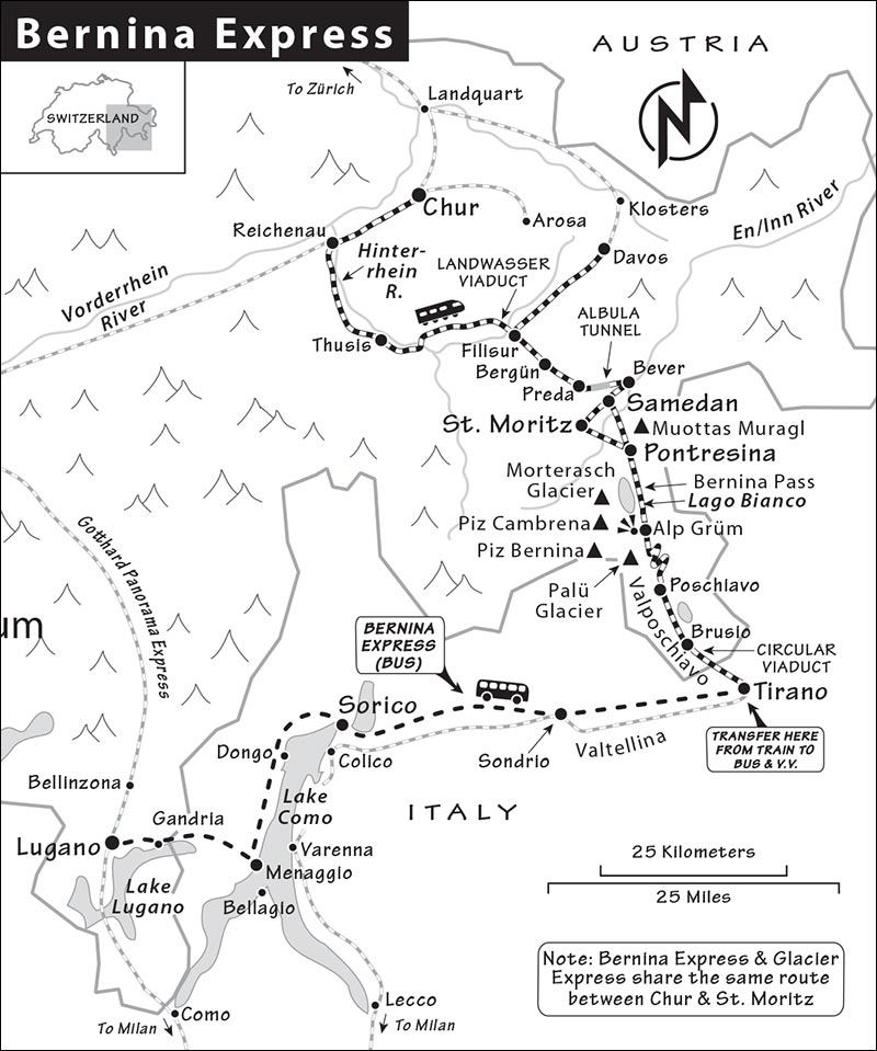
The Bernina Express combines a bus trip through Italy with a train ride up into the mountains. The bus begins in Lugano but soon crosses the border to run along the west side of Italy’s Lake Como and up the vineyard-draped valley called Valtellina, eventually arriving at Tirano. Here passengers change to a train that crosses back into Switzerland, stops in the sleepy and charming town of Poschiavo, then twists north up the mountainside—mastering a very steep grade on regular tracks (no cogwheels) en route to the most spectacular stretch: over the Bernina Pass. Then the train winds back down the other side and finally deposits you in one of several eastern Swiss towns, such as Pontresina, St. Moritz, Samedan, or—farther north, via the Albula Pass—Chur. (In summer, you can also finish in the resort town of Davos.)
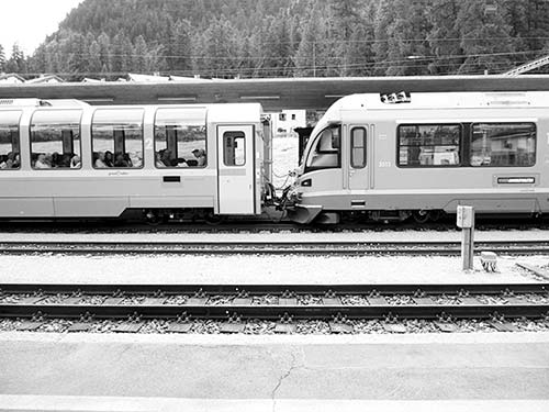
As with other scenic rail journeys, the route can be reversed (Chur or Pontresina to Tirano by train, then bus to Lugano).
PLANNING YOUR TIME
The trip between Lugano and Pontresina takes about six hours—or longer, if you linger en route at Poschiavo or Tirano (see next). Finishing or starting in Chur makes for a very long day (8-9 hours). If you want to travel the whole route, split it up and do the two-hour Pontresina-Chur stretch on the way to destinations such as Zürich or Appenzell, or as part of the Glacier Express (which overlaps with the Bernina Express on this segment). If you’re being selective, the most scenic and rewarding stretch is the two hours over the Bernina Pass between Poschiavo and St. Moritz/Pontresina.
As you’re sorting through schedules, consider a brief stopover in Tirano (Italy), Poschiavo (Switzerland), or both. Depending on your train and travel direction, you could spend up to an hour and a half in either (or both). Of the two, Poschiavo is more charming, compact, and easier to appreciate. Tirano, on the other hand, is...in Italy, with all the good and bad that entails (lively street life, shabbier, great food, more traffic, more chaos).
If you have more time, consider taking a standard regional train along the Pontresina-Tirano route (rather than the official Bernina Express train, with panoramic cars). The regional train makes more stops en route, so you can get off as you like to hike and explore (see “Skipping the Official Panorama Train,” later).
Also remember that you don’t have to start or end the trip in Lugano. You could use the Pontresina-Tirano train as a way of connecting to Milan or Lake Como (see “Connecting to Towns in Italy,” later in this section).
Given how long (and relatively uncomfortable) the bus leg is, here’s another possibility: Make a day trip out of the Bernina Express, leaving Pontresina in the morning, exploring over the pass to Poschiavo (2 hours) or Tirano (2.5 hours), then heading back—perhaps stopping en route for a glacier hike or a lift.
And finally, don’t worry too much about which of the Upper Engadine towns your train stops in (Pontresina, St. Moritz, or Samedan)—the three towns are within 10 minutes of each other by local bus or train.
For onward train connections from the major Bernina Express stops, see the Connections sections for Lugano (here) and Chur (at the end of this chapter).
ORIENTATION TO THE BERNINA EXPRESS
Cost: The total cost for a one-way trip on the Bernina Express from Lugano to Pontresina is about 100 CHF second class or 120 CHF first class; continuing to Chur raises the price to 130 CHF second class or 180 CHF first class. St. Moritz is a few francs more expensive than Pontresina. These prices include reservations for the bus (10-16 CHF depending on season) and the panoramic Bernina Express train (20-26 CHF depending on season); in summer, the total reservation fee, first or second class, is 42 CHF. The entire trip (including the bus) is covered by the Swiss Travel and Eurail Global passes, but passholders have to pay for reservations.
If you don’t have a reservation for the bus, you may be allowed to board and pay if there’s room, but there are no guarantees (and the bus is typically full, so have a plan B in mind). If you don’t have a reservation for the panoramic cars on the train, no worries: Every train on this route also has nonpanoramic cars, accessible without a reservation.
Schedule: I’ve provided sample departure times; confirm schedules before your trip.
The bus from Lugano to Tirano leaves daily at 10:00 (mid-May-Oct only) from outside Lugano’s train station. The departure point may be in flux while this area is under construction, but it’s likely in the big parking lot to the right as you face the train station building (look for yellow signs saying Tirano, St. Moritz, and #731). Give yourself plenty of time to find it...or scout it the night before.
About 13:00, you’ll arrive in Tirano. Here, you’ll board a panoramic train that continues north over the mountains. In summer, one train leaves Tirano almost immediately, at 13:17 (arrives in Pontresina at 15:34 and St. Moritz at 15:45; change here to continue to Chur for a regional train, arriving at 18:04). For those wanting a little more time for lunch in Tirano, there’s another train at 14:24 (arrives in Pontresina at 16:22—change here for St. Moritz; then in Chur at 18:20). All trains follow the same tracks for most of the trip before fanning out at the end to different destinations.
If you’re doing it the other way around, the train from St. Moritz leaves at 9:17, stops in Pontresina at 9:28, and arrives in Tirano at 11:32. From Chur, the train departs at 8:32 and stops in Pontresina at 10:22, arriving in Tirano at 12:49. (Note that if you’re starting in Pontresina, you can take the first train to Poschiavo, spend about an hour there, then hop on the second train onward to Tirano. Otherwise you may have more time than you really want in Tirano.) There’s just one bus from Tirano, which departs at 14:20 and arrives in Lugano around 17:30.
Service is reduced off-season. Generally, the bus still runs daily from April through October; weekends only in November and mid-February through March; and not at all from December through mid-February. The Bernina Express panoramic trains continue to run over the pass to Tirano once or twice a day.
Information: The Bernina Express is operated by the Rhätische Bahn (RhB, +41 81 288 6565, www.berninaexpress.ch). They hand out a free leaflet on board explaining the key stops. You can use the Wi-Fi on the train and the bus to access the “InfoT(r)ainment” website, which tracks your route and offers both text and audio commentary. For major points of interest, recorded English commentary plays on the train’s loudspeaker.
Bring Food: For those traveling west to east, the connection time between bus and train in Tirano may be brief (especially if the bus is running late), so it’s smart to pack a lunch. No food is available on the bus, and there’s no dining car on Bernina Express trains. In a pinch, buy a takeaway lunch during your bathroom break on the bus ride. If the timing works out, get lunch in Poschiavo (see “Eating in Poschiavo,” later).
Bus Tips: Be warned that this is not a luxurious tour bus. Seats are extremely tight, there’s limited space for day bags under seats (and no over-seat storage), and the bus is typically jam-packed. Large bags can be stored under the bus. There are no WCs on the bus, but it stops for a WC break about halfway through, near the north end of Lake Como. The bus trip is almost entirely through Italy. If many people reserve the trip, a second bus may be added. For the best Lake Como views, sit on the right side of the bus going westbound (from Lugano), or the left side going eastbound (to Lugano).
Train Tips: Tirano is where the bus and train meet. Heading north, for the first part of the ride, views are somewhat better on the right (though the left is better for seeing the train curve around the famous spiral viaduct at Brusio). After Poschiavo, views are better on the left.
Topless Trains: If traveling in July and August, ask about sitting in the yellow “convertible” train cars—called carrozze panoramiche—with flip seats and no roof (but be aware that these go only on certain segments of the trip). The railway decides the day before—depending on the weather—whether to add these cars to the train (available in both first and second class). Bring a jacket, hat, and sunscreen. If you get cold, you can move into a regular car when the train stops.
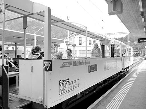
Skipping the Official Panorama Train: The train segment of the Bernina Express can be done on a standard regional train (with smaller windows that open, and possibly a car with larger-view windows). These trains stop at all stations along the line, giving you more options to hop off and walk around in the beautiful surroundings. (The “official” Bernina Express only stops at three important stations—Poschiavo, Alp Grüm, and Ospizio Bernina.) On a standard train, you can get off at Poschiavo for a quick visit, at the Bernina Pass for hiking, at Diavolezza to do a cable-car trip, or at Morteratsch for a glacier hike. Alp Grüm and Ospizio Bernina are also starting points for several great high-mountain hikes. Take advantage of the frequent and easy train connections to make as many short stops as time and interest allow. Not only do you save yourself the panoramic train supplement, but you have the flexibility of traveling without a seat reservation. The panoramic cars are indeed lovely—and this stretch is particularly well suited for a panoramic car—but the trip is still very rewarding on a standard train.
Connecting to Towns in Italy: There are many other ways to reach Tirano than by bus from Lugano. For example, inexpensive, direct, hourly trains run to Tirano from both Milan (2.5 hours) and Varenna, a favorite stop on Lake Como (1.5 hours).
History Exhibit in St. Moritz: A small, free exhibit on the history of the Bernina Express rail line, including an English film, is in the St. Moritz train station. It’s worth a look if you’re killing time there, though not a special trip.
SELF-GUIDED TOUR
I’ve narrated this journey going westbound: starting in Lugano, taking the bus around Lake Como to Tirano, then taking the Bernina Express train north (via Poschiavo) to the Upper Engadine and Chur.
Bus Trip: Lake Lugano, Lake Como, and Valtellina to Triano
The bus trip is more scenic than relaxing. Lakes Lugano and Como are almost fjord-like, lined with little Italian getaways. For the best views, sit on the right-hand side (if your reserved seat is on the left and seats are available, change once the bus is under way).

Lake Lugano: At first, the bus takes you around Lake Lugano on narrow, winding roads—often in tunnels, sometimes with peek-a-boo views over the lake—frequently honking its horn to warn oncoming traffic at tight passages. Leaving Lugano, you’ll pass the town of Gandria (fun to visit from Lugano by boat and described in the Lugano chapter).
Shortly after Gandria, you cross the border into Italy (no need to show passports, or even stop). You may notice changes in architecture and design: Whereas the Swiss love meticulously manicured gardens, painstakingly renovated houses, and clean, uncluttered lines, the Italians generally take things a bit easier. One exception is well-tended little Porlezza—the last lakefront village you’ll pass through—which has a picture-perfect square with a fountain.
Lake Como: Once the bus leaves Lake Lugano, the road broadens and takes you through modern Italian villages before reaching picturesque Lake Como, above the town of Menaggio. First you’ll see the lake from a distance, then you’ll wind down through a confusing (and shockingly tight) series of switchback roads and interchanges, until you’re driving along the lakeside.
The village across the lake on the right (by the funny hump of land) is the real Bellagio. Along the lakeside road, you’ll pass through several more villages: In unassuming Dongo, the Italian fascist dictator Mussolini was captured at the end of World War II. In Gravedona, the street narrows, and getting the bus through is a tight squeeze. Posh private villas and gardens line the street; look for the 12th-century Romanesque Church of Santa Maria del Tiglio. From here, the trip takes you to the tiny harbor town of Domaso, a touristy area with plenty of campgrounds, hotels, and swimming pools.
The Y-shaped lake is huge; your drive along the northern finger takes about as long (30 minutes) as each of the two southern fingers. Somewhere around the northern end of the lake (likely in or near Sorico—but without a view), the bus stops for 15 dull minutes for the trip’s sole WC break. Here you can also buy a snack or drink (Swiss francs and credit cards accepted).
The bus then crosses the Mera River and the “Pian di Spagna”—today a nature reserve, but famous as the site of a tense standoff between Spanish and Swiss troops during the religious wars of the Counter-Reformation.
Valtellina: The trip continues up the fertile valley called Valtellina, where some of northern Italy’s best white wine is produced. The sunny slopes on the left side are reserved for vineyards, the right lower slopes are for woodland, and the bottom of the valley is occupied by apple plantations. For centuries (from 1512 until Napoleon in 1797) this region belonged to Switzerland’s largest canton, Graubünden. The region is Italian today, but many Swiss are still nostalgic for the valley (called the Veltlin in German) and its wines. The white Grüner Veltliner grape is named after the valley, though it isn’t actually grown here.
While famous for its food and wine, Valtellina is pretty drab from the bus, which follows the same rail line that eventually crosses the Bernina Pass and is the lifeline of commerce in the region. Through the main town of Sondrio—and the other towns that flow into it—you’ll drive by hardworking industry, punctuated with occasional vineyards and apple orchards.
In Tresivio (just after Sondrio, toward the end of the bus ride) you’ll notice the creamy white, brown-trimmed 17th-century Baroque pilgrimage church of Santa Casa on the hill to your left.
Eventually the bus pulls into Tirano—our last stop in Italy.
Tirano
This town of about 9,000 people is defined by its position as the “end of the road” of the Valtellina (and Italian territory) and the base station for the Bernina Pass railway line.
On your way into town, watch on the left as the bus passes an impressive Renaissance pilgrimage church, Madonna di Tirano. (You’ll see this again, even closer, as the train passes right next to it on the way out of town.) If you have plenty of time here, you could consider walking about 15 minutes from the train station to see it up close.
You’ll arrive at the back of the Italian Railways train station (on the far side of the tracks). Now you’ll need to cross under the tracks to the separate, narrow-gauge, Swiss rail station. Go down the ramp or the stairs and through the tunnel.
You’ll emerge at a little piazza where two rail systems come together. On your left is the boxy, handsome Swiss Railways terminal—this is where you’ll catch the train onward to the Bernina Pass. Entering this station, you’ll actually pass by a customs office, which normally shows no interest in you. Inside are free WCs. If you need to leave your bags here, ask at the ticket desk; you can pay an exorbitant 8 CHF per bag to store them in the luggage room. (There is no bag storage at the Italian train station, or anywhere else nearby.)
While Tirano is pleasant, the Swiss town of Poschiavo (described later)—just over the border—is arguably more appealing. To cram in more sightseeing, consider taking an earlier departure from Tirano on a regional train to gain time for a stopover in Poschiavo, then catch another train onward from there.
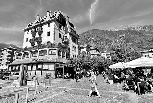
Visiting Tirano: If you have some time to spend here between your bus and train connections, here are some tips:
There’s a small TI at the Italian train station (at the corner closest to the Swiss station) where you can get a free map and advice.
From the station piazza, walk straight out—past some cafés, bars, restaurants, and souvenir stands—to the busy main road, Viale Italia. Following this left for about 15 minutes will take you to the Madonna di Tirano church; about 10 minutes to the right will take you to the humble old town.
Eating in Tirano: On the left where the train-station road hits the main road, $$ Merizzi is a good choice for interesting local pastas and other dishes—either out on the leafy sidewalk or in the retro-mod interior. Or head right on the main road to find other options: $ El Trigo is simpler and cheaper, selling fresh pasta dishes. Across the street, $ Profumo di Pizza has takeout pizzas. And farther along past El Trigo, you’ll find a welcoming café, a Valtellina products shop, and a gelateria. Note that most of these places don’t take Swiss francs—but they accept credit cards.
Train Trip
Part 1: Tirano to Poschiavo
Tirano: Leaving the Swiss station in Tirano, the train rolls streetcar-style through the center of town. You’ll pass right by the Madonna di Tirano church; notice that the area surrounding it acts as a sort of secondary town square for the whole community.
Valposchiavo: After Tirano, your train crosses the Italian-Swiss border (in Campocologno), and then climbs uphill. Now you’re traversing the Valposchiavo (“Valley of Poschiavo”), the southernmost valley of Switzerland’s largest canton, Graubünden (Grigioni, in Italian). The rest of the Bernina Express journey—from here all the way to the end of the line in Chur—is in Graubünden.
Brusio Viaduct: Just before Brusio, be ready: The train swirls up a circular viaduct—an ingenious construction allowing the train to reach higher altitudes without the help of a cogwheel mechanism. As the train spirals up, you can see the front and back cars curving in front of and behind you, riding over the viaduct. In the very center of the circle of rails, you’ll see a few statues—and, often, trainspotters here to take videos of the train maneuvering the loops. (There’s another 360-degree loop later on this trip, but it’s entirely in tunnels—so passengers barely notice.)
Upper Valposchiavo: As you gain altitude, sit back and enjoy the gentle beauty of this part of the trip, where you leave the flatter, broader valleys behind and head higher and higher up the Valposchiavo. You’ll pass dark old pine forests with needle-and-moss-covered boulders. Chestnut forests, tobacco plantations, and vineyards contribute to the lush tableau. Wildflowers along the track include bright-orange lilies and mountain azaleas.
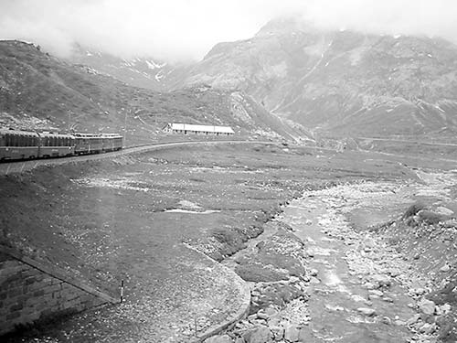
Lago di Poschiavo: Soon the train runs along the beautiful emerald waters of the mile-and-a-half-long Lago di Poschiavo. You’ll pass through a resort town on each end—first Miralago (ahem, not Mar-a-Lago), then La Prese. Notice how, in La Prese (as in Tirano), the track runs along city streets, as if it’s a streetcar rather than an intercity scenic train. Then your train pulls into Poschiavo (if you’re not stopping here, skip the next section).
Poschiavo
This extremely pleasant town of 3,500 people is a delight to explore if you have the time. (Confirm the time of your onward train carefully before leaving the station.) The station has free WCs on the platform. Inside the hall, the local TI hands out a free map with a short orientation walk; if you ask nicely, they’ll also let you leave your bags here for free (TI +41 81 839 0060, www.valposchiavo.ch).
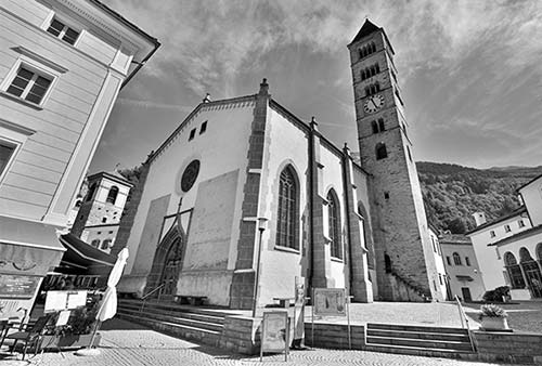
Eating in Poschiavo: A big, handy Co-op is just down the tracks (toward Italy) from the station, and there’s a small $ pizzeria directly outside the station’s front door that sells pizzas after 11:30. Or take my town walk (see next), where you’ll find some nicer restaurants on and near the main square, plus a sprinkling of bakeries, butchers, and small grocery stores.
Visiting Poschiavo: The best quick visit to Poschiavo includes a stroll to the main square (Piazza Comunale), with the Museo Casa Console and near the town’s main church (St. Ignazio). From the station, walk straight out and down the main street until it ends at the river, then turn left, following signs for Museo Casa Console. Cross the river over the pedestrian bridge and continue left. Follow this street for a few blocks through town. When the road narrows, turn right (again following brown Museo Casa Console signs) to reach the main piazza.
The main square, Piazza Comunale, is lined with Neoclassical and Neo-Gothic buildings. Two big hotel restaurants face each other (worth considering for a sit-down meal if time allows).
To the right stands the impressive Catholic church, Chiesa di San Vittore Mauro. A church stood here as early as 703, but the building has been rebuilt and renovated several times: The bell tower dates from 1202, and the Baroque front door was carved in the 1700s. Circle around the back of the church (up a few steps to the elevated terrace) for a better look at the tower. Directly opposite the tower’s base is an orange building with intricate wrought-iron grills. Have a peek inside, and don’t be startled by the skulls lining the walls—you’re standing in front of the local ossuary.
Now circle back around to the main square. Find the rustic-looking 12th-century tower, and head up the little street in front of it (Via da Mez). You’ll pass the old Town Hall, then the tiny Museo Casa Console. It has a nice collection of Romantic-era paintings of this region—the sort that helped kick off the tourism boom and, in a sense, brought you here. Before becoming glamorized in the Romantic era, mountains were seen more as obstacles than objects of beauty (free with Swiss Travel Pass, otherwise overpriced at 10 CHF, Tue-Sun 11:00-16:00, closed Mon and Nov-mid-Dec, +41 81 844 0040, www.museocasaconsole.ch).
Carry on a few more steps up this same street to find the Church of St. Ignazio. It’s ironic that this Protestant church’s namesake, St. Ignatius of Loyola, was the founder of the militant Jesuit order, whose main purpose was to fight “heretic” Protestants. For confirmation that it’s Protestant indeed, head into the austere interior. Notice the inscription above the central pulpit, which is fervently Protestant: Chiesa cristiana vangelica riformata da gli errori e superstizioni umane (“Christian evangelical church, reformed from human errors and superstitions”).
But you’ve got a train to catch! For a slightly more interesting return to the station, take the street that goes straight south from the main square, alongside the old church tower. After a few blocks through sleepy streets, turn right (next to Hotel Suisse) and find the footbridge that leads back to your train.
Part 2: The Bernina Pass, from Poschiavo to Pontresina
Above Valposchiavo: Leaving Poschiavo, it takes only a few minutes before you begin your ascent—probably the most dramatic stretch of this entire journey. The train slaloms up the steep mountain—making four switchback turns—and offers more and more views of waterfalls, steep cliffs, and the Poschiavo valley and lake far below.
Bernina Railway: As you gain altitude, remember why the Bernina Pass (and this journey) is famous: This is the highest rail crossing over the Alps. More impressive, it accomplishes this feat without rack-and-pinion or cogwheel systems; the tracks are simply engineered to curve just so, allowing a standard locomotive to make the ascent at up to a 7 percent grade. Completed in 1910, the Bernina Railway was a follow-up to another remarkable engineering feat, the Albula Pass (described later). The Albula Railway, completed just a few years earlier, connected Graubünden to the Swiss mainstream, and the Bernina Railway completed the connection to Italy. (The two lines meet in St. Moritz.) Taken together, these two ambitious projects revolutionized transportation, trade, and culture in this part of Switzerland.
Cavaglia: Just before Cavaglia, keep an eye out the window to see the Glacier Garden—a series of walkways that offer an up-close view of fascinating circular shafts carved out of the rock by glaciers. Cavaglia’s rustic, chalet-like station marks the bottom of another big ascent. As you twist up and up, notice many places where you go under avalanche shelters—little roofed sections that protect the most vulnerable stretches of the line from fierce winter weather.
Palü Glacier: Thirty minutes after leaving Poschiavo, you’ll glimpse the trip’s first glacier, the Palü (above the little lake called Palüsee). As you twist up through tunnels, you’ll see it on both the left and the right side of the train. It lies nestled between the peak of Piz Varuna (11,330 feet) on the left and the eastern summit of Piz Palü on the right (12,790 feet).
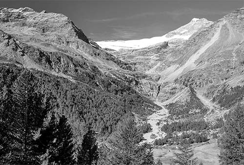
Alp Grüm: At the top of this section of curves, the train stops at the Alp Grüm station. You may be given a few minutes outside to appreciate the sweeping views of the glacier. Looking back, you’ll also enjoy hazy views over the narrow, lush Valposchiavo.
Alp Grüm is the first stop in German-speaking Switzerland; ascending this mountain, you’ve left Italian behind. (Most of Italian-speaking Switzerland is the canton of Ticino. But the finger of Graubünden occupied by Poschiavo also speaks Italian.)
The screeching of the wheels as you leave Alp Grüm is another reminder that this is the only train that crosses over the Alps without any tunnels. It goes right over the top.
Ospizio Bernina and Lago Bianco: This station marks the Bernina Pass and the highest point of this trip (7,380 feet, above the tree line). Next to the station, you’ll see Lago Bianco (“White Lake”), which gets its color from the snowmelt, also called glacier milk. At the end of the lake, look to the left for a watershed sign that explains that this is a European continental divide: From here, rivers flow either north (toward the Inn and Danube rivers, and finally to the Black Sea) or south (to the Adriatic Sea via the Adda and Po rivers).
Behind Lago Bianco, you can see the glaciers of Sassal Masone and Piz Cambrena. This mountain pass separates not only European drainage basins but also cultures. In earlier decades, the train line was more susceptible to bad-weather closures. The Valposchiavo was often cut off from Switzerland in the winter, and better connected to the valleys across the border in Italy.
Engadine: Now the train crosses the barren landscape and descends into the Engadine valley. Tourists and convalescents discovered this part of Switzerland at the end of the 19th century. Imagine the gorgeous skiing here in the winter, which still attracts the rich and famous. After the railroad opened this secluded valley to the world, the first hotels and sanatoriums were built (the air and sunshine supposedly helped cure diseases like tuberculosis). Poets found their muse in the wild, romantic landscape, while painters flocked in, attracted by the quality of the light. Keep an eye out for typical Engadine architecture—small windows set in thick walls, etched sgraffito decorations, and carved wooden doors. (For more on this topic, see here.)
Start watching on the left for snow-capped peaks peering over the bald, jagged, brown and gray cliffs—we’ll get a better view of these soon, at the Montebello curve. At the Bernina Diavolezza station, a cable car ascends to the top of this peak (“She-Devil,” 9,930 feet, described on here).
Montebello Curve: This stretch offers you the best views over the Morteratsch Glacier on the left, with impressive peaks in the background. From left to right: the Bellavista Range (12,770 feet), Crest Agüzza (12,690 feet), and the highest peak in the canton, Piz Bernina (13,280 feet).
Piz Bernina was first climbed in 1850 by a team led by rangers from the village of Schanf. Their gear consisted only of thick woolen pants, a shirt and jacket, hobnailed shoes, and a hat with a black veil to shade them from the strong sunshine. Others followed: Lucy Walker (1836–1916), a Canadian-born Liverpudlian who suffered from rheumatism, was recommended by her doctor to take up hiking. She took this advice very seriously, traveled to Switzerland, and became addicted to mountaineering. Wearing a flannel skirt, she became the first woman to conquer the Eiger (1864), the Matterhorn (1866), Piz Bernina (1869), and many other peaks.
Morteratsch: At the base of the curve, you’ll pass through the Morteratsch station. If staying in the area, consider backtracking here for a fine one-hour hike to the edge of the glacier, past posts tracking the glacier’s recent retreat (described on here).
As you continue, the tracks are lined by more and more larch trees. The milky-white waters from Lago Bianco and the Morteratsch Glacier run wild in a broad riverbed alongside the tracks, as satisfied cows chew away in the meadows while waterfalls tumble down the cliffs.
Pontresina: This town is a good place to break the journey (see the Upper Engadine chapter). Consider spending a night or two in Pontresina, exploring the quaint village of Samedan, visiting the glitzy resort of St. Moritz, and maybe doing some hiking before continuing on your way.
If you’re going to St. Moritz, your train trip is nearly over (about 10 minutes after Pontresina). If you’re continuing to Chur (or, in summer, to Davos), there’s more to see.
Part 3: The Albula Pass, from Pontresina to Filisur
Although you’re leaving the glaciers behind, your trip will still lead you through magnificent mountain scenery, with steep cliffs and deep gorges. (Note that from here on, the journey overlaps with the Glacier Express.)
Upper Engadine: First, you’ll slide through the broad and mellow valley around Samedan, following the “shortest river in Switzerland,” the Flazbach. On the right, look for the funicular heading up to Muottas Muragl, a viewpoint overlooking the valleys that come together in Samedan (described in the Upper Engadine chapter). Samedan is home to Europe’s highest airport. It serves glider enthusiasts and vacationers in St. Moritz.
After Samedan, in Bever, the train leaves the Inn River valley and climbs to another spectacular leg of its journey.
Albula Railway: The section between Bever and Bergün boasts amazing engineering work. Technicians from all over the world come here to admire the diversity of spiral tunnels, looping viaducts, galleries, and bridges that span the Albula Gorge.
The train works its way up along a cheerfully splashing mountain creek, between the Swiss pine and larch trees and some isolated farmhouses. The Albula Tunnel, the highest subterranean alpine crossing in Europe, takes you up to 5,970 feet.
It’s difficult to overstate the importance of this tunnel and rail line—opened in 1903—to the fate of Graubünden. Just a generation earlier, a north-south transalpine route was very nearly built through here. Instead, the Gotthard Tunnel was built to the west (see “Gotthard Panorama Express,” earlier). As trade shifted away from this pass—which still required a complicated, meandering route over the high mountains—to that slick new tunnel, Graubünden’s economy collapsed. So Graubündners decided to build their own tunnel. Over the four-year construction of this tunnel, more than 1,300 workers toiled in hazardous conditions. (While some died because of accidents, even more were claimed by a worm infection caused by contaminated wastewater.) With the completion of the Albula Railway, the journey from St. Moritz to Chur that took twelve hours by horse and carriage could be done in four; today it takes just two. The population of the Upper Engadine grew tenfold, and it’s because of this tunnel that St. Moritz was transformed from a humble farming village into a glitzy resort and Winter Olympics host.
A new Albula Tunnel, under construction since 2014, is finally nearing completion. The length of time it has taken—more than twice as long as the first tunnel, built more than a century earlier—is both a testament to the original feat of engineering and construction, and an indication of modern safety standards and environmental considerations.
The pass you’re conquering right now is another barrier between cultures and climate—it takes you from the valley of the Inn River (part of the Danube watershed) to the valley of the Albula, a tributary of the Rhine, and the weather is often quite different on either side of the tunnel.
Preda: After this village, the train loops down through five spiral and two straight tunnels, crosses nine viaducts, and goes under two galleries—more reminders of why the Albula Railway is considered the most ingenious ever built. It covers almost eight miles and descends more than 1,365 feet. The village of Bergün will be visible three separate times as you loop around the valley.
Bergün: This town greets you with a modern, public open-air swimming pool and an onion-shaped 17th-century “Roman tower.” When the Albula Railway was completed, there were high hopes that Bergün might become a big resort—like Pontresina, or even St. Moritz. They built an elaborate spa to wow visitors. But those dreams were never realized, and the village remains as sleepy as it is remote. Even so, it has a certain offbeat charm. Every winter, the street along the tracks above Bergün is closed to cars, and 100,000 sled enthusiasts enjoy the ride of their lives on a winding three-mile stretch.
Below Bergün: As the train continues winding down the pretty valley, you may be able to see other parts of the track below or next to you. Just before Filisur, the train does a 360-degree spin inside a tunnel. In Filisur, summer Bernina Express trains to Davos split off. If you’re continuing to Chur, read on.
Part 4: Filisur to Chur
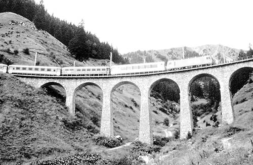
Landwasser Viaduct: After Filisur, the train enters a tunnel, and an announcement reminds you to ready your camera and position yourself on the left side. Just after the tunnel, you’ll cross the famous Landwasser viaduct. (The train might pause here—mid-bridge—for a brief photo op.) A masterpiece of engineering, the viaduct’s pillars were built without scaffolding. Iron towers, which formed the center of each pillar, were built first. With the help of cranes set up atop each pillar, materials were hoisted up and the brick was laid. The 425-foot-long viaduct curves elegantly in a radius of 330 feet. Notice how nicely the dark limestone masonry matches the surrounding landscape (it was quarried right here).
Albula River Gorge: After the viaduct, you continue through a gentle valley—with picturesque towns—to Tiefencastel. As you leave that town, the Albula River runs far beneath you. In Solis, watch on the left for the dramatic Solis Viaduct, which rises high above the gorge. Between here and Thusis, the wild Albula River carves the dramatic gorge; above, your train’s panoramic windows allow you to see the steep, rugged cliffs looming over the tracks.
Domleschg Valley: Thusis is the commercial hub of the broad and lush Domleschg valley, which stretches from here to Reichenau. The trip takes you down along the Hinterrhein (“Back-Rhine”) River. Notice the many fortresses, castles, towers, and ruins along the river—a reminder that taxes were levied on the traders who traveled this major route between northern and southern Europe. The 13th-century castle above Thusis now belongs to a local chemical company.
Reichenau: Surrounded by wide waters, this town marks the confluence of two arms of the Upper Rhine (the Hinterrhein and the Vorderrhein—“Front-Rhine”). Reichenau became wealthy from the taxes it got from the passing merchants. The 17th-century Reichenau Castle, right where the rivers converge, was once used as a school, but now it’s a hotel. From here, the Upper Rhine flows to Lake Constance (Bodensee), then follows the German-Swiss border to Basel.
The train follows the Rhine at the foot of Calanda Mountain to our final stop.
Chur: The area around Chur is Heidi country. This was the home of Johanna Spyri (1827-1901), who lived on an alp high above Maienfeld, just 12 miles north of here. Her Heidi novels were semi-autobiographical: Spyri was an orphan who lived with her grandfather and a goatherd named Peter, and came to know the majesty of the Alps.
For more on Chur, see the end of this chapter. You can catch the Glacier Express (explained next) from Chur or from St. Moritz. Or, from Chur, you can transfer to destinations elsewhere in Switzerland.
Glacier Express
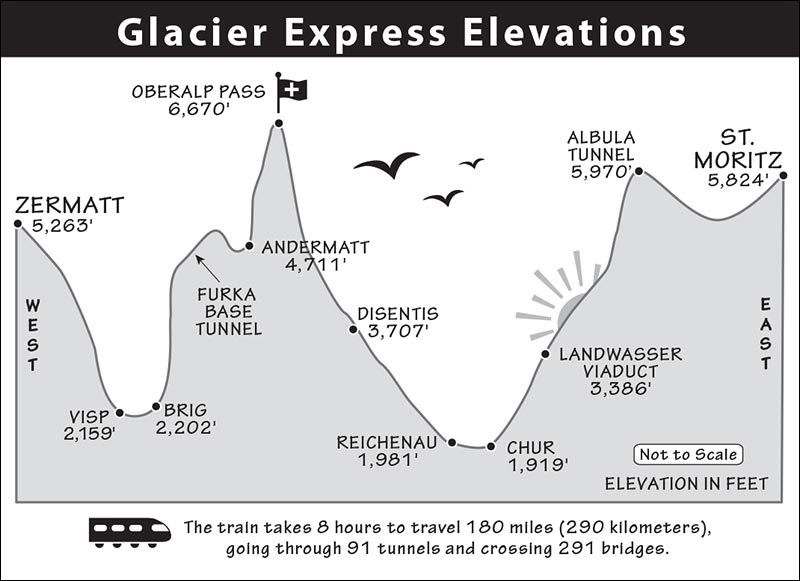
This most promoted of the Swiss scenic rail routes travels between Zermatt in the southwest of Switzerland and the best-known resort towns in eastern Switzerland (St. Moritz and Davos). If you stay on for the whole ride, you’ll spend more than eight hours crossing 291 bridges, going through 91 tunnels, and reaching an altitude of 6,670 feet.
While it’s an impressive and famous journey, the Glacier Express is not necessarily the be-all and end-all of Swiss rail trips. Much of the journey is down in valleys (as opposed to along the sides of cliffs), meaning that high-altitude views are a little lacking. And doing the whole route makes for a long day. But the stark landscape, carved by the glaciers that gave the train its name, is striking. The trip offers a dramatic way to connect eastern Switzerland with tucked-away-in-the-mountains Zermatt.
ROUTE OVERVIEW
“Glacier Express” is a misnomer—you’ll only glimpse glaciers at the two ends of the route, and it’s hardly an express. Not only does it take its time (traveling at about 20 mph to make the full trip in 8 hours), but it also makes plenty of stops along the way. The route cuts along the southern part of Switzerland, between St. Moritz/Davos (in the east) and Zermatt (in the west). You can ride in either direction.
One two-hour stretch of track—the Albula Pass between Chur and the St. Moritz area—is on both the Glacier Express and Bernina Express routes.
PLANNING YOUR TIME
Eight hours on a winding, jolting narrow-gauge train is a long time. If you don’t want to commit to the whole journey, keep in mind that the most distinctive stretch of the trip is the high-mountain pass between Disentis and Brig. The trip over the Albula Pass between St. Moritz and Filisur (which is also part of the Bernina Express route) is also a highlight.
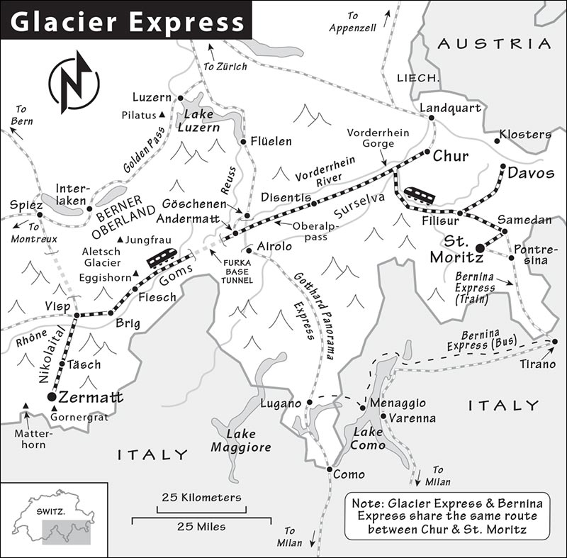
There are several ways of doing just a part of the route, though none is an obvious winner. Consider doing just St. Moritz to Chur (2 hours), then continuing to Zürich or Appenzell; St. Moritz to Brig (6.5 hours), then branching off to Interlaken, Bern, or Lausanne; Luzern or Lugano to Zermatt, connecting at Göschenen (6 hours); Luzern to St. Moritz, connecting at Andermatt (6.5 hours, see “Luzern to St. Moritz Option” later); or Lugano to Bern, via Göschenen and Brig (5.5 hours).
ORIENTATION TO THE GLACIER EXPRESS
Cost: You’ll pay 152 CHF for second class, or 268 CHF for first class, between St. Moritz and Zermatt (prices include seat reservation fees). The entire trip is covered by the Swiss Travel and Eurail passes except the required reservation fee (29-49 CHF, price depends on the season, cheaper if you don’t do the whole route). Those with a second-class rail pass will need to pay an additional fee to upgrade to first class. If you’re riding the full length of the Glacier Express sans rail pass, the cost is high enough to warrant a look at the Swiss Half-Fare Card, which can quickly pay for itself (see here).
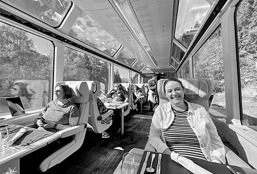
All Glacier Express trains have panoramic first- and second-class cars with air-conditioning and the option of an in-seat meal. Second-class seating can get extremely crowded in summer, so consider splurging on first class.
For the crème de la crème, step up to the “Excellence Class,” with much roomier cabins (one row of seats on each side of the train—all window seats), a full-service bar, and lots of drinks and food—including a seven-course lunch and afternoon tea (420 CHF extra).
Schedule: The Glacier Express train runs at least once daily in each direction, except from late October to mid-December (when local trains are your only option). Going from east to west, the train begins in St. Moritz at 8:51 and arrives in Zermatt at 17:10. Going from west to east, the train departs Zermatt at 8:52 and arrives in St. Moritz at 16:38. Those overnighting in Davos need to change trains in Filisur. In summer, one or two extra departures per day are added, an hour earlier and later than the times above. Confirm all times before your trip.
Information: The Glacier Express is operated jointly by the Matterhorn Gotthard Bahn (MGB), based in Brig (+41 84 864 2442, www.glacierexpress.ch or www.matterhorngotthardbahn.ch), and the Rhätische Bahn (RhB), based in Chur (+41 81 288 6565, www.rhb.ch). Trains have free Wi-Fi with access to their “InfoT(r)ainment” multimedia guide, providing insightful tidbits about towns and natural attractions along the way.
Seats: For most of the trip—including the most dramatic stretch, between Disentis and Brig—it’s much better to sit on the south-facing side of the train (generally seat numbers ending in 1 or 2 in both classes face south on this stretch; in second class, seats ending in 3 or 8 are along the aisle on the south-facing side). Coming from the east, even-numbered seats face forward for most of the trip. Keep in mind that trains change directions in Chur—so if you start on the right side facing backward in Davos, Samedan, or St. Moritz, you’ll be on the (preferable) left side facing forward for most of the trip. Conductors take reserved seat numbers seriously but may allow you to switch into an unoccupied seat.
Luggage: You’ll keep your luggage with you (they don’t check it through, except in Excellence Class)—just slip it between the backs of the seats.
Taking Regular Trains: This is one scenic route where regular trains are not a good option. While they do save you the seat reservation fee, they require changing trains three times. Regular trains are, however, the only option in late fall, when the express doesn’t run.
Luzern to St. Moritz Option: An alternative, convenient way to connect visits to the Berner Oberland and the Upper Engadine regions is to go by train from Luzern to St. Moritz on a route that covers some of the nicest portions of the Glacier Express trip. Two trains leave Luzern every morning for St. Moritz with changes in Erstfeld, Göschenen, and Andermatt (see www.rail.ch for schedules).
Connecting to Pontresina: Pontresina, on the Bernina Express route, is easy to connect to the Glacier Express route—it’s less than a 10-minute train ride away from St. Moritz or (somewhat simpler) in little Samedan.
Eating: A fancy restaurant car offers a $$$$ lunch, which is handy if you’re in for the full trip. A plate of the day costs 34 CHF, or you can pay more for a two-, three-, or four-course fixed-price meal (drinks cost extra).
Most seats have tables—perfect for a bring-your-own grocery-store feast. Each table has a rail in the middle with bumpers built in, to prevent drinks from sliding around too much on the twisty tracks.
SELF-GUIDED TOUR
All Glacier Express trains—whether they begin in St. Moritz or Davos—go through Chur. I’ll describe the route starting at Chur and heading toward Zermatt. (For details on the trip from St. Moritz to Chur, see parts 3 and 4 of the Bernina Express self-guided tour, earlier.)
Note: In Chur, the train changes directions, resupplies, and changes locomotives. If you’ve started out your journey in St. Moritz or Davos, this is a great time to stretch your legs (be clear on the departure time).
Part 1: Graubünden, from Chur to Oberalppass
Chur and Reichenau: A few miles outside Chur, Reichenau—roughly 2,000 feet above sea level—marks the lowest altitude of the route. From here, the big climb begins. (For more on Reichenau, see the Bernina Express section, earlier.) This is also where the Chur line hits the St. Moritz line, so if you’re riding the full Glacier Express route, your train will backtrack on this short stretch.
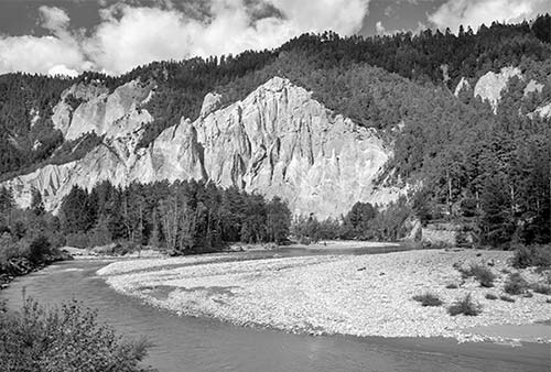
Vorderrhein Gorge: Leaving Reichenau, you’ll begin following the river called Vorderrhein (in Romansh, Rein Anterieur). This “Front-Rhine”—an early tributary of the Rhine River—carved the Vorderrhein Gorge, nicknamed “the Swiss Grand Canyon,” through which you’ll soon be traveling. While this gorge is significantly less dramatic than its namesake, the chalky, jagged, white cliffs that rocket up from the river’s surface are certainly picturesque. (Watch for rafters and kayakers frolicking (or at least attempting to stay alive) in the rapids.
Surselva: After exiting the gorge, the train enters a pastoral region called Surselva, centered on the town of Ilanz. This is Romansh country, where the fourth official language of Switzerland is kept alive—barely. Even in innocuous, idyllic small towns like this one, Switzerland is prepared for war. Tucked under small brown roofs along the bottom of the hillside are loads of explosives. They’re part of Switzerland’s military defenses; access to this pass can be blown up on short notice.
As you approach Disentis, the tracks begin to twist along the edge of a canyon—making the scenery more dramatic (a taste of what’s to come). Thirty years ago, those mountains above you were covered in snow year-round—but no longer. The Swiss, so in touch with nature, are painfully aware of their changing, ever-hotter climate. In Zermatt—where this journey terminates—2022 was the first time in living memory that summer skiing was not possible up at the Klein Matterhorn summit. It was just too slushy.
Disentis: You’ll pull into Disentis, with its big 17th-century Benedictine monastery looming in your window. At the Disentis station, you may get a brief break to stretch your legs as a cogwheel engine (a.k.a. rack-and-pinion drive) is attached to the train. If you’re on board, you’ll feel it jiggle, but trainspotters enjoy hopping out to watch them make the switch. This locomotive has gears that can lower to latch onto the cogs of an extra rail with grippable teeth. At a 10 percent incline (that’s 100 meters of gain per kilometer, or about 500 feet per mile), conventional train wheels start to slip.
Disentis is also where the eastbound and westbound Glacier Express runs cross. The trains don’t just swap engines; they swap some members of the crew—allowing them to head home for the evening rather than spend the night stranded all the way across the country.
All aboard! We’re moving on.
Above Disentis: You’ll work your way up the mountain alongside the Vorderrhein River. Appreciate the glorious views of farmhouses and hamlets climbing up grassy green hills on the far side of the valley. Just west of the larger town of Sedrun was the staging ground for the excavation of the Gotthard Base Tunnel (completed in 2016), which runs for 35 miles under the mountain from the Lake Geneva area to Lake Lugano in Ticino. (We’ll cross over the other, original, Gotthard Tunnel farther along in Andermatt.)
Beyond Rueras, the track steepens and the train slows to allow its gears to latch into the cog rail. After Tschamut, the last inhabited place before Oberalppass, you enter a long series of snow sheds—designed to protect the tracks (and trains) in case an avalanche strikes. If you hadn’t noticed, you’re now entering the most dramatic stretch of this entire trip.
Part 2: Uri Canton, from Oberalppass to Furka Tunnel
Oberalppass: You’ll emerge from the sheds at Oberalppass, the literal high point of this journey (6,670 feet). Keep an eye out for the red lighthouse, which seems extremely out of place high in the Alps. It’s not functional but symbolic: The lighthouse matches a much larger one at Rotterdam, Netherlands, where the Rhine River empties into the North Sea after traveling through Switzerland, Germany, and Holland. This lighthouse marks the source of that river. (Well, almost. The official Rhine source is Lake Toma, downhill from here in Graubünden. But technically that water must begin as snow, up in these mountains.)
The train glides along Lake Oberalp—like many alpine lakes, this is controlled by a dam, making it larger than it might naturally be. This water is used to generate snow for nearby ski areas in winter.
The scenery up here is stark. Notice the extensive network of avalanche fences high above you—a reminder of the many generations of Swiss farmers who have learned to live on the land. The reddish streaks you might see on the snow? Believe it or not, that’s sand from the Sahara Desert. It gets caught up in high-altitude winds and carried all the way to the Swiss Alps.
Oberalp also marks your departure from Graubünden and your entrance to the canton of Uri, with just 37,000 people and no cities. This canton, birthplace of the legendary William Tell, stretches along the Reuss River valley to the southern shores of Lake Luzern. While this train line feels remote, Uri is in the very heart of Switzerland and was one of the original eight cantons that united to create the Old Swiss Confederacy in the 14th century.
Over Andermatt: After the little station at Nätschen, you’ll twist under a gondola line into the valley around Andermatt. First you’ll get a high, wide overview of the entire valley; then you’ll curl down four switchbacks, partly through tunnels, into the town itself. (If you miss the view the first time around, no worries—you’ll see it a few more times, from each side of the train.)
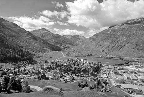
Andermatt: This fairly dreary, hardworking mountain town is making a supreme effort to rebrand itself as a luxury ski resort. (While it isn’t quite Davos or St. Moritz, it certainly enjoys some wonderful scenery.) Running directly beneath Andermatt is the junction for the nearly 10-mile-long Gotthard Tunnel (not visible from here), which takes trains unscenically from Göschenen to Airolo. While still used by the Gotthard Panorama Express train (described earlier in this chapter), the tunnel has been made nearly obsolete by another corridor: the 35-mile Gotthard Base Tunnel, which speedily connects Luzern with Lugano in just two hours.
Reuss River: Leaving Andermatt, the scenery opens up again. You’ll (very briefly) follow the Reuss River, which from its source near here runs north through the mountains to the Vierwaldstättersee (a.k.a. “Lake Luzern”) and through downtown Luzern. The huge boulders seen throughout this desolate terrain were deposited by—what else?—glaciers.
Furka Pass: As you approach a high, bald peak, notice the roads snaking up the hillside. They’re headed to the Furka Pass...but you don’t have to. Instead, you’re headed into the nearly 10-mile-long Furka Base Tunnel. While it might seem like a view killer, realize that this tunnel—finished in 1982—makes it possible for the Glacier Express to continue running through the winter. Automobiles are allowed onto the train to ride smoothly and safely between Realp and Oberwald. This is especially handy in the winter, when the road is closed. (The train picks up speed here, zipping through the tunnel before you know it.)
Part 3: Valais Canton, from Furka Tunnel to Brig and Visp
Goms and Rhône River Valley: Exiting the tunnel, things feel different. While you were underground, you left Uri and entered the canton of Valais (Wallis, in German). This vast region—which stretches from here south to the Italian border, and west all the way to the shores of Lake Geneva (and France)—is where you’ll spend the rest of this journey. Notice how the terrain has changed: less bald, rugged, and arid; more bucolic and green-rolling-hills...classic “Switzerland.”
Specifically, we’re in the region called Goms. The river we’re following through this relatively flat valley is the Rhône, whose source is the glaciers just overhead. From here, the Rhône flows into, and back out of, Lake Geneva before coursing through southern France, under the bridges of Lyon, Avignon, and Arles, to where it meets the Mediterranean at the Camargue delta—famous for its pink flamingoes and precious fleur de sel salt deposits. Just imagine: Over the last few miles of track, we passed the sources of the Rhine (which powers industry on its way north to the Atlantic at Rotterdam), the Rhône (which courses through idyllic Provence to Le Med), and the Reuss (which flows under the famous wooden bridges of Luzern). And that’s what they mean by “continental divide.”
As we travel through this valley, you may see ongoing work to channel and control this upper stretch of the powerful river, which has a long history of flooding the valley.
Reckingen: About 20 minutes after exiting the tunnel, be ready for the up-close view of the village of Reckingen, which is particularly fun as the train snakes through a narrow passage between the houses made of local larch wood that darkens naturally in the sun.
Eggishorn: As the valley gets rockier, consider that you’re on the “back” side of the Berner Oberland. (As the crow flies, you’re less than 20 miles from Gimmelwald.) In fact, farther along in the town of Fiesch, notice the cable car running overhead. This runs up to Eggishorn, which—on clear days—boasts views of the Eiger, Mönch, Jungfrau, and Matterhorn, plus Mont Blanc (not to mention the Aletsch Glacier—more on that later). Imagine...you’re at the very center of many of Europe’s most famous Alps, spanning three countries.
Grengiols Tunnel: About 10 minutes after Fiesch, just before the village of Grengiols, the train does a 360-degree loop-de-loop inside a darkened tunnel, then descends to a valley floor. We’re getting close to the junction city of Brig. But first...
Aletsch Glacier: While this is called the “Glacier Express,” have you noticed that we haven’t seen too many, you know, glaciers? Here’s another unseen glacier to add to the list: The Alps’ biggest glacier, the 14-mile-long, up to 3,000-feet-thick Aletsch Glacier, stretches overhead on your right, just out of sight. From here, it runs all the way to the Berner Oberland; if you ride the lift up to the Jungfraujoch, you can walk on it.
Brig and Visp: Finally, you’ll arrive at Brig, an ugly industrial town with good connections to other train lines (some key connections are listed at the end of this section). While not much to look at, Brig acts as a sort of linguistic and cultural hinge of Switzerland: You’re in the German-speaking Valais, but straight ahead, the Rhône River leads to Lake Geneva and French Switzerland. Keep an eye out for vineyards—the highest in Europe. We’re out of milk country and into wine country. The Simplon Pass, near here, is one of the main crossings (and historic trade routes) to Italy—to Domodossola, Lake Maggiore, and eventually Milan and Torino.
Visp, the next town you’ll reach (just a few minutes down the track), is another common transit point. If you’re staying on the train here, you’ll feel the tug as the train’s cogwheel attaches again for another steep climb...toward Zermatt.
Part 4: Nikolaital Valley, from Visp to Zermatt
Visp marks the entrance to the Nikolaital Valley, which follows the Matter Vispa upriver through a narrow canyon to Zermatt and the Matterhorn.
Matter Vispa River: Leaving Visp, as you get deeper into the mountains, you’ll be following the Matter Vispa River. At Neubrück, just after a giant factory, you’ll pass two dramatic, stone bridges arching elegantly over the water. Later, as things get steeper, the river has a particularly scenic stretch of rapids that churns over chunky white boulders on the right side of the train (soon after the village of Kalpetran).
From there, you’ll be going through the Mattertal—Switzerland’s deepest valley, and the steepest stretch of the entire Glacier Express.
Shortly before the village of Randa, you pass a cone of rubble left by a huge avalanche that wiped out two miles of road and track here in 1991.
Randa: This town is known to adventure seekers as the site of what was, for a time, the world’s longest suspension footbridge, at 1,621 feet. (It has since been surpassed by several longer bridges.) If you’d like to go for a bounce and a swing on the bridge, the Zermatt TI has tips.
Täsch: Vast parking lots mark the end of the road for drivers. From here it’s train-only into the traffic-free terminus of this line, Zermatt. Think about how much the terrain has changed since you started the trip: from remote valleys to fertile farmlands, to tundra above the tree line, to this rough and rocky terrain.
The Matterhorn: As you continue along the valley lined with quarries, you’ll get your first glimpses (provided the weather’s clear) of the unmistakable shape of the Matterhorn—a fitting exclamation point marking the end of this long journey. Zermatt—with its bunker-like, avalanche-proof train station—lies just around the bend.
GLACIER EXPRESS CONNECTIONS
If you’re not going all the way to St. Moritz or Zermatt, Chur and Brig are handy places to bail out of the Glacier Express.
From Brig by Train to: Bern (2-3/hour, 1-2 hours direct), Lausanne (2/hour, 2 hours direct), Interlaken Ost (1-2/hour, 70 minutes, change in Spiez), Luzern (1-2/hour, 2.5 hours, change in Bern and sometimes Olten), Zürich (hourly, 2 hours, more with change in Bern).
For Chur connections, see the next section.
Chur
The routes of the Glacier Express and the Bernina Express both pass through Chur—supposedly Switzerland’s oldest and warmest town. Fanning out over the foothills from the Rhine River, filling its broad valley with industry and commerce, Chur is a handy transportation hub for these two scenic train lines and has a charming-enough old town. Overall, Chur (pronounced “khoor”) is just a typical Swiss burg—fine for passing through, but not worth a detour.
Visiting Chur: Chur’s train station is at the bottom (north end) of the town center, where it sits atop a long underground concourse housing the TI (+41 81 252 1818, https://chur.graubuenden.ch), a ticket office, the handy Bahnhofplatz parking garage, and a Co-op supermarket. To get to the old town, follow Stadtzentrum signs up the escalator, then walk straight up Bahnhofstrasse. In two blocks, you’ll reach the big roundabout at Postplatz. The old town is straight ahead.
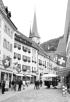
Public WCs are next to the cathedral. If you’ve got time to kill, you can wander up through the cobbled old town to two big churches (the Romanesque cathedral and the Gothic Church of St. Martin), some remains of the medieval city wall, and the town museum (Rätisches Museum, https://raetischesmuseum.gr.ch). Follow the handy red signs pointing you toward the attractions.
Sleeping in Chur: Sleep in Chur only if you must, in order to connect to one of the scenic rail lines. (If you’re connecting both the Glacier and Bernina Express routes, note that they also overlap farther south, in St. Moritz; nearby Pontresina is a more enjoyable place to overnight than Chur—see here.) Here are three moderately priced places in the atmospheric old town, an easy 10-to-15-minute walk from the train station: $ Hotel Restaurant Rebleuten (overlooking a quiet little square a block off Kornplatz at Pfisterplatz 1, +41 81 255 1144, www.rebleutenchur.ch); $$ Hotel Freieck (with a mod lobby and 41 rooms over a low-key café, Reichsgasse 44, +41 81 255 1515, www.freieck.ch [URL inactive]); and charming $$ Hotel Franziskaner (with rooms above a popular restaurant, Kupfergasse 18, +41 81 252 1261, www.hotelfranziskaner.ch).
Chur Connections: In addition to being a key stop for the Glacier Express and the Bernina Express, Chur also offers speedy, frequent connections to Zürich (3/hour, 2 hours), Luzern (2/hour, 2.5 hours, 1-2 changes), and Appenzell (3/hour, 2.5 hours, 1 or more changes).