NORTHERN SCOTLAND
Wester Ross & the North • Orkney Islands
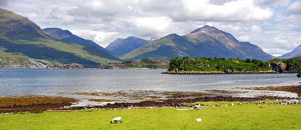
Scotland’s far north is its rugged and desolate “Big Sky Country”—with towering mountains, vast and moody moors, achingly desolate glens, and a jagged coastline peppered with silver-sand beaches. Far less discovered than the big destinations to the south, this is where you can escape the crowds and touristy “tartan tat” of the Edinburgh-Stirling-Oban-Inverness rut, and sometimes even get a picturesque corner of Scotland all to yourself.
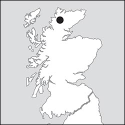
The area is tied together by a driving route called the North Coast 500 (NC-500)—Scotland’s answer to Iceland’s Ring Road or America’s Route 66. This 516-mile loop drive—beginning and ending in Inverness—ties together the destinations in this chapter, except Orkney (which is a ferry ride away). You can buy maps and guidebooks that outline and narrate the route in local bookstores and on the official website, www.northcoast500.com. But whether or not you stick strictly to the official route, this stunning swath of Scotland is ideal for a meandering road trip.
Fully exploring northern Scotland takes some serious time. The roads are narrow, twisty, and slow, and the pockets of civilization are few and far between. You’ll share the road with tour buses, camper vans, motorcyclists, and bicyclists, all making the same circuit. On some stretches, you may not pass another car for miles. It’s just you and the Munro baggers.
This chapter covers the area north of the Isle of Skye and Inverness: the scenic west coast (called Wester Ross) and the sandy north coast; plus the fascinating Orkney archipelago just offshore from Britain’s northernmost point.
With two weeks or less in Scotland, this area doesn’t make the cut (except maybe Orkney). But if you have time to linger, and appreciate backcountry scenery and an end-of-the-world feeling, the untrampled north is worth considering.
Even on a shorter visit, Orkney may be alluring for adventurous travelers seeking a contrast to the rest of Scotland. The islands’ claims to fame—astonishing prehistoric sites, Old Norse (Norwegian) heritage, and recent history as a WWI and WWII naval base—combine to spur travelers’ imaginations.
PLANNING YOUR TIME
For a scenic clockwise drive through this area, try this four-day plan, which starts from the Isle of Skye and hits the best of the North Coast 500 (NC-500) stops before ending in Inverness. For some, this may be an unreasonable amount of driving, on twisty, challenging, often one-lane roads (especially on days 1 and 2). With more time, consider adding another overnight to break up the trip. You can also do this trip in reverse, starting with the drive north from Inverness.
| Day 1 | From the Isle of Skye, drive up the west coast (including the Applecross detour, if time permits), overnighting in Ullapool. |
| Day 2 | Continue the rest of the way up the west coast, then trace the north coast from west to east, catching the late-afternoon or evening ferry to Orkney. Overnight in tidy Kirkwall (2 nights). |
| Day 3 | Spend all day on Orkney. |
| Day 4 | Take the ferry from Orkney back to the mainland; with enough time and interest, squeeze in a visit to John O’Groats before driving back to Inverness (on the relatively speedy A-9). |
Planning Tips: To reach Orkney most efficiently—without the slow-going west-coast scenery—consider zipping up on a flight (easy and frequent from Inverness, Edinburgh, or Aberdeen), or make good time on the A-9 highway from Inverness up to Thurso (figure 3 hours one-way) to catch the ferry.
Without a car I’d skip this area. (It’s very slow to traverse this area by bus.) If you’re flying to Orkney, consider renting a car for your time there.
Wester Ross and the North
North of the Isle of Skye, Scotland’s scenic Wester Ross coast (the western part of the region of Ross), is remote, sparsely populated, mountainous, and slashed with jagged “sea lochs.” (That’s “inlets” in American English, or “fjords” in Norwegian.) After seeing Wester Ross’ towering peaks, you’ll understand why George R.R. Martin named the primary setting of his Game of Thrones epic “Westeros.”
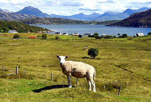
The area is a big draw for travelers seeking stunning views without the crowds—though it’s becoming more well known as the most dramatic stretch of the NC-500. For casual visitors, the views in Glencoe and on the Isle of Skye are much more accessible and just as good as what you’ll find farther north. But diehards enjoy getting away from it all in Wester Ross.
Scotland’s 100-mile-long north coast, which stretches from Cape Wrath in the northwest corner to John O’Groats in the northeast, is gently scenic, but less dramatic than Wester Ross. Views here are dominated by an alternating array of moors and rugged coastline.
I’ve also briefly outlined the speedy trip along the placid east coast from John O’Groats south to Inverness. With few sights, this is a good place to make up time while contemplating your return to urban life.
Scenic Drives in the North
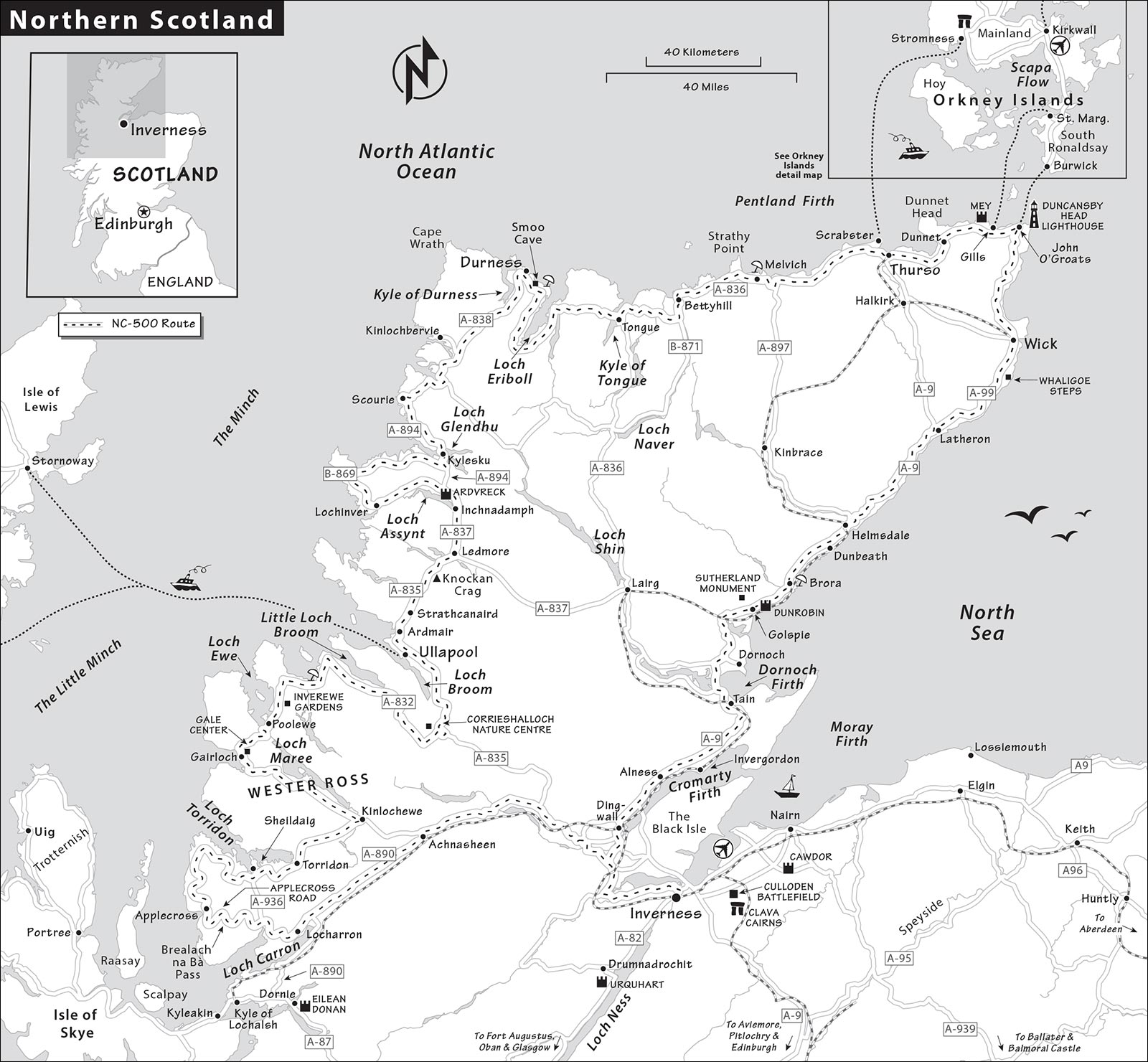
This section outlines four drives that, when combined, take you along this region’s west, north, and east coasts. The first Wester Ross leg (from Eilean Donan Castle to Ullapool) is the most scenic, with a fine variety of landscapes—but not many towns—along the way. The next Wester Ross leg gets you to Scotland’s northwest corner and the town of Durness. The third leg sweeps you across the north coast, to John O’Groats. The fourth leg is a quick return to Inverness.
PLANNING YOUR DRIVE
Note that the route I’ve described here—if you take all of the optional scenic detours—covers about 440 miles of the full North Coast 500 (NC-500) loop. I’ve omitted the cross-country section between Inverness and Lochcarron; instead this drive starts at Eilean Donan Castle, just inland from the Isle of Skye.
If you want just a taste of this rugged landscape—without going farther north—you can drive the Wester Ross coastline almost as far as Ullapool, then turn off on the A-835 for a quick one-hour drive to Inverness.
Get the good NC-500 map at www.northcoast500.com to help navigate: GPS may be unreliable in more remote areas. In this region, roads are twisty and often only a single lane, so don’t judge a drive by its mileage alone. Allow plenty of extra time.
EILEAN DONAN CASTLE TO ULLAPOOL
This long drive, worth ▲▲, connects the picture-perfect island castle of Eilean Donan to the humble fishing village of Ullapool, the logical halfway point up the coast. Figure about 130 miles and nearly a full day for this drive, plus another 20 slow-going miles if you take the Applecross detour.
From the A-87, a few miles east of Kyle of Lochalsh (and the Skye Bridge), follow signs for the A-890 north toward Lochcarron. (Note that Eilean Donan Castle is just a couple of miles farther east from this turnoff; for details see here).
Follow the A-890 as it cuts across a hilly spine, then twists down and runs alongside Loch Carron, and be prepared for your first taste of single-track driving as you encounter a one-lane tunnel. At the end of the loch, just after the village of Strathcarron, you’ll reach a T-intersection. Turn left, following the A-896 and signs for Lochcarron. This is also where you pick up the official North Coast 500 (NC-500) driving loop. From here, you’ll follow the opposite bank of Loch Carron. (For the faster route to Ullapool—which skips much of the best scenery, take a right at the T-intersection, which brings you to the A-890, toward Inverness.)
Soon after you pull away from the lochside, you’ll cross over a high meadow, then descend a gorge and see your first NC-500 sign at a well-marked turnoff on the left for a super-scenic—but challenging—route: the Applecross Road, over a pass called Bealach na Bà (Gaelic for “Pass of the Cattle”). Signs suggest a much more straightforward alternate route that keeps you on the A-896 straight up to Loch Torridon (if doing this, skip down to the “Loch Torridon” section, later). But if you’re comfortable negotiating steep switchbacks, and have time to spare (adding about 20 miles to the total journey), this road is drivable.
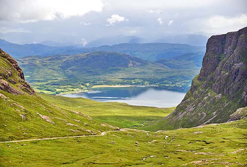
Applecross Detour: You’ll twist up, up, up—hearing your engine struggle up grades of up to 20 percent—and finally over, with rugged-moonscape views over peaks and lochs. From the summit (at 2,053 feet), the jagged mountains rising from the sea are the Cuillin Hills on the Isle of Skye. Finally, you’ll corkscrew back down the other side, arriving at the humble seafront town of Applecross.
Once in Applecross, you could either backtrack to the A-896 (slightly faster), or, for a meandering but very scenic route that sticks with the NC-500, carry on all the way around the northern headland of the peninsula. This provides you with further views of Raasay and Skye, through a deserted-feeling landscape on one-lane roads. Then, turning the corner at the top of the peninsula, you’ll begin to drive above Loch Torridon, with some of the finest views on this drive.
Loch Torridon: Whether you take the Applecross detour or the direct route, you’ll wind up at the stunning sea loch called Loch Torridon—hemmed in by thickly forested pine-covered hills, it resembles the Rockies. You’ll pass above an idyllic fjordside hamlet, Shieldaig (turn off here for lunch at the Sheildaig Coastal Bar and Kitchen, http://tighaneilean.co.uk), then cross over a finger of land and plunge deeper into Upper Loch Torridon. Nearing the end of the loch, keep an eye out for The Torridon—a luxurious lochfront grand hotel with gorgeous Victorian Age architecture, a café serving afternoon tea, and expensive rooms (reservations required for tea and other meals, www.thetorridon.com).
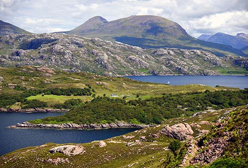
As you loop past the far end of the loch—with the option to turn off for the village of Torridon (which has a good youth hostel and a general store/café with a soup of the day)—the landscape shifts dramatically, from pine-covered hills to a hauntingly desolate glen. You’ll cut through this valley—bookended by towering peaks and popular with hikers—before reaching the town of Kinlochewe (gas, WC).
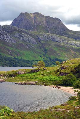
Loch Maree: At Kinlochewe, take the A-832 west (following Ullapool signs from here on out). Watch on the left for the unstaffed Beinn Eighe Visitor Centre, with good displays about Scotland’s pine forests (free, closed Nov-March, WCs, www.nnr.scot). Soon you’ll be tracing the bonnie, bonnie banks of Loch Maree—considered by many connoisseurs to be one of Scotland’s finest lochs. You’ll see campgrounds, nature areas, and scenic pullouts as you make good time on the speedy two-lane lochside road. (The best scenery is near the beginning, so stop early for photos.)
Leaving the end of Loch Maree, the road becomes single-track again as you twist up over another saddle of scrubby land. On the other side, you’ll get glimpses of Gair Loch through the trees, before finally arriving at the little harbor of Gairloch. Just beyond the harbor, where the road straightens out as it follows the coast, keep an eye out (on the right) for the handy Gale Center. Run as a charity, it has WCs, a small café with treats baked by locals, a fine shop of books and crafts, and comfortable tables and couches for taking a break (www.galeactionforum.co.uk).
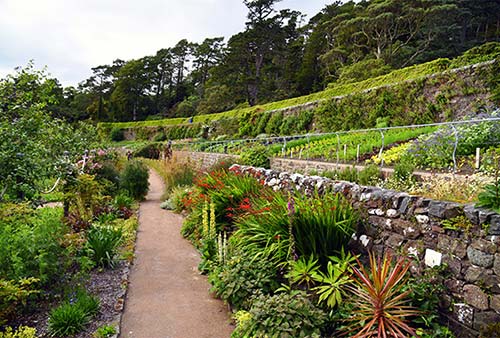
Loch Ewe to Corrieshalloch: True to its name, Gair Loch (“Short Loch”) doesn’t last long, and soon you’ll head up a hill (keep an eye out for the pullout on the left, offering fine views over the village). Drive across a high plain with bubbly rock formations at your right, then wind down to the next village, Poolewe, on Loch Ewe. Just after the village, on the left, is the Inverewe Gardens (£15, closed Nov-March, café, www.nts.org.uk). These beautiful gardens, run by the National Trust for Scotland, were the pet project of Osgood Mackenzie, who in 1862 began transforming 50 acres of his lochside estate into a subtropical paradise. The warming Gulf Stream and—in some places—stout stone walls help make this oasis possible. If you have time and need to stretch your legs, spend an hour wandering its sprawling grounds. The walled garden, near the entrance, is a highlight, with each bed thoughtfully labeled.
Continuing on the A-832 toward Ullapool, just as you turn away from Loch Ewe, historians may be interested in the Russian Arctic Convoy Museum, with a small exhibit about Loch Ewe’s WWII role in supplying the Soviet Union (£6, closed Nov-March, on the left, https://racmp.co.uk). Carrying on, watch on the right for parking and access to Gruinard Beach, with wooden stairs down a few steps to a protected golden-sand beach—one of many along this route. Soon you’ll find yourself following Little Loch Broom (with imposing mountains on your right). At the end of that loch, continue straight and work your way past a lush strip of farmland at the apex of the loch. You’ll climb through a canyon and across misty headlands, before dropping down to felted green hills.
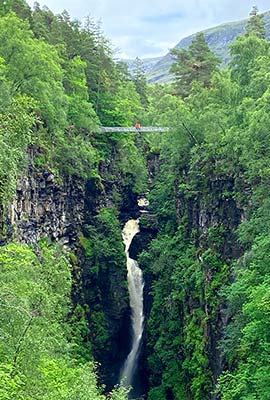
Just before the junction with A-835, the Corrieshalloch Gateway to Nature Centre (on the left) offers info panels and a short hike down to the wonderfully scenic gorge. You’ll pass several small cascades before emerging at a Victorian-era suspension bridge that spans the gorge just above the plummeting 150-foot-tall Falls of Measach. Continue across the bridge to reach a platform with views back to the falls (closed Nov-Feb, café, WCs, pay parking, www.nts.org.uk).
A few hundred yards after the visitor center, you’ll meet the big A-835 highway at a “T” intersection; turn left and take this speedy road the rest of the way into Ullapool. (Or you can turn right to zip on the A-835 all the way to Inverness—just an hour away.) Whew!
Ullapool
A gorgeously set, hardworking town of about 1,500 people, Ullapool (ulla-PEWL) is what passes for a metropolis in Wester Ross. Its most prominent feature is its big, efficient ferry dock, connecting the mainland with Stornoway on the Isle of Lewis (Scotland’s biggest, in the Outer Hebrides). Facing the dock is a broad promenade and strip of cute little houses, today housing restaurants, shops, B&Bs, and residences. Behind the waterfront, the town is only a few blocks deep—you can get the lay of the land in a few minutes’ stroll. Curving around the back side of the town—along a big, grassy campground—is an inviting rocky beach, facing across the loch in one direction and out toward the open sea in the other.
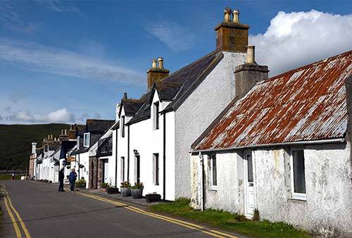
Orientation to Ullapool: Ullapool has several handy services for travelers. The excellent Ullapool Bookshop is a block up, straight ahead from the ferry dock, and has a good selection of maps, NC-500 guidebooks, and local advice (www.ullapoolbookshop.co.uk). Many services line Argyle Street, which runs parallel to the harbor one block up the hill: the TI and an ATM are to the right, while the post office and a fine little town museum, with well-done exhibits about local history, are to the left (closed Thu and Nov-March, www.ullapoolmuseum.co.uk). This street, nicknamed “Art-gyle Street,” also has a smattering of local art galleries.
Sleeping in Ullapool: Several guesthouses line the harborfront Shore Street, including $ Waterside House (3 rooms, minimum 2-night stay in peak season, https://waterside.uk.net), and the town’s official ¢ youth hostel (closed Nov-March, www.hostellingscotland.org.uk). A block up from the ferry terminal, in the big, white, turreted building, is the $$$ Caledonian Hotel (83 rooms, Quay Street, https://bespokehotels.com).
Eating in Ullapool: Two reliable places are the $$ Seaforth, directly across from the ferry terminal (www.theseaforth.com), and the more upscale $$ Ceilidh Place, on West Argyle Street a block above the harbor (www.theceilidhplace.com). Both have a nice pubby vibe as well as sit-down dining rooms with a focus on locally caught seafood. Ceilidh also rents rooms and frequently hosts live music.
A half-block down from Ceilidh, $ The Seafood Shack and Gin Pop Up is a classy, fun lunch truck where Kirsty and Fenella prepare a daily menu of fresh seafood and a little cart offers gin cocktails (daily, covered outdoor seating, www.seafoodshack.co.uk). For a quick meal, two $ chippies (around the corner from each other, facing the ferry dock) keep the breakwater promenade busy with al fresco budget diners and happy seagulls.
ULLAPOOL TO THE NORTH COAST
This shorter drive, worth ▲, connects one quaint seaside town (Ullapool) to another (Durness—on the north coast) through rolling hills sprinkled with wee lochs and the dramatic landscape. Expect this drive (about 70 miles) to take another couple scenic hours, depending on your sightseeing stops.
Leaving Ullapool, follow signs that read simply North (A-835), then NC-500/John O. Groats. You’ll pass through the cute little beachside village of Ardmair, then pull away from the coast.
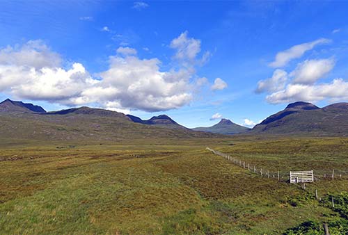
About 15 minutes after leaving Ullapool, just after you exit the village of Strathcanaird and head uphill, watch on the left for a pullout with a handy orientation panel describing the panorama of towering peaks that line the road. It looks like a mossy Monument Valley. Enjoy the scenery for about four more miles—surrounded by lochs and gigantic peaks—and watch for the unstaffed Knockan Crag visitors center, above you on the right, with exhibits on local geology, flora, and fauna, along with suggestions for area hikes (open 24/7, WCs, www.nnr.scot).
Continuing north along the A-835, you’ll soon pass out of the region of Ross and Cromarty and enter Sutherland. At the T-intersection, turn left for Kylesku and Lochinver (on the A-837). You’ll also see another sign for John O’Groats at the northeastern corner of Scotland (now 152 miles away).
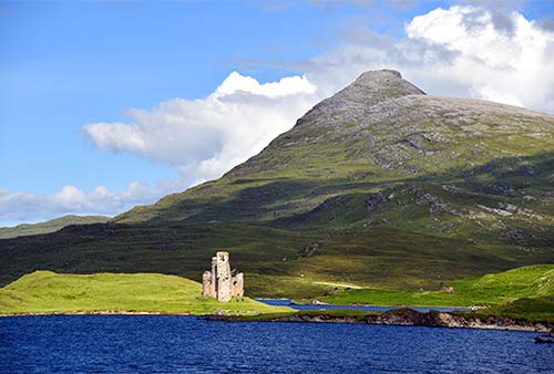
You’ll roll through moors, surrounded on all sides by hills. Just after the barely-there village of Inchnadamph, keep an eye out on the left for the ruins of Ardvreck Castle, which sits in crumbled majesty upon its own little island in Loch Assynt, connected to the world by a narrow sandy spit (parking nearby). Just after these ruins, you’ll have another choice: For the fastest route to the north coast, turn right to follow A-894 (toward Kylesku and Durness). But if you have at least an hour to spare, you could stick with the NC-500 route and carry on straight to scenically follow Loch Assynt toward the sleepy fishing village of Lochinver (12 miles, all services). After seeing the village, you could go back the way you came to the main road (faster), or continue along the single-track B-869 all the way around the little peninsula, passing several appealing sandy beaches and villages.
Back on the main A-894, you’ll pass through an almost lunar landscape, with peaks all around, finally emerging at the gorgeous, mountain-rimmed Loch Glendhu, which you’ll cross on a stout modern bridge. (A pullout just after the bridge offers a good view of the loch.) From here, it’s a serene landscape of rock, heather, and bracken, with occasional glimpses of the coast—such as at the village of Scourie, with a nice sandy beach. Finally (after the road becomes A-838—keep left at the fork, toward Durness), you’ll head up, over, and through a vast and dramatic moor, dodging sheep and camper vans. At Rhiconich, you could detour to the tiny harbor town of Kinlochbervie (4 miles, all services). Returning to the A-838, at the end of the glen, you’ll start to see sand below you on the left; this is Kyle of Durness, which goes on for miles. You’ll see the turnoff for the ferry to Cape Wrath, then follow tidy stone walls the rest of the way into Durness.
THE NORTH COAST
This driving route—which sticks with the official NC-500 the whole way—takes you along the picturesque, remote north coast from west (Durness village) to east (the touristy town of John O’Groats). Allow at least 2.5 hours for this 90-mile drive (add more time for stops along the way).
Durness Town
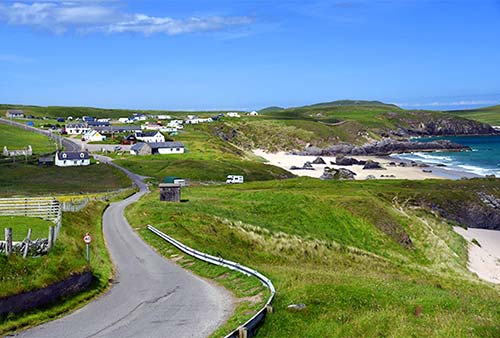
This beachy village of cow meadows is delightfully perched on a bluff above sandy shores. This area has a different feel from Wester Ross—it’s more manicured, with tidy farms hemmed in by neatly stacked stone walls. There’s not much to see or do in the town, but there is a 24-hour gas station (gas up now—this is your last chance for a while...trust me) and an electric-car charging station, on the east end of town.
Head east out of the village on the A-838, watching for brown signs on your right to Durness Village Hall Garden. Pull over here to stroll through the small memorial garden for John Lennon, who enjoyed his boyhood vacations in Durness.
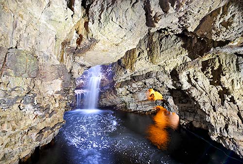
Just after the village hall, on the left, pull over at Smoo Cave. Its goofy-sounding name comes from the Old Norse smúga, for “cave.” (Many places along the north coast—which had a strong Viking influence—have Norse rather than Gaelic or Anglo-Saxon place names.) From the parking lot (with free WCs), it’s free to hike down to a protected cove, where an underground river has carved a deep cave into the bluff (the route to the left of the WC is more direct) and walk inside the cave to get a peek at the waterfall. For a longer visit, you can pay for a 20-minute tour, which includes a short boat ride followed by a guided walk (unnecessary for most; sign up at the mouth of the cave, tours run April-Oct, none in bad weather, https://smoocavetours.com).
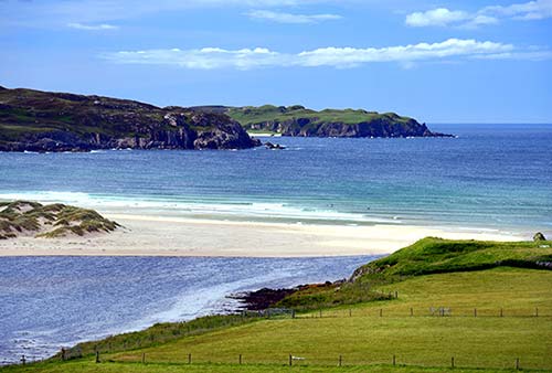
Back on the road, soon after Smoo Cave, on the left, is the gorgeous Ceannabeinne Beach (Gaelic for “End of the Mountains”). Of the many Durness-area beaches, this is the locals’ favorite.
Durness to Thurso
Heading east from the Durness area, you’ll traverse many sparsely populated miles—long roads that cut in and out from the coast, with scrubby moorland and distant peaks on the other side. You’ll emerge at the gigantic Loch Eriboll, which you’ll slowly circumnavigate—passing sheep farms and crumbling stone walls—to continue your way east. Leaving this fjord, you’ll see a sign for NC-500/John O’Groats (now only 72 miles away) as the road becomes two lanes again. You’ll cut through some classic Highland scenery, crossing a vast moor until you finally pop out at the scenic Kyle of Tongue. You’ll cross over the big, modern causeway, then twist up through the village of Tongue (with a good hotel/restaurant) and continue your way eastward (the A-838 becomes the A-836)—through more of the same scrubby moorland scenery. Make good time for the next 40 lonely miles. Notice how many place names along here use the term “strath”—a wide valley (as opposed to a narrower “glen”), such as where jagged mountains open up to the sea.
Finally—after going through little settlements like Bettyhill (with services and the good Strathnaver Museum, about the Clearances, www.strathnavermuseum.org.uk) and Melvich (with another good beach)—the moors begin to give way to working farms; you’ll pass the decommissioned Dounreay nuclear plant as you approach Thurso. The main population center of northern Scotland (pop. 8,000), Thurso is a functional transit hub with a charming old core. A smattering of restaurants and the North Coast Visitor Centre are on the pedestrianized High Street (Tue-Sat 10:00-17:00, closed Sun-Mon; good exhibits on Pictish stones and the Dounreay plant, www.highlifehighland.com/north-coast-visitor-centre). The beach is a few blocks below the TI. As you face out to sea, the industrialized point on the left is Scrabster, with the easiest ferry crossing to Orkney (for details, see “Getting to Orkney,” later).
Sights Near Thurso
Several sights near Thurso are worth driving the extra few miles.
Dunnet Head: About eight miles east of Thurso (following brown NC-500/John O’Groats signs on the A-836) through a sea of grassy sand dunes is the village of Dunnet. If you have time for some rugged scenery, turn off here to drive the four miles (each way) to the Dunnet Head peninsula.
While John O’Groats is often dubbed “Britain’s northernmost point,” Dunnet Head pokes up just a bit farther. And, while it lacks the too-cute signpost marking distances to faraway landmarks, views from here are better than from John O’Groats. Out at the tip of Dunnet Head, a lonely lighthouse enjoys panoramic views across the Pentland Firth to Orkney, while a higher vantage point is just up the hill. Keep an eye out for seabirds, including puffins.
Mary-Ann’s Cottage: In the village of Dunnet, between the main road and Dunnet Head, this little stone house explains traditional crofting lifestyles. It appears just as it was when 92-year-old Mary-Ann Calder moved out in 1990 (limited hours daily, closed Oct-May, www.caithness.org).
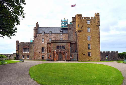
Castle of Mey: About four miles east of Mary-Ann’s Cottage (on the A-836) is the Castle of Mey. The Queen Mother grew up at Glamis Castle (near Dundee), but after her daughter became Queen Elizabeth II, she purchased and renovated this sprawling property as an escape from the bustle of royal life...and you couldn’t get much farther from civilization than this. For nearly 50 years, the Queen Mum came here for annual visits in August and October. Today it welcomes visitors to tour its homey interior and 30 acres of manicured gardens (£14.50 castle and gardens, £9 gardens only; open Wed-Sun from 11:00, last entry at 15:00, closed Mon-Tue and Oct-April; www.castleofmey.org.uk).
From Mey, it’s another six miles east to John O’Groats. About halfway there, in Gills Bay, is another ferry dock for cars heading to Orkney (see “Getting to Orkney,” later).
John O’Groats
A total tourist trap that’s somehow also genuinely stirring, John O’Groats marks the northeastern corner of the Isle of Britain—bookending the country with Land’s End, 874 miles to the southwest in Cornwall. People enjoy traversing the length of Britain by motorcycle, by bicycle, or even by foot (it takes about eight weeks to trudge along the “E2E” trail—that’s “End to End”). And upon arrival, whether they’ve walked for two months, wound around the north on the NC-500, or just driven up for the day from Inverness, everyone wants to snap a “been there, done that” photo with the landmark signpost. Surrounding that is a huge pay parking lot, a souvenir stand masquerading as a TI, and lots of tacky “first and last” shops and eateries. Orkney looms just off the coast.
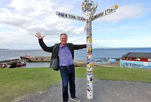
Nearby: The real target of “End to End” pilgrims isn’t the signpost, but the Duncansby Head Lighthouse—about two miles to the east, it’s the actual northeasternmost point, with an even more end-of-the-world vibe. (By car, head away from the John O’Groats area on A-99, and watch for the Duncansby Head turnoff on the left, just past the Seaview Hotel.) If you have time for a hike, about a mile south of the lighthouse are the Duncansby Stacks—dramatic sea stacks rising up above a sandy beach.
THE EAST COAST: RETURNING TO INVERNESS
Compared to the rest of this drive, the 120-mile route back to Inverness is speedy, straightforward, and anticlimactic. Enjoy the gentle seaside scenery, and consider these possible stops.
From John O’Groats, meander south along the A-99, through the one-time herring capital of Wick. Its labyrinthine Heritage Museum chronicles the harborfront neighborhood called Pulteneytown, created in the 1800s to encourage crofters displaced by the Clearances to take up fishing (www.wickheritage.org). A half-mile away, the Old Pulteney Distillery offers tours (https://oldpulteney.com).
Just 15 minutes south of Wick, watch on the left for the parking lot for the Whaligoe Steps. A short walk across the headlands takes you to the edge of a cliff, where the stable-footed can descend 330-some steps to Whaligoe Harbor (and ponder the fact that fishing boats and schooners delivering salt and other supplies landed here through the 1950s).
Farther south, in Latheron, you’ll pick up the A-9, which zips south to Inverness. (If you’re coming back on the Orkney ferry to Thurso, you can cut the corner by taking the A-9 overland from there.) About three miles past Latheron, the Laidhay Croft Museum (on the left) is an original 200-year-old thatched longhouse and a good example of pre-Clearance life on the coast (http://laidhay.co.uk). Continuing south, you’ll pass through more small towns such as Dunbeath, birthplace of Scottish author Neil Gunn, and Brora, with one of the east coast’s most accessible beaches.
Leaving Brora, perched atop a prominent hill ahead in the distance, is the Sutherland Monument, a 30-foot-high statue (on a 70-foot column) of George Leveson-Gower, the infamous first Duke of Sutherland (1758-1833). The duke is best known for his role in the Sutherland Clearances, in which thousands of crofters were summarily evicted from his land in favor of large-scale sheep farming. (The monument is accessible only via a steep 1.5-hour hike; skip it.)
The duke’s gaze is fixed on Dunrobin Castle, the picturesque traditional home of Clan Sutherland. (Watch for the turnoff about five miles past Brora.) This massive, French-château-style castle—“the largest house in the Highlands”—has 189 rooms, walled gardens, and a museum. The Sutherlands are thought to have had a stronghold here since at least 1400. The early fortified keep was expanded over the years and remodeled in 1865 to the present form. The self-guided tour visits 18 rooms in the castle (with posted descriptions); after that you’re free to climb down the steps to the formal garden overlooking the sea. The museum holds the family’s Victorian-era collection of curiosities, from stuffed trophy heads of African animals killed on safari to Pictish stones (£14; castle open daily 10:00-17:00, shorter hours April and Oct, closed Nov-March; museum daily 11:00-16:00; falconry show, café, outside Golspie, www.dunrobincastle.co.uk).
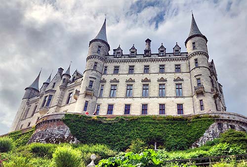
From Golspie it’s just 50 miles back to Inverness, crossing over Dornoch Firth and the Black Isle.
The Orkney Islands
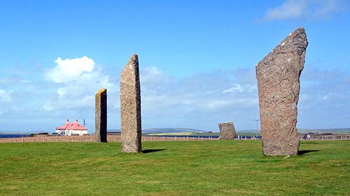
The Orkney Islands, perched just an hour’s ferry ride north of the mainland, are uniquely remote, historic, and—for the right traveler—well worth the effort.
Crossing the 10-mile Pentland Firth separating Orkney from northern Scotland, you leave the Highlands behind and enter a new world. With no real tradition for clans, tartans, or bagpipes, Orkney feels not “Highlander” or even “Scottish,” but Orcadian (as locals are called). Though Orkney was inhabited by Picts from the sixth century BC, during most of its formative history—from 875 all the way until 1468—it was a prized trading hub of the Norwegian realm, giving it a feel more Scandinavian than Celtic. The Vikings (who sailed from Norway, just 170 miles away) left their mark, both literally (runes carved into prehistoric stone monuments) and culturally: Many place names are derived from Old Norse, and the Orkney flag looks like the Norwegian flag with a few yellow accents.
In later times, Canada’s Hudson’s Bay Company recruited many Orcadians to staff its outposts. And given its status as the Royal Navy headquarters during both World Wars, Orkney remains one of the most pro-British corners of Scotland. In the 2014 independence referendum, Orkney cast the loudest “no” vote (67 percent against). But Orkney also clings to its independence: To draw attention to local grievances, Orcadian leaders often threaten to rejoin Norway or Denmark.
Orkney’s landscape is also a world apart: Aside from some dramatic sea cliffs hiding along its perimeter, the main island is mostly flat or low hills, with few trees, tidy fields of grain, gently mooing cows, and the small town of Kirkwall. While the blustery weather (which can change several times a day) keeps vegetation on the scrubby side, for extra greenery every village has a sheltered community garden run by volunteers. Orkney’s fine sandy beaches seem always empty—as if Orcadians have become immune to their beauty. Sparsely populated, the islands have no traffic lights, and most roads are single lane with “passing places” politely spaced as necessary.
Today’s economy is based mostly on North Sea oil, renewable energy, farming, and fishing. The boats you’ll see are creel boats with nets and cages to collect crabs, lobsters, scallops, and oysters. Until a cruise ship drops by, tourism seems to be secondary; when a ship is in port, crowds threaten to overwhelm even remote sights.
For the sightseer, Orkney has two draws unmatched elsewhere in Scotland: It has some of the finest prehistoric sites in northern Europe, left behind by an advanced Stone Age civilization that flourished here. And the harbor called Scapa Flow has fascinating remnants of its important military role during the World Wars—from intentional shipwrecks designed to seal off the harbor, to muscular Churchill-built barriers to finish the job a generation later.
Orientation to Orkney
Orkney (as the entire archipelago is called) is made up of 70 islands, with a total population of 22,000. The main island—with the primary town (Kirkwall) and ferry ports connecting Orkney to northern Scotland (Stromness and St. Margaret’s Hope)—is called, confusingly, Mainland.
PLANNING YOUR TIME
Orkney merits at least two nights and one full day. Some people (especially WWII aficionados) spend days exploring Orkney, but I’ve focused on the main sights to see in a short visit—all on the biggest island.
The only town of any substance, Kirkwall is your best home base. You can see its sights in a few hours (a town stroll, the fine Orkney Museum, and its striking cathedral). From there, to see the best of Orkney in a single day, plan on driving about 70 miles, looping out from Kirkwall in two directions: Spend the morning at the prehistoric sites (Maeshowe, Brogdar, Skara Brae), and the afternoon driving along the Churchill Barriers and visiting the Italian Chapel.
Cruise Crowds: Orkney is Scotland’s busiest cruise port; on days when ships are in port, normally sleepy destinations can be jammed. Check the cruise schedule (www.orkneyharbours.com) and plan accordingly to avoid busy times at popular sights (such as Skara Brae and the Italian Chapel).
GETTING TO ORKNEY
By Car/Ferry: Two different car-ferry options depart from near Thurso, on Scotland’s north coast, about a three-hour drive from Inverness (on the A-9). The two companies land at opposite corners of Orkney, at Stromness (NorthLink) and St. Margaret’s Hope (Pentland); from either, it’s about a 30-minute drive to Kirkwall.
In peak season, plan on about £130 round-trip for a car on the NorthLink ferry, or £90 round-trip on the Pentland ferry, plus £40 per passenger. For either company, reserve online at least a day in advance (or longer, to guarantee your preferred departure time); check in at the ferry dock 30 minutes before departure.
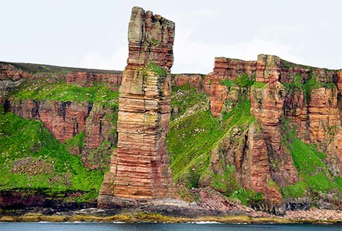
For most, the best choice is the Scrabster-Stromness ferry, operated by NorthLink (3/day in each direction in summer, 2/day off-season, 1.5-hour crossing, www.northlinkferries.co.uk). While it’s a slightly longer crossing, it’s also a bigger boat, with more services (including a good sit-down cafeteria—and famously tasty fish-and-chips), and it glides past the Old Man of Hoy, giving you an easy glimpse at one of Orkney’s top landmarks. This ferry is coordinated with bus #X99, connecting Scrabster to Inverness (www.stagecoachbus.com).
The Gills Bay-St. Margaret’s Hope route is operated by Pentland Ferries. In addition to being cheaper than the NorthLink ferry, its main advantage is the proximity of Gills Bay to John O’Groats, making it easy to visit Britain’s northeasternmost point on your way to or from the ferry—but Gills Bay is also that much farther from Inverness (4/day in each direction in peak season, 1-hour crossing, www.pentlandferries.co.uk).
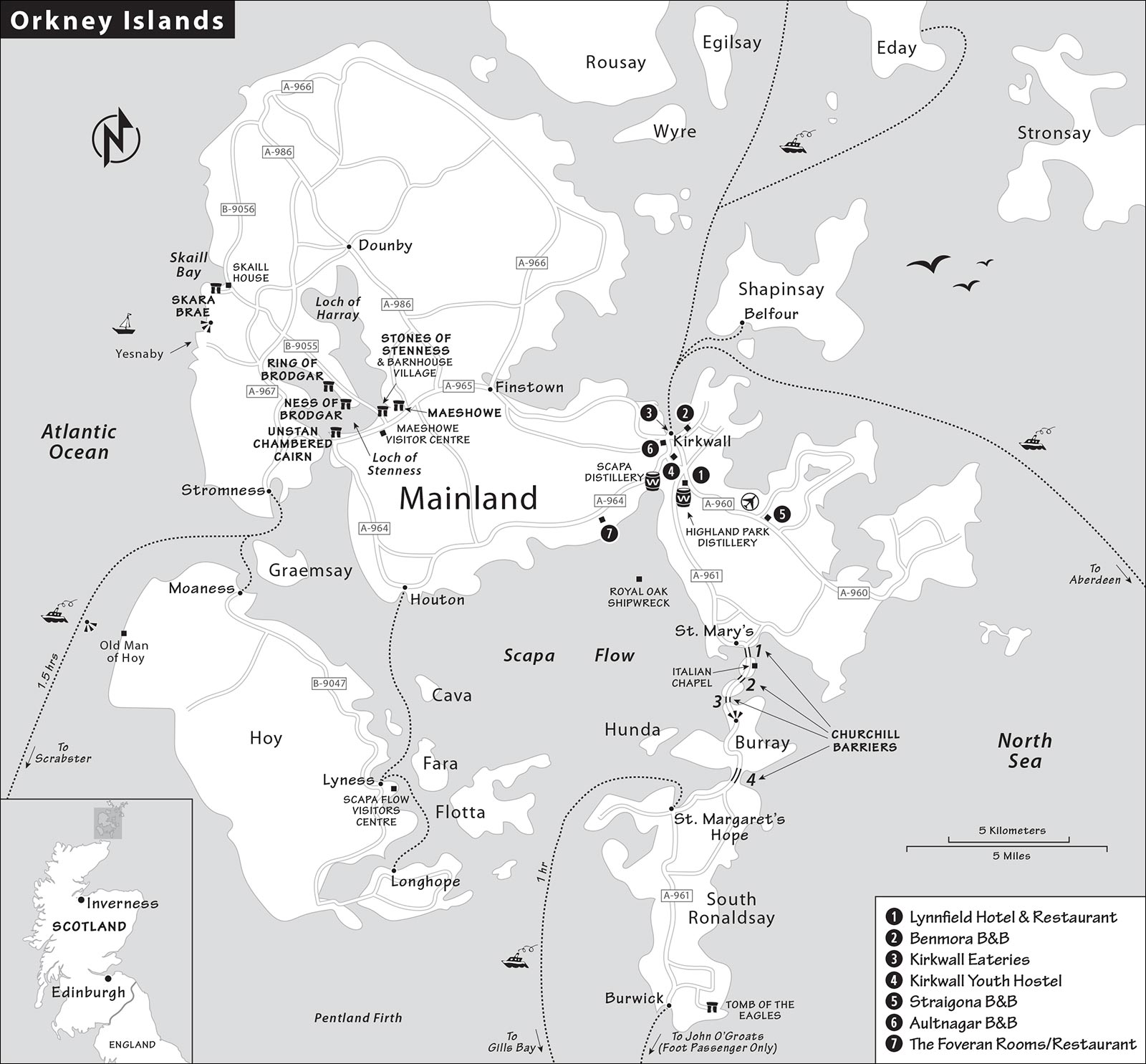
There’s also a passenger-only boat directly from John O’Groats to Burwick, which connects conveniently to an onward bus to Kirkwall (£18 one-way, 2/day May-Sept, none Oct-April, 40-minute crossing, no credit card payments on ship—book online in advance or bring cash, www.jogferry.co.uk). This works for those leaving their car at John O’Groats for a quick Orkney day trip, but it’s more weather-dependent.
By Plane: Kirkwall’s little airport has direct flights to Inverness, Edinburgh, Glasgow, and Aberdeen. Landing at the airport, you’re four miles southeast of Kirkwall; pick up a town map at the info desk. It’s convenient to pick up a rental car at the airport (see below). There are not many taxis, so without a car your best bet is the bus that runs every 30 minutes—just pay the driver (code: KOI, +44 1856 872 421, www.hial.co.uk/kirkwall-airport).
By Tour from Inverness: The John O’Groats foot ferry operates a very long all-day tour from Inverness that includes bus and ferry transfers, and a guided tour around the main sights (£85, none Oct-April, www.jogferry.co.uk).
GETTING AROUND ORKNEY
While this chapter is designed for travelers with a car (or a driver/guide—see “Tours on Orkney,” below), public buses do connect sights on Mainland (operated by Stagecoach, www.stagecoachbus.com). From Mainland, ferries fan out to outlying islets (www.orkneyferries.co.uk); the main ports are Kirkwall (for points north) and Houton (for Hoy). If taking a car on a ferry, it’s always smart to book ahead.
Car Rental: WR Tullock and Sons—a family business that’s been selling and renting cars on Orkney for five generations—represents Avis and Europcar with offices at the Kirkwall airport and in town by St. Magnus Cathedral (+44 1856 876 262, www.wrtullock.com/rental-car-list).
TOURS ON ORKNEY
Local Guide: Husband-and-wife team Kinlay and Kirsty run Orkney Uncovered. Energetic and passionate about sharing their adopted home with visitors, they’ll show you both prehistoric and wartime highlights (everything in this chapter—which Kinlay helped research). They’re also happy to tailor an itinerary to your interests and offer a special price for Rick Steves readers (RS%—£475 for a full-day tour for up to 4 people in a luxury 6-person van, more for up to 6 people, multiday tours and cruise excursions possible, +44 1856 878 822, www.orkneyuncovered.co.uk, enquiries@orkneyuncovered.co.uk).
App: Historic Scotland offers a downloadable Orkney Digital Guide that can help fill in the gaps as you tour both the ancient and WWII sights (£3, https://stor.scot/products/orkney-digital-guide).
Kirkwall
Kirkwall (pop. 9,000) is tidy and functional. Like the rest of the island, most of its buildings are more practical than pretty. But it has an entertaining and interesting old center and is a smart home base from which to explore the island. Whether sleeping here or not, you’ll likely pass through at some point (to gas up, change buses, use the airport, or stock up on groceries).
Orientation to Kirkwall
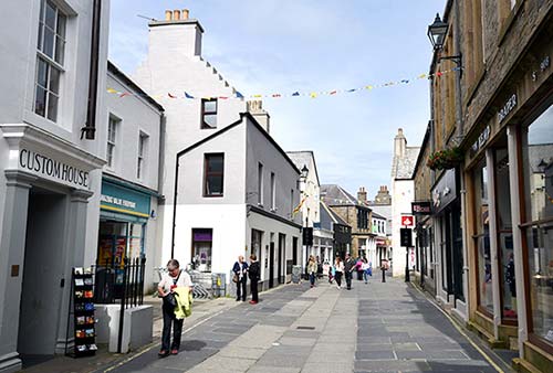
Historic Kirkwall’s shop-lined, pedestrian-only main drag leads from the cathedral down to the harbor, changing names several times as it curls through town. It’s a workaday strip, lined with a combination of humble local services (a butcher, an optometrist) and upscale gift shops (Hume Sweet Hume, The Brig Larder). You’ll pop out at the little harbor, where fishing boats bob and ferries fan out to the northern islets.
The handy TI is at the bus station (on West Castle Street, daily 9:00-17:00, +44 1856 872 856, www.visitscotland.com, but see also the helpful www.orkney.com). They produce a handy weekly “What’s On” bulletin with events and tourist news—ask where you might find live music at night.
If you don’t have a car, Craigies Taxi is reliable and responds quickly to a call (+44 1856 878 787).
Sights in Kirkwall
▲St. Magnus Cathedral
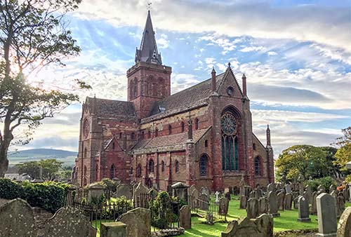
This grand edifice, which has a pointy steeple that is visible from just about anywhere in town, is one of Scotland’s most enjoyable churches to visit. The building dates from the 12th century, back when this was part of the Parish of Trondheim, Norway. Built from vibrant red sandstone by many of the same stonemasons who worked on Durham’s showpiece cathedral, St. Magnus is harmonious Romanesque inside and out: stout columns and small, rounded windows and arches. Inside, it boasts a delightful array of engaging monuments, all well described by the app: a bell from the Royal Oak battleship, sunk in Scapa Flow in 1939; a reclining monument of arctic explorer John Rae, who appears to be enjoying a very satisfying eternal nap; the likely bones of St. Magnus (a beloved local saint); and many other characteristic flourishes. But the highlight is the gravestones that line the walls of the nave, each one carved with reminders of mortality: skull and crossbones, coffin, hourglass, and the shovel used by the undertaker. Read some of the poignant epitaphs: “She lived regarded and dyed regreted.”
Cost and Hours: Free; Mon-Sat 9:00-13:00 & 14:00-17:00, Sun open only for services; use free Wi-Fi at the cathedral to download free app with a guided tour.
Nearby: The Bishop and Earl’s Palaces (across the street) are a pair of once-grand, now-empty ruined buildings—for most, they’re not worth the admission fee.
▲▲Orkney Museum
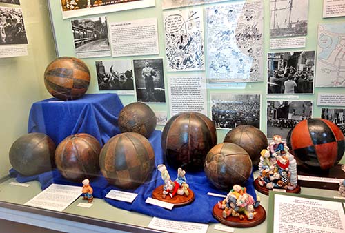
Just across the street from the cathedral, this museum packs the old parsonage with well-described exhibits covering virtually every dimension of history and life on the island. A visit here (to see the Stone Age, Iron Age, and Viking artifacts) can be good preparation before exploring the islands’ archaeological sites. Poking around, you’ll see a 1539 map showing how “Orcadia” was part of Scandinavia, an exhibit about the crazy annual brawl called The Ba’, and lots of century-old photos of traditional life.
Cost and Hours: Free, Mon-Sat 10:30-17:00, closed Sun, fine book shop, +44 1856 873 535, www.orkney.gov.uk.
Mercat Cross
In front of the cathedral stands Kirkwall’s mercat cross (market cross), which is the starting point for the annual event called The Ba’. Short for “ball,” this is a no-holds-barred, citywide rugby match that takes place every Christmas and New Year’s Day. Hundreds of Kirkwall’s rough-and-tumble young lads team up based on neighborhood (the Uppies and the Doonies) and attempt to deliver the ball to the opposing team’s goal by any means necessary. The only rule: There are no rules. While it’s usually just one gigantic scrum pushing back and forth through the streets, other tactics are used (such as the recent controversy when one team simply tossed the ball in a car and drove it to the goal). Ask locals about their stories—or scars—from The Ba’.
▲Scapa Distillery
A short drive outside the town center, with sweeping views of the natural harbor of Scapa Flow, is the Scapa Distillery, a “boutique” whisky distiller founded in 1885. Personable guides give 1.5-hour tours, ending with a chance to try several different whiskies. Scapa doesn’t use peat to dry its barley, resulting in a sweeter, fruitier flavor. Some tours end in the exquisite Scapa Noust tasting room, with big glass windows overlooking the harbor and a wooden ship’s hull ceiling.
Cost and Hours: £20 regular tour, £40 version includes tasting room, tours limited to 8-12 people—reservations smart; June-Sept daily 10:00-17:00, no tours Oct-May; takeaway kits available, gift shop, two miles southwest of Kirkwall in St. Ola, +44 1856 873 269, www.maltwhiskydistilleries.com/scapa.
Highland Park Distillery
The bigger, more commercial Highland Park Distillery is closer to town in a sprawling stone facility that’s been distilling whisky since 1798 (legally). They give 75-minute tours similar to other distilleries, but this is one of a handful in all of Scotland that malts its own barley—you’ll see the malting floor (where the barley is spread and stirred while germinating) and the peat-fired kilns. While the distillery is “silent” for much of July and August, its tour is good even if the workers are gone.
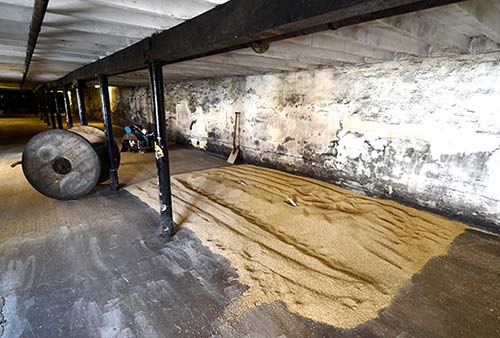
Cost and Hours: £30, includes three tastes, daily 10:00-17:00, reservations required; on the edge of town to the south, toward the Scapa Flow WWII sites; +44 1856 885 604, www.highlandparkwhisky.com.
Sleeping in Kirkwall
These accommodations are in or near Kirkwall. Orkney’s B&Bs are not well marked; get specific instructions from your host before you arrive.
In Kirkwall: $$ Lynnfield Hotel rents 20 rooms with modern hotel amenities. Rooms in the original building are more traditional while those in the new building have a contemporary feel (on Holm Road/A-961, +44 1856 872 505, good on-site whisky bar, www.lynnfield.co.uk).
$ Benmora B&B is a modern home with three plain-Jane rooms in a stellar location just a five-minute walk from the ferry terminal (Cromwell Road, +44 1856 874 956, www.benmora.co.uk, carolyn@benmora.co.uk, Carolyn).
The ¢ Kirkwall Youth Hostel rents both dorm beds and private rooms (Old Scapa Road, 15-minute walk from center, +44 1856 872 243, www.hostellingscotland.org.uk).
In the Countryside: Just past the airport, $ Straigona B&B has three comfortable rooms in a quiet modern home, run by helpful Julie and Mike (2-night minimum stay in summer, about a 5-minute drive outside of Kirkwall, +44 1856 861 328, www.straigona.co.uk).
$$ Aultnagar B&B, on the other side of town above the golf course with views over Kirkwall and its harbor, has three bright rooms with a private entrance (continental breakfast, +44 1856 879 611, Sunnyside Road, https://aultnagaraccommodation.co.uk, aultnagaracccommodation@gmail.com, Laura).
For grand views over Scapa Flow, the recommended restaurant $$ The Foveran has eight ground-floor rooms, some with contemporary flourishes and others more traditional (3-night minimum in summer, 5 minutes from Kirkwall by car on the A-964, +44 1856 872 389, www.thefoveran.com).
Eating in Kirkwall
The main pedestrian street connecting the harbor and cathedral is lined with options. Hotels along the harbor are also a good bet for dinner.
$$ Judith Glue and the Real Food Café is a souvenir-and-craft shop featuring handmade knitwear designed by Orkney artist Judith Glue, with a cutesy café in the back (Mon-Sat 9:00-18:00, Sun 10:00-17:30, shorter hours off-season, across from the cathedral at 25 Broad Street, +44 1856 874 225).
$ The Harbour Fry is the best place for fish-and-chips, with both eat-in and takeaway options (daily, a half-block off the harbor at 3 Bridge Street, +44 1856 873 170).
$$ Twenty One is a cheerfully modern, casual taphouse with a wide range of beers and an inventive small-plate dinner menu (closed Sun-Tue, on the main pedestrian drag at 21 Albert Street, reserve by email at hello@twentyonekirkwall.co.uk).
Destination Restaurants Near Kirkwall: With talented chefs working hard to elevate Orcadian cuisine—using traditional local ingredients with an international flourish—these are considered the best restaurants around.
$$$$ The Foveran, perched on a bluff with smashing views over Scapa Flow, has a cool, contemporary dining room with a wall of windows (dinner nightly May-Sept, call or email for availability in other months, southwest of Kirkwall on the A-964, +44 1856 872 389, www.thefoveran.com).
$$$$ Lynnfield Hotel, near the Highland Park Distillery on the way out of town, has a more traditional feel (daily, reservations smart in the evening, on Holm Road/A-961, +44 1856 872 505, www.lynnfield.co.uk).
Sights in Orkney
PREHISTORIC SITES
Orkney boasts an astonishing concentration of 5,000-year-old Neolithic monuments—one of the best such collections in Great Britain (and that’s saying something). And here on Orkney, there’s also a unique Bronze and Iron Age overlay, during which Picts, and then Vikings, built their own monuments to complement the ones they inherited. The best of these sites are easily toured along a single stretch of road. Most of these sites are managed by Historic Environment Scotland; for up-to-date visiting and special-event information, search www.historicenvironment.scot.
Background: Five thousand years ago—centuries before Stonehenge—Orkney had a bustling settlement with some 30,000 people (a population larger than today’s). The climate, already milder than most of Scotland thanks to the Gulf Stream, was even warmer then, making this a desirable place to live. Orkney’s prehistoric residents left behind structures from every walk of life: humble residential settlements (Skara Brae, Barnhouse Village), mysterious stone circles (Ring of Brodgar, Stenness Stones), more than 100 tombs (Maeshowe, Unstan), and what appears to be a sprawling ensemble of spiritual buildings (the Ness of Brodgar). And, this being the Stone Age, all of this was accomplished using tools made not of metal, but of stone and bone. Many more sites await excavation. (Any time you see a lump or a bump in a field, it’s likely an ancient site—identified with the help of ground-penetrating radar—and protected by the government.) Actual artifacts from these sites are on display only in the Orkney Museum in Kirkwall. While you could spend days poring over all of Orkney’s majestic prehistoric monuments, on a short visit focus on the following highlights.
▲▲▲Maeshowe
The finest chambered tomb north of the Alps, Maeshowe (mays-HOW) was built around 3500 BC. From the outside, it looks like yet another big mound. But inside, the burial chamber is remarkably intact. The only way to go inside is on a fascinating 30-minute tour, limited to 16 people at a time. How the builders managed to cut and transport gigantic slabs of sandstone, then assemble this dry-stone, corbeled pyramid—all in an age before metal tools—still intrigues present-day engineers. Adding to this place’s mystique, in the 12th century, a band of Norsemen took shelter here for three days during a storm, and entertained themselves by carving runic messages into the walls—many of them still readable.
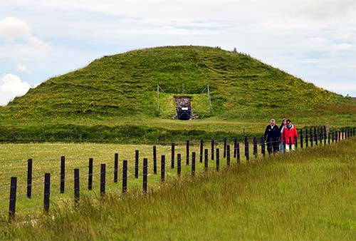
Cost and Hours: £10—book online in advance; ticket includes shuttle ride to the cairn and guided tour; tours run at 10:00, 12:00, 14:00, and 16:00 (no 16:00 tour in Oct-March); visitor center open daily 10:00-16:00; site closes in bad weather, +44 1856 761 606, www.historicenvironment.scot.
Ticket Tips: If you can’t get a reservation, it’s worth stopping by in person to see if any cancellations or additional departures have opened up.
Visiting Maeshowe: Tours depart from the Maeshowe Visitor Centre at Stenness village (be there at least 15 minutes before your tour time). The visitor center has a small exhibit, gift shop, and WCs. From there you board a shuttle bus for the one-mile ride to the site, then walk a flat path along a cow pasture to the grass-covered tomb. Squeezing through the entrance tunnel, you emerge into a space likely designed for ancestor worship, surrounded by three smaller cells. The guide explains the history of the tomb, from its construction, through visits by Vikings and Victorian-age antiquarians, up to today’s archaeological research. At the winter solstice, the setting sun shines through the entrance tunnel, illuminating the entrance to the main cell.
Maeshowe Alternative: If you can’t get in to Maeshowe, the similar Unstan Chambered Cairn, three miles to the southwest, is free to enter without a tour. A signboard at the entrance explains the history of the cairn, which contained human remains and Neolithic pottery when it was first excavated. That pottery’s fine-grooved decorations have come to be known as “Unstan ware.”
▲▲Prehistoric Sites near Maeshowe
A narrow spit of land just a few hundred yards from Maeshowe is lined with several stunning, free-to-visit, always “open” Neolithic sites (from the Maeshowe Visitor Centre, head north on the A-965 and immediately turn left onto the B-9056, following Bay of Skaill signs). Along this road, you’ll reach the following sites, in this order (watch for the brown signs). Conveniently, these line up on the way to Skara Brae.
(In summer, these sights can be overwhelmed by tourists during the day. If you’re staying overnight, try visiting either very early or very late, and you’ll have these evocative sights all to yourself.)
Stones of Stenness: Three-and-a-half standing stones survive from an original 12 that formed a 100-foot-diameter ring. Dating from around 3000 BC, these are some of the oldest standing stones in Britain (a millennium older than Stonehenge). A few sheep are usually napping nearby. In summer, Historic Scotland rangers lead daily one-hour tours at 10:00 (meet at the entrance to the stones).
Barnhouse Village: From the Stones of Stenness, a footpath continues through the field to the Barnhouse Village. Likely built around the same time as the Stones of Stenness, this was probably a residential area for the priests and custodians of the ceremonial monuments all around. Discovered in 1984, much of what you see today has been reconstructed—making this the least favorite site of archaeological purists. Still, it provides an illuminating contrast to Skara Brae: While the Skara Brae homes were built underground, the ones at Barnhouse were thatched stone huts not unlike ones you still see around Great Britain today. The entire gathering was enclosed by a defensive wall.
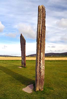
Back on the road, just before the causeway between two lochs—saltwater on the left and freshwater on the right—two pillars flank the road (one intact, the other stubby). These formed a gateway of sorts to the important Neolithic structures just beyond.
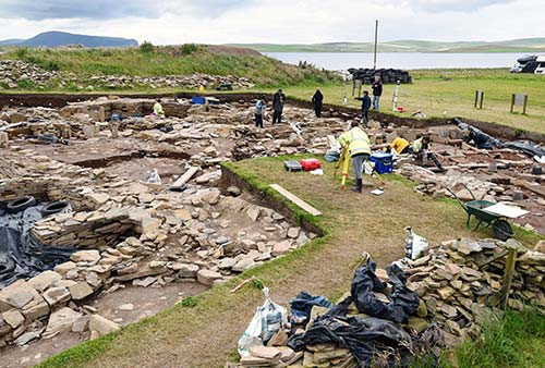
Ness of Brodgar: On the left, look for either a busy excavation site in action—or an empty field. Only discovered in 2003, the Ness of Brodgar is an ensemble of important ceremonial buildings...think of it as the “Orkney Vatican” that archaeologists have been excavating for the past 20 years. The biggest foundation, nicknamed “the Cathedral,” appears to have been a focal point for pilgrimages. As 2024 may be the last season of digging at the Ness (in order to preserve what’s left of the ruins), the site may not be open to the public when you visit (check www.nessofbrodgar.co.uk for updates).
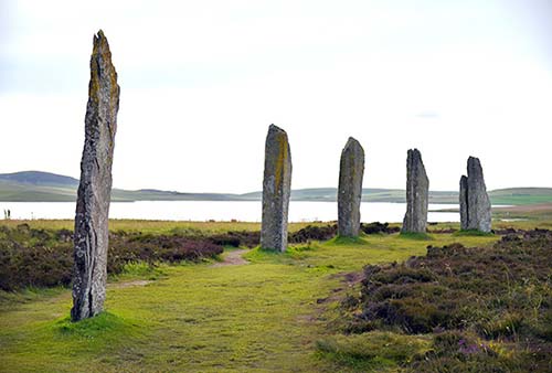
The Ring of Brodgar: Farther along on the left, look for a circle of standing stones capping a ridge above the road, then park 300 yards past the stones, across the street. A short path leads back to the stones, and signboards explain what you are seeing. The Ring of Brodgar is more than three times larger than the Stones of Stenness (and about 500 years newer). Of the original 60 or so stones—creating a circle as wide as a football field—25 still stand. The ring, which sits amidst a marshy moor, was surrounded by a henge (moat) that was 30 feet wide and 20 feet deep. Some of the stones are carved with “graffiti”—names of visitors from the late 19th century and early 20th century, as well as some faint Norse runes carved by a Viking named Bjorn around AD 1150. Historic Scotland rangers lead free one-hour tours daily in summer at 13:00.
▲▲▲Skara Brae
At the far-eastern reaches of Mainland (about a 20-minute drive from Maeshowe), this remarkable site illustrates how some Neolithic people lived like rabbits in warrens—hunkered down in subterranean homes, connected by tunnels and lit only by whale-oil lamps. Uncovered by an 1850 windstorm, Skara Brae (meaning roughly “village under hills”) has been meticulously excavated and is very well presented.
Cost and Hours: £11, reservations required in season—book online at least a week in advance to guarantee entry; daily 9:30-17:30, Oct-March 10:00-16:00; café, WCs, www.historicenvironment.scot. Skara Brae can sell out when cruise ships are in town. You’ll be turned away at the entrance to the parking lot if you don’t have a reservation.
Visiting Skara Brae: Begin your visit in the small exhibition hall, where you’ll watch a short film and see displays on Neolithic life. Exiting the exhibit, walk inside a reconstructed home from Skara Brae—with a hearth, beds, storage area, and live-bait tanks dug into the floor. Because wood was scarce, rock was used to make everything, even the furniture. Then walk across a field where plaques count backward in time, from the moon landing, to ancient Rome, to the pyramids, to Stonehenge—until, finally, you arrive at Skara Brae. Museum attendants stand by at the site to answer any questions.
The oldest, stand-alone homes at Skara Brae were built around 3100 BC; a few centuries later, the complex was expanded and connected with tunnels. You’ll walk on a grassy ridge just above the complex, peering down into 10 partially ruined homes and the tunnels that connect them. For safety, all of this was covered with turf, with only two or three entrances and exits. Because sandstone is a natural insulator, these spaces—while cramped and dank—would have been warm and cozy during the frequent battering storms. If you see a grate, squint down into the darkness: A primitive sewer system, flushed by a rerouted stream, ran beneath all of the homes, functioning not too differently from modern sewers. And all of this was accomplished without the use of metal tools. They even created an ingenious system of giant stone slabs on pivots, allowing them to be opened and closed like modern doors.
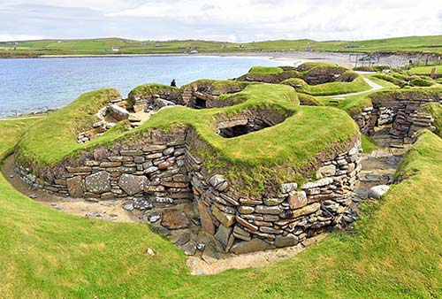
Before leaving, look out over the nearby bay, and consider that this is only about one-third of the entire size of the original Skara Brae. What’s now a curve of sandy beach was once a freshwater loch. But with the rising Atlantic, the water became unusable. About 800 years after it was built, the village was abandoned; since then, most of it has been lost to the sea. A retaining wall protects what’s left of the site from continuing erosion. This area is called Skaill Bay, from the Old Norse skål, for “cheers!”—during Viking times, this was a popular place for revelry...but the revelers had no clue they were partying on top of a Neolithic village.
And now for something completely different: Your ticket to Skara Brae also includes the Skaill House, the sprawling stone mansion on the nearby hilltop. Here you can tour some lived-in rooms (c. 1950) and see a fascinating hodgepodge of items once important to a leading Orkney family. Some items illustrate Orkney’s prime location for passing maritime trade: The dining room proudly displays Captain James Cook’s dinner service—bartered by his crew on their return voyage after the captain was killed in Hawaii (Orkney was the first place they made landfall in the UK). You’ll also see traditional Orkney chairs (with woven backs for warmth); in the library, an Old Norse “calendar”—a wooden stick that you could hold up to the horizon at sunset to determine the exact date; a Spanish chest salvaged from a shipwreck; and some very “homely” (and supposedly haunted) bedrooms.
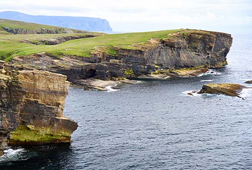
Nearby: About five miles south of Skara Brae, the sightseeing twofer of Yesnaby is worth a quick visit for drivers (watch for the turnoff on the B-9056). On a bluff overlooking the sea, you’ll find an old antiaircraft artillery battery from World War II, and some of Orkney’s most dramatic sea-cliff scenery.
SCAPA FLOW: WORLD WAR II SITES
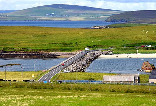
For a quick and fascinating glimpse of Orkney’s World War II locations, drive 10 minutes south from Kirkwall on the A-961 (leave town toward St. Mary’s and St. Margaret’s Hope, past the Highland Park Distillery) to the natural harbor called Scapa Flow (see the sidebar). From the village of St. Mary’s, you can cross over all four of the Churchill Barriers, worth ▲▲, with subtle reminders of war all around. The floor of Scapa Flow is littered with shipwrecks, and if you know where to look, you can still see many of them as you drive by.
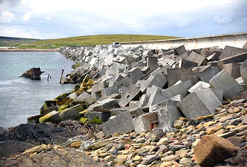
Barrier #1 crosses from St. Mary’s to the Isle of Burray. This narrow channel is where, in the early days of World War II, the German U-47 slipped between sunken ships to attack the Royal Oak—demonstrating the need to build these barriers. Notice that the Churchill Barriers have two levels: smaller quarried stone down below, and a Jenga-like jumble of huge concrete blocks on top.
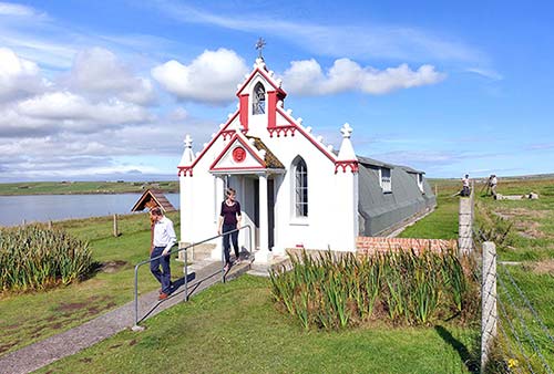
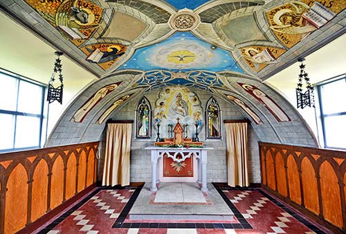
Just over the first barrier, perched on the little rise on the left, is one of Orkney’s most fascinating wartime sites: the Italian Chapel (£3.50, daily 9:00-17:30 in summer, shorter hours off-season, www.orkney.com—search “Italian Chapel”). Italian POWs who were captured during the North African campaign (and imprisoned here on Orkney to work on the Churchill Barriers) were granted permission to create a Catholic chapel to remind them of their homeland. While the front view is a pretty Baroque facade, if you circle around you’ll see that the core of the structure is two prefab Nissen huts (similar to Quonset huts). Inside, you can see the remarkable craftsmanship of the artists who decorated the church. In 1943, Domenico Chiocchetti led the effort to create this house of worship, and personally painted the frescoes that adorn the interior. The ethereal Madonna e Bambino over the main altar is based on a small votive he had brought with him to war. An experienced ironworker named Palumbi used scrap metal (much of it scavenged from sunken WWI ships) to create the gate and chandeliers, while others used whatever basic materials they could to finish the details. (Notice the elegant corkscrew base of the baptismal font near the entrance; it’s actually a suspension spring coated in concrete.) These lovingly crafted details are a hope-filled symbol of the gentility and grace that can blossom even during brutal wartime. (And the British military is proud of this structure as an embodiment of Britain’s wartime ethic of treating POWs with care and respect.) Spend some time examining the details—such as the stained-glass windows, which are painted rather than leaded. The chapel was completed in 1944, just two months before the men who built it were sent home. Chiocchetti returned for a visit in the 1960s, bringing with him the wood-carved Stations of the Cross that now hang in the nave.
Continuing south along the road, you’ll cross over two more barriers in rapid succession. You’ll see the masts and hulls of shipwrecks (on the left) scuttled here during World War I to block the harbor. As you cross over the bridges, notice that these are solid barriers, with no water circulation—in fact, the water level on each side of the barrier varies slightly, since the tide differs by an hour and a half.
At the far end of Barrier #3, on the left, watch for the huge wooden boxes on the beach. These were used in pre-barrier times (World War I) for boom floats, which supported nets designed to block German submarines.
Orkney’s arc of scattered islands forms one of the world’s largest natural harbors, called Scapa Flow (SKAH-pah flow). The Norsemen named this area skalpai floi—“scabbard water,” where a sword was sheathed—suggesting that they used this area to store their warships when not in use. And in the 20th century, Scapa Flow was the main base for Britain’s Royal Navy.
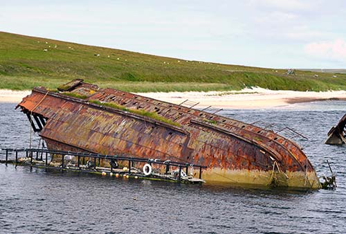
During World War I, to thwart U-boat attacks, dozens of old ships and fishing vessels were requisitioned and intentionally sunk to block the gaps between the islets that define Scapa Flow. You can still see many of these “block ships” breaking the surface today.
At the end of World War I, a fleet of 74 German battleships surrendered at Scapa Flow. On the morning of June 21, 1919—days before the Treaty of Versailles was formally enacted—the British admiral took most of his navy out on a “victory lap” patrol. Once they were gone, the German commander ordered his men to scuttle the entire fleet rather than turn the ships over. By the time the British returned five hours later, 52 German ships littered the bottom of the bay. The British opened fire on the remaining German ships, killing nine Germans—the final casualties of World War I. While most of the ships were later salvaged for scrap, to this day, German crockery washes up on Orkney beaches after a storm. Seven ships remain underwater, making this one of Europe’s most popular scuba diving destinations.
Scapa Flow also played an important role in World War II. Even before Britain declared war on Germany, Luftwaffe reconnaissance flights had identified a gap in the sunken-ship barriers around the harbor. And on October 14, 1939—just weeks after war was declared—a Nazi U-47 slipped inside the harbor and torpedoed the HMS Royal Oak, killing 834 (including 110 seamen-in-training under the age of 15). To this day, the battleship—which had been fully loaded with fuel and ordnance—sits on the bottom of the bay, marked with a green warning buoy.
In April 1940, Luftwaffe planes flew from German-occupied Norway to bomb Orkney for three days straight in what’s termed the “Battle of Orkney.” But the islands were bulked up with heavy-duty gun batteries and other defenses, turning Orkney into a fortress. A sea of blimps called “barrage balloons”—designed to interfere with air attacks—clogged the air overhead. They even built a false fleet out of wood (also protected by barrage balloons) as a decoy for the Luftwaffe. The local population of 22,000 was joined by some 80,000 troops. Many surviving fragments from the Battle of Orkney can still be seen all over the island.
To ensure that no further surprises would sneak into the bay, First Lord of the Admiralty Winston Churchill visited here (just weeks before becoming prime minister) and hatched a plan to build sturdy barriers spanning the small distances between the islands south of Kirkwall. Throughout the wartime years, British workers and Italian prisoners of war labored to construct the “Churchill Barriers.” The roads on top of the barriers opened just a few days after V-E Day, and today tourists use them to island-hop—and to learn about the dramatic history of Scapa Flow.
After Barrier #3, as you climb the hill, watch for the pullout on the right with an orientation board. From this viewpoint, you can see three of the Churchill Barriers in one grand panorama.
Continuing south, the next barrier isn’t a Churchill Barrier at all—it’s an ayre, a causeway that was built during the Viking period.
Finally, you’ll reach Barrier #4—hard to recognize because so much sand has accumulated on its east side (look for the giant breakwater blocks). Surveying the dunes along this barrier, notice the crooked concrete shed poking up—actually the top of a shipwreck. The far side of this sand dune is one of Orkney’s best beaches—sheltered and scenic.
From here, the A-961 continues south past St. Margaret’s Hope (where the ferry to Gills Bay departs) and all the way to Burwick, at the southern tip of South Ronaldsay. From here you can see the tip of Scotland. Nearby is the Tomb of the Eagles, a burial cairn similar to Maeshowe (currently closed to the public).
More WWII Sites: For those really interested in WWII history, consider a ferry trip out to the Isle of Hoy. The main settlement, Lyness, has the expansive Scapa Flow Visitors Centre, with a modern exhibit worth ▲▲ that explains the scale of wartime military operations on Orkney (https://hoyorkney.com). Near Lyness alone are some 37 Luftwaffe crash sites. A tall hill, called Wee Fea, was hollowed out to hold 100,000 tons of fuel oil. Also on Hoy, you can hike seven miles round-trip to the iconic Old Man of Hoy—a 450-foot-high sea stack in front of Britain’s tallest vertical sea cliffs. (Or you can see it from a distance from the deck of the Stromness-Scrabster ferry.)
FERRY PORT TOWNS
With more time, check out these two towns with connections to northern Scotland. Stromness is Orkney’s “second city,” with 3,000 people. It’s a stony 17th-century fishing town and worth a look. Equal parts fishing town and tourist depot, its traffic-free main drag has a certain salty charm. If driving, there’s easy parking at the harbor. When catching the ferry to Scrabster, get here early to enjoy a stroll.
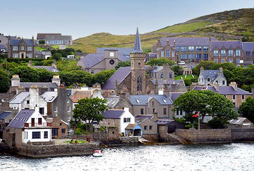
St. Margaret’s Hope—named for a 13th-century Norwegian princess who was briefly Queen of Scots until she died en route to Orkney—is even smaller, with a charming seafront-village atmosphere. Ferries leave here for Gills Bay.