GLENCOE & FORT WILLIAM
Glencoe • Fort William • Road to the Isles
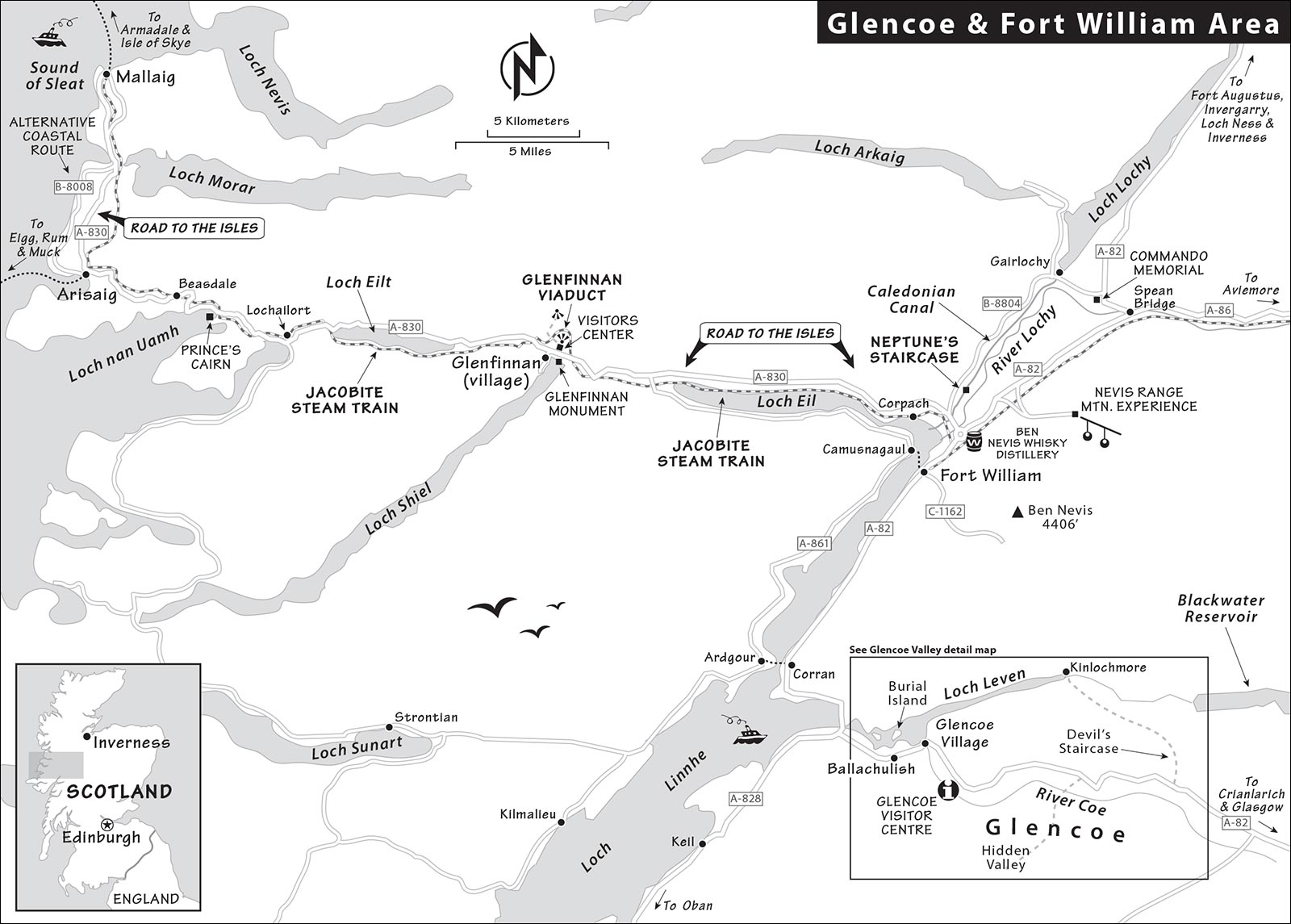
Map: Glencoe & Fort William Area
Sleeping and Eating in Fort William
Sights on the Road to the Isles
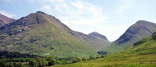
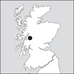
Scotland is a land of great natural wonders. And some of the most spectacular—and most accessible—are in the valley called Glencoe, just an hour north of Oban and on the way to Fort William, Loch Ness, Inverness, or the Isle of Skye. The evocative “Weeping Glen” of Glencoe aches with both history and natural beauty. Beyond that, Fort William anchors the southern end of the Caledonian Canal, offering a springboard to more Highlands scenery. This is where Britain’s highest peak, Ben Nevis, keeps its head in the clouds, and where you’ll find a valley made famous by a bonnie prince...and (later) by a steam train carrying a young wizard named Harry.
PLANNING YOUR TIME
On a quick visit, this area warrants just a few hours between Oban and either Inverness or Skye: Stop at the Glencoe Visitors Center, then drive up Glencoe valley for views and perhaps a short hike before continuing north. But if you have only a day or two to linger in the Highlands, Glencoe is an ideal place to do it. Settle in for a night (or more) to make time for a more leisurely drive and to squeeze in a hike or two.
Beyond Glencoe, Fort William—a touristy and overrated transportation hub—is skippable, but can be a handy lunch stop. The “Road to the Isles,” stretching west from Fort William to the coast, isn’t worth a detour on its own, but is logical for those connecting to the Isle of Skye. Along the way, the only stop worth more than a quick photo is Glenfinnan, with its powerful ties to Bonnie Prince Charlie and Jacobite history and its iconic viaduct.
Glencoe
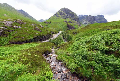
This valley is the essence of the wild, powerful, and stark beauty of the Highlands. Along with its scenery, Glencoe offers a good dose of bloody clan history: In 1692, government Redcoats (led by a local Campbell commander) came to the valley and were sheltered and fed for 12 days by the MacDonalds—whose leader had been late in swearing an oath to the British monarch. Then, on the morning of February 13, the soldiers were ordered to rise up early and kill their sleeping hosts, violating the rules of Highland hospitality and earning the valley the nickname “The Weeping Glen.” Thirty-eight men were killed outright; hundreds more fled through a blizzard, and some 40 additional villagers (mostly women and children) died from exposure. It’s fitting that such an epic, dramatic incident—dubbed the Glencoe Massacre—should be set in this equally epic, dramatic valley, where the cliffsides seem to weep (with running streams) when it rains.
Aside from its tragic history, this place attracts all manner of outdoor enthusiasts, who come here to hike, mountain bike, climb, fish, sail, and even dive. Glencoe has also captured the imaginations of artists. Movies filmed here include, among others, Monty Python and the Holy Grail, Harry Potter and the Prisoner of Azkaban, and the James Bond film Skyfall. Glencoe also appears in the opening credits for the TV series Outlander. When filmmakers want a stunning, rugged backdrop; when hikers want a scenic challenge; and when Scots want to remember their hard-fought past...they think of Glencoe.
Orientation to Glencoe
The valley of Glencoe is an easy side trip just off the main A-828/A-82 road between Oban and points north (such as Fort William and Inverness). If you’re coming from the north, the signage can be tricky—at the roundabout south of Fort William, follow signs to Crianlarich and A-82.
The sleepy one-street village of Glencoe is the blink-and-you’ll-miss-it gateway to the valley. There’s a free parking lot and pay WC at the village entrance, a modest folk museum worth a look if you have extra time, and a friendly and well-stocked grocery store (near the museum, daily 9:00-19:00, closes earlier when it’s slow).
The slightly larger and more modern town of Ballachulish (a half-mile away) has more services, including a Co-op grocery store (long hours daily), and more accommodations and restaurants.
In the loch just outside Glencoe (near Ballachulish), notice the burial island—where the souls of those who “take the low road” are piped home. (For an explanation of “Ye’ll take the high road, and I’ll take the low road,” see here.) Specifically, this was the final resting place of members of clan Stewart of Ballachulish, clan Cameron of Callart, and clan MacDonald of Glencoe. The next island was the Island of Discussion—where those in dispute went until they found agreement.
TOURIST INFORMATION
There is no real TI in the area; the independent “information centre” inside Ballachulish’s Quarry Centre café—sharing a parking lot with the Co-op grocery—stocks some brochures and sells souvenirs, but the staff is often more focused on café customers rather than answering travelers’ questions (daily 9:00-17:00, www.ballachulishvisitorcentre.co.uk). There is some good information on the area at https://discoverglencoe.scot. For information on walks and hikes, the best resource is the Glencoe Visitor Centre, a few miles up the valley (described later).
Local Guide: For a healthy dose of history and folklore with your scenery, Craig Dubh Adventures offers guided hikes, lowland walks, and hillwalks in the Glencoe and Fort William areas, including up Ben Nevis, customized for your ability and interest (from £100/day, can also organize bike tours, +44 7738 665 418, www.craigdubhadventures.co.uk, craigdubhadventures@gmail.com, Craig McDonald).
Sights in Glencoe
Glencoe Village
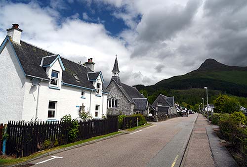
Glencoe village is just a line of houses sitting beneath the brooding mountains. The only sight is the folk museum (described later). But walking the main street gives a good glimpse of village Scotland. From the free parking lot at the entrance to town, go for a stroll. You’ll pass several charming, small homes, many that are now rented out as self-catering accommodations or serving as housing for staff at the area’s big hotels. You’ll also pass the stony Episcopal church, the folk museum, the town’s grocery store, and the village hall.
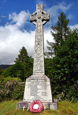
At the far end of the village, on the left just before the bridge, a Celtic cross WWI memorial stands on a little hill. Even this wee village lost 11 souls during that war—a reminder of Scotland’s disproportionate contribution to Britain’s war effort. You’ll see memorials like this (usually either a Celtic cross or a soldier with bowed head) in virtually every town in Scotland.
If you were to cross the little bridge, you’d head up into Glencoe’s wooded parklands, with some easy hikes (described later). But for one more landmark, turn right just before the bridge and walk about five minutes. Standing on a craggy bluff on your right is another memorial—this one to the Glencoe Massacre, which still haunts the memories of people here and throughout Scotland (described earlier).
▲Glencoe Folk Museum
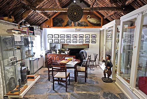
This gathering of thatched-roof, early 18th-century croft houses is a volunteer-run community effort. It’s jammed with local history, creating a huggable museum filled with humble exhibits gleaned from the town’s old closets and attics. When one house was being rethatched, its owner found a cache of 200-year-old swords and pistols hidden there from the government Redcoats after the disastrous Battle of Culloden. You can listen to an interview with the late Arthur Smith, a local historian, about the valley and its story in the “Scottish Highlands” program available on my Rick Steves Audio Europe app.
Cost and Hours: £3; Wed-Sun 11:00-15:00, closed Mon-Tue and in winter; +44 1855 811 664, www.glencoemuseum.com.
Visiting the Museum: In the main building, you’ll see those thatch-hidden swords, along with antique toys, boxes from old food products, sports paraphernalia (look for the crossed shinty sticks), a cabinet of curiosities, mountaineering gear, evocative old black-and-white photos, an exhibit on the slate quarry in nearby Ballachulish, and plenty of information on the MacDonald clan. Be sure to look for the museum’s little door that leads out back, where additional, smaller buildings are filled with everyday items (furniture, farm tools, and so on) and exhibits on the Glencoe Massacre and a beloved Highland doctor. Out here, you’ll also see the “coffin boat” that was used to transport the bodies of the departed to the burial isle in the loch.
▲Glencoe Visitor Centre
This modern facility, a mile past Glencoe village up the A-82 into the dramatic valley, is the gateway to the Glencoe National Nature Reserve (similar to a US national park). The visitor center is designed to resemble a clachan, or traditional Highland settlement. Inside is a big shop, a helpful information desk, a modest exhibit, and a café. Out back you’ll find great views and an interesting reconstructed turf house.
Cost and Hours: Free, daily 9:30-17:00, shorter hours in winter; café, parking-£4, +44 1855 811 307, www.nts.org.uk/visit/places/glencoe.
Visiting the Center: You’ll begin by working your way through the sprawling gift shop. Then, in the back part of the complex, you’ll find an information desk that’s your single best resource for advice (and maps or guidebooks) about local walks and hikes, several of which are outlined later in this chapter. A giant relief map of the nature reserve—clearly marked with various hiking paths—is ideal for understanding routes and difficulty levels before heading out. There’s also a small, rotating exhibit, generally covering Glencoe’s nature and mountaineering, as well as a short film about the Glencoe Massacre.
Continue out back to find a viewpoint, with a smaller 3-D model of the hills for orientation. A short walk away is a thatched-roof turf house that was built from scratch in 2021, using 17th-century materials and methods. The views from here are superb. Step inside the turf house to hear sound effects and smell the peat smoke they use to help preserve the structure. (Free guided tours of the turf house typically run daily in midafternoon.) An easy woodland walk starts nearby.
Glencoe Valley Drive
If you have a car, spend an hour or so following the A-82 through the valley, past the Glencoe Visitor Centre, up into the desolate moor beyond, and back again. You’ll enjoy grand views, dramatic craggy hills, and, if you’re lucky, a chance to hear a bagpiper in the wind: Roadside Highland buskers sometimes set up here on good-weather summer weekends. (If you play the recorder—and the piper’s not swarmed with other tourists—ask to finger a tune while he does the hard work.)
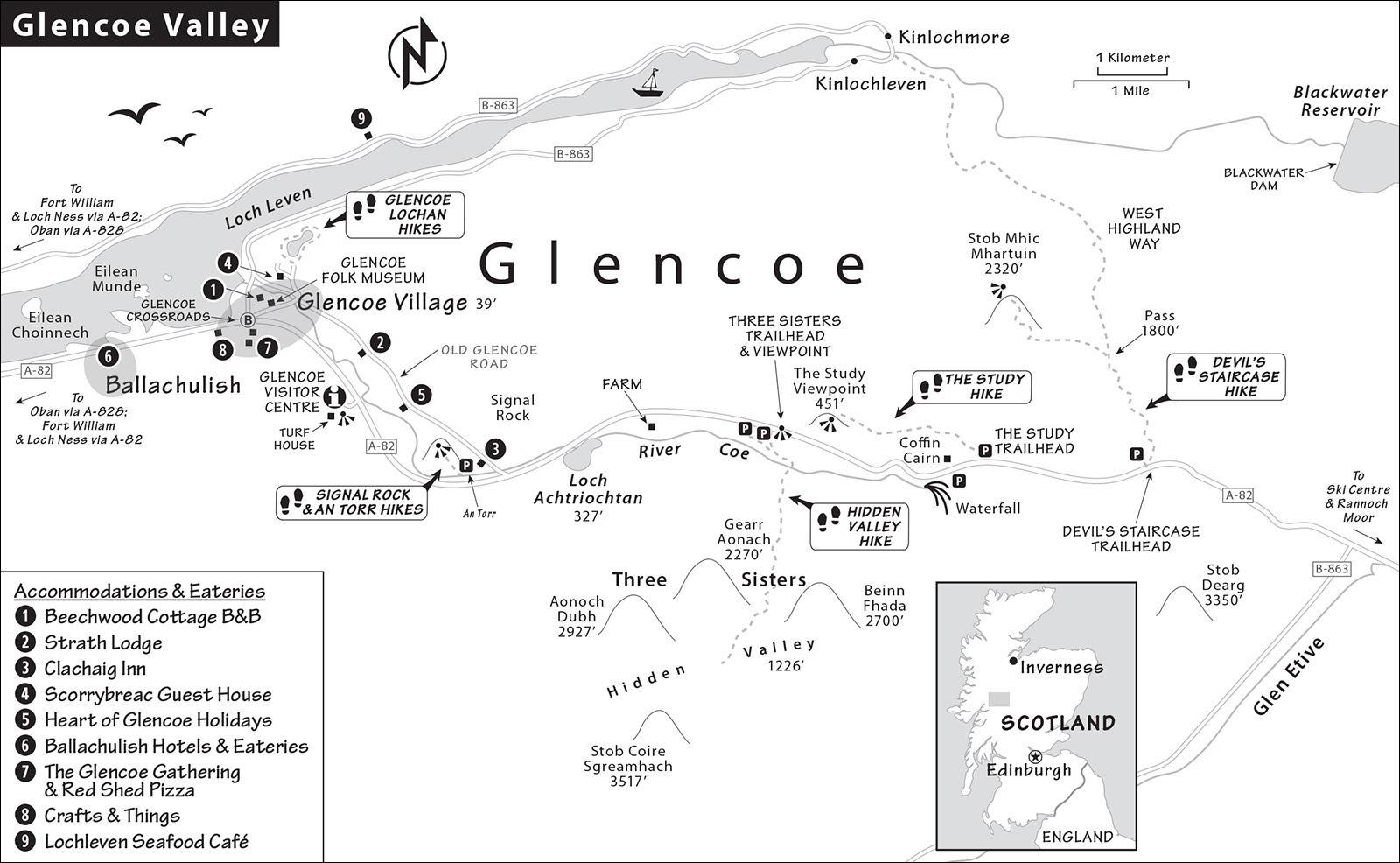
Here’s a brief explanation of the route. Along the way, I’ve pointed out sometimes easy-to-miss trailheads, in case you’re up for a hike (hikes described in the next section).
From Glencoe Village to the End of the Valley: Leaving Glencoe village on the A-82, it’s just a mile to the Glencoe Visitor Centre (on the right, described earlier). Soon after, the road pulls out of the forested hills and gives you unobstructed views of the U-shaped valley.
About a mile after the visitor center, on the left, is a parking lot for Signal Rock and An Torr, a popular place for low-impact forested hikes. Just beyond, also on the left, is a one-lane road leading to the recommended Clachaig Inn, a classic hikers’ pub. (The single-track road continues scenically, along the river then through the woods, all the way back to Glencoe village.) The hillsides above the inn were the setting for Hagrid’s hut in the third Harry Potter movie.
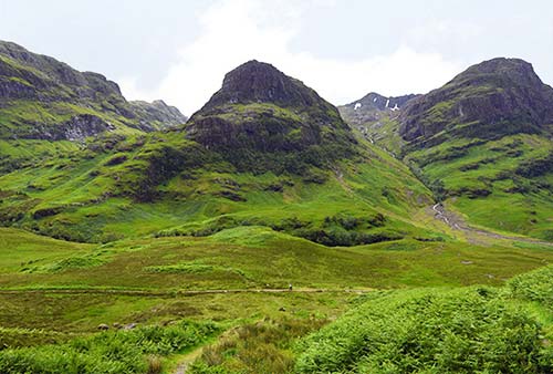
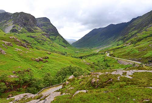
Continuing along the A-82, you’ll hit a straight stretch, passing a lake (Loch Achtriochtan), and then a small farm, both on the right. After the farm, the valley narrows a bit as you cut through Glencoe Pass. Then, on the right, you’ll pass two small parking lots. Pull into the second one for perhaps the best viewpoint of the entire valley, with point-blank views (directly ahead) of the steep ridge-like mountains known as the Three Sisters. Hike about 100 feet away from the pullout to your own private bluff to enjoy the view alone—it makes a big difference. This is also the starting point for the challenging Hidden Valley hike, which leads between the first and second sisters.
As you continue, you’ll pass a raging waterfall in a canyon—the Tears of the MacDonalds—on the right. After another mile or so—through more glorious waterfall scenery—watch on the left for the Coffin Cairn, which looks like a stone igloo (parking is just across the road if you want a photo op). Just after the cairn, look on the left for pullout parking for the hike to The Study, a viewpoint overlooking the road you just drove down.
After this pullout, you’ll hit a straightaway for about a mile, followed by an S-curve. At the end of the curve, look for the pullout parking on the left, just before the stand of pine trees. This is the trailhead for the Devil’s Staircase hike, high into the hills.
Continuing past here, you’re nearing the end of the valley. The intimidating peak called the Great Shepherd of Etive (Stob Dearg, on the right) looms like a dour watchman, guarding the far end of the valley. Soon you’ll pass the turnoff (on the right) for Glen Etive, an even more remote-feeling valley. (This was the setting for the final scenes of Skyfall—where James Bond grew up.) While you could detour up here for some bonus scenery, it just feels empty—with peaty waterfalls flowing into a churning river—and is less striking than what you just drove through.
Continuing past the Glen Etive turnoff, the last sign of civilization (on the right) is the Glencoe Ski Centre, where you can ride the chairlift in summer for views from 2,000 feet (café at valley level, www.glencoemountain.co.uk). From here, the terrain flattens out as you enter the vast Rannoch Moor—50 bleak square miles of heather, boulders, and barely enough decent land to graze a sheep. Robert Louis Stevenson called it the “Highland Desert.”
You could keep driving as far as you like—but the moor looks pretty much the same from here on out. Turn around and head back through Glencoe...it’s scenery you’ll hardly mind seeing twice.
Hiking in Glencoe
Glencoe is made for hiking. Many routes are not particularly well marked, so it’s essential to get specific instructions (from the rangers at the Glencoe Visitor Centre) and equip yourself with a good map (the Ordnance Survey Explorer Map #384, sold at the center). The Walk Highlands website is another good source (www.walkhighlands.co.uk).
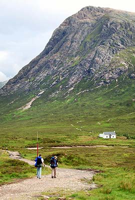
I’ve suggested a few walks and hikes, from easy, level strolls to challenging climbs. Wear proper footwear (even easy trails can be swamped or slippery in wet weather) and carry rain gear—you never know when a storm will blow in. I’ve listed these roughly in order of how close they are to Glencoe village, and provided a rough sense of difficulty for each. Some of them (including the first two) are more forested, but the ones out in the open—which really let you feel immersed in the wonders of Glencoe—are even better.
While you can walk to the first two areas from Glencoe village, the rest are best for drivers. Some of these trailheads are tricky to find—for help locating the hikes off the A-82, see the drive described in the previous section.
Glencoe Lochan (Easy)
Perched on the forested hill above Glencoe village is an improbable slice of the Canadian Rockies. A century ago, this was the personal playground of Lord Strathcona, a local boy done good when he moved to Canada and eventually became a big Canadian Pacific Railway magnate. In 1894, he returned home with his Canadian wife and built the Glencoe House (which is now an exclusive, top-of-the-top hotel). His wife was homesick for the Rockies, so he had the grounds landscaped to represent the lakes, trees, and mountains of her home country. They even carved out a man-made lake (Glencoe Lochan), which looks like a piece of Alberta tucked under a craggy Scottish backdrop. (She was still homesick—they eventually returned to Canada.)
Today, the house and immediate surroundings are closed to visitors, but the rest of the area is open for exploration. Head to the end of Glencoe village, cross the bridge, and continue straight up (following signs for Glencoe Lochan)—it’s a 20-minute uphill walk, or 5-minute drive (free parking), from the village center. Once there, a helpful orientation panel in the parking lot suggests three different, color-coded, one-mile walking loops—mostly around that beautiful lake, which reflects the hillsides of Glencoe.
From this area, a good trail network called the Orbital Recreational Track follows the river through the forest up the valley, all the way to the Clachaig Inn (about 45 minutes one-way). This links you to the Signal Rock and An Torr areas (described next). Eventually they hope to extend this trail system across the valley and back to the Glencoe Visitor Centre, which would allow a handy loop hike around the valley floor.
Signal Rock and An Torr (Easy to Moderate)
This forested area has nicely tended trails and gives you a better chance of spotting wildlife than the more desolate hikes described later. To explore this area, park at the well-marked lot just off the A-82. A panel at the trailhead gives good descriptions of three options: easy yellow route to the Clachaig Inn (including an all-abilities path suitable for wheelchair users); longer blue route to Signal Rock; and strenuous black route along the hillsides of An Torr. The Signal Rock route—so named because a fire could be lit here to alert others in case of danger—offers little in the way of views at the top.
Hidden Valley (Challenging)
Three miles east of Glencoe village, this aptly named glen is tucked between two of the dramatic Three Sisters mountains. Also called the Lost Valley (Coire Gabhail in Gaelic), this was supposedly where the MacDonalds hid stolen cattle from their rivals, the Campbells (who later massacred them). This is the most challenging of the hikes I describe—it’s strenuous and has stretches with uneven footing. Expect to scramble a bit over rocks, and to cross a river on stepping stones (which may be underwater after a heavy rain). As the rocks can be slippery when wet, skip this hike in bad weather. Figure about 2.5-3 hours round-trip (2.5 miles one-way with an ascent of more than 1,000 feet).
Begin at the second parking lot at Glencoe Pass (on the right when coming from Glencoe), with views of the Three Sisters. You’re aiming to head between the first and second Sisters (counting from the left). Hike down into the valley between the road and the mountains. Bear left, head down a metal staircase, and cross the bridge over the river. (Don’t cross the bridge to the right of the parking lots—a common mistake.) Once across, you’ll start the treacherous ascent up a narrow gorge. Some scrambling is required, and at one point a railing helps you find your way. The next tricky part is where you cross the river. You’re looking for a pebbly beach and a large boulder; stepping stones lead across the river, and you’ll see the path resume on the other side. But if the water level is high, the stones may be covered—though still passable with good shoes and steady footing. (Don’t attempt to scramble over the treacherous slopes on the side of the river with the loose rocks called scree.) Once across the stepping stones, keep on the trail, hiking farther up into the valley.
Much Easier Alternative: If you’d simply enjoy the feeling of walking deep in Glencoe valley—with peaks and waterfalls overhead—you can start down from the parking lot toward the Hidden Valley trail, and then simply stroll the old road along the valley floor as far as you want in either direction.
The Study (Easy to Moderate)
For a relatively easy, mostly level hike through the valley with a nice viewpoint at the end, consider walking to the flat rock called “The Study” and back. It takes about 45-60 minutes round-trip. The walk essentially parallels the main highway, but on the old road a bit higher up. You’ll park just beyond the Three Sisters and the Coffin Cairn. From there, cut through the field of stone and marshy turf to the old road—basically two gravel tire ruts—and follow them to your left. You’ll hike above the modern road, passing several modest waterfalls, until you reach a big, flat rock with stunning views of the Three Sisters and the valley beyond. (Fellow hikers have marked the spot with a pile of stones.)
The Devil’s Staircase (Strenuous but Straightforward)
About eight miles east of Glencoe village, near the end of the valley, you can hike this brief stretch of the West Highland Way. It was built by General Wade, the British strategist who came to Scotland after the 1715 Jacobite rebellion to help secure government rule here. Designed to connect Glencoe valley to the lochside town of Kinlochmore, to the north, it’s named for its challenging switchbacks. While strenuous, it’s easier to follow and has more comfortable footing than the Hidden Valley hike. Figure about 45-60 minutes up, and 30 minutes back down (add 45-60 minutes round-trip for the optional ascent to the summit of 2,320-foot Stob Mhic Mhartuin).
From the parking lot, a green sign points the way. Most hikers simply ascend to the pass at the top (an 800-foot gain), then come back down to Glencoe. It’s a steep but straightforward hike up, on switchback trails.
From the pass (marked by a piled-stone cairn), you can return back down into the valley. Or, if you have stamina left, consider continuing higher—head up to the peak on the left, called Stob Mhic Mhartuin. The hike to the top (an additional gain of 500 feet) earns you even grander views over the entire valley.
For an even longer hike, it’s possible to continue down the other side of the staircase to Kinlochmore (about 2 hours’ descent)—but your car will still be back in the trailhead parking lot. Consider this plan: Leave your car in Glencoe. Take a taxi to the trailhead. Hike across to Kinlochmore. From there you can take the #N44 bus back to Glencoe, though be aware that the bus only runs a few times midday (see “Glencoe Connections,” later).
Sleeping in Glencoe
The Glencoe area is an extremely low-key place to spend the night between Oban or Glasgow and the northern destinations. You’ll join two kinds of guests: one-nighters just passing through and outdoorsy types settling in for several days of hiking. In addition to the places I list, you’ll find many self-catering options on booking sites such as VRBO or Airbnb.
GLENCOE VILLAGE
$ Beechwood Cottage B&B is a shoes-off, slippers-on, whisky-honor-bar kind of place where Jackie rents three lovely rooms and Iain pursues his rock-garden dreams in the yard while the family cats laze about (no kids under age 12, laundry service available, look for the sign at the church on Main Street, +44 1855 811 062, www.beechwoodcottage.scot, stay@beechwoodcottage.scot).
JUST OUTSIDE TOWN
Strath Lodge, Heart of Glencoe Holidays, and Clachaig Inn are on the back road that runs through the forest parallel to the A-82 (best suited for drivers). Scorrybreac is on a hill above the village. For locations, see the “Glencoe Valley” map, earlier.
$$$ Strath Lodge, energetically run by Dawn and Lawrence, brings a fresh perspective to Glencoe’s sometimes-stodgy accommodations scene. Their three spacious, luxurious-for-a-B&B rooms, in a modern, light-filled, lodge-like home, are partway down the road to the Clachaig Inn (2-night minimum, no kids under 16, +44 1855 811 820, www.strathlodgeglencoe.com, stay@strathlodgeglencoe.com). Take the road up through the middle of Glencoe village, cross the bridge, and keep right following the river for a few minutes; it’s on the right.
$$$ Clachaig Inn, which runs two popular pubs on site, also rents 23 rooms, all en-suite. It’s a family-friendly place surrounded by a dramatic setting that works well for hikers seeking a comfy mountain inn (2-night minimum on weekends in summer, +44 1855 811 252, 3 miles from Glencoe, https://clachaig.com, frontdesk@clachaig.com, general manager William Stewart). Follow the directions for the Strath Lodge, and drive another three miles past the campgrounds and hostels—the Clachaig Inn is on the right.
$$ Scorrybreac Guest House enjoys a secluded forest setting and privileged position next to the restored Glencoe House (now a luxury hotel). From here, walks around the Glencoe Lochan wooded lake park are easy, and it’s about a 10-minute walk down into the village. Emma and Graham rent four peaceful rooms and serve a daily breakfast special that goes beyond the usual offerings (2-3 nights preferred in peak season, handy drying room for wet clothes and boots, +44 1855 811 354, www.scorrybreacglencoe.com, stay@scorrybreacglencoe.com). After crossing the bridge at the end of the village, head left up the hill and follow signs.
$$ Heart of Glencoe Holidays offers a variety of options with kitchenettes. Choose from a cozy “eco-cabin” or permanently parked “caravan” (trailer) that sleep two to four people, or stay in a farmhouse “bothy” sleeping five or six. Three lower-cost rooms are in a newer bunkhouse with a shared kitchen (private rooms sleep four or eight). This is a good choice if you’re traveling with a group or seeking a private, self-catering option that’s close to nature (2-night minimum preferred for cabins and bothies, +44 1855 811 906, www.heartofglencoe.co.uk, info@heartofglencoe.co.uk). It’s a few minutes farther up the road beyond Strath Lodge.
BALLACHULISH
$ St. Munda’s Manse sounds rather grand—because Colin and Mary renovated a lovely old stone house that once belonged to the church down the road. Now they offer two bright rooms that manage to feel both modern and classic, in a quiet location above Ballachulish village (cash only, +44 1855 811 966, www.bedandbreakfastglencoe.com, hello@stmundasmanse.com). See their website for driving directions.
$ Fern Villa Guest House has five classic, cozy, tidy rooms with comfy beds in a big, traditional old stone house midway up the village, plus a lounge with a fireplace for cold nights (good breakfast, Loanfern, +44 1855 811 393, https://fernvilla.scot, ghfernvilla@gmail.com, Catherine and David).
$ Strathassynt Guest House sits in the center of Ballachulish, across from the recommended Laroch Bar & Bistro. The six bedrooms have recently updated bathrooms and are a good value, and you can’t go wrong with Katya’s homemade pancakes for breakfast (family rooms, closed Nov-Jan, +44 1855 811 261, www.strathassynt.com, info@strathassynt.com, Neil and Katya).
Eating in Glencoe
Choices around Glencoe are slim—this isn’t the place for fine dining. But the following options offer decent food a short walk or drive away. For evening fun, take a walk or ask your B&B host where to find music and dancing.
In Glencoe: The only real restaurant is $$$ The Glencoe Gathering, with a busy dining area and a large outdoor deck. The menu has a variety of seafood, burgers, pizza, and pasta. While the food is nothing special, it will fill you up after a day in the mountains (daily 8:00-20:00, at junction of A-82 and Glencoe village, +44 1855 811 265, www.crerarhotels.com/the-glencoe-inn/eat-drink/gathering-bar-grill). In the parking lot out back, their $$ Red Shed Pizza shack sells takeaway, wood-fired pizzas, which you can enjoy at one of the picnic tables.
Facing the loch, $$ Crafts & Things has a pleasant coffee shop serving baked goods, soups, and light lunches (daily 9:30-17:00, shop sells gifts and outdoor clothing, Clennoch Lane, +44 1855 811 325, www.craftsandthings.co.uk, David).
Near Glencoe: Set in a valley a few miles from Glencoe village, $$ Clachaig Inn, one of my recommended accommodations, serves solid pub grub all day long to a clientele that’s half locals and half tourists. This unpretentious and very popular social hub features billiards and live music, and proudly serves more than 400 Scottish whiskies, 150 Scottish gins, and a wide range of hand-pulled ales. There are two areas, sharing the same menu: The Bidean Lounge feels a bit like an upscale ski lodge, while the Boots Bar has a spit-and-sawdust, pub-around-an-open-fire atmosphere (daily, music Sat from 21:00, Sun open-mic folk music also at 21:00, see hotel listing earlier for driving directions, +44 1855 811 252, no reservations, https://clachaig.com/the-food).
If you need to grab lunch on your way to a hike, the $ Glencoe Visitor Centre has a decent café (see listing earlier, daily 9:30-17:00, off-season until 16:00).
In Ballachulish: Aiming to bring some sophistication to this rugged corner of Scotland, $$$ The Laroch Bar & Bistro has both a low-key pub section and a proper restaurant sharing the same menu (closed Mon-Tue, +44 1855 811 940; driving from Glencoe into Ballachulish, it’s on the left, next to the town shinty pitch). A basic $ Quarriers’ Kitchen fish-and-chips and pizza joint is next door (Mon-Sat 16:00-20:00, closed Sun, +44 1855 811 600, http://quarrierskitchen.yolasite.com).
Across the Loch: The only “destination” restaurant between here and Fort William is $$$ Lochleven Seafood Café—across the loch from Glencoe. It requires an extremely scenic 15-minute drive, but it’s worth it for the views and for the food: good, unfussy dishes of mussels, clams, scallops, langoustine, and fish, along with both seafood and landfood specials. It has two indoor areas and outdoor tables, all with views looking out over the loch to the steep hills beyond; it’s worth booking ahead by phone before making the drive (closed Tue-Wed, +44 1855 821 048, www.lochlevenseafoodcafe.co.uk). The seafood is extremely fresh, as they operate their own fishing boats.
Glencoe Connections
Buses stop just outside Glencoe village, near the highway at a place called “Glencoe Crossroads” (in front of The Glencoe Inn, a short walk into the village center). Buses also stop in the town of Ballachulish, a half-mile away (£3 by taxi). Tell the bus driver where you’re going (“Glencoe village”) and ask to be let off as close as possible.
Citylink buses #914/#915/#916 stop at Glencoe Crossroads and Ballachulish, heading north to Fort William (8/day, 30 minutes) or south to Glasgow (3 hours). Another option is local Shiel bus #N44, which runs from either Glencoe Crossroads or Ballachulish to Fort William (7/day, fewer Sat-Sun). From Ballachulish, you can take Citylink bus #918 to Oban (4/day, 1 hour).
To reach Inverness or Portree on the Isle of Skye, transfer in Fort William. To reach Edinburgh, there’s one direct bus each afternoon (#913, 4 hours; best to reserve ahead); otherwise, transfer in Glasgow.
Bus info: Citylink: Citylink.co.uk [URL inactive]; Shiel Buses: +44 1967 431 272, ShielBuses.co.uk.
Fort William
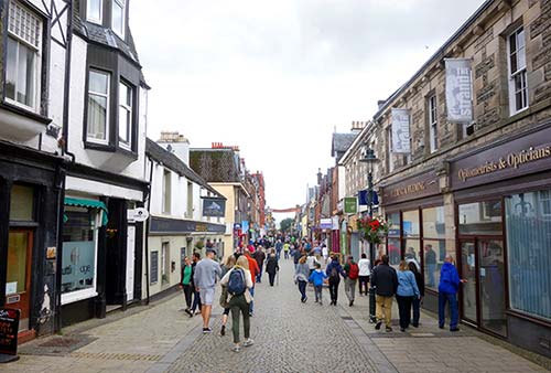
Fort William—after Inverness, the second-biggest town in the Highlands (pop. 10,000)—is Glencoe’s opposite. While Glencoe is a humble one-street village, appealing to hikers and nature lovers, Fort William’s glammed-up, car-free main drag feels like one big Scottish shopping mall (with souvenir stands and outdoor stores touting perpetual “70 percent off” sales). The town is clogged with a United Nations of tourists trying to get out of the rain. Big bus tours drive through Glencoe...but they sleep in Fort William.
While Glencoe touches the Scottish soul of the Highlands, Fort William was a steely and intimidating headquarters of the British counter-insurgency movement—in many ways designed to crush that same Highland spirit. After the English Civil War (early 1650s), Oliver Cromwell built a fort here to control his rebellious Scottish subjects. This was beefed up (and named for King William III) in 1690. And following the Jacobite uprising in 1715, King George I dispatched General George Wade to coordinate and fortify the crown’s Highland defenses against further Jacobite dissenters. Fort William was the first of a chain of intimidating bastions (along with Fort Augustus on Loch Ness, and Fort George near Inverness) stretching the length of the Great Glen. But Fort William’s namesake fortress is long gone, leaving precious little tangible evidence (except a tiny bit of rampart in a park near the train station) to help today’s visitors imagine its militaristic past.
With the opening of the Caledonian Canal in 1822, the first curious tourists arrived. Many more followed with the arrival of the train in 1894, and grand hotels were built. Today, sitting at the foot of Ben Nevis, the tallest peak in Britain, Fort William is considered the outdoors capital of the United Kingdom.
Orientation to Fort William
Given its strategic position—between Glencoe and Oban in the south, Inverness in the east, and the Isle of Skye in the west—you’re likely to pass through Fort William at some point during your Highlands explorations. And, while “just passing through” is the perfect plan here, Fort William can provide a good opportunity to stock up on whatever you need (last supermarket before Inverness), grab lunch, and get any questions answered at the TI.
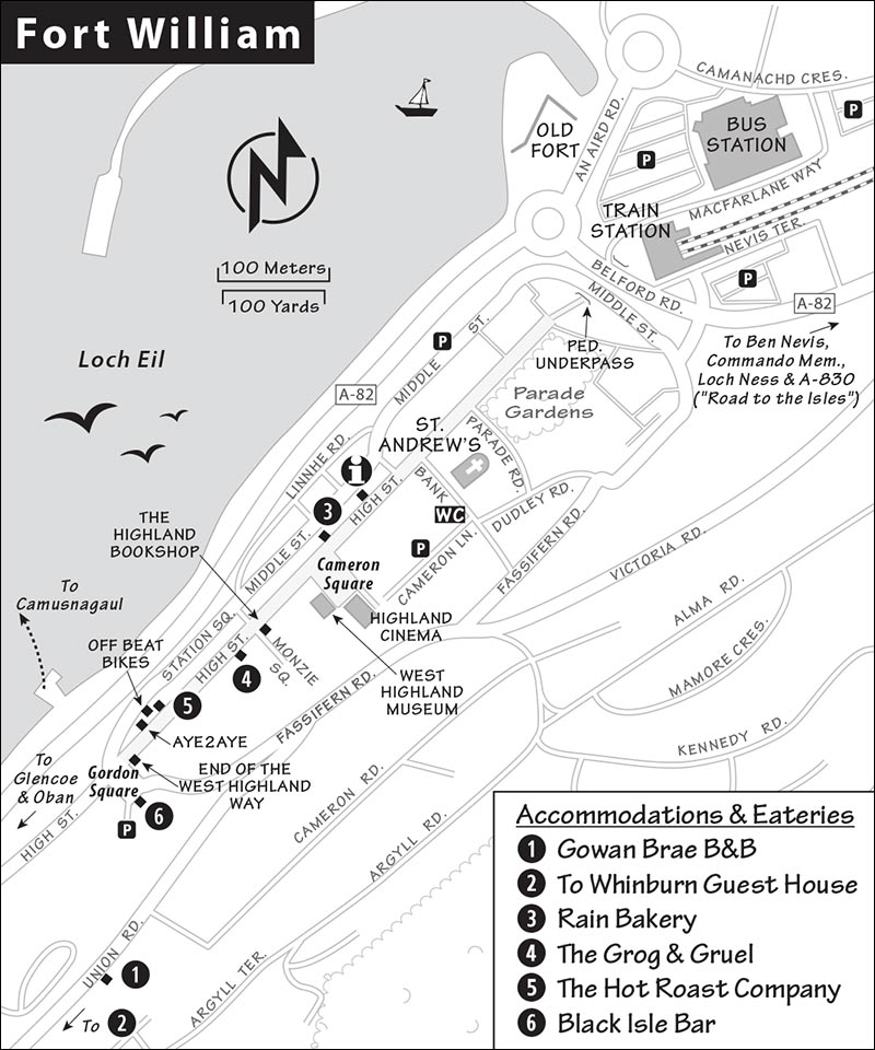
Arrival in Fort William: You’ll find pay parking lots flanking the main pedestrian zone, High Street. The train and bus stations sit side by side just north of the old town center, where you’ll also find a handy pay parking lot.
Tourist Information: The TI is near the north end of the car-free main drag (generally daily 9:00-17:00, likely open later in summer, 29 High Street, +44 1397 701 801, www.visitscotland.com).
Bike Rental: Off Beat Bikes rents all manner of e-bikes and mountain bikes, and can suggest biking routes along the Caledonian Canal (closed Sun-Mon, 117 High Street, +44 1397 704 008, www.offbeatbikes.co.uk).
Sights in Fort William
Fort William’s High Street
Enjoy a half-hour stroll up and down the length of Fort William’s main street for lots of Scottish clichés and great people-watching. The heart of this strip runs from St. Andrew’s Church (the pointy spire near the TI, with WCs nearby) south several blocks to Gordon Square. Along the way, you’ll pass a variety of shops: outdoor outfitters; tacky “tartan tat” souvenir shops; charity stores; whisky shops; lowbrow pubs and fish-and-chips joints; and a few good eateries (see “Sleeping and Eating in Fort William,” later).
Halfway along the street is Cameron Square, with the West Highland Museum (described next) on its right side. Dominating the square is the big, modern (yet tasteful) Highland Cinema, which shows first-run movies as well as a short film of Highland scenery from the air—either one a tempting activity if you need to get out of the rain (https://highlandcinema.co.uk).
Keep window-shopping your way down the street. You’ll pass the great Highland Bookshop (on the left at #60). Near the far end, look for the Aye2Aye storefront (on the right at #123), which favors a new referendum on Scottish independence.
The main drag culminates at Gordon Square (in front of the Travelodge). Here a marker represents the end of the West Highland Way—a challenging 95-mile hiking path that begins in Glasgow. You may see happy but exhausted hikers celebrating here (likely ready to unwind at the big, recommended Black Isle Bar, just behind). Notice the map of the walk’s main landmarks etched into the square’s paving stones.
▲West Highland Museum
Fort William’s only real sight is its humble but well-presented museum. It’s a fine opportunity to escape the elements, and—if you take the time to linger over the many interesting exhibits—genuinely insightful about local history and Highland life.
Cost and Hours: Free, £3 suggested donation, may charge extra for special exhibits; Mon-Fri 10:00-17:00, Sat 10:30-13:30, closed Sun, shorter hours off-season; midway down the main street on Cameron Square, +44 1397 702 169, www.westhighlandmuseum.org.uk.
Visiting the Museum: Follow the suggested one-way route through exhibits on two floors. You’ll begin by learning about the WWII green beret commandos, who were trained in secrecy near here (see “Commando Memorial” listing, later). Then you’ll see the historic Governor’s Room, decorated with the original paneling from the room in which the order for the Glencoe Massacre was signed. The ground floor also holds exhibits on natural history (lots of stuffed birds and other critters), mountaineering (old equipment), and archaeology (stone and metal tools).
Upstairs, you’ll see a selection of old tartans and a salacious exhibit about Queen Victoria and John Brown (her Highlander attendant...and, possibly, suitor). The Jacobite exhibit gives a concise timeline of that complicated history, from Charles I to Bonnie Prince Charlie, and displays a selection of items emblazoned with the prince’s bonnie face—including a clandestine portrait that you can only see by looking in a cylindrical mirror. Finally, the Highland Life exhibit collects a hodgepodge of tools, musical instruments (some fine old harps that were later replaced by the much louder bagpipes as the battlefield instrument of choice), and other bric-a-brac.
NEAR FORT WILLIAM
Sights and activities outside Fort William include the following, as well as the round-trip journey on the Jacobite Steam Train, which runs from Fort William to the port town of Mallaig and back. For details, see the sidebar, later in this chapter.
Ben Nevis
From Fort William, take a peek at Britain’s highest peak, Ben Nevis (4,406 feet). Thousands walk to its summit each year. On a clear day, you can admire it from a distance. Scotland’s only mountain cable cars—at the Nevis Range Mountain Experience—can take you to a not-very-lofty 2,150-foot perch on the slopes of Aonach Mòr for a closer look (£25, 15-minute ride, generally open daily but closed in high winds and winter—call ahead, signposted on the A-82 north of Fort William, café at bottom and restaurant at top, +44 1397 705 825, www.nevisrange.co.uk). The cable car also provides access to trails particularly popular with mountain bikers.
▲Commando Memorial
This powerful bronze ensemble of three stoic WWII commandos, standing in an evocative mountain setting, is one of Britain’s most beloved war memorials. During World War II, Winston Churchill decided that Britain needed an elite military corps. He created the British Commandos, famous for wearing green berets (an accessory—and name—later borrowed by elite fighting forces in the US and other countries). The British Commandos trained in the Lochaber region near Fort William, in the windy shadow of Ben Nevis. Many later died in combat, and this memorial—built in 1952—remembers those fallen British heroes.
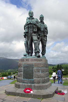
A few steps away is the Garden of Remembrance, honoring British Commandos who died in more recent conflicts, from the Falkland Islands to Afghanistan. It’s also a popular place to spread Scottish military ashes. Taken together, these sights are a touching reminder that the US is not alone in its distant wars. Every nation has its share of honored heroes willing to sacrifice for what they believe to be the greater good.
Getting There: The memorial is about nine miles outside of Fort William, on the way to Inverness (just outside Spean Bridge); see “Route Tips for Drivers” later in this section.
Sleeping and Eating in Fort William
Sleeping: Both of these options are a five-minute walk up the hill above High Street. The Hobbit-cute $ Gowan Brae B&B (“Hill of the Big Daisy”) has an antique-filled dining room and two rooms with loch or garden views (cash only, 2-night minimum, on Union Road, +44 1397 704 399, www.gowanbrae.co.uk, gowan_brae@btinternet.com, Jim and Ann Clark). $$$ Whinburn Guest House, in a gray stone house with leaded-glass windows, looks like a tiny, romantic castle. It has three guest rooms and loch views (on Lundavra Road, +44 7525 088 359, www.whinburnguesthouse.com, whinburnguesthouse@gmail.com, Donna).
Eating: These places are on traffic-free High Street. I’ve listed them in the order you’ll pass them, heading south from the TI. $ Rain Bakery serves breakfast, brunch, and lunch (soup and sandwiches) in a mellow, trendy atmosphere (closed Sun-Mon, 41 High Street, +44 1397 701 011). $$ The Grog & Gruel serves real ales, good pub grub, and Tex-Mex and Cajun dishes, with some unusual choices such as burgers made from boar and haggis or Highland venison. There’s also a variety of “grog dogs” (daily, 66 High Street, +44 1397 705 078). $ Hot Roast Company sells beef, turkey, ham, or pork sandwiches topped with some tasty extras, along with soup, salad, and coleslaw (lunch only, closed Sun, 127 High Street, +44 1397 700 606). $$ Black Isle Bar, an outpost of the Inverness-based brewery, is popular for its microbrews and wood-fired pizzas (daily, on Gordon Square at the south end of the main drag, +44 1397 700 876).
Fort William Connections
Fort William is a major transit hub for the Highlands, so you’ll likely change buses here at some point during your trip.
From Fort William by Bus to: Glencoe or Ballachulish (all Glasgow-bound buses—#914/#915/#916, 8/day, 30 minutes; also Shiel bus #N44, 7/day, fewer Sat-Sun), Oban (bus #918, 4/day, 1.5 hours), Portree on the Isle of Skye (buses #915/#916, 3/day, 3 hours), Inverness (bus #919, 6/day, 2 hours, fewer Sat-Sun), Glasgow (#914/#915/#916, 8/day direct, 3 hours). To reach Edinburgh, there’s a direct bus once each afternoon in the summer (#913, 4.5 hours); otherwise, take the bus to Glasgow, then transfer to a train or bus (figure 5 hours total). Citylink: Citylink.co.uk [URL inactive]; Shiel Bus: +44 1397 700 700, ShielBuses.co.uk.
From Fort William by Train to: Glasgow (4/day, 4 hours), Mallaig and ferry to Isle of Skye (4/day, 1.5 hours). Train info: +44 3457 484 950, www.nationalrail.co.uk.
ROUTE TIPS FOR DRIVERS
From Fort William to Loch Ness and Inverness: Head north out of Fort William on the A-82. After about eight miles, in the village of Spean Bridge, take the left fork (staying on the A-82). About a mile later, on the left, keep an eye out for the Commando Memorial (described earlier and worth a quick stop). From here, the A-82 sweeps north and follows the Caledonian Canal, passing through Fort Augustus (a good lunch stop, with its worthwhile Caledonian Canal Centre), and then follows the north side of Loch Ness on its way to Inverness. Along the way, the A-82 passes Urquhart Castle and the Loch Ness Centre & Exhibition in Drumnadrochit (described in the Inverness & Loch Ness chapter).
From Oban to Fort William via Glencoe: See here in the Oban chapter.
From Fort William to the Isle of Skye: You have two options: Head west on the A-830 through Glenfinnan, then catch the ferry from Mallaig to Armadale on the Isle of Skye (this “Road to the Isles” area is described in the next section). Or, head north on the A-82 to Invergarry, and turn left (west) on the A-87, which you’ll follow (past Eilean Donan Castle) to Kyle of Lochalsh and the Skye Bridge to the island. Consider using one route one way, and the other on the return trip.
The Road to the Isles
Between Fort William and the Isle of Skye lies a rugged landscape with close ties to the Jacobite rebellions. It was here that Bonnie Prince Charlie first set foot on Scottish soil in 1745, in his attempt to regain the British throne for his father. The settlement of Glenfinnan, about 30 minutes west of Fort William, is where he first raised the Stuart family standard—and an army of Highlanders. Farther west, the landscape grows even more rugged, offering offshore glimpses of the Hebrides. It’s all tied together by a pretty, meandering road—laid out by the great Scottish civil engineer Thomas Telford—that’s evocatively (and aptly) named “The Road to the Isles.” While these sights aren’t worth going out of your way to see, they’re ideal for those heading to the Isle of Skye (via the Mallaig-Armadale car ferry), or for those who’d enjoy taking the so-called “Harry Potter train” through a Hogwartian landscape.
If you’re driving, be sure you allow enough time to make it to Mallaig at least 30 minutes before the ferry departs (figure at least 90 minutes of driving time from Fort William to the ferry, not including stops). Ferry reservations are required; for details, see “Getting to the Isle of Skye” on here.
Sights on the Road to the Isles
I’ve connected these sights with some commentary for those driving from Fort William to Mallaig for the Skye ferry. (If you’re interested in the Jacobite Steam Train instead, see the sidebar.) In addition to the sights at Glenfinnan, this route is graced with plenty of loch-and-mountain views and, near the end, passes along a beautiful stretch of coast with some fine sandy beaches.
• From Fort William, head north on the A-82 (signed Inverness and Mallaig). At the big roundabout (where you’ll see the tempting Ben Nevis Whisky Distillery with a visitors center), turn left onto the A-830 (marked for Mallaig and Glenfinnan). You’ll pass a big sign listing the next Skye ferry departure. Just after, you’ll cross a bridge; look up and to the right to see Neptune’s Staircase. There’s a park-like viewing zone on the right.
Neptune’s Staircase
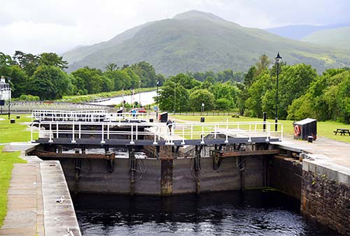
This network of eight stair-step locks, designed by Thomas Telford in the early 19th century, offers a handy look at the ingenious locks of the Caledonian Canal. For more on this remarkable engineering accomplishment—which combined natural lochs with man-made locks and canals to connect Scotland’s east and west coasts—see the sidebar on here. Engineers might want to pull over just after the bridge (well marked) to stroll around the locks for a closer look, but the rest of us can pretty much get the gist from the road.
• Continue west on the A-830 for another 14 miles, much of it along Loch Eil. Soon you’ll reach a big parking lot and visitors center at...
▲Glenfinnan
In the summer of 1745, Bonnie Prince Charlie—grandson of James II of England, who was kicked off the British throne in 1688—arrived at Glenfinnan...and waited. He had journeyed a long way to this point, sailing from France by way of the Scottish Isle of Eriskay and finally making landfall at Loch nan Uamh (just west of here). For the first time in his life, he set foot on his ancestral homeland...the land he hoped that, with his help, his father would soon rule. But to reclaim the thrones of England and Scotland for the Stuart line, the fresh-faced, 24-year-old prince would need the support of the Highlanders. And here at Glenfinnan, he held his breath at the moment of truth. Would the Highland clans come to his aid?
As Charlie waited, gradually he began to hear the drone of bagpipes filtering through the forest. And then, the clan chiefs appeared: MacDonalds. Camerons. MacDonnells. McPhees. They had been holding back—watching and waiting, to make sure they weren’t the only ones. Before long, the prince felt confident that he’d reached a clan quorum. And so, here at Glenfinnan, on August 19, 1745, Bonnie Prince Charlie raised his royal standard—officially kicking off the armed Jacobite rebellion that came to be known as “The Forty-Five.” Two days later, Charlie and his 1,500 clansmen compatriots headed south to fight for control of Scotland. (Glenfinnan is also the place where Bonnie Prince Charlie retreated, just eight months later, after his crushing defeat at Culloden.)
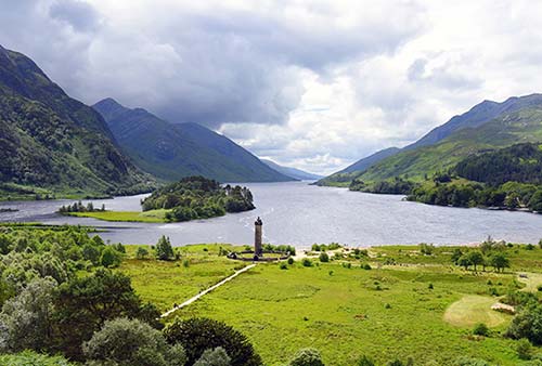
Today Glenfinnan, which still echoes with history, is a wide spot in the road with a big visitors center and two landmarks: a monument to Bonnie Prince Charlie’s raising of the standard, and a railroad viaduct made famous by the Hogwarts Express.
Visiting Glenfinnan: Start at the visitors center (free; daily 9:30-17:00, shorter hours off-season; café, WCs, pay parking, +44 1397 722 250, www.nts.org.uk). The small but enlightening Jacobite Exhibit inside the visitors center explains the story of Bonnie Prince Charlie and “The Forty-Five.” You can pay £5.25 at the visitors center for a ticket to climb the 62 stairs to the top of the monument (limited hours).
The Glenfinnan Viaduct, with 416 yards of raised track over 21 supporting arches, is worth seeing—especially if you can time your visit for when the steam train goes chugging over the tracks, trailing a giant white plume. Times vary so confirm by phone or online before you plan a trip around it; current times are also posted inside the visitors center (April-Oct you’ll likely see the train go by at around 10:45 and 15:15; May-Sept it also passes through at around 13:20 and 18:00).
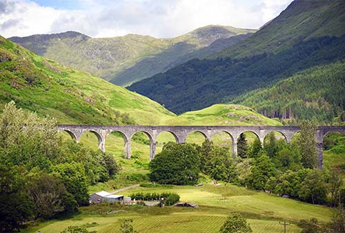
There are various ways to get a better view of the viaduct. Most straightforward is to hike 10 minutes up the hill next to the visitors center—find the well-marked, steep switchback path. From the viewpoint, you’ll enjoy sweeping (if distant) views of the viaduct in one direction, and the monument and banks of Loch Shiel in the other. The other options involve heading to the big, adjacent parking lot, then walking toward the viaduct. It’s a nice, scenic walk across a bridge, then along a gurgling river. You can find a vantage point from here; walk all the way up until you’re right under the viaduct (takes about 20 minutes each way); or continue to the other side of the viaduct and climb the hill behind it for an even more dramatic view (allow plenty of time to get to the top).
The Glenfinnan Monument sits across the road, between the visitors center and the loch. Capped with a stirring statue of a kilted “Unknown Highlander,” it commemorates the Jacobites who perished in the Forty-Five. While it’s possible to climb to the top (see above), it’s plenty evocative just to see it from below. A couple of half-mile nature walks, on boardwalks and through the woods, also begin from this area—look for signs.
• Carrying on west along the A-830, the scenery crescendos and grows more rugged: bald, mossy mountains; bushy trees; shaggy ferns. The road plays hopscotch with the train line, crossing to and fro. Keep an eye out for humble and sweet, middle-of-nowhere train stations that are little more than lonely platforms.
Shortly you’ll begin to catch glimpses of silver sand beaches at the heads of the rocky lochs. (If catching a ferry, figure 50 minutes’ drive from Glenfinnan to Mallaig.) Fans of Bonnie Prince Charlie with some time to spare should consider the next stop, 13 miles west of Glenfinnan.
The Prince’s Cairn
Just after the road passes under a small railway viaduct and begins to travel alongside a sea loch, look for a small sign on the right. Park in the waterside pullout just beyond, on the left. From here you can walk a few minutes back along the main road, then follow signs down through the woods to the Prince’s Cairn.
Perched above bonnie Loch nan Uamh, this cairn memorializes the spot from where Prince Charlie sailed for France after his failed uprising. (To find the cairn, from the pullout, hug the roadside guardrail and backtrack a hundred yards to the short trail.) The haystack-shaped cairn is made of local stone and marked by a memorial plaque. Imagine the day, September 20, 1746, when a French frigate spirited away the weary prince and his followers. He would never set foot in Scotland again.
• Continuing west you’ll soon reach the village of...
Arisaig
While there’s not much to see in this village, it has an interesting history. Gaelic for “safe place,” Arisaig has provided shelter for many seafarers—including the real Long John Silver (Robert Louis Stevenson was inspired by tales from his father, who was an engineer who built lighthouses here). In the 20th century, remote Arisaig was a secret training ground for WWII-era spies. The “Special Operations Executive” prepared brave men and women here for clandestine operations in Nazi-occupied Europe.
• Around Arisaig, signs for the Alternative Coastal Route direct you to the B-8008, which parallels the A-830 highway the rest of the way (7 miles) to Mallaig. If you’ve got ample time, consider taking these back roads for a more scenic approach to the end of the road. Either way, you’ll end up at...
Mallaig
The small, hardworking port town of Mallaig (the departure point for the Isle of Skye ferry to Armadale) has a certain salty charm and is enjoyable for a stroll; in fact, at midday, when Jacobite Steam Train passengers have no choice but to kill some time here, you’ll see them doing just that. There’s a big parking lot with pay WCs along the main road into town, which essentially drives straight onto the ferry dock. To the right runs the little main street, past the train station and Co-op grocery store to a small marina area. Several takeaway fish-and-chips places are along here.
Consider walking a few minutes past the core of town, and past a busy shipyard (where you may see old boats being restored), to the marina area. Overlooking the marina, near a modern crannog building, is $ The Bakehouse, selling good sandwiches and sweet rolls (Tue-Sat 9:00-15:00, closed Sun-Mon, Old Quay, +44 1687 462 808).